Showing images tagged with road:A666 tag.
|
Irlam o th' Height
by Gerald England geograph for square SD7900 The traffic on the right is coming off the A6 onto a roundabout that provides... (more)
|

|
Croal Viaduct - 4
by Alan Murray-Rust geograph for square SD7209 The easternmost iron span with subway into the town centre under the A666 St... (more)
Tags:
date:1847X
road:A666
building material:Cast IronX
top:PathsX
Railway ViaductX
top:RailwaysX
top:Roads, Road TransportX
top:Suburb, Urban FringeX
|

|
Slip road to everywhere
by Gerald England for square SD7900
This slip road off Bolton Road SD7900 : Bolton Road leads onto the slip road off Broad... (more)
Tags:
road:A580X
road:A6X
road:A666
type:Close LookX
Road JunctionX
Road SignX
top:Roads, Road TransportX
Slip RoadX
|

|
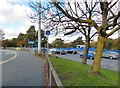
Bolton Road
by Gerald England geograph for square SD7702 The A666 through Newtown.
|

|
Station Road
by Gerald England geograph for square SD7802
The B5231 approaching the A666.
|

|
Lark Hill
by Gerald England geograph for square SD6828 The A666 out of Blackburn from Barbara Castle Way.
Tags:
road:A666
top:Roads, Road TransportX
|

|
Bolton Road (A666), Cadshaw Bridge
by David Dixon geograph for square SD7018 |

|
Astley Bridge crossroads
by Alan Murray-Rust geograph for square SD7111 The A58 (Bolton northern ring road) crosses the A666 Blackburn Road.
Tags:
A Road (Classified A)X
road:A58X
road:A666
Ring RoadX
top:Roads, Road TransportX
top:Suburb, Urban FringeX
Traffic LightsX
|

|
A666, Blackburn Road
by David Dixon geograph for square SD7018 |

|
St Peter's Way, Bolton
by David Dixon for square SD7208 I didn't count the steps, but it's 180 feet of narrow, spiral, stone... (more)
|

|
Spread Eagle, Kearsley
by David Dixon geograph for square SD7504 The Spread Eagle public house at the corner of Slackey Brow and Manchester Road (A666).
Tags:
road:A666
top:Business, Retail, ServicesX
Parked CarsX
PubX
Public HouseX
Satellite DishX
top:Suburb, Urban FringeX
|

|
St Peter's Way (A666)
by David Dixon geograph for square SD7208 Looking across St Peter's Way from the old Burnden railway embankment.
|

|
Croal Viaduct, St Peter's Way
by David Dixon geograph for square SD7209 The Croal (railway) Viaduct, built in 1847, crosses the A666 St Peter's Way... (more)
|

|
The Croal Viaduct
by David Dixon geograph for square SD7209 The Croal (railway) Viaduct, built in 1847, crosses the A666 St Peter's Way... (more)
|

|
Burnden Viaduct
by David Dixon geograph for square SD7208 This viaduct was originally opened in 1848 for the Liverpool and Bury (later the... (more)
|

|
Blackburn Road in Darwen
by Steve Daniels geograph for square SD6823 |

|
Blackburn Road in Darwen
by Steve Daniels geograph for square SD6823 |

|
Bull Hill, Bolton Road
by David Dixon geograph for square SD7019 |

|
View from St Peter's Church Tower
by David Dixon for square SD7208 A view towards the Springfield area of Bolton from SD7209 : Bolton Parish Church, St Peter's.
Tags:
2012 Heritage Open DaysX
road:A666
ChimneyX
top:City, Town CentreX
HousesX
top:Housing, DwellingsX
RooftopsX
TownscapeX
|

|
The Croal Railway Viaduct
by David Dixon geograph for square SD7209 The Croal Railway Viaduct, built in 1847.
|