McPherson County, South Dakota
Appearance
McPherson County | |
|---|---|
 McPherson County Courthouse | |
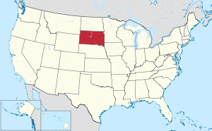
 Location within the U.S. state of South Dakota | |
 South Dakota's location within the U.S. | |
| Coordinates: 45°46′N 99°13′W / 45.77°N 99.22°W | |
| Country | |
| State | |
| Founded | 1873 (created) 1884 (organized) |
| Named for | James B. McPherson |
| Seat | Leola |
| Largest city | Eureka |
| Area | |
| • Total | 1,152 sq mi (2,980 km2) |
| • Land | 1,137 sq mi (2,940 km2) |
| • Water | 15 sq mi (40 km2) 1.3% |
| Population (2020) | |
| • Total | 2,411 |
| • Density | 2.1/sq mi (0.81/km2) |
| Time zone | UTC−6 (Central) |
| • Summer (DST) | UTC−5 (CDT) |
| Congressional district | At-large |
| Website | mcpherson |
McPherson County is a county located in the U.S. state of South Dakota. As of the 2020 census, 2,411 people lived there.[1] Its county seat is Leola. It was created in 1873.[2]
References
[change | change source]- ↑ "QuickFacts: McPherson County, South Dakota". United States Census Bureau. Retrieved January 20, 2024.
- ↑ National Association of Counties. "NACo County Explorer". Retrieved January 20, 2024.