Brown County, South Dakota
Appearance
Brown County | |
|---|---|
 Brown County Courthouse in fall | |
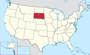
 Location within the U.S. state of South Dakota | |
 South Dakota's location within the U.S. | |
| Coordinates: 45°36′N 98°21′W / 45.6°N 98.35°W | |
| Country | |
| State | |
| Founded | July 6, 1881[1] |
| Seat | Aberdeen |
| Largest city | Aberdeen |
| Area | |
| • Total | 1,731 sq mi (4,480 km2) |
| • Land | 1,713 sq mi (4,440 km2) |
| • Water | 18 sq mi (50 km2) 1.0% |
| Population (2020) | |
| • Total | 38,301 |
| • Density | 22/sq mi (8.5/km2) |
| Time zone | UTC−6 (Central) |
| • Summer (DST) | UTC−5 (CDT) |
| Congressional district | At-large |
| Website | www |
Brown County is a county located in the U.S. state of South Dakota. As of the 2020 census, 38,301 people lived there,[2] making it the fourth-most populous county in South Dakota. Its county seat is Aberdeen.[3] The county is named after Alfred Brown, of Hutchinson County, South Dakota, a Dakota Territory legislator in 1879.[1][4]
References
[change | change source]- ↑ 1.0 1.1 Legislative Manual, South Dakota, 2005, p. 596
- ↑ "QuickFacts: Brown County, South Dakota". United States Census Bureau. Retrieved January 20, 2024.
- ↑ National Association of Counties. "NACo County Explorer". Retrieved January 20, 2024.
- ↑ History of the Origin of the Place Names in Nine Northwestern States. 1908. p. 12.
