McCook County, South Dakota
Appearance
McCook County | |
|---|---|
 McCook County Courthouse | |
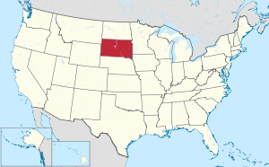
 Location within the U.S. state of South Dakota | |
 South Dakota's location within the U.S. | |
| Coordinates: 43°40′N 97°22′W / 43.67°N 97.36°W | |
| Country | |
| State | |
| Founded | January 8, 1873 (created) June 15, 1878 (organized) |
| Named for | Edwin Stanton McCook |
| Seat | Salem |
| Largest city | Salem |
| Area | |
| • Total | 577 sq mi (1,490 km2) |
| • Land | 574 sq mi (1,490 km2) |
| • Water | 2.7 sq mi (7 km2) 0.5% |
| Population (2020) | |
| • Total | 5,682 |
| • Density | 9.8/sq mi (3.8/km2) |
| Time zone | UTC−6 (Central) |
| • Summer (DST) | UTC−5 (CDT) |
| Congressional district | At-large |
| Website | www |
McCook County is a county located in the U.S. state of South Dakota. As of the 2020 census, 5,682 people lived there.[1] Its county seat is Salem.[2] It was created in 1873.[3] It was named for the former governor of the Dakota Territory and Civil War general Edwin Stanton McCook.[4][5]
Communities
[change | change source]Cities
[change | change source]- Bridgewater
- Canistota
- Montrose
- Salem (county seat)
- Spencer
Unincorporated communities
[change | change source]- Golden View Colony
- Orland Colony
- Unityville
Townships
[change | change source]The county is divided into sixteen townships:
- Benton
- Bridgewater
- Brookfield
- Canistota
- Emery
- Grant
- Greenland
- Jefferson
- Pearl
- Montrose
- Union
- Ramsey
- Richland
- Salem
- Spring Valley
- Sun Prairie
Other places
[change | change source]- Laurent - (proposed / abandoned housing development)
References
[change | change source]- ↑ "QuickFacts: McCook County, South Dakota". United States Census Bureau. Retrieved January 20, 2024.
- ↑ National Association of Counties. "NACo County Explorer". Retrieved January 20, 2024.
- ↑ "Dakota Territory, South Dakota, and North Dakota: Individual County Chronologies". Dakota Territory Atlas of Historical County Boundaries. The Newberry Library. 2006. Archived from the original on April 2, 2018. Retrieved March 30, 2015.
- ↑ Hellmann, Paul T. (May 13, 2013). Historical Gazetteer of the United States. Routledge. p. 997. ISBN 978-1135948597. Retrieved 30 November 2013.
- ↑ Chicago and North Western Railway Company (1908). A History of the Origin of the Place Names Connected with the Chicago & North Western and Chicago, St. Paul, Minneapolis & Omaha Railways. p. 162.
Other websites
[change | change source]Wikimedia Commons has media related to McCook County, South Dakota.