Timber
America relies on timber and wood products from national forests for building materials, jobs, firewood, biochar, paper, and more. U.S. Department of Agriculture, Forest Service researchers, since the inception of the Agency, have worked shoulder to shoulder with forest managers to ensure sustainable and efficient timber production from America’s forests. Forest Service science has supported timber production for nearly a century. Forest Service Research and Development continues to provide insights for timber production on public and private forest lands and innovations in wood products.
Cutting edge science produced by Forest Service research improves timber production efficiency and profitability, projects future forest resources, reduces risks to timber resources, increases efficiency of silvicultural practices, protects water and soil, informs salvage logging, and improves reforestation efforts after fire, flood, blowdowns, and other major disturbances. Forest Service researchers partner with States, local governments, Tribes, rural communities, private companies, and the timber industry to evaluate future wood supply and economic scenarios, assess new timber harvesting techniques, and develop and assess biomass markets and wood innovations.

Even if the primary objective of these types of treatments is not to generate revenue from the sale of timber and biomass, it is possible to reduce the cost of forest operations by tailoring harvest systems to specific fuel treatments and forest restoration needs. Working with the contractors when laying out the project area can also increase the efficiency of the harvest operation.
Improving Feasibility, Efficiency, and Profitability of Timber Projects
Forest Service scientists partnered with the University of Idaho to evaluate the future wood supply on the Salmon-Challis National Forest in an economic feasibility study of the forest industry. The team projected economic scenarios with different types of forest industries and associated mills and bioenergy options that could use materials from timber harvesting, fuels reduction, and other activities.
Developed by Forest Service scientists, the new Delivered Cost Model helps ensure the profitability of timber and fuels projects. This new model is an important update to past harvest models because it accounts for any type of material, including dead trees and biomass, not just green trees.
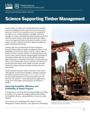
 Photo CreditUSDA Forest Service photo by P. Keres
Fontaine Mill in Stratton, Maine manufactures a broad range of wood products.
Forest Service science helps forest managers determine the best timber harvest and wood procurement scenarios. The Raster Utility is a decision tool that integrates lidar-derived maps in an easy-to-use GIS toolbar. This tool is used by managers to better calculate the volume of biomass in a given harvest area.
Forest Service research mapped the suitability of different harvest systems across a 74,000-acre landscape area of the Nez Perce-Clearwater National Forests. By combining lidar and ground plot inventory data with engineering information, Forest Service scientists provided forest managers information about optimal deployment of harvest systems, including tethered and winch-assisted equipment. This approach can be replicated across other national forests.
Harvesting timber on steep slopes usually can’t be done with conventional ground-based logging operations. Ground-based, steep slope logging, and cable logging can be performed on such landscapes. Forest Service researchers found that adjusting investment and implementation strategies can significantly increase the area available for mechanical treatments.
Reducing Risks to Timber Resources

Forest mortality caused by bark beetle on the Arapaho Roosevelt National Forest.
Bark beetles have devastated millions of acres of forest, including valuable timber lands, in the western United States in recent epidemic-level outbreaks. Forest Service scientists have not only been studying these recent beetle outbreaks since their inception, they are also working hand in hand with forest health protection managers to map areas impacted by beetle mortality and develop management strategies based on the best available science.
Forest Service scientists are following the long-term effects of these bark beetle outbreaks at experimental forests to describe changes in nitrogen and forest dynamics in the decades after the initial outbreak.
A new, high-powered analytical framework developed by Forest Service scientists, called RiskMonitor, helps managers identify the most effective strategies to reduce wildfire risk and monitor progress toward risk reduction goals.
Forest Service long-term research studies at sites in northern Montana, the southwest United States., and elsewhere, have followed fuels treatments over decades, measuring the effectiveness of fuels treatments over the long term.
Forest Service scientists synthesized 30 years of studies on fuels treatment effects on wildfire severity. Areas where thinning and prescribed burning occurred experience lower burn severity from subsequent wildfires as compared to areas that were only thinned or untreated.
- Forest Service research is yielding promising new approaches to detecting and managing Armillaria root disease, a devastating forest disease that damages valuable timber species such as Douglas-fir. Scientists are using DNA-based tools to correctly identify Armillaria species, allowing us to identify the highest risk areas for this invasive pathogen.
Developing Biomass Markets and Wood Innovations
Biochar is a carbon-rich soil amendment created by burning slash with specially designed equipment at relatively low temperatures. Benefits and applications of biochar production include reduced wildfire risk, added local revenue, improved soil health, enhanced carbon sequestration, and mine reclamation.
 Photo CreditUSDA Forest Service photo by D. Weseman
The CharBoss® is an air curtain burner-style mobile biochar production machine.
The CharBoss® is an in-woods machine that converts unmerchantable woody biomass into biochar. Under a cooperative agreement, Air Burners, Inc., a private company based in Florida, worked closely with Forest Service scientists and managers to design and manufacture the CharBoss®. This public-private partnership grew out of a need to find a market solution to the problem of woody waste materials generated from forest management activities, beyond burning it or hauling it off-site. Forest Service researchers teamed up with national forests to host CharBoss® demonstrations in five western states.
Biochar is not well known to land managers who are potential users of biochar, Forest Service scientists are deliberately engaging forest managers with punchy communication materials like Biochar at a Glance and Soil Restoration with Biochar factsheets and taking field demonstrations to the farms and forests where they work.
A team of interdisciplinary scientists from the Forest Service and university colleagues studied the feasibility of developing profitable biomass markets in Arizona, New Mexico, and southern Colorado to handle excess waste biomass. This feasibility study found that developing biomass energy markets would have net benefits over broad areas in the southwest United States, including reducing wildfire risk and increasing diversity of energy sources.
Maintaining Forest Inventories and Projecting Tomorrow's Resources
Based in Forest Service Research and Development, Forest Inventory and Analysis collects, processes, analyzes, and reports on forest data necessary for assessing the extent and condition of forest resources in the United States. This congressionally mandated program delivers current, consistent, and credible information about America’s forests and forest resources.
Mandated by the 1974 Forest and Rangeland Renewable Resources Planning Act, the Resources Planning Act Assessment (RPA) is conducted by Forest Service Research and Development. Projections in the RPA Assessment are based on scenarios that consider United States and global population and economic growth, the openness of international trade, bioenergy, wood-energy consumption and other factors. The forecasting in the assessment can help timber managers think about long term management strategies and American timber companies can use the assessment to inform the viability of large investments.
- The National Land Cover Database and its Tree Canopy Cover dataset inform management of forests, watersheds, and wildlife. These datasets are used to investigate land cover projections, postfire vegetation cover, wildlife habitat, bioenergy, and forest health.
The National Land Cover Database supports multiple Forest Service business needs including the Resources Planning Act Assessment, Forest Inventory and Analysis estimation for State and national reporting, i-Tree Landscape, a tree canopy assessment tool, and much more.
 Photo CreditUSDA Forest Service photo by Ben Bright.
Scientists collect data about fuels from the 2018 Rattlesnake Creek fire near Riggins, Idaho.
TreeMap is a tree-level model of forests that provides detailed spatial information on forest characteristics, including the number of live and dead trees, biomass, and carbon across the entire forested extent of the continental United States. It combines Forest Inventory and Analysis data with LANDFIRE data to better estimate forest characteristics at a variety of scales. It is used to determine which trees to remove during fuel treatments, inform the distribution of dead trees, estimate risk to forest carbon from wildfire, and map wildlife habitat.
Forest Service researchers are developing new methods of using drones to monitor forests. Foresters can now use drones to track changes in silvicultural prescriptions, measure forest treatment effects, assess wildfire risk, and plan fuel management treatments.
Increasing Success of Postfire Restoration
Developed by Forest Service research, the Target Plant Concept ensures that managers plant the right trees, in the right place, at the right time. It considers the connections among seed sources, nursery practices, seedling characteristics, and post-planting growth and survival to develop the next generation of trees, while ensuring efficiency and cost savings.
REGEN MAPPER is a tool for forest managers to assess and prioritize sites for planting following wildfire and other disturbances. This science-backed tool facilitates acceleration of timber harvest after fire, followed by reforestation.
 Photo CreditCourtesy photo by Dave Gardner.
Contract tree planters with some of the 530,500 seedlings that would be planted across 2,536 acres in the Lolo National Forest in Montana.
The Southern Rockies Reforestation Tool is a decision support tool developed by Station scientists and university collaborators. This tool identifies climatically and topographically suitable sites to plant ponderosa pine and Douglas-fir seedlings after wildfire.
A recent study, conducted in collaboration with forest managers on the Arapaho and Roosevelt National Forests, found that seedling survival was nearly twice as high on north aspects and developed recommendations for managers, such as planting seedlings in depressions and the shade of other objects.
Forest Service scientists are developing strategies for conditioning seedlings before they are planted in the field to improve the establishment success of ponderosa pines planted for forest recovery. One strategy that limits irrigation of seedlings known as drought conditioning is proving to be a promising strategy for improving outplanted seedling success.
Aiding Salvage Logging Decisions

Forest Service research enables forest managers to predict which trees are likely to die and subsequently plan for salvage and other management activities. Foresters rely on this research to develop postfire tree-marking guidelines that assist timber-marking crews laying out salvage sales on every national forest.
Forest managers and the timber industry are adapting to changing forest conditions, notably, moving away from the exclusive harvest of green trees and towards increased harvesting of dead trees and smaller materials. As part of work with the Bioenergy Alliance Network of the Rockies, Forest Service scientists studied how salvage operations in beetle-killed stands could be made more efficient and safer.
Timber managers need the most up to date information to plan salvage projects. This is why Forest Service scientists teamed up with the Joint Fire Science Program partners to host a series of Salvage Logging Science technology transfer sessions in which panels of experts provided the newest research and tools for salvage logging management and planning.
Conserving Water and Soil During Timber Operations

Ponderosa pines on the Black Hills Experimental Forest.
Increasing timber production from National Forest System lands will require road improvements or, in some cases, new road construction. National Forest System engineers, hydrologists, and timber managers rely on tools developed by Forest Service scientists to evaluate road maintenance needs and erosion potential. For example, GRAIP-lite, a tool developed by Forest Service researchers, is a go-to resource that estimates road maintenance needs and predicts road sediment delivery to streams with less field effort than traditional surveys.
Forest managers must be able to estimate the erosion potential of both planned management activities and catastrophic events to decide where to use limited funds to focus erosion control efforts. To meet this need, Forest Service scientists and collaborators have spent over a decade developing a suite of online tools that can be used to predict erosion potential of road building, forest management, and wildfire, as part of the Forest Service–Water Erosion Prediction Project (WEPP).
When harvesting timber, some disturbance is inevitable. For example, heavy equipment that moves trees and slash can also compact soil. But do these soils recover? A long-held assumption was that soils take a very long time to recover, if at all, after timber harvest. A 20-year study in collaboration with managers on the Kootenai National Forest asked and answered this question. Soils in over 85 percent of the harvest units recovered 3–5 years following timber harvest.
Enhancing Wildlife and Timber Management Compatibility

During 1999–2006, 218 Canada lynx were reintroduced into the Rio Grande National Forest by the state of Colorado’s Division of Wildlife.
Supporting timber harvest and thriving wildlife populations are not mutually exclusive. Forest Service scientists have developed novel approaches that help land managers support both priorities. In some cases, Forest Service research provides defensible data that can improve the efficiency of timber project implementation. For example, Canada lynx require large and intact areas of mature forest, but these forests are increasingly at risk of more frequent, severe fire, that jeopardizes lynx habitat. Forest Service researchers have found that maintaining a mix of forest stands, including actively managed stands, supports Canada lynx use. Further research on remapping Canada lynx habitat has helped identify additional areas available for timber removal.
Game species such as mule deer, white-tailed deer, and elk are critical considerations for timber operations given the importance to hunting and recreation-based economies. Logging may benefit mule deer because early seral habitats often contain a greater variety, quantity, and quality of mule deer forage than mature forests. These and many other important findings are contained in the Fire Effects Information System species and ecosystem syntheses.
Forest Service scientists developed the cutting-edge wildlife habitat monitoring system, Living Maps, which enables monitoring of wildlife habitat for at-risk species in near-real-time. Living Maps are hosted on an interactive, high-resolution, and high accuracy platform hosted on Google Earth Engine.
New studies by Forest Service scientists provide rationale for incorporating forest treatments into California spotted owl recovery efforts. This work shows that forest restoration focused on improving fire resilience can be compatible with spotted owl habitat management in California’s Sierra Nevada mountains.
FIRE-BIRD is an ArcGIS spatial tool for applying wildlife habitat suitability models to generate maps that inform forest management planning. This tool brings together decades of research into an easy-to-use mapping tool for managers and focuses on disturbance-associated woodpecker species of conservation concern. FIRE-BIRD outputs identify areas of high suitability, which can be targeted to conservation needs, such as design criteria for postfire salvage logging, and identifies areas of marginal suitability where habitat improvements could be conducted, such as forest restoration activities.
Leading Out with Foundational Silvicultural Knowledge
Forest Service research has a long legacy of research supporting the Forest Service’s timber management and our multiple use mandate dating back to the early 1900s. Authorized by Congress and designated by the Chiefs of the Forest Service, experimental forests and ranges host long-term studies over decades or even a century while serving as demonstration and training sites.
White pine, a fast-growing tree that reaches heights of 150 feet, was once an economic driver in the northern Rockies. A combination of blister rust, beetles, and logging severely reduced the range of white pine during the 20th century. Over a decade of research by Forest Service scientists has resulted in updated guidelines for regenerating and establishing white pine on the landscape by focusing on factors such as forest openings and visible sky.
The nation’s very first experimental forest was the Forest Service Rocky Mountain Research Station’s Fort Valley Experimental Forest, established in 1908, near Flagstaff, AZ. Its focus was to understand why ponderosa pine wasn’t regenerating after logging. Silvicultural research continues at Fort Valley and at many experimental forests including the Black Hills in South Dakota, Coram in Montana, Priest River in Idaho, and Fraser and Manitou in Colorado.
One strategy to increase vigor and decrease mortality of white pines is radial thinning—clearing openings around individual trees. Forest Service researchers worked with white pine managers on the Umpqua National Forest and the nearby Bureau of Land Management Roseburg District Office to understand the effectiveness of this silvicultural treatment. This research revealed that radial thinning is not as beneficial for promoting white pine as originally hoped demonstrating the importance of monitoring and learning from treatment attempts.

Buzzards Roost lookout on the Black Hills National Forest.
Understory Publications
- Fact Sheet