


The Stewardship Mapping Project (STEW-MAP)
- Overview
- What is Stewardship
- Why do STEW-MAP?
- STEW-MAP Step-By-Step
- Community of Practice
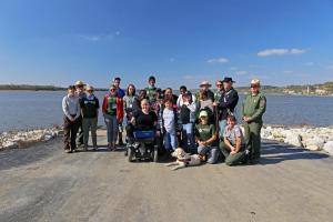
- People
- Resources
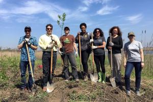
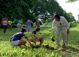
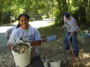
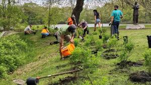
People across the country work together to plant and care for trees, share gardens, remove litter, plan river cleanups, and find other ways to green their communities. These land managers, non-profits, and volunteers build stronger, healthier, and more resilient landscapes. But who are these groups? And how might they boost their impact?
Started by scientists at the USDA Forest Service Northern Research Station, STEW-MAP pinpoints where stewardship groups are improving their surroundings. STEW-MAP helps stewards find novel partners and gaps in coverage. The project also recognizes agents of change in vulnerable communities — furthering diversity, equity, and inclusion.
First applied in New York City in 2007, STEW-MAP has since been realized in 12 communities in many parts of the world.

So far STEW-MAP has aided in:
- Supporting MillionTrees New York City. STEW-MAP data, paired with an Urban Tree Canopy Assessment, helped the city’s parks department plant and care for one million trees.
- Preparing for and responding to disaster. The Mayor's Office in New York City partnered with STEW-MAP to find neighborhood groups helping people cope with extreme events like heat waves and floods.
- Investing in networks. The Chesapeake Bay Foundation used Baltimore STEW-MAP data and insights to advocate for increased investment in networks and coalitions connecting neighborhood-based groups.
- Mapping partnerships. The Bridger-Teton National Forest in Wyoming used STEW-MAP to find who in their agency develops and manages external partnerships. This allowed the forest to support relationships, even in a division with high staff turnover.
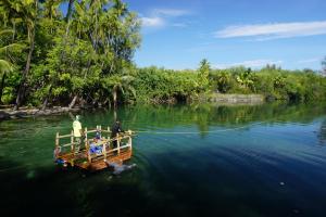
- Deepening local connections. Researchers and stewards in O’ahu, Hawaii collected data using STEW-MAP methods, creating a conversation space for civic groups. New coalitions focused on local environmental issues such as Rapid Ohia Death and fire management formed because of this process.
What is Stewardship?

Stewardship is defined as the activity or job of protecting, taking care of, or being responsible for something.
Natural resource stewardship refers to people’s efforts to take care of the natural world. These stewardship activities may take place on public or private lands and include actions such as tree planting and/or pruning, community gardening, watershed restoration, removal of litter or invasive species, creation of green public spaces or other community greening efforts, as well as activities that help conserve, improve, or address land, water, or air quality issues. STEW-MAP defines stewardship as consisting of six functions: conservation, management, education, advocacy, monitoring, and transformation.
Civic engagement means working to make a difference in the civic life of our communities and developing the combination of knowledge, skills, values, and motivation to make that difference. It means promoting the quality of life in a community, through both political and non-political processes. Research findings have begun to illuminate the transformative power of natural resources stewardship as an activity that naturally cultivates and strengthens civic engagement. This relationship has powerful implications for individual and community health and well-being, as well as for the health and well-being of our democracy. In addition, leveraging stewardship interest and capacity can be a powerful way for governments, non-profits, and other organizations to achieve goals and outcomes that would otherwise be improbable or impossible with finite resources.
Research has shown that stewardship can help achieve the following objectives:
- Provides a means by which individuals and communities contribute to a purpose, and to the beauty and health of their environment.
- Serves as an outward cue of care and concern and can catalyze change and investment by internal and external forces in a community.
- Serves as a form of empowerment, especially in communities that have experienced hardship, economic divestment, or natural disasters.
- Plays a key role in helping communities recover from natural disturbances and human-caused disasters.
- Creates benefits that extend into the future by building and strengthening communities.

Strong civic engagement can yield strong communities. Leveraging stewardship capacity can be a powerful way for governments, non-profits, and other organizations to achieve outcomes that would otherwise be impossible with finite resources, and to create communities that are stronger, healthier, greener, and more resilient. Mobilizing this potential requires understanding what stewardship capacity and connections exist across a landscape and being able to connect these to form a model of shared stewardship.
As our cities, towns, and public lands face all kinds of challenges ranging from overstressed infrastructure to extreme weather, community-based civic groups often find themselves on the frontlines of response; these groups are capable of being nimble and coming up with effective locally driven solutions. In addition, today’s forest land managers face a range of urgent challenges, among them catastrophic wildfires, more public demand, degraded watersheds, and epidemics of forest insects and disease. All of these could benefit from an approach of shared stewardship, which STEW-MAP helps enable. STEW-MAP recognizes that there is an opportunity to discover and link the capacities of a range of stewardship groups that complement the capacities of government to create communities that are stronger, healthier, greener, and more resilient.
STEW-MAP does this by helping communities, governments, land management agencies, and nonprofits understand the social fabric of a landscape. STEW-MAP helps land managers make more informed decisions with stakeholders and stewards in mind. STEW-MAP data can accelerate landscape-scale conservation by promoting coordination, collaboration, and synergies across mixed ownerships and among diverse stewardship groups. STEW-MAP provides network information that can be crucial for emergency preparedness and recovery. The data can also help identify shifting social dynamics associated with megatrends affecting landscapes from city street corners to our nation’s forests.
Applications range from developing conservation goals or policies; to conducting and coordinating resource assessments, planning, and monitoring efforts; to effectively educating, messaging, and/or engaging stakeholder.

Click the list below to read stories of how STEW-MAP has been used by different partners:
The Chesapeake Bay Funders Network is an organization that supports grantmakers and philanthropic organizations throughout the Chesapeake region. Recently, they became interested in investments in the city of Baltimore and wanted to better understand why it felt like some investments were resulting in lasting impacts. The Network used STEW-MAP data to understand the network of stewards and partners across Baltimore. They used this empirical evidence to describe something they had sensed: the Baltimore stewardship network is highly fragmented but there are many nodes of social connections throughout. As a result, the network created a request for proposals with five years of funding to hire someone to work as a node within the network and focus on building cross-jurisdictional connections within the city.
Additionally, The Baltimore Department of Public works utilizes the STEW-MAP data to understand the network of stewards who could be partners in their water education and greening initiatives. They analyzed the data to better understand where there were “resource deserts,” areas where there were fewer stewardship groups and established social networks and targeted the GROW centers in these areas. This allowed the department of public works to target resources such as trees, mulch, plants, as well as training and workshops in the neighborhoods with the most need.
USDA Forest Service employees on the Bridger-Teton National Forest (BTNF) in Wyoming carried out a two-phase approach to STEW-MAP in order to better inform the way they manage and grow partnerships on a national forest. In 2022, during the first phase of their project, BTNF conducted an internal staff survey to better understand how their staff are connecting to partners. This internal survey was followed by an external partner survey with a goal of getting beyond the “known knowns” and identifying new and potential partners. The results of this partnership survey can be found here.
At the kickoff to the effort, Rob Holsher, District Ranger of Big Piney offered these reflections on the importance of partnership mapping: “All these folks have been huge in helping us out on the forest to date, and I’m sure there’s more. We get a lot of work done by our partners and that is something that is a huge benefit to the forest…It seems like we’re just scraping the surface of what partnerships can do on the forest.”
The survey provided critical baseline data for BTNF and their partners, particularly the recently formed Friends of Bridger Teton, to better understand the stewardship landscape and support org outreach and engagement strategies.
Gowanus Canal Conservancy (GCC), the environmental steward for the Gowanus Canal and Watershed, is an example of a STEW-MAP group that is both a respondent and potential data user. Gowanus, a rapidly changing neighborhood in Brooklyn, is famous for the highly contaminated Gowanus Canal, which was declared a Superfund site by the EPA in 2010. The following 10-15 years remediation efforts were and still are underway, including dredging the canal and replacing the sides and floor of the canal with sheet tile and concrete. Andrea Parker, the Executive Director of GCC, said that they are working to ensure that the voice of the community is included in Gowanus Canal planning. STEW-MAP has been an important tool in ensuring that GCC connects with new partners in a continually changing neighborhood, one of the reasons Parker and her team think STEW-MAP is important.
GCC’s network relationships have been supported by STEW-MAP data in some concrete ways as well. Two years ago, when trying to figure out how to best steward bioswales, GCC partnered with the Forest Service to convene relevant groups. "We had that bioswale roundtable a couple of years ago, which was basically like STEW-MAP actualized, that all of these groups that are thinking about bioswale stewardship were in one room together," Parker said. Creating a list of stewardship groups that focus on bioswales was possible in part because of STEW-MAP data, which Forest Service researchers used to identify participants of the roundtable. The Gowanus Canal Conservancy has also partnered with the Urban Field Station on some grant applications and is interested in working towards building out a STEW-MAP tool that allows stewards to track their work and impact in real-time.
In reflecting on the impact of STEW-MAP, Parker shares, "I think it’s really important for us to be on the map. We know that [the Forest Service] works with the city and other citywide entities and I think it’s really important for us to be on the map, so other entities see where we are actively stewarding areas and where making connections will advance our work and the work others are doing."
La Paz developed a communications plan comprising seven strategies for disseminating the STEW-MAP survey. This plan aimed to promote the survey among groups and organizations that act as stewards in La Paz City, Mexico.
After launching the survey, Niparajá, a partner in the project, implemented the first strategy: bi-weekly reminders via email to the list of groups. These emails not only invited them to participate in the survey but also extended the team's support to address any questions personally, through phone calls, or via video calls.
Simultaneously with the survey launch, a radio campaign commenced to raise awareness among the citizens of La Paz about the project and its objectives. This campaign aimed to build trust and motivate people to respond. Also, team members actively participated in interviews on local news programs, all which were a part of their second strategy for dissemination.
The third strategy involved consistently publishing information on social media platforms (Facebook and Instagram) to reach a diverse range of groups, including neighborhood groups, informal groups, and formal organizations (NGOs, Civic Associations, etc.). As the fourth strategy, Niparajá members participated in an event organized by the municipality and the organization Innovaciones Alumbra. Citizens were invited to map the areas they cared for and considered important for the city's sustainability. As participants engaged in mapping, information about the survey and the objectives of the STEW-MAP La Paz project was shared, fostering trust among participants and the project.
The fifth strategy, and one strategy commonly employed by STEW-MAP projects, was hiring full-time or part-time staff responsible for personally surveying groups, delivering printed surveys to group offices, or scheduling meetings to answer the survey via video call. In the case of STEW-MAP La Paz, two part-time individuals were hired midway through the project. They conducted surveys both in person and through video calls using the Zoom platform.
The sixth strategy to encourage group participation was the creation of videos. These videos featured different group members explaining why they see themselves as guardians of nature and detailing the stewardship activities that they do such as monitor, manage, transform, educate, and advocate for the ecosystems present in the city.
Finally, STEW-MAP La Paz held a raffle to incentivize participation. Groups that had already completed the survey were automatically entered into the raffle and notified through social media posts and emails, while groups that had not yet responded were contacted again, this time sharing that they had a chance to win a flashlight, a thermos, or a backpack, incentivizing participation.
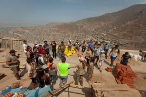
Ficus is an organization based in Lima, Peru. In 2021, the EcoRed project was implemented with the assistance of the USFS in Lima. This project was based on the STEW-MAP methodology and aimed to create a database and interactive maps that would allow land use managers, community organizations, non-profit organizations, and the public to see where hundreds of environmental management groups were working in the city of Lima.
Before launching the survey, it was necessary to have a comprehensive and detailed list of all formal and informal groups, civil, governmental, and non-governmental organizations involved in environmental management activities in the city. Such an inclusive list didn’t previously exist in Lima, so Ficus members took several steps to compile a first draft. The search started on websites and social media platforms like Facebook and Instagram, through phone calls, and by consulting partners about other groups.
In 2022, an oil spill occurred on the coasts of Lima, adversely affecting the flora and fauna of the Peruvian sea. Following this event, various protests erupted in the city demanding government action. Ficus members and volunteers participated in these events, discovering additional groups engaged in stewardship activities. Attendance at these events expanded the list of groups and organizations, a prerequisite before launching the survey.
Ficus's work extended beyond the development of a web map featuring groups operating in Lima. They carried out a series of publications focused on disseminating the results and the web map. For instance, a monthly Newsletter was crafted, showcasing the web map and providing guidance on navigating it. These publications also included information promoting environmental activities planned by the various groups comprising EcoRed for the month. Additionally, a directory was compiled, featuring the mission, vision, objectives, address, contact details, and work area of the groups that participated in the survey. To culminate these efforts, a workshop was conducted with the groups to introduce and distribute the directory.
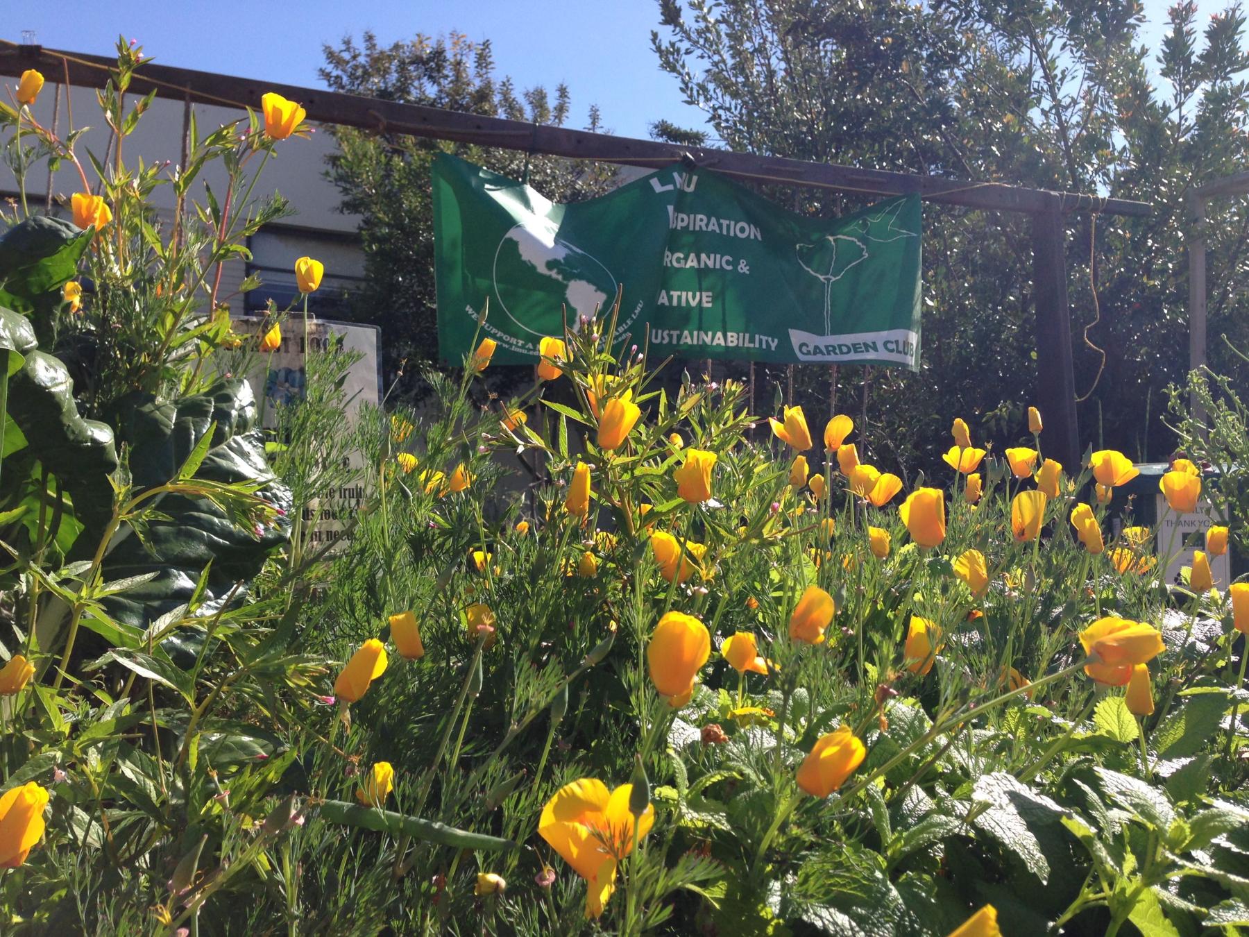
In Los Angeles, STEW-MAP data were collected for Los Angeles County in 2014. Follow-up participatory workshops with respondents indicated that there was a real need to focus in on stewardship of the Los Angeles River watershed. The LA River is a 51-mile-long waterway with headwaters in the Angeles National Forest and emptying into the Pacific Ocean. Known for its channel lined with concrete by the Army Corps of Engineers, it has been featured as a backdrop for iconic Hollywood car chases in moves like Terminator 2 and Gone in 60 Seconds. More recently, there has been a great deal of attention toward restoring ecological functionality and revitalizing the River as a blue-green space for recreation. STEW-MAP workshop participants suggested that data on LA River stewardship groups could help support these efforts. At the same time, the Angeles National Forest was interested in better understanding the landscape of stewardship in the watershed, to maximize the reach of their partnerships and increase visitation of urban residents to the forest.
With these needs in consideration, Loyola Marymount University partnered with the Angeles National Forest, the LA River Urban Waters Federal Partnership (UWFP), the US Forest Service, and several civic organizations to launch LA River STEW-MAP at a 2019 quarterly meeting of the UWFP. The project was also workshopped at other local meetings led by groups such as the Friends of the Los Angeles River and LA River Waterkeeper. During discussion sessions on the uses of resulting STEW-MAP data, several participants were eager to have access to the stewardship data and maps. One partner, the City of Los Angeles’ Department of Sanitation & Environment, expressed interest in utilizing STEW-MAP data in their Biodiversity Team’s development of a local biodiversity index. The LA Biodiversity Index measures a number of indicators, including the management of natural resources. In planning for this index, the city used data from STEW-MAP to better understand the current landscape of stewardship organizations.
In collaboration with Region 9 staff, the R9 Urban Connections program, and NRS - Mark Twain National Forest (MTNF) launched Missouri Outdoor Connections in 2023.
Through this effort, over 170 organizations were identified, using the STEW-MAP methodology, including federal, state and local governments, volunteer groups, recreational and trail clubs, civic and environmental organizations, community-based groups, and nonprofit organizations. Groups work across the State of Missouri, spanning rural to urban environments, from the MTNF to the cities of St. Louis and Kansas City and across public and private lands. This new and engaging online toolset helps link individuals and groups, enabling the advancement of stewardship and equity together, leveraging resource capacity, sharing expertise, and getting stewardship actions accomplished on the ground.
Forest Supervisor for Mark Twain National Forest, Vince Keeler, shared, “I am thankful for the many groups that participated in the development of Missouri Outdoor Connections; and everyone in Missouri will benefit from this effort over the long term, by having partnerships build healthier landscapes where people can get out and enjoy nature!”
In 2007, a public-private partnership between the NYC Parks Department and New York Restoration Project launched a campaign with the lofty goal of planting one million new trees across New York City, known as the MillionTreesNYC Project. Considering the scope and timeline of the project, the campaign leaders decided to convene, and advisory board made up of over 400 people representing over 100 organizations familiar with the various components of the project. These groups and individuals already had expertise in environmental education and engagement, as well as access to existing networks. A concern raised during meetings was the long-term survival of the newly planted trees. Laying the groundwork for long-term stewardship of new trees required a lot of community outreach and reaching community members required a deeper understanding of the neighborhoods in question. By partnering with existing stewardship groups, Million Trees amassed community investment in the new trees. STEW-MAP was an important bridge in this part of the project. The Forest Service shared neighborhood-specific lists of community stewardship groups with Parks and NYRP, which enabled them to target their outreach and access existing networks of volunteers.
When MillionTreesNYC finished in 2015, NYC Parks Stewardship was created to essentially care for and build on all that work we accomplished. Parks Stewardship was created in the hopes that the energy generated around million trees could be applied to ongoing acts of stewardship in the city. Their purpose is to connect New Yorkers to outdoor spaces beyond the major parks they may already visit, including the less familiar forested areas and wetlands, and the everyday nature of street trees and pocket parks. Their staff is situated to train people about the technical aspects of stewardship, like plant identification and invasive removal, so that anyone can gain the knowledge and comfort necessary to engage in stewardship, whether on a one-time or everyday basis.
One of the struggles facing new programs like Parks Stewardship is a lack of awareness. "People don’t realize they can go out there and do these activities, they don’t realize that these opportunities are available", says Nichole Henderson-Roy, Senior Management of Parks Stewardship. She wants to be the bridge that connects New Yorkers to stewardship in a friendly and accessible way that encourages people to stay involved. Key to this mission is the ability to reach out to groups and individuals that may be able to serve as stewards, and STEW-MAP gave a starting point. STEW-MAP is a tool both to connect Parks Stewardship with groups looking for resources and support, and to help those groups identify and form partnerships with one-another. The groups can be anything from two people who organize annual cleanups to groups with 10 or more employees, with budget, non-profit status, and connections to council members or other people in positions of power. STEW-MAP is the only public interface that tracks all of these groups, regardless of size and legal status. While Parks Stewardship may not be able to provide the necessary tools and resources for all of these groups, they can assist in connecting groups to each other based on their needs and services offered.
The overlap between environmental stewardship and community resilience is often overlooked, yet it is key to understanding how to best leverage resources to inform emergency preparedness efforts. The Mayor’s Office of Recovery and Resiliency (now called the Mayor’s Office of Climate and Environmental Justice), a major data provider and STEW-MAP partner, recognizes the potential for collaboration between stewardship work and emergency preparedness to build stronger and more resilient New York City neighborhoods. The Office of Recovery and Resiliency, or ORR, was originally the Office of Long-Term Planning and Sustainability, charged with implementing PlaNYC, the citywide planning report from the Mayor’s Office. After Hurricane Sandy, Mayor Bloomberg created the Special Initiative for Rebuilding and Resiliency, which convened staff from multiple agencies to come together and create a plan for preparing the city for future climate-related disasters.
ORR’s connection to these many community groups made the agency a crucial stakeholder and advisor for STEW-MAP 2017. The Social and Economic Resiliency team from ORR was pulled into the process early in the development of the survey and was excited to collaborate with STEW-MAP because of the possibilities the data and public map would open up for community groups looking to engage in disaster preparedness and recovery. "I feel like STEW-MAP did a good job of capturing some of the smaller groups that might not necessarily come up in some of the ways that we engage with other community organizations," said Erika Lindsey, a Senior Policy Advisor.
By visualizing the spatial relationships of all of these groups, and the opportunity to overlay it with other datasets, ORR will be able to point groups towards STEW-MAP to support them in connecting and supporting one-another in the face of future disasters.
In their data collection efforts, STEW-MAP Oʻahu engaged with environmental groups as well as other civic organizations including canoe clubs, Hawaiian civic clubs, hālau hula, and schools. Out of this broadly inclusive process, researchers and stewards were able to pinpoint groups that don’t identify their primary goal as environmental stewards but are undertaking important work caring for the land. Throughout the STEW-MAP process, these groups had space to connect and discuss shared intentions and goals. New coalitions focused on local environmental issues such as Rapid Ohia Death and Fire management formed as a result of this process.
The STEW-MAP survey questions must be modified to suit the context of the city where the project is implemented. Keeping this in mind, it is highly recommended to hold a workshop that brings together partners or collaborators to test the survey. During the workshop, aside from presenting the project, you can receive feedback on the relevance of the questions and topics, as well as on the clarity of survey instructions. Simultaneously, it serves to explain in detail how to fill out the survey.
When STEW-MAP was implemented in San Juan, Puerto Rico, it took some time to receive responses. Because the project received support from members of the USFS who had previously worked on environmental governance in the city, they didn't need to hold a workshop to gain an existing list of groups and organizations. However, when the survey was initially sent, the groups did not respond as they were unaware of the project. To address this, a student from the University of Puerto Rico was awarded a scholarship to conduct in-person surveys, extending the data collection phase.
This example highlights the importance of holding a workshop to familiarize groups with the project, reduce response time, and enhance the quality of questions and survey content. Conducting a workshop before launching the survey proves to be a powerful tool for building trust in the project and its members.
As of 2024, Superior National Forest in Minnesota is the most recent collaboration for the STEW-MAP team, engaging both the STEW-MAP method and the National Forest Foundation’s “Partnerships in Every Forest” Program. This was decided after the need to develop a strategy for “Stewarding the Superior” to achieve key forest priorities was identified.
This multi-faceted collaboration provides an opportunity to integrate these two complementary approaches and provide an expanded toolkit for National Forests in their partnership activities. Particular areas of focus for Stewarding the Superior include streamlining the Superior NF’s partnership efforts and innovatively supporting the Forest’s vast network of partners, in particular in the areas of youth and volunteer engagement.
Tom Hall, Superior NF Forest Supervisor, said: “Our approach allows us to look across both the breadth of our partner network and also at the depth of our relationships with our partners. The STEW-MAP method provides the breadth by helping us engage the whole of our partner base and visualizing where and how they steward our forest resources. Partnerships on Every Forest will give us a deeper examination of our relationships with key partners and how we can collectively nurture those supportive relationships.”
The implementation of STEW-MAP in Colombia has been accompanied by Urban Tree Management Plans and i-Tree tools.
STEW-MAP was implemented at two different levels. The project conducted in Valledupar was integrated into the city's Urban Tree Management Plan. This integration aimed to determine the number of groups involved in stewardship activities in the city and the composition of these groups. Forty-five groups responded to the survey, revealing that over 64% of them engage in management activities primarily in public parks.
Furthermore, the project unveiled that civic groups are primarily composed of members, but they also have more than 600 volunteers. The programs and projects of these groups focus on parks, street trees, and forests. This information was crucial, aligning with the priority areas outlined in the Urban Tree Management Plan for the city. In this way, STEW-MAP provided valuable insights for the development of management plans and agreements.
The second project implemented in Colombia was at the “comuna” scale. In this STEW-MAP Comuna 10, the project joined forces with i-Tree tools to understand the city's ecosystem services and explore how groups within the city could contribute to their improvement. The survey in this project received responses from 29 groups, with 86% of them engaged in territory defense and environmental education activities. The organizations primarily focus on gardening, urban forestry, urban agriculture, and the protection of water and air.
A notable outcome of this project is the creation of an environmental network map. Based on the responses from the 29 organizations surveyed, an additional 82 organizations were identified as actively involved in environmental care activities within Commune 10. Such projects not only help identify connected organizations but also reveal the level of closeness between them. Combining this information with data obtained from i-Tree tools allows the initiation of creating management plans for urban trees at the city level. Currently, work is underway to expand this effort in Medellín, in support of developing an urban forest management plan.
Fueling Adaptation is a BIL-funded Forest Service R&D project to examine ongoing wildfire adaptation on key landscapes across the Western United States. This research aims to increase the effectiveness of federal fuels reduction efforts and ensure that federal investments are joining and enhancing other community risk reduction and adaptation actions.
In this project, the STEW-MAP methodology has been harmonized with the CoMFRT approach (led by collaborators at Portland State University) to understanding wildfire risk-management networks and applied to two of the Wildfire Crisis Strategy (WCS) landscapes: Southwest Idaho (Boise NF and Payette NF) and the Colorado Front Range (Arapaho and Roosevelt NF and Pike San Isabel NF). Surveys were completed in fall 2024 with 617 organizations identified in Colorado and 101 identified in Idaho – reflecting a dynamic and evolving landscape of collaboration in wildfire adaptation and management.
John Riling, the Project Manager of the Southwest Idaho Landscape of the Wildfire Crisis Strategy said, “Modeling in Southwest Idaho clearly shows we cannot effectively reduce wildfire risk to communities without addressing all ownerships. Additionally, the Forest Service cannot scale treatments to match the need without assistance from partners and taking novel approaches to collaboration. Working across a large diverse landscape with multiple partners is incredibly complex, requiring time to grow trust and establish clear sightlines for shared objectives, roles/responsibilities, and communication. Work completed through the Fueling Adaptation project has helped us better understand the diverse group of partners working across this landscape and how best to incorporate them into our newly formedSouthwest Idaho All-Lands Partnership.”
Public-facing products from this work are forthcoming, and will be incorporated into the WCS StoryMaps.
STEW-MAP Step-By-Step
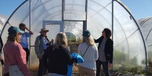
STEW-MAP has been successfully implemented in many places over the last decade. The methodology can be adapted for a range of budgets, for cities or regions of various sizes, and in urban, suburban, and rural areas. The six main steps are described briefly below: For additional information, see the list of resources for download below.

Additional Resources
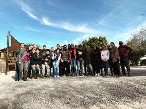
Scientists with Northern Research Station have developed a community of practice for stewardship science, including consultations and discussions around implementing STEW-MAP projects with indirect USDA Forest Service involvement. In addition to projects led by FS scientists, STEW-MAP has been implemented in multiple locations by partners. Click on the locations below to navigate to project pages about each of these partner-led efforts:
- Washington DC - University of District of Columbia
- Charlottesville, Virginia region - Thomas Jefferson Planning District Commission
- Southern New England – EPA, RISD, and Brown University
- Paris - University Paris Diderot 7
If you want to be part of the community of practice or you’re considering using STEW-MAP, please email Lindsay Campbell, lindsay.campbell@usda.gov.
Collaborators
Team Leads
- Lindsay K. Campbell
- Michelle Johnson
- Erika Svendsen
Team Members
- Baltimore, Maryland: Morgan Grove and Nancy Sonti
- Bridger-Teton National Forest: Evan Guzik
- Chicago, Illinois: Cherie Fisher
- Denver, Colorado: Travis Warziniak
- La Paz, Mexico: Arantxa Zamora
- Lima, Peru: Camilla Satler, Nicole Heise, Julio Onofre
- Los Angeles, California: Michele Romolini
- Medellín, Colombia: Maria Arroyave
- Missouri: Alison Koopman, Kim Houf, Cody Norris, Sonja Lin
- New York City, New York: Erika Svendsen, Lindsay K. Campbell, and Michelle Johnson
- North Kona, South Kohala, O'ahu, Hawai'i: Heather McMillen
- Paris, France: Nathalie Blanc
- Philadelphia, Pennsylvania: Michelle Johnson and Krista Heinlen
- San Juan, Puerto Rico: Tischa Munoz-Erickson
- Santo Domingo, Dominican Republic: Tischa Munoz-Erickson
- Seattle, Washington: Weston Brinkley
- Southeast New England: Bryce DuBois
- Springfield, Massachusetts: David Bloniarz
- Valledupar, Colombia: Michelle Johnson
Interactive Maps and Dashboards
- Tool

- Tool
- Tool
- Tool
- Tool
- Tool
- Tool
- Tool
- Tool
- Tool
- Tool
- Tool
- Tool
- Tool

- Tool
- Tool
- Tool
- Tool
- Tool
Dataset Downloads
- Dataset

- Tool
- Dataset
- Dataset
- Dataset
- Dataset
- Dataset
- Dataset
- Dataset
Videos about STEW-MAP
STEW-MAP Locations
- Project
- Project
- Project

- Project
- Project
- Project
- Project
- Project

- Project
- Project
- Project
- Project
- Project

- Project
- Project
- Project
- Project
- Project
- Project
- Project
Publications
- Michele Romolini, R. Patrick Bixler, Morgan Grove. 2016. A Social-ecological framework for urban stewardship network research to promote sustainable and resilient cities
- Lindsay K. Campbell, Erika Svendsen, Michelle Johnson, Laura Landau. 2021. Activating urban environments as social infrastructure through civic stewardship
- Sophie Plitt, Erik Andersson, Michelle Johnson. 2022. Assessing the Potential of E-Tools for Knowledge Sharing and Stewardship of Urban Green Infrastructure
- Holly Caggiano, Laura F. Landau, Lindsay K. Campbell, Michelle L. Johnson, Erika S. Svendsen. 2022. Civic Stewardship and Urban Climate Governance: Opportunities for Transboundary Planning
- Heather L. McMillen, Lindsay K. Campbell, Erika S. Svendsen, Kekuhi Kealiikanakaoleohaililani, Kainana S. Francisco, Christian P. Giardina. 2020. Biocultural stewardship, Indigenous and local ecological knowledge, and the urban crucible
- Michelle L. Johnson, Lindsay K. Campbell, Erika S. Svendsen. 2020. Conceptualizing, analyzing, and supporting stewardship: examining the role of civil society in environmental governance
- T.A. Muñoz-Erickson, L.K. Campbell, D.L. Childers, J.M. Grove, D.M. Iwaniec, S.T.A. Pickett, Michelle Romolini, Erika S. Svendsen. 2016. Demystifying governance and its role for transitions in urban social–ecological systems
- Michelle L. Johnson, Dexter H. Locke, Erika Svendsen, Lindsay K. Campbell, Lynne M. Westphal, Michele Romolini, J. Morgan. Grove. 2019. Context matters: influence of organizational, environmental, and social factors on civic environmental stewardship group intensity
- Michelle L. Johnson, Lindsay Campbell, Erika S. Svendsen. 2025. Examining capacity-outcome relationships to develop an environmental stewardship capacity index in New York City
- Alyssa Thomas, Michele Romolini. 2023. Expanding current definitions of environmental stewardship through organizational mission statement analysis
- James J.T. Connolly, Erika S. Svendsen, Dana R. Fisher, Lindsay K. Campbell. 2015. Mixed methods analysis of urban environmental stewardship networks
- Lindsay K. Campbell, Erika S. Svendsen, Michelle L. Johnson, Sophie Plitt. 2022. Not by trees alone: Centering community in urban forestry
- Erika Svendsen. 2009. Cultivating resilience: urban stewardship as a means to improving health and well-being
- Lindsay K. Campbell, Erika Svendsen, Michelle Johnson, Natalia Piland, Dexter Locke, Nancy Sonti, J. Grove, Michele Romolini, Heather McMillen, Rachel Dacks, Bryce DuBois, Jesse Sayles, Tischa Muñoz-Erickson, Laura Landau, Lorien Jasny, Krista Heinlen, Maria Arroyave, Camille McCarthy, David Bloniarz, Brian Goldberg, Gerald Bauer, Travis Warziniack, Sophie Plitt, Julio Onofre, Nicole Heise Vigil, Arantxa Zamora-Rendon, Alejandra García Castro, Nicole Harmelin García, Bryan Flores. 2024. Reflecting on Local Ecological Stewardship, Care, and Action across Two Decades of Research
- Laura Landau, Lindsay K. Campbell, Michelle Johnson, Erika Svendsen, Holly Berman. 2019. STEW-MAP in the New York City region: survey results of the Stewardship Mapping and Assessment Project
- Erika S. Svendsen, Lindsay K. Campbell, Dana R. Fisher, James J.T. Connolly, Michelle L. Johnson, Nancy Falxa Sonti, Dexter H. Locke, Lynne M. Westphal, Cherie LeBlanc Fisher, Morgan Grove, Michele Romolini, Dale J. Blahna, Kathleen L. Wolf. 2016. Stewardship mapping and assessment project: a framework for understanding community-based environmental stewardship
- Lindsay K. Campbell, Michelle Johnson, Erika Svendsen, Brian Goldberg, Evan Guzik, Paul Archual, Chris McCollister, Sophie Plitt, Molly Radwell. 2023. Strengthening partnerships across the landscape: Bridger-Teton National Forest STEW-MAP report 2021
- Dana R. Fisher, Lindsay Campbell, Erika S. Svendsen. 2012. The organisational structure of urban environmental stewardship
- Erika s. Svendsen, Lindsay K. Campbell. 2008. Urban ecological stewardship: understanding the structure, function and network of community-based urban land management
- Dexter H. Locke, Kristen L. King, Erika S. Svendsen, Lindsay K. Campbell, Christopher Small, Nancy F. Sonti, Dana R. Fisher, Jacqueline W.T. Lu. 2014. Urban environmental stewardship and changes in vegetative cover and building footprint in New York City neighborhoods (2000-2010)
- Selena M. Livas, Dexter H. Locke, Nancy F. Sonti. 2025. Urban environmental stewardship networks: How organizations collaborate, share resources, and exchange knowledge within Baltimore, Maryland
- Lorien Jasny, Michelle Johnson, Lindsay K. Campbell, Erika Svendsen, Josh Redmond. 2019. Working together: the roles of geographic proximity, homophilic organizational characteristics, and neighborhood context in civic stewardship collaboration networks in Philadelphia and New York City
STEW-MAP Summarized


External Publications
Dacks, R; McMillen, H; Heimuli, P; Kahaleua, K; Burgess, S; Giardina, CP; Francisco, K; Ticktin, T. 2021. The Important Role of Environmental Stewardship Groups in Supporting Human Health and Well-Being. Front. Sustain. Cities 3:710355. doi: 10.3389/frsc.2021.710355
Filip, A. 2020. Local institutions of culture as urban stewards: in pursuit of hybrid governance in Warsaw, Poland. Ecology and Society, 25(2).
Blanc, Nathalie. 2019. From ordinary environmentalism to the public environment: theoretical reflections based on French and European empirical research. Ecology and Society, 24(3).
Golly, Krystle M., "Assessing the distribution of environmental stewardship organizations and their relationship to the demographics of Los Angeles County" (2017).LMU/LLS Theses and Dissertations. 319. http://digitalcommons.lmu.edu/etd/319
Brinkley, W.; Wolf, K.L.; Blahna, D.J. 2010. Stewardship Footprints and Potential Ecosystem Recovery: Preliminary Data for Seattle and Puget Sound. In D.N. Laband (ed.) Linking Science and Society. Proceedings of Emerging Issues Along Urban/Rural Interfaces III. Atlanta, GA.