Forest Inventory and Analysis
The Forest Inventory and Analysis (FIA) program of the USDA Forest Service Research and Development Branch collects, processes, analyzes, and reports on data necessary for assessing the extent and condition of forest resources in the United States.
What does the Forest Inventory and Analysis Program do?
Forest Inventory and Analysis (FIA) is a congressionally mandated program that delivers current, consistent, and credible information about the status of forests and forest resources within the United States by continually collecting and analyzing data about these forests and the values they provide. FIA works to:
- Collect annualized data relating to forest resources, health and ownership.
- Collect and analyze a consistent core set of ecological data on all forests to view trends over time.
- Utilize new and emerging technologies to acquire data through remote sensing and field activities.
FIA completes data collection and analysis work within four main inventories:
- The Nationwide Forest Inventory (NFI): a national network of permanent plots that are remeasured every 5-10 years depending on location. Land use information is collected on all plots, with additional site and tree (live and standing dead) data collected on plot areas having forest land use present. Additionally, information about down woody material, soils and understory vegetation is collected on a subset of plots.
- The National Resource Use Monitoring (NRUM): a survey which collects information on manufacturers that use harvested wood products for reporting on size of facilities, products that are manufactured, manufacturing capacity, and other data points.
- The National Woodland Owners Survey (NWOS): a survey that collects information on private forest landowners to understand why they own the land, what they use it for, and how they are planning on managing their land over time.
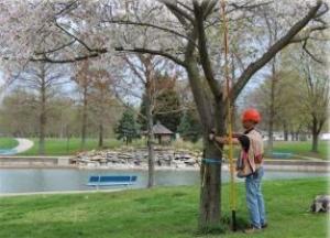
- Urban Inventory: an inventory program that monitors the Nation’s urban forests, examines social dimensions of urban forests and green spaces, and estimates the industrial and nonindustrial uses of urban wood.
FIA also works with experts from universities and trusted partners to expand research capacity, analytical capabilities, and continually develop and enhance our inventory and monitoring techniques within these inventories.
Program Deliverables
Information and trends are important indicators of the conservation and sustainable management of United States forests, and these trends provide policymakers, partners, and other users a variety of data that inform their land-management decisions over time. Our users can rely on the credibility of our information to make critical land management, policy, and investment decisions. Data outputs include, but are not limited to:
- Developing summaries and reports detailing forest health and productivity every five years.
- Providing current and historical data across political and administrative boundaries and land ownerships, including urban forests.
- Developing data sets and analytical products that include a wide array of forest ecosystem parameters addressing the extent, productivity, health, ownership, and utilization of United States forests.
FIA seeks to address emerging user needs by conducting development research in additional to its operational surveys. Current research focuses on seven strategic areas that were identified in previous legislation and the 2015 FIA Strategic Plan. Three of these research portfolios have successfully been operationalized and are each described above (NRUM, NWOS, and Urban). The other four research portfolios include:
- Volume, biomass, and carbon: This priority area aims to advance the science, monitoring, and reporting of timber volume, forest biomass and ecosystem carbon in the United States. Research encompasses:
- advancing methods and models to support forest resource assessment and harvested wood products analysis,
- leveraging FIA inventories and auxiliary information to characterize the demographic drivers of change in forest ecosystems and the goods and services forests provides, and
- developing estimation and accounting compilation systems, data, and tools to inform forest management, mitigation, and adaptation activities.
- Digital Engagement: The mission of the digital engagement portfolio is to transform FIA's analysis, reporting, and delivery of information. This work is made possible through collaboration with agency and external partners to develop and publish relevant and authoritative data that supports user needs. To see examples of FIA's digital engagement work in action, visit the FIA Geospatial Showcase or learn about the BIGMAP project.
- Land Use and Land Cover (LULC): This portfolio addresses the need for FIA to understand and report changes in land use and land cover. FIA continuously monitors the largest set of ground based LULC observations in the world, thanks to the NFI plot network. FIA analysis of LULC focuses on three goals:
- leverage FIA's unique dataset to lead national LULC monitoring,
- create a forum for FIA LULC experts to coordinate research within and outside of the program; and
- communicate new LULC research to FIA's customers. Visit the FIA Land Resources Explorer to view information on land use, land cover, and change in an interactive map.
- Small Area Estimation (SAE): The purpose of the small area estimation research portfolio is to modernize FIA's methods for estimation of forest characteristics within small geographic areas (generally smaller than a state or county) and short time intervals (less than 5 years). Current research is anticipated to lead to operational techniques and tools that will produce the following products:
- a nationwide, experimental series of annual, county level forest area and biomass estimates by 2025, and
- area and biomass change by 2027.
National Program Coordination
The FIA Program is implemented across four units located at USDA Forest Service Research Stations: The Northern Research Station, the Pacific Northwest Research Station, the Rocky Mountain Research Station, and the Southern Research Station. National teams of FIA specialists work together to ensure consistency and efficiency in data collection, management, and analysis. They review and implement modifications, additions, or deletions to any component of the National FIA Program. These teams cross four functional areas, known as Bands:
- Data Acquisition Band: Focuses on standardization of FIA’s core field data collection across the US. This includes testing new protocols, developing documentation and training programs, and conducting quality assurance.
- Information Management Band: Focuses on data management systems for FIA data, including systems for data collection, data editing and validation, internal and public databases, and web applications that allow all users to access and analyze FIA data.
- Analysis Band: Focuses on reporting and providing statistically defensible methods for summarizing FIA data, including identification of new variables (either field measured or computed) needed by FIA customers.
- Techniques Research Band: Focuses on improving the efficiency, timeliness, and quality of the FIA program through research that assesses and integrates new technologies and methodologies into current FIA workflows. The band addresses problem areas outlined in the FIA strategic plan or identified by Congress, FIA Program Managers for each unit, or National FIA leadership.
Background Information and History
The FIA program concept is over 120 years old. The Organic Act of 1897, which established the National Forest System, included provisions for inventory and management of those lands. In 1928, the Forestry Research Act (McSweeney-McNary) directed the Secretary of Agriculture to make and keep current a comprehensive inventory and analysis of the Nation’s forest resources. The Resources Planning Act of 1974 (RPA, PL 93-378) amended the earlier research act. The Forest and Rangeland Renewable Resources Research Act of 1978 (PL 95-307) replaced earlier Forestry Research legislation but repeated the amendment contained in the RPA and further instructed the Secretary of Agriculture to:
“...obtain, analyze, develop, demonstrate, and disseminate scientific information about protecting, managing, and utilizing forest and rangeland renewable resources in rural, suburban, and urban areas”
The National Forest Management Act of 1976 (PL 94-588) directed the USDA Forest Service to:
“ensure research on and (based upon continuous monitoring and assessment in the field) evaluation of the effects of each management system…”
More recently, in 1999 (Farm Bill, Public Law 105-185) and again in 2014 (Farm Bill, Public Law 113-79), Congress directed the Forest Service to reevaluate its statewide inventory mission and to transition to survey each State annually rather than periodically, with the exception of Interior Alaska and U.S. associated islands of the Caribbean and Pacific Ocean. Additionally, FIA was directed to implement urban forest inventories, improve sub-state estimation precision, and improve the timber product output program among other provisions. In collaboration with partners, FIA developed strategic plans to fully transition into an annualized inventory and comply with other requirements.
User Notifications and Bulletins
- [October 31, 2024] Users are advised that DATIM is no longer available. Please use EVALIDator for your data summary needs.
- [June 21, 2022] Estimates and statistics based on Alaska borough and census areas may be misleading. FIA's Alaska inventory is ongoing and many survey units have yet to be sampled. The FIA inventory Alaska survey unit boundaries do not follow Alaska’s borough and census area boundaries or ecoregions. The survey units were outlined broadly encompassing major watershed boundaries. Because much of Alaska is not organized into a recognized borough (county equivalent), the FIA program utilizes the Census Bureau Census Area boundaries as the county equivalents in those areas. However, Alaskan borough and municipality boundaries have changed multiple times since the inception of the FIA annualized inventory (~2004). The Census Bureau has also frequently changed Alaskan Census Area boundaries over that same timeframe. Therefore, any FIA reported estimates reflect only the Alaska survey units involved. Any estimates and summary statistics calculated based on borough or Census Area spatial extents may be misleading due to the variability of these features. For more information, please see the supporting documentation here.
Upcoming Events
Forest Inventory and Analysis National User Group Meeting
- The FIA National User Group Meeting has been postponed. We will provide more information once we are able to reschedule.
Past Events
Forest Inventory and Analysis Science Symposium
- Held every two to three years, the FIA Science Symposium offers an opportunity for scientific and technical exchange, drawing together a world-class group of partners, practitioners, and scientists with regional, national, and international inventory and monitoring missions.
Forest Inventory and Analysis National User Group
- The Biometrics Working Group (BWG), administered by the National Council for Air and Stream Improvement, Inc. (NCASI), organizes meetings where knowledgeable forest biometricians from academia, government forestry agencies and industry discuss technical issues. Meeting topics are often related to the USDA Forest Service Forest Inventory and Analysis (FIA) program; however, technical issues on carbon monitoring or sustainable forestry are also of interest.
Notes from recent BWG meetings can be found on the FIA User Community page of the Society of American Foresters site.
Work with Us
FIA work is coordinated and accomplished out of four regional units that cover the nation, including U.S. territories. Staff and contractors complete our work from different locations across the country. For more information on contracts for field work, contact the person associated with the location you are interested in.
- Northern (CT, DE, IA, IL, IN, KS, MA, MD, ME, MI, MN, MO, ND, NE, NH, NJ, NY, OH, PA, RI, SD, VT, WI, WV): Gayle Geiger
- Pacific Northwest (AK): Dan Irvine
- Pacific Northwest (OR, CA, and WA): Jonny Beals-Nesmith
- Rocky Mountain (AZ, CO, ID, MT, NM, NV, WY, UT): Maryfaith Snyder
- Southern (AL, AR, FL, GA, KY, LA, MS, NC, OK, SC, TN, TX, VA): Angie Rowe
Data Download
| Data/Tool Name | Description |
|---|---|
| FIA DataMart | FIA DataMart allows visitors to download raw data files, standard tables, SQLite databases, Forest Vegetation Simulator (FVS) input files, and a desktop EVALIDator reporting tool. DataMart also provides access to the FIA State reports, FIADB load history, API EVALIDator, and FIADB User Guides. |
| National Resource Use Monitoring - Data Downloads | The NRUM data download allows users to access files that contain data from both the Timber Products Output (TPO) and Harvest Utilization (HU) studies, combined with FIA inventory data and residential firewood estimates derived from the U.S. Department of Energy residential energy consumption survey |
| Urban DataMart | Urban DataMart allows visitors to download raw urban data, as well as Urban FIADB User Guides. |
Data Analysis Tools
| Data/Tool Name | Description |
|---|---|
| BIGMAP | FIA's cloud-based national scale modeling, mapping, and analysis environment for US forests. This online platform combines FIA's NFI data with remote sensing and other datasets to produce maps of forest resources. |
| Business Report Dashboard | The Forest Inventory and Analysis (FIA) Program produces an annual business report aimed at ensuring accountability and transparency to Congress and the public. This dashboard summarizes key financial, partner, and plot measurement information from the business report in an interactive format designed to make it easier for stakeholders to explore the data. |
| FIA Geospatial Showcase | A showcase of FIA maps, tools, data and applications. |
| FIA Land Resources Explorer | The Land Resources Explorer is an interactive, user-friendly suite of tools for viewing land area estimates and maps from multiple information sources, including information on land use, land cover, and change. |
| EVALIDator and FIADB-API | EVALIDator and FIADB-API allows users to produce a large variety of population estimates and their sampling errors based on the current FIA database. Estimates can be produced as totals (e.g. number of trees) or as ratios (e.g., number of trees per acre of forest land). |
| FIA DataMart | FIA DataMart allows visitors to download raw data files, standard tables, SQLite databases, Forest Vegetation Simulator (FVS) input files, and a desktop EVALIDator reporting tool. DataMart also provides access to the FIA State reports, FIADB load history, API EVALIDator, and FIADB User Guides. |
| FIA One-Click State Factsheets | Allows users to view FIA snapshots of a state’s forest land through an interactive tool. Select the desired state to produce a real-time factsheet based on the most currently available FIA data. |
| Timber Products Output Interactive Reporting Tool | The TPO Interactive Tool includes estimates of timber products, logging residue, mill residue, residential fuelwood, and other removals based on the selected area. |
| Timber Products One Click Factsheets | Data include state-wide production, products, number of primary mills and types, roundwood exports/imports, and retained production. |
| National Woodland Owner Survey Dashboard | This tool generates plots and tables for user selected survey question, cycle (i.e. time period), and geography (e.g. national-, regional-, or state-level summaries). |
| My City's Trees | My City's Trees enables anyone to access Urban FIA data and produce custom analyses and reports. Currently, My City's Trees includes information for all targeted cities with a complete certified dataset. |
| i-Tree | i-Tree is a suite of software tools that provides forestry analysis and benefits assessment tools, within urban and non-urban forests that quantify forest structure and the environmental benefits that trees provide. |
| Urban Forest Stats | Urban Forest Stats provides accessible and customized summaries of the estimates produced by Urban FIA data. |
Data Consultations and Requests
| Data/Tool Name | Description |
|---|---|
| Data Consultations and Requests |
|
| Spatial Data Services | In order to protect the privacy of landowners and the integrity of the FIA sample, the exact coordinates of plot locations are kept confidential. Exact plot locations are protected by federal law. Therefore, actual FIA plot locations are very rarely shared and only under a specific, limited set of circumstances. Visit the Spatial Data Services page to learn more. |
The Inventories
Sampling and Estimation Documentation
- J.A. Westfall, J.W. Coulston, G.G. Moisen, H.-E Andersen. 2022. Sampling and estimation documentation for the Enhanced Forest Inventory and Analysis Program: 2022
- William A. Bechtold, Paul L. Patterson, [Editors]. 2005. The enhanced forest inventory and analysis program - national sampling design and estimation procedures
Business and Organizational Documents
- Strategic Plan
- Business Report
Additional Resources
Contributions to National and Global Reporting
FIA data is analyzed on a five-year cycle to produce The Forest Resources of the United States, a supporting document to the RPA Assessment that contains information on the status, condition, and trends in the Nation’s Forest resources.
National Report on Sustainable Forests
FIA data is an essential foundation for the National Report on Sustainable Forests and its 54 indicators of forests sustainability, particularly those indicators covering forest extent, structure, and productivity. Without FIA data, the National Report would not be possible.
FAO Global Forest Resources Assessment
Data concerning the state of the Nation’s forests reported by the United States to the Global Forest Resources Assessment and assembled by the United Nations Food and Agriculture Organization (UN-FAO) come almost exclusively from the Forest Inventory and Analysis Program.
Greenhouse gas inventories to the United Nations Framework Convention for Climate Change
FIA estimates of carbon in forests are crucial for the U.S. national reporting of greenhouse gas inventories to the United Nations Framework Convention for Climate Change.
The North American Forest Database
A platform for enhanced North American forest inventory and monitoring data integration that complements the national forest assessment tools of Canada, Mexico and the USA and the UN FAO Global Forest Resources Assessment (FRA).
The Forest Service produces the authoritative research, analyses, and tools for carbon monitoring and estimation across the nation The Forest Inventory and Analysis (FIA) program is the foundation for data on forest carbon stocks and fluxes at all scales, from farm scale to the National Greenhouse Gas Inventory reporting for the United Nations Framework Convention on Climate Change (UNFCCC), Forest Sustainability Reporting for the Montreal Process, carbon assessment across National Forests and Grasslands, and beyond.
Fifth National Climate Assessment
The Fifth National Climate Assessment is the US Government’s preeminent report on climate change impacts, risks, and responses. FIA scientists and FIA data contributed to the sections related to forests.


