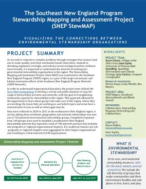
The Stewardship Mapping Project (STEW-MAP): Southeast New England
The Southeast New England Program (SNEP) Network is a collaboration between universities, non-profit organizations and consultants whose mission is to empower communities to achieve healthy watersheds, sustainable financing, and long-term climate resilience through management of stormwater and restoration projects in Rhode Island and southeastern Massachusetts.

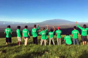
Many non-profits, stewardship groups, and local institutions workday-in and day-out in the region’s watersheds and shorelines. Working with water, one is constantly reminded how everything flows together, how regional and local efforts can be more than the sum of parts. Through stewardship mapping, the links between these efforts become better known, partnerships can be better supported, and new ones fostered in an effort to enhance the social infrastructure underlying stormwater management and restoration.
Bryce DuBois, an Assistant Professor at the Rhode Island School of Design (RISD) became familiar with the value of STEW-MAP as a tool for both practitioners and stewards in the NYC Region during his time as a Totten Fellow at the USDA Forest Service NYC Urban Field Station. Growing local interest in understanding environmental social networks, along with a funding opportunity from SNEP catalyzed a partnership between RISD, Brown University, EPA’s Atlantic Coastal Environmental Sciences Division through the ORISE fellowship program, and thirteen other members of the SNEP Network, led by the New England Environmental Finance Center at the University of Southern Maine to implement STEW-MAP in the Southern New England region.
The SNEP STEW-MAP survey was launched in Fall 2020 and closed in June 2021 developing new outreach protocols to work across municipal and state boundaries. The team worked with a team of RISD research assistants to conduct the initial survey as well as two rounds of alter surveys resulting in a high response rate. In addition to the STEW-MAP survey, they collected data about how many of the responding organizations have been impacted by COVID-19. They asked questions about how their capacity, public engagement and ability to perform direct stewardship shifted during the pandemic. The team is currently working to conduct follow-up interviews and process and analyze all of the collected data. In 2022, SNEP will publish the results of the survey as well as a public web map. SNEP is building on the work of Springfield STEW-MAP to refine online data tools using ESRI’s Survey123.
Collaborators
Contact
- Bryce DuBois, Rhode Island School of Design, Assistant Professor
Partners