[go: up one dir, main page]

Next Issue
Volume 13, December-2
Previous Issue
Volume 13, November-2
 
 
water-logo

Journal Browser

Journal Browser

Water, Volume 13, Issue 23 (December-1 2021) – 164 articles

Cover Story (view full-size image): 
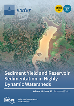
Soil erosion, exacerbated by poor land management practices, can reduce reservoir storage capacity via sedimentation. Accurate sediment yield estimation assists in the adoption of sustainable land-use activities and best management practices. This paper investigates the spatial variability in soil losses and sediment delivery to the Koga Reservoir in Ethiopia using the Soil & Water Assessment Tool (SWAT) along with a rating curve. An alternative approach, using a spatially referenced SWAT model, improved the estimation of suspended sediment in the reservoir. Findings would benefit policymakers towards land and water management decisions. View this paper
  • Issues are regarded as officially published after their release is announced to the table of contents alert mailing list.
  • You may sign up for e-mail alerts to receive table of contents of newly released issues.
  • PDF is the official format for papers published in both, html and pdf forms. To view the papers in pdf format, click on the "PDF Full-text" link, and use the free Adobe Reader to open them.
Order results
Result details
Section
Select all
Export citation of selected articles as:
24 pages, 6809 KiB  
Article
Splitting and Length of Years for Improving Tree-Based Models to Predict Reference Crop Evapotranspiration in the Humid Regions of China
by Xiaoqiang Liu, Lifeng Wu, Fucang Zhang, Guomin Huang, Fulai Yan and Wenqiang Bai
Water 2021, 13(23), 3478; https://doi.org/10.3390/w13233478 - 6 Dec 2021
Cited by 8 | Viewed by 3121
Abstract
To improve the accuracy of estimating reference crop evapotranspiration for the efficient management of water resources and the optimal design of irrigation scheduling, the drawback of the traditional FAO-56 Penman–Monteith method requiring complete meteorological input variables needs to be overcome. This study evaluates [...] Read more.
To improve the accuracy of estimating reference crop evapotranspiration for the efficient management of water resources and the optimal design of irrigation scheduling, the drawback of the traditional FAO-56 Penman–Monteith method requiring complete meteorological input variables needs to be overcome. This study evaluates the effects of using five data splitting strategies and three different time lengths of input datasets on predicting ET0. The random forest (RF) and extreme gradient boosting (XGB) models coupled with a K-fold cross-validation approach were applied to accomplish this objective. The results showed that the accuracy of the RF (R2 = 0.862, RMSE = 0.528, MAE = 0.383, NSE = 0.854) was overall better than that of XGB (R2 = 0.867, RMSE = 0.517, MAE = 0.377, NSE = 0.860) in different input parameters. Both the RF and XGB models with the combination of Tmax, Tmin, and Rs as inputs provided better accuracy on daily ET0 estimation than the corresponding models with other input combinations. Among all the data splitting strategies, S5 (with a 9:1 proportion) showed the optimal performance. Compared with the length of 30 years, the estimation accuracy of the 50-year length with limited data was reduced, while the length of meteorological data of 10 years improved the accuracy in southern China. Nevertheless, the performance of the 10-year data was the worst among the three time spans when considering the independent test. Therefore, to improve the daily ET0 predicting performance of the tree-based models in humid regions of China, the random forest model with datasets of 30 years and the 9:1 data splitting strategy is recommended. Full article
(This article belongs to the Section Hydrology)
Show Figures

Figure 1

Figure 1
<p>The geographical locations of the twenty-one weather stations in the humid areas of China in the present study.</p>
Full article ">Figure 2
<p>General architecture of the random forest model.</p>
Full article ">Figure 3
<p>Simple flowchart of the proposed methodology in this study.</p>
Full article ">Figure 4
<p>The data splitting strategies, lengths of years, and various cross-validation stages involved in this study.</p>
Full article ">Figure 5
<p>Box diagrams of daily FAO56-PM ET<sub>0</sub> values and predicted ET<sub>0</sub> values by the S5 proportion during ten cross-validation stages using the perfect dataset in the testing stage (1966–2015) at the four weather stations. The numbers on the horizontal direction represent the 10 cross-validation periods at S5 proportion, respectively.</p>
Full article ">Figure 6
<p>Bar plots of average RMSE values of the models for estimating daily ET<sub>0</sub> by various length of years using the different proportions in the testing stage at the 21 weather stations. (<b>a</b>,<b>b</b>) stand for RF and XGBoost, respectively; S1, S2, S3, S4, and S5 represent data splitting proportions of 5:5, 6:4, 7:3, 8:2, and 9:1, respectively. RF1, RF2, RF3, and RF4 represent the four combinations of the random forest model; XGB1, XGB2, XGB3, and XGB4 represent the four combinations of the extreme gradient boosting model.</p>
Full article ">Figure 7
<p>Bar chart of each average statistical indicator value in the fixed test dataset (2016–2019) with S5 proportion under combination 2 of random forest and extreme gradient boosting model.</p>
Full article ">
20 pages, 3882 KiB  
Article
Hydrogeochemical Investigation of Elevated Arsenic Based on Entropy Modeling, in the Aquifers of District Sanghar, Sindh, Pakistan
by Zahid Ullah, Muhammad Afnan Talib, Abdur Rashid, Junaid Ghani, Asfandyar Shahab, Muhammad Irfan, Abdur Rauf, Sami Bawazeer, Zainab M. Almarhoon and Yahia N. Mabkhot
Water 2021, 13(23), 3477; https://doi.org/10.3390/w13233477 - 6 Dec 2021
Cited by 19 | Viewed by 6469
Abstract
Arsenic (As) contamination in drinking groundwater is a common environmental problem in Pakistan. Therefore, sixty-one groundwater samples were collected from various groundwater sources in District Sanghar, Sindh province, Pakistan, to understand the geochemical behavior of elevated As in groundwater. Statistical summary showed the [...] Read more.
Arsenic (As) contamination in drinking groundwater is a common environmental problem in Pakistan. Therefore, sixty-one groundwater samples were collected from various groundwater sources in District Sanghar, Sindh province, Pakistan, to understand the geochemical behavior of elevated As in groundwater. Statistical summary showed the cations and anions abundance in decreasing order of Na+ > Ca2+ > Mg2+ > K+, and HCO3 > Cl > SO42− > NO3. Arsenic was found with low to high concentration levels ranging from 5 µg to 25 µg/L with a mean value of 12.9 µg/L. A major water type of groundwater samples was mixed with NaCl and CaHCO3 type, interpreting the hydrochemical behavior of rock–water interaction. Principal component analysis (PCA) showed the mixed anthropogenic and natural sources of contamination in the study area. Moreover, rock weathering and exchange of ions controlled the hydrochemistry. Chloro-alkaline indices revealed the dominance of the reverse ion exchange mechanism in the region. The entropy water quality index (EWQI) exposed that 17 samples represent poor water, and 11 samples are not suitable for drinking. Full article
(This article belongs to the Special Issue Sustainable Management of Water and Wastewater)
Show Figures

Figure 1

Figure 1
<p>Groundwater sampling points and geological settings represent different formations in the study area.</p>
Full article ">Figure 2
<p>Piper diagram shows the category of water type in the study area.</p>
Full article ">Figure 3
<p>Groundwater chemistry of major ions versus Log TDS. The data plotted as: (<b>a</b>) Na<sup>+</sup>/Na<sup>+</sup> + Ca<sup>2+</sup> mg/L versus Log TDS, and (<b>b</b>) Cl<sup>−</sup>/Cl<sup>−</sup> + HCO<sub>3</sub><sup>−</sup> mg/L verses Log TDS.</p>
Full article ">Figure 4
<p>Relationship of ions in meq/L viz. (<b>a</b>) Na<sup>+</sup> versus Cl<sup>−</sup>, (<b>b</b>) Na<sup>+</sup> versus Total cations, (<b>c</b>) Ca<sup>2+</sup> + Mg<sup>2+</sup> versus HCO<sub>3</sub><sup>−</sup> + SO<sub>4</sub><sup>2−</sup> to represent carbonate dissolution and silicate weathering, (<b>d</b>) Ca<sup>2+</sup> + Mg<sup>2+</sup> versus HCO<sub>3</sub><sup>−</sup>, respectively.</p>
Full article ">Figure 5
<p>(<b>a</b>) Relationships of HCO<sub>3</sub><sup>−</sup>/Na<sup>+</sup> versus Ca<sup>2+</sup>/Na<sup>+</sup>, (<b>b</b>) Mg<sup>2+</sup>/Na<sup>+</sup> versus Ca<sup>2+</sup>/Na<sup>+</sup> represent silicate weathering, carbonate weathering, and evaporite dissolution in the study area.</p>
Full article ">Figure 6
<p>Saturation indices (<b>a</b>) Calcite against TDS, (<b>b</b>) Dolomite against TDS, (<b>c</b>) Gypsum against TDS, and (<b>d</b>) Halite against TDS, respectively, in the study area.</p>
Full article ">Figure 7
<p>Plots showing (<b>a</b>) CAI-1 versus CAI-2; (<b>b</b>) (Ca<sup>2+</sup> + Mg<sup>2+</sup>) − (HCO<sub>3</sub><sup>−</sup> + SO<sub>4</sub><sup>2−</sup>) versus (Na<sup>+</sup> +K<sup>+</sup>) − Cl<sup>−</sup>.</p>
Full article ">Figure 8
<p>Suitability assessment map of EWQI showing high and low regions in the study area.</p>
Full article ">
14 pages, 3749 KiB  
Article
The Current Oxygen and Hydrogen Isotopic Status of Lake Baikal
by Andrey Fedotov, Ruslan Gnatovsky, Vadim Blinov, Maria Sakirko, Valentina Domysheva and Olga Stepanova
Water 2021, 13(23), 3476; https://doi.org/10.3390/w13233476 - 6 Dec 2021
Viewed by 3457
Abstract
This study revises the δ18O and δ2H status of Lake Baikal. The mean values of δ18O and δ2H varied from −15.9 to −15.5‰ and from −123.2 to 122.2‰, respectively, for the past 30 yr. The [...] Read more.
This study revises the δ18O and δ2H status of Lake Baikal. The mean values of δ18O and δ2H varied from −15.9 to −15.5‰ and from −123.2 to 122.2‰, respectively, for the past 30 yr. The isotopic composition of the lake remained more ‘‘light” compared to the regional precipitation and rivers inflows. The isotopic composition of the lake has begun to change since ca.1920 after the Little Ice Age; however, Lake Baikal still has not reached the isotopically steady state in the present. The calculated composition of the steady-state should be −12.3‰ for δ18O and −103.6‰ for δ2H. If regional climate parameters do not change dramatically, Lake Baikal will reach these values in ca. 226 yr. Based on isotopic fingerprints of the upper (0 to 150 m) and near-bottom layers (ca. 150 m from the bottom floor), the renewal in the southern and central basins of Lake Baikal has occurred recently compared to the northern Baikal basin, and the size of the mixing-cell of downwelling is close to 30 km. Full article
Show Figures

Figure 1

Figure 1
<p>A sketch shows the location of points of isotopic samples. The upper panel—isotopic composition of regional precipitation from weather stations—Irkutsk, Bagdarin, and Sukhe-Bator [<a href="#B12-water-13-03476" class="html-bibr">12</a>,<a href="#B13-water-13-03476" class="html-bibr">13</a>,<a href="#B14-water-13-03476" class="html-bibr">14</a>,<a href="#B22-water-13-03476" class="html-bibr">22</a>]. Numbers into grey circles are 1, 2, and 3—inflow via Selenga, Bargyzin, and Upper Angara Rivers, respectively. 4—outflow via the Angara River. Prim, Baik, and Barg—Primorsky, Baikalsky, and Barguzinsky Ridges, respectively. The bottom panel is Lake Baikal, grey lines—isobaths countered at 200 m [<a href="#B23-water-13-03476" class="html-bibr">23</a>]. Blue circles are stations of vertical profiles of temperatures, oxygen concentration, and isotopic composition from the surface to the bottom. Red circles—surface samples.</p>
Full article ">Figure 2
<p>Vertical profiles showing the distribution of δ<sup>18</sup>O, δ<sup>2</sup>H, <span class="html-italic">d</span>-excess, temperatures, and oxygen concentrations along stations from <a href="#water-13-03476-f001" class="html-fig">Figure 1</a>. Black lines and symbols (+) are the distribution of δ<sup>18</sup>O, δ<sup>2</sup>H, <span class="html-italic">d</span>-excess in June 1991–1922 [<a href="#B2-water-13-03476" class="html-bibr">2</a>]. Gray areas define the vertical zonation of the water column.</p>
Full article ">Figure 3
<p>Panel (<b>A</b>)—isotopic composition of the surface water in Lake Baikal at June 2021 (red circles) and June 1991–1992 (black circles, No. 336, 337 and 338) from [<a href="#B2-water-13-03476" class="html-bibr">2</a>]. Panel (<b>B</b>)—the result of cluster analysis notes that there is no difference between the southern, central, and northern Baikal (see <a href="#water-13-03476-f001" class="html-fig">Figure 1</a>) in the isotopic composition of the surface water.</p>
Full article ">Figure 4
<p>Monthly isotopic characteristics of regional precipitation. Blue circles—Irkutsk at 2012–2017, black circles—Bagdarin at 1996–2000, red circles—Sukhe-Bator 2002–2003, green triangles—Irkutsk at 1971, 1990. Horizontal black lines—seasonal means isotopic values.</p>
Full article ">Figure 5
<p>Line regressions of oxygen and hydrogen isotopic composition of regional precipitation (Irkutsk—blue, Bagdarin—grey), rivers inflow—green, and Lake Baikal—red. GMWL—Global Water Meteoric Line (δ<sup>2</sup>H = 8 × δ<sup>18</sup>O + 10).</p>
Full article ">Figure 6
<p>(<b>Left</b>) pane—seasonal variation in the hydrological balance of Lake Baikal. (<b>Right</b>) pane—weight average season isotopic characteristic (red and blue curves) of inflow into Lake Baikal, and the mean values of δ<sup>18</sup>O and δ<sup>2</sup>H (black dashed lines) for the lake.</p>
Full article ">Figure 7
<p>The example of changes in δ<sup>18</sup>O and δ<sup>2</sup>H in a month scale, when June 1992 was the beginning for calculation Equations (1) and (2).</p>
Full article ">
16 pages, 4979 KiB  
Article
Evolution of Surface Drainage Network for Spoil Heaps under Simulated Rainfall
by Dongkai Chen, Jiaorong Lv, Han Luo and Yongsheng Xie
Water 2021, 13(23), 3475; https://doi.org/10.3390/w13233475 - 6 Dec 2021
Cited by 4 | Viewed by 3111
Abstract
Spoil heaps laid from the infrastructure building sites or the mining sites are confoundedly prone to accelerated soil erosion and inducing debris flows on extreme rainfall occasion, thus threatening water quality and personal safety. In present study, the roughness and drainage network evolution [...] Read more.
Spoil heaps laid from the infrastructure building sites or the mining sites are confoundedly prone to accelerated soil erosion and inducing debris flows on extreme rainfall occasion, thus threatening water quality and personal safety. In present study, the roughness and drainage network evolution of the loess spoil heap (a 33° slope gradient) were investigated via indoor simulation experiment under three rainfall intensities (60, 90, and 120 mm/h). A detailed scan of the slope using laser scanner, topographic analysis based on ArcGIS software, and statistical analyses were the main methods utilized in the study. The results showed that surface roughness increased with cumulative rainfall. For three rainfall intensity treatments, the proneness of shallow landslide under 90 mm/h intensity resulted in the largest roughness. The drainage density and stream frequency of the spoil heap slope both decreased with cumulative rainfall and negatively correlated with surface roughness, which indicated the convergence of the drainage network. Meanwhile, the individual flow paths presented an increasing sinuosity and a decreasing gradient with cumulative rainfall. However, drainage network features varied in a less marked degree during different rainfall intensities, showing comparable fractal dimensions of 1.350–1.454, 1.305–1.459, and 1.292–1.455 for the three rainfall intensities. Evaluating the response of four hydrodynamic characteristics of runoff to the drainage network evolution, stream power was found to be most sensitive. The linearity of the relationships between stream power and drainage density and that between stream sinuosity and gradient were estimated to have R2 between 0.961 and 0.979. Full article
(This article belongs to the Special Issue Latest Advances in Urban Stormwater Pollution Management)
Show Figures

Figure 1

Figure 1
<p>Experimental equipment.</p>
Full article ">Figure 2
<p>Change of the soil surface roughness with cumulative rainfall (four rainfall sequence in four days, 60 mm/day, the same below).</p>
Full article ">Figure 3
<p>Photograph of spoil heap after the second rainfall at 90 mm/h intensity and the DEM of the landslide profile.</p>
Full article ">Figure 4
<p>Relationship between critical accumulation areas (threshold) and total stream lengths.</p>
Full article ">Figure 5
<p>Changes of drainage density and stream frequency with cumulative rainfall.</p>
Full article ">Figure 6
<p>Drainage networks evolution for the 90 mm/h rainfall intensity treatment (the stream order was classified by STRAHLER method), (<b>a</b>–<b>d</b>) respectively shows the drainage network after the first to fourth rainfall.</p>
Full article ">Figure 7
<p>Changes of the steam numbers of different orders with cumulative rainfall (the stream order was classified by STRAHLER method).</p>
Full article ">Figure 8
<p>Relationships between surface roughness and drainage networks, stream frequency.</p>
Full article ">Figure 9
<p>Changes of the stream sinuosity and gradient of the stream paths with cumulative rainfall.</p>
Full article ">Figure 10
<p>Relationships between surface roughness, stream sinuosity, and stream gradient.</p>
Full article ">
17 pages, 3165 KiB  
Article
The Study of Drought in Future Climate Scenarios in the Huang-Huai-Hai Region
by Gengmin Jiang, Xiaobo Gu, Dongsheng Zhao, Jun Xu, Changkun Yang, Siyu Wang, Yuying Li and Bai-Lian Li
Water 2021, 13(23), 3474; https://doi.org/10.3390/w13233474 - 6 Dec 2021
Cited by 4 | Viewed by 3236
Abstract
In the context of global warming, agricultural production and social and economic development are significantly affected by drought. The future change of climate conditions is uncertain; thus, it is of great importance to clarify the aspects of drought in order to define local [...] Read more.
In the context of global warming, agricultural production and social and economic development are significantly affected by drought. The future change of climate conditions is uncertain; thus, it is of great importance to clarify the aspects of drought in order to define local and regional drought adaptation strategies. In this study, the meteorological data from 1976 to 2005 was used as a historical reference, and nine Global Climate Models (GCMs), downscaling to meteorological stations from 2039 to 2089, were used as future climate data. Based on Penman–Monteith, the reference crop Evapotranspiration (ET0) and Standardized Precipitation Evapotranspiration Index (SPEI) of the reference crop in three emission scenarios of RCP2.6, RCP4.5, and RCP8.5, under future climate conditions, were calculated. A non-parameter Mann–Kendall trend test was performed on temperature, precipitation, ET0, and SPEI to analyze the drought spatiotemporal distribution traits under upcoming climate scenarios. The results showed that, under future climate conditions, SPEI values in most areas of the Huang-Huai-Hai region would continuously increase year by year, and drought would be alleviated to some extent at the same pace. However, with the increase of greenhouse gas concentration in the emission scenarios, SPEI values continued to decline. In the RCP8.5 scenario, the area of severe drought was large. To sum up, in the future climate scenario, the degree of drought in the Huang-Huai-Hai region will be alleviated to some extent with the increase of rainfall, but with the increase of greenhouse gas concentration, the degree of drought will be further intensified, posing a huge challenge to agricultural water use in the region. This study provides a theoretical foundation for alleviating drought in the Huang-Huai-Hai region in future climate scenarios. Full article
(This article belongs to the Section Water and Climate Change)
Show Figures

Figure 1

Figure 1
<p>Study area.</p>
Full article ">Figure 2
<p>Spatiotemporal distribution of temperature under future climate scenarios.</p>
Full article ">Figure 3
<p>The MK trend test of temperature under future climate scenarios.</p>
Full article ">Figure 4
<p>Spatiotemporal distribution of precipitation under future climate scenarios.</p>
Full article ">Figure 5
<p>MK trend test of precipitation under future climate scenarios.</p>
Full article ">Figure 6
<p>Spatiotemporal distribution of ET<sub>0</sub> under future climate scenarios.</p>
Full article ">Figure 7
<p>Spatiotemporal distribution of SPEI under future climate scenarios (2030s, 2050s, and 2080s).</p>
Full article ">Figure 8
<p>MK trend test of SPEI under future climate scenarios.</p>
Full article ">Figure 9
<p><span class="html-italic">Z<sub>c</sub></span> values of ET<sub>0</sub> in the MK trend test and the rate of decadal ET<sub>0</sub> variation in major stations in different RCP scenarios.</p>
Full article ">Figure 10
<p>The variation trend of drought and moist under RCP scenarios in the Huang-Huai-Hai region (red represents severe drought and blue stands for severe moist; colors from light to dark represent 2030s, 2050s, and 2080s).</p>
Full article ">
15 pages, 2993 KiB  
Article
Analyzing the Impact of Climate Change and Human Activities on Surface Runoff in the Changbai Mountain Area, Northeast China
by Shanjun Zhang, Jia Liu, Chuanzhe Li, Fuliang Yu, Lanshu Jing and Jiahui Sun
Water 2021, 13(23), 3473; https://doi.org/10.3390/w13233473 - 6 Dec 2021
Cited by 7 | Viewed by 3394
Abstract
Climate change and human activities are two important factors affecting surface runoff. In water resource management and planning, it is generally important to separate the contribution of these factors when assessing runoff changes. The Changbai Mountain area is rich in water resources and [...] Read more.
Climate change and human activities are two important factors affecting surface runoff. In water resource management and planning, it is generally important to separate the contribution of these factors when assessing runoff changes. The Changbai Mountain area is rich in water resources and is an important hydropower energy base for Northeast China. This study used Sen’s slope estimator to explore trends in runoff precipitation and evapotranspiration from 1960 to 2016, and the results showed a downward trend in runoff and an upward trend in precipitation and evaporation in most areas. The mutation point of the annual time series for the observed runoff was estimated, and the time series was divided into the base period (1960–1975) and impact period (1976–2016). Based on the Budyko framework, we performed attribution analysis of the runoff changes, and analyzed the difference between the mountainous region and the whole basin. We determined that the impacts of climate change and human activities, on average, accounted for decreases in the runoff by 60.15% and 39.85%, respectively, for the Second Songhua River Basin; 73.74% and 26.26%, respectively, for the Tumen River Basin; 84.76% and 15.24%, respectively, for the Yalu River Basin; human activities were the main causes of runoff changes in the Changbai Mountain area; climate change was the main cause of runoff changes in mountainous regions. The results of this study show that the reasons for the change in runoff in mountainous regions and the whole basin in the same area are different, which has some illuminating significance for water resources management of different elevation areas. Full article
Show Figures

Figure 1

Figure 1
<p>River networks and hydrological stations in the Changbai Mountain area (CMA).</p>
Full article ">Figure 2
<p>Results of Sen’s slope estimator for partitions of the Changbai Mountain area. (<b>a</b>,<b>b</b>) show the trend and significance of the runoff, (<b>c</b>,<b>d</b>) show the trend of the precipitation and the potential evapotranspiration.</p>
Full article ">Figure 3
<p>Distribution of the mean annual evaporation ratio (<math display="inline"><semantics> <mrow> <mi>E</mi> <msub> <mi>T</mi> <mi>a</mi> </msub> <mo>/</mo> <mi>P</mi> </mrow> </semantics></math>) vs. the mean annual dryness index (<math display="inline"><semantics> <mrow> <mi>E</mi> <msub> <mi>T</mi> <mn>0</mn> </msub> <mo>/</mo> <mi>P</mi> </mrow> </semantics></math>) in a Budyko framework. Fengman (FM), Quanhe (QH), Huanggou (HG), Gaolichengzi (GLCZ), Hanyangtun (HYT), Kaishantun (KST), and Changbai (CB) hydrological stations.</p>
Full article ">Figure 4
<p>Results of the Pettitt mutation point test in partitions of the Changbai Mountain area. (<b>a</b>) Fengman, (<b>b</b>) Gaolichengzi, (<b>c</b>) Hanyangtun, (<b>d</b>) Quanhe, (<b>e</b>) Kaishantun, (<b>f</b>) Huanggou, and (<b>g</b>) Changbai hydrological stations.</p>
Full article ">Figure 5
<p>Relationship between the elasticity of runoff and the dryness index under different parameter values of <math display="inline"><semantics> <mi>n</mi> </semantics></math>. (<b>a</b>,<b>b</b>) Second Songhua River Basin, (<b>c</b>,<b>d</b>) Tumen River Basin, (<b>e</b>,<b>f</b>) Yalu River Basin. Fengman (FM), Quanhe (QH), Huanggou (HG), Gaolichengzi (GLCZ), Hanyangtun (HYT), Kaishantun (KST), and Changbai (CB) hydrological stations.</p>
Full article ">
12 pages, 2417 KiB  
Article
Competition and Plant Trait Plasticity of Invasive (Wedelia trilobata) and Native Species (Wedelia chinensis, WC) under Nitrogen Enrichment and Flooding Condition
by Ahmad Azeem, Mai Wenxuan, Tian Changyan, Qaiser Javed and Adeel Abbas
Water 2021, 13(23), 3472; https://doi.org/10.3390/w13233472 - 6 Dec 2021
Cited by 11 | Viewed by 3393
Abstract
Nitrogen (N) is the important nutrition that regulatory plant functioning and environmental stability of invasive plant species under flooding (F) conditions. Little information clarifies the role of nitrogen enrichment and flooding on the invasive plant functional traits and competition with native competitors. Plant [...] Read more.
Nitrogen (N) is the important nutrition that regulatory plant functioning and environmental stability of invasive plant species under flooding (F) conditions. Little information clarifies the role of nitrogen enrichment and flooding on the invasive plant functional traits and competition with native competitors. Plant functional traits play an essential role in the successful growth of plants under different environmental conditions. Therefore, greenhouse pots experiment was conducted with invasive plant species (Wedelia trilobata, WT), and its native competitor (Wedelia chinensis, WC) in monoculture and cocultivation culture, along with flooding and nitrogen enrichment conditions. Considering the impact of flooding (F) and nitrogen (N) on an individual basis, the plant physiological traits of WC were nonsignificant compared to that of WT. However, in the combination of flooding × additional nitrogen (F.N, F.2N), plant physiological traits of WT were comparatively higher than those of WC, especially in cocultivation. In flooding × additional nitrogen (F.N and F.2N), better phenotypic plasticity at different plant traits makes WT more dominant in resource competition over WC. In conclusion, improved functional traits of WT under nitrogen enrichment and flooding conditions enhanced its competitiveness over native competitors. Full article
Show Figures

Figure 1

Figure 1
<p>Details of experimental treatments and their combination along with planting culture. Nitrogen treatments were made with an equal proportion of KNO<sub>3</sub> and NH<sub>4</sub>Cl. Note: F = combination of water flooding along with control nitrogen, CK = normal water along with control nitrogen, F.N = flooding along with additional nitrogen, N = normal water along with additional nitrogen, F.2N = flooding along with additional double nitrogen, 2N = normal water along with additional double nitrogen.</p>
Full article ">Figure 2
<p>Plant height (<b>a</b>), dry weight (<b>b</b>), and leaf nitrogen (<b>c</b>) of Wedelia trilobata and Wedelia chinensis under different treatments. Mean ± SE and different letter represented significant difference under mono- and cocultivation of Wedelia trilobata and Wedelia chinensis, according to ANOVA and Tukey Test (<span class="html-italic">p</span> &lt; 0.05). Note: WT mono = Wedelia trilobata under monoculture, WC mono = Wedelia chinensis under monoculture, WT mix = Wedelia trilobata under mixed culture, WC mix = Wedelia chinensis under mixed culture.</p>
Full article ">Figure 3
<p>Specific leaf area (<b>a</b>) and chlorophyll content (<b>b</b>) of Wedelia trilobata and Wedelia chinensis under different treatments; Mean ± SE and different letter represented significant difference under mono and cocultivation of Wedelia trilobata and Wedelia chinensis, according to ANOVA and Tukey Test (<span class="html-italic">p</span> &lt; 0.05). Note: WT mono = Wedelia trilobata under monoculture, WC mono = Wedelia chinensis under monoculture, WT mix = Wedelia trilobata under mixed culture, WC mix = Wedelia chinensis under mixed culture.</p>
Full article ">Figure 4
<p>Difference in phenotypic plasticity indices of functional traits of Wedelia trilobata and Wedelia chinensis between plant species and different treatments under cocultivation. (<b>a</b>) representing functional traits between both species and (<b>b</b>) representing functional traits under different treatments. Mean ± SE and different letters indicate a significant difference (<span class="html-italic">p</span> &lt; 0.05) measured by ANOVA among groups followed by Tukey Test. Note: WT = Wedelia trilobata, WC = Wedelia chinensis. * Significant at <span class="html-italic">p</span> &lt; 0.05.</p>
Full article ">Figure 5
<p>Relative competition intensity of dry weight, plant height, specific leaf area, leaf nitrogen, and chlorophyll content of Wedelia trilobata and Wedelia chinensis under different nitrogen and water treatments in Cocultivation; Mean ± SE and different letters indicate a significant difference; according to ANOVA among groups followed by Tukey Test (<span class="html-italic">p</span> &lt; 0.05). Note: WT = Wedelia trilobata, WC = Wedelia chinensis.</p>
Full article ">
13 pages, 3170 KiB  
Article
The Use of Phytoplankton in the Assessment of Water Quality in the Lower Section of Poland’s Largest River
by Ewa Anna Dembowska
Water 2021, 13(23), 3471; https://doi.org/10.3390/w13233471 - 6 Dec 2021
Cited by 9 | Viewed by 5561
Abstract
Phytoplankton studies were carried out in the lower course of Poland’s largest river, the Vistula. This section of the Vistula has changed much since the 19th century due to regulation of the bed and limitation of its flood banks. In the years 1994–2020, [...] Read more.
Phytoplankton studies were carried out in the lower course of Poland’s largest river, the Vistula. This section of the Vistula has changed much since the 19th century due to regulation of the bed and limitation of its flood banks. In the years 1994–2020, hydrobiological studies of physical and chemical parameters and phytoplankton were carried out. On the basis of these studies, this research investigated the water quality of the river. Since 2000, a gradual improvement in water quality in the river has been observed, as manifested by decreasing phytoplankton biomass (from over 15 mg/L in 1994 and 2003 to less than 10 mg/L in the 2000s) and lower chlorophyll a concentrations (from 48 µg/L in 1998 to 12.5 µg/L in 2020). The river’s ecological potential index, calculated on the basis of indicator species of phytoplankton and chlorophyll a concentration, also indicates a progressive improvement. In the 1990s, the ecological potential was poor; at the turn of the century, it was moderate; and in the following years, the phytoplankton studies showed an ecological potential that was good or moderate (slightly below the lower threshold of good potential). Full article
(This article belongs to the Special Issue Water Quality Assessment and Ecological Monitoring in Aquatic System)
Show Figures

Figure 1

Figure 1
<p>Location of the investigated station on the Vistula River.</p>
Full article ">Figure 2
<p>Number of taxa and Shannon–Wienner diversity index calculated on the basis of phytoplankton biomass in the Vistula in the period from 1994 to 2020.</p>
Full article ">Figure 3
<p>Changes in phytoplankton biomass, chlorophyll <span class="html-italic">a</span> concentrations, and the trend lines in the Vistula in the period from 1994 to 2020.</p>
Full article ">Figure 4
<p>Percentage share of phytoplankton groups during the investigation period.</p>
Full article ">Figure 5
<p>Changes in IFPL values and the trend line in the Vistula in the period from 1994 to 2020 (orange—poor, yellow—moderate, green—good ecological potential).</p>
Full article ">Figure 6
<p>Changes in pH values and the trend line in the Vistula in the period from 1994 to 2020.</p>
Full article ">Figure 7
<p>Changes in oxygen concentration (DO) and the trend line in the Vistula in the period from 1994 to 2020.</p>
Full article ">Figure 8
<p>Changes in conductivity (EC) and the trend line in the Vistula in the period from 1994 to 2020.</p>
Full article ">
21 pages, 15505 KiB  
Article
Block-Greedy and CNN Based Underwater Image Dehazing for Novel Depth Estimation and Optimal Ambient Light
by Fayadh Alenezi, Ammar Armghan, Sachi Nandan Mohanty, Rutvij H. Jhaveri and Prayag Tiwari
Water 2021, 13(23), 3470; https://doi.org/10.3390/w13233470 - 6 Dec 2021
Cited by 63 | Viewed by 4426
Abstract
A lack of adequate consideration of underwater image enhancement gives room for more research into the field. The global background light has not been adequately addressed amid the presence of backscattering. This paper presents a technique based on pixel differences between global and [...] Read more.
A lack of adequate consideration of underwater image enhancement gives room for more research into the field. The global background light has not been adequately addressed amid the presence of backscattering. This paper presents a technique based on pixel differences between global and local patches in scene depth estimation. The pixel variance is based on green and red, green and blue, and red and blue channels besides the absolute mean intensity functions. The global background light is extracted based on a moving average of the impact of suspended light and the brightest pixels within the image color channels. We introduce the block-greedy algorithm in a novel Convolutional Neural Network (CNN) proposed to normalize different color channels’ attenuation ratios and select regions with the lowest variance. We address the discontinuity associated with underwater images by transforming both local and global pixel values. We minimize energy in the proposed CNN via a novel Markov random field to smooth edges and improve the final underwater image features. A comparison of the performance of the proposed technique against existing state-of-the-art algorithms using entropy, Underwater Color Image Quality Evaluation (UCIQE), Underwater Image Quality Measure (UIQM), Underwater Image Colorfulness Measure (UICM), and Underwater Image Sharpness Measure (UISM) indicate better performance of the proposed approach in terms of average and consistency. As it concerns to averagely, UICM has higher values in the technique than the reference methods, which explainsits higher color balance. The μ values of UCIQE, UISM, and UICM of the proposed method supersede those of the existing techniques. The proposed noted a percent improvement of 0.4%, 4.8%, 9.7%, 5.1% and 7.2% in entropy, UCIQE, UIQM, UICM and UISM respectively compared to the best existing techniques. Consequently, dehazed images have sharp, colorful, and clear features in most images when compared to those resulting from the existing state-of-the-art methods. Stable σ values explain the consistency in visual analysis in terms of sharpness of color and clarity of features in most of the proposed image results when compared with reference methods. Our own assessment shows that only weakness of the proposed technique is that it only applies to underwater images. Future research could seek to establish edge strengthening without color saturation enhancement. Full article
(This article belongs to the Special Issue AI and Deep Learning Applications for Water Management)
Show Figures

Figure 1

Figure 1
<p>Underwater hazing problem model showing back, forward and direct scattering. The effect of light absorption due to the three types of scattering (back, direct and forward) results in the in-camera hazing of assumed haze-free scenes.</p>
Full article ">Figure 2
<p>Theoretical attenuation coefficient showing different regions in water. The light gray shaded region has the grain-size distribution (GSD) ranging between <math display="inline"><semantics> <mrow> <mo>(</mo> <mn>0.4</mn> </mrow> </semantics></math>–4 <math display="inline"><semantics> <mrow> <mi mathvariant="sans-serif">μ</mi> <mi mathvariant="normal">m</mi> <mo>)</mo> </mrow> </semantics></math> and the darker gray shaded region has the GSD ranging between <math display="inline"><semantics> <mrow> <mo>(</mo> <mn>4</mn> </mrow> </semantics></math>–<math display="inline"><semantics> <mrow> <mn>300</mn> <mspace width="3.33333pt"/> <mi mathvariant="sans-serif">μ</mi> <mi mathvariant="normal">m</mi> <mo>)</mo> </mrow> </semantics></math>. The vertical dotted line represents the mean particle radius <math display="inline"><semantics> <mrow> <mo>(</mo> <mo>∼</mo> </mrow> </semantics></math><math display="inline"><semantics> <mrow> <mn>10.5</mn> <mspace width="3.33333pt"/> <mi mathvariant="sans-serif">μ</mi> <mi mathvariant="normal">m</mi> <mo>)</mo> </mrow> </semantics></math> [<a href="#B37-water-13-03470" class="html-bibr">37</a>].</p>
Full article ">Figure 3
<p>The effect of Lie-grouping during training in the proposed technique is visible in the saturated color in the surf plot of the underwater dehazed image compared to that of the underwater hazed image. The most notable difference is in the red and blue colors in the hazed and dehazed image surf plot.</p>
Full article ">Figure 4
<p>The proposed CNN architecture of our technique consists of three modules. These modules are a Global light and Local light network, a depth estimation network, and a <math display="inline"><semantics> <mo>Λ</mo> </semantics></math>-Estimator. The Global light and Local light network is used to estimate the global and local ambient light based on the underwater pixels. The depth estimation network estimates the depth of the transmission of the underwater image. The <math display="inline"><semantics> <mo>Λ</mo> </semantics></math>-Estimator restores the dehazed image.</p>
Full article ">Figure 5
<p>The proposed architecture of our Global light and Local light network consisting of two operations. The operations are convolution and max-pooling. The input of the Global light and Local light network is the underwater image after downsampling and the output in the approximated scene light based on global and local ambient light. The scene light depends on global and local pixel relationships and intensities.</p>
Full article ">Figure 6
<p>The architecture of the depth estimation network consists of three layers. The layers contain two operations, convolution and pooling. The loss function is managed at the end of the two operations before upsampling.</p>
Full article ">Figure 7
<p>A subjective comparison of different methods with proposed results. From left to right is input image (hazed image), and results of RLSCD (<b>a</b>) [<a href="#B25-water-13-03470" class="html-bibr">25</a>], and HUIE (<b>b</b>) [<a href="#B61-water-13-03470" class="html-bibr">61</a>] and the proposed.</p>
Full article ">Figure 8
<p>A subjective comparison of different methods with proposed results. From left to right is (<b>a</b>) input image (hazed image), and results of (<b>b</b>) ARC [<a href="#B58-water-13-03470" class="html-bibr">58</a>], (<b>c</b>) UWGAN [<a href="#B59-water-13-03470" class="html-bibr">59</a>], (<b>d</b>) WSCT [<a href="#B60-water-13-03470" class="html-bibr">60</a>], (<b>e</b>) RLSCD [<a href="#B25-water-13-03470" class="html-bibr">25</a>] and (<b>f</b>) the proposed.</p>
Full article ">Figure 9
<p>A subjective comparison of different methods with proposed results. From top to bottom is (<b>a</b>) input image (hazed image), and results of (<b>b</b>) UEBLL [<a href="#B22-water-13-03470" class="html-bibr">22</a>], and (<b>c</b>) the proposed.</p>
Full article ">Figure 10
<p>A subjective comparison of different methods with proposed results. From left to right is input image (hazed image), and results of (<b>a</b>) [<a href="#B61-water-13-03470" class="html-bibr">61</a>], and the proposed.</p>
Full article ">Figure 11
<p>A subjective comparison of different methods with proposed results. From left to right is input image (hazed image), and results of (<b>a</b>) HUIE [<a href="#B61-water-13-03470" class="html-bibr">61</a>], and the proposed.</p>
Full article ">Figure 12
<p>A subjective comparison of transmission map of existing method [<a href="#B23-water-13-03470" class="html-bibr">23</a>] with proposed results.</p>
Full article ">Figure 13
<p>A subjective comparison of the effectiveness of the proposed ambient light in the proposed technique.</p>
Full article ">
13 pages, 37851 KiB  
Article
A New Strategy for Sponge City Construction of Urban Roads: Combining the Traditional Functions with Landscape and Drainage
by Chengyao Wei, Jin Wang, Peirong Li, Bingdang Wu, Hanhan Liu, Yongbo Jiang and Tianyin Huang
Water 2021, 13(23), 3469; https://doi.org/10.3390/w13233469 - 6 Dec 2021
Cited by 5 | Viewed by 5427
Abstract
Urban roads play a key role in sponge city construction, especially because of their drainage functions. However, efficient methods to enhance their drainage performance are still lacking. Here, we propose a new strategy to combine roads, green spaces, and the drainage system. Generally, [...] Read more.
Urban roads play a key role in sponge city construction, especially because of their drainage functions. However, efficient methods to enhance their drainage performance are still lacking. Here, we propose a new strategy to combine roads, green spaces, and the drainage system. Generally, by considering the organization of the runoff and the construction of the drainage system (including sponge city facilities) as the core of the strategy, the drainage and traffic functions were combined. This new strategy was implemented in a pilot study of road reconstruction conducted in Zhangjiagang, Suzhou, China. Steel slag was used in the structural layers to enhance the water permeability of the pavement and the removal of runoff pollutants. The combined effects of this system and of the ribbon biological retention zone, allowed achieving an average removal rate of suspended solids, a chemical oxygen demand, a removal of total nitrogen and total phosphorus of 71.60%, 78.35%, 63.93%, and 49.47%; in contrast, a traditional road could not perform as well. Furthermore, the volume control rate of the annual runoff met the construction requirements (70%). The results of the present study indicate that, combining the traditional basic functions of roads with those of landscape and drainage might be a promising strategy for sponge city construction of urban road. Full article
(This article belongs to the Special Issue Urban Runoff Control and Sponge City Construction)
Show Figures

Figure 1

Figure 1
<p>Location and typical section of the pilot road.</p>
Full article ">Figure 2
<p>(<b>a</b>) Main aspects of different features in the design of SCCUR; (<b>b</b>) transformation strategies for different surfaces.</p>
Full article ">Figure 3
<p>(<b>a</b>) Typical runoff organization and drainage model of urban roads; (<b>b</b>) optimization of runoff rainwater.</p>
Full article ">Figure 4
<p>Structures of the steel slag–permeable asphalt pavement: (<b>a</b>) semi-pervious; (<b>b</b>) fully pervious; (<b>c</b>) structures of the steel slag–permeable concrete pavement (fully pervious).</p>
Full article ">Figure 5
<p>The road before (<b>a</b>) and after (<b>b</b>) reconstruction; (<b>c</b>) vertical relationship between different parts; (<b>d</b>) schematic diagram of the overflow inlet.</p>
Full article ">Figure 6
<p>Removal rate of SS, COD, removal rates of TN and TP of the steel slag–permeable asphalt pavement (<b>a</b>) and the ribbon biological retention zone (<b>b</b>) in different samples.</p>
Full article ">
21 pages, 4783 KiB  
Article
Characteristics of Turbulence in the Downstream Region of a Vegetation Patch
by Masoud Kazem, Hossein Afzalimehr and Jueyi Sui
Water 2021, 13(23), 3468; https://doi.org/10.3390/w13233468 - 6 Dec 2021
Cited by 17 | Viewed by 2936
Abstract
In presence of vegetation patches in a channel bed, different flow–morphology interactions in the river will result. The investigation of the nature and intensity of these structures is a crucial part of the research works of river engineering. In this experimental study, the [...] Read more.
In presence of vegetation patches in a channel bed, different flow–morphology interactions in the river will result. The investigation of the nature and intensity of these structures is a crucial part of the research works of river engineering. In this experimental study, the characteristics of turbulence in the non-developed region downstream of a vegetation patch suffering from a gradual fade have been investigated. The changes in turbulent structure were tracked in sequential patterns by reducing the patch size. The model vegetation was selected carefully to simulate the aquatic vegetation patches in natural rivers. Velocity profile, TKE (Turbulent Kinetic Energy), turbulent power spectra and quadrant analysis have been used to investigate the behavior and intensity of the turbulent structures. The results of the velocity profile and TKE indicate that there are three different flow layers in the region downstream of the vegetation patch, including the wake layer, mixing layer and shear layer. When the vegetation patch is wide enough (Dv/Dc > 0.5, termed as the patch width ratio, where Dv is the width of a vegetation patch and Dc is the width of the channel), highly intermittent anisotropic turbulent events appear in the mixing layer at the depth of z/Hv = 0.7~1.1 and distance of x/Hv = 8~12 (where x is streamwise distance from the patch edge, z is vertical distance from channel bed and Hv is the height of a vegetation patch). The results of quadrant analysis show that these structures are associated with the dominance of the outward interactions (Q1). Moreover, these structures accompany large coherent Reynolds shear stresses, anomalies in streamwise velocity, increases in the standard deviation of TKE and increases in intermittent Turbulent Kinetic Energy (TKEi). The intensity and extents of these structures fade with the decrease in the size of a vegetation patch. On the other hand, as the size of the vegetation patch decreases, von Karman vortexes appear in the wake layer and form the dominant flow structures in the downstream region of a vegetation patch. Full article
(This article belongs to the Special Issue Fluvial Hydraulics Affected by River Ice and Hydraulic Structures)
Show Figures

Figure 1

Figure 1
<p>(<b>A</b>) The layout of the experimental device, (<b>B</b>) a sample of vegetation patches (120 × 90 cm, <span class="html-italic">D<sub>v</sub>/D<sub>c</sub></span> = 1), (<b>C</b>) sample of vegetation patch in a natural gravel bed river (Marbor River, Iran), (<b>D</b>) a sample of bed materials, (<b>E</b>) a single synthetic plant used to simulate patch; (<b>F</b>) a sketch of the experimental setup (not to scale).</p>
Full article ">Figure 2
<p>Streamwise velocity profiles along the centerline of the flume; <span class="html-italic">x/H<sub>v</sub></span> is the normalized distance from the downstream edge of the vegetation patch, and <span class="html-italic">H</span> is the depth of flow. The boundaries between zones affected by the wake and over the canopy flow are shown as red lines. The velocity of the Log–Law zone is shown as dashed and is not to scale.</p>
Full article ">Figure 3
<p>Normalized TKE and streamwise velocity behind 4 different patch layouts near channel bed (<span class="html-italic">z/H<sub>v</sub></span> = 0), at the middle height of patch (<span class="html-italic">z/H<sub>v</sub></span> = 0.5) and top of patch (<span class="html-italic">z/H<sub>v</sub></span> = 1).</p>
Full article ">Figure 4
<p>Samples of the power spectra behind the patch showing different classes of turbulence: (<b>A</b>) isotropic–homogenious turbulent flow without dominant frequency on <span class="html-italic">S<sub>uw</sub></span>, (<b>B</b>) isotropic–homogenious turbulent flow with dominant frequency on <span class="html-italic">S<sub>uw</sub></span>, observed below the height of the patch, (<b>C</b>) anisotropic turbulent flow with dominant frequency on <span class="html-italic">S<sub>uw</sub></span>, observed alongside the height of patch, (<b>D</b>) <span class="html-italic">S<sub>uw</sub></span> of the same anisotropic sample.</p>
Full article ">Figure 5
<p>Values of <math display="inline"><semantics> <mrow> <mo>−</mo> <mover accent="true"> <mrow> <mi>u</mi> <mo>′</mo> <mi>w</mi> <mo>′</mo> </mrow> <mo stretchy="true">¯</mo> </mover> </mrow> </semantics></math> along the centerline of the channel beyond the vegetation patch (colored figures) beside values of <math display="inline"><semantics> <mrow> <msub> <mi>τ</mi> <mi>c</mi> </msub> <mo>/</mo> <msub> <mi>τ</mi> <mi>r</mi> </msub> </mrow> </semantics></math> (graysclae). Note that the blank area in <math display="inline"><semantics> <mrow> <msub> <mi>τ</mi> <mi>c</mi> </msub> <mo>/</mo> <msub> <mi>τ</mi> <mi>r</mi> </msub> </mrow> </semantics></math> is where no dominant frequency was detectable in <span class="html-italic">S<sub>uw</sub></span>. The end of the patch is located at <span class="html-italic">x</span> = 800.</p>
Full article ">Figure 6
<p>Probability of occurrence of quadrant classes behind the patch; the end of the patch is located at <span class="html-italic">x</span> = 800. The height of the patches is 105 ± 5 mm, and the values are shown up to level of the maximum domain of ADV capability (~140 mm).</p>
Full article ">Figure 7
<p>Conceptual illustration of the quadratic bursting events in the boundary between the mixing layer and the shear layer.</p>
Full article ">Figure 8
<p>Values of <math display="inline"><semantics> <mrow> <msub> <mi>f</mi> <mi>k</mi> </msub> <mrow> <mo>(</mo> <mrow> <mi mathvariant="normal">Q</mi> <mn>1</mn> </mrow> <mo>)</mo> </mrow> </mrow> </semantics></math> and <math display="inline"><semantics> <mrow> <msub> <mi>f</mi> <mrow> <msub> <mi>d</mi> <mrow> <mrow> <msup> <mi>u</mi> <mo>′</mo> </msup> </mrow> <mrow> <msup> <mi>w</mi> <mo>′</mo> </msup> </mrow> </mrow> </msub> </mrow> </msub> </mrow> </semantics></math> for 278 points in the downstream region of the vegetation patches.</p>
Full article ">Figure 9
<p>Values of <span class="html-italic">Error<sub>CDF</sub></span> for different depths behind the decaying patch at a distance of <span class="html-italic">x/H<sub>v</sub></span> = 8.</p>
Full article ">Figure 10
<p>Probability density function and the turbulent spectra for the mixing layer of Case 1.</p>
Full article ">Figure 11
<p>Formation of the intermittent fluctuations in the mixing layer beyond the patch (case 1). The filtered velocity time series is shown as intermittent fluctuations above the original velocity time series. Variations in the normalized standard deviation of TKE and normalized intermittent Turbulent Kinetic Energy are shown at the bottom.</p>
Full article ">
21 pages, 1510 KiB  
Article
Exploring Risk Perception and Behaviours at the Intersection of Flood Events and Private Groundwater Supplies: A Qualitative Focus Group Study
by Cillian P. McDowell, Luisa Andrade, Viviana Re, Jean O’Dwyer, Paul D. Hynds and Eoin O’Neill
Water 2021, 13(23), 3467; https://doi.org/10.3390/w13233467 - 6 Dec 2021
Cited by 4 | Viewed by 3570
Abstract
Flooding events can inflict major disruption on society and cause significant infrastructural and environmental damage. However, the adverse health impacts of flooding, particularly as they pertain to private groundwater resources used for consumption, are frequently overlooked. Whilst the literature has previously found a [...] Read more.
Flooding events can inflict major disruption on society and cause significant infrastructural and environmental damage. However, the adverse health impacts of flooding, particularly as they pertain to private groundwater resources used for consumption, are frequently overlooked. Whilst the literature has previously found a lack of well stewardship among private well owners under ‘normal’ conditions, our understanding of private well owners’ perceptions of and preparedness for the risks posed by flooding to their domestic well-water supply is limited. This study advances the qualitative literature on this subject. It is amongst the first qualitative studies employing focus groups to examine private well owners, and the first in an Irish context. Six focus groups were conducted in four counties in Ireland, with the themes emerging from the focus groups refined, organised, and interpreted in the context of the Health Belief Model. Most focus group participants expressed awareness of the potential severity of well contamination following flooding, but many did not consider their local area “at risk” of it, notwithstanding the occurrence of previous local flooding events. All focus group participants shared the view that owners were primarily responsible for their own wells. However, their capacity to undertake appropriate actions was reduced by reliance on visual and olfactory evidence to assess water quality, and concerns regarding the financial cost and accessibility of water testing facilities. The phenomenon of misperception was also evident among participants. In light of the increasing frequency and severity of extreme weather events including flooding, these findings provide direction for future socio-hydrogeological interventions. Targeted communication strategies highlighting the risks posed by flooding, mitigation measures that promote well stewardship, and protective behaviours are required. The provision of access to free well water testing would also promote protective actions. Full article
Show Figures

Figure 1

Figure 1
<p>Primary protective actions for successful well stewardship and health protection.</p>
Full article ">Figure 2
<p>Location of qualitative focus groups (including rivers and principal urban centres).</p>
Full article ">Figure 3
<p>Application of study results to the Health Belief Model.</p>
Full article ">
17 pages, 5370 KiB  
Article
Study on the Influence of Sponge Road Bioretention Facility on the Stability of Subgrade Slope
by Wensheng Tang, Haiyuan Ma, Xinyue Wang, Zhiyu Shao, Qiang He and Hongxiang Chai
Water 2021, 13(23), 3466; https://doi.org/10.3390/w13233466 - 6 Dec 2021
Cited by 6 | Viewed by 2805
Abstract
With the large-scale application of sponge city facilities, the bioretention facility in urban roads will be one of the key factors affecting the safety of construction facilities in areas with abundant rainfall. In this study, by establishing a three-dimensional finite element model for [...] Read more.
With the large-scale application of sponge city facilities, the bioretention facility in urban roads will be one of the key factors affecting the safety of construction facilities in areas with abundant rainfall. In this study, by establishing a three-dimensional finite element model for numerical analysis and combining it with geotechnical tests, the effects of bioretention facility on water pressure distribution, seepage path, and slope stability under rainwater seepage conditions are proposed. In addition, this study puts forward the relationship between the parameters of the bioretention facility and the stability of the slope in combination with the effect of runoff pollution control, which provides direction and basis for the planning, design, and construction of sponge cities in road construction. Full article
(This article belongs to the Special Issue Urban Runoff Control and Sponge City Construction)
Show Figures

Figure 1

Figure 1
<p>Cross-sectional view of road bioretention.</p>
Full article ">Figure 2
<p>Finite element mesh model used in this study, 1–4 in the figure indicates the control points in the model.</p>
Full article ">Figure 3
<p>Rainfall intensity over time.</p>
Full article ">Figure 4
<p>Hydraulic conductivity (<b>a</b>) and soil-water characteristic (<b>b</b>) curves of different materials.</p>
Full article ">Figure 5
<p>Comparison of water pressure distribution on subgrade slopes without or with biological retention facilities within 48 h after rainfall: (<b>a</b>,<b>b</b>) 6 h; (<b>c</b>,<b>d</b>) 12 h; (<b>e</b>,<b>f</b>) 24 h; (<b>g</b>,<b>h</b>) 48 h.</p>
Full article ">Figure 6
<p>Pore water pressure curves of different control points.</p>
Full article ">Figure 7
<p>Comparison of water flow rate distribution in subgrade slopes without or with biological retention facilities within 48 h after rainfall: (<b>a</b>,<b>b</b>) 6 h; (<b>c</b>,<b>d</b>) 12 h; (<b>e</b>,<b>f</b>) 24 h; (<b>g</b>,<b>h</b>) 48 h.</p>
Full article ">Figure 8
<p>Flow velocity curves of different control points.</p>
Full article ">Figure 9
<p>Comparison of horizontal displacement distribution in subgrade slopes without or with biological retention facilities within 48 h after rainfall: (<b>a</b>,<b>b</b>) 6 h; (<b>c</b>,<b>d</b>) 12 h; (<b>e</b>,<b>f</b>) 24 h; (<b>g</b>,<b>h</b>) 48 h.</p>
Full article ">Figure 10
<p>Comparison of vertical displacement distribution in subgrade slopes without or with biological retention facilities within 48 h after rainfall: (<b>a</b>,<b>b</b>) 6 h; (<b>c</b>,<b>d</b>) 12 h; (<b>e</b>,<b>f</b>) 24 h; (<b>g</b>,<b>h</b>) 48 h.</p>
Full article ">Figure 11
<p>Horizontal (<b>a</b>) and vertical (<b>b</b>) displacement curves of different control points.</p>
Full article ">
11 pages, 3024 KiB  
Article
Combined Effects of Hillslope-Concentrated Flows and Riverine Stream Waves on Soil Erosion in the Reservoir Riparian Zone
by Yuhai Bao, Yantong Yu, Qiang Tang, Xiubin He, Jie Wei, Yunhua Hu and Jinlin Li
Water 2021, 13(23), 3465; https://doi.org/10.3390/w13233465 - 6 Dec 2021
Cited by 5 | Viewed by 2818
Abstract
During the exposed season, the water level fluctuation zone of the Three Gorges Reservoir has suffered from hillslope-concentrated flows and riverine stream waves, which considerably complicates the processes and magnifies the rate of bank erosion. This study depicts the forms and patterns of [...] Read more.
During the exposed season, the water level fluctuation zone of the Three Gorges Reservoir has suffered from hillslope-concentrated flows and riverine stream waves, which considerably complicates the processes and magnifies the rate of bank erosion. This study depicts the forms and patterns of integrated bank erosion in this reservoir marginal landscape, decouples the evolutionary processes involved, explores the underlying mechanisms, and quantifies the magnitude through a case study on a fine-grained sandy bank. Hillslope-concentrated flows over rainfall storm events developed continuous gullies starting from uplands and extending throughout the entire slope of the reservoir bank, characterized by relatively larger depths and widths compared with discontinuous gullies on the lower slope developed by riverine stream waves. Full article
Show Figures

Figure 1

Figure 1
<p>The components of interactions between the riparian zone and river channel (partly modified from [<a href="#B14-water-13-03465" class="html-bibr">14</a>]).</p>
Full article ">Figure 2
<p>Map of the Three Gorges Reservoir and location of study area.</p>
Full article ">Figure 3
<p>Change of reservoir water level and daily rainfall over the hydrological year of 2012–2013, and the study period is indicated using a red rectangle.</p>
Full article ">Figure 4
<p>Photographs: (<b>a</b>) continuous gullies start from upland hillslopes and extend throughout the entire slope, (<b>b</b>) discontinuous gullies occur in lower portions, and slope gradient transition around the flooding level.</p>
Full article ">Figure 5
<p>The evolutionary processes for discontinuous gullies in the riparian zone: (<b>a</b>) wall failure, (<b>b</b>) head retreat, (<b>c</b>) bed deepening, and (<b>d</b>) width enlargement.</p>
Full article ">Figure 6
<p>Gully development by head movement, width enlargement, and inter-gully area sheeting below the flooding level: (<b>a</b>) gully initiation, and (<b>b</b>) gully development.</p>
Full article ">
14 pages, 2013 KiB  
Article
Sensitivity Analysis of Hydraulic Transient Simulations Based on the MOC in the Gravity Flow
by Jinhao Liu, Jianhua Wu, Yusheng Zhang and Xinhao Wu
Water 2021, 13(23), 3464; https://doi.org/10.3390/w13233464 - 6 Dec 2021
Cited by 6 | Viewed by 2674
Abstract
The purpose of this study was to evaluate the sensitivity of input parameters to output results when using the method of characteristics (MOC) for hydraulic transient simulations. Based on a gravity flow water delivery project, we selected six main parameters that affect the [...] Read more.
The purpose of this study was to evaluate the sensitivity of input parameters to output results when using the method of characteristics (MOC) for hydraulic transient simulations. Based on a gravity flow water delivery project, we selected six main parameters that affect the hydraulic transient simulation and selected maximum pressure as the output parameter in order to perform a parameter sensitivity analysis. The Morris sensitivity analysis (Morris) and the partial rank correlation coefficient method based on Latin hypercube sampling (LHS-PRCC) were both adopted. The results show that the sensitivity of each parameter is the same except for the friction factor. The flow rate and Young’s modulus are positively correlated with the maximum pressure, whereas the pipe diameter, valve closing time, and wall thickness are negatively correlated. It is discussed that the variability of the friction factor comes from the function of the flow and pressure regulating valve. When other conditions of the gravity flow project remain unchanged, the maximum pressure increases with the increase in the friction factor. The flow rate, pipe diameter, and valve closing time are the key parameters that affect the model. Meanwhile, Morris and LHS-PRCC proved to be effective methods for evaluating parameter sensitivity in hydraulic transient simulations. Full article
(This article belongs to the Special Issue About an Important Phenomenon—Water Hammer)
Show Figures

Figure 1

Figure 1
<p>Pipeline elevation trend and envelopes of maximum and minimum pressure heads for the case with initial values.</p>
Full article ">Figure 2
<p>The characteristic lines of the MOC.</p>
Full article ">Figure 3
<p>The flow charts of two sensitivity analysis methods: (<b>a</b>) the flow chart of Morris; (<b>b</b>) the flow chart of PRCC.</p>
Full article ">Figure 4
<p>Sensitivity analysis results of Morris: (<b>a</b>) the change rate of the maximum pressure caused by parameter disturbance; (<b>b</b>) sensitivity parameter S radar chart.</p>
Full article ">Figure 5
<p>Comparison analysis chart of LHS-PRCC r results.</p>
Full article ">
12 pages, 3795 KiB  
Article
Recovery of Alkaline Earth Metals from Desalination Brine for Carbon Capture and Sodium Removal
by Cheng-Han Lee, Pin-Han Chen and Wei-Sheng Chen
Water 2021, 13(23), 3463; https://doi.org/10.3390/w13233463 - 6 Dec 2021
Cited by 18 | Viewed by 4074
Abstract
Because carbon dioxide adsorbs the radiation from the Sun and the Earth’s surface, global warming has become a severe problem in this century. Global warming causes many environmental problems such as heatwave, desertification, and erratic rainfall. Above all, erratic rainfall makes people have [...] Read more.
Because carbon dioxide adsorbs the radiation from the Sun and the Earth’s surface, global warming has become a severe problem in this century. Global warming causes many environmental problems such as heatwave, desertification, and erratic rainfall. Above all, erratic rainfall makes people have insufficient freshwater. To solve this problem, desalination technology has been developed in many countries. Although desalination technology can provide freshwater, it produces brine as well (producing 1 L of freshwater would result in 1 L of brine). The brine will decrease the dissolved oxygen in the sea and affect the organism’s habitat. In this study, magnesium and calcium from desalination brine were recovered in the form of magnesium hydroxide and calcium hydroxide by adjusting the pH value for carbon capture and sodium removal. Magnesium hydroxide would turn into magnesium carbonate through contacting CO2 in saturated amine carriers. Calcium hydroxide was added to the brine and reacted with CO2 (modified Solvay process). Sodium in brine would then be precipitated in the form of sodium bicarbonate. After removing sodium, brine can be released back into the ocean, or other valuable metals can be extracted from brine without the side effect of sodium. The results revealed that 288 K of 3-Amino-1-propanol could capture 15 L (26.9 g) of CO2 and that 25 g/L of Ca(OH)2 at 288 K was the optimal parameter to remove 7000 ppm sodium and adsorb 16 L (28.7 g) of CO2 in the modified Solvay process. In a nutshell, this research aims to simultaneously treat the issue of CO2 emission and desalination brine by combining the amines carrier method and the modified Solvay process. Full article
(This article belongs to the Special Issue Advanced Technologies for Sustainable Water Treatment)
Show Figures

Figure 1

Figure 1
<p>The chemical structure of (<b>a</b>) 3-Amino-1-propanol, (<b>b</b>) ethylamine, and (<b>c</b>) diethylenetriamine.</p>
Full article ">Figure 2
<p>The CO<sub>2</sub> adsorption system in this study.</p>
Full article ">Figure 3
<p>Precipitation efficiencies of magnesium hydroxide and calcium hydroxide.</p>
Full article ">Figure 4
<p>The saturated CO<sub>2</sub> adsorption capacities of (<b>a</b>) 3-Amino-1-propanol, (<b>b</b>) ethylamine, and (<b>c</b>) diethylenetriamine.</p>
Full article ">Figure 5
<p>Saturated CO<sub>2</sub> capacity of 3-Amino-1-propanol at different temperatures.</p>
Full article ">Figure 6
<p>XRD analysis of magnesium carbonate.</p>
Full article ">Figure 7
<p>SEM analysis of magnesium carbonate (nesquehonite).</p>
Full article ">Figure 8
<p>Removal of sodium at different Ca(OH)<sub>2</sub> concentrations through modified Solvay process.</p>
Full article ">Figure 9
<p>Removal of sodium at different temperatures through the modified Solvay process.</p>
Full article ">
13 pages, 1958 KiB  
Communication
Nitrogen Removal by an Anaerobic Iron-Dependent Ammonium Oxidation (Feammox) Enrichment: Potential for Wastewater Treatment
by Carolina Rodríguez, Jaime Cisternas, Jennyfer Serrano and Eduardo Leiva
Water 2021, 13(23), 3462; https://doi.org/10.3390/w13233462 - 6 Dec 2021
Cited by 14 | Viewed by 4200
Abstract
Nitrogen pollution in water is a growing concern. Anthropogenic activities have increased the amount of nitrogen released into watercourses, which harms human health and the environment, and causes serious problems, such as eutrophication. Feammox is a recently discovered biological pathway associated with the [...] Read more.
Nitrogen pollution in water is a growing concern. Anthropogenic activities have increased the amount of nitrogen released into watercourses, which harms human health and the environment, and causes serious problems, such as eutrophication. Feammox is a recently discovered biological pathway associated with the nitrogen cycle that has gained scientific interest. This process couples anaerobic ammonium oxidation with iron reduction. This work presents a study on the Feammox mechanism from the enrichment of an activated sludge obtained from a sewage treatment plant. The enrichment was carried out at neutral pH to study the N2 pathway, that is, the Feammox process with the oxidation of ammonium (NH4+) directly to N2. In addition, different sources of iron were studied: iron chloride (FeCl3); ferrihydrite; and goethite. The characterization of the sludge showed the genes associated with ammonia monooxygenase, nitrate and nitrite reductases processes, along with relevant microbial species. The enrichment, carried out for 42 days and monitored every 14 days, showed that FeCl3 as a source of Fe was more effective for the coupled process of oxidation of NH4+ and the reduction of Fe(III) to Fe(II). At the end of the enrichment period, a removal of 31% and 32.2% of NH4+, and an increase in Fe(II) concentration by 52.4 and 63.9 times regarding the initial value were achieved in aerobic and anaerobic sludge, respectively. This study provides information on the potential of Feammox in the removal of N from wastewater, and the oxidation/reduction yields in the initial enrichment phase. Full article
(This article belongs to the Special Issue Nitrogen Removal and Nitrous Oxide Emission in Wastewater Treatment)
Show Figures

Figure 1

Figure 1
<p>Illustrative diagram of the Anammox, denitrifiers, and Feammox process.</p>
Full article ">Figure 2
<p>Procedure for obtaining samples for sludge characterization analysis.</p>
Full article ">Figure 3
<p>Electrophoresis gels PCR products to check for the presence of relevant Feammox genes. (<b>A</b>). amoAF AOA—amoAR AOA primers (<span class="html-italic">Ammonia</span><span class="html-italic">-oxidizing archaea</span>, 635 bp), (<b>B</b>). Geo546F—Geo840R primers (<span class="html-italic">Geobacter</span> spp., 276 bp), (<b>C</b>). She120F- She220R primers (<span class="html-italic">Shewanella</span> spp., 100 bp), (<b>D</b>). Ferrovum643F—Uni-338F-RC primers (<span class="html-italic">Ferrovum myxofaciens</span>, 323 bp), (<b>E</b>). Uni-907R—RdoR-RC primers (<span class="html-italic">Albidiferax ferrireducens</span>, 312 bp), (<b>F</b>). AMX809F—AMX1066R, respectively (<span class="html-italic">anammox bacteria</span>, 239 bp). The PCR conditions are shown in <a href="#water-13-03462-t0A1" class="html-table">Table A1</a> (<a href="#app1-water-13-03462" class="html-app">Appendix A</a>). The list of all primer sets tested is shown in <a href="#water-13-03462-t0A1" class="html-table">Table A1</a> (<a href="#app1-water-13-03462" class="html-app">Appendix A</a>).</p>
Full article ">Figure 4
<p>The concentration of sCOD during the preincubation process.</p>
Full article ">Figure 5
<p>Concentration of NH<sub>4</sub><sup>+</sup>, NO<sub>3</sub><sup>−</sup>, Fe(II), and Fe(III) over 42 days of incubation, and measurements using different iron sources: (<b>A</b>,<b>B</b>) FeCl<sub>3</sub>; (<b>C</b>,<b>D</b>) ferrihydrite; (<b>E</b>,<b>F</b>) gothite; and (<b>G</b>) without Fe (control). The concentrations of the different parameters were grouped on the right and left y-axes, in order to be easily visualized.</p>
Full article ">
28 pages, 2229 KiB  
Article
A Machine Learning Framework for Olive Farms Profit Prediction
by Panagiotis Christias and Mariana Mocanu
Water 2021, 13(23), 3461; https://doi.org/10.3390/w13233461 - 6 Dec 2021
Cited by 7 | Viewed by 4260
Abstract
Agricultural systems are constantly stressed due to higher demands for products. Consequently, water resources consumed on irrigation are increased. In combination with the climatic change, those are major obstacles to maintaining sustainable development, especially in a semi-arid land. This paper presents an end-to-end [...] Read more.
Agricultural systems are constantly stressed due to higher demands for products. Consequently, water resources consumed on irrigation are increased. In combination with the climatic change, those are major obstacles to maintaining sustainable development, especially in a semi-arid land. This paper presents an end-to-end Machine Learning framework for predicting the potential profit from olive farms. The objective is to estimate the optimal economic gain while preserving water resources on irrigation by considering various related factors such as climatic conditions, crop management practices, soil characteristics, and crop yield. The case study focuses on olive tree farms located on the Hellenic Island of Crete. Real data from the farms and the weather in the area will be used. The target is to build a framework that will preprocess input data, compare the results among a group of Machine Learning algorithms and propose the best-predicted value of economic profit. Various aspects during this process will be thoroughly examined such as the bias-variance tradeoff and the problem of overfitting, data transforms, feature engineering and selection, ensemble methods as well as pursuing optimal resampling towards better model accuracy. Results indicated that through data preprocessing and resampling, Machine Learning algorithms performance is enhanced. Ultimately, prediction accuracy and reliability are greatly improved compared to algorithms’ performances without the framework’s operation. Full article
(This article belongs to the Special Issue Smart Water Solutions with Big Data)
Show Figures

Figure 1

Figure 1
<p>ML algorithms performance estimations after cross-validation.</p>
Full article ">Figure 2
<p>ML algorithms sensitivity analysis on cross-validation.</p>
Full article ">Figure 3
<p>ML algorithms sensitivity analysis on repeated cross-validation.</p>
Full article ">Figure 4
<p>Correlation between LOOCV and RCV for all algorithms.</p>
Full article ">Figure 5
<p>ML algorithms accuracy scores after optimized RCV.</p>
Full article ">
5 pages, 179 KiB  
Editorial
Rainwater Harvesting for Sustainable Developments: Non-Potable Use, Household Irrigation and Stormwater Management
by Ataur Rahman
Water 2021, 13(23), 3460; https://doi.org/10.3390/w13233460 - 6 Dec 2021
Cited by 6 | Viewed by 5199
Abstract
At present, nearly 47% of the world’s population live in areas that are affected by water scarcity at least one month in a year [...] Full article
12 pages, 1446 KiB  
Article
Trophic Niche Overlap between Invasive and Indigenous Fish in a Northwest Reservoir of China
by Jie Wei, Zhulan Nie, Fenfen Ji, Longhui Qiu and Jianzhong Shen
Water 2021, 13(23), 3459; https://doi.org/10.3390/w13233459 - 6 Dec 2021
Cited by 3 | Viewed by 2694
Abstract
The Kizil reservoir in the Tarim River basin is an important habitat for the native Schizothoracinae fish (including Aspiorhynchus laticeps, Schizothorax biddulphi, Schizothorax eurystomus, Schizothorax intermedius and Schizothorax barbatus). Unfortunately, these species are threatened by many exotic fish, such [...] Read more.
The Kizil reservoir in the Tarim River basin is an important habitat for the native Schizothoracinae fish (including Aspiorhynchus laticeps, Schizothorax biddulphi, Schizothorax eurystomus, Schizothorax intermedius and Schizothorax barbatus). Unfortunately, these species are threatened by many exotic fish, such as Ctenopharyngodon idellus, Silurus asotus. As an isolated habitat, the Kizil reservoir is an ideal area for studying biological invasions. However, the impact of invasive species on indigenous species in this reservoir remains unknown. In this study, the niche width and niche overlap between invasive and indigenous species in Kizil reservoir were studied based on stable isotope analysis. The results showed that niche width of two invasive species, S. asotus and C. idellus, was larger than that of native fish species, which confirmed the hypotheses that successful invaders have larger niche width. The niche overlap analysis showed that the two invasive species had high niche overlap with native fish species, which meant that there might be intensive interspecific competitions between them. The invasion of non-native species could be the main reason for the decrease of native species in the Kizil reservoir. Full article
(This article belongs to the Special Issue Biology and Ecology of Threatened Freshwater Fish)
Show Figures

Figure 1

Figure 1
<p>Locations of sampling sites in the Kizil Reservoir.</p>
Full article ">Figure 2
<p>Overall trophic position based on mean stable isotope values (error bars indicate standard deviation) for organisms from the Kizil reservoir. (POM: particulate organic matter, SOM: soil organic matter).</p>
Full article ">Figure 3
<p>Estimated proportional source contributions (with 50%, 75% and 95% credibility intervals; POM: particulate organic matter, SOM: soil organic matter, P: phytoplankton and microphytobenthos, H: hygrophyt) as determined by SIAR [<a href="#B42-water-13-03459" class="html-bibr">42</a>] for five native schizothorax fish (<span class="html-italic">A. laticeps</span>, <span class="html-italic">S. biddulphi</span>, <span class="html-italic">S. eurystomus</span>, <span class="html-italic">S. intermedius</span>, <span class="html-italic">S. barbatus</span>) and two invasive fish (<span class="html-italic">S. asotus, C.idellus</span>).</p>
Full article ">
21 pages, 5612 KiB  
Article
Spatial Delimitation of Small Headwater Catchments and Their Classification in Terms of Runoff Risks
by Petr Kavka
Water 2021, 13(23), 3458; https://doi.org/10.3390/w13233458 - 6 Dec 2021
Cited by 3 | Viewed by 2305
Abstract
The hydrological similarity of catchments forms a basis for generalizing their hydrological response. This similarity of the hydrological response enables catchments to be classified from numerous perspectives, e.g., hydrological extremes or ecological aspects of catchments. A specific group is formed by so-called “first-order [...] Read more.
The hydrological similarity of catchments forms a basis for generalizing their hydrological response. This similarity of the hydrological response enables catchments to be classified from numerous perspectives, e.g., hydrological extremes or ecological aspects of catchments. A specific group is formed by so-called “first-order catchments”. This article describes the derivation process of small headwater catchments up to 5 km2 in size on the territory of the Czech Republic. The delimitation is based on the digital terrain model, the stream network, and the water reservoirs. The catchments derived in this way cover 80% of the country. Five mutually independent and sufficiently representative parameters were selected with Principal Components Analysis (PCA), and were used for the cluster analysis performed on two to eight clusters. Clustering Validity Indices (CVI) was used to determine the optimal number of clusters. Subsequently, each generated cluster was assessed for the potential risk of the occurrence of direct runoff, in five classes, on a scale from a moderate degree of risk to a high degree of risk. Six clusters were generated, which is the optimal number in terms of the CVI and their hydrological properties. In this case, 17% of the Czech Republic territory is assessed as lying within a high-risk area, 39% as lying within a medium-risk area, and 24% as lying within a below-average risk area in terms of the occurrence of direct runoff. Full article
(This article belongs to the Section Hydrology)
Show Figures

Figure 1

Figure 1
<p>Study area of the Czech Republic with elevation model (CUZK—Zabaged<sup>®</sup>).</p>
Full article ">Figure 2
<p>Visualization of the correlation coefficients between individual parameters for all catchments regardless of size category. A negative correlation is shown in red, and a positive correlation is shown in blue. The stronger the correlation between two parameters, the darker and larger the symbol. Parameters in correlation are grouped. The main groups (<b>A</b>–<b>D</b>) are separated by a black line. A description of the parameters is provided in <a href="#water-13-03458-t002" class="html-table">Table 2</a>.</p>
Full article ">Figure 3
<p>Percentage of explained variances with PCA, individual proportion (black) and cumulative (blue).</p>
Full article ">Figure 4
<p>Contribution of variables for first four dimensions of PCA for all parameters. (<b>a</b>) to first, (<b>b</b>) second, (<b>c</b>) third, (<b>d</b>) fourth substitute variables.</p>
Full article ">Figure 5
<p>Correlation of five selected parameters. The correlation coefficients are numerically shown below the diagonal, and the correlations are visually presented above the diagonal, as in <a href="#water-13-03458-f002" class="html-fig">Figure 2</a>. The selected parameters can be regarded as independent variables.</p>
Full article ">Figure 6
<p>The left column displays the box plots showing the median value, the interquartile range, and the 25 or 75 quartiles of the values. The right column displays the frequency histograms in each class. The values in the histograms are normalized to achieve a comparable number of values in each catchment size category.</p>
Full article ">Figure 7
<p>Sankey diagram of the development of clusters of SoLC. The widths of the bands are proportional to number of elements. The diagram also shows transfer of individual catchments and regrouping together with the growing number of clusters. The basic subdivision is already evident when two main groups (A, B) are formed. The groups generated up to five clusters, which are subdivisions of A or B. Group D, which is a combination of previously formed groups, is generated in the six clusters step. Group C arises when the number of clusters reaches seven and eight as combinations of Groups A2 and B2.</p>
Full article ">Figure 8
<p>Geographical representation of the development of the groups during the formation of two to eight (<b>a</b>–<b>g</b>) clusters.</p>
Full article ">Figure 9
<p>CVI (Davies-Bouldin).</p>
Full article ">Figure 10
<p>Degree of risk of the Small Headwater Catchments for case of six clusters—optimal count.</p>
Full article ">Figure A1
<p>Biplots of the first two dimensions of the PCA analysis for Groups <b>A</b>–<b>D</b>.</p>
Full article ">
20 pages, 5953 KiB  
Article
Using a Self-Organizing Map to Explore Local Weather Features for Smart Urban Agriculture in Northern Taiwan
by Angela Huang and Fi-John Chang
Water 2021, 13(23), 3457; https://doi.org/10.3390/w13233457 - 6 Dec 2021
Cited by 8 | Viewed by 3603
Abstract
Weather plays a critical role in outdoor agricultural production; therefore, climate information can help farmers to arrange planting and production schedules, especially for urban agriculture (UA), providing fresh vegetables to partially fulfill city residents’ dietary needs. General weather information in the form of [...] Read more.
Weather plays a critical role in outdoor agricultural production; therefore, climate information can help farmers to arrange planting and production schedules, especially for urban agriculture (UA), providing fresh vegetables to partially fulfill city residents’ dietary needs. General weather information in the form of timely forecasts is insufficient to anticipate potential occurrences of weather types and features during the designated time windows for precise cultivation planning. In this research, we intended to use a self-organizing map (SOM), which is a clustering technique with powerful feature extraction ability to reveal hidden patterns of datasets, to explore the represented spatiotemporal weather features of Taipei city based on the observed data of six key weather factors that were collected at five weather stations in northern Taiwan during 2014 and 2018. The weather types and features of duration and distribution for Taipei on a 10-day basis were specifically examined, indicating that weather types #2, #4, and #7 featured to manifest the dominant seasonal patterns in a year. The results can serve as practical references to anticipate upcoming weather types/features within designated time frames, arrange potential/further measures of cultivation tasks and/or adjustments in response, and use water/energy resources efficiently for the sustainable production of smart urban agriculture. Full article
Show Figures

Figure 1

Figure 1
<p>The location of five Central Weather Bureau stations in northern Taiwan.</p>
Full article ">Figure 2
<p>The SOM network structure for clustering weather features in this research.</p>
Full article ">Figure 3
<p>The counts of datasets and numbering labels that were associated with the neurons of the SOM topological map. (<b>a</b>) The hits of datasets clustered in each neuron. (<b>b</b>) Numbering label for each neuron.</p>
Full article ">Figure 4
<p>The heatmap of weather factors and the corresponding characteristics.</p>
Full article ">Figure 5
<p>The significance of weather factors in each weather type are transformed into radar diagrams (with examples of weather types #7 and #2). (<b>a</b>) Weather factors integrated into weather type #7. (<b>b</b>) Weather factors integrated into weather type #2.</p>
Full article ">Figure 6
<p>The occurrence distribution on a 10-day basis for each weather type at Taipei Station.</p>
Full article ">Figure 7
<p>The occurrence percentages of the nine weather types at Taipei Station.</p>
Full article ">Figure 8
<p>The occurrences distribution of nine weather types on a 10-day basis and the leading types at Taipei Station. (<b>a</b>) Seasonal weather features of sections A, B and C on aggregated occurrences. (<b>b</b>) Leading weather types analysis on a 10-day basis.</p>
Full article ">Figure 9
<p>The occurrence distribution of the main weather types in sections A, B &amp; C at Taipei Station from 2014 and 2018. (<b>a</b>) Section A. (<b>b</b>) Section B &amp; C.</p>
Full article ">Figure 10
<p>The leading weather types of Sections A, B, and C in radar diagrams.</p>
Full article ">
15 pages, 2369 KiB  
Article
Effect of the Recycling Process on Drinking Water Treatment: Evaluation Based on Fluorescence EEM Analysis Using the Peak-Picking Technique and Self-Organizing Map
by Hudori Hudori, Maulana Yusup Rosadi, Toshiro Yamada, Sartaj Ahmad Bhat and Fusheng Li
Water 2021, 13(23), 3456; https://doi.org/10.3390/w13233456 - 6 Dec 2021
Cited by 8 | Viewed by 3143
Abstract
The recycling process is applied in many water treatment plants (WTPs), although this process can lead to adverse effects. The effect of the recycling process on the characteristics of dissolved organic matter was evaluated based on a fluorescence excitation-emission matrix using the peak-picking [...] Read more.
The recycling process is applied in many water treatment plants (WTPs), although this process can lead to adverse effects. The effect of the recycling process on the characteristics of dissolved organic matter was evaluated based on a fluorescence excitation-emission matrix using the peak-picking technique and self-organizing map (SOM). In this study, an evaluation of two WTPs, one with and one without a recycling system, was carried out. Both WTPs show moderate efficiency during the coagulation–flocculation process in removing DOC, fulvic acid-like, humic acid-like, and tryptophan-like substances. The recycling process causes increased values of fulvic acid-like, humic acid-like, and tryptophan-like substances and specific ultraviolet absorbance (SUVA) after the filtration process of about 31.0%, 35.7%, 22.2%, and 6%, respectively. Meanwhile, the WTP without recycling showed a reduction in the level of fulvic acid-like, humic acid-like, and tryptophan-like substances and SUVA by 23.3%, 52.9%, 27.8%, and 21.1%, respectively. Moreover, SOM analysis based on the peak-picking technique can determine differences in sample clusters due to the recycling process. Full article
(This article belongs to the Section Wastewater Treatment and Reuse)
Show Figures

Figure 1

Figure 1
<p>Flowchart of the water treatment processes of Plant A and Plant B.</p>
Full article ">Figure 2
<p>SUVA, UV<sub>260,</sub> and DOC changes (purified water and sedimentation effluent) in Plants A and B.</p>
Full article ">Figure 3
<p>Fluorescence intensity of each peak during water treatment in Plants A and B.</p>
Full article ">Figure 4
<p>Fluorescence index for Plants A and B during the water treatment process.</p>
Full article ">Figure 5
<p>The U-matrix and BMU map for Plants A and B (RW = raw water; SW = sedimentation water; PW = purified water).</p>
Full article ">Figure 5 Cont.
<p>The U-matrix and BMU map for Plants A and B (RW = raw water; SW = sedimentation water; PW = purified water).</p>
Full article ">Figure 6
<p>Fluorescence EEM spectra for water samples.</p>
Full article ">Figure 7
<p>Component planes for the peak of fluorescence intensity.</p>
Full article ">Figure 7 Cont.
<p>Component planes for the peak of fluorescence intensity.</p>
Full article ">
15 pages, 2936 KiB  
Article
Qualitative and Quantitative Beach Cleanliness Assessment to Support Marine Litter Management in Tropical Destinations
by Camilo M. Botero, Diana Tamayo, Seweryn Zielinski and Giorgio Anfuso
Water 2021, 13(23), 3455; https://doi.org/10.3390/w13233455 - 6 Dec 2021
Cited by 14 | Viewed by 5283
Abstract
In addition to its ecological and recreational relevance, beach cleanliness is also one of the five most important aspects (i.e., the “Big Five”) for beach visitors around the world. Nonetheless, few efforts have been carried out to guide the sound management of this [...] Read more.
In addition to its ecological and recreational relevance, beach cleanliness is also one of the five most important aspects (i.e., the “Big Five”) for beach visitors around the world. Nonetheless, few efforts have been carried out to guide the sound management of this rising issue. This paper presents a quantitative and qualitative method to assess the level of beach cleanliness, in order to allow managers to focus their attention on the environmental management of the most frequent and relevant types of litter in tropical areas. In a first step, a survey on users’ perception was applied to 361 beachgoers in eight beaches in Colombia to identify the most relevant types of beach litter and the weighting factors to obtain quantitative calculations. In a second step, the thirteen categories of litter identified were analyzed in relation to beach cleanliness, origin of litter, and environmental impact, to define its individual weighting importance. Some categories were also selected according to particularities of tropical countries, such as the presence of abundant natural vegetation debris and gross polystyrene items, largely transported by rivers in great quantities. In a third step, the method was then tested at eight beaches in the Caribbean coast of Colombia through a period of four months, during which 192 transect samplings were carried out. The qualitative module of the proposed technique, named Beach Litter Assessment Technique—Qualitative and Quantitative (BLAT-QQ), identified the main types of beach litter and the quantitative module gave an overview on the state of beach cleanliness. The method is demonstrated to be quick and effective in diagnosing beach cleanliness, providing a simple instrument to carry out sound environmental management actions in coastal destinations. Full article
Show Figures

Figure 1

Figure 1
<p>Location map of the beaches where litter surveys were carried out. Numbers refer to beaches where enquiries were carried out (see text).</p>
Full article ">Figure 2
<p>Procedure followed to obtain beach litter grades (qualitative module) and Equations (1) and (2) (quantitative module).</p>
Full article ">Figure 3
<p>Litter categories/types identified from the users’ survey. See <a href="#water-13-03455-t004" class="html-table">Table 4</a> for litter types.</p>
Full article ">Figure 4
<p>Example of beach litter categories 2 (river transported), 5 (gross vegetation) and 8 (gross polystyrene).</p>
Full article ">Figure 5
<p>Beach users’ perceptions of the degree of impact of different litter categories/types.</p>
Full article ">Figure 6
<p>Application of the quantitative results of the BLAT-QQ technique in eight Colombian beaches (<b>a</b>). beach litter cleanliness in the three stripes of each beach; (<b>b</b>). mathematical function of BLAT-QQ calculation).</p>
Full article ">Figure 7
<p>Application of the qualitative results of the BLAT-QQ technique.</p>
Full article ">
28 pages, 15267 KiB  
Article
A Multigrid Dynamic Bidirectional Coupled Surface Flow Routing Model for Flood Simulation
by Yanxia Shen, Chunbo Jiang, Qi Zhou, Dejun Zhu and Di Zhang
Water 2021, 13(23), 3454; https://doi.org/10.3390/w13233454 - 5 Dec 2021
Cited by 4 | Viewed by 2554
Abstract
Surface flow routing is an important component in hydrologic and hydrodynamic research. Based on a literature review and comparing the different coupling models (the hydrologic model and hydrodynamic model), a multigrid dynamic bidirectional coupled surface flow routing model (M-DBCM), consisting of diffusion wave [...] Read more.
Surface flow routing is an important component in hydrologic and hydrodynamic research. Based on a literature review and comparing the different coupling models (the hydrologic model and hydrodynamic model), a multigrid dynamic bidirectional coupled surface flow routing model (M-DBCM), consisting of diffusion wave equations (DWEs) and shallow water equations (SWEs), is proposed herein based on grids with different resolutions. DWEs were applied to obtain runoff routing in coarse grid regions to improve the computational efficiency, while the DWEs and SWEs were bidirectionally coupled to detail the flood dynamics in fine grid regions to obtain good accuracy. In fine grid zones, the DWEs and SWEs were connected by an internal moving boundary, which ensured the conservation of mass and momentum through the internal moving boundary. The DWEs and SWEs were solved by using the time explicit scheme, and different time steps were adopted in regions with different grid sizes. The proposed M-DBCM was validated via three cases, and the results showed that the M-DBCM can effectively simulate the process of surface flow routing, which had reliable computational efficiency while maintaining satisfactory simulation accuracy. The rainfall runoff in the Goodwin Creek Watershed was simulated based on the proposed M-DBCM. The results showed that the discharge hydrographs simulated by the M-DBCM were closer to the measured data, and the simulation results were more realistic and reliable, which will be useful in assisting flood mitigation and management. Full article
(This article belongs to the Special Issue Urban Flood Model Developments and Flood Forecasting)
Show Figures

Figure 1

Figure 1
<p>The classification of the coupling of the hydrologic and hydrodynamic models.</p>
Full article ">Figure 2
<p>Schematic diagram of zone partition.</p>
Full article ">Figure 3
<p>The variable interpolations between the coarse and fine grids.</p>
Full article ">Figure 4
<p>The coupling process between SWEs and DWEs based on different grid sizes.</p>
Full article ">Figure 5
<p>Discharge hydrographs obtained from different models of the case study: (<b>a</b>) whole discharge hydrograph; (<b>b</b>) peak discharge.</p>
Full article ">Figure 6
<p>The grid partition of the case study.</p>
Full article ">Figure 7
<p>The discharge hydrographs obtained from different models.</p>
Full article ">Figure 8
<p>The positions of the internal moving boundary between the SWEs and DWEs in the fine grids at different times.</p>
Full article ">Figure 9
<p>The simulation time of different models.</p>
Full article ">Figure 10
<p>Detailed dimensions and related information of the V-shaped watershed.</p>
Full article ">Figure 11
<p>The grid partition of the V-shaped catchment (fully computational domain).</p>
Full article ">Figure 12
<p>The gird partition of the V-shaped catchment (local computational domain).</p>
Full article ">Figure 13
<p>The hydrographs obtained from different models.</p>
Full article ">Figure 14
<p>The simulation times of different models in different grid sizes.</p>
Full article ">Figure 15
<p>The position of the coupling boundary at different times.</p>
Full article ">Figure 16
<p>The Goodwin Creek Experimental Watershed.</p>
Full article ">Figure 17
<p>The classification of land-use types.</p>
Full article ">Figure 18
<p>The soil types of the watershed.</p>
Full article ">Figure 19
<p>The gird partition of the Goodwin Creek Experimental Watershed.</p>
Full article ">Figure 20
<p>Discharge hydrographs obtained from different models of the watershed. (<b>a</b>) Station 1; (<b>b</b>) Station 4; (<b>c</b>) Station 6; (<b>d</b>) Station 7; (<b>e</b>) Station 8; (<b>f</b>) Station 14.</p>
Full article ">Figure 20 Cont.
<p>Discharge hydrographs obtained from different models of the watershed. (<b>a</b>) Station 1; (<b>b</b>) Station 4; (<b>c</b>) Station 6; (<b>d</b>) Station 7; (<b>e</b>) Station 8; (<b>f</b>) Station 14.</p>
Full article ">Figure 21
<p>Map of flow depth and position of the coupling boundary at different times.</p>
Full article ">Figure 21 Cont.
<p>Map of flow depth and position of the coupling boundary at different times.</p>
Full article ">
16 pages, 4110 KiB  
Article
Runoff Characteristics and Soil Loss Mechanism in the Weathered Granite Area under Simulated Rainfall
by Tianyu Sun, Longzhou Deng, Kai Fei, Xiaojuan Fan, Liping Zhang, Liang Ni and Rui Sun
Water 2021, 13(23), 3453; https://doi.org/10.3390/w13233453 - 5 Dec 2021
Cited by 5 | Viewed by 3641
Abstract
Soils developed from the parent materials of highly weathered granite are particularly susceptible to soil erosion. Therefore, it is of great significance to conduct in-depth research on runoff characteristics and soil loss mechanisms in weathered granite areas. Using the weathered granite area in [...] Read more.
Soils developed from the parent materials of highly weathered granite are particularly susceptible to soil erosion. Therefore, it is of great significance to conduct in-depth research on runoff characteristics and soil loss mechanisms in weathered granite areas. Using the weathered granite area in the hilly region of southeastern China as the research object, we conducted indoor artificial rainfall simulation experiments involving three slope steepnesses (SSs), 8°, 15°, and 25°, and five rainfall intensities (RIs), 0.5, 1.0, 1.5, 2.0, and 2.5 mm/min. The results showed that sediment load (SL) has positively linear relationships with mean runoff velocity (V), Reynolds number (Re), Froude number (Fr), shear stress (τ), and stream power (w). The eroded sediment was principally composed of silt and clay that accounted for 65.41–73.41% of the total SL. There was a boundary point at 0.02 mm for the particle size distribution (PSD) of the eroded sediment. The enrichment ratio (Er) of sand-grained particles (0.02–2 mm) ranged from approximately 0.45 to 0.65, while the Er of fine-grained particles (<0.02 mm) ranged from approximately 1.37 to 1.80. These results increase our understanding of the relationships among RI, SS, runoff, and soil losses from weathered granite hillslopes, particularly the relationships between different hydraulic parameters and sediment size characteristics. Full article
(This article belongs to the Special Issue Modelling of Soil Conservation, Soil Erosion and Sediment Transport)
Show Figures

Figure 1

Figure 1
<p>Schematic diagrams of experimental equipment with (<b>a</b>) rainfall simulator, (<b>b</b>) test plots, and (<b>c</b>) soil layers for classical weathered granite slopes.</p>
Full article ">Figure 2
<p>Runoff rate with rainfall duration under different experimental conditions.</p>
Full article ">Figure 3
<p>Relationships between measured runoff velocity and rainfall intensity on different slopes.</p>
Full article ">Figure 4
<p>Sediment rate with rainfall duration under different experimental conditions.</p>
Full article ">Figure 5
<p>Relationships between (<b>a</b>) sediment load and runoff volume, (<b>b</b>) average sediment concentration and rainfall intensity under different experimental conditions.</p>
Full article ">Figure 6
<p>Relationships between runoff volume, sediment load, and different hydraulic parameters.</p>
Full article ">Figure 7
<p>Particle size distribution of eroded sediment under different experimental conditions.</p>
Full article ">Figure 8
<p>Enrichment ratio of various sediment particles under different experimental conditions.</p>
Full article ">Figure 9
<p>Mean weight diameter of eroded sediment under different experimental conditions.</p>
Full article ">
20 pages, 2042 KiB  
Article
Coevolution of Economic and Industrial Linkages within the Land-Sea Industrial Structure of China
by Xue Jin, Shiwei Zhou, Ussif Rashid Sumaila, Kedong Yin and Xinman Lv
Water 2021, 13(23), 3452; https://doi.org/10.3390/w13233452 - 5 Dec 2021
Cited by 6 | Viewed by 2548
Abstract
The joint development of continental and marine economies has become an important driving force for the upgrading of industrial structures. However, because of the differences in resource endowment and development potential, developing industrial structures and the quality of economic development are uneven among [...] Read more.
The joint development of continental and marine economies has become an important driving force for the upgrading of industrial structures. However, because of the differences in resource endowment and development potential, developing industrial structures and the quality of economic development are uneven among regions. In this study, the added values of three land-sea industries in the three marine economic circles of northern, eastern, and southern China, were employed to clarify the evolutionary behavior of the industrial structure of these three circles on the land and sea; the synchronization, lag, equilibrium, and dislocation of developing the industrial structure were also explored which a gray relational model based on convex judgment and gray time difference analyses were used to construct a relational model from the static and dynamic aspects of the system, and the internal and external linkages of the industrial structure of the three circles were analyzed from the perspective of industrial correlation. The results show that: (1) Correlations among the linkages of the three economic circles in the marine industrial structure, both including and without temporal and spatial differences, and the marine feedback driver, differ markedly. (2) The effects of feedback for marine industrial development from the Eastern Marine Economic Circle were stronger, whereas those of the Southern Marine Economic Circle were weak and those of the Northern Marine Economic Circle were ambiguous. (3) A significant difference was observed in the degree of coevolution among the land-sea industrial structures of these areas. The Northern Marine Economic Circle exhibited a slightly higher degree of coevolution than the other two economic circles, showing a stable trend of coevolution and wide spatial development. The eastern and southern circles displayed high degrees of coordination in developing their industrial structures. The research results provide a reference for regional adjustment and optimization of industrial structure. Full article
(This article belongs to the Special Issue Marine Economic Development and Conservation)
Show Figures

Figure 1

Figure 1
<p>Industrial added values of continental three sectors in the Northern Marine Economic Circle of China (2006–2019).</p>
Full article ">Figure 2
<p>Industrial added values of continental three sectors in the Eastern Marine Economic Circle of China (2006–2019).</p>
Full article ">Figure 3
<p>Industrial added values of continental three sectors in the Southern Marine Economic Circle of China (2006–2019).</p>
Full article ">Figure 4
<p>Industrial added values of three marine sectors in the Northern Marine Economic Circle of China (2006–2019).</p>
Full article ">Figure 5
<p>Industrial added values of three marine sectors in the Eastern Marine Economic Circle of China (2006–2019).</p>
Full article ">Figure 6
<p>Industrial added values of three marine sectors in the Southern Marine Economic Circle of China (2006–2019).</p>
Full article ">Figure 7
<p>Relative advantages of three land-sea industries in the Northern Marine Economic Circle (2006–2019).</p>
Full article ">Figure 8
<p>Relative advantages of three land-sea industries in the Eastern Marine Economic Circle (2006–2019).</p>
Full article ">Figure 9
<p>Relative advantages of three land-sea industries in the Southern Marine Economic Circle (2006–2019).</p>
Full article ">Figure 10
<p>Degree of deviation among the industrial structures of three coastal economic circles (2006–2019).</p>
Full article ">Figure 11
<p>Coefficients of coevolution among the industrial structures in the three coastal economic zones (2006–2019).</p>
Full article ">
17 pages, 7344 KiB  
Article
Evaluation of Flood Mitigation Effectiveness of Nature-Based Solutions Potential Cases with an Assessment Model for Flood Mitigation
by Weicheng Lo, Chih-Tsung Huang, Meng-Hsuan Wu, Dong-Jiing Doong, Leng-Hsuan Tseng, Chun-Hung Chen and Yen-Ju Chen
Water 2021, 13(23), 3451; https://doi.org/10.3390/w13233451 - 5 Dec 2021
Cited by 14 | Viewed by 5039
Abstract
In recent years, climate change has been widely discussed around the world. The Intergovernmental Panel on Climate Change (IPCC) published the Sixth Assessment Report (AR6) in 2021, which stated that with the intensification of global warming, heavy rainfalls are becoming more severe and [...] Read more.
In recent years, climate change has been widely discussed around the world. The Intergovernmental Panel on Climate Change (IPCC) published the Sixth Assessment Report (AR6) in 2021, which stated that with the intensification of global warming, heavy rainfalls are becoming more severe and frequent. Economic development in recent years has also caused the proportion of impervious areas in urban regions to increase with the advancement of urbanization. When the two aforementioned factors are coupled together, the result is faster surface runoff speeds and reduced infiltration rates, which in turn result in worse flooding. Thus, water disaster mitigation is becoming a topic of great importance to developed and developing countries. This study examined five Nature-based Solutions (NbS) cases (A, B C, D, E) for the Nangang river in Taiwan. Case A is to design levees with a 100-year return period flood design standard. Under steady flow conditions, floods can be smoothly discharged downstream without any significant inundation in most situations. Case B and C used gabions with a 10-year return period flood design standard and discontinuous levees with a 25-year return period flood design standard, respectively. Though neither case is as effective in flood mitigation, both cases B and C can still reduce inundation from the flooding disaster relatively well. Case D is to dredge local areas of the main channel, but the steady flow simulation showed little flood mitigation effect. Case E is the implementation of “Room for the River”, and employs main channel dredging and floodplain land grading to increase flood conveyance capacity. Case E provides good flood mitigation. Full article
(This article belongs to the Topic Water Management in the Era of Climatic Change)
Show Figures

Figure 1

Figure 1
<p>The flow chart of assessment effectiveness of flood mitigation.</p>
Full article ">Figure 2
<p>The elevation of Nangang River catchment.</p>
Full article ">Figure 3
<p>The free weir and the submerged weir flow.</p>
Full article ">Figure 4
<p>Computational cells.</p>
Full article ">Figure 5
<p>The comparison between simulated and observed water level. (<b>a</b>) Heavy rain event from June 2016; (<b>b</b>) Heavy rain event from May 2019.</p>
Full article ">Figure 6
<p>Maximum inundation depth of current situation. (<b>a</b>) 5-year return period flood; (<b>b</b>) 10-year return period flood; (<b>c</b>) 25-year return period flood; (<b>d</b>) 100-year return period flood.</p>
Full article ">Figure 7
<p>Maximum inundation depth of case A. (<b>a</b>) 5-year return period flood; (<b>b</b>) 10-year return period flood; (<b>c</b>) 25-year return period flood; (<b>d</b>) 100-year return period flood.</p>
Full article ">Figure 8
<p>Maximum inundation depth of case B. (<b>a</b>) 5-year return period flood; (<b>b</b>) 10-year return period flood; (<b>c</b>) 25-year return period flood; (<b>d</b>) 100-year return period flood.</p>
Full article ">Figure 9
<p>Maximum inundation depth of case C. (<b>a</b>) 5-year return period flood; (<b>b</b>) 10-year return period flood; (<b>c</b>) 25-year return period flood; (<b>d</b>) 100-year return period flood.</p>
Full article ">Figure 10
<p>Maximum inundation depth of case D. (<b>a</b>) 5-year return period flood; (<b>b</b>) 10-year return period flood; (<b>c</b>) 25-year return period flood; (<b>d</b>) 100-year return period flood.</p>
Full article ">Figure 11
<p>Maximum inundation depth of case E. (<b>a</b>) 5-year return period flood; (<b>b</b>) 10-year return period flood; (<b>c</b>) 25-year return period flood; (<b>d</b>) 100-year return period flood.</p>
Full article ">
18 pages, 2145 KiB  
Review
Sustainable Treatment of Food Industry Wastewater Using Membrane Technology: A Short Review
by Md. Nahid Pervez, Monira Rahman Mishu, George K. Stylios, Shadi W. Hasan, Yaping Zhao, Yingjie Cai, Tiziano Zarra, Vincenzo Belgiorno and Vincenzo Naddeo
Water 2021, 13(23), 3450; https://doi.org/10.3390/w13233450 - 5 Dec 2021
Cited by 32 | Viewed by 10839
Abstract
Water is needed for food processing facilities to carry out a number of tasks, including moving goods, washing, processing, and cleaning operations. This causes them to produce wastewater effluent, and they are typically undesirable since it contains a high volume of suspended solids, [...] Read more.
Water is needed for food processing facilities to carry out a number of tasks, including moving goods, washing, processing, and cleaning operations. This causes them to produce wastewater effluent, and they are typically undesirable since it contains a high volume of suspended solids, bacteria, dyestuffs, salts, oils, fats, chemical oxygen demand and biological oxygen demand. Therefore, treatment of food industry wastewater effluent is critical in improving process conditions, socio-economic benefits and our environmental. This short review summarizes the role of available membrane technologies that have been employed for food wastewater treatment and analyse their performance. Particularly, electrospun nanofiber membrane technology is revealed as an emerging membrane science and technology area producing materials of increasing performance and effectiveness in treating wastewater. This review reveals the challenges and perspectives that will assist in treating the food industry wastewater by developing novel membrane technologies. Full article
Show Figures

Figure 1

Figure 1
<p>Typical representation of anaerobic MBR (AnMBR) and aerobic MBR (AMBR).</p>
Full article ">Figure 2
<p>Typical representation of pressure-driven membrane process.</p>
Full article ">Figure 3
<p>Representative diagram of the membrane distillation process.</p>
Full article ">Figure 4
<p>Conventional electrodialysis set up for wastewater treatment.</p>
Full article ">Figure 5
<p>Forward osmosis (FO) process treatment.</p>
Full article ">
11 pages, 920 KiB  
Article
Antibiotic Resistance among Escherichia coli Isolates from Hospital Wastewater Compared to Community Wastewater
by Cristina-Mirabela Gaşpar, Ludovic Toma Cziszter, Cristian Florin Lăzărescu, Ioan Ţibru, Marius Pentea and Monica Butnariu
Water 2021, 13(23), 3449; https://doi.org/10.3390/w13233449 - 4 Dec 2021
Cited by 12 | Viewed by 4574
Abstract
This study aimed to compare the antibiotic resistance levels of the indicator bacteria Escherichia coli in wastewater samples collected from two hospitals and two urban communities. Antimicrobial susceptibility testing was performed on 81 E. coli isolates (47 from hospitals and 34 from communities) [...] Read more.
This study aimed to compare the antibiotic resistance levels of the indicator bacteria Escherichia coli in wastewater samples collected from two hospitals and two urban communities. Antimicrobial susceptibility testing was performed on 81 E. coli isolates (47 from hospitals and 34 from communities) using the disc diffusion method according to the European Committee on Antimicrobial Susceptibility Testing (EUCAST) methodology. Ten antibiotics from nine different classes were chosen. The strains isolated from the community wastewater, compared to those from the hospital wastewater, were not resistant to gentamicin (p = 0.03), but they showed a significantly higher susceptibility—increased exposure to ceftazidime (p = 0.001). Multidrug resistance was observed in 85.11% of the hospital wastewater isolates and 73.53% of the community isolates (p > 0.05). The frequency of the presumed carbapenemase-producing E. coli was higher among the community isolates (76.47% compared to 68.09%) (p > 0.05), whereas the frequency of the presumed extended-spectrum beta-lactamase (ESBL)-producing E. coli was higher among the hospital isolates (21.28% compared to 5.88%) (p > 0.05). The antibiotic resistance rates were high in both the hospital and community wastewaters, with very few significant differences between them, so the community outlet might be a source of resistant bacteria that is at least as important as the well-recognised hospitals. Full article
(This article belongs to the Special Issue Role of Water in the Metabolism and Life of Living Organisms)
Show Figures

Figure 1

Figure 1
<p>Wastewater sampling sites and their approximate geographical locations in Timisoara city.</p>
Full article ">Figure 2
<p>Susceptibility pattern of <span class="html-italic">E. coli</span> strains to critically important antimicrobials—highest priority (RED) and high priority (BLUE) and highly important (GREEN) and important (ORANGE) antimicrobials for human medicine.</p>
Full article ">Figure 3
<p>The proportion of multidrug-resistant <span class="html-italic">E. coli</span> (resistance to at least three antibiotics from three different classes—starting from no. 3) in hospital wastewater (HW) and community wastewater (CW).</p>
Full article ">
Previous Issue
Back to TopTop