[go: up one dir, main page]

Next Issue
Volume 10, February
Previous Issue
Volume 9, December


Atmosphere, Volume 10, Issue 1 (January 2019) – 40 articles

Cover Story (view full-size image): 
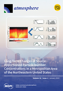
Particle number size distributions have been measured in Rochester, NY since 2002, along with PM2.5, black carbon, and pollutant gases. Obvious features such as the morning rush hour and afternoon regional nucleation events can be identified. However, assessing the particle sources requires the applications positive matrix factorization to the seasonal data from winter, summer, and the transitional seasons. From 2002 to 2016, there were substantial changes in particle emissions and formation rates due to the implementation of multiple policies related to cleaner fuels, additional controls on vehicles, and reduced emissions from coal-fired power plants. Those coal combustion reductions came from reduced electricity demand during the 2008 recession and the change in the relative prices of coal and natural gas. View this paper.
  • Issues are regarded as officially published after their release is announced to the table of contents alert mailing list.
  • You may sign up for e-mail alerts to receive table of contents of newly released issues.
  • PDF is the official format for papers published in both, html and pdf forms. To view the papers in pdf format, click on the "PDF Full-text" link, and use the free Adobe Reader to open them.
Order results
Result details
Section
Select all
Export citation of selected articles as:
19 pages, 10146 KiB  
Article
Interannual Variability of Spring Extratropical Cyclones over the Yellow, Bohai, and East China Seas and Possible Causes
by Jiuzheng Zhang, Haiming Xu, Jing Ma and Jiechun Deng
Atmosphere 2019, 10(1), 40; https://doi.org/10.3390/atmos10010040 - 21 Jan 2019
Cited by 7 | Viewed by 4499
Abstract
Interannual variability of cyclones that are generated over the eastern Asian continent and passed over the Yellow, Bohai, and East China seas (YBE cyclones) in spring is analyzed using reanalysis datasets for the period of 1979–2017. Possible causes for the variability are also [...] Read more.
Interannual variability of cyclones that are generated over the eastern Asian continent and passed over the Yellow, Bohai, and East China seas (YBE cyclones) in spring is analyzed using reanalysis datasets for the period of 1979–2017. Possible causes for the variability are also discussed. Results show that the number of YBE cyclones exhibits significant interannual variability with a period of 4–5 years. Developing cyclones are further classified into two types: rapidly developing cyclones and slowly developing cyclones. The number of rapidly developing cyclones is highly related to the underlying sea surface temperature (SST) anomalies (SSTA) and the atmospheric baroclinicity from Lake Baikal to the Japan Sea. The number of slowly developing cyclones, however, is mainly affected by the North Atlantic Oscillation (NAO) in the preceding winter (DJF); it works through the upper-level jet stream over Japan and the memory of ocean responses to the atmosphere. Positive NAO phase in winter is associated with the meridional tripole pattern of SSTA in the North Atlantic Ocean, which persists from winter to the following spring (MAM) due to the thermal inertia of the ocean. The SSTA in the critical mid-latitude Atlantic region in turn act to affect the overlying atmosphere via sensible and latent heat fluxes, leading to an increased frequency of slowly developing cyclones via exciting an anomalous eastward-propagating Rossby wave train. These results are confirmed by several numerical simulations using an atmospheric general circulation model. Full article
(This article belongs to the Section Meteorology)
Show Figures

Figure 1

Figure 1
<p>Map of the Yellow, Bohai, and East China seas (the black border, i.e., 35°–41° N, 117°–127° E; 23°–35° N, 120–130° E).</p>
Full article ">Figure 2
<p>Time series of Yellow, Bohai, and East China (YBE) spring cyclone number (black curve) and the linear trend (red line) for (<b>a</b>) all cyclones, (<b>b</b>) rapidly developing cyclones (R ≥ 0.5 B), (<b>c</b>) slowly developing cyclones (0 &lt; R &lt; 0.5 B), and (<b>d</b>) non-developing cyclones (R ≤ 0).</p>
Full article ">Figure 3
<p>Power spectra of the numbers of YBE spring cyclones for (<b>a</b>) all cyclones, (<b>b</b>) rapidly developing cyclones (R ≥ 0.5 B), (<b>c</b>) slowly developing cyclones (0 &lt; R &lt; 0.5 B), and (<b>d</b>) non-developing cyclones (R ≤ 0). The red curve denotes the 95% confidence level of red noise spectrum. The x-axis shows several major periods.</p>
Full article ">Figure 4
<p>Correlation coefficients between the number of rapidly developing cyclones and (<b>a</b>) sea surface temperature anomalies (SSTA) over the East China Sea, (<b>b</b>) latent heat fluxes, and (<b>c</b>) sensible heat fluxes in spring. Red and blue shadings represent the positive and negative correlation coefficients exceeding the 90% confidence level, respectively.</p>
Full article ">Figure 5
<p>Correlation coefficients between the number of rapidly developing cyclones and 700-hPa atmospheric baroclinicity in spring. Red and blue shadings represent the positive and negative correlation coefficients exceeding the 90% confidence level, respectively.</p>
Full article ">Figure 6
<p>Spatial-temporal evolutions of composite (<b>a1</b>–<b>d1</b>) 500-hPa, (<b>a2</b>–<b>d2</b>) 700-hPa, and (<b>a3</b>–<b>d3</b>) 850-hPa height (contour; gpm) and horizontal thermal advection (color shading; ×10<sup>−4</sup> K∙s<sup>−1</sup>), and (<b>a4</b>–<b>d4</b>) sea level pressure (contour; hPa) for rapidly developing cyclones (94 in total) on (<b>a1</b>–<b>a4</b>) day-2, (<b>b1</b>–<b>b4</b>) day-1, (<b>c1</b>–<b>c4</b>) day 0, and (<b>d1</b>–<b>d4</b>) day+1. Day 0 indicates the time when the cyclone enters the seas and intensify.</p>
Full article ">Figure 7
<p>(<b>a</b>) Correlation coefficients between the number of slowly developing cyclones and spring 200-hPa wind speeds. (<b>b</b>) Correlation coefficients between 200-hPa wind speeds in spring (MAM) and North Atlantic Oscillation (NAO) index in the preceding winter (DJF). Red and blue shadings represent the positive and negative correlation coefficients exceeding the 90% confidence level, respectively. The hatching in (a) indicates the area with wind speed exceeding 40 m∙s<sup>−1</sup>.</p>
Full article ">Figure 8
<p>Normalized time series of the number of slowly developing cyclones in spring (black), winter NAO index (green), and spring mid-latitude Atlantic sea surface temperature anomalies index (MASI) (blue) for the period of 1979–2017.</p>
Full article ">Figure 9
<p>Correlation coefficients between the number of slowly developing cyclones and the Atlantic SSTA in the (<b>a</b>) preceding winter and (<b>b</b>) spring. Red and blue shadings represent the positive and negative correlation coefficients exceeding the 90% confidence level, respectively.</p>
Full article ">Figure 10
<p>(<b>a</b>) Regression coefficients of spring SSTA onto the NAO index in the preceding winter. Composite differences of heat fluxes (sensible and latent fluxes) between positive and negative spring MASI years (positive upward; W∙m<sup>−2</sup>) in the (<b>b</b>) preceding winter and (<b>c</b>) spring. Positive MASI years are 1983, 1992, 1993, 1995, 1999, 2000, and 2012; and negative MASI years are 1979, 1982, 1985, 1997, 2001, 2010, and 2011. Red and blue shadings in (a) represent the positive and negative regression coefficients exceeding the 90% confidence level, respectively. Red and blue shadings in (b) and (c) represent the positive and negative differences statistically significant at the 90% confidence level, respectively. The blue rectangles in (a), (b), and (c) denote the critical mid-latitude Atlantic (CMA) region.</p>
Full article ">Figure 11
<p>Regression coefficients of spring 500-hPa geopotential height (contour; interval of 5 gpm) onto the spring MASI, and the associated Rossby wave activity fluxes (vectors; m<sup>2</sup>∙s<sup>−</sup><sup>2</sup>). Red and blue shadings represent the positive and negative regression coefficients exceeding the 90% confidence level, respectively. The blue rectangle indicates the critical mid-latitude Atlantic (CMA) region.</p>
Full article ">Figure 12
<p>Spatial distribution of spring SSTA (color shading; K) averaged from (<b>a</b>) positive and (<b>b</b>) negative MASI years used in the positive and negative SSTA experiment (PSSTA and NSSTA), respectively.</p>
Full article ">Figure 13
<p>Simulated differences of 500-hPa height (contour; interval of 10 gpm) between two sensitivity experiments (PSSTA minus NSSTA) in spring, and the associated Rossby wave activity fluxes (vector; m<sup>2</sup>∙s<sup>−2</sup>) averaged over the last 10 model years. Red and blue shadings represent the positive and negative differences statistically significant at the 90% confidence level, respectively.</p>
Full article ">
16 pages, 3864 KiB  
Article
Measurements and Modeling of the Full Rain Drop Size Distribution
by Merhala Thurai, Viswanathan Bringi, Patrick N. Gatlin, Walter A. Petersen and Matthew T. Wingo
Atmosphere 2019, 10(1), 39; https://doi.org/10.3390/atmos10010039 - 19 Jan 2019
Cited by 31 | Viewed by 4992
Abstract
The raindrop size distribution (DSD) is fundamental for quantitative precipitation estimation (QPE) and in numerical modeling of microphysical processes. Conventional disdrometers cannot capture the small drop end, in particular the drizzle mode which controls collisional processes as well as evaporation. To overcome this [...] Read more.
The raindrop size distribution (DSD) is fundamental for quantitative precipitation estimation (QPE) and in numerical modeling of microphysical processes. Conventional disdrometers cannot capture the small drop end, in particular the drizzle mode which controls collisional processes as well as evaporation. To overcome this limitation, the DSD measurements were made using (i) a high-resolution (50 microns) meteorological particle spectrometer to capture the small drop end, and (ii) a 2D video disdrometer for larger drops. Measurements were made in two climatically different regions, namely Greeley, Colorado, and Huntsville, Alabama. To model the DSDs, a formulation based on (a) double-moment normalization and (b) the generalized gamma (GG) model to describe the generic shape with two shape parameters was used. A total of 4550 three-minute DSDs were used to assess the size-resolved fidelity of this model by direct comparison with the measurements demonstrating the suitability of the GG distribution. The shape stability of the normalized DSD was demonstrated across different rain types and intensities. Finally, for a tropical storm case, the co-variabilities of the two main DSD parameters (normalized intercept and mass-weighted mean diameter) were compared with those derived from the dual-frequency precipitation radar onboard the global precipitation mission satellite. Full article
(This article belongs to the Special Issue Advances in Applications of Weather Radar Data)
Show Figures

Figure 1

Figure 1
<p>(<b>a</b>) Ground instrumentation at Greeley (GXY), 13 km away from the CSU-CHILL radar site; (<b>b</b>) ground instrumentation at the Huntsville (HSV) site.</p>
Full article ">Figure 2
<p>(<b>a</b>) Three-minute raindrop size distributions (DSDs) from the meteorological particle spectrometer (MPS) (black) and 2D-video (2DVD) (blue) together with the fitted generalized gamma (GG) curve (red) for the 10 Aug 2015 event at GXY during a convective period (21:57 UTC); (<b>b</b>) same as (<b>a</b>) but for a more stratiform rain period (22:27 UTC); (<b>c</b>) the CHILL S-band RHI scan of radar reflectivity over the instrument site (at 13 km range marked by white arrow) corresponding to (<b>a</b>); (<b>d</b>) CHILL RHI scan corresponding to period (<b>b</b>).</p>
Full article ">Figure 3
<p>(<b>a</b>) Vertically pointing X-band Doppler radar (XPR) observations during tropical storm Nate at UAH during stratiform rain period with varying bright-band thickness; (<b>b</b>) three-minute composite DSDs from the MPS-2DVD measurements corresponding to thick bright-band period (14:30 UTC) in red and weak bright-band period (17:00 UTC) in green, together with their fitted GG curves; (<b>c</b>) <span class="html-italic">h</span>(<span class="html-italic">x</span>) versus x computed from three-minute DSDs during 1400–1500 UTC (thick bright band period) in red, and during 1700–1800 UTC (weak bright band) in green, which show considerable overlap.</p>
Full article ">Figure 4
<p>Histograms of the relative deviation (in %) between the measurements and the GG fits for selected drop diameter intervals. The center diameter is on top of each panel.</p>
Full article ">Figure 5
<p>Rain accumulations from GG fitted one-minute DSDs (red) compared with Pluvio measurements for six example events in GXY.</p>
Full article ">Figure 6
<p><span class="html-italic">D<sub>m</sub></span> versus <span class="html-italic">σ<sub>M</sub></span> from one-minute DSDs (color intensity) compared with the corresponding GG-fitted variations (black dots). The black line is Equation (22) in Williams et al. [<a href="#B42-atmosphere-10-00039" class="html-bibr">42</a>] and the grey lines are their Equations (23) and (24).</p>
Full article ">Figure 7
<p>(<b>a</b>) Color intensity plot of the fitted values of <span class="html-italic">μ</span> versus <span class="html-italic">c</span> from all events from GXY and HSV; (<b>b</b>) same as (a) but for the fitted <span class="html-italic">c</span> versus <span class="html-italic">D<sub>m</sub></span>; (<b>c</b>) same as (<b>b</b>) but for HSV events only; (<b>d</b>) <span class="html-italic">h</span>(<span class="html-italic">x</span>) versus <span class="html-italic">x</span> in terms of frequency of occurrence (color) and the most probable variation shown as a black curve.</p>
Full article ">Figure 8
<p>(<b>a</b>) Composite radar image of tropical storm Nate during the GPM satellite overpass over HSV on 07 Oct 2017 at 22:55 UTC, with the orange diamond representing the location of the ground instruments; (<b>b</b>) values of <span class="html-italic">D<sub>m</sub></span> from the DPR retrievals at 1 km above ground, within the region marked as red box in (<b>a</b>); (<b>c</b>) log<sub>10</sub>(<span class="html-italic">N<sub>w</sub></span>) versus <span class="html-italic">D<sub>m</sub></span> from the GPM-DPR retrievals from the high sensitivity DPR scans (orange) and the normal sensitivity scans (cyan) for the region in Panel (<b>b</b>), compared with those derived from the ground-based composite DSDs (black asterisks) over several hours during Nate.</p>
Full article ">Figure 9
<p>(<b>a</b>) <span class="html-italic">N</span><sub>0</sub>′ derived from the full DSD spectra (red) compared with those using the 2DVD DSDs alone using data for <span class="html-italic">D</span> &gt; 0.3 mm (blue) and for <span class="html-italic">D</span> &gt; 0.6 mm (green); (<b>b</b>) the same as (<b>a</b>) but for <span class="html-italic">D<sub>m</sub></span>’; (<b>c</b>) the same as (<b>a</b>) but for the fitted <span class="html-italic">c</span> values; (<b>d</b>) the same as (<b>a</b>) but for the fitted <span class="html-italic">μ</span> values. The event corresponds to the outer bands of hurricane Irma on 12 September 2017, which traversed the ground instrumentation site in Huntsville.</p>
Full article ">
19 pages, 9914 KiB  
Article
A Turbulence-Oriented Approach to Retrieve Various Atmospheric Parameters Using Advanced Lidar Data Processing Techniques
by Iulian-Alin Rosu, Marius-Mihai Cazacu, Otilia Sanda Prelipceanu and Maricel Agop
Atmosphere 2019, 10(1), 38; https://doi.org/10.3390/atmos10010038 - 18 Jan 2019
Cited by 14 | Viewed by 4394
Abstract
The article is aimed at presenting a semi-empirical model coded and computed in the programming language Python, which utilizes data gathered with a standard biaxial elastic lidar platform in order to calculate the altitude profiles of the structure coefficients of the atmospheric refraction [...] Read more.
The article is aimed at presenting a semi-empirical model coded and computed in the programming language Python, which utilizes data gathered with a standard biaxial elastic lidar platform in order to calculate the altitude profiles of the structure coefficients of the atmospheric refraction index C N 2 ( z ) and other associated turbulence parameters. Additionally, the model can be used to calculate the PBL (Planetary Boundary Layer) height, and other parameters typically employed in the field of astronomy. Solving the Fernard–Klett inversion by correlating sun-photometer data obtained through our AERONET site with lidar data, it can yield the atmospheric extinction and backscatter profiles α ( z ) and β ( z ) , and thus obtain the atmospheric optical depth. Finally, several theoretical notions of interest that utilize the solved parameters are presented, such as approximated relations between C N 2 ( z ) and the atmospheric temperature profile T ( z ) , and between the scintillation of backscattered lidar signal and the average wind speed profile U ( z ) . These obtained profiles and parameters also have several environmental applications that are connected directly and indirectly to human health and well-being, ranging from understanding the transport of aerosols in the atmosphere and minimizing the errors in measuring it, to predicting extreme, and potentially-damaging, meteorological events. Full article
(This article belongs to the Special Issue Remote Sensing of Aerosols)
Show Figures

Figure 1

Figure 1
<p>RCS time series on the 28th of May 2017; temporal resolution: 1 minute; spatial resolution: 3.75m: (<b>a</b>) Entirety of RCS timeframe for 28/05/2017, from 20:01 to 00:56, Iasi, Romania; (<b>b</b>) RCS timeframe zoomed in on the PBL 28/05/2017, from 20:01 to 00:56, Iasi, Romania; (<b>c</b>) RCS timeframe zoomed in above the PBL 28/05/2017, from 20:01 to 00:56, Iasi, Romania.</p>
Full article ">Figure 1 Cont.
<p>RCS time series on the 28th of May 2017; temporal resolution: 1 minute; spatial resolution: 3.75m: (<b>a</b>) Entirety of RCS timeframe for 28/05/2017, from 20:01 to 00:56, Iasi, Romania; (<b>b</b>) RCS timeframe zoomed in on the PBL 28/05/2017, from 20:01 to 00:56, Iasi, Romania; (<b>c</b>) RCS timeframe zoomed in above the PBL 28/05/2017, from 20:01 to 00:56, Iasi, Romania.</p>
Full article ">Figure 2
<p>RCS profiles; temporal resolution: 1 minute; spatial resolution: 3.75m: (<b>a</b>) RCS(z) profile taken at 20:01; Iasi, Romania; black—<math display="inline"><semantics> <mrow> <mi>RCS</mi> <mrow> <mo>(</mo> <mi mathvariant="normal">z</mi> <mo>)</mo> </mrow> </mrow> </semantics></math> profile itself, blue—Savitsky–Golay processing of profile; (<b>b</b>) RCS(z) profile taken at 21:01; Iasi, Romania; black—RCS(z) profile itself, blue—Savitsky–Golay processing of profile; (<b>c</b>) RCS(z) profile taken at 22:01; Iasi, Romania; black—RCS(z) profile itself, blue—Savitsky–Golay processing of profile; (<b>d</b>) RCS(z) profile taken at 23:01; Iasi, Romania; black—RCS(z) profile itself, blue—Savitsky–Golay processing of profile.</p>
Full article ">Figure 3
<p>C2N profiles; temporal resolution: 1 minute, scintillation calculated with 3 RCS profiles; spatial resolution: 3.75 m: (<b>a</b>) C2N(z) profile taken at 20:01; Iasi, Romania; black—C2N(z) profile itself, blue—Savitsky–Golay processing of profile; (<b>b</b>) C2N(z) profile taken at 21:01; Iasi, Romania; black—C2N(z) profile itself, blue—Savitsky–Golay processing of profile; (<b>c</b>) C2N(z) profile taken at 22:01; Iasi, Romania; black—C2N(z) profile itself, blue—Savitsky–Golay processing of profile; (<b>d</b>) C2N(z) profile taken at 23:01; Iasi, Romania; black—C2N(z) profile itself, blue—Savitsky–Golay processing of profile.</p>
Full article ">Figure 3 Cont.
<p>C2N profiles; temporal resolution: 1 minute, scintillation calculated with 3 RCS profiles; spatial resolution: 3.75 m: (<b>a</b>) C2N(z) profile taken at 20:01; Iasi, Romania; black—C2N(z) profile itself, blue—Savitsky–Golay processing of profile; (<b>b</b>) C2N(z) profile taken at 21:01; Iasi, Romania; black—C2N(z) profile itself, blue—Savitsky–Golay processing of profile; (<b>c</b>) C2N(z) profile taken at 22:01; Iasi, Romania; black—C2N(z) profile itself, blue—Savitsky–Golay processing of profile; (<b>d</b>) C2N(z) profile taken at 23:01; Iasi, Romania; black—C2N(z) profile itself, blue—Savitsky–Golay processing of profile.</p>
Full article ">Figure 4
<p>Turbulence length scales profiles; temporal resolution: 1 minute, scintillation calculated with 3 RCS profiles; spatial resolution: 3.75 m: (<b>a</b>) L0(z) and l0(z) profiles at 20:01; Iasi, Romania; black—L0(z) profile itself, blue—Savitsky–Golay processing of profile, red—l0(z) profile (<b>b</b>) L0(z) and l0(z) profiles at 21:01; Iasi, Romania; black—L0(z) profile itself, blue—Savitsky–Golay processing of profile, red—l0(z) profile; (<b>c</b>) L0(z) and l0(z) profiles at 22:01; Iasi, Romania; black—L0(z) profile itself, blue—Savitsky–Golay processing of profile, red—l0(z) profile; (<b>d</b>) L0(z) and l0(z) profiles at 23:01; Iasi, Romania; black—L0(z) profile itself, blue—Savitsky–Golay processing of profile, red—l0(z) profile.</p>
Full article ">Figure 5
<p>Reynolds number profiles; temporal resolution: 1 minute, scintillation calculated with 3 RCS profiles; spatial resolution: 3.75m: (<b>a</b>) Re(z) profile taken at 20:01; Iasi, Romania; black—<math display="inline"><semantics> <mrow> <mi>Re</mi> <mrow> <mo>(</mo> <mi mathvariant="normal">z</mi> <mo>)</mo> </mrow> </mrow> </semantics></math> profile itself, blue—Savitsky–Golay processing of profile; (<b>b</b>) Re(z) profile taken at 21:01; Iasi, Romania; black—Re(z) profile itself, blue—Savitsky–Golay processing of profile; (<b>c</b>) Re(z) profile taken at 22:01; Iasi, Romania; black—Re(z) profile itself, blue—Savitsky–Golay processing of profile; (<b>d</b>) Re(z) profile taken at 23:01; Iasi, Romania; black—Re(z) profile itself, blue—Savitsky–Golay processing of profile.</p>
Full article ">Figure 6
<p>Backscatter profiles; temporal resolution: 1 minute; spatial resolution: 3.75m: (<b>a</b>) β(z) profile taken at 20:01, Iasi, Romania; black—β(z) profile itself, blue—βa (z) profile, red—βm (z) profile; (<b>b</b>) β(z) profile taken at 21:01, Iasi, Romania; black—β(z) profile itself, blue—βa (z) profile, red—βm (z) profile; (<b>c</b>) β(z) profile taken at 22:01, Iasi, Romania; black—β(z) profile itself, blue—βa (z) profile, red—βm (z) profile; (<b>d</b>) β(z) profile taken at 23:01, Iasi, Romania; black—β(z) profile itself, blue—βa (z) profile, red—βm (z) profile.</p>
Full article ">Figure 6 Cont.
<p>Backscatter profiles; temporal resolution: 1 minute; spatial resolution: 3.75m: (<b>a</b>) β(z) profile taken at 20:01, Iasi, Romania; black—β(z) profile itself, blue—βa (z) profile, red—βm (z) profile; (<b>b</b>) β(z) profile taken at 21:01, Iasi, Romania; black—β(z) profile itself, blue—βa (z) profile, red—βm (z) profile; (<b>c</b>) β(z) profile taken at 22:01, Iasi, Romania; black—β(z) profile itself, blue—βa (z) profile, red—βm (z) profile; (<b>d</b>) β(z) profile taken at 23:01, Iasi, Romania; black—β(z) profile itself, blue—βa (z) profile, red—βm (z) profile.</p>
Full article ">Figure 7
<p>U(z) profiles; temporal resolution: 1 minute, scintillation calculated with 3 RCS profiles; spatial resolution: 3.75m: (<b>a</b>) U(z) profile taken at 20:01, Iasi, Romania (<b>b</b>) U(z) profile taken at 21:01, Iasi, Romania (<b>c</b>) U(z) profile taken at 22:01, Iasi, Romania (<b>d</b>) U(z) profile taken at 23:01, Iasi, Romania.</p>
Full article ">Figure 8
<p>(<b>a</b>) T(z) profile taken at 21:01, Iasi, Romania; temporal resolution: 1 minute, scintillation calculated with 3 RCS profiles; spatial resolution: 3.75m: black—T(z) profile itself, red—standard theoretical constant lapse rate T(z) profile. (<b>b</b>) Zoomed in T(z) profile taken at 21:01, Iasi, Romania; temporal resolution: 1 minute, scintillation calculated with 3 RCS profiles; spatial resolution: 3.75m: black—T(z) profile itself, red—standard theoretical constant lapse rate T(z) profile. (<b>c</b>) RCS time series zoomed in for 21/04/2018, from 08.05 to 08.15, Iasi, Romania; temporal resolution: 45 seconds; spatial resolution: 3.75 m. (<b>d</b>) T(z) profile taken at 08:09, 21/04/2018, Iasi, Romania; temporal resolution: 45 seconds, scintillation calculated with 3 RCS profiles; spatial resolution: 3.75 m: black—T(z) profile itself, red—standard theoretical constant lapse rate T(z) profile. (<b>e</b>) Zoomed in T(z) profile taken at 08:09, 21/04/2018, Iasi, Romania; temporal resolution: 45 seconds, scintillation calculated with 3 RCS profiles; spatial resolution: 3.75m: black—T(z) profile itself, red—standard theoretical constant lapse rate T(z) profile. (<b>f</b>) RCS time series zoomed in for 07/05/2018, from 09.05 to 09.25, Iasi, Romania; temporal resolution: 45 seconds; spatial resolution: 3.75m. (<b>g</b>) T(z) profile taken at 09:10, 07/05/2018, Iasi, Romania; temporal resolution: 45 seconds, scintillation calculated with 3 RCS profiles; spatial resolution: 3.75m: black—T(z) profile itself, red—standard theoretical constant lapse rate T(z) profile. (<b>h</b>): Zoomed in T(z) profile taken at 09:10, 07/05/2018, Iasi, Romania; temporal resolution: 45 seconds, scintillation calculated with 3 RCS profiles; spatial resolution: 3.75m: black—T(z) profile itself, red—standard theoretical constant lapse rate T(z) profile.</p>
Full article ">Figure 8 Cont.
<p>(<b>a</b>) T(z) profile taken at 21:01, Iasi, Romania; temporal resolution: 1 minute, scintillation calculated with 3 RCS profiles; spatial resolution: 3.75m: black—T(z) profile itself, red—standard theoretical constant lapse rate T(z) profile. (<b>b</b>) Zoomed in T(z) profile taken at 21:01, Iasi, Romania; temporal resolution: 1 minute, scintillation calculated with 3 RCS profiles; spatial resolution: 3.75m: black—T(z) profile itself, red—standard theoretical constant lapse rate T(z) profile. (<b>c</b>) RCS time series zoomed in for 21/04/2018, from 08.05 to 08.15, Iasi, Romania; temporal resolution: 45 seconds; spatial resolution: 3.75 m. (<b>d</b>) T(z) profile taken at 08:09, 21/04/2018, Iasi, Romania; temporal resolution: 45 seconds, scintillation calculated with 3 RCS profiles; spatial resolution: 3.75 m: black—T(z) profile itself, red—standard theoretical constant lapse rate T(z) profile. (<b>e</b>) Zoomed in T(z) profile taken at 08:09, 21/04/2018, Iasi, Romania; temporal resolution: 45 seconds, scintillation calculated with 3 RCS profiles; spatial resolution: 3.75m: black—T(z) profile itself, red—standard theoretical constant lapse rate T(z) profile. (<b>f</b>) RCS time series zoomed in for 07/05/2018, from 09.05 to 09.25, Iasi, Romania; temporal resolution: 45 seconds; spatial resolution: 3.75m. (<b>g</b>) T(z) profile taken at 09:10, 07/05/2018, Iasi, Romania; temporal resolution: 45 seconds, scintillation calculated with 3 RCS profiles; spatial resolution: 3.75m: black—T(z) profile itself, red—standard theoretical constant lapse rate T(z) profile. (<b>h</b>): Zoomed in T(z) profile taken at 09:10, 07/05/2018, Iasi, Romania; temporal resolution: 45 seconds, scintillation calculated with 3 RCS profiles; spatial resolution: 3.75m: black—T(z) profile itself, red—standard theoretical constant lapse rate T(z) profile.</p>
Full article ">Figure 9
<p>PBL/SBL retrieval functions; temporal resolution: 1 minute, scintillation calculated with 3 RCS profiles; spatial resolution: 3.75m: (<b>a</b>) Retrieval functions profiles taken at 20:01, Iasi, Romania; black—BL(z) profile, blue—RCS variance profile, red—<math display="inline"><semantics> <mrow> <mfrac> <mi>d</mi> <mrow> <mi>d</mi> <mi>Z</mi> </mrow> </mfrac> <mi>R</mi> <mi>C</mi> <mi>S</mi> </mrow> </semantics></math> profile; (<b>b</b>) Retrieval functions profiles taken at 21:01, Iasi, Romania; black—BL(z) profile, blue—RCS variance profile, red—<math display="inline"><semantics> <mrow> <mfrac> <mi>d</mi> <mrow> <mi>d</mi> <mi>Z</mi> </mrow> </mfrac> <mi>R</mi> <mi>C</mi> <mi>S</mi> </mrow> </semantics></math> profile; (<b>c</b>) Retrieval functions profiles taken at 22:01, Iasi, Romania; black—BL(z) profile, blue—RCS variance profile, red—<math display="inline"><semantics> <mrow> <mfrac> <mi>d</mi> <mrow> <mi>d</mi> <mi>Z</mi> </mrow> </mfrac> <mi>R</mi> <mi>C</mi> <mi>S</mi> </mrow> </semantics></math> profile; (<b>d</b>) Retrieval functions profiles taken at 23:01, Iasi, Romania; black—BL(z) profile, blue—RCS variance profile, red—<math display="inline"><semantics> <mrow> <mfrac> <mi>d</mi> <mrow> <mi>d</mi> <mi>Z</mi> </mrow> </mfrac> <mi>R</mi> <mi>C</mi> <mi>S</mi> </mrow> </semantics></math> profile.</p>
Full article ">
22 pages, 1837 KiB  
Article
Heterogeneous Freezing of Liquid Suspensions Including Juices and Extracts from Berries and Leaves from Perennial Plants
by Laura Felgitsch, Magdalena Bichler, Julia Burkart, Bianca Fiala, Thomas Häusler, Regina Hitzenberger and Hinrich Grothe
Atmosphere 2019, 10(1), 37; https://doi.org/10.3390/atmos10010037 - 17 Jan 2019
Cited by 6 | Viewed by 4574
Abstract
Heterogeneous ice nucleation in the atmosphere is not fully understood. In particular, our knowledge of biological materials and their atmospheric ice nucleation properties remains scarce. Here, we present the results from systematic investigations of the ice nucleation activity of plant materials using cryo-microscopy. [...] Read more.
Heterogeneous ice nucleation in the atmosphere is not fully understood. In particular, our knowledge of biological materials and their atmospheric ice nucleation properties remains scarce. Here, we present the results from systematic investigations of the ice nucleation activity of plant materials using cryo-microscopy. We examined berry juices, frozen berries, as well as extracts of leaves and dried berries of plants native to boreal regions. All of our samples possess reasonable ice nucleation activity. Their ice nucleating particle concentrations per unit of water volume vary between 9.7 × 10⁵ and 9.2 × 109 cm−3 when examined within temperatures of −12 to −34 °C. Mean freezing temperatures ranged from −18.5 to −45.6 °C. We show that all samples contained ice nuclei in a size range below 0.2 µm and remain active if separated from coarse plant tissue. The results of examining ice nucleation properties of leaves and dry berry extracts suggests that their ice-nucleating components can be easily suspended in water. Sea buckthorn and black currant were analyzed using subtilisin (a protease) and urea. Results suggest proteinaceous compounds to play an important role in their ice nucleation activity. These results show that separation between ice nucleation particles stemming from microorganisms and those stemming from plants cannot be differentiated solely on proteinaceous features. Further oxidation experiments with ozone showed that black currant is highly stable towards ozone oxidation, indicating a long atmospheric life time. Full article
(This article belongs to the Special Issue Ice Nucleation in the Atmosphere)
Show Figures

Figure 1

Figure 1
<p>Schematic of the ozone treatment setup. On the right side is an ozonizer, with gas in- and outlet. The outlet is connected to a washing flask containing the sample, which is mounted on a magnetic stirrer.</p>
Full article ">Figure 2
<p>(<b>a</b>): MFT (circles) and onset temperature (stars) of the analyzed juices (black currant (J1), blueberry (J2), chokeberry (J3), cranberry (J4), lingonberry (J5), sambuccus (J6), sea buckthorn (J7)), dried berry extracts (juniper berries (E1), rowanberries (E2), sea buckthorn (E3)), frozen berries (blueberry (B1) and Raspberry (B2)) and leaf extracts ((L1) blueberry, (L2) juniper, (L3) raspberry, (L4) sea buckthorn). Samples marked with an f are filtered (particles &lt; 0.2 µm in diameter) and are displayed as hollow symbols; filled symbols correspond to unfiltered samples. MFTs are given with the respective standard deviation as error bar. The graph contains three lines: the dashed line refers to the mean freezing temperature of birch pollen washing water (−18.7 °C), the dotted line to juniper pollen washing water (−21.4 °C, extracted from Pummer et al. [<a href="#B51-atmosphere-10-00037" class="html-bibr">51</a>]), and the solid line refers to the MFT of ultrapure water (UPW) measured with our setup during the measurement series (−36.8 °C). (<b>b</b>): The cumulative nucleus concentration at −34 °C (K(−34 °C)). Again, filtered samples are marked with an f and hollow symbols, while unfiltered samples are represented by filled symbols.</p>
Full article ">Figure 3
<p>(<b>a</b>) K(T<sub>photo</sub>) of the analyzed samples. Juices (black currant (J1a,b), blueberry (J2), chokeberry (J3), cranberry (J4), lingonberry (J5), sambuccus (J6) sea buckthorn (J7a,b)); (<b>b</b>) extracts of leaves (blueberry (L1), juniper (L2), raspberry (L3), and sea buckthorn (L4)); (<b>c</b>) extracts of leaves (blueberry (L1), juniper (L2), raspberry (L3), and sea buckthorn (L4)); (<b>d</b>) extracts of dried berries (juniper berries (E1), rowanberries (E2), sea buckthorn (E3)). Samples marked with an f are filtered and do not contain particles bigger 0.2 µm. Data points at temperatures below −35 °C are not represented, since we cannot exclude homogeneous nucleation events at lower temperatures and therefore cannot attribute those data points to INM with full certainty.</p>
Full article ">Figure 4
<p>Relationship between the INP concentration of the juice samples and their dry mass. Included juices were black currant (J1a,b), blueberry (J2), chokeberry (J3), cranberry (J4), lingonberry (J5), sambuccus (J6), sea buckthorn (J7a,b). Linear regression (not shown) yields an R<sup>2</sup> value of 0.0124.</p>
Full article ">Figure 5
<p>Results of the urea and subtilisin treatments from left to right of black currant juice ((J1a) (<b>a</b>–<b>c</b>)), sea buckthorn juice (J7a (<b>d</b>–<b>f</b>)), Snomax<sup>®</sup> (SM (<b>g</b>–<b>i</b>)), and the blanks (blank (<b>j</b>–<b>l</b>)) shown as fraction of frozen droplets in relation to the temperature. Filled symbols correspond to the sample solutions prior treatment, hollow symbols to the sample after 1 h of treatment in a shaker at 60 °C, and half-filled symbols to the sample after 24 h of treatment. The treatment with subtilisin are shown in the top row (<b>a</b>,<b>d</b>,<b>g</b>,<b>j</b>), the treatment with urea are shown in the middle row (<b>b</b>,<b>e</b>,<b>h</b>,<b>k</b>), and the treatment with urea and subtilisin is shown in the bottom row (<b>c</b>,<b>f</b>,<b>i</b>,<b>l</b>). All depicted samples were diluted 10 fold with ultrapure water prior to measurement.</p>
Full article ">Figure 6
<p>Relation between mean freezing temperature and ozone treatment time of black currant juice (J1b).</p>
Full article ">
15 pages, 3871 KiB  
Article
Summertime Urban Mixing Layer Height over Sofia, Bulgaria
by Ventsislav Danchovski
Atmosphere 2019, 10(1), 36; https://doi.org/10.3390/atmos10010036 - 17 Jan 2019
Cited by 11 | Viewed by 4407
Abstract
Mixing layer height (MLH) is a crucial parameter for air quality modelling that is still not routinely measured. Common methods for MLH determination use atmospheric profiles recorded by radiosonde but this process suffers from coarse temporal resolution since the balloon is usually launched [...] Read more.
Mixing layer height (MLH) is a crucial parameter for air quality modelling that is still not routinely measured. Common methods for MLH determination use atmospheric profiles recorded by radiosonde but this process suffers from coarse temporal resolution since the balloon is usually launched only twice a day. Recently, cheap ceilometers are gaining popularity in the retrieval of MLH diurnal evolution based on aerosol profiles. This study presents a comparison between proprietary (Jenoptik) and freely available (STRAT) algorithms to retrieve MLH diurnal cycle over an urban area. The comparison was conducted in the summer season when MLH is above the full overlapping height of the ceilometer in order to minimize negative impact of the biaxial LiDAR’s drawback. Moreover, fogs or very low clouds which can deteriorate the ceilometer retrieval accuracy are very unlikely to be present in summer. The MLHs determined from the ceilometer were verified against those measured from the radiosonde, which were estimated using the parcel, lapse rate, and Richardson methods (the Richardson method was used as a reference in this study). We found that the STRAT and Jenoptik methods gave lower MLH values than radiosonde with an underestimation of about 150 m and 650 m, respectively. Additionally, STRAT showed some potential in tracking the MLH diurnal evolution, especially during the day. A daily MLH maximum of about 2000 m was found in the late afternoon (18–19 LT). The Jenoptik algorithm showed comparable results to the STRAT algorithm during the night (although both methods sometimes misleadingly reported residual or advected layers as the mixing layer (ML)). During the morning transition the Jenoptik algorithm outperformed STRAT, which suffers from abrupt changes in MLH due to integrated layer attribution. However, daytime performance of Jenoptik was worse, especially in the afternoon when the algorithm often cannot estimate any MLH (in the period 13–16 LT the method reports MLHs in only 15–30% of all cases). This makes day-to-day tracing of MLH diurnal evolution virtually impracticable. This problem is possibly due to its early version (JO-CloVis 8.80, 2009) and issues with real-time processing of a single profile combined with the low signal-to-noise ratio of the ceilometer. Both LiDAR-based algorithms have trouble in the evening transition since they rely on aerosol signature which is more affected by the mixing processes in the past hours than the current turbulent mixing. Full article
(This article belongs to the Special Issue Lower Atmosphere Meteorology)
Show Figures

Figure 1

Figure 1
<p>The locations of the ceilometer and the radiosonde indicated by a blue and a purple triangle in the Sofia valley. (Source of the map is Google LLC).</p>
Full article ">Figure 2
<p>Inter-comparison of the three radiosonde-based MLH methods. The correlation matrix (<b>a</b>) shows correlation coefficients in the upper-right triangle, the diagonal shows a histogram of each method, and the lower-left triangle shows scatter-plots and linear regression lines with corresponding 95% confidence intervals. The box and whisker plot (in the style of Tukey) is on plot (<b>b</b>). The box lines correspond to the 25, 50 and 75 percentiles. The lower and upper whiskers represent the lowest values still within 1.5 IQR (inter-quantile range) of the lower quartile, and the highest values still within 1.5 IQR of the upper quartile. The data beyond the end of the whiskers signify outliers and are plotted as black dots. White dots indicate mean values. In both figures, atmospheric pressure is color-coded as “High” (blue), “Low” (yellow), “Normal” (green).</p>
Full article ">Figure 3
<p>A correlation matrix (<b>a</b>) and Tukey’s box and whiskers plot (<b>b</b>) of radiosonde-(Richardson) and LiDAR-based (STRAT and Jenoptik) algorithms for MLH detection. Conventions are the same as in <a href="#atmosphere-10-00036-f002" class="html-fig">Figure 2</a>.</p>
Full article ">Figure 4
<p>The dependence of drought duration (in number of dry days) on the mean MLH determined by Richardson and STRAT methods.</p>
Full article ">Figure 5
<p>Time-height cross section of the ceilometer’s range-corrected backscatter power (PR<sup>2</sup> in arbitrary units) on 24 July 2015. The MLH retrieved from ceilometer’s data by Jenoptik and STRAT algorithms are marked by magenta triangles and red circles, respectively (for clarity, the Jenoptik MLHs are plotted with the same temporal resolution as STRAT—10 min). Radiosonde-based MLH according to the Ri method is presented by black ”x” marks.</p>
Full article ">Figure 6
<p>Time-height cross section of the ceilometer’s range-corrected backscatter power (PR<sup>2</sup> in arbitrary units) on 24 July 2015. The MLH calculated by the Jenoptik algorithm (magenta dots) and STRAT’s candidates (the strongest gradient—red triangles, the second strongest gradient—green “x” marks, and the lowest gradient—blue upside down triangles) are also shown.</p>
Full article ">Figure 7
<p>Diurnal evolution of the availability of MLH determined by STRAT (<b>a</b>) and Jenoptik (<b>b</b>) algorithms at “Normal”, “Low” and “High” atmospheric pressure in summer of 2015.</p>
Full article ">Figure 8
<p>Diurnal cycle of the MLH over Sofia determined by STRAT (red) and Jenoptik (magenta) algorithms as a box and whiskers plot (in Tukey’s style) at “High”, “Low” and “Normal” atmospheric pressure in summer of 2015.</p>
Full article ">
14 pages, 2666 KiB  
Article
Impact of Control Measures on Nitrogen Oxides, Sulfur Dioxide and Particulate Matter Emissions from Coal-Fired Power Plants in Anhui Province, China
by Haitao Dai, Dawei Ma, Renbin Zhu, Bowen Sun and Jun He
Atmosphere 2019, 10(1), 35; https://doi.org/10.3390/atmos10010035 - 17 Jan 2019
Cited by 22 | Viewed by 5652
Abstract
Anhui is one of the highest provincial emitters of air pollutants in China due to its large coal consumption in coal-fired plants. In this study, the total emissions of nitrogen oxides (NOx), sulfur dioxide (SO2) and particulate matter (PM) [...] Read more.
Anhui is one of the highest provincial emitters of air pollutants in China due to its large coal consumption in coal-fired plants. In this study, the total emissions of nitrogen oxides (NOx), sulfur dioxide (SO2) and particulate matter (PM) from coal-fired power plants in Anhui were investigated to assess the impact of control measures on the atmospheric emissions based upon continuous emission monitoring systems (CEMS). The total NOx, SO2 and PM emissions significantly decreased from 2013 to 2017 and they were estimated at 24.5 kt, 14.8 kt and 3.0 kt in 2017, respectively. The emission reductions of approximately 79.0%, 70.1% and 81.2% were achieved in 2017 compared with a 2013 baseline, respectively, due to the application of high-efficiency emission control measures, including the desulfurization, denitration and dust-removing devices and selective catalytic reduction (SCR). The NOx, SO2 and PM emission intensities were 0.125 g kWh−1, 0.076 g kWh−1 and 0.015 g kWh−1 in 2017, respectively, which were lower than the average of national coal-fired units. The coal-fired units with ≥600 MW generated 80.6% of the total electricity amount while they were estimated to account for 70.5% of total NOx, 70.1% of total SO2 and 71.9% of total PM. Their seasonal emissions showed a significant correlation to the power generation with the maximum correlation found in summer (July and August) and winter (January and December). The major regional contributors are the cities along the Huai River Basin and Yangtze River Basin, such as Huainan, Huaibei, Tongling, Maanshan and Wuhu, and the highest emission occurred in Huainan, accounting for approximately 26–40% of total emission from all the power plants. Our results indicated that the application of desulfurization, denitration and dust-removing devices has played an important role in controlling air pollutant emissions from coal-fired power plants. Full article
(This article belongs to the Section Air Quality)
Show Figures

Figure 1

Figure 1
<p>Study area and location of major coal-fired power plants in Anhui Province. The power plants around Huainan City are separately shown on the left of the map due to the dense distribution of coal-fired plants. The maps were drawn using ArcMap 10.2.</p>
Full article ">Figure 2
<p>CEMS validation using reference test. (<b>a</b>,<b>b</b>) comparisons of SO<sub>2</sub>/NO<sub>x</sub> mole ratios obtained using MRU NOVA2000 (black squares) and CEMS (grey dots) in 2013 and 2014. Bars on CEMS data are ±30% (2σ) combined uncertainties. Bars on MRU NOVA2000 measurements are the ±28% (2σ) combined uncertainties. (<b>c</b>) comparisons of PM concentration measured by MRU NOVA2000 (black squares) and CEMS (grey dots) in 2014. Data are arranged in the order of decreasing MRU NOVA2000 PM emission. The dotted line represents the allowable range of error, which is the value measured by MRU NOVA2000 plus or minus 15 mg m<sup>−3</sup>.</p>
Full article ">Figure 2 Cont.
<p>CEMS validation using reference test. (<b>a</b>,<b>b</b>) comparisons of SO<sub>2</sub>/NO<sub>x</sub> mole ratios obtained using MRU NOVA2000 (black squares) and CEMS (grey dots) in 2013 and 2014. Bars on CEMS data are ±30% (2σ) combined uncertainties. Bars on MRU NOVA2000 measurements are the ±28% (2σ) combined uncertainties. (<b>c</b>) comparisons of PM concentration measured by MRU NOVA2000 (black squares) and CEMS (grey dots) in 2014. Data are arranged in the order of decreasing MRU NOVA2000 PM emission. The dotted line represents the allowable range of error, which is the value measured by MRU NOVA2000 plus or minus 15 mg m<sup>−3</sup>.</p>
Full article ">Figure 3
<p>NO<sub>x</sub>, SO<sub>2</sub> and PM emissions from coal-fired power plants in Anhui Province. (<b>a</b>) Annual emissions of NO<sub>x</sub>, SO<sub>2</sub> and PM and their emission intensities (EI) from coal-fired power plants between 2013 and 2017; (<b>b</b>) Emission inventory of different unit groups in Anhui in 2016.</p>
Full article ">Figure 4
<p>Monthly variations of power generation and NO<sub>x</sub>, SO<sub>2</sub> and PM emissions from coal-fired power plants in Anhui Province between 2013 and 2017.</p>
Full article ">Figure 5
<p>Spatial distribution of (<b>a</b>) NO<sub>x</sub>, (<b>b</b>) SO<sub>2</sub> and (<b>c</b>) PM emissions from coal-fired power plants in Anhui Province from 2013 to 2017.</p>
Full article ">Figure 5 Cont.
<p>Spatial distribution of (<b>a</b>) NO<sub>x</sub>, (<b>b</b>) SO<sub>2</sub> and (<b>c</b>) PM emissions from coal-fired power plants in Anhui Province from 2013 to 2017.</p>
Full article ">Figure 6
<p>The contribution of the control measures to the reduction in NO<sub>x</sub>, SO<sub>2</sub> and PM emissions from 2014 to 2017 in Anhui relative to the baseline emissions for 2013.</p>
Full article ">
19 pages, 155111 KiB  
Article
Sensitivity to Convective Schemes on Precipitation Simulated by the Regional Climate Model MAR over Belgium (1987–2017)
by Sébastien Doutreloup, Coraline Wyard, Charles Amory, Christoph Kittel, Michel Erpicum and Xavier Fettweis
Atmosphere 2019, 10(1), 34; https://doi.org/10.3390/atmos10010034 - 17 Jan 2019
Cited by 18 | Viewed by 4369
Abstract
The aim of this study is to assess the sensitivity of convective precipitation modelled by the regional climate model MAR (Modèle Atmosphérique Régional) over 1987–2017 to four newly implemented convective schemes: the Bechtold scheme coming from the MESO-NH regional model and the Betts-Miller-Janjić, [...] Read more.
The aim of this study is to assess the sensitivity of convective precipitation modelled by the regional climate model MAR (Modèle Atmosphérique Régional) over 1987–2017 to four newly implemented convective schemes: the Bechtold scheme coming from the MESO-NH regional model and the Betts-Miller-Janjić, Kain-Fritsch and modified Tiedtke schemes coming from the WRF regional model. MAR version 3.9 is used here at a resolution of 10 km over a domain covering Belgium using the ERA-Interim reanalysis as forcing. The simulated precipitation is compared against SYNOP and E-OBS gridded precipitation data. Trends in total and convective precipitation over 1987–2017 are discussed. None of the MAR experiments compares better with observations than the others and they all show the same trends in (extreme) precipitation. Over the period 1987–2017, MAR suggests a significant increase in the mean annual precipitation amount over the North Sea but a significant decrease over High Belgium. Full article
(This article belongs to the Special Issue Regional Climate Modeling)
Show Figures

Figure 1

Figure 1
<p>Model elevation of the study area (in meters) and location of the weather stations of the surface synoptic observations network (SYNOP) used in this study (black crosses). Dotted black lines represent the 100 m and 300 m elevation and the blue lines represent the major rivers of our studied area.</p>
Full article ">Figure 2
<p>Monthly mean biases of daily precipitation simulated by MAR for each experiment and provided by E-OBS with respect to SYNOP observations (in mm/day).</p>
Full article ">Figure 3
<p>Monthly mean correlation (R) of daily precipitation simulated by MAR and provided by E-OBS with respect to SYNOP observations.</p>
Full article ">Figure 4
<p>Mean annual precipitation over 1987–2017 simulated by MAR for each experiment and provided by E-OBS in mm/year. Dotted black lines represent the 100 m and 300 m elevation of the MAR (resp. E-OBS) and the blue lines represent the major rivers of our studied area.</p>
Full article ">Figure 5
<p>Trends in annual precipitation simulated by MAR for each experiment and provided by E-OBS over 1987–2017 in mm/decade. Crosshatched pixels indicate statistically non-significant trends.</p>
Full article ">Figure 6
<p>Mean annual convective precipitation over 1987–2017 simulated by MAR for each experiment in mm/year. Dotted black lines represent the 100 m and 300 m elevation of the MAR and the blue lines represent the major rivers of our studied area.</p>
Full article ">Figure 7
<p>Idem as <a href="#atmosphere-10-00034-f006" class="html-fig">Figure 6</a> but for stratiform precipitation.</p>
Full article ">Figure 8
<p>Trends in annual convective precipitation simulated by MAR for each experiment over 1987–2017 in mm/decade. Crosshatched pixels indicate statistically non-significant trends.</p>
Full article ">Figure 9
<p>Idem as <a href="#atmosphere-10-00034-f004" class="html-fig">Figure 4</a> but for the 95th percentile of daily precipitation in mm/day.</p>
Full article ">Figure A1
<p>Precipitation simulated by MAR for each experiment and provided by E-OBS on the 29 May 2008 (in mm/day).</p>
Full article ">Figure A2
<p>Precipitation simulated by MAR for each experiment and provided by E-OBS on the 22 May 2016 (in mm/day).</p>
Full article ">Figure A3
<p>Precipitation simulated by MAR for each experiment and provided by the IMERG satellite data on the 22 May 2016 (in mm/day).</p>
Full article ">
17 pages, 4660 KiB  
Article
An Investigation of the Quantitative Correlation between Urban Morphology Parameters and Outdoor Ventilation Efficiency Indices
by Yunlong Peng, Zhi Gao, Riccardo Buccolieri and Wowo Ding
Atmosphere 2019, 10(1), 33; https://doi.org/10.3390/atmos10010033 - 16 Jan 2019
Cited by 46 | Viewed by 5354
Abstract
Urban outdoor ventilation and pollutant dispersion have important implications for urban design and planning. In this paper, two urban morphology parameters, i.e. the floor area ratio (FAR) and the building site coverage (BSC), are considered to investigate their quantitative correlation with urban ventilation [...] Read more.
Urban outdoor ventilation and pollutant dispersion have important implications for urban design and planning. In this paper, two urban morphology parameters, i.e. the floor area ratio (FAR) and the building site coverage (BSC), are considered to investigate their quantitative correlation with urban ventilation indices. An idealized model, including nine basic units with FAR equal to 5, is considered and the BSC is increased from 11% to 77%, generating 101 non-repetitive asymmetric configurations, with attention to the influence of plan density, volume ratio, and building layout on ventilation performance within urban plot areas. Computational Fluid Dynamics (CFD) simulations are used to assess the ventilation efficiency at pedestrian level (2m above the ground) within each model central area. Six indices, including the air flow rate (Q), the mean age of air (τP), the net escape velocity (NEV), the purging flow rate (PFR), the visitation frequency (VF), and the resident time (TP) are used to assess the local ventilation performance. Results clearly show that, fixing the FAR, the local ventilation performance is not linearly related to BSC, but it also depends on buildings arrangement. Specifically, as the BSC increases, the ventilation in the central area does not keep reducing. On the contrary, some forms with low BSC have poor ventilation and some particular configurations with high BSC have better ventilation, which indicates that not all high-density configurations experience poor ventilation. The local ventilation performance can be effectively improved by rationally arranging the buildings. Even though the application of these results to real cities requires further research, the present findings suggest a preliminary way to build up a correlation between urban morphology parameters and ventilation efficiency tailored to develop a feasible framework for urban designers. Full article
(This article belongs to the Special Issue Recent Advances in Urban Ventilation Assessment and Flow Modelling)
Show Figures

Figure 1

Figure 1
<p>Description of floor area ratio (FAR) and building site coverage (BSC). The yellow area is the plot area considered in this paper (which can be covered by buildings), while the blue area is the central area which cannot be covered by buildings and where the ventilation indices are calculated.</p>
Full article ">Figure 2
<p>Idealized configurations with BSC increasing from 11% to 77% in the plot area, with indication of building heights and forms. Please note that the wind blows from below.</p>
Full article ">Figure 3
<p>Schematic sketch of the computational domain and boundary conditions used in Computational Fluid Dynamics (CFD) simulations. The yellow area represents the plot area (see <a href="#atmosphere-10-00033-f001" class="html-fig">Figure 1</a>).</p>
Full article ">Figure 4
<p>Velocity magnitude at pedestrian level for BSC equal to (<b>a</b>) 11%, (<b>b</b>,<b>c</b>) 44%, (<b>d</b>,<b>e</b>) 55%, (<b>f</b>) 77%.</p>
Full article ">Figure 5
<p>Values of ventilation indices (<b>a</b>) air flow rate (<span class="html-italic">Q</span>), (<b>b</b>) purging flow rate (<span class="html-italic">PFR</span>), (<b>c</b>) net escape velocity (<span class="html-italic">NEV</span>), and (<b>d</b>) visitation frequency (<span class="html-italic">VF</span>) for each configuration with BSC increasing from 11% to 77%. The best (blue) and poorest (red) configurations and the corresponding forms are explicitly indicated.</p>
Full article ">Figure 6
<p>Pollutant concentration at pedestrian level and vertical distribution for BSC equal to (<b>a</b>) 11%, (<b>b</b>,<b>c</b>) 44%, (<b>d</b>,<b>e</b>) 55%, and (<b>f</b>) 77%.</p>
Full article ">Figure 6 Cont.
<p>Pollutant concentration at pedestrian level and vertical distribution for BSC equal to (<b>a</b>) 11%, (<b>b</b>,<b>c</b>) 44%, (<b>d</b>,<b>e</b>) 55%, and (<b>f</b>) 77%.</p>
Full article ">Figure 7
<p>Average values and variances of ventilation indices (<b>a</b>) <span class="html-italic">Q</span>, (<b>b</b>) <span class="html-italic">τ<sub>p</sub></span>, (<b>c</b>) <span class="html-italic">NEV</span>, (<b>d</b>) <span class="html-italic">PFR</span>, (<b>e</b>) <span class="html-italic">VF</span>, and, (<b>f</b>) resident time (<span class="html-italic">TP</span>) for all the configurations with BSC increasing from 11% to 77%.</p>
Full article ">Figure 8
<p>Average values of the six ventilation for all of the configurations with BSC increasing from 11% to 77%: (<b>a</b>) C forms, (<b>b</b>) B2 forms, (<b>c</b>) B3 forms, and (<b>d</b>) all type of forms.</p>
Full article ">
16 pages, 199 KiB  
Editorial
Acknowledgement to Reviewers of Atmosphere in 2018
by Atmosphere Editorial Office
Atmosphere 2019, 10(1), 32; https://doi.org/10.3390/atmos10010032 - 15 Jan 2019
Viewed by 3207
Abstract
Rigorous peer-review is the corner-stone of high-quality academic publishing [...] Full article
16 pages, 2318 KiB  
Article
Selection of an Optimal Distribution Curve for Non-Stationary Flood Series
by Xiaohong Chen, Changqing Ye, Jiaming Zhang, Chongyu Xu, Lijuan Zhang and Yihan Tang
Atmosphere 2019, 10(1), 31; https://doi.org/10.3390/atmos10010031 - 15 Jan 2019
Cited by 4 | Viewed by 3266
Abstract
The stationarity assumption of hydrological processes has long been compromised by human disturbances in river basins. The traditional hydrological extreme-value analysis method, i.e., “extreme value theory” which assumes stationarity of the time series, needs to be amended in order to adapt to these [...] Read more.
The stationarity assumption of hydrological processes has long been compromised by human disturbances in river basins. The traditional hydrological extreme-value analysis method, i.e., “extreme value theory” which assumes stationarity of the time series, needs to be amended in order to adapt to these changes. In this paper, taking the East River basin, south China as a case study, a framework was put forward for selection of a suitable distribution curve for non-stationary flood series by using the time-varying moments (TVM). Data used for this study are the annual maximum daily flow of 1954–2009 at the Longchuan, Heyuan and Boluo Stations in the study basin. Five types of distribution curves and eight kinds of trend models, for a combination of 40 models, were evaluated and compared. The results showed that the flood series and optimal distribution curves in the East River basin have been significantly impacted by a continuously changing environment. With the increase of the degree of human influence, the thinner tails of distributions are more suitable for fitting the observed flow data, and the trend models are changed from CP (mean and standard deviation fitted by parabolic trend model) to CL (mean and standard deviation fitted by linear trend model) from upstream to downstream of the catchment. The design flood flow corresponding to a return period of more than 10 years at the Longchuan, Heyuan and Boluo Stations was overestimated by more than 28.36%, 53.24% and 26.06%, respectively if the non-stationarity of series is not considered and the traditional method is still used for calculation. The study reveals that in a changing environment, more advanced statistical methods that explicitly account for the non-stationarity of extreme flood characteristics are required. Full article
(This article belongs to the Special Issue Flood Control and Management)
Show Figures

Figure 1

Figure 1
<p>Location of the study area and the hydrological stations.</p>
Full article ">Figure 2
<p>Change process of mean value and standard deviation calculated by TVM model for annual maximum flood peak flow series in East River basin.</p>
Full article ">Figure 3
<p>Comparison for 5 typical distributions fitted to stationary annual maximum flood peak flowseries by TVM method.</p>
Full article ">Figure 4
<p>Change process of the sum of seven-day rainfall values before the annual maximum daily flow.</p>
Full article ">
19 pages, 1497 KiB  
Article
Analysis of Dual-Polarimetric Radar Variables and Quantitative Precipitation Estimators for Landfall Typhoons and Squall Lines Based on Disdrometer Data in Southern China
by Yonghua Zhang, Liping Liu, Shuoben Bi, Zhifang Wu, Ping Shen, Zhenlang Ao, Chao Chen and Yang Zhang
Atmosphere 2019, 10(1), 30; https://doi.org/10.3390/atmos10010030 - 14 Jan 2019
Cited by 14 | Viewed by 3888
Abstract
Typhoon rainstorms often cause disasters in southern China. Quantitative precipitation estimation (QPE) with the use of polarimetric radar can improve the accuracy of precipitation estimation and enhance typhoon defense ability. On the basis of the observed drop size distribution (DSD) of raindrops, a [...] Read more.
Typhoon rainstorms often cause disasters in southern China. Quantitative precipitation estimation (QPE) with the use of polarimetric radar can improve the accuracy of precipitation estimation and enhance typhoon defense ability. On the basis of the observed drop size distribution (DSD) of raindrops, a comparison is conducted among the DSD parameters and the polarimetric radar observation retrieved from DSD in five typhoon and three squall line events that occurred in southern China from 2016 to 2017. A new piecewise fitting method (PFM) is used to develop the QPE estimators for landfall typhoons and squall lines. The performance of QPE is evaluated by two fitting methods for two precipitation types using DSD data collected. Findings indicate that the number concentration of raindrops in typhoon precipitation is large and the average diameter is small, while the raindrops in squall line rain have opposite characteristics. The differential reflectivity (ZDR) and specific differential phase (KDP) in these two precipitation types increase slowly with the reflectivity factor (ZH), whereas the two precipitation types have different ZDR and KDP in the same ZH. Thus, it is critical to fit the rainfall estimator for different precipitation types. Enhanced estimation can be obtained using the estimators for specific precipitation types, whether the estimators are derived from the conventional fitting method (CFM) or PFM, and the estimators fitted using the PFM can produce better results. The estimators for the developed polarimetric radar can be used in operational QPE and quantitative precipitation foresting, and they can improve disaster defense against typhoons and heavy rains. Full article
(This article belongs to the Section Meteorology)
Show Figures

Figure 1

Figure 1
<p>Location of disdrometers (black dots or black squares) and typhoon paths (colored dotted lines).</p>
Full article ">Figure 2
<p>(<b>a</b>) The averaged DSD for typhoon and squall line. The solid line is for typhoons and dotted line is for squall lines. (<b>b</b>) The scatterplot of log10<span class="html-italic">N</span><sub>w</sub> versus <span class="html-italic">D</span><sub>m</sub> for typhoon (solid blue dots) and squall line (blank green dots). The two gray rectangles correspond to the maritime and continental convective clusters reported by Bringi et al. [<a href="#B43-atmosphere-10-00030" class="html-bibr">43</a>]. The orange dashed line is that of Bringi et al. [<a href="#B43-atmosphere-10-00030" class="html-bibr">43</a>] for stratiform rain; the red dashed line is applied in this study to distinguish typhoon and squall line precipitation in southern China. (<b>c</b>,<b>d</b>) The scatterplot of log10<span class="html-italic">N</span><sub>t</sub> versus <span class="html-italic">D</span> with different rainfall rates for typhoon and squall line. (<b>e</b>,<b>f</b>) The percentage contribution of various diameter raindrop to <span class="html-italic">N</span><sub>t</sub> and <span class="html-italic">R</span> for typhoon and squall line.</p>
Full article ">Figure 3
<p>The averaged <span class="html-italic">Z</span><sub>DR</sub>, <span class="html-italic">K</span><sub>DP</sub>, and occurrence frequencies of <span class="html-italic">Z</span><sub>DR</sub> and <span class="html-italic">K</span><sub>DP</sub> for two precipitation systems. (<b>a</b>,<b>d</b>) for typhoon, (<b>b</b>,<b>d</b>) for squall line. The colorbar stands for occurrence frequencies of <span class="html-italic">Z</span><sub>DR</sub> and <span class="html-italic">K</span><sub>DP</sub>, and the black lines and vertical black lines indicate the mean and variance of <span class="html-italic">Z</span><sub>DR</sub> or <span class="html-italic">K</span><sub>DP</sub>, respectively.</p>
Full article ">Figure 4
<p>The scattering of retrieved rainfall rates from estimators using PFM and that from DSD. The x-axis <span class="html-italic">R</span><sub>dsd</sub> represents rainfall rates calculated directly from DSD data, and the y-axis <span class="html-italic">Rn</span><sub>cal</sub> represents the rainfall rates retrieved from four estimators for typhoon and squall line in <a href="#atmosphere-10-00030-t003" class="html-table">Table 3</a> (where <span class="html-italic">Rn</span> corresponds to the estimators in <a href="#atmosphere-10-00030-t003" class="html-table">Table 3</a>, <span class="html-italic">R</span>1 (<b>a</b>–<b>d</b>), <span class="html-italic">R</span>2 (<b>e</b>–<b>h</b>), <span class="html-italic">R</span>3 (<b>i</b>–<b>l</b>), and <span class="html-italic">R</span>4 (<b>m</b>–<b>p</b>)). Adopted data, estimator, CC, RMSE, NE, and NB are also denoted in each panel.</p>
Full article ">Figure 5
<p>The scattering of retrieved rainfall rates from estimators using CFM or PFM and that from DSD. The x-axis <span class="html-italic">R</span><sub>dsd</sub> represents rainfall intensity calculated directly from DSD data, and the y-axis <span class="html-italic">Rt</span><sub>cal</sub> (<b>a</b>–<b>d</b>) represents the rainfall rate calculated from CFM; the y-axis <span class="html-italic">Rs</span><sub>cal</sub> (<b>e</b>–<b>h</b>) represents the rainfall rate calculated from PFM. Adopted data, estimator, CC, RMSE, NE, and NB are also denoted in each panel.</p>
Full article ">
24 pages, 6042 KiB  
Article
Medieval Climate in the Eastern Mediterranean: Instability and Evidence of Solar Forcing
by Yochanan Kushnir and Mordechai Stein
Atmosphere 2019, 10(1), 29; https://doi.org/10.3390/atmos10010029 - 13 Jan 2019
Cited by 18 | Viewed by 9538
Abstract
This paper examines the hydroclimate history of the Eastern Mediterranean (EM) region during the 10th to 14th centuries C.E., a period known as the Medieval Climate Anomaly (MCA), a time of significant historical turmoil and change in the region. The study assembles several [...] Read more.
This paper examines the hydroclimate history of the Eastern Mediterranean (EM) region during the 10th to 14th centuries C.E., a period known as the Medieval Climate Anomaly (MCA), a time of significant historical turmoil and change in the region. The study assembles several regional hydroclimatic archives, primarily the Dead Sea reconstructed lake level curve together with the recently extracted deep-lake sediment record, the Soreq Cave speleothem record and its counterpart, the EM marine sediment record and the Cairo Nilometer record of annual maximum summer flood levels in lower Egypt. The Dead Sea record is a primary indicator of the intensity of the EM cold-season storm activity while the Nilometer reflects the intensity of the late summer monsoon rains over Ethiopia. These two climate systems control the annual rainfall amounts and water availability in the two regional breadbaskets of old, in Mesopotamia and Egypt. The paleoclimate archives portray a variable MCA in both the Levant and the Ethiopian Highlands with an overall dry, early-medieval climate that turned wetter in the 12th century C.E. However, the paleoclimatic records are markedly punctuated by episodes of extreme aridity. In particular, the Dead Sea displays extreme low lake levels and significant salt deposits starting as early as the 9th century C.E. and ending in the late 11th century. The Nile summer flood levels were particularly low during the 10th and 11th centuries, as is also recorded in a large number of historical chronicles that described a large cluster of droughts that led to dire human strife associated with famine, pestilence and conflict. During that time droughts and cold spells also affected the northeastern Middle East, in Persia and Mesopotamia. Seeking an explanation for the pronounced aridity and human consequences across the entire EM, we note that the 10th–11th century events coincide with the medieval Oort Grand Solar Minimum, which came at the height of an interval of relatively high solar irradiance. Bringing together other tropical and Northern Hemisphere paleoclimatic evidence, we argue for the role of long-term variations in solar irradiance in shaping the early MCA in the EM and highlight their relevance to the present and near-term future. Full article
Show Figures

Figure 1

Figure 1
<p>Regional map of the Levant showing the geographical features discussed in <a href="#sec2-atmosphere-10-00029" class="html-sec">Section 2</a> and <a href="#sec3-atmosphere-10-00029" class="html-sec">Section 3</a> of the paper. The numbered bold dots indicate the locations of the paleoclimate archives discuss in <a href="#sec3-atmosphere-10-00029" class="html-sec">Section 3</a>: (1) Jableh (the location of the sediment core described in reference [<a href="#B3-atmosphere-10-00029" class="html-bibr">3</a>]; (2) The Dead Sea (the black dot is where the deep core discussed in references [<a href="#B4-atmosphere-10-00029" class="html-bibr">4</a>] and [<a href="#B5-atmosphere-10-00029" class="html-bibr">5</a>] was extracted); (3) The Soreq Cave [<a href="#B6-atmosphere-10-00029" class="html-bibr">6</a>]; (4) The marine sediment core [<a href="#B7-atmosphere-10-00029" class="html-bibr">7</a>]; (5) The Cairo Nilometer [<a href="#B8-atmosphere-10-00029" class="html-bibr">8</a>,<a href="#B9-atmosphere-10-00029" class="html-bibr">9</a>]. The figure was modified after Gasse et al. [<a href="#B10-atmosphere-10-00029" class="html-bibr">10</a>].</p>
Full article ">Figure 2
<p>(<b>a</b>) The climatological annual rainfall in the eastern Mediterranean (contours) superimposed on the region’s topography (colors). Contours are in mm year<sup>−1</sup> drawn at uneven intervals to bring out the details in the rainfall poor areas. The isohyet of 200 mm year<sup>−1</sup> is highlighted to separate between the part of the region under arid climate and the relatively wet Mediterranean or monsoon climates. (<b>b</b>) The difference between cold (October–March) and warm (April–September) season rainfall, emphasizing the seasonal partition of precipitation throughout the region. The zero contours are highlighted by a bold line. Precipitation annual totals are calculated from the gridded, 0.5°, 1901–2007 climatology, from the University of East Anglia, Climatic Research Unit. Topography data are from the 5-Minute Gridded Global Relief Data Collection (ETOPO5), World Data Service for Geophysics, Boulder.</p>
Full article ">Figure 3
<p>The trend in cold-season precipitation due to GHG forcing during the 20th century (colors and contours in mm decade<sup>−1</sup>). Calculated by projecting the annual, cold-season (November–April) precipitation between 1902 and 2009 on the time series of annual GHG radiative forcing during the same period. Precipitation is from the University of East Anglia, Climate Research Unit TS3.1 gridded data. Greenhous gas annual forcing time series is from the Goddard Institute of Space Studies, “Forcings in GISS Climate Model, Well-Mixed Greenhouse Gases Historical Data” web page (<a href="https://data.giss.nasa.gov/modelforce/ghgases/" target="_blank">https://data.giss.nasa.gov/modelforce/ghgases/</a>). For more information on the method used to calculate the trend see [<a href="#B15-atmosphere-10-00029" class="html-bibr">15</a>].</p>
Full article ">Figure 4
<p>(<b>a</b>) The solid black line depicts the late Holocene Dead Sea level record reconstructed from a survey of several shore areas and dated by <sup>14</sup>C analysis of buried organic debris, as described in [<a href="#B27-atmosphere-10-00029" class="html-bibr">27</a>,<a href="#B47-atmosphere-10-00029" class="html-bibr">47</a>]. In dashed red lines are the modification made to the earlier curve after studying the Ein Kedem site that was exposed in recent lake level drops by [<a href="#B51-atmosphere-10-00029" class="html-bibr">51</a>]. The horizonal orange line marks the level of the Sill—a natural barrier that separates the lake into a deep northern part and shallow southern section. (<b>b</b>) The late Holocene smoothed curve of δ<sup>18</sup>O values measured in a Mediterranean sediment core close to the coast of southern Israel analyzed by Schilman et al. [<a href="#B55-atmosphere-10-00029" class="html-bibr">55</a>], together with the δ<sup>18</sup>O record retrieved from the Soreq Cave speleothems analyzed by Bar-Matthews and Ayalon [<a href="#B6-atmosphere-10-00029" class="html-bibr">6</a>]. Panel (<b>a</b>) is adapted from [<a href="#B42-atmosphere-10-00029" class="html-bibr">42</a>] and panel (<b>b</b>) from [<a href="#B7-atmosphere-10-00029" class="html-bibr">7</a>]. The time axis is in units of 1000 “years before present,” where the year 0 stands for 1950, 1 indicates the year 950 C.E., 2 is 50 B.C.E., etc.</p>
Full article ">Figure 5
<p>(<b>a</b>) Solar irradiance variations during the last millennium and a half. Shown are two estimates of total solar irradiance (TSI, scale in W m<sup>−2</sup> on the left) based on <sup>10</sup>Be concentration in ice cores according to [<a href="#B63-atmosphere-10-00029" class="html-bibr">63</a>] (in red) and [<a href="#B64-atmosphere-10-00029" class="html-bibr">64</a>] (in green). The blue line is the smoothed, reconstructed number of sunspots, based on <sup>14</sup>C from tree rings according to [<a href="#B65-atmosphere-10-00029" class="html-bibr">65</a>] (scale on right). The times of the Oort and Wolf Grand Minima are indicated by blue vertical stripes. (<b>b</b>) The Nile flood record (solid line), smoothed to retain fluctuations with a period of 20 years and longer and the number of years in an 11-year window with flood levels in the lowest quartile of the distribution of annual levels recorded between A.D. 641 and A.D. 1470 (vertical bars). Also shown are years when period chronicles indicate droughts in Egypt according to [<a href="#B28-atmosphere-10-00029" class="html-bibr">28</a>] (brown squares) and in the years of cold winters in Iraq and Iran according to [<a href="#B29-atmosphere-10-00029" class="html-bibr">29</a>] and [<a href="#B28-atmosphere-10-00029" class="html-bibr">28</a>] (blue diamonds). (<b>c</b>) The number of wet years in a decade, in an area bounded by 22.5° N and 37.5° N and 125° W and 97.5° W, in Southwest US and northern Mexico, where El Niño has a marked influence on precipitation. The analysis is based on the North American Drought Atlas (NADA, [<a href="#B66-atmosphere-10-00029" class="html-bibr">66</a>]) gridded Palmer Drought Severity (PDSI) values (positive value indicates wet and negative is dry). Wet years are years with an area-averaged PDSI value &gt; 1. The average PDSI value in the area indicated, varies between −2 and 2.</p>
Full article ">Figure 6
<p>In (<b>b</b>) is the regression of global SST on a time series representing monsoon season (June–September) rainfall in the Ethiopian Highlands, which contains the origins of the Blue Nile and Atbara River. The rainfall was averaged in the box: 30–38° E and 8–16° N and is shown in (<b>a</b>). Regression contours are drawn every 0.1 °C per one standard deviation of the rainfall time series. The area where the regression is significant (α ≤ 5%, two sided, based on the local correlation) is highlighted in color, with blue indicating negative and orange positive values. The darker the value the large is the significance.</p>
Full article ">Figure 7
<p>The relationship between (<b>a</b>) solar irradiance variations (from [<a href="#B64-atmosphere-10-00029" class="html-bibr">64</a>], in Wm<sup>−2</sup>), (<b>b</b>) Nile River summer flood level deviation from average at Roda Island, Cairo, Egypt (in inches) and (<b>c</b>) the concentration of Titanium (Ti, in %) in a sediment core extracted from the Cariaco Basin on the northern shelf of Venezuela (see [<a href="#B91-atmosphere-10-00029" class="html-bibr">91</a>]). In (<b>c</b>) we indicated along the right ordinate, the relation between Ti and the position of the ITCZ as argued in [<a href="#B91-atmosphere-10-00029" class="html-bibr">91</a>]. The transparent blue ribbons mark the time of the Oort and Wolf Grand Solar Minima). Time is in calendar years C.E.</p>
Full article ">Figure 8
<p>Decadal variations in winter (December–March) Central Asia sea level pressure in hPa (<b>a</b>), temperature in °C (<b>b</b>) and precipitation in mm/month (<b>c</b>) compared with the “11-year” cycle of Open Solar Flux in 10<sup>14</sup> Wb (dotted red line in all three panels). Meteorological data were averages in the domains indicated in the figures.</p>
Full article ">Figure A1
<p>Stratigraphy of the upper sections of the Dead Sea deep sediment core recovered in the winter of 2010–2011 (see reference [<a href="#B4-atmosphere-10-00029" class="html-bibr">4</a>]). The segment shown here is part of the full core stratigraphy presented in Reference [<a href="#B103-atmosphere-10-00029" class="html-bibr">103</a>]. The different types of core facies are shown in the legend. To find the dates of the drought-related salt layer, between the depth of 9.2 m and 6.2 m, we use the nearest <sup>14</sup>C dated location, at a depth of 9.49 m (marked by the arrow). This depth location was dated by Kitagawa et al. [<a href="#B54-atmosphere-10-00029" class="html-bibr">54</a>] as having an age of 1300 ± 40 years BP, corresponding to the year of 710 C.E. ± 40 years. We then use a sedimentation rates of ~4 mm/year (the estimated rate for all types of sediments except for salt) to estimate the date at the bottom of the salt layer and a sedimentation rate of ~10 mm/yr for salt to determine the date at the top of the salt layer. Based on this we calculate that the salt was deposited between about 790 and 1090 C.E.</p>
Full article ">Figure A2
<p>A full last millennium segment of the (<b>a</b>) solar irradiance curve and (<b>b</b>) wet years per decade record in the El Niño impacted region in southwest US and Northern Mexico (see <a href="#atmosphere-10-00029-f005" class="html-fig">Figure 5</a>c).</p>
Full article ">
12 pages, 7746 KiB  
Article
Effects of the Convective Triggering Process in a Cumulus Parameterization Scheme on the Diurnal Variation of Precipitation over East Asia
by Ji-Young Han, So-Young Kim, In-Jin Choi and Emilia Kyung Jin
Atmosphere 2019, 10(1), 28; https://doi.org/10.3390/atmos10010028 - 12 Jan 2019
Cited by 7 | Viewed by 3303
Abstract
Effects of the convective triggering process in a cumulus parameterization scheme on the diurnal variation of precipitation over East Asia are examined using a regional climate model. Based on a cloud-resolving simulation showing the irrelevance of convective inhibition once convection is initiated and [...] Read more.
Effects of the convective triggering process in a cumulus parameterization scheme on the diurnal variation of precipitation over East Asia are examined using a regional climate model. Based on a cloud-resolving simulation showing the irrelevance of convective inhibition once convection is initiated and the sensitivity experiments to trigger conditions, the triggering process in the simplified Arakawa-Schubert (SAS) convection scheme is modified to use different convective initiation and termination conditions. The diurnal variation of precipitation frequency with the modified triggering process becomes in phase with the observed one, leading to a delayed afternoon peak in precipitation rate that is in better agreement with the observation. However, the bias in the phase of precipitation intensity is not resolved and the bias of excessive precipitation increases, indicating that adequate representation of not only the triggering process but also other moist convective processes that determine the strength of convection is required for further improvement in the simulation of the diurnal variation of precipitation. Full article
(This article belongs to the Section Meteorology)
Show Figures

Figure 1

Figure 1
<p>Spatial distribution of precipitation (mm month<sup>−1</sup>; top) over East Asia averaged for June–July–August (JJA) 2006 from the (<b>a</b>) Tropical Rainfall Measuring Mission (TRMM) Multi-satellite Precipitation Analysis (TMPA) observation and (<b>b</b>) CTL experiment, and sea-level pressure (hPa; middle) and 500 hPa geopotential height (gpm; solid line) and temperature (K; shading) (bottom) from the (<b>d</b>,<b>g</b>) FNL data and (<b>e</b>,<b>h</b>) CTL experiment. (<b>c</b>, <b>f</b>, and <b>i</b>) The differences between the CTL experiment and observations are shown in the right column. Contour interval is 1 hPa in (<b>f</b>), with negative contours dashed.</p>
Full article ">Figure 2
<p>(<b>a</b>) Time series of spatially averaged precipitation rate (mm h<sup>−1</sup>) and (<b>b</b>) power spectral density (PSD) of precipitation rate plotted on a logarithmic scale as a function of period (mm<sup>2</sup> h<sup>−2</sup>/s<sup>−1</sup>) for July 2006, and (<b>c</b>) mean diurnal variation of precipitation rate (mm h<sup>−1</sup>) for JJA 2006 averaged over the East Asian land area from the TMPA observation (dashed lines) and CTL experiment (solid lines). Note that precipitation rate is averaged over all grid points over land shown in <a href="#atmosphere-10-00028-f001" class="html-fig">Figure 1</a> at latitudes below 50° N where the TMPA data are available, and the PSD is averaged across the spectral bins of period with an interval of 1 h.</p>
Full article ">Figure 3
<p>Diurnal variations of convective (solid line) and non-convective (dashed line) precipitation rates (mm h<sup>−1</sup>) averaged for JJA 2006 over the East Asian land area from the CTL experiment.</p>
Full article ">Figure 4
<p>Diurnal variations of (<b>a</b>) precipitation frequency (%) and (<b>b</b>) precipitation intensity per precipitation occurrence (mm h<sup>−1</sup>) averaged for JJA 2006 over the East Asian land area from the TMPA observation (dashed lines) and CTL experiment (solid lines).</p>
Full article ">Figure 5
<p>Time series of spatially averaged precipitation rate (mm h<sup>−1</sup>; <b>left</b>) and PSD of precipitation rate plotted on a logarithmic scale as a function of period (mm<sup>2</sup> h<sup>−2</sup>/s<sup>−1</sup>; <b>right</b>) for July 2006 over the East Asian land area from the TMPA observation (dashed line), experiment without the LFC1 trigger condition (blue solid line; <b>top</b>), and experiment without the LFC2 trigger condition (blue solid line; <b>bottom</b>). The result of the CTL experiment is also plotted for comparison as a black solid line.</p>
Full article ">Figure 6
<p>Schematic diagram of the modified triggering process in the simplified Arakawa-Schubert (SAS) convection scheme.</p>
Full article ">Figure 7
<p>Diurnal variations of (<b>a</b>) precipitation rate (mm h<sup>−1</sup>), (<b>b</b>) precipitation frequency (%), and (<b>c</b>) precipitation intensity per precipitation occurrence (mm h<sup>−1</sup>) averaged for JJA 2006 over the East Asian land area from the TMPA observation (dashed lines) and skipLFC1 experiment (blue solid lines). The result of the CTL experiment is also plotted for comparison as a black solid line.</p>
Full article ">Figure 8
<p>Spatial distribution of LST of daily maximum precipitation rate over East Asia averaged for JJA 2006 from the (<b>a</b>) TMPA observation, (<b>b</b>) CTL experiment, and (<b>c</b>) skipLFC1 experiment. The blue colors represent morning peaks, and the yellow to orange colors represent afternoon peaks.</p>
Full article ">Figure 9
<p>Spatial distribution of (<b>a</b>) precipitation (mm month<sup>−1</sup>), (<b>c</b>) sea-level pressure (hPa), and (<b>e</b>) 500 hPa geopotential height (gmp; solid lines) and temperature (K; shading) over East Asia averaged for JJA 2006 from the skipLFC1 experiment. (<b>b</b>, <b>d</b>, and <b>f</b>) The difference between the skipLFC1 experiment and observations are shown in the right column. Contour interval is 1 hPa in (<b>d</b>), with negative contours dashed.</p>
Full article ">Figure 9 Cont.
<p>Spatial distribution of (<b>a</b>) precipitation (mm month<sup>−1</sup>), (<b>c</b>) sea-level pressure (hPa), and (<b>e</b>) 500 hPa geopotential height (gmp; solid lines) and temperature (K; shading) over East Asia averaged for JJA 2006 from the skipLFC1 experiment. (<b>b</b>, <b>d</b>, and <b>f</b>) The difference between the skipLFC1 experiment and observations are shown in the right column. Contour interval is 1 hPa in (<b>d</b>), with negative contours dashed.</p>
Full article ">
17 pages, 4074 KiB  
Article
Long-Term Changes of Source Apportioned Particle Number Concentrations in a Metropolitan Area of the Northeastern United States
by Stefania Squizzato, Mauro Masiol, Fereshteh Emami, David C. Chalupa, Mark J. Utell, David Q. Rich and Philip K. Hopke
Atmosphere 2019, 10(1), 27; https://doi.org/10.3390/atmos10010027 - 12 Jan 2019
Cited by 28 | Viewed by 5560
Abstract
The northeastern United States has experienced significant emissions reductions in the last two decades leading to a decrease in PM2.5, major gaseous pollutants (SO2, CO, NOx) and ultrafine particles (UFPs) concentrations. Emissions controls were implemented for coal-fired [...] Read more.
The northeastern United States has experienced significant emissions reductions in the last two decades leading to a decrease in PM2.5, major gaseous pollutants (SO2, CO, NOx) and ultrafine particles (UFPs) concentrations. Emissions controls were implemented for coal-fired power plants, and new heavy-duty diesel trucks were equipped with particle traps and NOx control systems, and ultralow sulfur content is mandatory for both road and non-road diesel as well as residual oil for space heating. At the same time, economic changes also influenced the trends in air pollutants. Investigating the influence of these changes on ultrafine particle sources is fundamental to determine the success of the mitigation strategies and to plan future actions. Particle size distributions have been measured in Rochester, NY since January 2002. The particle sources were investigated with positive matrix factorization (PMF) of the size distributions (11–470 nm) and measured criteria pollutants during five periods (2002–2003, 2004–2007, 2008–2010, 2011–2013, and 2014–2016) and three seasons (winter, summer, and transition). Monthly, weekly, and hourly source contributions patterns were evaluated. Full article
(This article belongs to the Special Issue Air Quality and Sources Apportionment)
Show Figures

Graphical abstract

Graphical abstract
Full article ">Figure 1
<p>Location of the sampling sites and major coal-fired facilities in Rochester, New York (NY).</p>
Full article ">Figure 2
<p>Profiles for the sources resolved from the data collected in December, January, and February 2011–2013 in Rochester, NY. Particle number size distributions (PNSD) profiles: The black solid lines present the normalized fractions on the total PNC, the open circles are the mean fractional displacement (DISP) values, the error bars represent the minimum and maximum fractional DISP values, and the dashed lines present the % explained variation Species profiles: The bars present the base case values, the open circles are the mean DISP values, the error bars represent the minimum and maximum DISP values, and the filled squares present the % explained variation.</p>
Full article ">Figure 3
<p>Average and ranges of concentrations of commonly identified sources as boxplots by season (W, T, and S) and by period (1–5) as defined in <a href="#atmosphere-10-00027-t001" class="html-table">Table 1</a> (line = median, red circle = mean, box = interquartile range, whiskers = ±1.5*interquartile range).</p>
Full article ">Figure 4
<p>Diel variations of the identified sources during summer. Each plot reports the hourly average source contribution as a filled line and the associated 75th and 99th confidence intervals calculated by bootstrapping the data (n = 200).</p>
Full article ">Figure 5
<p>Diel variations of the identified sources during the transition period. Each plot reports the hourly average source contribution as a filled line and the associated 75th and 99th confidence intervals calculated by bootstrapping the data (n = 200).</p>
Full article ">Figure 6
<p>Diel variations of the identified sources during winter. Each plot reports the hourly average source contribution as a filled line and the associated 75th and 99th confidence intervals calculated by bootstrapping the data (n = 200).</p>
Full article ">
14 pages, 3278 KiB  
Article
Variations in the Simulation of Climate Change Impact Indices due to Different Land Surface Schemes over the Mediterranean, Middle East and Northern Africa
by Katiana Constantinidou, George Zittis and Panos Hadjinicolaou
Atmosphere 2019, 10(1), 26; https://doi.org/10.3390/atmos10010026 - 12 Jan 2019
Cited by 19 | Viewed by 3878
Abstract
The Eastern Mediterranean (EM) and the Middle East and North Africa (MENA) are projected to be exposed to extreme climatic conditions in the 21st century, which will likely induce adverse impacts in various sectors. Relevant climate change impact assessments utilise data from climate [...] Read more.
The Eastern Mediterranean (EM) and the Middle East and North Africa (MENA) are projected to be exposed to extreme climatic conditions in the 21st century, which will likely induce adverse impacts in various sectors. Relevant climate change impact assessments utilise data from climate model projections and process-based impact models or simpler, index-based approaches. In this study, we explore the implied uncertainty from variations of climate change impact-related indices as induced by the modelled climate (WRF regional climate model) from different land surface schemes (Noah, NoahMP, CLM and RUC). The three climate change impact-related indicators examined here are the Radiative Index of Dryness (RID), the Fuel Dryness Index (Fd) and the Water-limited Yield (Yw). Our findings indicate that Noah simulates the highest values for both RID and Fd, while CLM gives the highest estimations for winter wheat Yw. The relative dispersion in the three indices derived by the different land schemes is not negligible, amounting, for the overall geographical domain of 25% for RID and Fd, and 10% for Yw. The dispersion is even larger for specific sub-regions. Full article
Show Figures

Figure 1

Figure 1
<p>Orography of the MENA domain used in the analysis, with the 6 sub-regions (Anatolia, Balkans, western, central &amp; eastern Mediterranean and Mesopotamia).</p>
Full article ">Figure 2
<p>Annual radiative index of dryness (RID) averaged for December 2000–November 2010 by Noah (on the right-hand side) and the differences in RID by NoahMP dyn. Veg. = OFF &amp; ON, CLM and RUC 6 and 9 soil layers from Noah.</p>
Full article ">Figure 3
<p>Diagram of the geobotanic zonality (adapted from Budyko et al 1974).</p>
Full article ">Figure 4
<p>Annual means of Radiative Index of Dryness (x-axis) vs. annual means of net radiation (y-axis).</p>
Full article ">Figure 5
<p>Fuel dryness index (Fd) for the summer period (JJA) averaged for 2000–2010 by Noah (on the right-hand side) and the differences in Fd by NoahMP dyn. Veg. = OFF &amp; ON, CLM and RUC 6 and 9 soil layers from Noah.</p>
Full article ">Figure 6
<p>Water-limited yield (Yw) for durum (winter) wheat for the growing period of 1 November–30 April averaged for 2000–2010 by Noah (on the right-hand side) and the differences of Yw by NoahMP dyn. Veg.= OFF &amp; ON, CLM and RUC 6 and 9 soil layers from Noah.</p>
Full article ">
32 pages, 10348 KiB  
Article
Skill-Testing Chemical Transport Models across Contrasting Atmospheric Mixing States Using Radon-222
by Scott D. Chambers, Elise-Andree Guérette, Khalia Monk, Alan D. Griffiths, Yang Zhang, Hiep Duc, Martin Cope, Kathryn M. Emmerson, Lisa T. Chang, Jeremy D. Silver, Steven Utembe, Jagoda Crawford, Alastair G. Williams and Melita Keywood
Atmosphere 2019, 10(1), 25; https://doi.org/10.3390/atmos10010025 - 11 Jan 2019
Cited by 28 | Viewed by 5673
Abstract
We propose a new technique to prepare statistically-robust benchmarking data for evaluating chemical transport model meteorology and air quality parameters within the urban boundary layer. The approach employs atmospheric class-typing, using nocturnal radon measurements to assign atmospheric mixing classes, and can be applied [...] Read more.
We propose a new technique to prepare statistically-robust benchmarking data for evaluating chemical transport model meteorology and air quality parameters within the urban boundary layer. The approach employs atmospheric class-typing, using nocturnal radon measurements to assign atmospheric mixing classes, and can be applied temporally (across the diurnal cycle), or spatially (to create angular distributions of pollutants as a top-down constraint on emissions inventories). In this study only a short (<1-month) campaign is used, but grouping of the relative mixing classes based on nocturnal mean radon concentrations can be adjusted according to dataset length (i.e., number of days per category), or desired range of within-class variability. Calculating hourly distributions of observed and simulated values across diurnal composites of each class-type helps to: (i) bridge the gap between scales of simulation and observation, (ii) represent the variability associated with spatial and temporal heterogeneity of sources and meteorology without being confused by it, and (iii) provide an objective way to group results over whole diurnal cycles that separates ‘natural complicating factors’ (synoptic non-stationarity, rainfall, mesoscale motions, extreme stability, etc.) from problems related to parameterizations, or between-model differences. We demonstrate the utility of this technique using output from a suite of seven contemporary regional forecast and chemical transport models. Meteorological model skill varied across the diurnal cycle for all models, with an additional dependence on the atmospheric mixing class that varied between models. From an air quality perspective, model skill regarding the duration and magnitude of morning and evening “rush hour” pollution events varied strongly as a function of mixing class. Model skill was typically the lowest when public exposure would have been the highest, which has important implications for assessing potential health risks in new and rapidly evolving urban regions, and also for prioritizing the areas of model improvement for future applications. Full article
(This article belongs to the Special Issue Air Quality in New South Wales, Australia)
Show Figures

Figure 1

Figure 1
<p>Location of monitoring sites used for the SPS campaigns in the Greater Sydney Region (including those operated by BoM and NSW OEH). A key for site abbreviations is provided at the end of this document. Land cover is derived from the MODIS satellite data [<a href="#B32-atmosphere-10-00025" class="html-bibr">32</a>], topography from Geoscience Australia [<a href="#B33-atmosphere-10-00025" class="html-bibr">33</a>], and basemap © OpenStreetMap contributors.</p>
Full article ">Figure 2
<p>Diurnal composite (<b>a</b>) observed and simulated air temperature, and (<b>b</b>) hourly differences, over the 27-day SPS-II campaign at Westmead in autumn 2012.</p>
Full article ">Figure 3
<p>(<b>a</b>) Mean bias, and its standard deviation, of hourly observed and simulated 2 m temperature, and (<b>b</b>) diurnal composite observed 2 m temperature at Westmead for days in each of the radon-based atmospheric mixing categories (<a href="#atmosphere-10-00025-t001" class="html-table">Table 1</a>).</p>
Full article ">Figure 4
<p>Diurnal composite observed (black) and modelled (red) 2 m temperature at Westmead during SPS-II. Panels a–d represent each of the four radon-based atmospheric mixing categories (<a href="#atmosphere-10-00025-t001" class="html-table">Table 1</a>).</p>
Full article ">Figure 5
<p>µ<sub>MB</sub> and σ<sub>MB</sub> of 2 m temperature at Westmead for each model. Numbers on the abscissa for each model represent the radon-based mixing states (categories #1 to #4) in <a href="#atmosphere-10-00025-t001" class="html-table">Table 1</a>.</p>
Full article ">Figure 6
<p>Diurnal composite observed and modelled 2 m relative humidity at Westmead. Panels a—d represent each of the four radon-based mixing categories (<a href="#atmosphere-10-00025-t001" class="html-table">Table 1</a>).</p>
Full article ">Figure 7
<p>µ<sub>MB</sub> and σ<sub>MB</sub> of 2 m relative humidity at Westmead for each model. Numbers on the abscissa for each model represent the radon-based mixing states (categories #1 to #4) in <a href="#atmosphere-10-00025-t001" class="html-table">Table 1</a>.</p>
Full article ">Figure 8
<p>Diurnal composite observed and modelled 10 m wind speed at Westmead. Panels a—d represent each of the four radon-based mixing categories (<a href="#atmosphere-10-00025-t001" class="html-table">Table 1</a>).</p>
Full article ">Figure 9
<p>µ<sub>MB</sub> and σ<sub>MB</sub> of 10 m wind speed at Westmead for (<b>a</b>) the entire SPS-II campaign, and (<b>b</b>) each model and radon-based mixing state (categories #1 to #4, <a href="#atmosphere-10-00025-t001" class="html-table">Table 1</a>).</p>
Full article ">Figure 10
<p>Diurnal composite (<b>a</b>) observed (lidar) and estimated (<span class="html-italic">h<sub>e</sub></span>—radon) mixing depths, and (<b>b</b>) simulated ABL depths from each model, for each of the radon-derived mixing categories at Westmead for the whole SPS-II campaign.</p>
Full article ">Figure 11
<p>(<b>a</b>) Simulated and observed hourly radon time series at Westmead, (<b>b</b>) fetch-related component of the simulated &amp; observed concentrations, and (<b>c</b>) mixing-related component of simulated &amp; observed radon concentrations.</p>
Full article ">Figure 12
<p>(<b>a</b>) Diurnal composite observed and simulated mixing-component of radon, and (<b>b</b>) diurnal mean biases of the mixing-component of radon, for each mixing category.</p>
Full article ">Figure 13
<p>Diurnal composite observed (5 m) and modelled (z<sub>1</sub> average) NO at Westmead. Panels a—d represent each of the four radon-based mixing categories (<a href="#atmosphere-10-00025-t001" class="html-table">Table 1</a>).</p>
Full article ">Figure 14
<p>Diurnal composite observed (5 m) and modelled (z<sub>1</sub> average) CO at Westmead. Panels a—d represent each of the four radon-based mixing categories (<a href="#atmosphere-10-00025-t001" class="html-table">Table 1</a>).</p>
Full article ">Figure 15
<p>Relationship between NOx and CO at Westmead, category #3 and #4 days only, for (<b>a</b>) observed, and (<b>b</b>) simulated values. The grey and blue dashed lines in (<b>a</b>) are only to guide the eye, not regression fits; the grey line has been transferred to (<b>b</b>) for comparison purposes only.</p>
Full article ">Figure 16
<p>Diurnal composite observed (5 m) and modelled (z<sub>1</sub> average) NO<sub>2</sub> at Westmead. Panels a—d represent each of the four radon-based mixing categories (<a href="#atmosphere-10-00025-t001" class="html-table">Table 1</a>).</p>
Full article ">Figure 17
<p>Diurnal composite observed (5 m) and modelled (z<sub>1</sub> average) O<sub>3</sub> at Westmead. Panels a—d represent each of the four radon-based mixing categories (<a href="#atmosphere-10-00025-t001" class="html-table">Table 1</a>).</p>
Full article ">Figure 18
<p>Mean bias (µ<sub>MB</sub>) and σ<sub>MB</sub> for (<b>a</b>) NO, (<b>b</b>) NO<sub>2</sub>, (<b>c</b>) O<sub>3</sub>, (<b>d</b>) CO, (<b>e</b>) PM<sub>10</sub>, and (<b>f</b>) SO<sub>2</sub>, at Westmead for all models and atmospheric mixing states.</p>
Full article ">Figure 19
<p>Angular distributions of (a) CO, (b) PM<sub>10</sub>, (c) NO, (d) NO<sub>2</sub>, (e) O<sub>3</sub> and (f) SO<sub>2</sub> at Westmead during SPS-II for all weather conditions (red) and category #3 &amp; #4 days only (black).</p>
Full article ">Figure 20
<p>Comparison of observed and simulated angular distributions of (<b>a</b>) CO, (<b>b</b>) PM<sub>10</sub>, (<b>c</b>) NO, (<b>d</b>) NO<sub>2</sub>, (<b>e</b>) O<sub>3</sub> and (<b>f</b>) SO<sub>2</sub> at Westmead during the autumn 2012 SPS-II campaign.</p>
Full article ">
17 pages, 3231 KiB  
Article
Ensemble Sensitivity Analysis-Based Ensemble Transform with 3D Rescaling Initialization Method for Storm-Scale Ensemble Forecast
by Yuxuan Feng, Jinzhong Min, Xiaoran Zhuang and Shiqi Wang
Atmosphere 2019, 10(1), 24; https://doi.org/10.3390/atmos10010024 - 10 Jan 2019
Cited by 23 | Viewed by 3640
Abstract
In order to further investigate the influence of ensemble generation methods on the storm-scale ensemble forecast (SSEF) system, a new ensemble sensitivity analysis-based ensemble transform with 3D rescaling (ET_3DR_ESA) method was developed. The Weather Research and Forecasting (WRF) Model was used to numerically [...] Read more.
In order to further investigate the influence of ensemble generation methods on the storm-scale ensemble forecast (SSEF) system, a new ensemble sensitivity analysis-based ensemble transform with 3D rescaling (ET_3DR_ESA) method was developed. The Weather Research and Forecasting (WRF) Model was used to numerically simulate a squall line that occurred in the Jianghuai region in China on 12 July 2014. In this study, initial perturbations were generated via ET_3DR_ESA, and the ensemble forecast performance was compared to that of the dynamical downscaling (Down) method and the ensemble transform with 3D rescaling (ET_3DR) method. Results from a set of experiments indicate that ET_3DR_ESA linked to multi-scale environmental fields generates initial perturbations that can not only capture analysis uncertainties, but also match the actual synoptic conditions. Such perturbations produce faster ensemble spread growth, lower root-mean-square error, and a lower percentage of outliers, especially during the peak period of the squall line. In addition, ET_3DR_ESA can effectively reduce the energy dissipation on different scales through the analysis of the power spectrum. Moreover, the intensity and distribution forecasts of heavy rainfall from the ET_3DR_ESA ensemble forecast system were demonstrated to better match the observation. Furthermore, according to results of the relative operating characteristic (ROC) test, Brier score (BS), and equitable threat score (ETS), ET_3DR_ESA significantly improved the forecast skills for heavy rain (15–30 mm/12 h) and extreme rain (>30 mm/12 h), which are critical to the realization of accurate storm-scale system precipitation forecasts. In general, these results suggest that ET_3DR_ESA can be effectively applied to SSEF systems. Full article
(This article belongs to the Special Issue Advancements in Mesoscale Weather Analysis and Prediction)
Show Figures

Figure 1

Figure 1
<p>Schematic diagram illustrating the ET_3DR_ESA ensemble forecast system.</p>
Full article ">Figure 2
<p>12 July 2014, 0000 UTC to 0300 UTC results. (<b>a</b>) Spread of 3-h accumulated precipitation (unit: mm) and (<b>b</b>) 3-h accumulated precipitation (unit: mm). The black box indicates the response region.</p>
Full article ">Figure 3
<p>12 July 2014, 0000 UTC results. (<b>a</b>) 500-hPa geopotential height (shaded and contoured, unit: dagpm) and 200-hPa wind (vectors, unit: m/s), (<b>b</b>) 850-hPa geopotential height and wind, (<b>c</b>) sensitivity of forecast variable <span class="html-italic">R</span> with respect to the 500-hPa temperature (shaded, unit: °C; the dashed area indicates that the sensitivity passed a 0.05-level significance test) and 500-hPa temperature (contoured, unit: °C), and (<b>d</b>) sensitivity of forecast variable <span class="html-italic">R</span> with respect to the 850-hPa temperature and 850-hPa temperature. The black box indicates the response region.</p>
Full article ">Figure 4
<p>12 July 2014, 0000 UTC results. (<b>a</b>) 500-hPa water vapor flux (vectors and shaded, unit: g/(s·cm·hPa)), (<b>b</b>) 850-hPa water vapor flux, (<b>c</b>) sensitivity of forecast variable <span class="html-italic">R</span> with respect to a 500-hPa water-vapor mixing ratio (shaded, unit: kg/kg, the dashed area indicates that the sensitivity passed a 0.05-level significance test) and a 500-hPa water-vapor mixing ratio (contoured, unit: kg/kg), and (<b>d</b>) sensitivity of forecast variable <span class="html-italic">R</span> with respect to an 850-hPa water-vapor mixing ratio and 850-hPa water-vapor mixing ratio. The black box indicates the response region.</p>
Full article ">Figure 5
<p>(<b>a</b>–<b>c</b>) Ensemble spread and (<b>d</b>–<b>f</b>) RMSE for the three ensemble forecast systems under 850-hPa conditions; (<b>a</b>,<b>d</b>) temperature T (unit: K), (<b>b</b>,<b>e</b>) zonal wind U (unit: m/s), and (<b>c</b>,<b>f</b>) radial wind V (unit: m/s).</p>
Full article ">Figure 6
<p>Percentage of outliers for the three ensemble forecast systems under 500-hPa conditions; (<b>a</b>) temperature T (unit: K), (<b>b</b>) zonal wind U (unit: m/s), and (<b>c</b>) radial wind V (unit: m/s).</p>
Full article ">Figure 7
<p>Power spectrum for 850-hPa total energy as a function of the wavenumber for the three ensemble forecast systems; (<b>a</b>) 3 h, (<b>b</b>) 6 h, (<b>c</b>) 9 h, and (<b>d</b>) 12 h.</p>
Full article ">Figure 8
<p>2-h accumulated precipitation distribution for 0000 UTC to 1200 UTC on 12 July 2014 (unit: mm); (<b>a</b>) observation, (<b>b</b>) EM, and (<b>c</b>) PM mean.</p>
Full article ">Figure 9
<p>12-h accumulated precipitation distribution for 0000 UTC to 1200 UTC on 12 July 2014 (unit: mm); (<b>a</b>) observation, (<b>b</b>) Down, (<b>c</b>) ET_3DR, and (<b>d</b>) ET_3DR_ESA.</p>
Full article ">Figure 10
<p>12-h accumulated precipitation relative operating characteristic (ROC) curves for the three ensemble forecast systems. (<b>a</b>) light rain (0.1–5 mm), (<b>b</b>) moderate rain (5–15 mm), (<b>c</b>) heavy rain (15–30 mm), and (<b>d</b>) extreme rain (&gt;30 mm).</p>
Full article ">Figure 11
<p>12-h accumulated precipitation (<b>a</b>) equitable threat score (ETS) and (<b>b</b>) Brier score (BS) for the three ensemble forecast systems.</p>
Full article ">
16 pages, 4160 KiB  
Article
Investigating West African Monsoon Features in Warm Years Using the Regional Climate Model RegCM4
by Ibrahima Diba, Moctar Camara and Arona Diedhiou
Atmosphere 2019, 10(1), 23; https://doi.org/10.3390/atmos10010023 - 10 Jan 2019
Cited by 10 | Viewed by 4774
Abstract
This study investigates the changes in West African monsoon features during warm years using the Regional Climate Model version 4.5 (RegCM4.5). The analysis uses 30 years of datasets of rainfall, surface temperature and wind parameters (from 1980 to 2009). We performed a simulation [...] Read more.
This study investigates the changes in West African monsoon features during warm years using the Regional Climate Model version 4.5 (RegCM4.5). The analysis uses 30 years of datasets of rainfall, surface temperature and wind parameters (from 1980 to 2009). We performed a simulation at a spatial resolution of 50 km with the RegCM4.5 model driven by ERA-Interim reanalysis. The rainfall amount is weaker over the Sahel (western and central) and the Guinea region for the warmest years compared to the coldest ones. The analysis of heat fluxes show that the sensible (latent) heat flux is stronger (weaker) during the warmest (coldest) years. When considering the rainfall events, there is a decrease of the number of rainy days over the Guinea Coast (in the South of Cote d’Ivoire, of Ghana and of Benin) and the western and eastern Sahel during warm years. The maximum length of consecutive wet days decreases over the western and eastern Sahel, while the consecutive dry days increase mainly over the Sahel band during the warm years. The percentage of very warm days and warm nights increase mainly over the Sahel domain and the Guinea region. The model also simulates an increase of the warm spell duration index in the whole Sahel domain and over the Guinea Coast in warm years. The analysis of the wind dynamic exhibits during warm years a weakening of the monsoon flow in the lower levels, a strengthening in the magnitude of the African Easterly Jet (AEJ) in the mid-troposphere and a slight increase of the Tropical Easterly Jet (TEJ) in the upper levels of the atmosphere during warm years. Full article
(This article belongs to the Special Issue Monsoons)
Show Figures

Figure 1

Figure 1
<p>Topography (m) of the simulation domain (West Africa) and the considered subdomains (western Sahel, central Sahel and the Guinea Coast) from the Regional Climate Model RegCM4.</p>
Full article ">Figure 2
<p>Mean summer surface temperature (left) and rainfall (mm/day) (right) averaged from 1980 to 2009 over West Africa: (<b>a</b>) ERA-Interim, (<b>b</b>) Global Precipitation Climatology Project (GPCP), (<b>c</b>,<b>d</b>) RegCM4, (<b>e</b>) RegCM4–ERA-Interim and (<b>f</b>) Relative bias of RegCM4 with respect to GPCP from June to September (JJAS).</p>
Full article ">Figure 3
<p>Interannual variability of June to September (JJAS) rainfall and surface temperature normalized anomalies from 1980 to 2009 for the RegCM4 model over West Africa (20° W–20° E; 5° N–17.5° N).</p>
Full article ">Figure 4
<p>Annual cycle of monthly surface temperature (left) and precipitation (right) from RegCM4 model averaged over: (<b>a</b>,<b>b</b>) the western Sahel, (<b>c</b>,<b>d</b>) the central Sahel and (<b>e</b>,<b>f</b>) the Guinea coast for the averages of the warmest years and the coldest years.</p>
Full article ">Figure 5
<p>Sensible heat flux (left) and latent heat flux (right) from RegCM4 model, June to September (JJAS) mean: (<b>a</b>,<b>b</b>) average of the warmest years, (<b>c</b>,<b>d</b>) average of the coldest years (<b>e</b>,<b>f</b>) differences between the average of the warmest years and the average of the coldest years.</p>
Full article ">Figure 6
<p>Climate indices over West Africa from RegCM4 model: (average of the warmest years—average of the coldest years) for JJAS mean; (<b>a</b>) the number of rainy days (R1mm), (<b>b</b>) the consecutive wet days (CWD), and (<b>c</b>) the consecutive dry days (CDD).</p>
Full article ">Figure 7
<p>Climate indices over West Africa from the RegCM4 model (Average of the warmest years—Average of the coldest years) for JJAS mean; (<b>a</b>) the very warm days (TX90P), (<b>b</b>) the warm nights (TN90P), and (<b>c</b>) the warm spell days index (WSDI).</p>
Full article ">Figure 8
<p>June to September (JJAS) zonal wind anomalies from the RegCM4 model over West Africa: difference between the average of the warmest years and the average of the coldest years, (<b>a</b>) at 925 hPa; (<b>b</b>) at 700 hPa and (<b>c</b>) at 200 hPa.</p>
Full article ">Figure 9
<p>Averaged June to September (JJAS) of the vertical velocity over the Sahel for the warmest years and the coldest years from RegCM4.</p>
Full article ">
15 pages, 1614 KiB  
Article
A Novel Interpretation of the Electromagnetic Fields of Lightning Return Strokes
by Vernon Cooray and Gerald Cooray
Atmosphere 2019, 10(1), 22; https://doi.org/10.3390/atmos10010022 - 9 Jan 2019
Cited by 6 | Viewed by 3045
Abstract
Electric and/or magnetic fields are generated by stationary charges, uniformly moving charges and accelerating charges. These field components are described in the literature as static fields, velocity fields (or generalized Coulomb field) and radiation fields (or acceleration fields), respectively. In the literature, the [...] Read more.
Electric and/or magnetic fields are generated by stationary charges, uniformly moving charges and accelerating charges. These field components are described in the literature as static fields, velocity fields (or generalized Coulomb field) and radiation fields (or acceleration fields), respectively. In the literature, the electromagnetic fields generated by lightning return strokes are presented using the field components associated with short dipoles, and in this description the one–to-one association of the electromagnetic field terms with the physical process that gives rise to them is lost. In this paper, we have derived expressions for the electromagnetic fields using field equations associated with accelerating (and moving) charges and separated the resulting fields into static, velocity and radiation fields. The results illustrate how the radiation fields emanating from the lightning channel give rise to field terms varying as 1 / r and 1 / r 2 , the velocity fields generating field terms varying as 1 / r 2 , and the static fields generating field components varying as 1 / r 2 and 1 / r 3 . These field components depend explicitly on the speed of propagation of the current pulse. However, the total field does not depend explicitly on the speed of propagation of the current pulse. It is shown that these field components can be combined to generate the field components pertinent to the dipole technique. However, in this conversion process the connection of the field components to the physical processes taking place at the source that generate these fields (i.e., static charges, uniformly moving charges and accelerating charges) is lost. Full article
(This article belongs to the Section Meteorology)
Show Figures

Figure 1

Figure 1
<p>Geometry, angles and unit vectors pertinent to the evaluation of electromagnetic fields generated by a channel element. The unit vector in the direction of positive z-axis is denoted by <math display="inline"><semantics> <mrow> <msub> <mstyle mathvariant="bold" mathsize="normal"> <mi>a</mi> </mstyle> <mstyle mathvariant="bold" mathsize="normal"> <mi>z</mi> </mstyle> </msub> </mrow> </semantics></math>. The unit vectors in the radial directions <math display="inline"><semantics> <mi>r</mi> </semantics></math>, <math display="inline"><semantics> <mrow> <msub> <mi>r</mi> <mn>1</mn> </msub> </mrow> </semantics></math> and <math display="inline"><semantics> <mrow> <msub> <mi>r</mi> <mn>2</mn> </msub> </mrow> </semantics></math> are denoted by <math display="inline"><semantics> <mrow> <msub> <mstyle mathvariant="bold" mathsize="normal"> <mi>a</mi> </mstyle> <mi>r</mi> </msub> </mrow> </semantics></math>, <math display="inline"><semantics> <mrow> <msub> <mstyle mathvariant="bold" mathsize="normal"> <mi>a</mi> </mstyle> <mrow> <msub> <mi>r</mi> <mn>1</mn> </msub> </mrow> </msub> </mrow> </semantics></math> and <math display="inline"><semantics> <mrow> <msub> <mstyle mathvariant="bold" mathsize="normal"> <mi>a</mi> </mstyle> <mrow> <msub> <mi>r</mi> <mn>2</mn> </msub> </mrow> </msub> </mrow> </semantics></math>, respectively. The unit vectors <math display="inline"><semantics> <mrow> <msub> <mstyle mathvariant="bold" mathsize="normal"> <mi>a</mi> </mstyle> <mi>θ</mi> </msub> </mrow> </semantics></math>, <math display="inline"><semantics> <mrow> <msub> <mstyle mathvariant="bold" mathsize="normal"> <mi>a</mi> </mstyle> <mrow> <msub> <mi>θ</mi> <mn>1</mn> </msub> </mrow> </msub> </mrow> </semantics></math> and <math display="inline"><semantics> <mrow> <msub> <mstyle mathvariant="bold" mathsize="normal"> <mi>a</mi> </mstyle> <mrow> <msub> <mi>θ</mi> <mn>2</mn> </msub> </mrow> </msub> </mrow> </semantics></math> are defined as <math display="inline"><semantics> <mrow> <msub> <mstyle mathvariant="bold" mathsize="normal"> <mi>a</mi> </mstyle> <mi>r</mi> </msub> <mo>×</mo> <mo stretchy="false">(</mo> <msub> <mstyle mathvariant="bold" mathsize="normal"> <mi>a</mi> </mstyle> <mi>r</mi> </msub> <mo>×</mo> <msub> <mstyle mathvariant="bold" mathsize="normal"> <mi>a</mi> </mstyle> <mi>z</mi> </msub> <mo stretchy="false">)</mo> </mrow> </semantics></math>, <math display="inline"><semantics> <mrow> <msub> <mstyle mathvariant="bold" mathsize="normal"> <mi>a</mi> </mstyle> <mrow> <msub> <mi>r</mi> <mn>1</mn> </msub> </mrow> </msub> <mo>×</mo> <mo stretchy="false">(</mo> <msub> <mstyle mathvariant="bold" mathsize="normal"> <mi>a</mi> </mstyle> <mrow> <msub> <mi>r</mi> <mn>1</mn> </msub> </mrow> </msub> <mo>×</mo> <msub> <mstyle mathvariant="bold" mathsize="normal"> <mi>a</mi> </mstyle> <mi>z</mi> </msub> <mo stretchy="false">)</mo> </mrow> </semantics></math> and <math display="inline"><semantics> <mrow> <msub> <mstyle mathvariant="bold" mathsize="normal"> <mi>a</mi> </mstyle> <mrow> <msub> <mi>r</mi> <mn>2</mn> </msub> </mrow> </msub> <mo>×</mo> <mo stretchy="false">(</mo> <msub> <mstyle mathvariant="bold" mathsize="normal"> <mi>a</mi> </mstyle> <mrow> <msub> <mi>r</mi> <mn>2</mn> </msub> </mrow> </msub> <mo>×</mo> <msub> <mstyle mathvariant="bold" mathsize="normal"> <mi>a</mi> </mstyle> <mi>z</mi> </msub> <mo stretchy="false">)</mo> </mrow> </semantics></math>, respectively. The unit vector <math display="inline"><semantics> <mrow> <msub> <mstyle mathvariant="bold" mathsize="normal"> <mi>a</mi> </mstyle> <mi>ϕ</mi> </msub> </mrow> </semantics></math> is in the direction of the vector <math display="inline"><semantics> <mrow> <msub> <mstyle mathvariant="bold" mathsize="normal"> <mi>a</mi> </mstyle> <mi>r</mi> </msub> <mo>×</mo> <msub> <mstyle mathvariant="bold" mathsize="normal"> <mi>a</mi> </mstyle> <mi>θ</mi> </msub> </mrow> </semantics></math> (i.e., into the page). Note that point P can be located anywhere in space.</p>
Full article ">Figure 2
<p>Geometry relevant to the calculation of electromagnetic fields from a return stroke.</p>
Full article ">Figure 3
<p>(<b>a</b>) The three field components and the total field associated with accelerating and moving charges, and (<b>b</b>) the three field components and the total field associated with dipole fields. The electric fields at 5 km distance from a lightning channel are obtained using the MTLE model with a 12 kA current, 1.5 × 10<sup>8</sup> m/s return stroke speed and 2 km current decay height constant. Note that in depicting the electric fields, the field components directed into the ground (i.e., directed along the negative z-axis) are considered positive.</p>
Full article ">
17 pages, 3547 KiB  
Article
Chemical Characterization of PM2.5 at Rural and Urban Sites around the Metropolitan Area of Huancayo (Central Andes of Peru)
by Alex Huamán De La Cruz, Yessica Bendezu Roca, Luis Suarez-Salas, José Pomalaya, Daniel Alvarez Tolentino and Adriana Gioda
Atmosphere 2019, 10(1), 21; https://doi.org/10.3390/atmos10010021 - 8 Jan 2019
Cited by 24 | Viewed by 6865
Abstract
The purpose of this study was to determine PM2.5 mass concentration and the contents of trace elements and water-soluble ions in samples collected inside the Metropolitan area of Huancayo. Four monitoring stations were installed at three urban areas (UNCP, HYO, and CHI) [...] Read more.
The purpose of this study was to determine PM2.5 mass concentration and the contents of trace elements and water-soluble ions in samples collected inside the Metropolitan area of Huancayo. Four monitoring stations were installed at three urban areas (UNCP, HYO, and CHI) and one rural (IGP). The sampling campaign was carried out from March 2017 to November 2017. The PM2.5 content was determined by gravimetric method, and fifteen trace elements (TE) and seven water-soluble ions were detected by inductively coupled plasma mass spectrometry (ICP–MS), and ion chromatography (IC), respectively. Datasets were assessed by one ANOVA test to detect significant differences among monitoring station. Hierarchical cluster analysis (HCA) and principal component analysis (PCA) were applied for source identification. The mean annual concentration of PM2.5 mass concentrations has ranged (average) from 3.4 to 36.8 µg/m3 (16.6 ± 6.8 µg/m3) for the monitoring stations under study. The annual World Health Organization thresholds and national air quality standards were exceeded. Significant differences (p < 0.05) were observed between most trace elements at urban and rural areas. PCA and HCA illustrated that the most important sources of traces element originated of natural origin (soil re-suspension) and vehicular sources (fuel combustion, abrasion of vehicles tires, wear car components). Full article
(This article belongs to the Section Air Quality)
Show Figures

Figure 1

Figure 1
<p>Location of the monitoring stations. The map was prepared with Arc GIS 10.0 software.</p>
Full article ">Figure 2
<p>Boxplot of mean mass concentration ± standard deviation (S.D.) of PM<sub>2.5</sub> at each monitoring station. Means with the same letter and color (a and b) code are not significantly different (Tukey multiple comparisons of means, <span class="html-italic">p</span> &lt; 0.05). Red line = 25 µg m<sup>−3</sup> value of National Air Quality Standards (ECA in Spanish) from Peru.</p>
Full article ">Figure 3
<p>Boxplot mean mass concentration ± standard deviation (S.D.) of PM<sub>2.5</sub> at each monitoring station for the dry season (May to September) and the wet season (March, April, October, and November). Means with the same letter (a and b) code are not significantly different (Tukey multiple comparisons of means, <span class="html-italic">p</span> &lt; 0.05).</p>
Full article ">Figure 4
<p>Results of the hierarchical cluster analysis (dendrogram) of the trace element concentrations measured in PM<sub>2.5.</sub></p>
Full article ">Figure 5
<p>Results of the hierarchical cluster analysis (dendrogram) of the water-soluble ions concentrations measured in PM<sub>2.5</sub>.</p>
Full article ">
30 pages, 11731 KiB  
Article
Implementation of Aerosol-Cloud Interaction within WRF-CHIMERE Online Coupled Model: Evaluation and Investigation of the Indirect Radiative Effect from Anthropogenic Emission Reduction on the Benelux Union
by Paolo Tuccella, Laurent Menut, Régis Briant, Adrien Deroubaix, Dmitry Khvorostyanov, Sylvain Mailler, Guillaume Siour and Solène Turquety
Atmosphere 2019, 10(1), 20; https://doi.org/10.3390/atmos10010020 - 8 Jan 2019
Cited by 27 | Viewed by 6957
Abstract
The indirect effects of aerosol are particularly important over regions where meteorological conditions and aerosol content are favourable to cloud formation. This was observed during the Intensive Cloud Aerosol Measurement Campaign (IMPACT) (European Integrated project on Aerosol Cloud Climate and Air quality Interaction [...] Read more.
The indirect effects of aerosol are particularly important over regions where meteorological conditions and aerosol content are favourable to cloud formation. This was observed during the Intensive Cloud Aerosol Measurement Campaign (IMPACT) (European Integrated project on Aerosol Cloud Climate and Air quality Interaction (EUCAARI) project) in the Benelux Union during May 2008. To better understand this cloud formation variability, the indirect effects of aerosol have been included within the WRF-CHIMERE online model. By comparing model results to the aircraft measurements of IMPACT, to surface measurements from EMEP and AIRBASE and to MODIS satellite measurements, we showed that the model is able to simulate the variability and order of magnitude of the observed number of condensation nuclei (CN), even if some differences are identified for specific aerosol size and location. To quantify the impact of the local anthropogenic emissions on cloud formation, a sensitivity study is performed by halving the surface emissions fluxes. It is shown that the indirect radiative effect (IRE) at the surface is positive for both shortwave and longwave with a net warming of +0.99 W/m2. In addition, important instantaneous changes are modelled at local scale with up to ±6 °C for temperatures and ±50 mm/day for precipitation. Full article
Show Figures

Figure 1

Figure 1
<p>The three nested domains used to run WRF-CHIMERE. D1 is 36 km resolution, D2 12 km, and D3 4 km (cloud resolving).</p>
Full article ">Figure 2
<p>The ATR-42 research flight tracks of for period (<b>a</b>) 1, (<b>b</b>) 2a, (<b>c</b>) 2b, and (<b>d</b>) 3 used in this study, the red star indicates Cabauw supersite. Refer to the main text (<a href="#sec4dot4-atmosphere-10-00020" class="html-sec">Section 4.4</a>) for a detailed description of the periods.</p>
Full article ">Figure 3
<p>Comparison of observed (black) and modelled (red) time series of daily trimean of mass concentrations of (<b>a</b>) SO<sub>4</sub>, (<b>b</b>) NO<sub>3</sub>, (<b>c</b>) NH<sub>3</sub>, and (<b>d</b>) OM, at Cabauw supersite. The black shaded area and red bars represent the observed and predicted 25th and 75th percentiles, respectively.</p>
Full article ">Figure 4
<p>Comparison of AMS measurements aboard of ATR-42 (black) and modelled (red) vertical profiles of trimean (dots) of mass concentration of SO<sub>4</sub> (fist column), NO<sub>3</sub> (second columns), NO<sub>4</sub> (third column), and OM (fourth column), during the period 1 (first row), 2a (second row), 2b (third row), and 3 (fourth row). The black and red bars represent the observed and predicted 25th and 75th percentiles, respectively.</p>
Full article ">Figure 5
<p>Comparison of measured (black) and modelled (red) vertical profiles along aboard ATR-42 track of PM<sub>2.5</sub> mass concentration trimean (dots) during the periods (<b>a</b>) 1, (<b>b</b>) 2a, (<b>c</b>) 2b, and (<b>d</b>) 3. The black and red bars represent the observed and predicted 25th and 75th percentiles, respectively.</p>
Full article ">Figure 6
<p>Comparison of measured (SMPS in black, PCASP in blue) and modelled (red) trimean of aerosol size number distribution within the PBL (first column) and FT (second column) along ATR-42 track during the periods 1 (first row), 2a (second row), 2b (third row), and 3 (fourth row). Vertical black and red lines represent the observed and predicted critical diameters for CCN, respectively.</p>
Full article ">Figure 7
<p>As in <a href="#atmosphere-10-00020-f005" class="html-fig">Figure 5</a>, but for observed and simulated cloud condensation nuclei (CCN) at 0.2% of supersaturation.</p>
Full article ">Figure 8
<p>Panels (<b>a</b>,<b>b</b>) show the trimeans of cloud droplet number concentration (CDNC) retrieved by MODIS-Aqua and that calculated by WRF-CHIMERE, respectively. Panel (<b>c</b>) reports the observed and CDNC distribution functions.</p>
Full article ">Figure 9
<p>As <a href="#atmosphere-10-00020-f008" class="html-fig">Figure 8</a>, but cloud droplet effective radius (R<sub>e</sub>).</p>
Full article ">Figure 10
<p>Panel (<b>a</b>,<b>b</b>) show the trimeans of liquid cloud optical depth retrieved by MODIS-Aqua and the one predicted by WRF-CHIMERE. Panel (<b>c</b>,<b>d</b>) display the observed and simulated ice cloud optical depth.</p>
Full article ">Figure 11
<p>Comparison between MODIS-Aqua and modelled distribution functions of (<b>a</b>) liquid cloud optical depth and (<b>b</b>) ice cloud optical depth.</p>
Full article ">Figure 12
<p>Indirect radiative effect (IRE) exerted by halving of emissions on (<b>a</b>) visible radiation, (<b>b</b>) longwave radiation and (<b>c</b>) total radiation.</p>
Full article ">Figure 13
<p>Cumulative distribution function of liquid cloud top height (CTH) above the land (black) and sea (red) (<b>a</b>), top change of low (100 &lt; CTH &lt; 800 m) (<b>b</b>), middle (800 &lt; CTH &lt; 1500 m) (<b>c</b>), and high liquid cloud (CTH &gt; 1500 m) (<b>d</b>).</p>
Full article ">
11 pages, 2048 KiB  
Article
A Case Study of Stratus Cloud Properties Using In Situ Aircraft Observations over Huanghua, China
by Chuanfeng Zhao, Lijun Zhao and Xiaobo Dong
Atmosphere 2019, 10(1), 19; https://doi.org/10.3390/atmos10010019 - 8 Jan 2019
Cited by 54 | Viewed by 5155
Abstract
Cloud liquid water content (LWC) and droplet effective radius (re) have an important influence on cloud physical processes and optical characteristics. The microphysical properties of a three-layer pure liquid stratus were measured by aircraft probes on 26 April 2014 over a [...] Read more.
Cloud liquid water content (LWC) and droplet effective radius (re) have an important influence on cloud physical processes and optical characteristics. The microphysical properties of a three-layer pure liquid stratus were measured by aircraft probes on 26 April 2014 over a coastal region in Huanghua, China. Vertical variations in aerosol concentration (Na), cloud condensation nuclei (CCN) at supersaturation (SS) 0.3%, cloud LWC and cloud re are examined. Large Na in the size range of 0.1–3 μm and CCN have been found within the planetary boundary layer (PBL) below ~1150 m. However, Na and CCN decrease quickly with height and reach a level similar to that over marine locations. Corresponding to the vertical distributions of aerosols and CCN, the cloud re is quite small (3.0–6 μm) at heights below 1150 m, large (7–13 μm) at high altitudes. In the PBL cloud layer, cloud re and aerosol Na show a negative relationship, while they show a clear positive relationship in the upper layer above PBL with much less aerosol Na. It also shows that the relationship between cloud re and aerosol Na changes from negative to positive when LWC increases. These results imply that the response of cloud re to aerosol Na depends on the combination effects of water-competency and collision-coalescence efficiency among droplets. The vertical structure of aerosol Na and cloud re implies potential cautions for the study of aerosol-cloud interaction using aerosol optical depth for cloud layers above the PBL altitude. Full article
(This article belongs to the Special Issue The Growth of Atmospheric Droplets)
Show Figures

Figure 1

Figure 1
<p>Flight tracks (<b>right</b>) over the observation location at Huanghua, China on 26 April 2014, along with the satellite map of clouds (<b>left</b>) from the Moderate Resolution Imaging Spectroradiometer (MODIS) at 10:30 LT on the same day.</p>
Full article ">Figure 2
<p>Profile of temperature observed by the aircraft between 600 m and 6900 m over Huanghua, China on 26 April 2014. The height ranges with filled gray colors are the height ranges with observed cloud layers. The black and red lines represent the 0 °C and PBL height, respectively.</p>
Full article ">Figure 3
<p>Vertical distribution of (<b>a</b>) aerosol number concentration (Na) with sizes between 0.1 and 10 μm (red squares) measured by PCASP, and cloud condensation nuclei (CCN) at a supersaturation of 0.3% (blue squares) measured by the CCN counter, (<b>b</b>) liquid water content (LWC), and (<b>c</b>) cloud droplet effective radius (r<sub>e</sub>), over Huanghua, China on 26 April 2014. The circles and bars represent the means and standard deviations of the examined variables at each bin of altitude.</p>
Full article ">Figure 4
<p>Relationship between cloud droplet re and aerosol Na for (<b>a</b>) the PBL cloud layer, and (<b>b</b>) upper layer above the PBL. The circles and bars represent the means and standard deviations of the examined variables (re and Na) at each bin of Na. The five bins are classified based on Na with the same sample volume, which are 260–446 cm<sup>−3</sup>, 460–540 cm<sup>−3</sup>, 540–618 cm<sup>−3</sup>, 626–705 cm<sup>−3</sup>, and 714–855 cm<sup>−3</sup> for the PBL cloud layer, and 8–35 cm<sup>−3</sup>, 35–53 cm<sup>−3</sup>, 54–69 cm<sup>−3</sup>, 70–93 cm<sup>−3</sup>, and 93–190 cm<sup>−3</sup> for the upper layer above the PBL. The fitting lines are all linearly regressed based on the bin averages of Na and r<sub>e</sub>.</p>
Full article ">Figure 5
<p>Relationship between cloud droplet r<sub>e</sub> and aerosol Na for the PBL cloud layer and upper layer above the PBL with two different ranges of LWC: (<b>a</b>) PBL cloud layer with LWC &lt; 0.05 g/m<sup>3</sup>; (<b>b</b>) PBL cloud layer with LWC ≥ 0.05 g/m<sup>3</sup>; (<b>c</b>) upper layer above the PBL with LWC &lt; 0.05 g/m<sup>3</sup>, and (<b>d</b>) upper layer above the PBL with LWC ≥ 0.05 g/m<sup>3</sup>. The circles and bars represent the means and standard deviations of the examined variables (r<sub>e</sub> and Na) at each bin of Na. The five bins are classified based on Na with the same sample volume. The fitting lines are all linearly regressed based on the bin averages of Na and r<sub>e</sub>.</p>
Full article ">
15 pages, 1105 KiB  
Article
Selection of Appropriate Thermal Indices for Applications in Human Biometeorological Studies
by Henning Staiger, Gudrun Laschewski and Andreas Matzarakis
Atmosphere 2019, 10(1), 18; https://doi.org/10.3390/atmos10010018 - 7 Jan 2019
Cited by 116 | Viewed by 7657
Abstract
Application of thermal indices has become very popular over the last three decades. It is mostly aimed at urban areas and is also used in weather forecasting, especially for heat health warning systems. Recent studies also show the relevance of thermal indices and [...] Read more.
Application of thermal indices has become very popular over the last three decades. It is mostly aimed at urban areas and is also used in weather forecasting, especially for heat health warning systems. Recent studies also show the relevance of thermal indices and their justification for thermal perception. Only twelve out of 165 indices of human thermal perception are classified to be principally suitable for the human biometeorological evaluation of climate for urban and regional planning: this requests that the thermal indices provide an equivalent air temperature of an isothermal reference with minor wind velocity. Furthermore, thermal indices must be traceable to complete human energy budget models consisting of both a controlled passive system (heat transfer between body and environment) and a controlling active system, which provides a positive feedback on temperature deviations from neutral conditions of the body core and skin as it is the case in nature. Seven out of the twelve indices are fully suitable, of which three overlap with the others. Accordingly, the following four indices were selected as appropriate: Universal Thermal Climate Index (UTCI), Perceived Temperature (PTJ), Physiologically Equivalent Temperature (PET), and rational Standard Effective Temperature (SET*). Full article
(This article belongs to the Section Biometeorology and Bioclimatology)
Show Figures

Figure 1

Figure 1
<p>Methodical framework for the selection of thermal indices for applications in human biometeorological studies.</p>
Full article ">Figure 2
<p>(<b>a</b>) PET, PT<sub>J</sub>, SET* (<span class="html-italic">t</span><sub>index</sub>) dependent on UTCI; (<b>b</b>) UTCI, PET, PT<sub>J</sub>, SET* (<span class="html-italic">t</span><sub>index</sub>) minus ambient temperature <span class="html-italic">t</span><sub>a</sub> dependent on <span class="html-italic">t</span><sub>a</sub>; Indices: each calculated based on identical environmental input from 5 European observational sites between 78.9° N and 30.9° N; <span class="html-italic">t</span><sub>mrt</sub> derived using exclusively measured radiant components.</p>
Full article ">
27 pages, 4150 KiB  
Article
Qualitative and Quantitative Investigation of Multiple Large Eddy Simulation Aspects for Pollutant Dispersion in Street Canyons Using OpenFOAM
by Arsenios E. Chatzimichailidis, Christos D. Argyropoulos, Marc J. Assael and Konstantinos E. Kakosimos
Atmosphere 2019, 10(1), 17; https://doi.org/10.3390/atmos10010017 - 7 Jan 2019
Cited by 30 | Viewed by 5633
Abstract
Air pollution is probably the single largest environment risk to health and urban streets are the localized, relevant hotspots. Numerous studies reviewed the state-of-the-art models, proposed best-practice guidelines and explored, using various software, how different approaches (e.g., Reynolds-averaged Navier–Stokes (RANS), large eddy simulations [...] Read more.
Air pollution is probably the single largest environment risk to health and urban streets are the localized, relevant hotspots. Numerous studies reviewed the state-of-the-art models, proposed best-practice guidelines and explored, using various software, how different approaches (e.g., Reynolds-averaged Navier–Stokes (RANS), large eddy simulations (LES)) inter-compare. Open source tools are continuously attracting interest but lack of similar, extensive and comprehensive investigations. At the same time, their configuration varies significantly among the related studies leading to non-reproducible results. Therefore, the typical quasi-2D street canyon geometry was selected to employ the well-known open-source software OpenFOAM and to investigate and validate the main parameters affecting LES transient simulation of a pollutant dispersion. In brief, domain height slightly affected street level concentration but source height had a major impact. All sub-grid scale models predicted the velocity profiles adequately, but the k-equation SGS model best-resolved pollutant dispersion. Finally, an easily reproducible LES configuration is proposed that provided a satisfactory compromise between computational demands and accuracy. Full article
(This article belongs to the Special Issue Pollutant Dispersion in the Atmospheric Boundary Layer)
Show Figures

Figure 1

Figure 1
<p>The quasi-2d street canyon geometry: (<b>a</b>) overview of the physical geometry and actual buildings (light shaded block), (<b>b</b>) detail of the modelled geometry and boundary conditions (discussed later); and (<b>c</b>) xz cross-section of a computational grid example.</p>
Full article ">Figure 2
<p>Vertical dimensionless concentration profiles for the upper atmosphere height and grid resolution: (<b>a</b>) the downwind and (<b>b</b>) the upwind wall for the unity street canyon.</p>
Full article ">Figure 3
<p>The calculated GCI<sub>fine</sub> for the medium to fine grid refinement with the corresponding dimensionless <span class="html-italic">U</span><sub>x</sub> and <span class="html-italic">U</span><sub>z</sub> at x/W = 0.25, x/W = 0.50, and x/W = 0.75.</p>
Full article ">Figure 4
<p>Calculated <span class="html-italic">GCI</span><sub>fine</sub> for the medium to fine grid refinement and corresponding averaged and dimensionless concentration <span class="html-italic">C</span>/<span class="html-italic">C</span><sub>max</sub> at (<b>a</b>) the downwind and (<b>b</b>) the upwind walls.</p>
Full article ">Figure 5
<p>The <span class="html-italic">LES_IQ</span><sub>v</sub> index for three selected grids: (<b>a</b>) coarse, (<b>b</b>) medium, and (<b>c</b>) fine.</p>
Full article ">Figure 6
<p>Comparison of the turbulence energy spectra in the frequency domain of velocity: (<b>a</b>) <span class="html-italic">U</span><sub>x</sub> and (<b>b</b>) <span class="html-italic">U</span><sub>z</sub> at <span class="html-italic">x</span>/<span class="html-italic">W</span> = 0.1 and <span class="html-italic">z</span>/<span class="html-italic">H</span> = 0.9 on the upwind side of the street canyon. The solid red time series represent the Δ<span class="html-italic">t</span> = 6 × 10<sup>−4</sup> s, blue the Δ<span class="html-italic">t</span> = 8 × 10<sup>−4</sup> s and green the Δ<span class="html-italic">t</span> = 9 × 10<sup>−4</sup> s.</p>
Full article ">Figure 7
<p>Normalized average velocity and concentration fields for the ideal street canyon (<span class="html-italic">AR</span> = 1): (<b>a</b>) and (<b>d</b>) at 0.15 m⋅s<sup>−1</sup>, (<b>b</b>) and (<b>e</b>) at 1.5 m⋅s<sup>−1</sup>, and (<b>c</b>) and (<b>f</b>) at 5 m⋅s<sup>−1</sup>.</p>
Full article ">Figure 8
<p>Average dimensionless concentration <span class="html-italic">C</span>/<span class="html-italic">C</span><sub>max</sub> after 900 s for three source heights: (<b>a</b>) 0.1 m, (<b>b</b>) 0.5 m, and (<b>c</b>) 1 m.</p>
Full article ">Figure 9
<p>Normalized averages for the velocity components <span class="html-italic">U</span><sub>x</sub> and <span class="html-italic">U</span><sub>z</sub> for a unity street canyon at: (<b>a</b>) and (<b>d</b>) <span class="html-italic">x</span>/<span class="html-italic">W</span> = 0.25; (<b>b</b>) and (<b>e</b>) <span class="html-italic">x</span>/<span class="html-italic">W</span> = 0.50; and (<b>c</b>) and (<b>f</b>) <span class="html-italic">x</span>/<span class="html-italic">W</span> = 0.75.</p>
Full article ">Figure 10
<p>Normalized fluctuations for the velocity components <span class="html-italic">U</span><sub>x</sub> and <span class="html-italic">U</span><sub>z</sub> for a unity street canyon at: (<b>a</b>) and (<b>d</b>) <span class="html-italic">x</span>/<span class="html-italic">W</span> = 0.25; (<b>b</b>) and (<b>e</b>) <span class="html-italic">x</span>/<span class="html-italic">W</span> = 0.50; and (<b>c</b>) and (<b>f</b>) <span class="html-italic">x</span>/<span class="html-italic">W</span> = 0.75.</p>
Full article ">Figure 11
<p>Turbulence energy spectra of the (<b>a</b>) <span class="html-italic">U</span><sub>x</sub> and (<b>b</b>) <span class="html-italic">U</span><sub>z</sub> velocity components, for three heights in the middle of the domain <span class="html-italic">x/W</span> = 0.5, at z<span class="html-italic">/H</span> = 0.1, 0.5, and 1.0.</p>
Full article ">
20 pages, 7087 KiB  
Article
Meteorological Differences Characterizing Tornado Outbreak Forecasts of Varying Quality
by Andrew Mercer and Alyssa Bates
Atmosphere 2019, 10(1), 16; https://doi.org/10.3390/atmos10010016 - 7 Jan 2019
Cited by 6 | Viewed by 3371
Abstract
Tornado outbreaks (TOs) are a major hazard to life and property for locations east of the Rocky Mountains. Improving tornado outbreak (TO) forecasts will help minimize risks associated with these major events. In this study, we present a methodology for quantifying TO forecasts [...] Read more.
Tornado outbreaks (TOs) are a major hazard to life and property for locations east of the Rocky Mountains. Improving tornado outbreak (TO) forecasts will help minimize risks associated with these major events. In this study, we present a methodology for quantifying TO forecasts of varying quality, based on Storm Prediction Center convective outlook forecasts, and provide synoptic and mesoscale composite analyses to identify important features characterizing these events. Synoptic-scale composites from the North American Regional Reanalysis (NARR) are presented for TO forecasts at three forecast quality levels, H-class (high quality), M-class (medium quality), and L-class (low quality), as well as false alarm TO forecasts. H-class and false alarm TO forecasts share many meteorological similarities, particularly in the synoptic-scale, though false alarm events show less well-defined low-level synoptic-scale features. M- and L-class TOs present environments dominated by mesoscale thermodynamic processes (particularly dryline structures), contrasting H-class TOs which are clearly synoptically driven. Simulations of these composites reveal higher instability in M- and L-class TOs that lack key kinematic structures that characterize H-class TOs. The results presented offer important forecast feedback that can help inform future TO predictions and ultimately produce improved TO forecast quality. Full article
(This article belongs to the Section Meteorology)
Show Figures

Figure 1

Figure 1
<p>Example TO case in the L class forecast group (50% of reports within the domain). Here, the dashed polygon represents the 40-km buffered SPC convective outlook polygon, while the dot-dashed polygon represents the buffered TO region as defined in [<a href="#B3-atmosphere-10-00016" class="html-bibr">3</a>]. Green points represent correctly forecast tornado reports, while red points represent missed reports. The blue report in southern IN was not within buffered outbreak polygon and was not counted in the verification percentage calculations.</p>
Full article ">Figure 2
<p>Percentages of tornadoes within SPC-issued convective outlook 10% tornado probability regions for the given study period. The vertical dashed lines represent the 33rd and 66th percentiles (terciles) used to break the classes into the H-class, M-class, and L-class events described above.</p>
Full article ">Figure 3
<p>Outbreak centers for each forecast class. The large filled circles represent the average geographic position for all outbreaks in each forecast class to assess geographic biases and tendencies within each group.</p>
Full article ">Figure 4
<p>Locations of missed tornado reports. (<b>a</b>): georeferenced to the centroid of the SPC convective outlook (center of the panel <b>a</b>); (<b>b</b>): shows the relative frequency of tornadoes in each quadrant to demonstrate forecaster error tendency based on the convective outlook polygon. Directions in panel <b>b</b> are relative to 0° as north, as is the case with meteorological wind direction.</p>
Full article ">Figure 5
<p>Outbreak valid times for each class. Outbreak valid times are based on the 3-h period of maximum tornado activity during the given outbreak.</p>
Full article ">Figure 6
<p>TO frequency by month for (<b>a</b>) H-class TOs; (<b>b</b>) M-class TOs; (<b>c</b>) L-class TOs and (<b>d</b>) False Alarm cases.</p>
Full article ">Figure 7
<p>Composite 300-mb ageostrophic divergence (shaded, units are 10<sup>−4</sup> s<sup>−1</sup>) with geopotential height (m) and winds (in m/s) for (<b>a</b>) H-class cluster 3; (<b>b</b>) M-class cluster 2; (<b>c</b>) L-class cluster 2; (<b>d</b>) false alarm cluster 2 TO forecasts. The composite is presented at the time the convective outlook was issued (roughly 9 h prior 2100 UTC, the assumed TO valid time for all composites). The black dot represents the composite outbreak center.</p>
Full article ">Figure 8
<p>500-mb differential geostrophic vorticity advection (as in QG theory) in 10<sup>−9</sup> s<sup>−2</sup> Pa<sup>−1</sup> for (<b>a</b>) H-class TOs; (<b>b</b>) M-class TOs; (<b>c</b>) L-class TOs; (<b>d</b>) false alarms. According to QG theory, negative values are supportive of sinking motion (ω &gt; 0) while positive values are supportive of rising motion (ω &lt; 0).</p>
Full article ">Figure 9
<p>850-mb temperature advection (units of 10<sup>−4</sup> K/s) with geopotential heights (solid lines) and isotherms (dashed lines) for (<b>a</b>) H-class TOs; (<b>b</b>) M-class TOs; (<b>c</b>) L-class TOs; (<b>d</b>) false alarms. Dashed lines are 850-mb isotherms.</p>
Full article ">Figure 10
<p>Surface composite characteristics for (<b>a</b>) the H-class TOs; (<b>b</b>) M-class TOs; (<b>c</b>) L-class TOs; (<b>d</b>) false alarms. Solid lines are isobars of mean sea level pressure and shading is specific humidity in g/kg.</p>
Full article ">Figure 11
<p>Simulated effective layer storm relative helicity (m<sup>2</sup> s<sup>−2</sup>) for the most commonly observed composite for each forecast class (<b>a</b>) the H-class TOs; (<b>b</b>) M-class TOs; (<b>c</b>) L-class TOs; (<b>d</b>) false alarms. Note that this domain fully encompasses the error domain seen in <a href="#atmosphere-10-00016-f004" class="html-fig">Figure 4</a> so intercomparisons can be made. As in <a href="#atmosphere-10-00016-f007" class="html-fig">Figure 7</a>, <a href="#atmosphere-10-00016-f008" class="html-fig">Figure 8</a>, <a href="#atmosphere-10-00016-f009" class="html-fig">Figure 9</a> and <a href="#atmosphere-10-00016-f010" class="html-fig">Figure 10</a>, outbreak centers are based on the average convective outlook center within constituent members of the given cluster. Simulations are valid at the assumed TO valid time (2100 UTC), based on the results in <a href="#atmosphere-10-00016-f005" class="html-fig">Figure 5</a>.</p>
Full article ">Figure 12
<p>Same as <a href="#atmosphere-10-00016-f011" class="html-fig">Figure 11</a>, but for mixed layer CAPE (J/kg) (<b>a</b>) the H-class TOs; (<b>b</b>) M-class TOs; (<b>c</b>) L-class TOs; (<b>d</b>) false alarms.</p>
Full article ">Figure 13
<p>Same as <a href="#atmosphere-10-00016-f012" class="html-fig">Figure 12</a>, but for supercell composite parameter (<b>a</b>) the H-class TOs; (<b>b</b>) M-class TOs; (<b>c</b>) L-class TOs; (<b>d</b>) false alarms.</p>
Full article ">
14 pages, 1767 KiB  
Article
Validation of HOAPS Rain Retrievals against OceanRAIN In-Situ Measurements over the Atlantic Ocean
by Karl Bumke, Robin Pilch Kedzierski, Marc Schröder, Christian Klepp and Karsten Fennig
Atmosphere 2019, 10(1), 15; https://doi.org/10.3390/atmos10010015 - 7 Jan 2019
Cited by 2 | Viewed by 3373
Abstract
The satellite-derived HOAPS (Hamburg Ocean Atmosphere Parameters and Fluxes from Satellite Data) precipitation estimates have been validated against in-situ precipitation measurements from optical disdrometers, available from OceanRAIN (Ocean Rainfall And Ice-phase precipitation measurement Network) over the open-ocean by applying a statistical analysis for [...] Read more.
The satellite-derived HOAPS (Hamburg Ocean Atmosphere Parameters and Fluxes from Satellite Data) precipitation estimates have been validated against in-situ precipitation measurements from optical disdrometers, available from OceanRAIN (Ocean Rainfall And Ice-phase precipitation measurement Network) over the open-ocean by applying a statistical analysis for binary estimates. In addition to using directly collocated pairs of data, collocated data were merged within a certain temporal and spatial threshold into single events, according to the observation times. Although binary statistics do not show perfect agreement, simulations of areal estimates from the observations themselves indicate a reasonable performance of HOAPS to detect rain. However, there are deficits at low and mid-latitudes. Weaknesses also occur when analyzing the mean precipitation rates; HOAPS underperforms in the area of the intertropical convergence zone, where OceanRAIN observations show the highest mean precipitation rates. Histograms indicate that this is due to an underestimation of the frequency of moderate to high precipitation rates by HOAPS, which cannot be explained by areal averaging. Full article
(This article belongs to the Section Meteorology)
Show Figures

Figure 1

Figure 1
<p>Locations of collocated data of ship measurements and HOAPS (Hamburg Ocean Atmosphere Parameters and Fluxes from Satellite Data) data merged to events. Colors indicate the results in terms of false alarms, hits, misses and correct negatives for each event used to build the 2 × 2 contingency table.</p>
Full article ">Figure 2
<p>Results of the binary statistic applied on collocated data events for latitude belts south of 45° S, 45° S–20° S, 20° S–5° N, 5° N–30° N, 30° N–55° N, and north of 55° N.</p>
Full article ">Figure 3
<p><b>Top</b>: Results of the binary statistic applied on collocated data events of all data (solid lines) and separately for R/Vs Polarstern, Meteor, and Maria S. Merian (dashed lines) as a function of a lower threshold applied on observations. Data of all latitudes were used. <b>Bottom</b>: Results of the binary statistic applied on collocated pairs of simulated data as a function of a lower threshold applied on observations. Simulated data are based on R/V Polarstern measurements south of 45° S.</p>
Full article ">Figure 4
<p>Mean rain rates and their standard deviation derived only from data with precipitation (<b>top</b>), frequency of rain and number of data (<b>center</b>) and resulting mean rain rates (<b>bottom</b>) estimated from collocated pairs of OceanRAIN (Ocean Rainfall And Ice-phase precipitation measurement Network) observations and HOAPS data taking zero values separately into account.</p>
Full article ">Figure 5
<p>Mean rain rates and their standard deviation derived only from data with precipitation (<b>top</b>), frequency of rain and number of data (<b>center</b>) and resulting mean rain rates (<b>bottom</b>) estimated for collocated data events merged from collocated pairs of OceanRAIN observations and HOAPS data taking zero values separately into account.</p>
Full article ">Figure 6
<p>Histogram of rain rates (0.1 mm·h<sup>−1</sup> increments) in terms of frequency for collocated ship measurements and HOAPS data as well as for 20 min averages of measurements and simulated HOAPS data derived from time series of measurements. Data of all latitudes are used.</p>
Full article ">
15 pages, 1357 KiB  
Article
The Response of Spring Barley (Hordeum vulgare L.) to Climate Change in Northern Serbia
by Milena Daničić, Vladislav Zekić, Milan Mirosavljević, Branislava Lalić, Marina Putnik-Delić, Ivana Maksimović and Anna Dalla Marta
Atmosphere 2019, 10(1), 14; https://doi.org/10.3390/atmos10010014 - 5 Jan 2019
Cited by 12 | Viewed by 5729
Abstract
The present study assessed the effect of projected climate change on the sowing time, onset, and duration of flowering, the duration of the growing season, and the grain yield of spring barley in Northern Serbia. An AquaCrop simulation covered two climate model integration [...] Read more.
The present study assessed the effect of projected climate change on the sowing time, onset, and duration of flowering, the duration of the growing season, and the grain yield of spring barley in Northern Serbia. An AquaCrop simulation covered two climate model integration periods (2001–2030 and 2071–2100) using a dual-step approach (with and without irrigation). After considering the effect of climate change on barley production, the economic benefit of future supplemental irrigation was assessed. The model was calibrated and validated using observed field data (2006–2014), and the simulation’s outcomes for future scenarios were compared to those of the baseline period (1971–2000) that was used for the expected climate analysis. The results showed that the projected features of barley production for the 2001–2030 period did not differ much from current practice in this region. On the contrary, for the 2071–2100 period, barley was expected to be sown earlier, to prolong its vegetation, and to shorten flowering’s duration. Nevertheless, its yield was expected to remain stable. An economic feasibility assessment of irrigation in the future indicated a negative income, which is why spring barley will most likely remain rain-fed under future conditions. Full article
Show Figures

Figure 1

Figure 1
<p>The mean air temperature in March, April, and May (MAM) over the baseline period (1971–2000) and in the projected climate scenarios (2001–2030 and 2071–2100).</p>
Full article ">Figure 2
<p>The total number of tropical (TTMS) and summer days (TSMS) over the baseline period (1971–2000) and in the projected climate scenarios (2001–2030 and 2071–2100).</p>
Full article ">Figure 3
<p>The sum of daily air temperatures above 10 °C over the baseline period (1971–2000) and the projected climate scenarios (2001–2030 and 2071–2100).</p>
Full article ">Figure 4
<p>The duration of the flowering of spring barley over the baseline (1971–2000) and in the projected climate scenarios (2001–2030 and 2071–2100).</p>
Full article ">Figure 5
<p>The duration of the growing season of spring barley over the baseline period (1971–2000) and in the projected climate scenarios (2001–2030 and 2071–2100).</p>
Full article ">Figure 6
<p>The mean grain yield of rain-fed spring barley over the baseline (1971–2000) and in the projected climate scenarios (2001–2030 and 2071–2100).</p>
Full article ">Figure 7
<p>The difference in the predicted mean grain yield for the 2001–2030 and 2071–2100 periods under rain-fed and irrigated conditions.</p>
Full article ">
24 pages, 18986 KiB  
Article
Filling Gaps in Hourly Air Temperature Data Using Debiased ERA5 Data
by Miloš Lompar, Branislava Lalić, Ljiljana Dekić and Mina Petrić
Atmosphere 2019, 10(1), 13; https://doi.org/10.3390/atmos10010013 - 4 Jan 2019
Cited by 20 | Viewed by 7470
Abstract
Missing data in hourly and daily temperature data series is a common problem in long-term data series and many observational networks. Agricultural and environmental models and climate-related tools can be used only if weather data series are complete. To support user communities, a [...] Read more.
Missing data in hourly and daily temperature data series is a common problem in long-term data series and many observational networks. Agricultural and environmental models and climate-related tools can be used only if weather data series are complete. To support user communities, a technique for gap filling is developed based on the debiasing of ERA5 reanalysis data, the fifth generation of the European Centre for Medium-Range Weather Forecasts (ECMWF) atmospheric reanalyses of the global climate. The debiasing procedure includes in situ measured temperature. The methodology is tested for different landscapes, latitudes, and altitudes, including tropical and midlatitudes. An evaluation of results in terms of root mean square error (RMSE) obtained using hourly and daily data is provided. The study shows very low average RMSE for all gap lengths ranging from 1.1 °C (Montecristo, Italy) to 1.9 °C (Gumpenstein, Austria). Full article
Show Figures

Figure 1

Figure 1
<p>Altitude (m a.s.l.) and position of the Kikinda (Serbia) automated weather station (AWS).</p>
Full article ">Figure 2
<p>Altitude (m a.s.l.) and position of the Gumpenstein (Austria) automated weather station (AWS).</p>
Full article ">Figure 3
<p>Altitude (m a.s.l.) and position of the el-Bahariya oasis (Egypt) automated weather station (AWS).</p>
Full article ">Figure 4
<p>Altitude (m a.s.l.) and position of the Montecristo Island (Italy) automated weather station (AWS).</p>
Full article ">Figure 5
<p>Altitude (m a.s.l.) and position of the Pianosa Island (Italy) automated weather station (AWS).</p>
Full article ">Figure 6
<p>(<b>a</b>) Time series with a gap in temperature observations. The blue line represents observations, the dashed blue line represents hidden observations, the red line represents ERA5 values for the nearest grid point, and the green line represents the result of the debiasing process; (<b>b</b>) Linear regression of learning data for one-time step in the gap following the standard equation: <math display="inline"><semantics> <mrow> <mi>O</mi> <mi>B</mi> <mi>S</mi> <mo>=</mo> <mi>k</mi> <mo> </mo> <mo>×</mo> <mi>E</mi> <mi>R</mi> <msub> <mi>A</mi> <mn>5</mn> </msub> <mo>+</mo> <mi>n</mi> </mrow> </semantics></math>.</p>
Full article ">Figure 7
<p>RMSE<sub>DEB</sub> (<b>left panel</b>) and (RMSE<sub>DEB</sub>-RMSE<sub>ERA5</sub>) difference (<b>right panel</b>) for DOY 60–273 in 2014 in Kikinda (Serbia).</p>
Full article ">Figure 8
<p>Standard deviation of the observed data which are used for bias correction for DOY 60–273 in 2014 in Kikinda (Serbia).</p>
Full article ">Figure 9
<p>RMSE<sub>DEB</sub> (<b>left panel</b>) and (RMSE<sub>DEB</sub>-RMSE<sub>ERA5</sub>) difference (<b>right panel</b>) for DOY 121–334 in 2017 in Gumpenstein (Austria).</p>
Full article ">Figure 10
<p>Standard deviation of observed data which were used for bias correction for DOY 121–334 in 2017 in Gumpenstein (Austria).</p>
Full article ">Figure 11
<p>RMSE<sub>DEB</sub> (<b>left panel</b>) and (RMSE<sub>DEB</sub>-RMSE<sub>ERA5</sub>) difference (<b>right panel</b>) for DOY 121–334 in 2017 in Bahariya (Egypt).</p>
Full article ">Figure 12
<p>Standard deviation of observed data which are used for bias correction for DOY 121–334 in 2017 in Bahariya (Egypt).</p>
Full article ">Figure 13
<p>Daily variation in air temperature for DOY 215–226 inBahariya (Egypt).</p>
Full article ">Figure 14
<p>Standard deviation of the observed data which were used for bias correction for the islands of Montecristo (<b>left panel</b>) and Pianosa (<b>right panel</b>) for the DOY 122–320 in 2016.</p>
Full article ">Figure 15
<p>RMSE<sub>DEB</sub> (<b>left panel</b>) and (RMSE<sub>DEB</sub>-RMSE<sub>ERA5</sub>) difference (<b>right panel</b>) for DOY 122–320in 2016 in Montecristo Island (Italy).</p>
Full article ">Figure 16
<p>RMSE<sub>DEB</sub> (<b>left panel</b>) and (RMSE<sub>DEB</sub>-RMSE<sub>ERA5</sub>) difference (<b>right panel</b>) for DOY 122–320 in 2016 in Pianosa Island (Italy).</p>
Full article ">Figure 17
<p>RMSE<sub>DEB</sub> for gap width = 1 and the correlation coefficient between the standard deviation of the observed data used for linear regression and RMSE<sub>DEB</sub> for Kikinda (Serbia; <b>top left</b>), Bahariya (Egypt; <b>top right</b>), Gumpenstein (Austria; <b>middle</b>), Montecristo (Italy; <b>bottom left</b>) and Pianosa (Italy; <b>bottom right</b>).</p>
Full article ">Figure 17 Cont.
<p>RMSE<sub>DEB</sub> for gap width = 1 and the correlation coefficient between the standard deviation of the observed data used for linear regression and RMSE<sub>DEB</sub> for Kikinda (Serbia; <b>top left</b>), Bahariya (Egypt; <b>top right</b>), Gumpenstein (Austria; <b>middle</b>), Montecristo (Italy; <b>bottom left</b>) and Pianosa (Italy; <b>bottom right</b>).</p>
Full article ">Figure A1
<p>B<sub>DEB</sub> (<b>top</b>, <b>left panel</b>), B<sub>ERA5</sub> (<b>top</b>, <b>right panel</b>), U(B)<sub>DEB</sub> (<b>bottom</b>, <b>left panel</b>), and U(B)<sub>ERA5</sub>(<b>bottom</b>, <b>right panel</b>) calculated using data for DOY 60-273 2014 in Kikinda.</p>
Full article ">Figure A2
<p>B<sub>DEB</sub> (<b>top</b>, <b>left panel</b>), B<sub>ERA5</sub> (<b>top</b>, <b>right panel</b>), U(B)<sub>DEB</sub> (<b>bottom</b>, <b>left panel</b>), and U(B)<sub>ERA5</sub> (<b>bottom</b>, <b>right panel</b>) calculated using data for DOY 121–334 2017 in Gumpenstein.</p>
Full article ">Figure A3
<p>B<sub>DEB</sub> (<b>top</b>, <b>left panel</b>), B<sub>ERA5</sub> (<b>top</b>, <b>right panel</b>), U(B)<sub>DEB</sub> (<b>bottom</b>, <b>left panel</b>), and U(B)<sub>ERA5</sub> (<b>bottom</b>, <b>right panel</b>) calculated using data for DOY 121–334 2017 in Bahariya.</p>
Full article ">Figure A4
<p>B<sub>DEB</sub> (<b>top</b>, <b>left panel</b>), B<sub>ERA5</sub> (<b>top</b>, <b>right panel</b>), U(B)<sub>DEB</sub> (<b>bottom</b>, <b>left panel</b>), and U(B)<sub>ERA5</sub> (<b>bottom</b>, <b>right panel</b>) calculated using data for DOY 122–320 2016 in Montecristo.</p>
Full article ">Figure A4 Cont.
<p>B<sub>DEB</sub> (<b>top</b>, <b>left panel</b>), B<sub>ERA5</sub> (<b>top</b>, <b>right panel</b>), U(B)<sub>DEB</sub> (<b>bottom</b>, <b>left panel</b>), and U(B)<sub>ERA5</sub> (<b>bottom</b>, <b>right panel</b>) calculated using data for DOY 122–320 2016 in Montecristo.</p>
Full article ">Figure A5
<p>B<sub>DEB</sub> (<b>top</b>, <b>left panel</b>), B<sub>ERA5</sub> (<b>top</b>, <b>right panel</b>), U(B)<sub>DEB</sub> (<b>bottom</b>, <b>left panel</b>), and U(B)<sub>ERA5</sub> (<b>bottom</b>, <b>right panel</b>) calculated using data for DOY 122–320 2016 in Pianosa.</p>
Full article ">Figure A6
<p>RMSE<sub>DEB</sub> <b>(left panel</b>) and (RMSE<sub>DEB</sub>-RMSE<sub>ERA5</sub>) difference (<b>right panel</b>) calculated using daily data for DOY 60-273 2014 in Kikinda.</p>
Full article ">Figure A7
<p>RMSE<sub>DEB</sub> <b>(left panel</b>) and (RMSE<sub>DEB</sub>-RMSE<sub>ERA5</sub>) difference (<b>right panel</b>) calculated using daily data for DOY 121–334 2017 in Gumpenstein.</p>
Full article ">Figure A8
<p>RMSE<sub>DEB</sub> (<b>left panel</b>) and (RMSE<sub>DEB</sub>-RMSE<sub>ERA5</sub>) difference (<b>right panel</b>) calculated using daily data calculated using daily data for DOY 121–334 2017 in Bahariya.</p>
Full article ">Figure A9
<p>RMSE<sub>DEB</sub> (<b>left panel</b>) and (RMSE<sub>DEB</sub>-RMSE<sub>ERA5</sub>) difference (<b>right panel</b>) calculated using daily data for DOY 122-320 2016 in Montecristo.</p>
Full article ">Figure A10
<p>RMSE<sub>DEB</sub> (<b>left panel</b>) and (RMSE<sub>DEB</sub>-RMSE<sub>ERA5</sub>) difference (<b>right panel</b>) calculated using daily data for DOY 122-320 2016 in Pianosa.</p>
Full article ">
26 pages, 35037 KiB  
Article
How Much Do Clouds Mask the Impacts of Arctic Sea Ice and Snow Cover Variations? Different Perspectives from Observations and Reanalyses
by Anne Sledd and Tristan L’Ecuyer
Atmosphere 2019, 10(1), 12; https://doi.org/10.3390/atmos10010012 - 4 Jan 2019
Cited by 26 | Viewed by 7158
Abstract
Decreasing sea ice and snow cover are reducing the surface albedo and changing the Arctic surface energy balance. How these surface albedo changes influence the planetary albedo is a more complex question, though, that depends critically on the modulating effects of the intervening [...] Read more.
Decreasing sea ice and snow cover are reducing the surface albedo and changing the Arctic surface energy balance. How these surface albedo changes influence the planetary albedo is a more complex question, though, that depends critically on the modulating effects of the intervening atmosphere. To answer this question, we partition the observed top of atmosphere (TOA) albedo into contributions from the surface and atmosphere, the latter being heavily dependent on clouds. While the surface albedo predictably declines with lower sea ice and snow cover, the TOA albedo decreases approximately half as much. This weaker response can be directly attributed to the fact that the atmosphere contributes more than 70% of the TOA albedo in the annual mean and is less dependent on surface cover. The surface accounts for a maximum of 30% of the TOA albedo in spring and less than 10% by the end of summer. Reanalyses (ASR versions 1 and 2, ERA-Interim, MERRA-2, and NCEP R2) represent the annual means of surface albedo fairly well, but biases are found in magnitudes of the TOA albedo and its contributions, likely due to their representations of clouds. Reanalyses show a wide range of TOA albedo sensitivity to changing sea ice concentration, 0.04–0.18 in September, compared to 0.11 in observations. Full article
(This article belongs to the Special Issue Atmospheric Processes Shaping Arctic Climate)
Show Figures

Figure 1

Figure 1
<p>The masking effects of clouds: large differences in albedo between Greenland and open water on 4 October 2018 (<b>a</b>) are obscured by the presence of clouds the following day (<b>b</b>). When aggregated over several such scenes, this effect reduces the impact of trends and interannual variations in sea ice and snow cover on the Arctic climate. Images from NASA Worldview.</p>
Full article ">Figure 2
<p>(<b>a</b>) Monthly average snow cover area (blue) and sea ice area (red) for 2002–2012 calculated from NSIDC SIC and SCF for the Arctic defined in <a href="#atmosphere-10-00012-f003" class="html-fig">Figure 3</a>a; (<b>b</b>) June snow cover area (blue) and September sea ice area (red).</p>
Full article ">Figure 3
<p>(<b>a</b>) Area in the Northern Hemisphere where 2002–2015 average 2-m air temperature from AIRS is less than or equal to 0 °C. NCEP land fraction is used to define land (≤0.5) and ocean (&gt;0.5). This definition of the Arctic removes oceans north of the Atlantic that are continually ice free and behave differently than the rest of the Arctic. In this definition of the Arctic, 45% of area is ocean and 55% is land. (<b>b</b>) Fractional area of surface partitions averaged over 2002–2012 from NSIDC. All ice is defined as ocean grid cells with sea ice concentration (SIC) &gt; 0.85, no ice refers to grid cells with ≤0.15 SIC, and all other grid cells are considered as having some ice. The same partitions are applied to land grid cells using snow cover fraction.</p>
Full article ">Figure 4
<p>The Arctic radiative energy budget (CERES-EBAF) for (<b>a</b>) clear-sky and (<b>b</b>) all-sky conditions. Area averaged values over the domain presented in <a href="#atmosphere-10-00012-f003" class="html-fig">Figure 3</a> from 2002–2012 are given in black. Fluxes are further partitioned by surface cover as follows: all sea ice (purple), some sea ice (red), no sea ice (blue), all snow (teal), some snow (gray), no snow (green).</p>
Full article ">Figure 5
<p>Annual cycles of (<b>a</b>) top of atmosphere (TOA) albedo, (<b>b</b>) surface albedo, (<b>c</b>) atmospheric contribution to TOA albedo, and (<b>d</b>) surface contribution to TOA albedo averaged over the Arctic (solid black) and surface partitions (colored lines) for 2002–2012 from CERES.</p>
Full article ">Figure 6
<p>Average monthly maps of snow cover and sea ice fractions from NSIDC and albedos and TOA albedo contributions calculated from CERES all-sky fluxes. Months are averaged over 2002–2012. Only March through September are shown as they account for approximately 95% of annual solar insolation in the Arctic.</p>
Full article ">Figure 7
<p>Cloud impacts on atmospheric and surface contributions to the TOA albedo are calculated using CERES all-sky and clear-sky fluxes. The clear-sky value is subtracted from the all-sky value and multiplied by the solar insolation at the TOA. These values correspond to SW radiation directly reflected by clouds (atmospheric contribution) (<b>a</b>) and the amount of SW that would have been reflected if clouds were not present (surface contribution) (<b>b</b>). Their annual cycles are plotted for Arctic-wide averages (solid black line) and various surface partitions (colored lines) for 2002–2012.</p>
Full article ">Figure 8
<p>Arctic-wide averages of (<b>a</b>) top of atmosphere (TOA) albedo, (<b>b</b>) surface albedo, (<b>c</b>) atmospheric contribution to TOA albedo, and (<b>d</b>) surface contribution to TOA albedo plotted against the average sea ice concentration for individual months (March–September) during 2002–2012. Albedos and TOA albedo contributions are calculated from CERES all-sky fluxes. Lines of best fit are calculated using a linear least-squares regression, the slopes of which are given in <a href="#atmosphere-10-00012-t002" class="html-table">Table 2</a>.</p>
Full article ">Figure 9
<p>Same as <a href="#atmosphere-10-00012-f008" class="html-fig">Figure 8</a> but with snow cover fraction (SCF). Arctic-wide averages of (<b>a</b>) top of atmosphere (TOA) albedo, (<b>b</b>) surface albedo, (<b>c</b>) atmospheric contribution to TOA albedo, and (<b>d</b>) surface contribution to TOA albedo plotted against the average SCF for individual months (March–September) during 2002–2012. Albedos and TOA albedo contributions are calculated from CERES all-sky fluxes. Lines of best fit are calculated using a linear least-squares regression, the slopes of which are given in <a href="#atmosphere-10-00012-t003" class="html-table">Table 3</a>.</p>
Full article ">Figure 10
<p>Average monthly (<b>a</b>) TOA albedos, (<b>b</b>) surface albedos, (<b>c</b>) atmospheric contributions and (<b>d</b>) surface contributions to the TOA albedos for CERES and reanalyses averaged over the Arctic for 2002–2012. Error in observational albedos and contributions (shown in gray) is propagated from uncertainties in CERES fluxes.</p>
Full article ">Figure 11
<p>Comparison of (<b>a</b>) TOA albedos, (<b>b</b>) surface albedos, (<b>c</b>) atmospheric contributions and (<b>d</b>) surface contributions to the TOA albedos between CERES and reanalyses partitioned by surface cover. Albedos and TOA albedo contributions are averaged over March–September, as these are the months that account for 95% of solar insolation in the Arctic. Error for observational albedo is propagated using CERES flux uncertainties.</p>
Full article ">Figure 12
<p>Cloud impacts on atmospheric and surface contributions to TOA albedo. These values correspond to the amount of reflected SW due to clouds and the amount of SW that would have been reflected if clouds were not present. Annual cycles of the cloud impacts on the atmospheric contributions (<b>a</b>) and surface contributions (<b>b</b>) are averaged over the Arctic for 2002–2012. Cloud impacts on the atmospheric contributions (<b>c</b>) and surface contributions (<b>d</b>) are also averaged over March-September from 2002–2012 for different surface partitions.</p>
Full article ">Figure 13
<p>Total cloud fraction averaged over the Arctic up to 82° N for 2007–2010.</p>
Full article ">Figure 14
<p>Sensitivity of (<b>a</b>) TOA albedo, (<b>b</b>) surface albedo, (<b>c</b>) atmospheric contribution, and (<b>d</b>) surface contribution to sea ice concentration in reanalyses and observations for two months: June (circles) and September (triangles).</p>
Full article ">
23 pages, 1998 KiB  
Article
Changes in the Atmospheric Circulation Conditions and Regional Climatic Characteristics in Two Remote Regions Since the Mid-20th Century
by Maria G. Lebedeva, Anthony R. Lupo, Yury G. Chendev, Olga V. Krymskaya and Aleksandr B. Solovyev
Atmosphere 2019, 10(1), 11; https://doi.org/10.3390/atmos10010011 - 3 Jan 2019
Cited by 14 | Viewed by 3431
Abstract
A meridional Northern Hemisphere (NH) circulation epoch, which began in 1957, is marked by changes in the temperature and precipitation regimes over southwest Russia and central USA depending on the occurrence of NH atmospheric circulation regimes. A classification scheme proposed in 1968, and [...] Read more.
A meridional Northern Hemisphere (NH) circulation epoch, which began in 1957, is marked by changes in the temperature and precipitation regimes over southwest Russia and central USA depending on the occurrence of NH atmospheric circulation regimes. A classification scheme proposed in 1968, and studied later put forth 13 NH circulation types, fitting more broadly into four groups, two of which are more zonal type flows and two of which are more meridional flows. Using the results of a previous study that showed four distinct sub-periods during the 1957–2017 epoch, the temperature and precipitation regimes of both regions were studied across all seasons in order to characterize modern day climate variability and their suitability for vegetation growth. Then the Hydrologic Coefficient, which combined the temperature and precipitation variables, was briefly studied. The most optimal conditions for vegetation growth, positive temperature and precipitation anomalies, were noted during the period 1970–1980 for southwest Russia, which was dominated by an increasingly more zonal flow regime in the Belgorod region and NH in general. For the central USA, the HTC showed more ideal conditions for agriculture in recent years due to favorable precipitation occurrence. In southwest Russia, variable precipitation regimes were noted during the meridional flow periods, and with the increase in temperature (since 1998), these can adversely affect the hydrothermal characteristics of the growing season. Finally, a comparison of the 13 NH circulation types with several teleconnection indexes demonstrated the robustness of the NH flow regime classification scheme used here. Full article
Show Figures

Figure 1

Figure 1
<p>The location of the two study regions; (<b>A</b>) Russia (superior–Belgorod Oblast marked with a star) and Belgorod Oblast (inferior–station used is BELF), and (<b>B</b>) the United States (superior–Missouri marked with a star) and State of Missouri (inferior–station used is KCOU).</p>
Full article ">Figure 2
<p>Examples of the large-scale circulation types using the 1200 UTC 500 hPa height field. The contour interval is 60 m and in color. The given examples are (<b>A</b>) Type 1 (6 October 2006 AO = 0.124), (<b>B</b>) Type 2 (8 March 2006 AO = 1.76), (<b>C</b>) Type 3 (6 January 2006 AO = −1.64), and (<b>D</b>) Type 4 (13 July 2013 AO = 0.28).</p>
Full article ">Figure 3
<p>The winter (left) and summer (right) 500 hPa height anomalies (with respect to 1957–2017) for the sub-periods defined in <a href="#atmosphere-10-00011-t002" class="html-table">Table 2</a>, where (<b>A</b>) and (<b>B</b>) is 1957–1969, (<b>C</b>) and (<b>D</b>) 1970–1980, (<b>E</b>) and (<b>F</b>) 1981–1997, and (<b>G</b>) and (<b>H</b>) 1998–2017. The contour interval is 3 m.</p>
Full article ">Figure 4
<p>As in <a href="#atmosphere-10-00011-f003" class="html-fig">Figure 3</a>, except for the 300 hPa meridional wind anomalies (m s<sup>−1</sup>), and the contour interval is 0.3 (m s<sup>−1</sup>).</p>
Full article ">Figure 5
<p>As in <a href="#atmosphere-10-00011-f004" class="html-fig">Figure 4</a>, except for the 300 hPa vector wind anomalies (m s<sup>−1</sup>).</p>
Full article ">Figure 5 Cont.
<p>As in <a href="#atmosphere-10-00011-f004" class="html-fig">Figure 4</a>, except for the 300 hPa vector wind anomalies (m s<sup>−1</sup>).</p>
Full article ">Figure 6
<p>The number of (<b>a</b>) NH days with a zonal (Type 1 and 2—blue) and meridional (Type 3 and 4—orange) flow regimes, and (<b>b</b>) the winter season NAO Index from 1957–2017 following reference [<a href="#B62-atmosphere-10-00011" class="html-bibr">62</a>].</p>
Full article ">
Previous Issue
Next Issue
Back to TopTop