
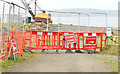
|
Path closed
by TCExplorer
geograph for square SJ5510
The National Trust is carrying out work to some of its trees which are suffering... (more)
|

|
Closed Blackhead path, Whitehead
by Albert Bridge
geograph for square J4893
The cliffs, to the north of Whitehead, are prone to periodic rock falls. As a... (more)
|

|
Path closed in Traquair woodland
by Jim Barton
geograph for square NT3334
Forestry work in the woodland has temporarily closed the path, with a diversion... (more)
|

|
Path temporarily closed
by Alan Murray-Rust
for square SH7877
I had climbed three flights of steps to find this notice facing me at the top. I... (more)
|

|
Conwy town walls
by Alan Murray-Rust
geograph for square SH7777
The western range looking southwest near Porth Ffordd Bangor. The section up to... (more)
|

|
Laying gas pipeline in Cranbourne Drive
by Christine Johnstone
geograph for square TQ1188
The pavement on the south side is temporarily closed. Why do they call it a... (more)
|

|
Closed boardwalk, Foulshaw Moss nature reserve
by Christine Johnstone
geograph for square SD4583
Temporarily closed in response to the Covid pandemic. This is not a circular... (more)
|

|
Closed path, Crawfordsburn Country Park
by Albert Bridge
geograph for square J4681
|

|
South West Coast Path, Isle of Portland
by Malc McDonald
geograph for square SY6871
The South West Coast Path on the western coastline of the Isle of Portland. The... (more)
|

|
Llwybr caeedig / Closed path, Cynwyd
by Christine Johnstone
geograph for square SJ0541
The steps lead to a path along the former Bala - Corwen railway. This appears to... (more)
|

|
Closed Connswater path, Belfast (May 2015)
by Albert Bridge
geograph for square J3674
The path is closed for the duration of the Connswater Greenway works between... (more)
|

|
Tyneham "Woodland Walk": closed
by Jim Champion
geograph for square SY8780
This is the entrance to the 'Woodland Walk' from the path that leads... (more)
|

|
Closed path, Holywood
by Albert Bridge
geograph for square J4079
A short stretch of the North Down coastal path, at Seapark, is currently closed... (more)
|

|
Closed footbridge, Crawfordsburn Country Park
by Albert Bridge
geograph for square J4681
This seems to be the unsound footbridge (seen from the open part of the path)... (more)
|

|
Path not closed!
by Bill Kasman
geograph for square NO3500
As part of the reinstatement of the Levenmouth Rail Link... (more)
|

|
The Sussex Border Path closed at Coach Hill
by Marathon
geograph for square TQ7628
This is the Sussex Border Path seen from Conghurst Lane but the notice on a... (more)
|

|
The Sussex Border Path closed at Coach Hill
by Marathon
geograph for square TQ7628
This is the Sussex Border Path seen from Conghurst Lane but the notice on the... (more)
|

|
Closed footpath, Torquay
by Derek Harper
geograph for square SX9063
Hmm. I've just walked along this pavement, having joined it at the... (more)
|

|
Closed Connswater path, Belfast
by Albert Bridge
for square J3674
12.05 as a precaution against possible flooding, the path from the Connswater... (more)
|

|
Work in the car park, The Willows
by Derek Harper
geograph for square SX8966
|
|
Coastal path improvements, Helen's Bay - February 2015(3)
by Albert Bridge
geograph for square J4482
|

|
Coast path closed, Dawlish
by Derek Harper
geograph for square SX9676
The path is inaccessible to the public from the breakwater, for 750 metres to... (more)
|

|
Closed path, Shiphay Lane
by Derek Harper
for square SX9065
|

|
Closed path, Shiphay Lane
by Derek Harper
geograph for square SX9065
|

|
Closed footpath by the River Wear
by Jim Barton
geograph for square NZ2842
The riverside path on the N bank was closed for the week for work on an area... (more)
|

|
Closed path, Cultra
by Albert Bridge
geograph for square J4080
|

|
Forest path still closed, Whitfold Hill
by Jim Barton
geograph for square NT2642
Storm Arwen (26-27 November 2021) brought down a number of trees further down... (more)
|

|
Path section closed, Glentress Forest
by Jim Barton
geograph for square NT2741
Part of the Time Trail has been closed here for Forest Holidays construction... (more)
|

|
Temporary path over the Regents Canal
by Stephen Craven
geograph for square TQ2983
The permanent towpath was closed for long-term construction work, so a temporary... (more)
|

|
New footbridge over the Regents Canal
by Stephen Craven
geograph for square TQ2983
A recent addition, as part of the adjacent Coal Drops Yard housing development.... (more)
|

|
Temporary closure of the High Peak Trail
by Humphrey Bolton
geograph for square SK3056
This length of the disused railway is on an embankment, and subsidence has... (more)
|

|
Forest gate, Whitfold Hill
by Jim Barton
geograph for square NT2642
The gate is on the boundary of Glentress Forest (Forestry and Land Scotland) and... (more)
|

|
Path to the Parrinder hide, RSPB Titchwell
by Christine Johnstone
geograph for square TF7544
Closed because of Covid-19, as it is too narrow to let people pass with confidence.
|

|
Footpath CLOSED, Newton Road
by Derek Harper
geograph for square SX9065
|

|
Closed footpath, Elland
by Humphrey Bolton
geograph for square SE1020
Elland FP 25, legally closed by Road Traffic Act 1984 or just advisory?
|

|
Closed footbridge
by Alan Murray-Rust
geograph for square SK6233
Closed for 3 weeks for assessment of the bridge deck, which is in poor... (more)
|

|
Coastal footpath, Niarbyl
by Christine Johnstone
geograph for square SC2177
Closed for a week, when this was taken.
|

|
Trail Closed sign, Glentress
by Jim Barton
for square NT2840
'Dougie Bank Climb is closed due to storm damage' - a result of Storm... (more)
|

|
Closed footpath at the Abbey Meadows
by Mat Fascione
geograph for square SK5806
The Abbey Meadows was the site of the former Wolsey Factory which quit the site... (more)
|

|
Pump at Cockington Lakes
by Derek Harper
for square SX8963
By the lowest of the three lakes, and required to carry out a lot of work, by... (more)
|

|
Footpath CLOSED, Newton Road
by Derek Harper
for square SX9065
Hmmm, this looks serious. Let's see, the alternative route involves moving... (more)
|

|
Second new bridge and path
by John Goldsmith
geograph for square TM3863
A new path down the side of the Waitrose store to the new Church Hill estate,... (more)
|

|
The Connswater, Mersey Street, Belfast (July 2015)
by Albert Bridge
geograph for square J3674
The view, upstream, from the Mersey Street bridge. The area on the left,... (more)
|

|
Path under construction at Abbey Park
by Mat Fascione
geograph for square SK5805
|

|
Plant at Cockington Lakes
by Derek Harper
geograph for square SX8963
|

|
Railway line, Dawlish
by Derek Harper
geograph for square SX9676
From the coastguard footbridge looking towards the stretch of track severely... (more)
|

|
Conwy Town Walls, western section
by Alan Murray-Rust
geograph for square SH7777
View from the Watchtower/Tŵr Gwylio, the highest part of the walls. This... (more)
|

|
No access to the moss
by Richard Sutcliffe
geograph for square NS6471
Barriers prevent access onto Lenzie Moss while work is being carried out to... (more)
|

|
Silt removal at Cockington lakes
by Derek Harper
geograph for square SX8963
|

|
Flooded towpath, Drumbeg, Dunmurry - November 2014(3)
by Albert Bridge
geograph for square J3067
|