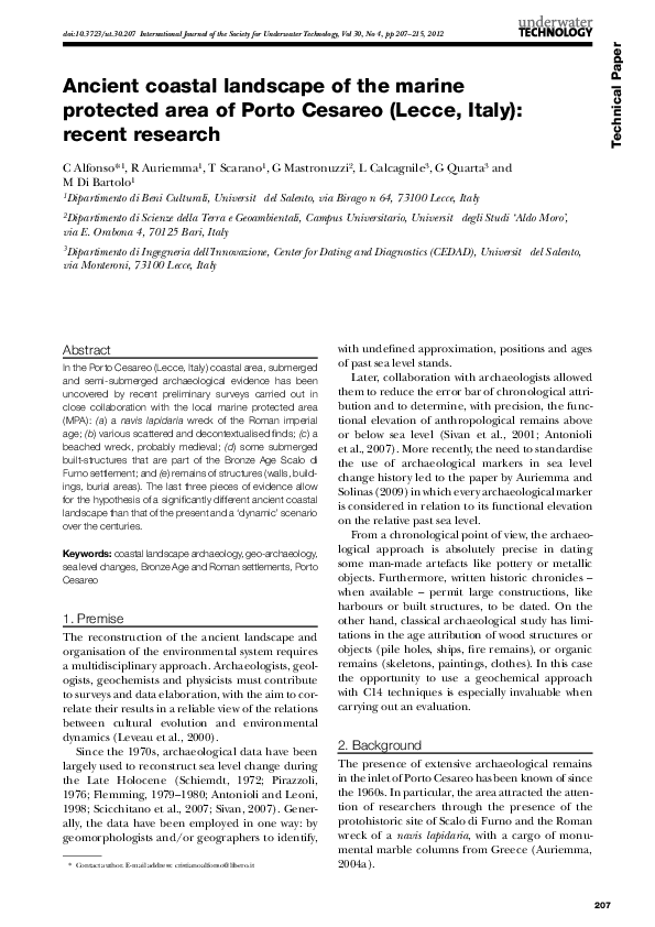
Technical Paper
doi:10.3723/ut.30.207 International Journal of the Society for Underwater Technology, Vol 30, No 4, pp 207–215, 2012
Ancient coastal landscape of the marine
protected area of Porto Cesareo (Lecce, Italy):
recent research
C Alfonso*1, R Auriemma1, T Scarano1, G Mastronuzzi2, L Calcagnile3, G Quarta3 and
M Di Bartolo1
1
Dipartimento di Beni Culturali, Università del Salento, via Birago n 64, 73100 Lecce, Italy
2
Dipartimento di Scienze della Terra e Geoambientali, Campus Universitario, Università degli Studi ‘Aldo Moro’,
via E. Orabona 4, 70125 Bari, Italy
3
Dipartimento di Ingegneria dell’Innovazione, Center for Dating and Diagnostics (CEDAD), Università del Salento,
via Monteroni, 73100 Lecce, Italy
Abstract
In the Porto Cesareo (Lecce, Italy) coastal area, submerged
and semi-submerged archaeological evidence has been
uncovered by recent preliminary surveys carried out in
close collaboration with the local marine protected area
(MPA): (a) a navis lapidaria wreck of the Roman imperial
age; (b) various scattered and decontextualised finds; (c) a
beached wreck, probably medieval; (d) some submerged
built-structures that are part of the Bronze Age Scalo di
Furno settlement; and (e) remains of structures (walls, buildings, burial areas). The last three pieces of evidence allow
for the hypothesis of a significantly different ancient coastal
landscape than that of the present and a ‘dynamic’ scenario
over the centuries.
Keywords: coastal landscape archaeology, geo-archaeology,
sea level changes, Bronze Age and Roman settlements, Porto
Cesareo
1. Premise
The reconstruction of the ancient landscape and
organisation of the environmental system requires
a multidisciplinary approach. Archaeologists, geologists, geochemists and physicists must contribute
to surveys and data elaboration, with the aim to correlate their results in a reliable view of the relations
between cultural evolution and environmental
dynamics (Leveau et al., 2000).
Since the 1970s, archaeological data have been
largely used to reconstruct sea level change during
the Late Holocene (Schiemdt, 1972; Pirazzoli,
1976; Flemming, 1979–1980; Antonioli and Leoni,
1998; Scicchitano et al., 2007; Sivan, 2007). Generally, the data have been employed in one way: by
geomorphologists and/or geographers to identify,
* Contact author. E-mail address: cristianoalfonso@libero.it
with undefined approximation, positions and ages
of past sea level stands.
Later, collaboration with archaeologists allowed
them to reduce the error bar of chronological attribution and to determine, with precision, the functional elevation of anthropological remains above
or below sea level (Sivan et al., 2001; Antonioli
et al., 2007). More recently, the need to standardise
the use of archaeological markers in sea level
change history led to the paper by Auriemma and
Solinas (2009) in which every archaeological marker
is considered in relation to its functional elevation
on the relative past sea level.
From a chronological point of view, the archaeological approach is absolutely precise in dating
some man-made artefacts like pottery or metallic
objects. Furthermore, written historic chronicles –
when available – permit large constructions, like
harbours or built structures, to be dated. On the
other hand, classical archaeological study has limitations in the age attribution of wood structures or
objects (pile holes, ships, fire remains), or organic
remains (skeletons, paintings, clothes). In this case
the opportunity to use a geochemical approach
with C14 techniques is especially invaluable when
carrying out an evaluation.
2. Background
The presence of extensive archaeological remains
in the inlet of Porto Cesareo has been known of since
the 1960s. In particular, the area attracted the attention of researchers through the presence of the
protohistoric site of Scalo di Furno and the Roman
wreck of a navis lapidaria, with a cargo of monumental marble columns from Greece (Auriemma,
2004a).
207
�Alfonso et al. Ancient coastal landscape of the marine protected area of Porto Cesareo (Lecce, Italy): recent research
Previous papers have aimed to describe these
emergences, but have not attempted to insert them
into a cultural-environmental context. The present
paper, instead, focuses on the numerous archaeological remains found along the shore which could
provide – directly or indirectly – data for the reconstruction of human history in relation to environmental dynamics.
Various submerged and semi-submerged remains
have been detected by some recent notifications and
preliminary surveys in the Marine Protected Area:
• scattered and decontextualised finds;
• a beached wreck;
• submerged structures, located between the locality called Scalo di Furno and the islet opposite it;
• remains of structures (walls, buildings, burial
areas) and findings of the Roman age (Fig 1).
The evidence has allowed researchers to hypothesise
a significantly different ancient coastal landscape
to that of the present and a dynamic environment
over the centuries.
The historical and archaeological capabilities
inside the Marine Protected Area of Porto Cesareo
have been uncovered by a series of recent preliminary surveys. Old and new recoveries, measurements
and reports concern isolated or decontextualised
finds, such as anchors, amphorae, lamps, tableware
and cooking pottery, fishing equipment and ship
elements (Congedo, 1984; Borricelli and Zaccaria,
1995; Auriemma, 2004a) (Fig 1). All these remains
testify to an intense inhabitation of this area in
ancient times, both along the fishing and coastal
routes.
New data, based on new finds, have given researchers the opportunity to attempt a reconstruction of
the paleolandscape.
3. Geomorphological setting
The coast of Porto Cesareo is an example of a gently sloping rocky coast (Mastronuzzi et al., 1994;
Mastronuzzi et al., 2002) shaped by a sequence of
Mesozoic limestone over-capped by Pleistocenic
calcarenite belonging to the Upper Pleistocene
(Mastronuzzi and Sansò, 2002). Unfortunately, this
last deposit did not show any evidence – paleontological or geo-chronological – that would permit
allocating a precise age to it.
The only chronological attribution seems to be
derived by the nearby Strombus bubonius, which
remains at about 4m above present sea level (APSL)
near Gallipoli (Hearty and Dai Pra, 1992). Another
attribution may be derived by a beach level at
6m APSL near cape Santa Maria di Leuca. This is
allocated to the marine isotope stage (MIS) 5.5 by
means of U/Th age determinations (Mastronuzzi
et al., 2007), so that the calcareous outcropping in
the Porto Cesareo bay can be categorised to a
generic MIS 5 but without the possibility of differentiating between the possible sub-stages.
From the tectonic point of view, the first consequence is that this area can be considered to be
more or less stable, characterised by a vertical displacement ranging from −0.03 and +0.02mm/yr
(Ferranti et al., 2006). The problems facing the
recognition of the environment in which fossils
have been found means that researchers cannot be
Fig 1: Archaeological map of recoveries in Proto Cesareo 40° 16′ 10″ N 17° 52′ 45″ E
208
�Vol 30, No 4, 2012
absolutely certain in identifying the sedimentation
depth as a consequence of the past sea level elevation. Therefore the chronological attribution and
the tectonic assessment are still questionable.
However, here the local geological sequence has
been partly submerged by the Holocene transgression which occurred in the last 20ky. At that time,
the sea level was 150m below its present position
(Lambeck et al., 2004a) and only 6ky BP stopped its
fast rise to a few metres below its current level (e.g.
Lambeck et al., 2004a,b; Auriemma et al., 2004b;
Auriemma et al., 2005; Antonioli et al., 2009). The
last 6ky were characterised by a slower rise in sea
level that reached the present zero, inducing the
inland migration of dune belts (Mastronuzzi and
Sansò, 2002; Mastronuzzi and Romaniello, 2008)
conditioning the development, and perhaps the
permanence, of human settlements.
4. Archaeological data
4.1. Scalo di Furno
The Bronze Age site of Scalo di Furno is a protohistoric, coastal, long-term settlement occupied
almost without interruption from the early middle
Bronze Age (17th–18th c. BC) to the late Iron Age
(5th–6th c. BC). The archaeological investigations,
directed by the Superintendence of Archaeological
Heritage of Apulia between 1969 and 1977, highlighted the importance of the fortified Bronze Age
settlement.
During the excavation of the inhabited area, a
great quantity and variety of local handmade
impasto pottery was unearthed in a good state of
preservation, along with some Aegean-type sherds
(LH IIIA–IIIC) and bronze objects (Lo Porto,
1990). Many of these artefacts, a large number of
bones and stone tools, and faunal, malacological
and botanical remains were often identified in
their functional position on the floor of the dwelling structures. Furthermore, the remains of a
large dry-stone fortification wall, running northwest to southeast along the isthmus and possessing a gate located on the southeast side of the
inhabited area, were identified during the archaeological excavations in the late 1960s. The wall,
possibly dating almost to the end of the 2nd millennium BC, probably marked the settlement
boundary on the landward side and defended the
inhabited area.
The underwater archaeological survey of the area
between Scalo di Furno and the islet produced two
important results. First, a submerged wall (about
17m long, 5m wide and 1m high) was found about
100m southwest of the southern remains of the
Bronze Age fortification wall (Fig 2). A reasonable
Fig 2: Submerged wall in Scalo di Furno (photo
by G Piccioli)
hypothesis is to consider this submerged structure
to be a part of that protohistoric enceinte.
The second piece of evidence documented concerns a large area (about 2000m²) paved with a
flagstone floor lying on the bedrock and preserving
archaeological soil with hundreds of local handmade impasto sherds and many animal bone fragments (Fig 3). The pottery sampled (mostly handles
and rims) can be seen to derive from some incomplete close- and open-shaped containers (cups, dippers, bowls, small jars, dolia and biconical vases)
dating mainly to the local middle Bronze Age archaeological facies (late proto-Apennine and Apennine)
(Scarano, 2011).
Both pieces of evidence lie about 3.5m under
the actual sea level and mark a deep change in the
coastal geography of this area that probably began
during the first half of the 2nd millennium BC
(Scarano et al., 2008). Some archaeological evidence suggests that both the submerged structures
(as well as the fortification wall above the sea level)
could date back to the early phase of occupation of
the middle Bronze Age settlement of Scalo di Furno.
Fig 3: The area paved with a flagstone floor lying on the
bedrock in Scalo di Furno (photo by C Alfonso)
209
�Alfonso et al. Ancient coastal landscape of the marine protected area of Porto Cesareo (Lecce, Italy): recent research
In the present day, the Bronze Age settlement
of Scalo di Furno is a small peninsula about 1ha
wide, and the marine erosion produced by the sea
level rise has heavily modified the morphology of
the ancient site.
4.2. Torre Chianca
Along the stretch of coast between the Torre
Chianca headland and the narrow peninsula immediately to the west, the continuous receding of the
coastline has brought to light many ancient remains
that attest to intense human activity in the area,
especially in the Roman age. A few of these pieces
of evidence were already known and had been
examined by the research group of the Unità Operativa di Topografia Antica, Dipartimento di Beni
Culturali. In the 1980s the group carried out some
surveys both on the Torre Chianca headland and
on the islet near to it. In the area black gloss, grey
gloss, African red slip and dolia sherds, net weights,
nails, hooks, besides relevant quantities of malacological remains (murices), were detected. The
marine shells found were actually of a small size
and not related to purple dye working process.
Only an archaeological excavation could verify the
existence of specimina used for this purpose (Guaitoli, 1997; Valchera and Zampolini Faustini, 1997).
There were also dozens of artificial holes, aligned
and of various diameters, that probably were associated with a sort of pile structure and could be
related to the protohistoric phase.
The whole promontory of the tower known as
Torre Chianca and the small western peninsula,
which has an archaeological deposit up to 1m above
the present sea level in the preserved part, has a
corroded border from the action of the sea. Numerous pottery fragments (belonging to amphorae, tiles
and coarse ware), together with remains of fauna,
can be observed in the section clearly evident behind
the bare rocky bench of the intertidal stretch.
These ceramic sherds are associated with local laterepublican amphorae, flat-bottomed amphorae
(Forlimpopoli type, end of 1st–2nd c. AD) and
common ware. There is also one lamp presumably
related to the high imperial age. Net weights and
nails by naval carpentry have been discovered also.
There are remains of wall foundations and a double curtain of limestone blocks. Two structures
located near the tip of headland are particularly significant; they are perpendicular to each other and
define a large room. Other archaeological evidence,
such as remains of limestone sarcophagi, have been
detected along the western side, near the dunes
which stretch to the north. They are represented by
a double slope lid with corner acroteri, which is fragmented and eroded, and other remains partially
210
preserved, only 30cm above sea level and attributable with caution to the 4th–5th c. AD.
Other burials partially submerged, together with
the remains of at least three individuals, are visible
in a simple grave cut into the rock near the sarcophagi. The bones are stuck to the bedrock because they
were lying at sea level. The lack of grave goods does
not allow researchers to date them more precisely,
but the burials could belong to the same phase of
the late imperial sarcophagi. With regard to the
chronological horizon, the few diagnostic materials
scattered in this area seem to indicate a range of
periods from the late Republic to late Antiquity.
4.3. Medieval wreck
The navis lapidaria wreck lies on a bed of silt-clay
sediments of very compact texture. It is oriented
330° N with the bow facing north and is perfectly
parallel to the shoreline (Fig 4). The boat, in fact,
pertains to the category of beached wrecks frequently found along the coasts of Salento. Their
presence could be considered as a marker of significant variations of sea level in the Late Holocene
(Mastronuzzi and Auriemma, 2007).
When determining how this vessel became a
beached wreck, it is important to calculate the
vessel draft. In particular, the gross tonnage of the
vessel (based on Colbert’s formula on mutual relations of length, width and height: 15 × 5 × 1.8m, in
this case), is estimated at about 20 tonnes. Then,
using a diagram reference that connects tonnage
to water displacement according to Archimedes’
principle (Charlin et al., 1978), the vessel draft can
be estimated (although completely approximately)
at about 1.5m. This is in line with the estimated
drafts of boats of similar size and shape, and especially contemporary ones, such as Serce Limani
11th c. AD (Steffy, 1994).
This draft explains the dynamics of how the
wreck came to be stranded. Encountering hazardous conditions, probably as a result of a storm,
Fig 4: The medieval wreck (photo by C Alfonso)
�Vol 30, No 4, 2012
the boat was dragged into a body of water (now at
2m deep) similar to Porto Cesareo bay. In the
10th c. AD, it is estimated this body of water would
have been about 1m deep, which would have prevented the vessel’s draft and therefore probably
remained aground.
It is unusual to come across a beached wreck of
this type because of its unusual naval architecture.
In fact, because of its chronological attribution, it
has only been possible to compare it to the shipwreck of Tantura Lagoon in Israel (Kahanov and
Royal, 2000). An interesting parallel can be found
with that shipwreck: it concerns the rabbet (receiving groove of the first planking). In both cases
there is a ‘lip’ that projects outward (1cm in Porto
Cesareo wreck and 3cm in Tantura B wreck) on
both sides of the upper face of the keel. It is likely
to be the wreck of a medium-sized cargo vessel, suitable for a long coastal navigation and similar to the
Yenikapi vessels (Ward, 2010), coming from the
Syro-Palestinian or the Aegean area.
Wood samples of the floor timber in the Porto
Cesareo wrecks were radiocarbon dated by accelerator mass spectrometry (AMS). Conventional radiocarbon ages (Stuiver et al., 1986) were then measured
by using the AMS beamline installed at the 3MV
Tandetron accelerator of CEDAD (Calcagnile et al.,
2005). The selected wood sample was dated to 1128
± 45 BP (uncalibrated radiocarbon age). The age
was then calibrated to calendar years by using the
INTACAL04 calibration curve to 770–1020cal AD
with a probability of 95.4% (Fig 5).
5. Methods
The coastal archaeological evidence can be correlated to geological data to determine changes in
Atmospheric data from Reimer et al (2004);
OxCal v3.10 Bronk Ramsey (2005); cub r:5 sd:12 prob usp[chron]
Radiocarbon determination
1500BP
LTL4757B : 1128±45BP
1400BP
68.2% probability
870AD (68.2%) 990AD
95.4% probability
770AD (95.4%) 1020AD
1300BP
1200BP
1100BP
1000BP
900BP
800BP
600Cal AD
800Cal AD
1000Cal AD
Calibrated date
1200Cal AD
Fig 5: Conventional radiocarbon ages, which were converted
to calendar ages by using the INTACAL calibration curve and
the OxCal software
the sea level in the recent past. The archaeological
structures that can be taken into consideration are
as follows: harbour infrastructure (quays, piers, navy
yards); fishponds; residential units (villae maritimae);
caves (nymphaea); private and public buildings, or
town quarters (foundations, floorings, roads and
pavements); thermal baths; plumbing installations
(wells, aqueducts, cisterns, sewers, drains, gullies);
tombs; pre- and protohistorical settlements; quarries; caves; beach rock; beached wrecks; and
anchorages (Kraft et al., 1985; Auriemma et al.,
2003; Auriemma and Solinas 2009).
It is necessary to collect the archaeological data
directly from the field (documenting which typology
of evidence, the constructive technique, presumed
dating, functional elements). In addition, the
geologic/geomorphological data (beach/dunes
deposits, beach rock, bioconstruction or bioconcrection, inner margin, wave cut platform, trottoir,
notch, cave, speleothem) should also be recorded,
although with different levels of approximation
(Ferranti et al., 2006). This will assist in correlating
them and determining the period of construction,
the chronological range of usage/frequentation,
and the dynamics of its abandonment/destruction/obliteration. This is possible only after a series
of surveys ranging from the prospecting of the
area, to the sampling of the chronological indicators (ceramic finds), and the detection and (partial) excavation of part of the structure (sample).
The surveys carried out in the area for the present
study did not permit the discovery of any geological or geomorphological markers that would permit direct correlation to past sea level stands with
precision. Unluckily, widespread dune belt and
wave cut platforms together were not enough to
indicate more than a transgressive tendency which
has occurred in the last 6ky; their analysis did not
supply data about the age and position of past sea
level.
On the contrary, archaeological evidence indicates an age when the area was frequented and,
consequently if submerged, an age ex-ante when
the sea level was lower than it is today. It is problematic to attribute the functional elevation that
corresponds to the height at which the structure
worked without directly receiving breaking waves
or extensive aerosol effects. Together, they would
not have permitted human settlement. Therefore
two parameters characteristic of the coastal landscape must be determined: the gradient of the
submerged/emerged slope; and the wave-climate
feature. The first set of data can be easily derived by
the analysis of the present landscape in an area in
which geological sequence and physical geography
(fetch and wind exposition) are about the same; in
211
�Alfonso et al. Ancient coastal landscape of the marine protected area of Porto Cesareo (Lecce, Italy): recent research
the case of the Porto Cesareo area, a slope of no
more than 5° can be given confidently.
It is more difficult to hypothesise the past waveclimate feature. Obviously, it is a function of the
past climate; however, since there is no record of
the past winds and consequent waves, the only way
to approximate this is to consider the present waves
as representative of the waves of 3500 years BP (the
submerged pavement), 1500 years BP (the tombs)
and 1000 BP (the wreck). Of course this approximation excludes any possibility of considering
occasional extreme events, such as an exceptional
storm or a tsunami, whose impact is evident not far
away (Mastronuzzi and Sansò, 2000).
Together these constraints need to consider a
functional elevation of at least 1.5m (Table 1).
6. Results and discussion
Considering the constraints adopted and explained
in the previous sections – age and functional
elevation – the present study attempted to reconstruct the sea level change by building a sea level
curve of the past 5000 years. Ages and elevations of
the surveyed remains have been reported on the most
recent curves elaborated, according to the model
produced by Lambeck et al. (2004a; 2011) (Fig 6).
The horizontal error bar indicates the supposed
Table 1: Measurement data and inferred sea levels for archaeological site in Porto Cesareo
Type, and
measured
height (m)
Age yrs BP
Corrected
height
(m)
Functional
height (m)
s.l.
change
(m)
Walking
surface of
flagstone
floor −3.55
2 Roman grave 2011/02/16 h grave cut
Torre Chianca 14.00 GMT
into the
rock −0.00
2011/05/10 h beached
3 Medieval
12:00 GMT
wreck
beached
−2,47
wreck
3400 ± 100
−3.85
1.5 a.m.s.l.
± 0.60
1600 ± 100
−0.55
1.5 a.m.s.l.
± 0.60
1128 ± 45
(14C uncalibrated)
1117 ± 125
(14C calibrated data)
−2.77
−1.5 a.m.s.l.
± 0.60
Site name
1 Flagstone
floor of Scalo
di Furno
Survey date
(yyyy/mm/
dd, h)
2011/10/01 h
11.30 GMT
Fig 6: Ubication of the archaeological data derived from Porto Cesareo with respect to the known curve by
Lambeck et al. (2004a; 2011)
212
�Vol 30, No 4, 2012
age, and the vertical error bar indicates the functional elevation on the correlated sea level for
1 and 2. In the case of site 3, it indicates the depth
of the beam for the medieval wreck.
As evident, the data from Porto Cesareo fit only
in part with previous curves from the two models
produced by Lambeck et al. (2004a; 2011). The
present position of the wreck and the Roman
remains below and above (respectively) the present
mean sea level are in acceptable agreement with
these curves. Both of them permit researchers to
estimate the position of the sea level 2000 years ago
at about 1.5m below the present one, and a mean
sea level rise of about 0.75mm/y can be calculated.
This data explains the transgression recognised on
the basis of morphological markers, such as wave
cut platforms and dune belts.
Conflicting scenarios were derived from the study
of the protohistoric submerged wall and flagstone
floor. In the absence of more precise data, their
chronological attribution seems to range from the
18th c. BC to the end of the 2nd millennium BC.
Considering the former, in relation to modelled
curves and if the yellow line is correct, it is necessary to invoke an anomalous subsiding behaviour
of the land, which could be connected to the tectonic. No other possibility can be hypothesised,
since a sediment load-induced subsidence and/or
a sinkhole-like modelling are not supported by geological or geomorphological evidence. Therefore,
it is necessary to suppose a tectonic subsidence estimated at 0.2/0.5mm/y, even though it is absolutely
in disagreement with the local geological background. In fact, the tectonic behaviour of the entire
Italian peninsula as suggested by the elevation of
raised marine deposits indicates tectonic stability in
the area around Porto Cesareo, with a possible downlift estimated at about 0.03/0.01mm/y and 10 order
of magnitude bigger (Ferranti et al., 2006).
A different scenario is derived from a different
chronological attribution of the submerged wall
and flagstone floor. An age of 3800 years BP tends
to overlap the curves of Lambeck et al. (2004b) and
is closer, but it is still far from those of 2011. It is
evident that the chronological attribution of the
protohistoric remains cannot be conditioned by a
geophysical model, no matter how thorough and
tested it may be. On the contrary, a model must be
verified by local data. At this stage it is evident that
it is not possible to calibrate the geophysical model
using archaeological data, since the precision of
the chronological attribution needs improvement.
In general, the present study could affirm that in
the Porto Cesareo area archaeological data seem to
confirm the long-term tectonic downlift and the
transgressive trend of the sea level, but are quite
different between the last 2000 years and the previous time.
7. Conclusions
The understanding of the ancient coastal landscape helps researchers to determine the particular
human choices connected to the exploitation of
the ancient resources and the settlement in the
ancient environment.
At the beginning of the 2nd millennium BC, the
coastal areas of southern Apulia saw extensive
growth in human settlements in the first centuries.
Frequently they were characterised by dry stone fortifications and walls built at the top of morphologically elevated areas, useful in the recognition and
control of the surrounding landscape both seaward
and inland. This choice indicates the need to be in
control of the nearby food and water resources from
the network of rivers, swamps and woodland. Both the
geographical and temporal extensions confer upon
this phenomenon the dignity of a cultural evolution
with historic foundations (Scarano, 2010).
Regarding the successive phase of occupation,
the geoarchaeological data render the image of
settlement form to be completely different. Some
coastal farmsteads/small holdings or manufacturing villages (vici), specialising in the exploitation of
the maritime resources and probably related to
more extensive landed properties, appear in the
Roman age near the shore. They were inhabited
only by small groups of people living on fishing and
its proceeds, though probably only seasonally.
Given recent research, this settlement pattern
seems to recur along the Salento coast from the late
Republic, and particularly in the imperial age and in
late Antiquity, when it reaches a significant development. Examples can been found in the well-known
and investigated case studies of S. Foca, Frascone –
Palude del Capitano, S. Maria al Bagno – and also in
less well documented case studies, such as Saturo,
Torre Ovo and Punta Prosciutto (Auriemma, 2004a).
Furthermore, the process of reconstruction of
the ancient coastline, by the reading of the archaeological data, is determined by the analysis of single
sites. This confers great importance on each
archaeological site, along with the need to improve
our scientific knowledge of it. In addition, accurate
archaeological information has to be supported by
areal geologic and biological investigations in
order to better define in extension the reconstruction of the ancient coastline and landscapes.
The particular coastal conformation of Porto
Cesareo and its numerous archaeological sites,
covering a large chronological span of time, allow
researchers to be able to further conduct studies
213
�Alfonso et al. Ancient coastal landscape of the marine protected area of Porto Cesareo (Lecce, Italy): recent research
on the variations in sea level over time, coastal shape
and erosion and the peculiarities of the ancient
population along the coast. It is possible to conclude
that more accurate data is necessary to compare
both archaeologically and geologically derived
uplift/downlift trends, and to validate existing geophysical models.
References
Antonioli F and Leoni G. (1998). Siti archeologici sommersi e loro utilizzazione quali indicatori per lo studio
delle variazioni recenti del livello del mare. Il Quaternario
11: 53–66.
Antonioli F, Carulli GB, Furlani S, Auriemma R and
Marocco R. (2004). The enigma of submerged marine
notches in Northern Adriatic sea. Quaternaria Nova 8:
263–275.
Antonioli F, Anzidei M, Lambeck K, Auriemma R, Gaddi D,
Furlani S, Orrù P, Solinas E, Gaspari A, Karinja S, Kovacic V
and Surace L. (2007). Sea level change during the
Holocene in Sardinia and the northeastern Adriatic (central Mediterranean Sea) from archaeological and geomorphological data. Quaternary Science Reviews 26: 2463–2486.
Antonioli F, Ferranti L, Fontana A, Amorosi A, Bondesan A,
Braitenberg C, Dutton A, Fontolan G, Furlani S, Lambeck K, Mastronuzzi G, Monaco C, Spada G and Stocchi P.
(2009). Holocene relative sea-level changes and vertical
movements along the Italian and Istrian coastlines. Quaternary International 206: 102–133.
Auriemma R. (ed.). (2004a). Salentum a salo. Porti, approdi,
merci e scambi lungo la costa adriatica del Salento, I. Galatina:
Congedo Editore, 359pp.
Auriemma R. (ed.). (2004b). Salentum a salo. Forma Maris
Antiqui, II. Galatina: Congedo Editore, 299pp.
Auriemma R and Solinas E. (2009). Archaeological remains
as sea level change markers: a review. Quaternary International 206: 134–146.
Auriemma R, Mastronuzzi G and Sansò P. (2003). I siti archeologici costieri come markers delle variazioni del livello
del mare: le evidenze salentine. Atti del XLII Convegno di
Studi sulla Magna Grecia (Taranto-Matera, 5-8 ottobre 2002),
515–521.
Auriemma R, Mastronuzzi G and Sansò P. (2004). Middle to
Late Holocene relative sea-level changes recorded on the
Coast of Apulia (Italy). Géomorphologie: relief, processus,
environnement 1/2004: 19–34.
Auriemma R, Mastronuzzi G, Sansò P and Zongolo F. (2005).
The harbour of the mansio ad speluncas (Brindisi, Italy):
a key to the lecture of sea level changes in the past 3500
years? In: Marcei i Barbe R, Brebbia CA and Olivella J.
(eds.). Maritime Heritage and Modern Ports. Southampton:
Wessex Institute of Technology Press, 5–14.
Borricelli D and Zaccaria A. (1995). Porto Cesareo (Lecce),
Torre Chianca. Taras 15: 151–152.
Calcagnile L, Quarta G and D’Elia M. (2005). High resolution accelerator-based mass spectrometry: precision,
accuracy and background. Applied Radiation and Isotopes
62: 623–629.
Charlin G, Gassend JM and Lequèment R. (1978). L’épave
antique de la baie de Cavaliére – Le Levandou Var.
Archeonautica 2: 9–93.
Congedo R. (ed.). (1984). Salento: scrigno d’acqua. Manduria:
Lacaita Editore, 200pp.
214
Ferranti L, Antonioli F, Mauz B, Amorosi A, Dai Prà G, Mastronuzzi G, Monaco C, Orrù P, Pappalardo M, Radtke U,
Renda P, Romano P, Sansò P and Verrubbi V. (2006).
Markers of the last interglacial sea level high stand along
the coast of Italy: tectonic implications. Quaternary International 145–146: 30–54.
Flemming NC. (1979–1980). Archaeological indicators of
sea level. Les indicateurs de niveaux marins. Oceanis 5, fasc.
Hors série: 149–166.
Guaitoli M. (1997). Attività dell’Unità Operativa Topografia
Antica. In: D’Andria F. (eds.). Metodologie di catalogazione
dei beni archeologici 1.2 (D’Andria F., eds.). Bari: Edipuglia,
9–45.
Hearty PJ and Dai Pra G. (1992). The age and stratigraphy of
middle Pleistocene and younger deposits along the Gulf
of Taranto (southeast Italy). Journal of Coastal Research 8:
882–905.
Kahanov Y and Royal JG. (2000). An Arab Period merchant
vessel at Tantura Lagoon, Israel. International Journal of
Nautical Archaeology 29: 151–153.
Kraft JC, Kayan I and Aschenbrenner SE. (1985). Geological studies of coastal change applied to archaeological
settings. In: Rapp G Jr and Gifford JA. (eds.) Archaeological Geology. New Haven: Yale University Press, 57–84.
Lambeck K, Antonioli F, Purcell A and Silenzi S. (2004a).
Sea-level change along the Italian coast for the past
10,000 yrs. Quaternary Science Reviews 23: 1567–1598.
Lambeck K, Anzidei M, Antonioli F, Benini A and Esposito E.
(2004b). Sea level in Roman time in the Central Mediterranean and implications for modern sea level rise. Earth
and Planetary Science Letters 224: 563–575.
Lambeck K, Antonioli F, Anzidei M, Ferranti L, Leoni G,
Scicchitano G and Silenzi S. (2011). Sea level change along
the Italian coast during the Holocene and projections
for the future. Quaternary International 232: 250–257.
Leveau P, Trement F, Walsh K and Barker G. (eds.). (2000).
Environmental Reconstruction in Mediterranean Landscape Archaeology (The Archaeology of Mediterranean
Landscapes). Oxford: Oxbow Books, 225pp.
Lo Porto FG. (1990). Porto Cesareo. Insediamento protostorico di Scala di Furno. In: D’Amicis A. (ed.). Archeologia dei Messapi. Bari: Edipuglia, 221–232.
Mastronuzzi G and Auriemma R. (2007). Shipwreck, wreckage, coastline and paleogeography: the study case of
Apulian coasts. Convegno Internazionale l’Archeologia dei
paesaggi costieri e le variazioni climatiche (Trieste, 8–10 novembre 2007, oral presentation).
Mastronuzzi G and Romaniello L. (2008). Holocene aeolian morphogenetic phases in Southern Italy: problems
in 14C age determinations using terrestrial gastropods.
Quaternary International 183: 123–134.
Mastronuzzi G and Sansò P. (2000). Boulders transport by
catastrophic waves along the Ionian coast of Apulia
(southern Italy). Marine Geology 170: 93–103.
Mastronuzzi G and Sansò P. (2002). Holocene coastal dune
development and environmental changes in Apulia
(southern Italy). Sedimentary Geology 150: 139–152.
Mastronuzzi G, Palmentola G and Sansò P. (1994). Le tracce
di alcune variazioni del livello del mare olocenico tra Torre
dell’Orso e Otranto (Lecce). Geogr. Fis. Din. Quat. 17: 55–60.
Mastronuzzi G, Palmentola G and Sansò P. (2002). Lineamenti e dinamica della costa pugliese. Studi Costieri 5: 9–22.
Pirazzoli PA. (1976). Sea level variations in the northwest
Mediterranean during Roman times. Science 194: 519–521.
Scarano T. (2010). Roca. Le fortificazioni della media età del
Bronzo, Notizie degli Scavi d’Antichità comunicate dalla
�Vol 30, No 4, 2012
Scuola Normale Superiore di Pisa – Rassegna Archeologica
del LSATMA, Annali della Scuola Normale Superiore di Pisa s.
5 2/2: 151–159.
Scarano T. (2011). Refuge or dwelling place? The middle
Bronze Age fortification walls of Roca (Lecce): spatial and
functional analysis of Postern C. Rivista di Scienze Preistoriche LXI: 95–122.
Scarano T, Auriemma R, Mastronuzzi G and Sansò P. (2008).
L’archeologia del paesaggio costiero e la ricostruzione
delle trasformazioni ambientali: gli insediamenti di Torre
Santa Sabina e Torre Guaceto (Carovigno, Br). Secondo
Simposio Internazionale “Il Monitoraggio Costiero Mediterraneo:
Problematiche e Tecniche di Misura”, Napoli, 1–6 giugno 2008,
CNR-IBIMET, Firenze, 391–402.
Schiemdt G. (ed.). (1972). Il livello antico del mar Tirreno. Testimonianze dei restiarcheologici. Firenze: Olschki, 326pp.
Scicchitano G, Antonioli F, Castagnino Berlinghieri FE and
Monaco C. (2007). Sea level change and archaeological
coastal sites: an interdisciplinary approach applied along
the south-eastern coast of Sicily. In: Auriemma R and
Karinja S. (eds.). Terre di mare. L’Archeologia dei paesaggi
costieri e le variazioni climatiche. Atti del Convegno Internazionale di Studi (Trieste, 8–10 novembre 2007). Udine: Arti
grafiche friulane, 239–246.
Sivan D. (2007). Underwater archaeology along the coast
of Israel, East Mediterranean, and its implications to
Holocene paleogeography, the question of tectonic activity,
and sea level change. Convegno Internazionale l’Archeologia
dei paesaggi costieri e le variazioni climatiche (Trieste, 8–10
novembre 2007 – oral presentation).
Sivan D, Wdowinski S, Lambeck K, Galili E and Raban A.
(2001). Holocene sea-level changes along the Mediterranean coast of Israel, based on archaeological observations
and numerical model. Palaeogeography, Palaeoclimatology,
Palaeoecology 167: 101–117.
Steffy JR. (1994). Wooden Shipbuilding and the Interpretation
of Shipwrecks. College Station, TX: A&M University,
85–86.
Stuiver M, Pearson GW and Braziunas T. (1986). Radiocarbon age calibration of marine samples back to 9000 cal yr
BP. Radiocarbon 28: 980–1021.
Valchera A and Zampolini Faustini S. (1997). Documenti
per una carta archeologica della Puglia meridionale. In:
D’Andria F. (ed.). Metodologie di catalogazione dei beni archeologici 1.2. Bari: Edipuglia, 103–158.
Ward C. (2010). The ‘Old Ships’ of the ‘New Gate’ –
Yenikapi ‘nın Eski Gemileri, Cilt I. International Journal of
Nautical Archaeology 39: 205–207.
215
�
 Teodoro Scarano