- Germany
Mirijam Zickel
University of Cologne, Geography, Department Member
In vielen Teilen der Erde haben sich im Verlauf der letzten Jahrtausende mannigfache Formen mobiler Viehzucht entwickelt. Eine besondere Stellung nimmt dabei der Pastoralnomadismus ein, für den eine permanente bzw. zyklische räumliche... more
In vielen Teilen der Erde haben sich im Verlauf der letzten Jahrtausende mannigfache Formen mobiler Viehzucht entwickelt. Eine besondere Stellung nimmt dabei der Pastoralnomadismus ein, für den eine permanente bzw. zyklische räumliche Mobilität charakteristisch ist: Hirten ziehen mit ihren Herden und dem auf Lasttieren transportierten Eigentum auf weitgehend festgelegten Routen von Weideplatz zu Weideplatz, dem jahreszeitlich bedingten Klima- und Vegetationswechsel folgend.
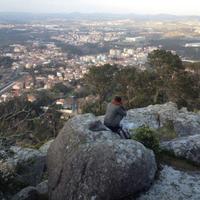
Ein neues Forschungsprojekt hat 2017 mit der wissenschaftlichen Dokumentation einer Nomadenfamilie aus der ethnischen Gruppe der Aït Atta im Jbel Sarhro Gebiet bzw. zentralen Hohen Atlas in Marokko begonnen. Die Untersuchungen sollen dabei auch Rückschlüsse auf die Viehzucht in älteren Perioden ermöglichen und durch die Einbindung geoarchäologischer Methoden naturwissenschaftlich ergänzt und gefestigt werden. GIS-Analysen und im Besonderen eine kombinierte Struktur-Signatur-Analyse von Satellitendaten (WorldView 2) sind hier eine sinnvolle Ergänzung,
um in 2500 m Höhe ü. NN viehwirtschaftliche Strukturen zu erkennen. Neben dem primären Fokus auf die Sommerweiden im Hohen Atlas wird zudem das ca. 150 km südlich gelegene Winterlager im Jbel Sarhro Gebiet untersucht. Insbesondere die geschichteten Sedimente in den Viehpferchen haben das Potenzial, als hochauflösendes Archiv der Weide- und Landschaftsgeschichte zu dienen. Sie stellen ebenso einen ökologischen Sonderstandort dar, der ein spezielles Nährstoff- und Bodenfeuchteregime besitzt. Diese Bedingungen wirken sich auf die Standortqualität der angrenzenden Umgebung aus. Solche Diffusionsmechanismen lassen sich supralokal in der Region über die GIS-Analyse fassen.
Research Interests: Prehistoric Archaeology, Anthropology, Ethnoarchaeology, Geoarchaeology, Landscape Archaeology, and 13 morePastoralism (Social Anthropology), Rock Art (Archaeology), Archaeological Soil Micromorphology, Ecology, Morocco, Nomadism, Alpine Archaeology, Pastoralism (Archaeology), Prehistory, Transhumance, Ethnoarchaeology Pastoralism, Haut Atlas, and Geographic Information Systems (GIS)

Introduction: This paper discusses the interaction between foragers and farmers during the various phases of the neolithisation processes in south-western and north-western central europe. The disparate state of research on Late... more
Introduction:
This paper discusses the interaction between foragers and farmers during the various phases of the neolithisation processes in south-western and north-western central europe. The disparate state of research on Late Mesolithic hunter-gatherer groups and early Neolithic farmers in terms of the certainty of the detailed chronology, the number of sites and the comprehensiveness of the find and feature analyses, does not permit a discussion on the basis of equally-weighted data. Nevertheless, examples can be found to illustrate and evaluate such interaction with regard to the questions raised in this volume on “Mobility in prehistoric sedentary societies”. Important for the following discussions are the distribution maps (Figs. 2–4) and the sites of special interest (Fig. 1; list of sites in Appendix, p. 73).
This paper discusses the interaction between foragers and farmers during the various phases of the neolithisation processes in south-western and north-western central europe. The disparate state of research on Late Mesolithic hunter-gatherer groups and early Neolithic farmers in terms of the certainty of the detailed chronology, the number of sites and the comprehensiveness of the find and feature analyses, does not permit a discussion on the basis of equally-weighted data. Nevertheless, examples can be found to illustrate and evaluate such interaction with regard to the questions raised in this volume on “Mobility in prehistoric sedentary societies”. Important for the following discussions are the distribution maps (Figs. 2–4) and the sites of special interest (Fig. 1; list of sites in Appendix, p. 73).
Research Interests:
The Zambezi Region of Namibia is known for its vast conservation landscape, which is part of the world’s largest transboundary conservation area – the Kavango Zambezi Transfrontier Conservation Area (KAZA TFCA). Less known are the... more
The Zambezi Region of Namibia is known for its vast conservation landscape, which is part of the world’s largest transboundary conservation area – the Kavango Zambezi Transfrontier Conservation Area (KAZA TFCA). Less known are the settlement histories of the communities displaced from their villages during the planning and implementation of this conservation landscape. We reconstruct the settlement history of two families that lived on two islands in the Kwando River and the adjacent riverbanks in today’s Mudumu NP, and we describe the circumstances that led to the designation of a national park in this region and the subsequent conservation-induced displacement. The evicted families increasingly protest and legally contest estrangement from their ancestral land, which is now a protected area. We argue that current nature-conservation efforts can succeed only if issues of past and present environmental injustices are comprehensively addressed.
Research Interests:
Research Interests: Humanities and DDC
Research Interests:
Abstract Since July 2013, the project D4 of the Collaborative Research Centre 806 at the University of Cologne has dealt with the Mesolithic in western Germany. During the first phase of this research, the primary tasks were to establish... more
Abstract Since July 2013, the project D4 of the Collaborative Research Centre 806 at the University of Cologne has dealt with the Mesolithic in western Germany. During the first phase of this research, the primary tasks were to establish a regional chronology for the Middle Stone Age on the one hand, and the mapping of all known sites in the Rhineland and Westphalia regarding the different Mesolithic phases on the other. Since July 2017, the project has focused on mobility, cultural exchange, and human-environment interactions during the Final Palaeolithic, Mesolithic, and Neolithic in Central Europe. Due to the poor conditions of preservation, numerous Palaeolithic and Mesolithic assemblages only contain lithic artefacts. Communication networks and mobility patterns of the hunter-gatherer groups can be deduced from the raw material of these finds for a considerable number of sites. Apart from pottery, lithic artefacts and their resources also illustrate the social and economic networks during the Neolithic. The raw material of knapped artefacts and their potential geological sources offer important information relating to the project's goals. A map of the potential raw material sources for knapped artefacts in comparison with the archaeological finds is the basis for any suggestion about mobility patterns and communication networks. In general, information on geological lithic sources and the archaeological inventories in western Central Europe is far more detailed than for other regions. These data and all the information gathered on lithic raw material sources for western Germany and the Benelux countries allow us to provide a GIS-database using the software QGIS in the form of several maps and data tables with geological and archaeological information as well as detailed descriptions and references. One important result of this paper addresses the reconstruction of lithic raw material catchment areas. Three examples from younger Mesolithic sites show that the more precise petrographic method for identifying lithic raw materials results in much larger catchment areas than traditional macroscopic identification, leading to new considerations for estimating population densities during the later Middle Stone Age.
Research Interests: Geography, Archaeology, Geology, Geoarchaeology, Mesolithic Archaeology, and 15 moreLithics, Mesolithic Europe, Quaternary, GIS and Landscape Archaeology, Geological mapping, Lithic Analysis, Digital mapping, Lithic Raw Materials, Lithic Raw Material Sourcing, Petroarchaeology, Archaeology of Westphalia, Benelux, History of the Rhineland, Lithic Raw Materials in Prehistory, and Lithic Raw Material Quarries
Im Verlauf dieser Arbeit werden auf eine geographische und archäologische Einordnung folgend, die zur Analyse angewandten Methoden und die daraus resultierenden Erkenntnisse dargestellt und diskutiert. Um die Ergebnisse, die unter anderem... more
Im Verlauf dieser Arbeit werden auf eine geographische und archäologische Einordnung folgend, die zur Analyse angewandten Methoden und die daraus resultierenden Erkenntnisse dargestellt und diskutiert. Um die Ergebnisse, die unter anderem paläoklimatische Aspekte bereithalten chronologisch einzuordnen und einen Kontext mit der Paläoumwelt herzustellen werden die heutigen Klimabedingungen und mögliche Ausprägungen der Paläoumwelt des Untersuchungsgebietes vorgestellt (Kapitel 4) und mit verschiedenen Paläoumweltarchiven des südosteuropäischen Raumes verglichen. Dies bezieht sich besonders auf den Zeitraum um 18 ka BP, was der Datierung der Fundschicht 3A entspricht (vgl. Kapitel 3.2) und das LGM. Die Ergebnisse der mikromorphologischen Analyse sollen die generellen Charakteristika des Westprofiles des Grabungsschnittes V (vgl. Kapitel 3.2) in der Blazi Cave herausstellen. Dies beinhaltet die Sedimentzusammensetzung, Dichte, Lagerung sowie die Verteilung der Komponenten und des enthal...
This geospatial dataset contains climate data from 120 ka to 0 ka in 1000 to 4000 year steps as raster data. The variable shows biomes representing nine different climate conditions modeled with the HadCM3 - general circulation model. The... more
This geospatial dataset contains climate data from 120 ka to 0 ka in 1000 to 4000 year steps as raster data. The variable shows biomes representing nine different climate conditions modeled with the HadCM3 - general circulation model. The source data from Hoogakker et al. (2016) was imported from the original published NetCDF file and translated to multiple GEOTIFFs with GDAL. The raster data has been converted to single GeoTIFFs with GDAL's gdal translate and gdalwarp tool. The dataset has a resolution of 93x73 cells, with a cell size of 3.75° width and 2.5° height. Source: Hoogakker et al.: Terrestrial biosphere changes over the last 120 kyr, Clim. Past, 12, 51-73, doi:10.5194/cp-12-51-2016, 2016.
This raster data is part of a geospatial dataset that contains climate data from 30 ka to 13 ka in 1000 year steps, provided by Tallavaara et al. (2015). The variables are PET (Potential Evapotranspiration) and WAB (Water balance) in... more
This raster data is part of a geospatial dataset that contains climate data from 30 ka to 13 ka in 1000 year steps, provided by Tallavaara et al. (2015). The variables are PET (Potential Evapotranspiration) and WAB (Water balance) in mm/year and MCM (Mean temperature of the coldest month) in C°. The source was supplied in a .xls file containing longitude/latitude coordinates with the related variable values. It was imported to a shapefile with QGIS' "Create a Layer from a Delimited Text File" tool. The vector point data has been converted to GeoTIFF with GDAL's gdal_rasterize tool. The dataset has a resolution of 216x141 cells, with a cell size of 0.375° width and 0.25° height. The original data by Tallavaara et al. (2015) was supplied in a .xls file containing longitude/latitude coordinates with the related variable values.
This GIS dataset contains 23 different modelled land masks of characteristic sea level high stand/ low stand for events and intervals during a period from 140 ka until today in Europe, the Nearer East and northern parts of Africa. The sea... more
This GIS dataset contains 23 different modelled land masks of characteristic sea level high stand/ low stand for events and intervals during a period from 140 ka until today in Europe, the Nearer East and northern parts of Africa. The sea level data was collected from data published in scholarly works and GIS proceeded using GIS software QGIS and ArcMap also as GEBCO DEM.
The here documented GIS map and dataset contains a collection of Last Glacial Maximum (LGM, ~21k yBP) paleoenvironmental data. It is the first result of a project that aims to acquire, produce and publish GIS datasets from non-GIS based... more
The here documented GIS map and dataset contains a collection of Last Glacial Maximum (LGM, ~21k yBP) paleoenvironmental data. It is the first result of a project that aims to acquire, produce and publish GIS datasets from non-GIS based sources such as analogous maps, textual informations or figures of scientific publications for prehistoric time slices. In combination with modelling results and already available GIS-datasets related to the mentioned time frame, it should enable other researchers and members from other projects to use the maps in their work, properly cited and referenced. The map shows LGM land ice sheets, paleo-stream networks and inland water in Europe, a sea-level adapted (-120m) land mass and a Köppen-Geiger climate classification derived from climate model data.
This is GIS dataset contains the major inland waters (rivers and lakes) of Europe during the LGM. The data was collected from data published in scholarly works.
Paleoenvironmental studies and according information (data) are abundantly pub-lished and available in the scientific record. However, GIS-based paleoenviron-mental information and datasets are comparably rare. Here, we present an... more
Paleoenvironmental studies and according information (data) are abundantly pub-lished and available in the scientific record. However, GIS-based paleoenviron-mental information and datasets are comparably rare. Here, we present an OpenScience approach for collecting and creating GIS-based data and maps of paleoenvironments, and publishing them in a web based Spatial Data Infrastructure (SDI),for access by the archaeology and paleoenvironment communities. The Open Science approach to the publication of data, allows to properly cite the publisheddatasets as bibliographic sources in research that builds upon these data sets.This paper has its focus on the implementation and setup of the Free and OpenSource Software for Geospatial (FOSS4G) based SDI, and on the workflow forcompiling and publishing the GIS data.
Research Interests:
Paleoenvironmental studies and corresponding data are abundantly published and available in scientific records. However, paleoenvironmental data sets are comparatively rarely provided in GIS data formats. Here, we present an Open Science... more
Paleoenvironmental studies and corresponding data are abundantly published and available in scientific records. However, paleoenvironmental data sets are comparatively rarely provided in GIS data formats. Here, we present an Open Science approach for collecting and creating GIS data, visualizing it in maps of paleoenvironments, and publishing them in a web-based Spatial Data Infrastructure (SDI), for access by the archaeology and paleoenvironment communities. The Open Science approach to the publication of data allows to properly cite the published data sets as bibliographic sources in research that builds upon these data sets. This paper has its focus on the implementation and setup of the Free and Open Source Software for Geospatial (FOSS4G)-based SDI, and on the workflow for compiling and publishing the GIS data
Research Interests:
Paleoenvironmental studies and according information (data) are abundantly pub-lished and available in the scientific record. However, GIS-based paleoenviron-mental information and datasets are comparably rare. Here, we present an... more
Paleoenvironmental studies and according information (data) are abundantly pub-lished and available in the scientific record. However, GIS-based paleoenviron-mental information and datasets are comparably rare. Here, we present an OpenScience approach for collecting and creating GIS-based data and maps of paleoenvironments, and publishing them in a web based Spatial Data Infrastructure (SDI),for access by the archaeology and paleoenvironment communities. The Open Science approach to the publication of data, allows to properly cite the publisheddatasets as bibliographic sources in research that builds upon these data sets.This paper has its focus on the implementation and setup of the Free and OpenSource Software for Geospatial (FOSS4G) based SDI, and on the workflow forcompiling and publishing the GIS data.
Research Interests:
Site preservation and associated terrain characteristics are among the major agents controlling the spatial distribution and discoverability of late Quaternary archaeological sites. However, site expectancy in extensive areas can be... more
Site preservation and associated terrain characteristics are among the major agents controlling the spatial distribution and discoverability of late Quaternary archaeological sites. However, site expectancy in extensive areas can be determined using a combination of geoarchaeological investigation and digital spatial analysis. In that sense a prediction model, respectively the result of a Multi Criteria Decision Analysis (MCDA), is presented to highlight areas with a high potential to contain Upper Palaeolithic sites in the Eastern Mediterranean and bordering arid margins. Based on detailed on-site analysis in the Wadi Sabra region, with its many sites and the location of other well-known sites in the southern Levant, eight individual parameters, aspect (cardinal point), elevation, geomorphology, hydrogeology, drainage network, slope inclination, vegetation, and a terrain ruggedness index (TRI) are evaluated and tested for significance. The statistical results confirm a significant ...
Research Interests: Geography, Geoarchaeology, Levantine Archaeology, Levant Prehistory, Remote sensing and GIS applications in Landscape Research, and 7 moreGeo-spatial analysis with GIS and GPS, Upper Paleolithic, Quaternary, Quaternary Sedimentology and Geomorphology, Predictive Modelling, Archaeology of the Levant, and Geographic Information Systems (GIS)
Research Interests:
Paleoenvironmental studies and corresponding data are abundantly published and available in scientific records. However, paleoenvironmental data sets are comparatively rarely provided in GIS data formats. Here, we present an Open Science... more
Paleoenvironmental studies and corresponding data are abundantly published and available in scientific records. However, paleoenvironmental data sets are comparatively rarely provided in GIS data formats. Here, we present an Open Science approach for collecting and creating GIS data, visualizing it in maps of paleoenvironments, and publishing them in a web-based Spatial Data Infrastructure (SDI), for access by the archaeology and paleoenvironment communities. The Open Science approach to the publication of data allows to properly cite the published data sets as bibliographic sources in research that builds upon these data sets. This paper has its focus on the implementation and setup of the Free and Open Source Software for Geospatial (FOSS4G)-based SDI, and on the workflow for compiling and publishing the GIS data.
Research Interests:
Since July 2013, the project D4 of the Collaborative Research Centre 806 at the University of Cologne has dealt with the Mesolithic in western Germany. During the first phase of this research, the primary tasks were to establish a... more
Since July 2013, the project D4 of the Collaborative Research Centre 806 at the University of Cologne has dealt with the Mesolithic in western Germany. During the first phase of this research, the primary tasks were to establish a regional chronology for the Middle Stone Age on the one hand, and the mapping of all known sites in the Rhineland and Westphalia regarding the different Mesolithic phases on the other. Since July 2017, the project has focused on mobility, cultural exchange, and human-environment interactions during the Final Palaeolithic, Mesolithic, and Neolithic in Central Europe. Due to the poor conditions of preservation, numerous Palaeolithic and Mesolithic assemblages only contain lithic artefacts. Communication networks and mobility patterns of the hunter-gatherer groups can be deduced from the raw material of these finds for a considerable number of sites. Apart from pottery, lithic artefacts and their resources also illustrate the social and economic networks duri...