Prilep
Appearance
Prilep Прилеп | |
|---|---|
 Panorama o Prilep frae Marko's Touers | |
| Eik-name(s): "the ceety unner Marko's Touers" | |
| Coordinates: 41°20′40″N 21°33′10″E / 41.34444°N 21.55278°ECoordinates: 41°20′40″N 21°33′10″E / 41.34444°N 21.55278°E | |
| Kintra | |
| Municipality | Prilep Municipality |
| Govrenment | |
| • Mayor | Marjan Risteski (VMRO-DPMNE)[1] |
| Area | |
| • City | 1194.44 km2 (461.18 sq mi) |
| Elevation | +620 m (2,030 ft) |
| Population (2002) | |
| • City | 66,246 |
| • Density | 64.27/km2 (166.5/sq mi) |
| • Metro | 79,834 |
| Time zone | UTC+1 (CET) |
| Postal codes | 7500 |
| Area code(s) | (+389) 048 |
| Patron saunts | Saunt Nicholas |
| Website | http://www.Prilep.gov.mk |
Prilep (Macedonie: Прилеп) is the fowert lairgest ceety in the Republic o Macedonie, wi ower 65,000 indwallers. It is kent as "the ceety unner Marko's Touers" acause o its proxeemity tae the touers o Keeng Marko.
Name
[eedit | eedit soorce]The name o the ceety in ither leids includes:
- Aromanie: Parleap
- Bulgarie: Прилеп, Prilep
- Greek: Πρίλαπος, Prílapos
- Serbo-Croatie: Прилеп, Prilep
- Turkish: Pirlepe or Perlepe
Geography
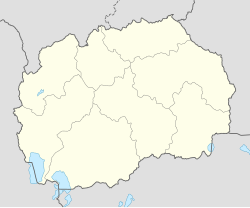
[eedit | eedit soorce]Prilep kivers aboot 1,675 km2 (647 sq mi) an is locatit in the northren Pelagonian carse, in soothren Macedonie. Prilep is the seat o the municipality o the same name (Prilep Municipality) an is accessed bi the M5/E65. It is 128 km (80 mi) frae the caipital Skopje, 44 km (27 mi) frae Bitola, an 32 km (20 mi) frae Kruševo.
References
[eedit | eedit soorce]- ↑ "Mayor of Prilep". Municipality of Prilep. Archived frae the original on 5 Mairch 2016. Retrieved 15 September 2015.
| Wikimedia Commons haes media relatit tae Prilep. |


