Beit Sawa
Appearance
Beit Sawa بيت سوا Bayt Sawa | |
|---|---|
Veelage | |
| Coordinates: 33°32′16″N 36°23′59″E / 33.53778°N 36.39972°E | |
| Kintra | |
| Govrenorate | Rif Dimashq Govrenorate |
| Destrict | Markaz Rif Dimashq |
| Nahiya | Kafr Batna |
| Population (2004)[1] | |
| • Total | 6,249 |
| Time zone | UTC+3 (EET) |
| • Summer (DST) | UTC+2 (EEST) |
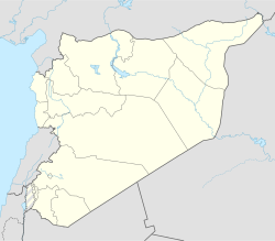
Beit Sawa (Arabic: بيت سوا; spelt Bayt Sawa an aw) is a veelage in soothren Sirie, admeenistratively pairt o the Markaz Rif Dimashq Destrict o the Rif Dimashq Govrenorate, locatit juist east o Damascus. Nearbi localities include Hammurah an Saqba tae the sooth, Arbin tae the wast, Mesraba an Duma tae the north. Accordin tae the Sirie Central Bureau o Statistics (CBS), Beit Sawa haed a population o 6,249 in the 2004 census.[1]
References
[eedit | eedit soorce]- ↑ a b General Census of Population and Housing 2004 Archived 2019-12-13 at the Wayback Machine. Sirie Central Bureau o Statistics (CBS). Rif Dimashq Govrenorate. (in Arabic)
Bibliografie
[eedit | eedit soorce]- Shahid, Irfan (2002). Toponymy, Monuments, Historical Geography and Frontier Studies. 21. Dumbarton Oaks. ISBN 0884022846.
- le Strange, Guy (1890). Palestine Under the Moslems: A Description of Syria and the Holy Land from A.D. 650 to 1500. Committee of the Palestine Exploration Fund.


