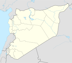
Al-Hamah
Appearance
Al-Hamah الهامة | |
|---|---|
Veelage | |
| Coordinates: 33°33′29″N 36°13′20″E / 33.55806°N 36.22222°E | |
| Kintra | |
| Govrenorate | Rif Dimashq Govrenorate |
| Destrict | Qudsaya Destrict |
| Nahiyah | Qudsaya |
| Population (2004 census)[1] | |
| • Total | 10,045 |
| Time zone | UTC+2 (EET) |
| • Summer (DST) | UTC+3 (EEST) |
Al-Hamah (Arabic: الهامة, al-hāmah; spelt al-Hameh an aw) is a sma veelage in Sirie wast o Damascus on the Barada river. Accordin tae the Sirie Central Bureau o Statistics, al-Hamah haed a population o 10,045 in the 2004 census.[1] The toun wis the target o repeatit raids an attacks bi the Israeli militar[2], especially prior tae the destruction o an early PLO trainin camp locatit on the toun's ootskirts. Ane o the mair notable attacks occurred durin the 1973 Arab-Israeli War; whare Israeli fechter jets attackit a pouer plant that wis in the middle o the toun, destroyin it completely an killin 87 fowk.
References
[eedit | eedit soorce]- ↑ a b General Census of Population and Housing 2004 Archived 2012-12-21 at Archive.today. Sirie Central Bureau o Statistics (CBS). Rif Dimashq Govrenorate. (in Arabic)
- ↑ http://www.onlineopinion.com.au/view.asp?article=4116


