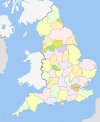
Gloucestershire
Aspect
| Gloucestershire | |||
| — comitat ceremonial — | |||
 | |||
| |||
| Coordonate: 51°50′00″N 2°10′00″W / 51.833333333333°N 2.1666666666667°V | |||
|---|---|---|---|
| Țară | |||
| Regiune | South West England | ||
| Cod ISO 3166-2 | GB-GLS | ||
| Reședință | Gloucester | ||
| Districte | 1. Gloucester 2. Tewkesbury 3. Cheltenham 4. Cotswold 5. Stroud 6. Forest of Dean 7. South Gloucestershire | ||
| Suprafață[1] | |||
| - Total | 3,15 km² | ||
| Populație (2010) | |||
| - Total | 858.300 locuitori | ||
| - Densitate | 272,4 loc./km² | ||
| Prezență online | |||
| http://www.gloucestershire.gov.uk/ GeoNames OpenStreetMap relation | |||
 | |||
| Modifică date / text | |||
Gloucestershire este un comitat ceremonial al Angliei.
Orașe
[modificare | modificare sursă]- Cheltenham
- Chipping Campden
- Cinderford
- Cirencester
- Coleford
- Dursley
- Fairford
- Gloucester
- Lechlade
- Lydney
- Moreton-in-Marsh
- Nailsworth
- Newent
- Painswick
- Stow-on-the-Wold
- Stroud
- Tetbury
- Tewkesbury
- Winchcombe
- Wotton-under-Edge
| |||||||||||
- ^ http://ons.maps.arcgis.com/home/item.html?id=a79de233ad254a6d9f76298e666abb2b Lipsește sau este vid:
|title=(ajutor)

