- School of Archaeology
University of Oxford
1-2 South Parks Road
Oxford
OX1 3TG
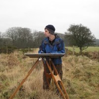
Michael Fradley
University of Oxford, School of Archaeology, Department Member
- Archaeology, Medieval Archaeology, Early Medieval Archaeology, Urbanism, Survey (Archaeological Method & Theory), Archaeo-topographical analysis, and 8 moreHistory, Anthropology, Social and Cultural Anthropology, Landscape Archaeology, Archaeology of salt, Watermills, Medieval Windmills, and Renewablesedit
- Landscape archaeologist with a background in both the academic and professional sectors, with a specialism in archaeo... moreLandscape archaeologist with a background in both the academic and professional sectors, with a specialism in archaeo-topographical survey. Research Assistant on the Arcadia-funded 'Endangered Archaeology' project, which aims to identify sites in the Middle East and North Africa using satellite imagery and assess areas threatened by human activity and environmental change, focusing on Yemen and Levant.edit
Research Interests:

Remote sensing survey in southern Jordan has identified at least three Roman temporary camps that indicate a probable undocumented military campaign into what is today Saudi Arabia, and which we conjecture is linked to the Roman... more
Remote sensing survey in southern Jordan has identified at least three Roman temporary camps that indicate a probable undocumented military campaign into what is today Saudi Arabia, and which we conjecture is linked to the Roman annexation of the Nabataean kingdom in AD 106.
Research Interests:
The remains of a small circular ringwork enclosure at Cam’s Hill, near Malmesbury, Wiltshire, was the focus of a geophysical and topographical survey carried out as part of the University of Exeter research project ‘Anarchy? War and... more
The remains of a small circular ringwork enclosure at Cam’s Hill, near Malmesbury, Wiltshire, was the focus of a geophysical and topographical survey carried out as part of the University of Exeter research project ‘Anarchy? War and Status in Twelfth-Century Landscapes of Conflict’. The methodology comprised an analytical survey of the earthwork, as well as earth resistance and magnetometer survey, supplemented by documentary, cartographic and GIS-based research. Earthwork analysis indicated two phases of development and that the monument stands at the head of a small water spring that flows to the north. Geophysical survey identified a number of anomalies, demonstrating that the monument was likely furnished with a gateway and possibly also a tower. Viewshed analysis confirms that the earthwork is located in a good strategic position on the easterly crest of a north-south spur overlooking the River Avon, and Cam’s Hill most likely represents a twelfth-century siegework used to restrict movement to the south of Malmesbury during the civil war known as the ‘Anarchy’.
Research Interests: Military History, Archaeology, Peace and Conflict Studies, Medieval History, Landscape Archaeology, and 15 moreConflict, War Studies, Early Medieval Archaeology, Landscape History, Early Medieval History, Medieval Archaeology, LiDAR, Archaeological GIS, Conflict Archaeology, Medieval Warfare, Castles, Siege Warfare, LiDAR for Landscape Archaeology, Anglo Saxon Archaeology, and Medieval castles
The Endangered Archaeology in the Middle East and North Africa (EAMENA) project (www.eamena.org) is among the most ambitious archaeological documentation projects ever to have taken place across the Middle East and North Africa. This... more
The Endangered Archaeology in the Middle East and North Africa (EAMENA) project (www.eamena.org) is among the most ambitious archaeological documentation projects ever to have taken place across the Middle East and North Africa. This paper explores the significance of big data approaches for archaeological research, and the important role of the EAMENA project in driving big data research for the MENA region. As the EAMENA database was developed in a UK based academic environment, by a group of researchers with backgrounds in UK academic research and archaeological practice, this paper also includes a brief overview of the history of UK- based initiatives aiming to document digital information about archaeological and heritage sites on a large scale, which can be traced back to the 19th century. The processes and decisions that shaped the formation of the EAMENA dataset, including its methodology and the structure of the database, will be discussed next. The final part of this chapter introduces the various papers that make up this Special Issue, starting with those that have helped to shape the project’s most important achievement to date — the database itself — and continuing with a few initial explorations of the research potential of the emerging dataset.
Research Interests:
This paper presents a study of the rich archaeological landscape of the Jericho Oasis, drawing on historical aerial photography and more recent satellite imagery to survey this cultural landscape and assess issues affecting its... more
This paper presents a study of the rich archaeological landscape of the Jericho Oasis, drawing on historical aerial photography and more recent satellite imagery to survey this cultural landscape and assess issues affecting its preservation over the past century. The timing of the paper is pertinent as non-U.S. satellite companies have recently begun to produce higher resolution satellite imagery of Israel and the Occupied Palestinian Territories (OPT), and restrictions on imagery resolution in the U.S. have been lowered as a result of research by the EAMENA project. Whilst increasingly widespread availability of high-resolution satellite imagery and orthophotos can effectively support heritage monitoring in this heavily-developed region, this paper demonstrates that it is the use of historical aerial photography that has enabled the identification of a range of previously unrecognized archaeological features. These new data offer a first tentative step in revising our current understanding of the development of human settlement across the Jericho Oasis.
Research Interests: History, Ancient History, Archaeology, Near Eastern Archaeology, Remote Sensing, and 10 moreNear Eastern Studies, Palestine, Remote sensing and GIS applications in Landscape Research, Levant, Jericho, Tell Es Sultan, Israel Palestine, Archaeological Evidence of Jericho, Salvage excavations in Jericho, and Endangered Archaeology
This paper reports on a recent survey of a range of archaeological sites on and around Gebel Ataqah, a mountain area to the west of Suez. These sites were identified through the analysis of publicly available satellite imagery,... more
This paper reports on a recent survey of a range of archaeological sites on and around Gebel Ataqah, a mountain area to the west of Suez. These sites were identified through the analysis of publicly available satellite imagery, principally Google Earth (GE), as part of the Endangered Archaeology in the Middle East and North Africa (EAMENA) project, supplemented by historical references to the area and notes published by earlier travellers. The absence of existing archaeological data is due to a military presence in this area, from at least the 1950s, limiting access and exploration. The results of this survey show high levels of archaeological potential across large parts of Gebel Ataqah that require more detailed analysis on the ground, in an important, yet often underexplored, region. A series of major current and future threats to these archaeological sites are also identified which, alongside the presented survey data, will inform any future heritage management schemes. Fradley ...
Research Interests:
Research Interests: History, Geography, Archaeology, Geophysics, Ethics, and 12 moreRemote Sensing, Middle East & North Africa, Aerial Archaeology, Documentation, Landscape Archaeology, Development in the Middle East and North Africa, Open Data, Archaeological Prospection, Middle East, North Africa, Linked Open Data, and Openness to experience
O presente texto apresenta as questões centrais de pesquisa do projetoPaisagens Jê do Sul do Brasil e também traz resultados preliminares do primeiroano de atividades de pesquisa em Arqueologia e Paleoecologia.
Research Interests:
Excavations at Abreu Garcia provide a detailed case study of a mound and enclosure mortuary complex used by the southern proto-Jê in the southern Brazilian highlands. The recovery of 16 secondary cremation deposits within a single mound... more
Excavations at Abreu Garcia provide a detailed case study of a mound and enclosure mortuary complex used by the southern proto-Jê in the southern Brazilian highlands. The recovery of 16 secondary cremation deposits within a single mound allows an in-depth discussion of spatial aspects of mortuary practices. A spatial division in the placement of the interments adds another level of duality to the mortuary landscape, which comprises: (1) paired mound and enclosures, (2) twin mounds within a mound and enclosure, and (3) the dual division in the mound interior. The multiple levels of nested asymmetric dualism evoke similarities to the moiety system that characterizes modern southern Jê groups, highlighting both the opposition and the complementarity of the social system. The findings offer deeper insight into fundamental aspects of southern proto-Jê social organization, including the dual nature of the community, the manifestation of social structure in the landscape, and its incorpora...
Research Interests:
Research Interests:
Research Interests: Geography and Archaeology
The use of aerial photography in the Middle East and North Africa region stretches back to the First World War. While historic aerial photography has continued to be utilized in research in the region, there has been only limited... more
The use of aerial photography in the Middle East and North Africa region stretches back to the First World War. While historic aerial photography has continued to be utilized in research in the region, there has been only limited consideration of different photographic sources. This paper will focus on the use of aerial photography by British forces in the MENA region for photogrammetric mapping missions in the period from the First World War through to the start of the Second World War, when large areas were surveyed via the capture of overlapping vertical photographs. The discussion will cover the survival and archiving of these collections, as well as current issues of access, as well as their overall archaeological potential, particularly as an early source of earth-observation data, comparable to more recent satellite imagery archives.
Research Interests:
This paper presents a study of the rich archaeological landscape of the Jericho Oasis, drawing on historical aerial photography and more recent satellite imagery to survey this cultural landscape and assess issues affecting its... more
This paper presents a study of the rich archaeological landscape of the Jericho Oasis, drawing on historical aerial photography and more recent satellite imagery to survey this cultural landscape and assess issues affecting its preservation over the past century. The timing of the paper is pertinent as non-U.S. satellite companies have recently begun to produce higher resolution satellite imagery of Israel and the Occupied Palestinian Territories (OPT), and restrictions on imagery resolution in the U.S. have been lowered as a result of research by the EAMENA project. Whilst increasingly widespread availability of high-resolution satellite imagery and orthophotos can effectively support heritage monitoring in this heavily-developed region, this paper demonstrates that it is the use of historical aerial photography that has enabled the identification of a range of previously unrecognized archaeological features. These new data offer a first tentative step in revising our current understanding of the development of human settlement across the Jericho Oasis.
Research Interests:
Key trends in methodological practice in later medieval archaeology in Britain largely follow those seen elsewhere in the discipline of archaeology. This chapter considers the key field techniques used in the study of later medieval... more
Key trends in methodological practice in later medieval archaeology in Britain largely follow those seen elsewhere in the discipline of archaeology. This chapter considers the key field techniques used in the study of later medieval archaeology. This includes traditional techniques such as archaeological excavation and survey, as well as more recent innovations such as the analysis of LiDAR data. Consideration is also given to how methodological practice has been influenced by changing theoretical viewpoints within the discipline, as well as pragmatic constraints and opportunities in undertaking archaeological research in Britain in the late twentieth and early twenty-first centuries.
We thank Sarah Parcak et al. for their response to our paper, for engaging in this important debate and for clarifying a number of points regarding Parcak et al. (2016), and for raising some important questions concerning the methods and... more
We thank Sarah Parcak et al. for their response to our paper, for engaging in this important debate and for clarifying a number of points regarding Parcak et al. (2016), and for raising some important questions concerning the methods and objectives of the EAMENA project. We can, however, only comment on what was presented in their original article and address, in these brief final remarks, a few of the points raised in their response.
Research Interests: Archaeology and Antiquity
In a recent article, Parcak et al. (2016) presented the results of a study in which they used satellite imagery to evaluate looting and other damage at over one thousand heritage sites in Egypt. Assessing imagery dating between 2002 and... more
In a recent article, Parcak et al. (2016) presented the results of a study in which they used satellite imagery to evaluate looting and other damage at over one thousand heritage sites in Egypt. Assessing imagery dating between 2002 and 2013, their results indicated an increase in visible damage to sites during this period caused by looting and encroachment, which by Parcak et al.’s definition “includes building development, cemetery growth, agricultural expansion and intentional damage through targeted destruction” (2016: 190). Their findings support the work of previous authors who have documented an increase in looting and other damage to archaeological sites connected with increasing nationwide economic and political instability (e.g. Ikram 2013; Ikram & Hanna 2013).
Research Interests: Archaeology and Antiquity
This core chapter analyses the archaeological and documentary evidence for the militarisation of the twelfth-century landscape through castle-building. The considerable challenges of identifying and dating castles built and strengthened... more
This core chapter analyses the archaeological and documentary evidence for the militarisation of the twelfth-century landscape through castle-building. The considerable challenges of identifying and dating castles built and strengthened during the civil war mean that the total picture of fortification in the period will always remain murky at best, irrespective of how much new archaeological evidence comes to light. The proportion of unfinished and lost castle sites is also far higher than for other periods. That Stephen’s reign saw a marked thickening in the distribution map of castles is beyond doubt, but this was probably more tightly focussed in contested regions than a genuinely nationwide phenomenon and is likely to have involved scores rather than hundreds of ‘new’ sites. Overall, archaeology highlights individuality in twelfth-century timber castle design, which went far beyond the ‘motte and bailey’ or ‘ringwork’ labels. ‘Enmotted’ towers were a hallmark of the period, as w...
Research Interests:
This chapter considers military apparel in in the mid-twelfth century and explores the interrelationship between changes in arms and armour and the creation of knightly identities. Outwardly, the mid-twelfth century knight looked quite... more
This chapter considers military apparel in in the mid-twelfth century and explores the interrelationship between changes in arms and armour and the creation of knightly identities. Outwardly, the mid-twelfth century knight looked quite similar to the Norman warriors depicted in the Bayeux Tapestry, although with some subtle differences. By the 1130s and 40s the knight was a little better protected with mail covering more of the bodily extremities. A slightly wider range of military personnel would have been armoured, and minor stylistic differences are distinguishable in showier swords, shields, spurs and scabbards. More important in the actual prosecution of warfare was the changing use of the crossbow, which saw widespread use alongside ‘armour-piercing’ bodkin-type arrowheads. The battles of the period were also the first major military clashes in England where heraldic display was visible — in particular on banners and shields, but also more subtly on horse harness pendants. Suc...
Research Interests:
This chapter provides an overview of how and with what consequences warfare was waged in the twelfth century, drawing particular attention to the landscape context of conflict. Case studies of the period’s two major pitched battles... more
This chapter provides an overview of how and with what consequences warfare was waged in the twelfth century, drawing particular attention to the landscape context of conflict. Case studies of the period’s two major pitched battles (Northallerton/the Battle of the Standard, 1138, and Lincoln, 1141) are presented, although the conflict as a whole saw few pitched battles and was instead dominated by siege warfare. The period saw the siege castle cemented as an essential part of the repertoire of Anglo-Norman conflict, mixing psychological and martial functions and favoured by rulers in an era when siege warfare was static and protracted while leaders needed to be mobile. The overall picture is that the conflict saw no radical departure in ways of waging war, and many of its characteristic features — such as the use of mercenaries, the avoidance of pitched battle, devastation of landscapes and the predominance of sieges — were not aberrations but part and parcel of an established patte...
Research Interests:
This chapter turns to consider the effects of the conflict on the urban and rural landscape. Despite the almost twenty-year duration of the civil war, its impacts on landscape and townscape had very significant geographical biases. There... more
This chapter turns to consider the effects of the conflict on the urban and rural landscape. Despite the almost twenty-year duration of the civil war, its impacts on landscape and townscape had very significant geographical biases. There was a greater effect upon urban rather than rural life, as urban castles, fortified towns and their hinterlands were the foci of sieges and counter-sieges. Behind the image of a slowdown in urban growth, lords were investing in new town plantations, invariably alongside fortifications and often as components within more comprehensive schemes of aggrandisement. Tracing the impact of the Anarchy on the rural landscape archaeology of England is a more difficult proposition, although we have strong evidence for landscape planning and the creation of fortified settlements by newly emboldened lords. Documentary sources catalogue widespread landscape devastation by armies, although on the ground the effects of the war had a strong regional dimension, with ...
Research Interests:
This final chapter presents a self-contained overview of what the material evidence tells us about the twelfth-century civil war and its consequences. Issues with dating archaeological evidence to the period in question mean that... more
This final chapter presents a self-contained overview of what the material evidence tells us about the twelfth-century civil war and its consequences. Issues with dating archaeological evidence to the period in question mean that conclusions must be cautious, but it seems clear that the Anarchy is not obviously identifiable in the material record as a distinct ‘event horizon’. Archaeology has much more to offer us in terms of illuminating the conduct and psychology of Anglo-Norman warfare and in showing how lordly identity was being transformed through the period, and how it was expressed through castle-building and ecclesiastical patronage. Consideration of these research themes and others can help extricate studies of the twelfth-civil war from the ‘anarchy or not?’ debate. In conclusion: the mid-twelfth century is best regarded not as an age of anarchy but as an age of transition.
Research Interests:
This chapter assesses the consequences of the civil war for religious institutions, communities and structures such as churches, cathedrals, monasteries and bishops’ palaces. The war crimes against churches catalogued by horrified... more
This chapter assesses the consequences of the civil war for religious institutions, communities and structures such as churches, cathedrals, monasteries and bishops’ palaces. The war crimes against churches catalogued by horrified chroniclers and borne out to some extent in the archaeological evidence affected modest numbers of sites in specific geographical zones. Archaeological investigation has revealed very real evidence for the militarisation of ecclesiastical sites, although in many contexts documentary evidence for the apparent transformation of a church into a fortification suggests that the building was garrisoned rather than being converted into something physically resembling a castle. The civil war also had a series of much longer-lasting impacts on the ecclesiastical world in terms of creating the social and tenurial conditions and a spiritual environment where religious patronage became increasingly politicised and where lower-ranked members within the elite had the me...
Research Interests:
This chapter covers two areas: it provides a sketch of English society and landscape in the late eleventh and early twelfth centuries, and presents a year-by-year chronology of Stephen’s reign. At the point of Stephen’s accession to the... more
This chapter covers two areas: it provides a sketch of English society and landscape in the late eleventh and early twelfth centuries, and presents a year-by-year chronology of Stephen’s reign. At the point of Stephen’s accession to the throne in 1135, the longer-term impacts of the Norman Conquest on English society and landscape were still being played out. Ethnicity and identity in the period were fluid, and so mid-twelfth-century England was a developing Anglo-Norman state rather that a subjugated dominion. While ‘the Anarchy’ of Stephens reign is frequently styled as a civil war, the conflict was unusually complex and protracted, and involved more than two opposing sides. The period saw persistent asymmetric warfare on the borderlands of Wales, a succession of incursions from Scotland and Angevin invasions from across the English Channel, while a struggle for control of Normandy dominated the wider strategic landscape. The most characteristic feature of conflict during the peri...
Research Interests:
This chapter examines the material culture of the twelfth century and assesses evidence for change as a result of the civil war. The period’s pottery shows a myriad of regionally distinctive patterns although towards the end of the... more
This chapter examines the material culture of the twelfth century and assesses evidence for change as a result of the civil war. The period’s pottery shows a myriad of regionally distinctive patterns although towards the end of the twelfth century we see the growth of markets and commercialisation of the industry in a post-war boom. In the sphere of the arts there is no evidence whatsoever of any hiatus nor of declining standards during Stephen’s reign, and instead the period witnessed achievement and innovation in several different areas. While it is difficult to isolate developments in the 1130s, 40s and 50s from longer-term trends, it does seem clear that sculpture in parish churches shows particularly high levels of experimentation, while grave slabs were a modish means of commemoration and expressing identity for emerging parish elites. Coinage provides our best means of mapping the fluid geopolitics of the civil war on the ground. An ever-expanding dataset is highlighting the ...
Research Interests:
This chapter provides a detailed case study of the campaigns in and around the Isle of Ely in the twelfth century. The circumstances of a wealthy but isolated region, combined with a rebel heritage, explain the prominent place of the Isle... more
This chapter provides a detailed case study of the campaigns in and around the Isle of Ely in the twelfth century. The circumstances of a wealthy but isolated region, combined with a rebel heritage, explain the prominent place of the Isle of Ely during the Anarchy, although the region’s experience in the civil war was also unusually severe. Even in the context of a conflict where the ravaging of estates was endemic the fenlands suffered especially high levels of destruction to a fragile agricultural base. Stephen’s response to Geoffrey de Mandeville’s fenland rebellion in 1143–44 also saw the largest-scale programme of royal castle-building recorded in the civil war. The scale and sophistication of individual fortifications, all keyed into local landscapes, are revealed by archaeological evidence, as exemplified by the royal campaign castle at Burwell, Cambridgeshire.
Research Interests:
Research Interests:
Research Interests:
Research Interests:
THE STUDY of High-medieval castles has benefited from the incorporation of elements of landscape archaeology in the last few years. While this paper is far from a complete study of the late 13th-century castle of Caernarfon and its... more
THE STUDY of High-medieval castles has benefited from the incorporation of elements of landscape archaeology in the last few years. While this paper is far from a complete study of the late 13th-century castle of Caernarfon and its relationship with its surrounding landscape, it ...
Research Interests:
ABSTRACTThe Romano-British lead-mining complex at Charterhouse-on-Mendip has long been recognised as amongst the most important industrial sites within the British province. This paper brings together the results of the recent English... more
ABSTRACTThe Romano-British lead-mining complex at Charterhouse-on-Mendip has long been recognised as amongst the most important industrial sites within the British province. This paper brings together the results of the recent English Heritage earthwork survey of the site which has enabled for the frst time the full characterisation of the settlement and its relationship with the core mining zones of the Blackmoor and Velvet Bottom valleys. It has also allowed a reassessment of life within an industrial settlement such as Charterhouse which challenges many preconceived perceptions of these settlement forms.
Research Interests:
This paper reports on a recent survey of a range of archaeological sites on and around Gebel Ataqah, a mountain area to the west of Suez. These sites were identified through the analysis of publicly available satellite imagery,... more
This paper reports on a recent survey of a range of archaeological sites on and around Gebel Ataqah, a mountain area to the west of Suez. These sites were identified through the analysis of publicly available satellite imagery, principally Google Earth (GE), as part of the Endangered Archaeology in the Middle East and North Africa (EAMENA) project, supplemented by historical references to the area and notes published by earlier travellers. The absence of existing archaeological data is due to a military presence in this area, from at least the 1950s, limiting access and exploration. The results of this survey show high levels of archaeological potential across large parts of Gebel Ataqah that require more detailed analysis on the ground, in an important, yet often underexplored, region. A series of major current and future threats to these archaeological sites are also identified which, alongside the presented survey data, will inform any future heritage management schemes.
Research Interests:
Research Interests:
This paper presents recent research by the Endangered Archaeology in the Middle East and North Africa (EAMENA) project at the Universities of Oxford and Leicester, and Jérémie Schiettecatte at Centre National de la Recherche Scientifique... more
This paper presents recent research by the Endangered Archaeology in the Middle East and North Africa (EAMENA) project at the Universities of Oxford and Leicester, and Jérémie Schiettecatte at Centre National de la Recherche Scientifique (CNRS) in Paris. It critically investigates the contribution of documenting sites through recent remote surveys using freely available satellite imagery to improve our understanding of ancient landscapes in Yemen, and the role of field surveys and excavations in this process. The documentation and recording includes an assessment of the threat to sites with a view to improving their protection in the future.
Research Interests:
Since 1997, the Kyl-Bingaman Amendment (KBA) to the 1997 U.S. National Defense Authorization Act, has limited the availability of high-resolution satellite imagery over Israel and Palestine. Although this law only applies to the United... more
Since 1997, the Kyl-Bingaman Amendment (KBA) to the 1997 U.S. National Defense Authorization Act, has limited the availability of high-resolution satellite imagery over Israel and Palestine. Although this law only applies to the United States of America, as this country dominates the commercial market for satellite imagery, its impact is global. Since 2012, the KBA has become increasingly anachronistic, as non-U.S. satellite firms, utilizing increasingly sophisticated satellite technologies, have begun retailing high-resolution imagery of Israel and Palestine. This major shift has, however, largely gone unrecognized, because the application of the KBA has become institutionalized in the commercial satellite imagery market. Nevertheless, the removal of these practical restrictions offers a major opportunity for all forms of remote-sensing analysis, whether for archaeologists, geographers, humanitarian organisations or others interested in landscape change across Israel and Palestine.
Research Interests: Archaeology, International Relations, Censorship, Politics, Israel/Palestine, and 9 morePalestine, Satellite remote sensing, Remote sensing and GIS applications in Landscape Research, Space Policy, Space Politics, Earth Observation, Google Earth, Space Law, and Satellite Remote Sensing & Image Processing
Resumo: O presente texto apresenta as questões centrais de pesquisa do projeto Paisagens Jê do Sul do Brasil e também traz resultados preliminares do primeiro ano de atividades de pesquisa em Arqueologia e Paleoecologia.
Research Interests:
Concluding remarks to the 2017 Antiquity paper 'Satellite imagery and heritage damage in Egypt: a response to Parcak et al. (2016)', following a response from Parcak et al.
Research Interests:
Excavations at Abreu Garcia provide a detailed case study of a mound and enclosure mortuary complex used by the southern proto-Jê in the southern Brazilian highlands. The recovery of 16 secondary cremation deposits within a single mound... more
Excavations at Abreu Garcia provide a detailed case study of a mound and enclosure mortuary complex used by the southern proto-Jê in the southern Brazilian highlands. The recovery of 16 secondary cremation deposits within a single mound allows an in-depth discussion of spatial aspects of mortuary practices. A spatial division in the placement of the interments adds another level of duality to the mortuary landscape, which comprises: (1) paired mound and enclosures, (2) twin mounds within a mound and enclosure, and (3) the dual division in the mound interior. The multiple levels of nested asymmetric dualism evoke similarities to the moiety system that characterizes modern southern Jê groups, highlighting both the opposition and the complementarity of the social system. The findings offer deeper insight into fundamental aspects of southern proto-Jê social organization, including the dual nature of the community, the manifestation of social structure in the landscape, and its incorporation into mortuary ritual. The results have implications for research design and developing appropriate methodologies to answer culture-specific questions. Furthermore, the parallels among archaeology, ethnohistory, and ethnography enable an understanding of the foundation of modern descendent groups and an assessment of the continuity in indigenous culture beyond European contact. As escavações no sítio Abreu Garcia oferecem um estudo de caso detalhado de um conjunto de recintos e montículos funerários utilizado pelos grupos proto-Jê meridionais nas terras altas do sul do Brasil. A descoberta de dezesseis depósitos cremados secundários dentro de um único montículo permite uma discussão profunda da dos aspectos espaciais das práticas mortuárias. Uma divisão espacial na disposição dos enterramentos acrescenta outro nível de dualidade à paisagem mortuária, que compreende: (1) recintos e montículos dispostos em pares, (2) montículos duplos no interior de um único recinto, e (3) a divisão dual no interior do montículo. Os múltiplos níveis de dualismo assimétrico evocam similaridades com o sistema de metades que caracteriza os grupos Jê meridionais modernos, ressaltando tanto a oposição quanto a complementaridade no sistema social. As descobertas propiciam uma compreensão mais profunda dos aspectos fundamentais da organização social proto-Jê meridional, incluindo a natureza dual da comunidade, as manifestações da estrutura social na paisagem e a sua incorporação no rito mortuário. Os resultados têm implicações para o planejamento das pesquisas e desenvolvimento de metodologias apropriadas para responder questões culturais específicas. Além disso, os paralelos entre arqueologia, etno-história e etnografia permitem uma compreensão da fundação dos grupos descendentes modernos e uma avaliação da continuidade das culturas indígenaspara além do momento de contato com os europeus.
Research Interests:
Abstract: This project uses satellite imagery and historic aerial photographs to discover and interpret archaeological sites. It has created an open access database of archaeological records that provides basic information so that the... more
Abstract: This project uses satellite imagery and historic aerial photographs to discover and interpret archaeological sites. It has created an open access database of archaeological records that provides basic information so that the sites can be better under- stood and preserved in the future. The threats to sites in the Middle East and North Africa are increasing and creating a record of previously unrecorded sites using this methodology may be our the last chance before they are destroyed.
Keywords: Endangered archaeology, Satellite imagery, Middle East, North Africa
Keywords: Endangered archaeology, Satellite imagery, Middle East, North Africa
Research Interests:
This project uses satellite imagery and historic air photographs to discover and interpret archaeological sites. It has created an open access database of archaeological records that provides basic information so that the sites can be... more
This project uses satellite imagery and historic air photographs to discover and interpret archaeological sites. It has created an open access database of archaeological records that provides basic information so that the sites can be better understood and preserved in the future. The threats to sites in the Middle East and North Africa are increasing and creating a record of previously unrecorded sites using this methodology may be our last chance before they are destroyed.
Bewley, R., Wilson, A. I., Kennedy, D., Mattingly, D., Banks, R., Bishop, M., Bradbury, J., Cunliffe, E., Fradley, M., Jennings, R., Mason, R., Rayne, L., Sterry, M., Sheldrick, N., and Zerbini, A. (2016). 'Endangered Archaeology in the Middle East and North Africa: Introducing the EAMENA Project', in S. Campana, R. Scopigno, G. Carpentiero, and M. Cirillo (eds), CAA2015. Keep the Revolution Going: Proceedings of the 43rd Annual Conference on Computer Applications and Quantitative Methods in Archaeology (Archaeopress Archaeology). Oxford, 919–32.
Bewley, R., Wilson, A. I., Kennedy, D., Mattingly, D., Banks, R., Bishop, M., Bradbury, J., Cunliffe, E., Fradley, M., Jennings, R., Mason, R., Rayne, L., Sterry, M., Sheldrick, N., and Zerbini, A. (2016). 'Endangered Archaeology in the Middle East and North Africa: Introducing the EAMENA Project', in S. Campana, R. Scopigno, G. Carpentiero, and M. Cirillo (eds), CAA2015. Keep the Revolution Going: Proceedings of the 43rd Annual Conference on Computer Applications and Quantitative Methods in Archaeology (Archaeopress Archaeology). Oxford, 919–32.
Research Interests: Archaeology, Middle East & North Africa, Cultural Heritage, North Africa Studies, Aerial Archaeology, and 11 moreCultural Heritage Management, World Cultural Heritage, Satellite Remote Sensing (Archaeology), Libyan archaeology, Middle East, Libya, North Africa, Satellite Imagery, Qanat systems, Foggaras, and Endangered Archaeology
Research Interests:
Transactions of the Staffordshire Archaeological and Historical Society 48, 1-5 Analysis of the results of the archaeo-topographical survey of a little-known villa site at Hales in Staffordshire. Excavated on several occasions during the... more
Transactions of the Staffordshire Archaeological and Historical Society 48, 1-5
Analysis of the results of the archaeo-topographical survey of a little-known villa site at Hales in Staffordshire. Excavated on several occasions during the 20th century, a number of earthwork elements survive. The site is also considered in its wider regional context.
Analysis of the results of the archaeo-topographical survey of a little-known villa site at Hales in Staffordshire. Excavated on several occasions during the 20th century, a number of earthwork elements survive. The site is also considered in its wider regional context.
Research Interests:
Research Interests:
The UK-based Endangered Archaeology in the Middle East and North Africa (EAMENA) project uses remote sensing techniques to rapidly record and evaluate the status of archaeological and cultural heritage sites in the MENA region. Applying... more
The UK-based Endangered Archaeology in the Middle East and North Africa (EAMENA) project uses remote sensing techniques to rapidly record and evaluate the status of archaeological and cultural heritage sites in the MENA region. Applying remote sensing methods to the archaeological landscapes of 20 countries, EAMENA is one of the largest documentation projects of its kind. Such a scope raises important ethical questions fundamental to the practice of remote-sensed archaeology, and this paper contributes to this discussion by reflecting on EAMENA's unique role in this subfield. We present ethical issues and possible solutions related to remote sensing and archaeology, drawing on models developed within the humanitarian aid sector and postcolonial archaeology. In addition, we consider issues of national sovereignty and their relationship to the engagement of local communities. Finally, this paper examines the roles of data openness and open access policies as ethical factors and how EAMENA has addressed these so far. K E Y W O R D S archaeology, cultural heritage preservation, ethics, Middle East and North Africa, open data, remote sensing
Research Interests:
As part of its aim to record episodes of heritage damage, the EAMENA team responds to reports across the MENA region, often originating via short social media statements. This is far from a simple process, and investigating the... more
As part of its aim to record episodes of heritage damage, the EAMENA team responds to reports across the MENA region, often originating via short social media statements. This is far from a simple process, and investigating the fragmentary reports is, in some cases, more complex than the original narratives would suggest. An example of this is the report of the aerial bombing of a religious site on Jabal an Nabi Shu’ayb, c. 25 km to the south-west of Sana’a in Yemen.
Research Interests:
The Endangered Archaeology in the Middle East and North Africa (EAMENA) project (www.eamena.org) is among the most ambitious archaeological documentation projects ever to have taken place across the Middle East and North Africa. This... more
The Endangered Archaeology in the Middle East and North Africa (EAMENA) project (www.eamena.org) is among the most ambitious archaeological documentation projects ever to have taken place across the Middle East and North Africa. This paper explores the significance of big data approaches for archaeological research, and the important role of the EAMENA project in driving big data research for the MENA region. As the EAMENA database was developed in a UK based academic environment, by a group of researchers with backgrounds in UK academic research and archaeological practice, this paper also includes a brief overview of the history of UK- based initiatives aiming to document digital information about archaeological and heritage sites on a large scale, which can be traced back to the 19th
century. The processes and decisions that shaped the formation of the EAMENA dataset, including its methodology and the structure of the database, will be discussed next. The final part of this chapter introduces the various papers that make up this Special Issue, starting with those that have helped to shape the project’s most important achievement to date — the database itself — and continuing with a few initial explorations of the research potential of the emerging dataset.
century. The processes and decisions that shaped the formation of the EAMENA dataset, including its methodology and the structure of the database, will be discussed next. The final part of this chapter introduces the various papers that make up this Special Issue, starting with those that have helped to shape the project’s most important achievement to date — the database itself — and continuing with a few initial explorations of the research potential of the emerging dataset.
Research Interests:
Follow the link to the full blog..