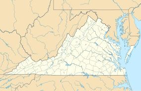
Matthews State Forest
Appearance
| Matthews State Forest | |
|---|---|
IUCN category IV (habitat/species management area) | |
| Location | Grayson County, Virginia |
| Nearest city | Galax |
| Coordinates | 36°37′38.3″N 80°57′31.6″W / 36.627306°N 80.958778°W |
| Area | 566 acres (229 ha) |
| Established | 1993 |
| Governing body | Virginia Department of Forestry |
| Matthews State Forest | |
Matthews State Forest is a Virginia state forest located in Grayson County, near the City of Galax. It is used for research into the American chestnut, as well as for demonstration of forestry management techniques; it serves as watershed protection and as a wildlife sanctuary, and has facilities for hiking. Hunting is permitted on its 566 acres (2.29 km2).[1]
References
[edit]- ^ "Matthews State Forest". Virginia Department of Forestry. Retrieved 2021-12-14.
