- Prehistoric Archaeology, Landscape Archaeology, Near Eastern Archaeology, Archaeological GIS, Geophysics, Environmental Archaeology, and 27 moreAncient economies (Archaeology), Settlement Patterns, Levantine Archaeology, Landscapes in prehistory, Archaeology of ethnicity, Prehistoric Settlement, Syro-Palestinian archaeology, Southeastern Archaeology (Archaeology in North America), Ground Penetrating Radar, Comparative Civilizations (Archaeology), Prehistoric Conflicts, Anthropology, Sociology, Edad Del Bronce, Edad Del Hierro, Italy, Spain, Greece, Cyprus, Phoenician, Late Bronze Age, Eaerly Iron Age, Chronology, Fibulae, Archaeology of Colonialism, Archaeology, and Historical Archaeologyedit
Research Interests:

ABSTRACT
Research Interests:
Research Interests:
Research Interests:
espanolPresentamos en este trabajo una evaluacion inicial de los trabajos de prospeccion sistematica llevados a cabo en la comarca de La Canal de Navarres (Valencia) desde el ano 2014 en el marco del proyecto NSF “The Emergence of Coupled... more
espanolPresentamos en este trabajo una evaluacion inicial de los trabajos de prospeccion sistematica llevados a cabo en la comarca de La Canal de Navarres (Valencia) desde el ano 2014 en el marco del proyecto NSF “The Emergence of Coupled Natural and Human Landscapes in the Western Mediterranean”. El programa desarrollado ha seguido un protocolo previamente establecido por nuestro equipo de trabajo con la novedad de la incorporacion de nuevas tecnologias en el trabajo de campo (dispositivos electronicos) cuyo objetivo ha sido agilizar el procesado de la informacion posterior en el laboratorio mediante el uso de un entorno GIS. Los resultados obtenidos confirman la presencia de materiales en diferentes puntos del valle indicativos de una amplia cronologia (entre el Pleistoceno final y el desarrollo del Holoceno) que se suman a los registros prehistoricos conocidos en el area desde el Paleolitico medio a la Edad del Bronce. EnglishIn this paper we present a preliminary approach to the...
Research Interests:
Research Interests:
Research Interests:
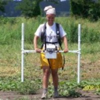
In the Symposium "Making Sense of Archaeological Survey we report on new digital field methods we have applied in La Canal de Navarrés (Valencia) in the summer of 2014. Although we have carried out archaeological surveys in the... more
In the Symposium "Making Sense of Archaeological Survey we report on new digital field methods we have applied in La Canal de Navarrés (Valencia) in the summer of 2014. Although we have carried out archaeological surveys in the Valencian Region for 25 years, this was the first time we undertook archaeological survey, in a new research area, without the support of any kind of documents in hard copies (e.g., paper maps, forms, aerial photos, transparencies or any other kind). All supporting documentation was carried to the field in digital tablets (two iPad Minis and one Android) or smartphones (iPhone or Samsung Galaxy). On the iOS platform, after evaluating other alternatives (iris, Autocad 360, ArcGis, ...), we selected the CartoMobile© GIS app for recording survey data. On the Android platform, after evaluating other alternatives (OruxMaps©, gvSIG mini, OSM tracker©, ...) we chose the OsmAnd© app. The functionalities in both are similar but CartoMobile is what we might call a...
Research Interests:
abstract: What causes social systems to resist change? Studies of the emergence of social complexity in archaeology have focused primarily on drivers of change with much less emphasis on drivers of stability. Social stability, or the... more
abstract: What causes social systems to resist change? Studies of the emergence of social complexity in archaeology have focused primarily on drivers of change with much less emphasis on drivers of stability. Social stability, or the persistence of social systems, is an essential feature without which human society is not possible. By combining quantitative modeling (Exponential Random Graph Modeling) and the comparative archaeological record where the social system is represented by networks of relations between settlements, this research tests several hypotheses about social and geographic drivers of social stability with an explicit focus on a better understanding of contexts and processes that resist change. The Valencian Bronze Age in eastern Spain along the Mediterranean, where prior research appears to indicate little, regional social change for 700 years, serves as a case study. The results suggest that social stability depends on a society’s ability to integrate change and promote interdependency. In part, this ability is constrained or promoted by social structure and the different, relationship dependencies among individuals that lead to a particular social structure. Four elements are important to constraining or promoting social stability—structural cohesion, transitivity and social dependency, geographic isolation, and types of exchange. Through the framework provided in this research, an archaeologist can recognize patterns in the archaeological data that reflect and promote social stability, or lead to collapse. Results based on comparisons between the social networks of the Northern and Southern regions of the Valencian Bronze Age show that the Southern Region’s social structure was less stable through time. The Southern Region’s social structure consisted of competing cores of exchange. This type of competition often leads to power imbalances, conflict, and instability. Strong dependencies on the neighboring Argaric during the Early and Middle Bronze Ages and contributed to the Southern Region’s inability to maintain social stability after the Argaric collapsed. Furthermore, the Southern Region participated in the exchange of more complex technology—bronze. Complex technologies produce networks with hub and spoke structures highly vulnerable to collapse after the destruction of a hub. The Northern Region’s social structure remained structurally cohesive through time, promoting social stability.Dissertation/ThesisWebpage with data tables and R codeDoctoral Dissertation Anthropology 202
Research Interests:
With a few exceptions, the distant past is an anonymous land occupied by people who made things and left behind a cryptic record of broken pieces. Even when the written word comes into play in human history and we can read the hieroglyphs... more
With a few exceptions, the distant past is an anonymous land occupied by people who made things and left behind a cryptic record of broken pieces. Even when the written word comes into play in human history and we can read the hieroglyphs naming an Egyptian pharaoh and describing royal achievements, the majority of human experience remains unknown and unrecover-able. Archaeologists usually excavate to gather physical evidence from ruins, monuments, and artifacts, which become data streams for the interpretation of past societies. Basic excavation is supplemented by a variety of scientific and historical research methods, all of which are far removed from observing the actual experiences of individuals in the past. The result is that aggregated categories such as households, neighborhoods, cities, nations, and civilizations become the units of analysis. These categories are incredibly important, but they are often used because finer analytical levels are unavailable. Furthermore, the aggregate categories are typically implemented under expectations of classical science, such as equilibrium outcomes that assume normal distributions as well as Fig. 1. Agent-based modeling is a powerful means for archeologists to explore the connections among individual action, intangible social entities, and broader interpretations at any time scale. If used more widely, ABM could free practitioners from many traditional limitations and make findings translatable to the general scientific public. Image courtesy of Wendy Cegielski and Jay Etchings
Research Interests:
In this paper we present a preliminary approach to the survey work carried out in La Canal de Navarrés (Valencia) since 2014 in the framework of the NSF Project " The Emergence of Coupled Natural and Human Landscapes in the Western... more
In this paper we present a preliminary approach to the survey work carried out in La Canal de Navarrés (Valencia) since 2014 in the framework of the NSF Project " The Emergence of Coupled Natural and Human Landscapes in the Western Mediterranean ". The programme developed follows previous protocols established by us with the novelty of the use of new technologies (electronic devices) with the goal to make more dynamic the analysis of data in a GIS environment. The results confirm the existence, in several open-air locations, of prehistoric artefacts along the valley regarding to a wide chronology (from the final Pleistocene and covering the Holocene) that can be added to the sequence known at the area including Middle Palaeolithic to Bronze Age evidences.