[go: up one dir, main page]

Next Issue
Volume 11, June
Previous Issue
Volume 11, April


Land, Volume 11, Issue 5 (May 2022) – 172 articles

Cover Story (view full-size image): 
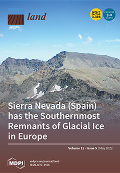
The Corral del Veleta cirque (3150 m), Sierra Nevada, houses relict glacial ice and permafrost in a process of degradation. Located in the Southwestern Mediterranean, it is where the southernmost glacial witnesses of the Little Ice Age in Europe are found, originating from the glacier that developed at the head of the Guarnón valley. Their evolution has been monitored over the period of 2001–2019 using geomatic and geophysical techniques applied to the morphogenic dynamic of a rock glacier. The results obtained reveal a progressive shrinkage in underlying frozen bodies and significant changes in the modeling of the rock glacier. All of this is associated with climatic variability in the Sierra Nevada high mountains since the end of the 1980s, particularly in the snowfall and thermal regimes. View this paper
  • Issues are regarded as officially published after their release is announced to the table of contents alert mailing list.
  • You may sign up for e-mail alerts to receive table of contents of newly released issues.
  • PDF is the official format for papers published in both, html and pdf forms. To view the papers in pdf format, click on the "PDF Full-text" link, and use the free Adobe Reader to open them.
Order results
Result details
Section
Select all
Export citation of selected articles as:
14 pages, 2199 KiB  
Article
Designing Policy Mixes to Address the World’s Worst Devastation of a Rural Landscape Caused by Xylella Epidemic
by Antonio Lopolito and Edgardo Sica
Land 2022, 11(5), 763; https://doi.org/10.3390/land11050763 - 23 May 2022
Cited by 2 | Viewed by 1555
Abstract
The socio-economic consequences of the Xylella fastidiosa epidemic represent a global problem that can only be addressed through tailored, local solutions. The selection of public interventions is not a trivial task for policy makers, as they must weigh many different interests (e.g., private [...] Read more.
The socio-economic consequences of the Xylella fastidiosa epidemic represent a global problem that can only be addressed through tailored, local solutions. The selection of public interventions is not a trivial task for policy makers, as they must weigh many different interests (e.g., private profit, ecosystem services, usability, preservation and growth of real estate value, amenities, and land protection). The present paper addresses this challenge by building participatory scenarios based on “fuzzy cognitive maps,” with the aim of identifying effective, acceptable, and efficient policy mixes to address the Xylella epidemic. The work investigates the case of southern Salento (Italy)–an olive production area at the epicentre of the global Xylella outbreak–to identify the most suitable actions for regenerating the landscape. To this end, the most efficient policy mixes are determined according to three possible policy perspectives, which provide different weights for effectiveness and acceptability. The results show that the proposed methodological approach may assist policy makers in coping with multifaceted policy challenges. Full article
Show Figures

Figure 1

Figure 1
<p>Salento’s landscape devastation due to <span class="html-italic">Xylella fastidiosa</span> infection [<a href="#B4-land-11-00763" class="html-bibr">4</a>].</p>
Full article ">Figure 2
<p>Category and overall cognitive maps.</p>
Full article ">Figure 3
<p>Effective, acceptable, and efficient policy mixes.</p>
Full article ">
27 pages, 7045 KiB  
Article
Integrated Planning and Implementation of a Blue-Green Architecture Project by Applying a Design-Build Teaching Approach
by Friederike Well and Ferdinand Ludwig
Land 2022, 11(5), 762; https://doi.org/10.3390/land11050762 - 23 May 2022
Cited by 1 | Viewed by 3238
Abstract
Blue-green architecture (BGA) describes buildings and open spaces that combine nature-based and technical systems of vegetation and urban water management. This creates positive effects on the urban climate, public health, biodiversity, and water balance. In this study, a design strategy for BGA is [...] Read more.
Blue-green architecture (BGA) describes buildings and open spaces that combine nature-based and technical systems of vegetation and urban water management. This creates positive effects on the urban climate, public health, biodiversity, and water balance. In this study, a design strategy for BGA is applied and evaluated on a practical project. The project consists of an interdisciplinary course in which students of architecture and landscape architecture designed and implemented a BGA for a school garden in Munich, Germany. The students worked in an interdisciplinary planning team in which they took on different roles and responsibilities (blue/green/integration). As a result, the design was put into practice by their own hands and a nature-based system was built. The greywater from the school garden is now treated in a constructed wetland and, in combination with rainwater, feeds into a redesigned pond. Biodiversity was increased and a contribution to the environmental education of the pupils was made. The students demonstrated high learning success. Finally, the design strategy for BGA was positively evaluated using a design-based research approach and additional points were added for future applications. Full article
(This article belongs to the Special Issue Urban Green and Blue Infrastructure in the View of Global Warming)
Show Figures

Figure 1

Figure 1
<p>Design of the presented study.</p>
Full article ">Figure 2
<p>Integrated design strategy for blue-green architecture [<a href="#B14-land-11-00762" class="html-bibr">14</a>]. The integrated planning approach has been developed in a previous design-based research project. The different steps are described in detail in the indicated reference. The design strategy for BGA is applied for the first time in this study. The design process for the BGA project is guided by this approach in order to achieve a balanced weighting of blue and green aspects.</p>
Full article ">Figure 3
<p>All three groups survey the construction site near the classroom hut during the first site visit.</p>
Full article ">Figure 4
<p>The pond in close proximity to the hut has not been well maintained so far. The area to the left of the entrance was identified as a suitable building site.</p>
Full article ">Figure 5
<p>The roof area of 22.3 m<sup>2</sup> close to the greywater source was considered for rainwater harvesting. The rainwater gutters would have to be connected to the system individually.</p>
Full article ">Figure 6
<p>Average monthly water volume from the roof drainage above the kitchen (rainwater) and greywater from kitchen sink and outdoor washbasin.</p>
Full article ">Figure 7
<p>Students’ documentation of tree population in proximity to the planning area. The sketch is not north-oriented.</p>
Full article ">Figure 8
<p>Snapshot of the students’ white board while mapping the greening potentials and further ideas to improve quality of experience.</p>
Full article ">Figure 9
<p>Preliminary design proposal of the students. (<b>a</b>) The single components were defined and brought into a spatial context. (<b>b</b>) The students’ axonometry shows the design of the filtration bed. The structure is based on other small greywater treatment plants (examples for comparable structures: [<a href="#B37-land-11-00762" class="html-bibr">37</a>,<a href="#B41-land-11-00762" class="html-bibr">41</a>,<a href="#B45-land-11-00762" class="html-bibr">45</a>]).</p>
Full article ">Figure 10
<p>Documentation of the development of technical components for the BGA project. (<b>a</b>) Considerations for septic tank design and filter loading. These students’ sketches do not show the final design, but an intermediate step in the planning. (<b>b</b>) Based on CAD drawings and 3D models, the assembly of the components was prepared. (<b>c</b>) The timber framework is pre-fabricated in the workshop.</p>
Full article ">Figure 11
<p>Final design of the blue-green greywater treatment system. The greywater from the kitchen sink (not shown in the picture) and the outdoor sink (on the right) is pre-cleaned in the septic tank (yellow). The roof runoff flows via the rainwater storage tank (blue) to the filtration bed and is fed directly in case of heavy rainfall. The timber frame that supports the septic tank and the rainwater storage tank is overgrown with climbers. The insulated filtration bed is filled with lava sand and grown with flowering marsh plants. The treated water is directed to the frog pond via an open gutter. The pond is planted in the shore area and has a nature observation place for the pupils.</p>
Full article ">Figure 12
<p>(<b>a</b>) The shore zone of the pond is planted with marsh plants. (<b>b</b>) The swale stones are poured and dried on site.</p>
Full article ">Figure 13
<p>Construction work on the filter trough. (<b>a</b>) The drainage layer consists of 15 cm of gravel. (<b>b</b>) A layer of lava sand follows the gravel.</p>
Full article ">Figure 14
<p>Built result of the BGA project 10 months after completion. The operation ran without any disruptions. In winter, the septic tank was bypassed. In the meantime, summer operation was resumed. The plants on the constructed wetland all survived the winter well and will grow even bigger in the next few years.</p>
Full article ">Figure 15
<p>The pond has become a biodiverse habitat.</p>
Full article ">Figure 16
<p>The design strategy for blue-green architecture was evaluated through its application in the presented project. In the course of planning and design, weaknesses emerged that should be considered in a revision. The lessons learned and considerations for possible points of intervention are shown in green.</p>
Full article ">
14 pages, 286 KiB  
Article
Governing the Metropolis: An International Review of Metropolitanisation, Metropolitan Governance and the Relationship with Sustainable Land Management
by Niamh Moore-Cherry, Carla Maria Kayanan, John Tomaney and Andy Pike
Land 2022, 11(5), 761; https://doi.org/10.3390/land11050761 - 23 May 2022
Cited by 13 | Viewed by 3344
Abstract
Recent research has identified the potential of the metropolitan scale, and indeed metropolitan bodies, in achieving greater coordination and more effective land-use management. In this paper, we have undertaken a systematic scoping review of the English-language literature (2014–2019) on metropolitanisation and metropolitan governance, [...] Read more.
Recent research has identified the potential of the metropolitan scale, and indeed metropolitan bodies, in achieving greater coordination and more effective land-use management. In this paper, we have undertaken a systematic scoping review of the English-language literature (2014–2019) on metropolitanisation and metropolitan governance, with a view to understanding the potential relationship with more sustainable land management. Our scoping review identified several dominant trends within current research on metropolitanisation and metropolitan governance illustrating the complexity between sustainable land management and issues of territorial politics, resourcing, and power relations. The centrality of collaborative working relationships in supporting sustainable land management is identified, yet collaboration and effective metropolitan scale governance is not always an easy task or readily implemented. The paper identifies a series of challenges and concludes that while there is general consensus that the metropolitan arena may be an appropriate scale through which to support more sustainable land management, there is no agreement on the mechanisms to enable this. Steering and more strongly directing metropolitanisation processes through either formal metropolitan governance structures or other tools could provide a potential approach but will require significant adaptation in power and funding structures. Full article
(This article belongs to the Special Issue The Governance of Land Use)
21 pages, 1239 KiB  
Article
Urban Sensory Gardens with Aromatic Herbs in the Light of Climate Change: Therapeutic Potential and Memory-Dependent Smell Impact on Human Wellbeing
by Izabela Krzeptowska-Moszkowicz, Łukasz Moszkowicz and Karolina Porada
Land 2022, 11(5), 760; https://doi.org/10.3390/land11050760 - 23 May 2022
Cited by 10 | Viewed by 3795
Abstract
The aim of this study was to analyze urban sensory gardens containing aromatic herbs in terms of the plants used in them. The analysis considered the impact of climate change, particularly of higher temperatures, which may affect the character of contemporary urban gardens. [...] Read more.
The aim of this study was to analyze urban sensory gardens containing aromatic herbs in terms of the plants used in them. The analysis considered the impact of climate change, particularly of higher temperatures, which may affect the character of contemporary urban gardens. The study was planned primarily in the context of the gardens’ therapeutic significance to their users. An important part of the work was to analyze how particular aromatic plants are perceived and received by the inhabitants, using the example of one of Poland's largest cities, Kraków, to assess whether they can have an impact on the inhabitants’ positive memories and thus improve their well-being. Initially, the plant composition of gardens located in Poland that feature aromatic herbs was analyzed. This was followed by a survey and an analysis of therapeutic gardens using the Trojanowska method as modified by Krzeptowska-Moszkowicz et al. The plant composition analysis of sensory gardens featuring herbs demonstrated that vulnerable plants in the Central European climate are being introduced to urban sensory gardens. In terms of major aromatic plants, it was found that almost every respondent reported the existence of scents that had some form of essential significance associated with personal memories. Considering the important sensory impact of water elements in therapeutic gardens, as well as problems related to the acquisition of drinking water or water used in agriculture or horticulture, the paper also addresses this topic. It was found that the city dwellers who filled in the questionnaire strongly preferred the introduction of more ecological solutions in the gardens related to water use—to collect and use rainwater, e.g., for watering, instead of piped water. Full article
Show Figures

Figure 1

Figure 1
<p>This illustration shows a map of Poland with the location of the herb gardens analyzed in this work. Colors and numbers with letters: 5B, 6A, 6B, 7A, 7B indicate frost zones of plants in Poland.</p>
Full article ">Figure 2
<p>Results showing the perception of the smell of each herb as reported by respondents.</p>
Full article ">Figure 3
<p>Results presenting associations with a smell that held particular significance to respondents divided into two age groups—young people up to 29 years of age (group A) and aged 30 and above (groups B and C).</p>
Full article ">Figure 4
<p>Overall results of the therapeutic potential analysis of the gardens under study.</p>
Full article ">
15 pages, 37439 KiB  
Article
Research on the Measurement Method of Benchmark Price of Rental Housing
by Hao Xi, Lin Tang and Changchun Feng
Land 2022, 11(5), 759; https://doi.org/10.3390/land11050759 - 22 May 2022
Cited by 2 | Viewed by 2229
Abstract
China’s rental housing market has just started to develop in recent years. It is relatively imperfect and lacks a clear reference for the pricing of rents, which is not fully transparent. A study on the rent formation mechanism of rental housing has policy [...] Read more.
China’s rental housing market has just started to develop in recent years. It is relatively imperfect and lacks a clear reference for the pricing of rents, which is not fully transparent. A study on the rent formation mechanism of rental housing has policy implications for the construction of a guiding price for the rental housing market and the establishment of a reference basis for the pricing of subsidized housing. Referring to the definition of a benchmark land price, we use data from Beijing to innovatively introduce the concept of benchmark rent. Based on hedonic price theory and the driving factors of benchmark rent, a system of indicators is constructed to explore the mechanism of influencing factors at meso and micro levels on the benchmark rent of market-based rental housing. After LaGrange and robustness tests, it is found that the spatial error model (SEM) is more suitable for benchmark rent determination. We conclude that benchmark rents are affected by spatial relationships caused by spatial heterogeneity and dependency, and that there is significant spatial variation in the factors affecting market-based rental housing benchmark rents. The determination of the benchmark rent can be used as a guiding signal for the market, as a clear signal expectation for the market, government, and tenants. Full article
(This article belongs to the Special Issue Urban Planning and Housing Market)
Show Figures

Figure 1

Figure 1
<p>Distribution of market-leased communities in Beijing.</p>
Full article ">Figure 2
<p>Employment opportunities within 60 min in Beijing.</p>
Full article ">Figure 3
<p>Space autocorrelation report of benchmark rent.</p>
Full article ">
19 pages, 7260 KiB  
Article
Consistency and Accuracy of Four High-Resolution LULC Datasets—Indochina Peninsula Case Study
by Hao Wang, Huimin Yan, Yunfeng Hu, Yue Xi and Yichen Yang
Land 2022, 11(5), 758; https://doi.org/10.3390/land11050758 - 22 May 2022
Cited by 19 | Viewed by 2473
Abstract
Open and high-temporal- and spatial-resolution global land use/land cover (LULC) mapping data form the foundation of global change research and cross-scale land management planning. However, the consistency and reliability of the use of multisource LULC datasets in specific regions need to be quantitatively [...] Read more.
Open and high-temporal- and spatial-resolution global land use/land cover (LULC) mapping data form the foundation of global change research and cross-scale land management planning. However, the consistency and reliability of the use of multisource LULC datasets in specific regions need to be quantitatively assessed. In this study, we selected the Indochina Peninsula as the research area; considered four datasets: LSV10, GLC_FCS30, ESRI10, and Globeland30; and analyzed them from four dimensions: the similarity of composition type, the degree of category confusion, spatial consistency, and data accuracy. The results show that: (1) the land composition descriptions of the different datasets are consistent. The study area is dominated by forest and cropland, supplemented by grassland, shrubland, and other land types. (2) The correlation coefficient between datasets is between 0.905 and 0.972; the spatial consistency of datasets is good; and the high-consistency area accounts for 77.87% of the total. (3) The overall accuracy of LSV10 is the highest (83.25%), and that of GLC_FCS30 is the lowest (72.27%). The accuracy of cropland, forest, water area, and built-up land is generally high (above 85%); the accuracy of grassland, shrubland, and bare land is low (below 60%). Therefore, researchers must conduct validation for specific regions and specific land types before using the above datasets. Our findings provide a basis for selecting LULC datasets in related research on the Indochina Peninsula and a reference method for assessing the reliability of multisource LULC datasets in other regions. Full article
(This article belongs to the Special Issue Land: 10th Anniversary)
Show Figures

Figure 1

Figure 1
<p>The location and topography of the study area.</p>
Full article ">Figure 2
<p>Distribution of LULC samples.</p>
Full article ">Figure 3
<p>LULC composition of the study area.</p>
Full article ">Figure 4
<p>Degree of land type category confusion of different LULC datasets.</p>
Full article ">Figure 5
<p>Spatial consistency of different LULC types.</p>
Full article ">Figure 6
<p>Overall pixel identification spatial consistency of multisource LULC datasets.</p>
Full article ">
16 pages, 28160 KiB  
Article
Characteristics of Changes in Urban Land Use and Efficiency Evaluation in the Qinghai–Tibet Plateau from 1990 to 2020
by Shujing Fu, Xuexia Zhang, Wenhui Kuang and Changqing Guo
Land 2022, 11(5), 757; https://doi.org/10.3390/land11050757 - 22 May 2022
Cited by 14 | Viewed by 2305
Abstract
The Qinghai–Tibet Plateau has seen decades of changes in land use/cover as a result of urbanization and regional planning policy. Research on the efficiency of social development aids in the pursuit of social and environmental sustainability. Based on CLUD and socioeconomic statistical data, [...] Read more.
The Qinghai–Tibet Plateau has seen decades of changes in land use/cover as a result of urbanization and regional planning policy. Research on the efficiency of social development aids in the pursuit of social and environmental sustainability. Based on CLUD and socioeconomic statistical data, this study systematically analyses the spatiotemporal evolution characteristics of urban land use in the Qinghai–Tibet Plateau and evaluates its social development efficiency from three perspectives—the holistic, the municipal, and urban hierarchy—by using indicators such as the Moran index, land use efficiency, and urban expansion speed and proportion. Results show that the urbanization rate climbed from 21.26% to 54.95%, and the area of urban lands increased from 201.93 km2 to 796.59 km2 from 1990 to 2020, with urban lands expanding from the Lanzhou–Xining City Area to the central and south of the Qinghai–Tibet Plateau. The holistic urban land use efficiency grew from 1.14 to 1.53, while the UPD decreased slightly from 1.44 to 1.31, and the UED increased steadily from 1.40 to 12.97 per decade. Moreover, we should pay attention to the rational allocation of land in human, social and ecosystem terms to comprehensively improve the quality of urbanization across the plateau. Full article
Show Figures

Figure 1

Figure 1
<p>Study area.</p>
Full article ">Figure 2
<p>LISA cluster map of the composite variable (<span class="html-italic">p</span>-value &lt; 0.01).</p>
Full article ">Figure 3
<p>Changes of urban land use in the Qinghai–Tibet Plateau during 1990–2020.</p>
Full article ">Figure 4
<p>Urban expansion speed and proportion in a municipal manner.</p>
Full article ">Figure 5
<p>Spatial distribution of urban expansion in urban hierarchies.</p>
Full article ">Figure 6
<p>UPD in the Qinghai–Tibet Plateau.</p>
Full article ">Figure 7
<p>UED in the Qinghai–Tibet Plateau.</p>
Full article ">
18 pages, 2979 KiB  
Article
Exploration of Informal Farmland Leasing Mode: A Case Study of Huang Village in China
by Tingting Fang, Yuefei Zhuo, Cifang Wu, Yihu Zhou, Zhongguo Xu and Guan Li
Land 2022, 11(5), 756; https://doi.org/10.3390/land11050756 - 21 May 2022
Cited by 6 | Viewed by 2318
Abstract
How to effectively promote the large-scale and market-oriented farmland leasing process in China is one of the most important practical issues concerning the current academic circle and decision makers. However, restricted by the current situation of rural social development, farmers’ spontaneous and informal [...] Read more.
How to effectively promote the large-scale and market-oriented farmland leasing process in China is one of the most important practical issues concerning the current academic circle and decision makers. However, restricted by the current situation of rural social development, farmers’ spontaneous and informal farmland leasing is still widespread. Exploring the long-term evolution characteristics of informal farmland leasing at the village scale is of great significance for optimizing the process of farmland leasing, perfecting the farmland leasing market, and promoting moderate-scale farmland management. Therefore, based on field survey data from the whole village and social network analysis methods, this research conducted a detailed empirical study on the characteristics, development process, and consequences of informal farmland leasing behavior in a traditional rural society in central China. The results show that with the development of time, the scope of informal farmland leasing in Huang village has been expanding, of which more than 70% of the farmland in 2020 was leased among acquaintances. Farmland leasing among acquaintances is becoming a trend toward informal farmland leasing in some villages. At present, 13 large-scale households lease 73.9% of the total area of farmland leasing in Huang village. The informal farmland leasing in the village has basically formed a centralized circulation pattern with the villager group as the core, which can promote moderate-scale farming to a certain extent. However, there are also problems, such as the ability of a simple internal leasing mode to resist external risks is limited. The findings may be helpful in rethinking China’s farmland leasing policy and provide useful insights into the multifaceted rural sustainability of other similar traditional villages. Full article
(This article belongs to the Special Issue Land Use and Rural Sustainability)
Show Figures

Figure 1

Figure 1
<p>Location of the study area.</p>
Full article ">Figure 2
<p>Households of farmland leasing in Huang village.</p>
Full article ">Figure 3
<p>General process of farmland leasing in Huang village.</p>
Full article ">Figure 4
<p>Farmland leasing of large-scale household in Huang village.</p>
Full article ">Figure 5
<p>Digraphs of farmland leasing network in the first wave (2000), second wave (2010), and third wave (2020).</p>
Full article ">Figure 6
<p>Important households in the network.</p>
Full article ">
27 pages, 7043 KiB  
Article
The Spatiotemporal Non-Stationary Effect of Industrial Agglomeration on Urban Land Use Efficiency: A Case Study of Yangtze River Delta, China
by Hangang Hu, Lisha Pan, Xin Jing, Guan Li, Yuefei Zhuo, Zhongguo Xu, Yang Chen and Xueqi Wang
Land 2022, 11(5), 755; https://doi.org/10.3390/land11050755 - 21 May 2022
Cited by 14 | Viewed by 2962
Abstract
All over the world, Industrial agglomeration has become a key to improve the efficiency of urban land use and regulate the process of urbanization. Industrial agglomeration, as a universal economic geographical phenomenon, has been extensively studied, but few scholars have discussed the relationship [...] Read more.
All over the world, Industrial agglomeration has become a key to improve the efficiency of urban land use and regulate the process of urbanization. Industrial agglomeration, as a universal economic geographical phenomenon, has been extensively studied, but few scholars have discussed the relationship between industrial agglomeration and urban land use efficiency. Based on this, after classifying the type of agglomeration externalities, our study uses OLS and GTWR models to explore the complex mechanism of interaction between industrial agglomeration externalities and urban land use efficiency, especially the spatiotemporal non-stationary characteristics. We found that the impact of industrial agglomeration externalities on urban land use efficiency is significantly unstable in time and space, and the coexistence, substitution and aging mechanism of agglomeration externalities among different types were also observed. Our research can provide reference for city managers to formulate reasonable industrial policies and enterprises to choose the location. Meanwhile, our research has made some contributions to the academic research on urban land use efficiency. Full article
(This article belongs to the Special Issue Urban Land Development in the Process of Urbanization)
Show Figures

Figure 1

Figure 1
<p>Theoretical framework of Industrial Agglomeration Externalities affecting ULUE.</p>
Full article ">Figure 2
<p>Location of the Study Area.</p>
Full article ">Figure 3
<p>Spatiotemporal distribution of ULUE.</p>
Full article ">Figure 4
<p>Spatiotemporal distribution of MAR.</p>
Full article ">Figure 5
<p>Spatiotemporal distribution of UV.</p>
Full article ">Figure 6
<p>Spatiotemporal distribution of RV.</p>
Full article ">Figure 7
<p>Spatiotemporal distribution of Porter.</p>
Full article ">Figure 8
<p>Spatiotemporal distribution of Porter.</p>
Full article ">Figure 9
<p>Annual Regression Coefficients of Three Agglomeration Externalities.</p>
Full article ">Figure 10
<p>Regression coefficients of control variables.</p>
Full article ">
23 pages, 9269 KiB  
Article
Landscape, Memory, and Adverse Shocks: The 1968 Earthquake in Belìce Valley (Sicily, Italy): A Case Study
by Gianni Petino, Maria Donata Napoli and Mario Mattia
Land 2022, 11(5), 754; https://doi.org/10.3390/land11050754 - 20 May 2022
Cited by 2 | Viewed by 3560
Abstract
The interaction between humans and nature dramatically reveals the role of sudden and destructive events in the progressive and never-ending trend of depletion of the territorial dimension of the Belìce Valley (Valle del Belìce, Sicily, Italy). If on the one hand a tragic [...] Read more.
The interaction between humans and nature dramatically reveals the role of sudden and destructive events in the progressive and never-ending trend of depletion of the territorial dimension of the Belìce Valley (Valle del Belìce, Sicily, Italy). If on the one hand a tragic event, such as the earthquake of 1968, that destroyed towns and villages in the Belìce Valley, represented a moment of pain and suffering for local communities and their territories, on the other, more than 50 years after the event, we are able to shed light on the reaction to the earthquake effects through an in-depth analysis of the heritage of the physical and immaterial rubble. Our research is aimed at framing, through special geovisual tools, the paths of this rebuilding process and to verify whether the “new” interaction of humans and nature has reached an acceptable balance. After introducing the concept of landscape and investigating some local manifestations within the Belìce Valley, we tackle the technical question of re-photography as a powerful and quick method for observing the territorial changes that occurred after the earthquake. This approach is based on the collection of historical photographs and, subsequently, onsite activities for the creation of a contemporary archive of images. The method used for comparing the images was that of re-photographic overlapping, a useful technique to compare different moments of the history of a landscape and to analyze the effectiveness of the process of rebuilding. Finally, this analysis introduces us to a new perspective where in our opinion, it is possible to frame some features of the Belìce Valley and some more general aspects that are useful for other territories hit by destructive events and having to face choices related to the future of their communities. Full article
Show Figures

Figure 1

Figure 1
<p>Framing of the area. Source: ISTAT data.</p>
Full article ">Figure 2
<p>Population trends and relationships with major historical events (1861–2020). Source: ISTAT data.</p>
Full article ">Figure 3
<p>(<b>A</b>) Tectonic model of the Central Mediterranean region where SFTB occur. Lines represent the main faults. Lines with triangles represent the main contractional tectonic features. (<b>B</b>) Geological sketch map of central western Sicily (from Finetti et al., [<a href="#B17-land-11-00754" class="html-bibr">17</a>] modified) showing the main tectonic units and contacts, the latter consisting mostly of thrust and strike-slip faults. From Barreca et al., [<a href="#B18-land-11-00754" class="html-bibr">18</a>], modified.</p>
Full article ">Figure 4
<p>Seismic intensity map of 15 January 1968 Belìce earthquake from INGV CPTI (Catalogo Parametrico dei Terremoti Italiani) ver. 4.0 [<a href="#B21-land-11-00754" class="html-bibr">21</a>,<a href="#B22-land-11-00754" class="html-bibr">22</a>,<a href="#B23-land-11-00754" class="html-bibr">23</a>].</p>
Full article ">Figure 5
<p>Montevago after the earthquake. Photo: Archivio de L’Ora, Biblioteca Regionale Siciliana “Alberto Bombace”, Palermo.</p>
Full article ">Figure 6
<p>Intervention of the early volunteers. Photo: Archivio de L’Ora, Biblioteca Regionale Siciliana “Alberto Bombace”, Palermo.</p>
Full article ">Figure 7
<p>“Flying” ticket offices of the FF. SS. (Italian railway company), 22 January 1969; free train tickets were available for the entire population of the Belìce Valley for every destination. Photo: Archivio de L’Ora, Biblioteca Regionale Siciliana “Alberto Bombace”, Palermo.</p>
Full article ">Figure 8
<p>Refugee departures from Palermo station, 27 January 1968. Photo: Archivio de L’Ora, Biblioteca Regionale Siciliana “Alberto Bombace”, Palermo.</p>
Full article ">Figure 9
<p>Chiesa Madre, Gibellina, project by Ludovico Quaroni (1970). Photo by the authors, Gibellina 2020.</p>
Full article ">Figure 10
<p>Piazza Elimo, Poggioreale nuova, project by Paolo Portoghesi (1988). Photo by the authors, Poggioreale Nuova 2020.</p>
Full article ">Figure 11
<p>Salaparuta city center. The “new” Chiesa Madre is visible in the background. Photo by the authors, Salaparuta 2020.</p>
Full article ">Figure 12
<p>Sistema delle Piazze, Gibellina, project by Franco Purini and Laura Thermes (1990). Photo by the authors, Gibellina 2020.</p>
Full article ">Figure 13
<p>Selected locations and itinerary. Source: our elaboration on Google base map.</p>
Full article ">Figure 14
<p>Old Gibellina destroyed by the earthquake. Photo: Archivio de L’Ora, Biblioteca Regionale Siciliana “Alberto Bombace”, Palermo. Photo by the authors, Gibellina 2020.</p>
Full article ">Figure 15
<p>Cretto, project by Alberto Burri (1984–89, completed in 2015). Photo by the authors, Gibellina 2020.</p>
Full article ">Figure 16
<p>Re-photographic overlap between Cathedral and Palazzo Cutò (Photo: Maggio for L’Ora, Archivio de L’Ora, Biblioteca Regionale Siciliana “Alberto Bombace”, Palermo) and Piazza Giacomo Matteotti (Photo by the authors, Santa Margherita di Belìce 2020).</p>
Full article ">Figure 17
<p>Villaggio Salaparuta, people at the temporary barrack camp town hall (Photo: Scafidi for L’Ora, Archivio de L’Ora, Biblioteca Regionale Siciliana “Alberto Bombace”, Palermo) and photovoltaic system in the Salaparuta area (Photo by the authors, Salaparuta 2020).</p>
Full article ">Figure 18
<p>Montevago, 14 January 1985 (Photo: Archivio de L’Ora, Biblioteca Regionale Siciliana “Alberto Bombace”, Palermo) and Ruins of the Chiesa Madre (Photo by the authors, Montevago 2020).</p>
Full article ">Figure 19
<p>Santa Margherita di Belìce (Photo: Scafidi for L’Ora, Archivio de L’Ora, Biblioteca Regionale Siciliana “Alberto Bombace”, Palermo) and Ruins of the Chiesa Madre (Photo by the authors, Montevago 2020).</p>
Full article ">Figure 20
<p>Santa Ninfa. Mayor Bellafiore in front of the Casa del Popolo under construction (Photo: Archivio de L’Ora, Biblioteca Regionale Siciliana “Alberto Bombace”, Palermo) and Casa del Popolo (Photo by the authors, Santa Ninfa 2022).</p>
Full article ">
19 pages, 2710 KiB  
Article
Carbon Emission Intensity Characteristics and Spatial Spillover Effects in Counties in Northeast China: Based on a Spatial Econometric Model
by Zhenjun Gao, Shujie Li, Xiufeng Cao and Yuefen Li
Land 2022, 11(5), 753; https://doi.org/10.3390/land11050753 - 20 May 2022
Cited by 16 | Viewed by 2088
Abstract
Under the “double carbon” target, it is important to reduce carbon emissions in each region. Using exploratory spatial data analysis (ESDA), the center of gravity method, and spatial econometric models, we analyzed the characteristics and spatial spillover effects of carbon emission intensity in [...] Read more.
Under the “double carbon” target, it is important to reduce carbon emissions in each region. Using exploratory spatial data analysis (ESDA), the center of gravity method, and spatial econometric models, we analyzed the characteristics and spatial spillover effects of carbon emission intensity in counties in Northeast China from 2000 to 2020 and made recommendations to the government for more reasonable carbon reduction strategies in order to achieve sustainable development. The results were as follows: (1) Since 2000, the carbon emission intensity in Northeast China has increased after first declining, and the carbon emission intensity in the western and northern regions of Northeast China has increased faster than Northeast China’s average. (2) After 2000, the spatial aggregation of carbon emission intensity has improved in Northeast China. (3) Northeast China’s carbon emission intensity has a positive spatial spillover effect. Through the feedback mechanism, the growth in population size, the rise in economic development level, the level of industrialization as well as the rise in living standard, the land use structure dominated by arable land and construction land, and the increase in urbanization level in the region will cause the carbon emission intensity in the surrounding areas to increase. An increase in public expenditures leads to a decrease in carbon emission intensity in the adjacent area. (4) When the vegetation cover exceeds its threshold value, it can have a larger inhibitory influence on carbon emission intensity. To summarize, each county in Northeast China is a carbon emission reduction community, and policymakers must consider the spatial spillover effect of carbon emission intensity when developing policies. Full article
Show Figures

Figure 1

Figure 1
<p>The spatial location of the study area.</p>
Full article ">Figure 2
<p>The research framework of this study. The orange represents the research methodology and the blue filled represents the part where the main conclusions were obtained.</p>
Full article ">Figure 3
<p>Changes in the average carbon emission intensity of counties in Northeast China.</p>
Full article ">Figure 4
<p>Analysis of the center of gravity shift of carbon emission intensity in Northeast China.</p>
Full article ">Figure 5
<p>Moran scatter plot of carbon emission intensity at the county level in Northeast China. (<b>a</b>) 2000; (<b>b</b>) 2004; (<b>c</b>) 2008; (<b>d</b>) 2012; (<b>e</b>) 2016; (<b>f</b>) 2020.</p>
Full article ">Figure 6
<p>Results of the correlation test.</p>
Full article ">
20 pages, 4223 KiB  
Article
Research on the Response of Ecosystem Service Function to Landscape Pattern Changes Caused by Land Use Transition: A Case Study of the Guangxi Zhuang Autonomous Region, China
by Yongqiang Liu, Shuang Wang, Zipeng Chen and Shuangshuang Tu
Land 2022, 11(5), 752; https://doi.org/10.3390/land11050752 - 20 May 2022
Cited by 12 | Viewed by 1931
Abstract
Land use transitions cause reconfigurations of regional landscape patterns which can further change the regional ecosystem service functions and its values, especially in environmentally fragile regions. Firstly, this paper theoretically examines the relationships between land use transitions, landscape pattern evolution and the responses [...] Read more.
Land use transitions cause reconfigurations of regional landscape patterns which can further change the regional ecosystem service functions and its values, especially in environmentally fragile regions. Firstly, this paper theoretically examines the relationships between land use transitions, landscape pattern evolution and the responses of ecosystem service functions in the Guangxi Zhuang Autonomous Region (Guangxi). Then, it explores the spatio-temporal evolution features of land use transition by using land use change matrices, examines landscape patterns by using the landscape pattern index, and studies ecosystem service value (ESV) by revising the coefficients of ESV per unit area. Finally, focus is placed on the empirical analysis of ESV responses to landscape pattern evolution caused by land use transitions in Guangxi. The results show that: (1) Guangxi has undergone an overall intensity-changing process of land use transition at a moderate rate during 1990–2010 and at a drastic rate during 2010–2018. In general, the area of construction land and waterbodies has increased, while forested land, grassland and farmland have decreased. Landscape fragmentation and heterogeneity are higher in the central area than that in the surrounding areas, while patch aggregation and connectivity show an opposite trend. Forested land patches are highly clustered, while grassland and farmland are fragmented and scattered and construction land patches tend to have aggregated. (2) The total loss of ESV has reached 20.56 billion RMB in Guangxi, and all areas’ single ESVs have decreased to different degrees during the past 28 years. Spatially, the ESV distribution shows a differentiated pattern of low in the central plain and high in the surrounding mountain regions which are mainly dominated by high-value zones. (3) The total ESV has significant positive correlations with the largest patch index (LPI), COHESION and the Aggregation Index (AI), and significant negative correlations with the Number of Patches (NP) and the Shannon Diversity Index (SHDI), while the correlation with the Landscape Shape Index (LSI) is not significant, indicating that the influence on ESV caused by landscape pattern evolution varies greatly. (4) The change of land area and multi-directional shifts among different land use types caused by land use transitions in Guangxi could both lead to the evolution of landscape patterns. Further, ecological service function responded obviously to the landscape pattern evolution in Guangxi, causing significant changes in strengthening or weakening of the ecological service function and its value. This systematic analysis should help coordinate the relationship of regional land use regulation, landscape pattern optimization and ecosystem operation in Guangxi or even China. Full article
Show Figures

Figure 1

Figure 1
<p>Location of the study area.</p>
Full article ">Figure 2
<p>Theoretical analysis framework of land use transition, landscape pattern evolution and ecosystem service function responses.</p>
Full article ">Figure 3
<p>The spatial distribution of land use transitions in Guangxi during 1990–2018.</p>
Full article ">Figure 4
<p>Spatio-temporal distribution of NP, LSI, AI, SHDI at the landscape scale level in Guangxi.</p>
Full article ">Figure 5
<p>Single ESV of Guangxi in 1990 and 2018.</p>
Full article ">Figure 6
<p>Spatial distribution of total ESV per unit area of Guangxi in 1990 and 2018.</p>
Full article ">Figure 7
<p>Empirical analysis framework of land use transition, landscape pattern evolution, Ecological Services Function response in Guangxi.</p>
Full article ">
25 pages, 2696 KiB  
Article
How Land Transactions Affect Carbon Emissions: Evidence from China
by Longji Zeng, Yuandi Wang and Yajuan Deng
Land 2022, 11(5), 751; https://doi.org/10.3390/land11050751 - 19 May 2022
Cited by 7 | Viewed by 2166
Abstract
Land use change has become the second-largest source of greenhouse gas emissions after fossil energy combustion. In the context of developing a low-carbon economy, it is important to study how to achieve energy savings and emission reduction by adjusting land prices, and transforming [...] Read more.
Land use change has become the second-largest source of greenhouse gas emissions after fossil energy combustion. In the context of developing a low-carbon economy, it is important to study how to achieve energy savings and emission reduction by adjusting land prices, and transforming land trading methods and land use types. Utilizing a balanced panel dataset about 291 sample cities in China, during the period of 2010–2016, this paper divided land transactions into three dimensions: land transaction price, land transaction modes, and land transfer structure; then employed a fixed-effect model to investigate the relationship between land transactions and carbon emissions. On top of this, we further analyzed the moderating role of economic development level and emission reduction policy. This study found that land transaction price can significantly inhibit carbon emissions; the amount of land sold by auction and listing has a stronger inhibitory effect on carbon emissions than by bidding; the higher the transfer proportion of industrial land, the higher the carbon emissions, while the transfer proportion of residential land is significantly negatively correlated with carbon emissions; the moderating mechanism shows that the level of economic development and emission reduction policy can play a moderating role in the relationship between land transactions and carbon emissions, but the moderating effect of emission reduction policy is limited, only existing in the relationships between land transaction price, the amount of listed land, and carbon emissions. Full article
(This article belongs to the Topic Climate Change and Environmental Sustainability)
Show Figures

Figure 1

Figure 1
<p>Research framework of this paper.</p>
Full article ">Figure 2
<p>Study area map.</p>
Full article ">Figure 3
<p>China’s land transfer structure from 2010 to 2016.</p>
Full article ">Figure 4
<p>The spatial distribution of land transaction prices in the study area from 2010–2016.</p>
Full article ">Figure 5
<p>The spatial distribution of land transaction modes in the study area from 2010–2016. (<b>a</b>) The mode of auctions. (<b>b</b>) The mode of listing. (<b>c</b>) The mode of bidding.</p>
Full article ">Figure 6
<p>The spatial distribution of land transfer structure in the study area from 2010–2016. (<b>a</b>) The transfer structure of residential land. (<b>b</b>) The transfer structure of commercial land. (<b>c</b>) The transfer structure of industrial land.</p>
Full article ">
21 pages, 4483 KiB  
Article
Soil Slope Exposure Affects Physico-Chemical and Microbiological Properties in Soil Aggregate Size Fractions
by Tommaso Bardelli, Shamina Imran Pathan, Paola Arfaioli, Nadia Vignozzi, Sergio Pellegrini, Flavio Fornasier, Markus Egli, María Gómez-Brandón, Heribert Insam, Giacomo Pietramellara and Judith Ascher-Jenull
Land 2022, 11(5), 750; https://doi.org/10.3390/land11050750 - 19 May 2022
Cited by 2 | Viewed by 2019
Abstract
Slope exposure is known to affect soil biogeochemical processes in mountainous forest ecosystems, but little attention has yet been paid to its influence at a soil aggregate scale. Therefore, we evaluated the effects of slope exposure (north- vs south-facing slope) on the physico-chemical [...] Read more.
Slope exposure is known to affect soil biogeochemical processes in mountainous forest ecosystems, but little attention has yet been paid to its influence at a soil aggregate scale. Therefore, we evaluated the effects of slope exposure (north- vs south-facing slope) on the physico-chemical and microbiological properties of bulk soil and dry-sieved and water-stable aggregate size fractions in both organic (OF) and mineral (AE) horizons in an Italian alpine forest. The changes in organic carbon (OC) and nitrogen (ON) fractions were assessed together with a battery of thirteen enzyme activities involved in the main nutrient cycles. In addition, soil biological properties including microbial biomass (estimated as double-stranded DNA content), and microbial activity (assessed as the ratio between the extra-(exDNA) and intracellular (iDNA) fractions of the total soil DNA pool) were determined. The OF horizon at the north-facing slope was enriched in recalcitrant and insoluble OC and ON fractions and characterized by a lower microbial activity, as indicated by the higher exDNA/iDNA ratio with respect to the south-facing slope. On the contrary, exDNA and iDNA contents, microbial biomass, as well as most of the enzyme activities, reached higher levels at the southern exposure in the AE horizon. These exposure-effects were bulk soil- and aggregate size fraction-specific. Overall, lower values of the chemical and microbiological parameters were found in the water-stable fraction. Our findings indicate that slope exposure (and thus topography), soil horizon, and aggregate size distinctly influence soil OC dynamics in mountain ecosystems. Full article
Show Figures

Figure 1

Figure 1
<p>Overview of the study area (Trentino Alto Adige, Italy) [<a href="#B26-land-11-00750" class="html-bibr">26</a>,<a href="#B33-land-11-00750" class="html-bibr">33</a>].</p>
Full article ">Figure 2
<p>Yields of sequentially extracted extracellular DNA (exDNA; (<b>A</b>)), intracellular DNA (iDNA; (<b>B</b>)), and exDNA/iDNA ratio (<b>C</b>), and directly extracted double-stranded total DNA (dsDNA; (<b>D</b>)) in the bulk soil and the aggregate size fractions in the organic (OF) horizon at the north- and the south-facing sites. Values are mean values ± standard deviation. Different letters indicate significant differences (<span class="html-italic">p</span> &lt; 0.05; ANOVA followed by Duncan post-hoc test) regarding the bulk soil (BS), and the dry-sieved (DS) and wet-sieved water-stable (WS) 1.00–0.50 mm fractions.</p>
Full article ">Figure 3
<p>Yields of sequentially extracted extracellular DNA (exDNA; (<b>A</b>)), intracellular DNA (iDNA; (<b>B</b>)), and exDNA/iDNA ratio (<b>C</b>), and directly extracted double-stranded total DNA (dsDNA; (<b>D</b>)) in the bulk soil and the aggregate size fractions in the mineral (AE) horizon at the north- and the south-facing sites. Different letters indicate significant differences (<span class="html-italic">p</span> &lt; 0.05; ANOVA followed by Duncan post-hoc test) regarding the bulk soil (BS), and the dry-sieved (DS) and wet-sieved water-stable (WS) 1.00–0.50 mm fractions.</p>
Full article ">Figure 4
<p>Nonmetric multidimensional scaling (NMDS) ordination to map the physico-chemical parameters to the shifts in organic (OF; (<b>A</b>)) and mineral (AE; (<b>B</b>)) horizons of microbiological properties (microbial biomass—dsDNA; and microbial activity—exDNA/iDNA ratio; and enzyme activities) as a function of slope exposure (north exposure = point symbol; south exposure = triangle symbol), and between the bulk soil (BS) and the different aggregate fractions (dry-sieved [DS] and water-stable [WS] 1.00–0.50 mm fractions).</p>
Full article ">
22 pages, 5297 KiB  
Article
The Trade-Offs/Synergies and Their Spatial-Temporal Characteristics between Ecosystem Services and Human Well-Being Linked to Land-Use Change in the Capital Region of China
by Mengxue Liu, Xiaobin Dong, Xuechao Wang, Bingyu Zhao, Hejie Wei, Weiguo Fan and Chenyang Zhang
Land 2022, 11(5), 749; https://doi.org/10.3390/land11050749 - 19 May 2022
Cited by 10 | Viewed by 2913
Abstract
With the rise of the strategy of Coordinated Development for the Beijing-Tianjin-Hebei Region, it is necessary to evaluate the trade-offs/synergies of the survival environment and human well-being in Hebei, the capital region of China. However, existing methods cannot analyze and express trade-offs/synergies of [...] Read more.
With the rise of the strategy of Coordinated Development for the Beijing-Tianjin-Hebei Region, it is necessary to evaluate the trade-offs/synergies of the survival environment and human well-being in Hebei, the capital region of China. However, existing methods cannot analyze and express trade-offs/synergies of two or more variables simultaneously. Therefore, this paper proposes a new framework to express the trade-offs/synergies among land-use intensity, ecosystem services, and human well-being. In this paper, we first identified the land-use intensity change and land-use transformation and evaluated ecosystem services and human well-being in Hebei from 2000–2015 under the Millennium Ecosystem Assessment framework. Then, the trade-offs/synergies of the three indicators were determined by GIS-based methods and MATLAB. The results show that land-use intensity and human well-being mainly present a synergistic relationship, while ecosystem services and land-use intensity mainly present a trade-off relationship, and ecosystem services and human well-being also present a trade-off relationship in Hebei during 2000–2015. In addition, some regional solutions to achieve sustainable development were proposed: region 1 needs to adjust land-use structure, region 2 needs to protect the ecological environment to improve the supply of ecosystem services, and region 3 needs to commit to improving the regional comprehensive human well-being. This study not only proposes a new framework for analyzing trade-offs/synergies of land use intensity, ecosystem services, and human well-being, but it also provides regional solutions for Hebei to achieve sustainable development. Full article
(This article belongs to the Special Issue New Approaches to Land Use/Land Cover Change Modeling)
Show Figures

Figure 1

Figure 1
<p>The geographical location and administrative division of Hebei province.</p>
Full article ">Figure 2
<p>Land-use type of Hebei from 2000–2015.</p>
Full article ">Figure 3
<p>The land-use intensity of 2000 and 2015 and the change rate of LUI during 2000–2015 in Hebei.</p>
Full article ">Figure 4
<p>The spatiotemporal distribution and difference of water yield, carbon sequestration, soil conservation, and natural landscape recreation in Hebei during 2000–2015.</p>
Full article ">Figure 5
<p>Spatiotemporal distribution of HWB in Hebei from 2000–2015: (<b>a</b>–<b>c</b>) basic material needs of maintaining a high-quality life; (<b>d</b>–<b>f</b>) health; (<b>g</b>–<b>i</b>) safety; (<b>j</b>–<b>l</b>) good relationship; and (<b>m</b>–<b>o</b>) the freedom of choice and action.</p>
Full article ">Figure 6
<p>Distribution of the hot spots of multiple ESs in Hebei during 2000–2015.</p>
Full article ">Figure 7
<p>The distribution of trade-offs/synergies between LUI and ESs in Hebei during 2000–2015.</p>
Full article ">Figure 8
<p>The distribution of trade-offs/synergies between LUI and HWB in Hebei during 2000–2015.</p>
Full article ">Figure 9
<p>The distribution of trade-offs/synergies between ESs and HWB in Hebei during 2000–2015.</p>
Full article ">Figure 10
<p>The distribution of trade-offs/synergies among LUI, ESs, and HWB in Hebei during 2000–2015. Note: 1 represents the trade-off between LUI—(ES and HWB), while ES-HWB is synergistic; represents the trade-off between ES—(LUI and HWB), while LUI-HWB is synergistic; represents trade-off between HWB—(LUI and ES), while LUI-ES is synergistic; 4 represents synergy among LUI-ES-HWB.</p>
Full article ">
20 pages, 2299 KiB  
Article
Microbiological Analysis and Metagenomic Profiling of the Bacterial Community of an Anthropogenic Soil Modified from Typic Haploxererts
by Pietro Barbaccia, Carmelo Dazzi, Elena Franciosi, Rosalia Di Gerlando, Luca Settanni and Giuseppe Lo Papa
Land 2022, 11(5), 748; https://doi.org/10.3390/land11050748 - 18 May 2022
Cited by 3 | Viewed by 2677
Abstract
This work aimed to characterize the microbial communities of an anthropogenic soil originating from application of pedotechniques to Vertisols in a Mediterranean environment. Bare soil profiles were sampled at three depths (0–10 cm, 10–30 cm, and 30–50 cm) and compared with the original [...] Read more.
This work aimed to characterize the microbial communities of an anthropogenic soil originating from application of pedotechniques to Vertisols in a Mediterranean environment. Bare soil profiles were sampled at three depths (0–10 cm, 10–30 cm, and 30–50 cm) and compared with the original soil not transformed at the same depths. The anthropogenic soils were characterized by a higher CaCO3 concentration (360–640 g/kg) than control soil (190–200 g/kg), while an opposite trend was registered for clay, where control soil showed a higher concentration (465 g/kg on average) than anthropogenic soil (355 g/kg on average). Organic carbon content was much higher in the untransformed soil. All samples were microbiologically investigated using a combined culture-dependent and -independent approach. Each pedon displayed a generally decreasing level with soil depth for the several microbial groups investigated; in particular, filamentous fungi were below the detection limit at 30–50 cm. To isolate bacteria actively involved in soil particle aggregation, colonies with mucoid appearance were differentiated at the strain level and genetically identified: the major groups were represented by Bacillus and Pseudomonas. MiSeq Illumina analysis identified Actinobacteria and Firmicutes as the main groups. A high microbial variability was found in all the three anthropogenic pedons and the microorganisms constitute a mature community. Full article
(This article belongs to the Topic Nature-Based Solutions)
Show Figures

Figure 1

Figure 1
<p>Location of the study area.</p>
Full article ">Figure 2
<p>Sampling points. Red circles are soil profiles.</p>
Full article ">Figure 3
<p>Dendrogram obtained from combined RAPD-PCR patterns generated with three primers (M13, AB106 and AB111) of the dominant bacteria identified from anthropogenic soils. Abbreviations: A., <span class="html-italic">Arthrobacter</span>; B., <span class="html-italic">Bacillus</span>; Br., <span class="html-italic">Brevibacterium</span>; C., <span class="html-italic">Cupriavidus</span>; E., <span class="html-italic">Ensifer</span>; I., <span class="html-italic">Isoptericola</span>; L., <span class="html-italic">Lysobacter</span>; M., <span class="html-italic">Microbacterium</span>; N., <span class="html-italic">Nocardia</span>; P., <span class="html-italic">Paenarthrobacter</span>; Pb., <span class="html-italic">Peribacillus</span>; Ps., <span class="html-italic">Pseudomonas</span>; R., <span class="html-italic">Rhodococcus</span>; S., <span class="html-italic">Serratia</span>; Sn., <span class="html-italic">Sinorhizobium</span>; St., <span class="html-italic">Stenotrophomonas</span>; Str., <span class="html-italic">Streptomyces</span>; T., <span class="html-italic">Terribacillus</span>; V., <span class="html-italic">Variovorax</span>.</p>
Full article ">Figure 4
<p>Relative abundances (%) of bacterial phyla identified by MiSeq Illumina in soil samples. Abbreviations are as follows: Soil samples: Mant 0, control soil (original Vertisol not affected by pedotechnics), while Mant 1, Mant 2 and Mant 3 represent the anthropogenic soils of sites 1 to 3. Depths: I, 0–10 cm; II, 10–30 cm; and III, 30–50 cm.</p>
Full article ">Figure 5
<p>Dendrogram obtained from the hierarchical cluster analysis (AHC). Abbreviations are as follows: Soil samples: Mant 0, control soil (original Vertisol not affected by pedotechnics), while Mant 1, Mant 2 and Mant 3 represent the anthropogenic soils of sites 1 to 3. Depths: I, 0–10 cm; II, 10–30 cm; and III, 30–50 cm.</p>
Full article ">Figure 6
<p>Principal component analysis (PCA) among the microbiological and physicochemical characteristics of soil sample. Abbreviations are as follows: CaCO<sub>3</sub> Tot; total content of carbonate; EC, electrical conductivity; CEC, cation exchange capability; C<sub>org</sub>, content of organic carbon. Soil samples: Mant 0, control soil (original Vertisol not affected by pedotechnics), while Mant 1, Mant 2 and Mant 3 represent the anthropogenic soils of sites 1 to 3. Depths: I, 0–10 cm; II, 10–30 cm; and III, 30–50 cm.</p>
Full article ">Figure 7
<p>Pearson’s correlation between bacterial phyla and physicochemical characteristics of soil samples. Colour intensity indicates the level of association. Abbreviations are as follows: CaCO<sub>3</sub> Tot; total content of carbonate; EC, electrical conductivity; CEC, cation exchange capability; C<sub>org</sub>, content of organic carbon.</p>
Full article ">
19 pages, 14790 KiB  
Article
Inference of Local Climate Zones from GIS Data, and Comparison to WUDAPT Classification and Custom-Fit Clusters
by Fadel Muhammad, Changkun Xie, Julian Vogel and Afshin Afshari
Land 2022, 11(5), 747; https://doi.org/10.3390/land11050747 - 18 May 2022
Cited by 12 | Viewed by 3051
Abstract
A GIS-based approach is used in this study to obtain a better LCZ map of Berlin in comparison to the remote-sensing-based WUDAPT L0 approach. The LCZ classification of land use/cover can be used, among other applications, to characterize the urban heat island. An [...] Read more.
A GIS-based approach is used in this study to obtain a better LCZ map of Berlin in comparison to the remote-sensing-based WUDAPT L0 approach. The LCZ classification of land use/cover can be used, among other applications, to characterize the urban heat island. An improved fuzzy logic method is employed for the purpose of classification of the zone properties to yield the GIS-LCZ map over 100 m × 100 m grid tiles covering the Berlin region. The zone properties are calculated from raster and vector datasets with the aids of the urban multi-scale environmental predictor (UMEP), QGIS and Python scripts. The standard framework is modified by reducing the threshold for the zone property impervious fraction for LCZ E to better detect paved surfaces in urban areas. Another modification is the reduction in the window size in the majority filter during post-processing, compared to the WUDAPT L0 method, to retain more details in the GIS-LCZ map. Moreover, new training areas are generated considering building height information. The result of the GIS-LCZ approach is compared to the new training areas for accuracy assessment, which shows better overall accuracy compared to that of the WUDAPT L0 method. The new training areas are also submitted to the LCZ generator and the resulting LCZ-map gives a better overall accuracy value compared to the previous (WUDAPT) submission. This study shows one shortcoming of the WUDAPT L0 method: it does not explicitly use building height information and that leads to misclassification of LCZs in several cases. The GIS-LCZ method addresses this shortcoming effectively. Finally, an unsupervised machine learning method, k-means clustering, is applied to cluster the grid tiles according to their zone properties into custom classes. The custom clusters are compared to the GIS-LCZ classes and the results indicate that k-means clustering can identify more complex city-specific classes or LCZ transition types, while the GIS-LCZ method always divides regions into the standard LCZ classes. Full article
Show Figures

Figure 1

Figure 1
<p>GIS-LCZ mapping method of Berlin.</p>
Full article ">Figure 2
<p>Local climate zones: Berlin’s training areas, see <a href="#sec2dot5-land-11-00747" class="html-sec">Section 2.5</a> (Google Earth image in QGIS).</p>
Full article ">Figure 3
<p>Zone properties of GIS-LCZ for Berlin.</p>
Full article ">Figure 4
<p>Trapezoidal membership function of fuzzy logic for ISF of LCZ 2 (adapted from Estacio et al. [<a href="#B23-land-11-00747" class="html-bibr">23</a>]).</p>
Full article ">Figure 5
<p>GIS-LCZ classification of Berlin.</p>
Full article ">Figure 6
<p>Misclassification in WUDAPT L0: LCZ 6 and 9 instead of LCZ A (Google Earth image in QGIS).</p>
Full article ">Figure 7
<p>Misclassification in WUDAPT L0: LCZ 4 instead of LCZ 5 (Google Earth image in QGIS).</p>
Full article ">Figure 8
<p>Boxplot accuracy of the LCZ generator map for the new training areas of Berlin; data from [<a href="#B39-land-11-00747" class="html-bibr">39</a>] (see also [<a href="#B15-land-11-00747" class="html-bibr">15</a>]).</p>
Full article ">Figure 9
<p>Boxplot accuracy of the LCZ generator map for the previous WUDAPT training areas of Berlin; data from [<a href="#B40-land-11-00747" class="html-bibr">40</a>] (see also [<a href="#B15-land-11-00747" class="html-bibr">15</a>]).</p>
Full article ">
15 pages, 3599 KiB  
Article
Effects of Forest Harvesting Operations on the Recovery of Earthworms and Nematodes in the Hyrcanain Old-Growth Forest: Assessment, Mitigation, and Best Management Practice
by Hadi Sohrabi, Meghdad Jourgholami, Angela Lo Monaco and Rodolfo Picchio
Land 2022, 11(5), 746; https://doi.org/10.3390/land11050746 - 18 May 2022
Cited by 2 | Viewed by 2046
Abstract
The quality and performance of forest soil is closely related to the characteristics of the faunal community in the soil. Focusing on soil organisms can provide good indicators to choose the best soil restoration methods to improve the properties of degraded forest soils. [...] Read more.
The quality and performance of forest soil is closely related to the characteristics of the faunal community in the soil. Focusing on soil organisms can provide good indicators to choose the best soil restoration methods to improve the properties of degraded forest soils. Therefore, the present study aimed to evaluate the effects of the tree litter of different species on the recovery of soil organisms (earthworms and nematodes) from skid trails over a 20-year period after harvest operations. For this purpose, three skid trails with different ages after harvest operations (6, 10, and 20 years), considering three tree litter treatments (beech, beech–hornbeam, and mixed beech) and three traffic intensity classes (low, medium, and high), were identified. The combination of treatments was carried out in the forest with three replications, and a total of 18 sample plots of 0.5 m2 were harvested to measure earthworms and nematodes. The results showed that 20 years after harvest operations, the highest values of earthworm density (5.72 n m−2), earthworm biomass (97.18 mg m−2), and total nematodes (313.65 in 100 g of soil) were obtained in the mixed beech litter treatment compared to other litter treatments. With decreasing traffic intensity from high to low, the activity of soil organisms increased, and the highest values of earthworm density (5.46 n m−2), earthworm biomass (87.21 mg m−2), and soil nematodes (216.33 in 100 g soil) were associated with low traffic intensity. Additionally, in all three litter treatments and traffic intensities, the epigeic ecological species were more abundant than the anecic and endogeic species. Key soil variables including water content, porosity, available nutrients, pH, total organic C, and total N were significantly correlated with earthworm density and biomass and soil nematode population. Litter management and addition to compacted soil can support the functional dynamics and processes of the soil and maintenance of the abundances and activities of the soil fauna. Full article
Show Figures

Figure 1

Figure 1
<p>Location of the study area in northern Iran (<b>a</b>); Kheyrud forests (Namkhaneh and Gorazbon districts) within the Hyrcanian forests (<b>b</b>); schematic representation of the experimental design on the skid trail and undisturbed area (<b>c</b>). Different tree litter treatments: B: beech, B-H: beech–hornbeam, B-H-O: mixed beech or beech–hornbeam–other species. Different traffic intensities: HT: high traffic intensity, MT: medium traffic intensity, and LT: low traffic intensity.</p>
Full article ">Figure 2
<p>Mean values of earthworm density (epigeic, anecic, and endogeic) (<b>a</b>) and biomass (<b>b</b>) in different years since harvest and in undisturbed area, under three litter treatments. The litter treatments studied were beech (B), beech–hornbeam (B-H), and mixed beech (B-H-O). Harvesting period: 6, 10, and 20 years since harvest. For earthworm density, time since harvest (F = 69.441; <span class="html-italic">p &lt;</span> 0.001), litter treatment (F = 52.393; <span class="html-italic">p &lt;</span> 0.001), and their interaction (F = 3.216; <span class="html-italic">p</span> = 0.035). For earthworm biomass, time since harvest (F = 20.742; <span class="html-italic">p &lt;</span> 0.001), litter treatment (F = 47.574; <span class="html-italic">p</span> &lt; 0.001), and their interaction (F = 10.560; <span class="html-italic">p &lt;</span> 0.001). Different capital and lowercase letters indicate significant differences (<span class="html-italic">p</span> &lt; 0.05 by Duncan test) between the harvesting period (year since harvest) and the litter treatments, respectively.</p>
Full article ">Figure 3
<p>Mean values (±SD) of the earthworm density and biomass 20 years after harvesting under different traffic intensities (HT: skid trail with high traffic intensity, MT: skid trail with medium traffic intensity, LT: skid trail with low traffic intensity, and UN: undisturbed area). Contribution of epigeic (orange color), anecic (white color), and endogeic (blue color) earthworm density and biomass under different traffic intensities. Different letters in a row indicate significant differences among the total nematodes of the soil (<span class="html-italic">p</span> &lt; 0.05), based on Duncan’s multiple range tests.</p>
Full article ">Figure 4
<p>Mean values of total nematodes in different years since harvest under three litter treatments. The studied litter treatments were beech (B), beech–hornbeam (B-H), and mixed beech (B-H-O). Harvesting period: 6, 10, and 20 years after harvest. For total nematodes, time since harvest (F = 473.015; <span class="html-italic">p &lt;</span> 0.001), traffic intensity (F = 220.172; <span class="html-italic">p &lt;</span> 0.001), and their interaction (F = 29.145; <span class="html-italic">p</span> = 0.021). Different capital and lowercase letters indicate significant differences (<span class="html-italic">p</span> &lt; 0.05 by Duncan test) between harvesting period (year after harvest) and litter treatments, respectively.</p>
Full article ">Figure 5
<p>PCA analysis of the measured variables (soil physicochemical and biological properties) in various treatments; Litter type: B: beech, B-H: beech–hornbeam, B-H-O: mixed beech; time since harvest: ST6: 6 years, ST10: 10 years, ST20: 20 years; Traffic intensity: HT: high traffic, MT: medium traffic, LT: low traffic, and UND: undisturbed area). Soil physical properties; BD: bulk density; TP: total porosity; SM: soil moisture.</p>
Full article ">Figure 6
<p>Pearson correlation coefficients (heat map) between soil physicochemical and biological properties. Soil physical properties (SM: soil moisture; BD: bulk density; TP: total porosity; D: density; B: biomass).</p>
Full article ">
16 pages, 263 KiB  
Article
Impact of Relationship Governance and Third-Party Intervention on Farmland Transfer Rents—Empirical Evidence from Rural China
by Jia Chen, Jingwen Xu and Hongxiao Zhang
Land 2022, 11(5), 745; https://doi.org/10.3390/land11050745 - 18 May 2022
Cited by 5 | Viewed by 1733
Abstract
The marketization of transfer rent is an important symbol of the development of the farmland factor market. At present, the price formation mechanism of rent in China’s farmland market is not perfect. Based on the theoretical analysis starting with the post transaction cost [...] Read more.
The marketization of transfer rent is an important symbol of the development of the farmland factor market. At present, the price formation mechanism of rent in China’s farmland market is not perfect. Based on the theoretical analysis starting with the post transaction cost of leasers, this paper uses 1648 farmland transfer samples collected by the China Land Economic Survey (CLES) in 2020, and employs OLS, 2SLS and CMP methods to empirically test the impact of relationship governance on transfer rent and the role of third-party (including county and township governments and village committees) intervention on the change in relationship governance pattern and rent decisions. The results show that the close relationship between the two sides of transfer represents the strong relationship governance functioned by the constraints of the trust and reputation mechanism, which can reduce the post transaction cost. Additionally, the two sides play a game on this part of the transaction cost, making the transfer rent lower than the market price. Furthermore, the involvement of third parties such as county and township governments and village committees in the transfer has replaced the role of relationship governance in reducing transaction cost, and changed the relationship governance pattern of acquaintance society, which makes the transfer rent close to the market price. Full article
22 pages, 10436 KiB  
Article
Spatio-Temporal Pattern and Conflict Identification of Production–Living–Ecological Space in the Yellow River Basin
by Furui Xi, Runping Wang, Jusong Shi, Jinde Zhang, Yang Yu, Na Wang and Zhiyi Wang
Land 2022, 11(5), 744; https://doi.org/10.3390/land11050744 - 18 May 2022
Cited by 25 | Viewed by 2506
Abstract
Production–living–ecological space (PLES) is the main body of the optimization of the development and protection pattern of territorial space, and the spatial conflict in PLES reflects a struggle for ecological protection and socio-economic development in the process of spatial development and utilization. The [...] Read more.
Production–living–ecological space (PLES) is the main body of the optimization of the development and protection pattern of territorial space, and the spatial conflict in PLES reflects a struggle for ecological protection and socio-economic development in the process of spatial development and utilization. The Yellow River Basin is one of the most concentrated and prominent areas of spatial conflict of PLES in China. Therefore, clarifying the spatio-temporal pattern of PLES of the region and scientifically identifying the characteristics of its spatial conflict will significantly improve the efficiency of comprehensive utilization of spatial resources, promote the integrated and orderly development of resource elements in the basin, and eventually achieve the strategic goals of ecological protection and high-quality development of the Yellow River Basin. In this research, the CA–Markov model was applied to simulate the spatio-temporal pattern of PLES in the Yellow River Basin from 2010 to 2025, and the landscape ecology method was adopted to construct the spatial conflict of the PLES measurement model for identifying the spatio-temporal trends of conflicts and their intensity. The results reveal that, from 2010 to 2025, ecological–production space (EPS) dominates the PLES in the Yellow River Basin, as its total area remains stable amid fluctuations; living–production space (LPS) shows the most notable change, as it grows yearly along with urbanization and industrialization process of the region; the transition between ecological–production space (EPS) and production–ecological space (PES) is the most frequent, and the two also account for the largest area. Spatial conflict of PLES in the Yellow River Basin is mainly reflected in the encroachment of LPS on other PLES, concentrated in the regions from Hekou Town to the left bank of Longmen, Fen River, Shizuishan to the southern bank of Hekou Town, and Daxia River and Tao River in the Yellow River Basin. From 2010 to 2025, the space conflict composite index of PLES (SCCI) of most regions in the basin lies within 0.7, which is a stable or basically controllable level. Among the 29 tertiary water resource divisions in the Yellow River Basin, the SCCI of 15 indicate a major, decreasing trend. Full article
Show Figures

Figure 1

Figure 1
<p>Location of the Yellow River Basin.</p>
Full article ">Figure 2
<p>Spatial pattern of PLES in the Yellow River Basin in 2010.</p>
Full article ">Figure 3
<p>Spatial pattern of PLES in the Yellow River Basin in 2015.</p>
Full article ">Figure 4
<p>Spatial pattern of PLES in the Yellow River Basin in 2018.</p>
Full article ">Figure 5
<p>Predicted spatial pattern of PLES in the Yellow River Basin in 2025.</p>
Full article ">Figure 6
<p>Spatial conflict of PLES in the Yellow River Basin in 2010.</p>
Full article ">Figure 7
<p>Spatial conflict of PLES in the Yellow River Basin in 2015.</p>
Full article ">Figure 8
<p>Spatial conflict of PLES in the Yellow River Basin in 2018.</p>
Full article ">Figure 9
<p>Predicted spatial conflict of PLES in the Yellow River Basin in 2025.</p>
Full article ">Figure 10
<p>PLES spatial conflict changes in 29 tertiary water resource divisions from 2010 to 2025.</p>
Full article ">
15 pages, 3056 KiB  
Article
The Impact of Human Activities on Net Primary Productivity in a Grassland Open-Pit Mine: The Case Study of the Shengli Mining Area in Inner Mongolia, China
by Fei Yang, Jinyang Wang, Chengye Zhang, Jun Li, Huizhen Xie and Zeren Zhuoge
Land 2022, 11(5), 743; https://doi.org/10.3390/land11050743 - 18 May 2022
Cited by 11 | Viewed by 2338
Abstract
In grassland open-pit mining areas, net primary productivity (NPP) is mainly affected by climate conditions and human activities. The identification and assessment of the influence of human activities on NPP is important for mining production and the implementation of ecological restoration. In this [...] Read more.
In grassland open-pit mining areas, net primary productivity (NPP) is mainly affected by climate conditions and human activities. The identification and assessment of the influence of human activities on NPP is important for mining production and the implementation of ecological restoration. In this study, we explored the influence of human activities on the NPP in the Shengli mining area in Inner Mongolia, China by using the Carnegie–Ames–Stanford Approach (CASA) model and the Chikugo model, in which a calibration method was applied. An analysis of four representative years showed that the proportion of NPP induced by human activities reached 56.2%, that the percentage of pixels with an inhibitory effect on NPP was 99% in 2011 with the highest intensity of mining activity, and that these two values decreased to 11.9% and 69% in 2020, respectively, with the steady implementation of ecological restoration. Moreover, from the analysis of global and local spatial correlation, mining activities and ecological restoration aggravated and weakened the aggregation of NPP induced by human activities, respectively. Full article
(This article belongs to the Section Land Systems and Global Change)
Show Figures

Figure 1

Figure 1
<p>Map of the study area.</p>
Full article ">Figure 2
<p>Annual coal production in the research area.</p>
Full article ">Figure 3
<p>Map of the contrast area.</p>
Full article ">Figure 4
<p>Boxplots of the NPP differences of the four study years in the contrast area.</p>
Full article ">Figure 5
<p>Distribution of the actual NPP in the experimental years.</p>
Full article ">Figure 6
<p>Spatial distribution of NPP induced by human activities in the experimental years.</p>
Full article ">Figure 7
<p>Hot spots mapping of the impact of human activities on NPP.</p>
Full article ">
17 pages, 4978 KiB  
Article
Local Residents’ Social-Ecological Adaptability of the Qilian Mountain National Park Pilot, Northwestern China
by Jing Li, Guoqiang Ma, Jinghua Feng, Liying Guo and Yinzhou Huang
Land 2022, 11(5), 742; https://doi.org/10.3390/land11050742 - 17 May 2022
Cited by 1 | Viewed by 2186
Abstract
Protected areas are critical for biodiversity conservation and ecosystem services. In the last few years, there has been growing recognition of the role of indigenous peoples and local communities in the management of government designated protected areas, and thus their perceptions and adaptability [...] Read more.
Protected areas are critical for biodiversity conservation and ecosystem services. In the last few years, there has been growing recognition of the role of indigenous peoples and local communities in the management of government designated protected areas, and thus their perceptions and adaptability were paid much attention. Drawing on a survey of 487 residents in the Qilian Mountain National Park Pilot of Northwestern China, this study used the adaptive analysis framework to study the adaptability of local residents. The main contribution of this paper is to select a typical social-ecological system to study the adaptability of local residents, and using Elinor Ostrom’s Social-Ecological System framework to analyze the adaptability mechanism. The results show that different types of residents had different adaptability to environmental change. People whose income mainly depends on work salary with a small part of herding have the highest level of adaptability, while people whose income mostly comes from farming with a small part of herding have the lowest level. This result is related to people’s living location, as people living in the core zone and buffer zone of the reserve mainly earned from grazing, and people living in the experimental zone and peripheral zone earned mainly from outside work. Moreover, people living in the core zone and buffer zone are mostly elders and ethnic groups, while people in the experimental zone and buffer zone are Han people. To improve management effectiveness and to avoid conflict between local residents and managers, this paper suggests that more attention should be paid to these who have lived for a long time in the core zone and buffer zone. They are the most vulnerable groups and show low adaptability in almost all domains. For the long run, education quality should be improved to decrease the population in the reserve. Full article
(This article belongs to the Special Issue National Parks and Protected Areas)
Show Figures

Figure 1

Figure 1
<p>Study area.</p>
Full article ">Figure 2
<p>Analysis framework of residents’ adaptability in the QMNPP (adopted from Smit et al. (1999) [<a href="#B25-land-11-00742" class="html-bibr">25</a>]).</p>
Full article ">Figure 3
<p>Result of analysis of variance and the adaptability of different livelihood types in different domains.</p>
Full article ">Figure 4
<p>Adaptability of residents in different functional zones.</p>
Full article ">Figure 5
<p>The adaptability of different regions in different dimensions.</p>
Full article ">Figure 6
<p>SES adaptability mechanism of residents (Ostrom, 2009, [<a href="#B47-land-11-00742" class="html-bibr">47</a>]).</p>
Full article ">
17 pages, 908 KiB  
Article
A System of Indicators for Socio-Economic Evaluation and Monitoring of Global Change: An Approach Based on the Picos de Europa National Park
by Iván López, Rodrigo Suarez and Mercedes Pardo
Land 2022, 11(5), 741; https://doi.org/10.3390/land11050741 - 16 May 2022
Viewed by 2120
Abstract
National Parks are spaces that are of great interest for evaluating and monitoring global environmental change as these parks encompass natural, cultural, and rural features, along with ecological processes, which are subject to social or economic changes that are much more difficult to [...] Read more.
National Parks are spaces that are of great interest for evaluating and monitoring global environmental change as these parks encompass natural, cultural, and rural features, along with ecological processes, which are subject to social or economic changes that are much more difficult to track outside of these spaces. To do this, it is necessary to have a sufficient set of data and indicators to monitor the effects of global change in the short, mid, and long term. The majority of indicators have been developed to monitor the bio-geophysical environment; socio-economic indicators of global change for National Parks are much more limited. The aim of this paper is to present a system of indicators for socio-economic evaluation and monitoring of global change for the Picos de Europa National Park. This park has two unique features: it has one of the two systems of socio-economic indicators developed for the Spanish National Parks, and it is practically the only one of Spain’s 16 National Parks with human populations living within its boundaries. Many of the indicators specifically developed for this park can be used for other national parks that have similar characteristics. Full article
Show Figures

Figure 1

Figure 1
<p>Location of the Picos de Europa National Park. Source:PNPE.</p>
Full article ">
17 pages, 7794 KiB  
Article
Cross-Scaling Approach for Water-Flow-Regulating Ecosystem Services: A Trial in Bochum, Germany
by Zhehao Xiong and Yuncai Wang
Land 2022, 11(5), 740; https://doi.org/10.3390/land11050740 - 16 May 2022
Cited by 3 | Viewed by 2120
Abstract
Water-flow-regulating ecosystem services (ESs) determine the regulation of hydrological flows on the ground’s surface. A lack of water-flow-regulating ESs would cause environmental problems such as heavy rainfall runoff and urban water logging, leading to floods affecting well-being, especially in dense urban areas. Research [...] Read more.
Water-flow-regulating ecosystem services (ESs) determine the regulation of hydrological flows on the ground’s surface. A lack of water-flow-regulating ESs would cause environmental problems such as heavy rainfall runoff and urban water logging, leading to floods affecting well-being, especially in dense urban areas. Research on water-flow-regulating ES supply–demand relationships in urban areas is urgently needed to better support the management of urban surface runoff. However, matching the supply–demand relationships of water-flow-regulating ESs remains challenging. In this contribution, a cross-scale approach linking the supply–demand assessment of water-flow-regulating ESs on a macroscale and the evaluation of the constructed urban environment on a microscale was developed. The approach was applied in the city of Bochum, Germany, as a trial of bridging the “science–practice gap”. Our findings show that the supply–demand budget of water-flow-regulating ESs in Bochum exhibits an urban–rural difference and is also partially influenced by land cover transformations such as vegetation degradation. In addition, further assessment of the constructed urban environment confirmed the result from the assessment of water-flow-regulating ESs based on the understanding of the urban hydrological cycle in Bochum. To account for the mismatch in the supply–demand budget, we classified the typical superior and inferior forms of urban water-flow-regulating ESs through field research on the same extreme areas to summarize the operable optimization, enhancement, and protection suggestions for urban construction decision makers. Finally, the cross-scale approach was approved as a possible way to bridge the “science–practice” gap for water-flow-regulating ES research in urban areas. Full article
Show Figures

Figure 1

Figure 1
<p>Conceptual framework linking ecosystem functions and human welfares as supply and demand sides of water regulating ES.</p>
Full article ">Figure 2
<p>Overview of the study area.</p>
Full article ">Figure 3
<p>Processing of high-resolution digital elevation model with building information.</p>
Full article ">Figure 4
<p>The method used in the assessment and mapping of water-flow-regulating ESs. 1: Mapping of the supply and demand of water-flow-regulating ESs. 2: Mapping of the budget of water regulating ES. 3: Downscaling research and field research on selected research sites.</p>
Full article ">Figure 5
<p>Flow graph of the approach for assessing water-flow-regulating ESs. (<b>a</b>) mapping of water-flow-regulating capacity on the macroscale; (<b>b</b>) mapping of drought index on the macroscale; (<b>c</b>) mapping of population density on the macroscale; (<b>d</b>) selection of oversupply and overdemand sites in 2018; (<b>e</b>) change of the supply–demand budget from 1991 to 2018 on the macroscale; (<b>f</b>) mapping of imperviousness ratio on the microscale; (<b>g</b>) mapping of slope on the microscale; (<b>h</b>) mapping of the area of water catchments on the microscale; (<b>i</b>) supply–demand budget mapping on the microscale.</p>
Full article ">Figure 6
<p>Water-flow-regulating ESs assessment results in 1991 and 2018.</p>
Full article ">Figure 7
<p>Water-flow-regulating ESs assessment results on downscaling sites.</p>
Full article ">
16 pages, 2918 KiB  
Article
Estimating Road Mortality Hotspots While Accounting for Imperfect Detection: A Case Study with Amphibians and Reptiles
by Noah Hallisey, Scott W. Buchanan, Brian D. Gerber, Liam S. Corcoran and Nancy E. Karraker
Land 2022, 11(5), 739; https://doi.org/10.3390/land11050739 - 14 May 2022
Cited by 10 | Viewed by 2855
Abstract
Wildlife road mortality tends to aggregate spatially at locations commonly referred to as road mortality hotspots. Predictive models can be used to identify locations appropriate for mitigation measures that reduce road mortality. However, the influence of imperfect detection (e.g., false absences) during road [...] Read more.
Wildlife road mortality tends to aggregate spatially at locations commonly referred to as road mortality hotspots. Predictive models can be used to identify locations appropriate for mitigation measures that reduce road mortality. However, the influence of imperfect detection (e.g., false absences) during road mortality surveys can lead to inaccurate or imprecise spatial patterns of road mortality hotspots and suboptimal implementation of mitigation measures. In this research, we used amphibians and reptiles as a case study to address imperfect detection issues when estimating the probability of road mortality hotspots using occupancy detection modeling. In addition, we determined the survey effort needed to achieve a high probability of detecting large roadkill events. We also assessed whether vehicle travel reductions associated with the COVID-19 pandemic travel restrictions led to reductions in road mortality. We conducted surveys at 48 sites throughout Rhode Island, USA, from 2019–2021. In total, we observed 657 carcasses representing 19 of Rhode Island’s 37 native species. Of the 19 native species, eight species of frogs, four species of salamanders, four species of snakes, and three species of turtles were observed. We documented a reduction in roadkill density and the proportion of dead versus live amphibians and reptiles in pandemic years (2020 and 2021), but we were unable to link reductions in roadkill density to reductions in traffic volume. Our model results indicated that large roadkill events were more likely to occur on roads near wetlands and with low traffic volume and were more likely to be detected as daily precipitation increased. We determined that there was a low probability of detecting large roadkill events, suggesting that imperfect detection influences detection of large roadkill events, and many were likely missed during our surveys. Therefore, we recommend using occupancy modeling to account for the influence of imperfect detection when estimating road mortality hotspots. This approach will more effectively guide the implementation of mitigation measures. Full article
(This article belongs to the Special Issue Wildlife Protection and Habitat Management: Practice and Perspectives)
Show Figures

Figure 1

Figure 1
<p>Marginal effect of covariates on estimated site occupancy from the model-averaged results. Black lines represent model estimates for occupancy, and red lines represent upper and lower confidence intervals. Plots hold other covariates at their mean value.</p>
Full article ">Figure 2
<p>Marginal effect of covariates on estimated detection probability from the model-averaged results. Black lines represent model estimates for detection probability, and red lines represent upper and lower confidence intervals. Plots hold other covariates at their mean value.</p>
Full article ">Figure 3
<p>Number of surveys versus the probability of detecting at least one large roadkill event (≥5 amphibian or reptile carcasses) at occupied sites in Rhode Island, USA, 2019–2021.</p>
Full article ">Figure A1
<p>Land use and land cover classification within the study area and the locations of study sites in Rhode Island (USA) from 2019–2021.</p>
Full article ">
25 pages, 4927 KiB  
Article
Stakeholders’ Perspective on Groundwater Management in Four Water-Stressed Mediterranean Areas: Priorities and Challenges
by Roberta Bonì, Pietro Teatini, Claudia Zoccarato, Carolina Guardiola-Albert, Pablo Ezquerro, Guadalupe Bru, Roberto Tomás, Javier Valdes-Abellan, Conception Pla, María I. Navarro-Hernández, Alper Elçi, Baris Çaylak, Ali Hakan Ören, Khaldoun Shatanawi, Alsharifa Hind Mohammad, Husam Abu Hajar, Tommaso Letterio, Roberto Genovesi, Hazem Hreisha, Qamar Al-Mimi and Claudia Meisinaadd Show full author list remove Hide full author list
Land 2022, 11(5), 738; https://doi.org/10.3390/land11050738 - 14 May 2022
Cited by 6 | Viewed by 4535
Abstract
Recent studies highlight the fragility of the Mediterranean basin against climate stresses and the difficulties of managing the sustainable development of groundwater resources. In this work, the main issues related to groundwater management have been identified from the stakeholder’s perspective in the following [...] Read more.
Recent studies highlight the fragility of the Mediterranean basin against climate stresses and the difficulties of managing the sustainable development of groundwater resources. In this work, the main issues related to groundwater management have been identified from the stakeholder’s perspective in the following four representative water-stressed Mediterranean areas: the coastal aquifer of Comacchio (Italy), the Alto Guadalentín aquifer (Spain), the alluvial aquifer of the Gediz River basin (Turkey), and the Azraq aquifer (Azraq Wetland Reserve, Jordan). This has been achieved by designing a methodology to involve and engage a representative set of stakeholders, including a questionnaire to learn their point of view concerning the current management of aquifer systems and their experience with the already available tools for groundwater resource management, such as monitoring networks and numerical models. The outcome of the survey has allowed us to identify both particular and common challenges among the four study sites and among the various groups of stakeholders. This information provides valuable insights to improve the transfer of scientific knowledge from the research centers to the authorities managing the groundwater resources and it will help to plan more effective research activities on aquifer management. The proposed methodology could be applied in other aquifers facing similar problems. Full article
(This article belongs to the Section Water, Energy, Land and Food (WELF) Nexus)
Show Figures

Figure 1

Figure 1
<p>Geographical locations of the four aquifer systems addressed in this study: the coastal aquifer of Comacchio in Italy, the Alto Guadalentín aquifer in Spain, the Gediz River basin in Turkey, and the Azraq Aquifer (Azraq Wetland Reserve) in Jordan. Background image obtained from the ArcGIS mapping software using the following sources: Esri, Maxar, Earthstar Geographics, CNES/Airbus DS, USDA FSA, USGS, Aerogrid, IGN, IGP, and the GIS User Community.</p>
Full article ">Figure 2
<p>Map of the coastal area of Comacchio, Italy. Background image obtained from the ArcGIS mapping software using the following sources: Esri, DigitalGlobe, GeoEye, i-cubed, USDA FSA, USGS, AEX, Getmapping, Aerogrid, IGN, IGP, Swisstopo, and the GIS User Community.</p>
Full article ">Figure 3
<p>Map of the Alto Guadalentín basin, Spain. Background image obtained from the ArcGIS mapping software using the following sources: Esri, DigitalGlobe, GeoEye, i-cubed, USDA FSA, USGS, AEX, Getmapping, Aerogrid, IGN, IGP, Swisstopo, and the GIS User Community.</p>
Full article ">Figure 4
<p>Map of the Gediz River basin, Turkey. Background image obtained from the ArcGIS mapping software using the following sources: Esri, DigitalGlobe, GeoEye, i-cubed, USDA FSA, USGS, AEX, Getmapping, Aerogrid, IGN, IGP, Swisstopo, and the GIS User Community.</p>
Full article ">Figure 5
<p>Map of the Azraq basin, Jordan. Background image obtained from the ArcGIS mapping software using the following sources: Esri, DigitalGlobe, GeoEye, i-cubed, USDA FSA, USGS, AEX, Getmapping, Aerogrid, IGN, IGP, Swisstopo, and the GIS User Community.</p>
Full article ">Figure 6
<p>Scheme of the proposed methodological approach for stakeholder engagement.</p>
Full article ">Figure 7
<p>Percentages with respect to the total of different types of institutions that completed the RESERVOIR questionnaire for each pilot site.</p>
Full article ">Figure 8
<p>Main issues related to groundwater management (question N° 1). Stakeholders feedback in (<b>a</b>) the Comacchio aquifer; (<b>b</b>) the Alto Guadalentín basin; (<b>c</b>) the Gediz River basin; and (<b>d</b>) the Azraq basin.</p>
Full article ">Figure 9
<p>Relevant issues related to the groundwater management tools (question N° 2). Stakeholders feedback in (<b>a</b>) the Comacchio aquifer; (<b>b</b>) the Alto Guadalentín basin; (<b>c</b>) the Gediz River basin; and (<b>d</b>) the Azraq basin.</p>
Full article ">Figure 10
<p>Flow modelling purposes (question N° 6).</p>
Full article ">Figure 11
<p>Stakeholder interest in the new products (question N° 7).</p>
Full article ">
23 pages, 14106 KiB  
Systematic Review
Challenges and Innovations of Real Estate for Achieving Spatial Balance in Post-Disaster Countries
by Mounir Azzam, Valerie Graw and Andreas Rienow
Land 2022, 11(5), 737; https://doi.org/10.3390/land11050737 - 13 May 2022
Viewed by 3219
Abstract
While real estate is a significant pillar of stability among communities, it can also be the most vulnerable to disasters triggered by natural or man-made hazards, which cause the spatial dimension of metropolitan areas to be disturbed due to critical variables, such as [...] Read more.
While real estate is a significant pillar of stability among communities, it can also be the most vulnerable to disasters triggered by natural or man-made hazards, which cause the spatial dimension of metropolitan areas to be disturbed due to critical variables, such as land loss, societal collapse, and changes in population distribution resulting from refugee movements, which, in turn, affect properties, causing a fluctuation in terms of equality. In this regard, the precise monitoring of spatial imbalance is an eminent instrument for achieving socio-spatial sustainability via recovery strategies. This paper provides a systematic review of 96 studies in order to analyze the spatial challenges and innovations of real estate in the aftermath of disasters with realistic projections on five case studies—from Haiti, Nigeria, Rwanda, Ethiopia, and the United States of America—varying according to the type, size, and impact of the disaster, and real estate administrative arrangements. Through the review, the challenges embodied by the legal deficit and the multiplicity of real estate tenure systems in addition to the discrimination of access rights to real estate and the insecurity of property and, subsequently, forced migration movements are highlighted. The impacts of the COVID-19 pandemic on the spatial balance of real estate have been examined. Finally, real estate innovations are reviewed to investigate the extent to which real estate can promote the spatial balance of disaster-prone nations. Full article
(This article belongs to the Section Urban Contexts and Urban-Rural Interactions)
Show Figures

Figure 1

Figure 1
<p>The systematic review process.</p>
Full article ">Figure 2
<p><span class="html-italic">The Neighborhood Unit</span> diagram. Source: Authors’ redrawing of Perry’s scheme for Neighborhood Units, representing the spatial balance of facilities (The Neighborhood Unit, 1929; Carpio-Pinedo et al., 2021).</p>
Full article ">Figure 3
<p>Interconnection between real estate and spatial balance in times of peace and disaster.</p>
Full article ">Figure 4
<p>The sequence of the refinement process reflecting the number of studies included in the review.</p>
Full article ">Figure 5
<p>Number of references used according to the type of studies.</p>
Full article ">Figure 6
<p>Number of references used according to the field of study.</p>
Full article ">Figure 7
<p>The refinement sequence toward discovering real estate challenges that cause spatial imbalance among urban and rural areas during disasters.</p>
Full article ">Figure 8
<p>The distribution of the case studies reviewed across the world.</p>
Full article ">Figure 9
<p>The refinement process of selecting case studies.</p>
Full article ">
25 pages, 11526 KiB  
Article
An Assessment of Geosites and Geomorphosites in the Lut Desert of Shahdad Region for Potential Geotourism Development
by Rasa Raeisi, Iulian Dincă, Seyed Ali Almodaresi, Magdalena Petronella (Nellie) Swart and Ali Boloor
Land 2022, 11(5), 736; https://doi.org/10.3390/land11050736 - 13 May 2022
Cited by 9 | Viewed by 2880
Abstract
In the fields of geology, economics, history, cultural studies, and ecology, tourism can be the basis for proper planning, for sustainable tourism management, and for economic development. The Dasht-e Lut is one of the most significant desert areas in Iran due to its [...] Read more.
In the fields of geology, economics, history, cultural studies, and ecology, tourism can be the basis for proper planning, for sustainable tourism management, and for economic development. The Dasht-e Lut is one of the most significant desert areas in Iran due to its exemplary desert patterns and world-famous landscapes, such as the kaluts and nebkhas landforms. Furthermore, it is the hottest spot in the world and can attract adventurous tourists, amongst others, from around the globe. The purpose of this study was to determine and compare the most suitable geomorphosites for better sustainable tourism planning using three methods of evaluating geotourism as proposed by Pereira et al., Pralong, and Reynard et al. The results show that the geomorphosites of kaluts, nebkhas, and Gandom Beryan had the greatest potential for different reasons. In addition to geosites and geomorphosites, the night sky was also demonstrated to have a high potential to attract tourists. Using the economic criteria of the Reynard method, all geomorphosites had similar scores. The familiarity of officials and tourism planners with the tourist capabilities of this region can lead to economic and cultural capacity building for the Indigenous people and the tourism industry. Full article
Show Figures

Graphical abstract

Graphical abstract
Full article ">Figure 1
<p>Map showing the position of geosites and geomorphosites in the study of the Shahdad region. In the medallions are satellite images of the position of the Lut Desert in Iran (top left) and the Shahdad region in which the study area is located (top right). (Source: Authors).</p>
Full article ">Figure 2
<p>Final results of the evaluation of the studied sites using the Pereira method.</p>
Full article ">Figure 3
<p>Final results of the evaluation of the studied sites using the Pralong method.</p>
Full article ">Figure 4
<p>Final results of the evaluation of the studied sites using the Reynard method.</p>
Full article ">Figure 5
<p>The results of the three methods.</p>
Full article ">Figure 6
<p>The potential for geotourism is insufficiently exploited through limited visitor reception infrastructure. Eco-camp network and capacities to serve geotourists and ecotourists in the Shahdad region.</p>
Full article ">
18 pages, 4315 KiB  
Article
An Analysis Method of Quantitative Coupling Rationality between Urban–Rural Construction Land and Population: A Case Study of Henan Province in China
by Jiwei Li, Qingqing Ye, Weiqiang Chen, Xuesong Kong, Qingsheng Bi, Jie Lu, Enxiang Cai, Hejie Wei, Xinwei Feng and Yulong Guo
Land 2022, 11(5), 735; https://doi.org/10.3390/land11050735 - 13 May 2022
Cited by 2 | Viewed by 3328
Abstract
Scientifically measuring the quantitative coupling relationship between urban–rural construction land (URCL) and population and formulating URCL utilization countermeasures are needed for protecting cultivated land resources, intensive utilization of land resources, and sustainable socioeconomic development. This study proposed an improved transition process theory of [...] Read more.
Scientifically measuring the quantitative coupling relationship between urban–rural construction land (URCL) and population and formulating URCL utilization countermeasures are needed for protecting cultivated land resources, intensive utilization of land resources, and sustainable socioeconomic development. This study proposed an improved transition process theory of URCL and population and a coupling model of polar coordinates. Then, the coupling model was applied to Henan Province in China to analyze the coupling relationship between URCL and population, showing that the coupling relationship between URCL and urban–rural population (URP) in the province was unreasonable. However, the coupling rationality between rural construction land (RCL) and rural population (RP) had a significant improvement tendency. Furthermore, the coupling relationship between URCL and the population of prefecture-level cities in Henan province was analyzed, and the coupling model of polar coordinates proposed in this study achieved satisfactory results. Thus, compared with the commonly used Tapio’s decoupling model of elasticity, the coupling model further extends the concept of coupling analysis to the coupling type, coupling strength, and coupling rationality. The extension makes the measurement of the quantitative coupling relationship between URCL and population more scientific, comprehensive, and accurate. Full article
(This article belongs to the Section Land Socio-Economic and Political Issues)
Show Figures

Figure 1

Figure 1
<p>The transition process of urban–rural construction land (URCL) and population: (<b>a</b>) PUR is the population urbanization rate. LUR<sub>is</sub> and LUR<sub>as</sub> are the land urbanization rates in the ideal and actual situations, respectively. (<b>b</b>) PCL<sub>ur_is</sub> and PCL<sub>ur_as</sub> are the per-capita URCL areas in the ideal and actual situations, respectively. (<b>c</b>) URP, UP, and RP are the urban–rural population size, urban population size, and rural population size, respectively. (<b>d</b>) URCL<sub>is</sub>, UCL, and RCL<sub>is</sub> are the urban–rural construction land area, urban construction land area, and rural construction land area in the ideal situation, respectively. URCL<sub>as</sub> and RCL<sub>as</sub> are the urban–rural construction land area and rural construction land area in the actual situation, respectively.</p>
Full article ">Figure 2
<p>Tapio’s decoupling model of elasticity and the coupling model of polar coordinates proposed in this study: (<b>a</b>) Tapio’s decoupling model of elasticity. In the figure, <span class="html-italic">R<sub>L</sub></span> and <span class="html-italic">R<sub>P</sub></span> are the change rates of construction land and population, respectively, and E is the population elasticity of construction land. (<b>b</b>) Coupling model of polar coordinates. In the figure, PCL and <span class="html-italic">PCL<sub>rv</sub></span> are the per-capita construction land area and its ideal value, respectively, and δ is the tolerance coefficient of PL.</p>
Full article ">Figure 3
<p>Location and subregions of Henan province.</p>
Full article ">Figure 4
<p>Quantity and structure changes of URCL and population in Henan province from 2010 to 2016: (<b>a</b>) changes in URCL, UCL, RCL, URP, UP, and RP; (<b>b</b>) changes in LUR, PUR, and the ideal value of LUR (<span class="html-italic">LUR<sub>rv</sub></span>).</p>
Full article ">Figure 5
<p>Static and dynamic coupling analysis of URCL and population in Henan province from 2010 to 2016: (<b>a</b>) PCL changes of URCL, UCL, and RCL; (<b>b</b>) coupling scatter plot; (<b>c</b>) changes of coupling angle and coupling types; (<b>d</b>) changes of coupling rationality and coupling strength. In the figure, CR<sub>ur</sub>, CR<sub>u</sub>, and CR<sub>r</sub> are the coupling rationality of URCL–URP, UCL–UP, and RCL–RP, respectively, and CS<sub>ur</sub>, CS<sub>u</sub>, and CS<sub>r</sub> are their coupling strengths.</p>
Full article ">Figure 6
<p>Regional PCL changes of URCL in Henan province from 2010 to 2016 (Unit: m<sup>2</sup>/person): (<b>a</b>) regional PCL of URCL in 2010; (<b>b</b>) regional PCL of UCL in 2010; (<b>c</b>) regional PCL of RCL in 2010; (<b>d</b>) regional PCL of URCL in 2016; (<b>e</b>) regional PCL of UCL in 2016; (<b>f</b>) regional PCL of RCL in 2016.</p>
Full article ">Figure 7
<p>Coupling scatter plot of URCL and population in the prefecture-level cites of Henan province from 2010 to 2016: (<b>a</b>) coupling scatter plot of URCL and URP from 2010 to 2013; (<b>b</b>) coupling scatter plot of UCL and UP from 2010 to 2013; (<b>c</b>) coupling scatter plot of RCL and RP from 2010 to 2013; (<b>d</b>) coupling scatter plot of URCL and URP from 2013 to 2016; (<b>e</b>) coupling scatter plot of UCL and UP from 2013 to 2016; (<b>f</b>) coupling scatter plot of RCL and RP from 2013 to 2016.</p>
Full article ">Figure 8
<p>Regional changes of coupling rationality between URCL and population in Henan province from 2010 to 2016: (<b>a</b>) regional coupling rationality between URCL and URP from 2010 to 2013; (<b>b</b>) regional coupling rationality between UCL and UP from 2010 to 2013; (<b>c</b>) regional coupling rationality between RCL and RP from 2010 to 2013; (<b>d</b>) regional coupling rationality between URCL and URP from 2013 to 2016; (<b>e</b>) regional coupling rationality between UCL and UP from 2013 to 2016; (<b>f</b>) regional coupling rationality between RCL and RP from 2013 to 2016.</p>
Full article ">Figure 9
<p>Transition analysis of the coupling state between URCL and population in Henan province from 2010 to 2016: (<b>a</b>) coupling state transition of URCL–URP; (<b>b</b>) coupling state transition of UCL–UP; (<b>c</b>) coupling state transition of RCL–RP.</p>
Full article ">
17 pages, 9925 KiB  
Article
Soybean Production and Spatial Agglomeration in China from 1949 to 2019
by Wenguang Chen, Bangbang Zhang, Xiangbin Kong, Liangyou Wen, Yubo Liao and Lingxin Kong
Land 2022, 11(5), 734; https://doi.org/10.3390/land11050734 - 13 May 2022
Cited by 9 | Viewed by 4017
Abstract
By mastering the spatial-temporal evolution of patterns of soybean production, a reference for optimizing a soybean production layout could be provided, ensuring food security. The variation coefficient method, and the comparative advantage and spatial autocorrelation models were used to analyze the spatial divergence [...] Read more.
By mastering the spatial-temporal evolution of patterns of soybean production, a reference for optimizing a soybean production layout could be provided, ensuring food security. The variation coefficient method, and the comparative advantage and spatial autocorrelation models were used to analyze the spatial divergence regularities of soybean production, sown area and yield, spatial-temporal changes in the comparative advantages of soybean planting efficiency and soybean planting scale, and the spatial agglomeration characteristics in China from 1949 to 2019. The results indicate that (1) from 1949 to 2019, soybean production and yield changes in China remained constant with a fluctuating upwards trend, and soybean sown areas hardly changed, yet experienced a sharp fluctuation. (2) The Northeast China Plain (NECP) was the main soybean-producing area, and its main position was strengthened. In contrast, the main soybean production position of the Huang-Huai-Hai Plain (HHHP) has declined. The Northern arid and semiarid region (NASR), the Sichuan Basin and surrounding areas (SBSR), the Middle-Lower Yangtze Plain (MLYP), and the Yunnan-Guizhou Plateau (YGP) became new soybean production growth poles. (3) The spatial distribution of soybean planting efficiency-related comparative advantages in China extended from northern China to the whole country, and the soybean planting scale-related comparative advantages proceeded through three stages: steady expansion, relative stability, contraction, and stabilization. (4) The spatial agglomeration of soybean planting efficiency-related comparative advantages has weakened, and the spatial agglomeration of the soybean planting scale-related comparative advantages exhibited a strengthening-weakening-strengthening-weakening process. Through our research analysis, we propose a policy resource to fully utilize the soybean planting efficiency-related comparative advantages in southern China (SC), promote grain-soybean rotation patterns in the HHHP and NECP, improve the soybean cultivation subsidy system, and build a soybean industry chain in the NECP. Full article
(This article belongs to the Special Issue Rural Land Use in China)
Show Figures

Figure 1

Figure 1
<p>Spatial distribution map of CPP in China.</p>
Full article ">Figure 2
<p>Changes in the soybean sown area, production, and yield in China from 1949 to 2019.</p>
Full article ">Figure 3
<p>Changes in soybean production in the nine agricultural zones of China from 1949 to 2019.</p>
Full article ">Figure 4
<p>Changes in the soybean sown area in the nine agricultural zones of China from 1949 to 2019.</p>
Full article ">Figure 5
<p>Spatial distribution of the comparative advantages in soybean planting efficiency in China from 1949 to 2019.</p>
Full article ">Figure 6
<p>Spatial distribution of comparative advantages in soybean planting scales in China from 1949 to 2019.</p>
Full article ">Figure 7
<p>Local indicator of spatial association (LISA) aggregation map of the comparative advantages of soybean planting efficiency in China.</p>
Full article ">Figure 8
<p>LISA aggregation map of the comparative advantages of soybean planting scale in China.</p>
Full article ">
Previous Issue
Next Issue
Back to TopTop