Showing latest 50 of 562,009 images tagged with top:Housing, Dwellings tag.
|
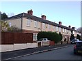
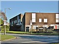
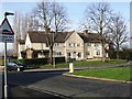
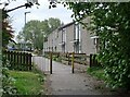
Council Housing - Giffard Road
by John M geograph for square SO9397 An unusually long terrace of eight properties near to East Park probably dating... (more)
|
|
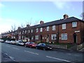
Council Housing - Stowheath Lane
by John M geograph for square SO9397 An unusually long terrace of eight properties near to East Park probably dating... (more)
|
|
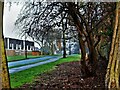
East Lothian Townscape : Piping at Victoria Street, Dunbar
by Richard West geograph for square NT6779 Category: House backs A plethora of plastic piping on the rear elevation of 12 to 30 (even) Victoria... (more)
Tags:
top:Housing, Dwellings
|
|
East Lothian Architecture : Rear of 12 - 30 Victoria Street, Dunbar
by Richard West geograph for square NT6779 Category: House backs Looking down Castle Gate towards the harbour housing of 1948-51 by (Sir) Basil... (more)
Tags:
top:Housing, Dwellings
|
|
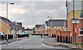
Surbiton Close, Kingston upon Hull
by Bernard Sharp geograph for square TA1232 Houses in Surbiton Close on the Ings Estate, built by the City Council in the... (more)
|
|
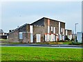
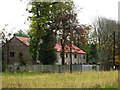
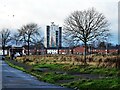
Council Housing - Old Fallings Lane
by John M geograph for square SJ9201 Open space with trees.
|
|
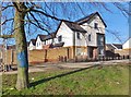
Camberwell Way, Kingston upon Hull
by Bernard Sharp geograph for square TA1332 Planning approval was granted in 2005 for the erection of 27 dwellings on the... (more)
|
|
Highgate Close, Kingston upon Hull
by Bernard Sharp geograph for square TA1332 Planning approval was granted in 2013 for the erection of 56 dwellings for rent... (more)
|
|
Mitcham Road, Kingston upon Hull
by Bernard Sharp geograph for square TA1332 Planning approval was granted in 2013 for the erection of 56 dwellings for rent... (more)
|
|
Camberwell Way, Kingston upon Hull
by Bernard Sharp geograph for square TA1332 Planning approval was granted in 2005 for the erection of 27 dwellings on the... (more)
|
|
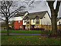
Council Housing - Park Lane
by John M geograph for square SJ9200 1920s housing on the fringe of the Low Hill Estate
|
|
Council Housing - Park Lane
by John M geograph for square SJ9200 1920s 'Tudor Waters' Report housing.
|
|
Council Housing - Park Lane
by John M geograph for square SJ9200 1920s style block on the corner plot with Third Avenue.
|
|
Balham Avenue, Kingston upon Hull
by Bernard Sharp geograph for square TA1232 Ings Regeneration, Phase 5: Brownfield land bounded by Balham Avenue, Hurn... (more)
|
|
Middlesex Road, Kingston upon Hull
by Bernard Sharp geograph for square TA1232 Land to the west of Middlesex Road and north of Bellfield Avenue is being... (more)
Tags:
top:Construction, DevelopmentX
type:GeographX
top:Housing, Dwellings
Ings WardX
top:Suburb, Urban FringeX
|
|
Surbiton Close, Kingston upon Hull
by Bernard Sharp geograph for square TA1232 In February 2017, Compendium Living began the construction of 83 new dwellings... (more)
|
|
Middlesex Road, Kingston upon Hull
by Bernard Sharp geograph for square TA1232 Land to the west of Middlesex Road and north of Bellfield Avenue is being... (more)
Tags:
top:Construction, DevelopmentX
type:GeographX
top:Housing, Dwellings
Ings WardX
top:Suburb, Urban FringeX
|
|
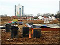
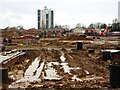
Battersea Park, Kingston upon Hull
by Bernard Sharp geograph for square TA1232 Ings Regeneration, Phase 2c: Construction is in progress of dwellings at The... (more)
|
|
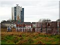
Middlesex Road, Kingston upon Hull
by Bernard Sharp geograph for square TA1232 Land to the west of Middlesex Road and north of Bellfield Avenue is being... (more)
Tags:
top:Derelict, DisusedX
type:GeographX
top:Housing, Dwellings
Ings WardX
top:Suburb, Urban FringeX
|
|
Middlesex Road, Kingston upon Hull
by Bernard Sharp geograph for square TA1232 Land to the west of Middlesex Road and north of Bellfield Avenue is being... (more)
Tags:
top:Derelict, DisusedX
type:GeographX
top:Housing, Dwellings
Ings WardX
top:Suburb, Urban FringeX
|
|
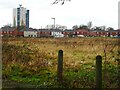
Middlesex Road, Kingston upon Hull
by Bernard Sharp geograph for square TA1232 Land to the west of Middlesex Road and north of Bellfield Avenue awaiting... (more)
Tags:
top:Construction, DevelopmentX
type:GeographX
top:Housing, Dwellings
Ings WardX
top:Suburb, Urban FringeX
|
|
Middlesex Road, Kingston upon Hull
by Bernard Sharp geograph for square TA1232 Land to the west of Middlesex Road and north of Bellfield Avenue awaiting... (more)
Tags:
top:Construction, DevelopmentX
type:GeographX
top:Housing, Dwellings
Ings WardX
top:Suburb, Urban FringeX
|
|
Middlesex Road, Kingston upon Hull
by Bernard Sharp geograph for square TA1232 Houses fronting Middlesex Road on the Ings Estate, built by the City Council in... (more)
|
|
Middlesex Road, Kingston upon Hull
by Bernard Sharp geograph for square TA1232 Houses in Middlesex Road on the Ings Estate, built by the City Council in the... (more)
|
|
Surbiton Close, Kingston upon Hull
by Bernard Sharp geograph for square TA1232 Houses in Surbiton Close on the Ings Estate, built by the City Council in the... (more)
Tags:
top:Derelict, DisusedX
type:GeographX
top:Housing, Dwellings
Ings WardX
top:Suburb, Urban FringeX
|
|
Surbiton Close, Kingston upon Hull
by Bernard Sharp geograph for square TA1232 Houses in Surbiton Close on the Ings Estate, built by the City Council in the... (more)
Tags:
top:Derelict, DisusedX
type:GeographX
top:Housing, Dwellings
Ings WardX
top:Suburb, Urban FringeX
|
|
Surbiton Close, Kingston upon Hull
by Bernard Sharp geograph for square TA1232 Houses in Surbiton Close on the Ings Estate, built by the City Council in the... (more)
Tags:
top:Derelict, DisusedX
type:GeographX
top:Housing, Dwellings
Ings WardX
top:Suburb, Urban FringeX
|
|
Surbiton Close, Kingston upon Hull
by Bernard Sharp geograph for square TA1232 Houses in Surbiton Close on the Ings Estate, built by the City Council in the... (more)
|
|
|
Surbiton Close, Kingston upon Hull
by Bernard Sharp geograph for square TA1232 Houses in Surbiton Close on the Ings Estate, built by the City Council in the... (more)
|
|
Surbiton Close, Kingston upon Hull
by Bernard Sharp geograph for square TA1232 Houses in Surbiton Close on the Ings Estate, built by the City Council in the... (more)
|
|
Surbiton Close, Kingston upon Hull
by Bernard Sharp geograph for square TA1232 Phase 3B, Ings Redevelopment, Kingston upon Hull: Dwellings on the east side of... (more)
|
|
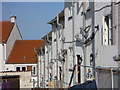
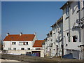
Battersea Park, Kingston upon Hull
by Bernard Sharp geograph for square TA1232 Recently-constructed dwellings, as yet unnumbered on the OS map, but some... (more)
|
|
Battersea Park, Kingston upon Hull
by Bernard Sharp geograph for square TA1232 Recently-constructed dwellings, as yet unnumbered on the OS map, but some... (more)
|
|
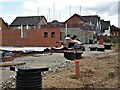
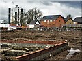
Middlesex Road, Kingston upon Hull
by Bernard Sharp geograph for square TA1232 Ings Regeneration, Phase 2b: Land to the west of Middlesex Road and north of... (more)
Tags:
top:Construction, DevelopmentX
type:GeographX
top:Housing, Dwellings
Ings WardX
top:Suburb, Urban FringeX
|
|
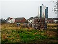
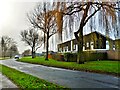
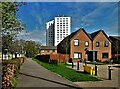
Muswell Court, Kingston upon Hull
by Bernard Sharp geograph for square TA1332 Muswell Court is a 17-floor sheltered housing scheme comprising 60 flats,... (more)
|
|
Greenford Gardens, Kingston upon Hull
by Bernard Sharp geograph for square TA1332 The rear of Nos. 1 to 11 (consecutive) Greenford Gardens. Confusingly, the... (more)
|
|
Finchley Close, Kingston upon Hull
by Bernard Sharp for square TA1232 Ings Regeneration, Phase 2a: The Leeway, 68 dwellings have been built on land at... (more)
|
|
Camberwell Way, Kingston upon Hull
by Bernard Sharp geograph for square TA1332 Planning approval was granted in 2009 for the erection of 127 semi-detached and... (more)
|
|
Camberwell Way, Kingston upon Hull
by Bernard Sharp geograph for square TA1332 Planning approval was granted in 2009 for the erection of 127 semi-detached and... (more)
|
|
Middlesex Road, Kingston upon Hull
by Bernard Sharp geograph for square TA1232 Land to the west of Middlesex Road and north of Bellfield Avenue is being... (more)
Tags:
top:Construction, DevelopmentX
type:GeographX
top:Housing, Dwellings
top:Suburb, Urban FringeX
|
|
Acton Close, Kingston upon Hull
by Bernard Sharp geograph for square TA1232 Ings Regeneration, Phase 3b. Dwellings in Acton Close, part of the ongoing... (more)
|
|
Middlesex Road, Kingston upon Hull
by Bernard Sharp geograph for square TA1232 Land to the west of Middlesex Road and north of Bellfield Avenue is being... (more)
|
|
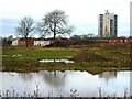
Middlesex Road, Kingston upon Hull
by Bernard Sharp geograph for square TA1232 Land to the west of Middlesex Road and north of Bellfield Avenue is vacant and... (more)
|
|
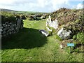
Chysauster - House 3b - Entrance
by Rob Farrow geograph for square SW4735 The entrance into the right-hand dwelling of the pair of semi-detached dwellings... (more)
Tags:
subject:Ancient SiteX
Ancient VillageX
place:ChysausterX
type:GeographX
top:Historic Sites and ArtefactsX
top:Housing, Dwellings
top:Village, Rural SettlementX
|
|
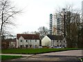
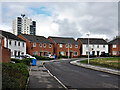
Bayswater Court, Bellfield Avenue, Kingston upon Hull
by Bernard Sharp geograph for square TA1232 Bayswater Court, on the Ings Road Estate, is a 17-floor sheltered housing scheme... (more)
|
|
Bayswater Court, Bellfield Avenue, Kingston upon Hull
by Bernard Sharp geograph for square TA1232 Bayswater Court, on the Ings Road Estate, is a 17-floor sheltered housing scheme... (more)
|
|
Bellfield Avenue, Kingston upon Hull
by Bernard Sharp geograph for square TA1332 Planning approval was granted in 2013 for the erection of 56 dwellings for rent... (more)
|
|
Saltshouse Road, Kingston upon Hull
by Bernard Sharp geograph for square TA1232 Ings Regeneration, Phase 2a: The Leeway, 68 dwellings are being built on land at... (more)
|
|
Middlesex Road, Kingston upon Hull
by Bernard Sharp geograph for square TA1232 Ings Regeneration, Phase 2a: The Leeway, 68 dwellings are being built on land at... (more)
|
|
Finchley Close, Kingston upon Hull
by Bernard Sharp geograph for square TA1232 Ings Regeneration, Phase 2a: The Leeway, 68 dwellings are being built on land at... (more)
|