2008
SK1383 : Castleton: near former Odin Mine
taken 17 years ago, near to Castleton, Derbyshire, England
This is 1 of 2 images, with title Castleton: near former Odin Mine in this square
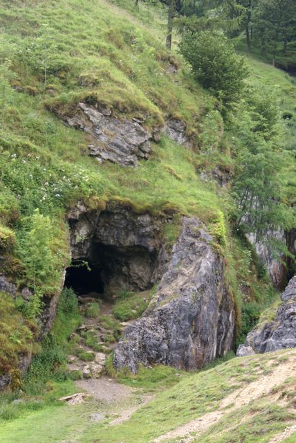
Castleton: near former Odin Mine
Disused lead mine workings - cave and adjacent wooded ravine.
TIP: Click the map for more Large scale mapping
- Grid Square
- SK1383, 191 images (more nearby 🔍)
- Photographer
- Natalia A McKenzie (more nearby)
- Date Taken
- Wednesday, 16 July, 2008 (more nearby)
- Submitted
- Saturday, 13 September, 2008
- Subject Location
-
OSGB36:
 SK 134 834 [100m precision]
WGS84: 53:20.8503N 1:48.0107W - Camera Location
-
OSGB36: SK 134 834
- View Direction
- West-southwest (about 247 degrees)