near to Castleton, Derbyshire, England
Coverage
We have
191 images
in grid square SK1383
Maps
TIP: Click the map for more Large scale mapping
Tip: Click the map to open the coverage map
A sample of 12 photos from 191
for SK1383
- View this square in the Browser >>>
|
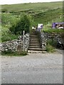
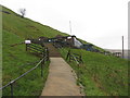
Steps to Treak Cliff Cavern
by David Dixon
Public footpath from Buxton Road to Treak Cliff Cavern.
|
|
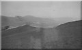
Hope valley from Blue John Caverns
Photo date c1960, Modern photo with same distant hill shape is SK1383 : The Western Hope Valley Viewed from Treak Cliff by Jonathan Clitheroe. Photo taken from just away from the cavern entrance. Thank you Link
|
|
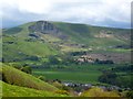
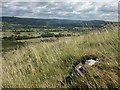
Mam Tor, the shivering mountain
by Graham Hogg
Looking over Castleton from the ridge above Pindale. See Link
|
|
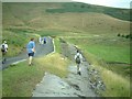
A625, Little Mam Tor, Easter 1976
The road here has been abandoned as a through route. After persistent landslides, the decision was made in 1979 to give up on this stretch and reroute the A625 trans-pennine route well away from this area.
|
|
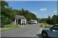
Blue John Cafe
by DS Pugh
Looking along Mam Tor Road at the Blue John caverns.
|
|
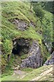
Castleton: near former Odin Mine
Disused lead mine workings - cave and adjacent wooded ravine.
|
|
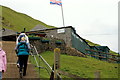
Treak Cliff Cavern Castleton
by Sue Trescott
Visitors climbing the steps to Treak Cliff Cavern
|
|
Road over Mam Tor
The gate marks the end of the useable road; up to this point it is maintained (albeit much narrower than the original carriageway) to give access to Mam Farm.
|
|
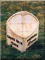
Old Milepost by the track of the former A625
by J Higgins
Cast iron post by the UC road, in parish of CASTLETON (HIGH PEAK District), Buxton Road; on abandoned portion of A625, East of Mam Tor, in grass behind wire fence, on West side of road. Heart scroll iron casting, erected by the Sheffield... (more)
|
|
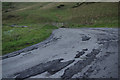
Collapsed Road, Little Mam Tor, Castleton, Peak District
by Bob Embleton
Many attempts to build a road on this "discontinuity" has resulted in disaster.
|
|
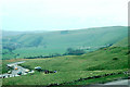
Hope Valley from Little Mam Tor
by Katy Walters
|
|
Treak Cliff Cavern, Castleton
by Gareth James
|
Explore more images in this square: | View Filtering options | View all 191 images page by page >>> |
|