2011
J2866 : The Lagan towpath, Ballyskeagh
taken 14 years ago, near to Ballyskeagh, Co Down, Northern Ireland
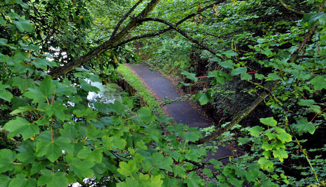
The Lagan towpath, Ballyskeagh
The summer leaves almost hiding the view, from the footbridge J2866 : Footbridge, Ballyskeagh beside the Ballyskeagh High Bridge, of this part of the Lagan towpath J2866 : The Ballyskeagh High Bridge (2 of 8).
The Ballyskeagh High Bridge, Drumbeg/Lambeg
A two-arch bridge, built about 1760 of local sandstone, carrying the Ballyskeagh Road (from Drumbeg to Lambeg) across the towpath and disused Lagan canal. The road is much higher than the canal an interesting challenge for a civil engineer 250 years ago. The bridge is narrow and now has a separate footbridge on the northern side. There is no direct access from the bridge to the towpath. Pedestrians and cyclists use the entrance to McIlroy Park on the Belfast side of the bridge.
Loading map... (JavaScript required)
- Grid Square
- J2866, 72 images (more nearby 🔍)
- Photographer
- Albert Bridge (more nearby)
- Date Taken
- Saturday, 18 June, 2011 (more nearby)
- Submitted
- Saturday, 18 June, 2011
- Subject Location
-
Irish:
 J 288 669 [100m precision]
WGS84: 54:32.0707N 6:0.6027W - Camera Location
-
Irish: J 288 669
- View Direction
- North-northeast (about 22 degrees)