5 km NNW of Bretherdale Head, Cumbria, England
Coverage
We have
11 images
in grid square NY5609
Maps
TIP: Click the map for more Large scale mapping
Tip: Click the map to open the coverage map
We have
11 images
for NY5609

|
A6
Looking north towards Shap Granite Quarries.
|

|
On The A6
Roadside plantation recently felled
|

|
Public Footpath
by David Brown
Appears to go to the quarry and stops.
|

|
A6 north approaching Shap lodge
by John Firth
|
|
Northbound A6 near Shap Wells
by David Dixon
The A6 road from Kendal to Penrith over Shap Fell. The road to the Shap Wells hotel is on the right hand side, after the next bend.
|

|
The A6 heads south for Shap Summit
In the days before the M6 motorway, it would have been difficult, if not suicidal, to get a photo like this!
The highest point on the A6 is about 4 kilometres (2.5 miles) south of here. Interestingly, it is some way south of the high... (more)
|

|
Woodland beside the A6
by JThomas
|

|
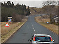
A6 heading north
by JThomas
Towards Shap.
|

|
Young conifers beside the A6
by JThomas
An older woodland has been felled.
|

|
Bridleway leaves lay-by on A6
by Russel Wills
Beyond the pylons the M6 is busy with its separated carriageways.
|

|
A6 towards Kendal
by Steven Brown
|
|