near to Craik, Scottish Borders, Scotland
Coverage
We have
15 images
in grid square NT3308
Maps
TIP: Click the map for more Large scale mapping
Tip: Click the map to open the coverage map
We have
15 images
for NT3308
|
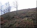
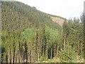
Felled area, Craik.
by Richard Webb
Slopes east of the Aithouse Burn have just been clear felled.
|
|
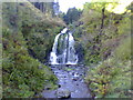
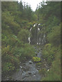
Wolfcleugh Waterfall
by Ryan Notman
A nice walk through the picturesque Craik Forest brings you to this wonderful waterfall up the Wolfcleuch Burn.
|
|
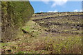
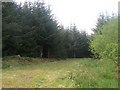
Before and after felling
by Jim Barton
Mature trees bordering a clear-felled area on the SW slopes of Crib Law.
|
|
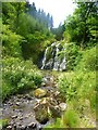
Wolfcleuch Waterfall
by ronnie leask
This scenic waterfall on the Wolfcleuch Burn in the Aithouse Valley can be accessed on one of the many forest walks in Craik Forest. During a period of wet weather it must be truly spectacular.
|
|
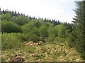
Colonised clearing
by Richard Webb
Unplanted area now being occupied by broad leafed trees.
|
|
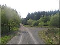
Crossroads
by Richard Webb
The track to the right goes up Wolfcleuch, straight on for Wolfcleuchhead and there is a nice bit of singletrack to the left running up from the carpark.
|
|
Spruce, Knowbog Hill
by Richard Webb
Looking along a short spur road on Knowebog Hill
|
|
Forest road, Knowebog Hill
by Richard Webb
Logging road cut into the hillside in Craik Forest.
|
|
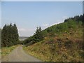
Steep slopes, Craik Forest
by Richard Webb
Steep slopes above the Aithouse Burn.
|
|
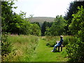
Walk to the waterfall
by Adam D Hope
Rest area on Craik Forest path to the waterfall
|
|
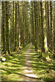
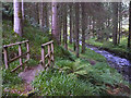
A path through the forest
by Malcolm Neal
One of several paths near Craik. There are also the longer distance Drovers and Reivers paths through this forest.
|
|
Waterfall, Wolfcleuch Burn
by Karl and Ali
The tracks to and from this pretty waterfall appear to have been left to fall into disrepair. It's worth the short trek from the Aithouse Burn to see though.
|
|
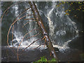
Fallen tree at Wolfcleuch Waterfall
by Karl and Ali
|
|
Footbridge by the Aithouse Burn
by Karl and Ali
The path which leads upstream towards the Wolfcleuch Waterfall appears to have been abandoned and all waymarks removed. The path is still in reasonably good condition although several small landslips have taken sections away and the... (more)
|
|
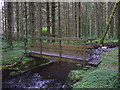
Footbridge over the Aithouse Burn
by Karl and Ali
The path which leads upstream towards the Wolfcleuch Waterfall appears to have been abandoned and all waymarks removed. The path is still in reasonably good condition although several small landslips have taken sections away and the... (more)
|
|