near to Humla [other Features], Highland, Great Britain
Coverage
We have
just one image
in grid square NG1900
Maps
TIP: Click the map for more Large scale mapping
Tip: Click the map to open the coverage map
We have
just one image
for NG1900
|
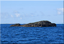
Humla, a basalt outlier
by George Brown
The seabed around the basalt outlier of Humla is formed by the tops of countless basalt columns. To the left of Humla can be seen another outlier, Oigh Sgeir, complete with its lighthouse. To the right can be seen a green starboard lateral... (more)
|
|