JOURNAL OF QUATERNARY SCIENCE (1997) 12 (6) 507–518
1997 by John Wiley & Sons, Ltd.
CCC 0267-8179/97/060507–12$17.50
Cesi, an early M iddle Pleistocene site in the
Colfiorito Basin (U mbro-M archean Apennine),
central Italy
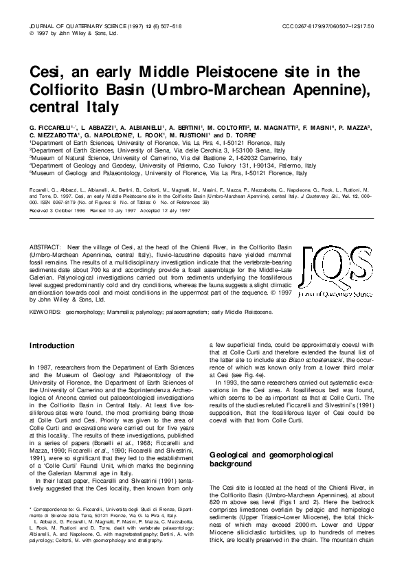
G. FICCARELLI 1,* , L. ABBAZZI 1, A. ALBIAN ELLI 1 , A. BERTIN I 1, M . CO LTO RTI 2 , M . M AGN ATTI 3, F. M ASIN I 4, P. M AZZA5,
C. M EZZABO TTA1 , G. N APO LEO N E1 , L. RO O K1 , M . RU STIO N I 1 and D . TO RRE1
1
Department of Earth Sciences, University of Florence, Via La Pira 4, I-50121 Florence, Italy
2
Department of Earth Sciences, University of Siena, Via delle Cerchia 3, I-53100 Siena, Italy
3
Museum of Natural Science, University of Camerino, Via del Bastione 2, I-62032 Camerino, Italy
4
Department of Geology and Geodesy, University of Palermo, C.so Tukory 131, I-90134, Palermo, Italy
5
Museum of Geology and Palaeontology, University of Florence, Via La Pira, I-50121 Florence, Italy
Ficcarelli, G., Abbazzi, L., Albianelli, A., Bertini, B., Coltorti, M., Magnatti, M., Masini, F., Mazza, P., Mezzabotta, C., Napoleone, G., Rook, L., Rustioni, M.
and Torre, D. 1997. Cesi, an early Middle Pleistocene site in the Colfiorito Basin (Umbro-Marchean Apennine), central Italy. J. Quaternary Sci., Vol. 12 , 000–
000. ISSN 0267-8179 (No. of Figures: 8 No. of Tables: 0 No. of References: 39)
Received 3 October 1996
Revised 10 July 1997
Accepted 12 July 1997
ABSTRACT: Near the village of Cesi, at the head of the Chienti River, in the Colfiorito Basin
(Umbro-Marchean Apennines, central Italy), fluvio-lacustrine deposits have yielded mammal
fossil remains. The results of a multidisciplinary investigation indicate that the vertebrate-bearing
sediments date about 700 ka and accordingly provide a fossil assemblage for the Middle–Late
Galerian. Palynological investigations carried out from sediments underlying the fossiliferous
level suggest predominantly cold and dry conditions, whereas the fauna suggests a slight climatic
amelioration towards cool and moist conditions in the uppermost part of the sequence. 1997
by John Wiley & Sons, Ltd.
KEYWORDS:
geomorphology; Mammalia; palynology; palaeomagnetism; early Middle Pleistocene.
Introduction
In 1987, researchers from the Department of Earth Sciences
and the Museum of Geology and Palaeontology of the
University of Florence, the Department of Earth Sciences of
the University of Camerino and the Soprintendenza Archeologica of Ancona carried out palaeontological investigations
in the Colfiorito Basin in Central Italy. At least five fossiliferous sites were found, the most promising being those
at Colle Curti and Cesi. Priority was given to the area of
Colle Curti and excavations were carried out for five years
at this locality. The results of these investigations, published
in a series of papers (Borselli et al ., 1988; Ficcarelli and
Mazza, 1990; Ficcarelli et al ., 1990; Ficcarelli and Silvestrini,
1991), were so significant that they led to the establishment
of a ‘Colle Curti’ Faunal Unit, which marks the beginning
of the Galerian Mammal age in Italy.
In their latest paper, Ficcarelli and Silvestrini (1991) tentatively suggested that the Cesi locality, then known from only
* Correspondence to: G. Ficcarelli, Universita degli Studi di Firenze, Dipartimento di Scienze della Terra, 50121 Firenze, Via G. la Pira 4, Italy.
L. Abbazzi, G. Ficcarelli, M. Magnatti, F. Masini, P. Mazza, C. Mezzabotta,
L. Rook, M. Rustioni and D. Torre, dealt with vertebrate palaeontology;
Albianelli, A. and Napoleone, G. with magnetostratigraphy; Bertini, A. with
palynology; Coltorti, M. with geomorphology and stratigraphy.
a few superficial finds, could be approximately coeval with
that at Colle Curti and therefore extended the faunal list of
the latter site to include also Bison schoetensacki , the occurrence of which was known only from a lower third molar
at Cesi (see Fig. 4e).
In 1993, the same researchers carried out systematic excavations in the Cesi area. A fossiliferous bed was found,
which seems to be as important as that at Colle Curti. The
results of the studies refuted Ficcarelli and Silvestrini’s (1991)
supposition, that the fossiliferous layer of Cesi could be
coeval with that from Colle Curti.
Geological and geomorphological
background
The Cesi site is located at the head of the Chienti River, in
the Colfiorito Basin (Umbro-Marchean Apennines), at about
820 m above sea level (Figs 1 and 2). Here the bedrock
comprises limestones overlain by pelagic and hemipelagic
sediments (Upper Triassic–Lower Miocene), the total thickness of which may exceed 2000 m. Lower and Upper
Miocene siliciclastic turbidites, up to hundreds of metres
thick, are locally preserved in the chain. The mountain chain
�508
JOURNAL OF QUATERNARY SCIENCE
ˆ
Figure 1 Structural setting of the central northern Apennines with the main relationships between the Tuscany Domain (Unita Falterona–
Trasimeno) and the Latium–Abruzzi Platform (PLA) from Calamita, 1990). AM, Amelia; ANT, Antrodoco; BT, Battiferro; CAS, Cascia; CO,
Contigliano; CL, Cottanello; CT, Castelluccio; FO, Foligno; GU, Gubbio; MA, Monte Acuto; MAG, Monte Aguzzo; MB, Monte Bove; MC,
Monte Cavallo; MCO, Monte Cosce; MCS, Monte Coscerno; MF, Monte Fema; MG, Monte Gorzano; MM, Monte Maggiore; MMA, Monte
Malbe; MMR, Monte Martano; MN, Monte Nerone; MP, Monte Patino; MPE, Monte Pellecchia; MPG, Monte Peglia; MPR, Monte Primo;
MS, Monte Subasio; MST, Monte della Strega; MSV, Monte San Vicino; MT, Monte Tezio; MTO, Monte Tolentino; MTR, Monte Torricella;
MV, Monte Vettore; MZ, Monte Zappi; NA, Narni; NO, Norcia; OR, Orte; PO, Posta; SFE, Sassoferrato; SP, Spoleto; TV, Tivoli.
J. Quaternary Sci., Vol. 12(6) 507–518 (1997)
1997 by John Wiley & Sons, Ltd.
�EARLY MIDDLE PLEISTOCENE SITE IN THE APENNINE
is bounded to the east by the Sibillini Mountain thrust,
which displaced these sediments over the Lower Miocene
to Lower Pliocene turbiditic deposits, exceeding 3000 m in
thickness, of the Periadriatic Basin (Fig. 1). Reverse faults
and overthrusts affected the sequence in the Early Pliocene
(Boccaletti et al ., 1983, 1986; Bally et al ., 1986; Calamita
and Deiana, 1988; Lavecchia et al ., 1988; Calamita et al .,
1991; Damiani et al ., 1991).
The area was first affected by uplift and finally emerged
above sea-level at the end of the Messinian (Ambrosetti et
al ., 1978, 1982, 1987; Calamita et al ., 1991, 1995). However, a compressional basin continued to exist in the East
Tiber area up to the Late Pliocene and was infilled by
fluviatile and lacustrine deposits (Coltorti and Pieruccini, in
press). In the Early–Middle Pleistocene, extensional tectonics
reached the Umbria-Marchean Apennines, and many basins
were formed (Calamita et al ., 1982, 1994, 1995; Raffy,
1981; Cattuto et al ., 1992).
Numerous thrusts are present in the study area, to the
east of the eastern Tiber Basin (Calamita and Pizzi, 1992;
Calamita et al ., 1994), as well as many normal faults with
an Apennine direction, which also dissect the thrust planes
and create important fault escarpments.
A ‘planation surface’ is developed on the units formed
during the compressional phase, and normal faults dissect
this surface (Fig. 2) (Coltorti and Farabollini, 1995; Coltorti
and Pieruccini, in press; Coltorti et al ., in press). In the
Spoleto Basin, this surface progressively dips under sediments
older than 3.3 Ma and it is therefore dated to the Early
Pliocene. At the same time, in the Periadriatic basin, east
of the mountain area, thick and coarse fan-delta deposits
(Ascensione Mountain, Fig. 1) (Cantalamessa et al ., 1986),
which originated from the dissection of the planation surface,
were emplaced.
Later, wide valleys, separated by smooth relief, were formed across all of the Apennine chain affected by progressive
uplifting between the Middle Pliocene and Early Pleistocene.
Also, the development of this secondary landscape has been
attributed to erosional processes that occurred in proximity
to base-level (Desplanques, 1969; Coltorti, 1981; Calamita et
al ., 1982; Ciccacci et al ., 1985), with palaeovalleys lacking a
definite flow direction (Coltorti and Farabollini, 1995). However, Dramis et al . (1991) and Dramis (1992) suggest the
existence of pedimentary processes at the mountain front
(Periadriatic Basin, Fig. 1) and therefore the possibility that
these valleys also developed at high elevations. Previous
studies in the Colfiorito (Coltorti et al ., in press) and recent
investigations in Castelluccio di Norcia areas (Fig. 1) (Coltorti
and Farabolini, 1995), where there are also wide palaeovalleys lacking a definite flow direction on the watershed, seem
to confirm the first hypothesis. Moreover, in the Periadriatic
area, littoral sediments coeval with the deposits that contain
the mammal fauna, were uplifted to over 400 m a.s.l. Moreover, convergent fluvial terraces reveal that the mountain
area was uplifted further than the coastal region (Coltorti et
al ., 1991), suggesting that the earlier elevation (today about
800 m) was probably less than 400 m a.s.l. The sequence
under investigation here, as well as the nearby Colle Curti
deposits, represents the infill of one of these valleys (Coltorti
et al ., in press).
The transition to the present-day landscape was favoured
by the deepening of the valleys that followed the increased
uplift after the final part of the Early Pleistocene. The activity
of anti-Apennine and extensional Apennine faults on the
Tyrrhenian side of the Apennine chain occurred in a subsequent movement, causing a series of captures in the drainage system. The Cesi and Colle Curti basins originally
1997 by John Wiley & Sons, Ltd.
509
belonged to the same hydrographic network, but were later
separated by both deformation resulting from the normal
faults located east of the upper Chienti valley, and the
intensive regressive erosion of the Percanestro stream, a
tributary of the Nera–Tiber Basin. The nearby Colfiorito Basin
represents a relic of the former landscape that was slightly
affected by Middle and Late Pleistocene erosional events. In
fact, the whole area is characterised by a very low-energy
relief, despite being located high on the Adriatic–Tyrrhenian watershed.
Stratigraphy
The limited erosion that affected the upper part of the Chienti
Basin did not expose any great thickness of Pleistocene
sediments. Late Middle and late Upper Pleistocene stratified
slope deposits (Coltorti and Dramis, 1988) outcrop along
the slopes of the valley and in the nearby Colfiorito Basin.
An alluvial fan entered the lacustrine basin that occupied the
Colfiorito plain during the late Pleniglacial, and lacustrine
sedimentation ended at the beginning of the Holocene
(Brugiapaglia and de Beaulieu, 1995). This was associated
with the strong solution processes that affected the bedrock,
and which is also indicated by fractured and faulted limestones. In fact, karstic wells and dolines are common in the
area, but during the cold phases of the Pleistocene were
filled with debris. The lacustrine basin was re-established
during the third millenium bc (Brugiapaglia and de Beaulieu,
1995), probably due to slope degradation induced by the
first clearing of the natural vegetation and then drained again
artificially in the Middle Ages. In fact, pollen of cereals
are found in the sediments overlying the unconformity/nondepositional surface that separates the lower (Upper
Pleistocene) from the upper (Holocene) part of the sequence
in the borehole.
In the Cesi valley, near Madonna del Piano, the palaeontological excavations exposed a sequence about 12 mm thick,
which represents the remnant of a thicker alluvial terrace.
The lower part of the outcrop is represented by Lower–
Middle Pleistocene sediments, predominantly clay-rich sediments with pebbly lenses. The total thickness of these sediments has never been precisely established. At the
palaeontological site (Fig. 3), a trench exposed over 8 m of
massive clays (bed US 5); thin stone-lines occur, a few
decimetres from one another. Fossil bones are preserved in
a fine gravel bed 20–50 cm thick (bed US 4), formed of
subangular and angular siliceous gravels, resulting from
decalcification of limestone clasts, which were locally affected by load casts. A thin pyroclastic lamina (bed US 4a)
discontinuously occurs at the base of the gravels. Oscillation
of the water table is responsible for the occurrence of Fe–
Mn concretions and nodules in the bed. In the same horizon,
centimetre-thick calcareous crusts occur linked with the presence of herbaceous roots. Gravels, weathered in a tropical
reddish palaeosol, of which only the flint elements remain,
occur at the top of the preserved sequence of the terrace.
However, in other parts of the basin, in the same morphoand lithostratigraphic unit, limestone gravels are still preserved locally. The evidence suggests a lacustrine environment succeeded in its upper part by clastic material derived
from an alluvial fan prograding into the lake. However, the
upper part of this sequence was also affected locally by
erosional processes, which removed tens of metres of sediments.
J. Quaternary Sci., Vol. 12(6) 507–518 (1997)
�510
J. Quaternary Sci., Vol. 12(6) 507–518 (1997)
JOURNAL OF QUATERNARY SCIENCE
1997 by John Wiley & Sons, Ltd.
�EARLY MIDDLE PLEISTOCENE SITE IN THE APENNINE
511
Figure 3 Stratigraphy at the site of Cesi (Madonna del Piano). Legend: 1, clays; 2, pyroclastic layer (US 40); 3, limestone gravels; 4, flint
gravels; 5, stone lines; 6, alluvial soils. The stratigraphical position of the samples taken for palynological (*) and palaeomagnetic (o)
analyses, is indicated.
Analogous deeply weathered gravels also characterize the
top of the nearby Colle Curti sequence. Pyroclastic sediments, containing sanidine crystals dated, using the Ar/Ar
method, to 424 kyr BP, are reported from a thin palustrine
layer (Coltorti et al ., in press). In Colle Curti, these sediments
overlie clayey beds over 20 m thick. Beneath the clays,
intercalations of gravelly lenses and beds become progressively more abundant, down to the base of the outcropping
sequence, which is about 100 m thick. The Colle Curti fossil
assemblage was recovered at the base of the clays. The Cesi
Figure 2 The Colle Curti and Cesi area in its geomorphological setting: 1, major fluvial escarpment; 2, gullies and streams; 3, alluvian
fans; 4, water-fall; 5, major captures; 6, hanging Lower Pleistocene palaeovalleys; 7, trough-floored valleys; 8, major extensional fault at
time with associated fault escarpments (tract in the lowered part); 9, major overthrusts; 10, major fault escarpment; 11, ‘flat iron’ forms
associated with the main extensional fault of the East Tiber Basin; 12, major structural escarpment; 13, ridges with sharp crest; 14,
colluvial sediments; 15, major landslides; 16, final Middle Pleistocene, Upper Pleistocene and Holocene alluvial sediments; 17, final
Middle Pleistocene and Holocene travertines; 18, Upper Pleistocene and Holocene lacustrine deposits; 19, final Middle Pleistocene and
Upper Pleistocene alluvial and fluvial deposits; 20, Lower Pleistocene alluvial and fluvial deposits; 21, remnants of the planation surface;
22, palaeontological sites of Colle Curti (A) and Cesi (B). Note the very flat nature of the planation surface remnants preserved at the top
of the relief. It affects all the formations strongly folded and overthrust during the Messinian. A series of palaeovalleys dissects the
planation surface and the Colle Curti deposits bear witness to a period of successive filling. Extensional faults were activated later and
created a complex network, which first generated a clear watershed between the Adriatic and the Tyrrhenian side.
1997 by John Wiley & Sons, Ltd.
J. Quaternary Sci., Vol. 12(6) 507–518 (1997)
�512
JOURNAL OF QUATERNARY SCIENCE
sequence shares many sedimentological characters with that
at Colle Curti, although most of the upper part is missing,
probably as a result of later erosion.
M ammal palaeontology
The taxa identified from Cesi are an advanced representative
of Stephanorhinus hundsheimensis, a caballine equid, Hippopotamus sp., Megaceroides solilhacus, Cervus elaphus,
Dama clactoniana, Bison schoetensacki , Homotherium
(Fig. 4) and an undetermined elephant. All this material is
kept in the Museum of Natural Science, University of Camerino. No micromammals nor any other microvertebrates have
been recovered.
The rhinoceros material is represented by a few poorly
preserved bones of a single individual; a mandible, a right
second metacarpal bone, a right femur and a right tibia.
The morphological characteristics and proportions of the
specimens are suggestive of Stephanorhinus hundsheimensis.
The femur is fairly diagnostic for recognising Pleistocene
European rhinoceroses. The specimen is massive, with a
very broad roundish head, a short sturdy neck, a prominent
greater trochanter and a well-developed lesser trochanter.
Slight disproportions in the lower cheek teeth distinguish the
Cesi rhinoceros from other representatives of S. hundsheimensis. However, as this rhinoceros is one of the largest
sized representatives of the species, the differences in the
dentition may probably reflect allometry (Fig. 4f). Stephanorhinus hundsheimensis probably inhabited fairly open
regions (Mazza, 1993) such as wooded steppes, probably
occupying a niche similar to that of the living black rhinoceros, Diceros bicornis.
The equid is represented only by a right metatarsal bone,
slightly deformed and fractured in its distal epiphysis, which
prevents a species determination.
The hippopotamus remains consist of very fragmentary
material: two lower incisors, two lower canines, two scaplae,
a humerus, two fragments of a pelvis, a femur, a patella
and two tibiae. Again, the very poor state of preservation
prevents a determination to species level.
Scanty cervid remains were found. Some large-sized and
stout remains (fragments of antlers and of antlered skulls,
and a calcaneum) indicate the occurrence of a megalocerine.
In particular a distal part of a beam, which expands in a
broad palmation characterised by several terminal points
at the posterior border, allows reference to Megaceroides
solilhacus (Fig. 5). Cervus elaphus is represented only by a
fragmentary mandible, still bearing the first and second
molar. The occurrence of Dama clactoniana is indicated by
a third lower molar, the distal fragments of two humeri, a
right one and a left one, and by a third phalanx. Although
among these remains diagnostic elements, such as antlers,
are absent, their larger size in comparison to those of Dama
dama allows them to be referred to Dama clactoniana
(Fig. 4g).
A large-sized bovid is represented by an incomplete mandible, a fourth lower premolar, a third lower molar and a
metacarpal bone, all referable to the genus Bison. Although
these specimens are poorly diagnostic for specific determination, their overall morphology and size compare with B.
schoetensacki . The metacarpal indicates a particularly slender individual; however, given the high phenotypical plasticity of these animals, the Bison material from Cesi is
confidently referred here to B. schoetensacki (Fig. 4a–e).
J. Quaternary Sci., Vol. 12(6) 507–518 (1997)
The occurrence of Homotherium, the only carnivore hitherto found at Cesi, is documented by a right second upper
incisor, but this find is weak evidence for any specific identification.
The elephant is represented by a large fragment of ox
coxae (ileum and part of the acetabulum), a patella and
probably a semilunar. The poor state of preservation of the
specimen prevents any determination.
The presence of a typical Stephanorhinus hundsheimensis,
Bison schoetensacki and Dama clactoniana suggests a more
recent age than that of the Colle Curti community. The
assemblage is of limited diversity and the specimens are
fragmentary and more poorly preserved than the material
from Colle Curti. The faunal composition is similar to that
from Isernia (Sala, 1983) and here it is referred to an early–
middle part of the Middle Pleistocene (according to the
location of the Early–Middle Pleistocene boundary, at about
Oxygen Isotope Stage 25, cf. Cita and Castradori, 1994). By
and large, the assemblage is suggestive of open woodlands
characterised by limited areas covered by trees. Moreover,
the presence of Hippopotamus and Dama indicates humid
and not markedly cold climatic conditions.
Palynology
The palynological content of the 12 m sequence underlying
the Cesi fossiliferous bed taken as reference (0 m; Fig. 3) has
been studied (A. Bertini, in progress). These sediments are
represented mainly by clays, in which Fe–Mn and CaCO 3
concretions occur frequently, and locally also by thin layers
containing calcareous and siliceous gravels. The sedimentological analysis and the predominance of palynologically
barren sediments suggest considerable weathering, both in
the biostratinomic and in the diagenetic phases.
The pollen diagram has been reconstructed on the basis
of the data from 12 samples (Fig. 6). In these samples, the
pollen concentration is generally high, with values ranging
from 6955 to 149 825 grains per gramme of sediment. The
palynological data from Cesi have been reported in association with those from Colle Curti (Fig. 6), cited in the literature (Coltorti et al ., in press), due to the geographical and
stratigraphical proximity of these two deposits.
The Cesi pollen diagram is characterised by the dominance of herbaceous elements, especially represented by
Poaceae and Asteraceae. Among Asteraceae, Artemisia is
very abundant, sometimes in association with Ephedra,
another steppe element. Ranunculaceae, Caryophyllaceae,
Plantaginaceae and Polygonaceae pollen is also well represented. Arboreal plants are represented mainly by Pinus
pollen, which can reach frequencies of 73.65% TLP. Abies
and Picea are less abundant although always present,
whereas Tsuga and Cedrus are sporadic. Deciduous broadleaf trees, never more than the 6% TLP, are represented
mainly by Quercus, and sometimes also by Acer and Carpinus. Mediterranean xerophytes are rare.
Zygnemataceae and Chlorophyceae algae and some local
herbaceous plants provide indications of the history of the
depositional environment. In particular, the constant presence of Pediastrum, in association with Botryococcus, Spirogyra and Mougeotia, suggests a freshwater environment,
sometimes under mesotrophic conditions.
The Cesi pollen assemblages suggest the occurrence of a
landscape dominated by open vegetation characterised by
taxa (Poaceae, Asteraceaeae, including Artemisia and
1997 by John Wiley & Sons, Ltd.
�EARLY MIDDLE PLEISTOCENE SITE IN THE APENNINE
513
Figure 4 (a) Bison shoetensacki . Left metacarpus, MSNC 255; dorsal view (×1/2). (b) Bison shoetensacki . Right mandibular ramus, MSNC
257, occlusal view (×1/2). (c) Bison shoetensacki . Right mandibular ramus, MSNC 257; lateral view (×1/2). (d) Bison shoetensacki . Right
M/3, MSNC 257 (×1). (e) Bison shoetensacki . Right M/3, MSNC 206 (×1). (f) Stephanorhinus hundsheimensis. Left mandibular ramus,
MSNC 290a; medial view (×1/4). (g) Dama clactoniana. Distal end of right humerus, MSNC 264; cranial view (×1).
1997 by John Wiley & Sons, Ltd.
J. Quaternary Sci., Vol. 12(6) 507–518 (1997)
�514
Figure 5
JOURNAL OF QUATERNARY SCIENCE
Megaceroides solilhacus. Fragment of antler, MSNC 287, and reconstruction of the same antler.
Ephedra, Chenopodiaceae, etc.) that were typical of the
glacial phases after 2.6 Ma in the Mediterranean region (Suc
et al ., 1995). The markedly arid climate prevented the growth
of plants demanding year-long humid conditions. Broad-leaf
trees, represented mainly by Quercus pollen grains occurred
but always at low frequencies. Woodland was dominated
by Pinus. The phases characterised by the expansion of Pinus
are probably linked with slight increases of the temperature
(wooded steppe). No new interglacial phases have been
recorded. The present-day arboreal vegetation in the Colle
Curti and Cesi areas is mainly a deciduous thermophilous
forest of Quercus pubescens and Ostrya carpinifolia series
in the hill belt, and woodland with Fagus sylvatica in the
mountain belt (Orsomando, 1993).
At Colle Curti, steppe associations (Asteraceae, Cyperaceae, Poaceae) are replaced by a mesophilous forest,
characterised principally by Tsuga and Cedrus. These
elements, which are more typical of the end of an interglacial, indicate the occurrence of more humid conditions
than at Cesi, where the main arboreal taxon is Pinus.
In view of the fact that the two sequences jointly span
over 0.4 myr, the absence of interglacial phases both at Cesi
and Colle Curti suggests the occurrence of several hiatuses.
fairly unfavourable sedimentary features, mainly inclusions
of siliceous clasts and oxidation of the clayey matrix. The
same problem was also encountered in the nearby section
at Colle Curti (Coltorti et al ., in press).
The polarity pattern is established on the basis of the VGP
(virtual geomagnetic pole) latitude values calculated from
the characteristic magnetisations, as shown in Fig. 8. From
the sample immediately below the fossiliferous bed and
down to that at 6.5 m, the magnetisation has a single behavioural component (Fig. 7, sample at 3.10 m). From 7 m
downwards, a clearly reversed polarity occurs. The sample
at 8.0 m (Fig. 7) shows, under the thermal treatment up to
200°C, the removal of an initially superimposed normal
field, which produces an increase of intensity with strongly
deviated directions. Thereafter, a regular decrease of the
primary magnetisation displays a characteristic vector. In the
lowest part of the trench, the signal deteriorates, although
the lowermost samples seem still to be in the reversed
polarity zone.
The distribution of the polarities in this section, together
with the stratigraphical and biochronological evidence of
the local fauna in the Cesi sequence, suggest that the polarity
transition at 7 m corresponds to the Brunhes–Matuyama (B–
M) boundary.
M agnetostratigraphy
D iscussion and conclusions
About 11 cm of the sequence was sampled from a trench
excavated for palaeomagnetic purposes beneath the fossiliferous bed at Cesi. Thermal demagnetisation was used for
assessing the characteristic vector of the primary remanence.
Figure 7 shows the demagnetisation pattern for two
samples of normal and reversed polarity, respectively: the
intensity decreases regularly, but the directions have two
distinct orientations. This suggests that in the upper part of
the section there is a very well-defined normal polarity,
whereas in the lower part the magnetisations seem poorly
retained; the material in fact appears to be affected by
J. Quaternary Sci., Vol. 12(6) 507–518 (1997)
The results of the multidisciplinary investigations on the Cesi
sequence suggest that the fossiliferous bed is of early–middle
Middle Pleistocene age and that the faunal assemblage can
be referred to the Middle–Late Galerian.
The Cesi sequence is thought to have accumulated in a
lacustrine environment, which, in its upper part, was succeeded by clastic sediments from an alluvial fan prograding
into the lake. On the basis of geomorphological evidence,
the lacustrine basin was formed by the extensional tectonics
that affected the Umbro-Marchean Apennines during the
1997 by John Wiley & Sons, Ltd.
�EARLY MIDDLE PLEISTOCENE SITE IN THE APENNINE
Figure 6 Palynological diagrams from Cesi and Colle Curti. Colle Curti palynological and palaeomagnetic determinations are from Coltorti et al (in press). AP: arboreal plant; in the curves of other AP
are included Buxus, Salix, indeterminates and indeterminable pollen grains. NAP: non-arboreal plants. Hydrophytes curve includes: Alismataceae, Potamogeton, Sparganium, Typha latifolia, Myriophyllum
and Epilobium. The curve of other NAP includes Apiaceae, Brassicaceae, Convolvulaceae, Dipsacaceae, Euphorbiaceae, Fabaceae, Geraniaceae, Lamiaceae, Liliaceae, Linum, Plumbaginaceae. Bone
symbol indicates fossiliferous beds.
515
�516
JOURNAL OF QUATERNARY SCIENCE
Figure 7 Demagnetisation and Zijderveld diagrams for samples of normal and reversed polarity (samples at 3.1 m and 8.0 m, respectively).
On the left, the diagrams relative to sample at 3.10 m show a regular decrease of a single normal component of the characteristic
magnetisation. On the right, the diagrams relative to sample at 8.0 m display a more complex behaviour with the removal of a secondary
component until 200°C and the consequent enhancement of the characteristic reversed magnetisation.
Early–Middle Pleistocene. The fauna from Cesi is more
advanced than that found in the adjacent Colle Curti basin,
as demonstrated by the stage of evolution of most of its
components. Likewise, in the pollen flora, the sporadic
occurrence of Tsuga, as well as the absence of other
elements such as Carya and Liquidambar, confirm a more
recent age for the Cesi sequence. The fossil assemblage was
obtained from a positively magnetized section of the local
sequence, which is thus attributed to the Brunhes Chron;
on the other hand, the Colle Curti fauna was preserved very
close to the base of the normal polarity magnetized sediments referred to the Jaramillo Subchrone (C1r1n) (Coltorti
et al ., in press). The fact that the Cesi fossiliferous bed lies
7 m above the B–M boundary (780 ka) suggests an age close
to the latter.
The analyses carried out on the Cesi sequence below the
fossil-bearing bed indicate the dominance of elements typical
of open vegetation, sometimes interrupted by a temporary
spread of pine forest. On the whole, markedly arid conditions and low temperatures typical of a glacial phase seem
to have occurred. The fauna from Cesi, obtained from the
uppermost part of the sequence, suggest open woodlands,
but not under particularly severe climatic conditions, and
therefore most probably indicate interstadial conditions.
The palynological record from both sites indicates a landscape strongly dominated by an open vegetation represented
principally by Asteraceae, Cyperaceae and Poaceae pollen
grains. The repeated episodes characterised by such a vegetation typical of markedly arid conditions apparently represent glacial phases. No significant expansions of thermophilous trees, with the exception of temporary spreads of a
pine forest at Cesi and of a mesophilous forest with Tsuga
and Cedrus at Colle Curti, have been recorded. The absence
of new interglacial phases is the striking feature of both the
pollen diagrams.
J. Quaternary Sci., Vol. 12(6) 507–518 (1997)
Previous hypotheses (Coltorti et al ., in press) put forward
to explain this peculiarity at Colle Curti, such as the strong
influence of geographical factors (e.g. altitude), do not seem
satisfactory, particularly in light of the new palynological
and palaeomagnetic evidence from Cesi. In fact the pollen
record obtained from the nearby extant Colfiorito swamp
(Brugiapaglia and de Beaulieu, 1995) reveal a similar picture.
It is interesting to note that in this sequence an
unconformity/non-depositional surface separates the Upper
Pleistocene sediments from those deposited during the Holocene, following the first evidence of human deforestation in
the area. In the Early Holocene, as in the previous interglacial, much of the fluvial activity was diverted underground
along buried karstic features and fractures. The deforestation
activated erosional processes on the slopes, artificially generating much drier conditions, which may have been comparable to those during the glacial phases. During the first phases
of slope erosion, the soil profiles were eroded as witnessed
by a thin stone-line. Only when the ongoing of slope degradation was able to fill the seepage lines was there again the
establishment of swamp conditions in the valley bottoms. In
the Colle Curti and Cesi sedimentological records, as well
as in the Colfiorito swamp, therefore, the interglacial hiatuses
tend to be represented by stone-lines.
Acknowledgements The research was financed by Consiglio
`
Nazionale delle Ricerche and Ministero dell’Universita e della
Ricerca Scientifica e Tecnica 60% grants. Special thanks are due to
A. Blasetti, V. Borselli, F. Cozzini, F. Landucci and M. Mazzini for
their contribution in the excavation and restoration of the fossil
material. We would also thank S. Cucchiari and F. Salvadori for
their contribution in the excavation of the site. We are indebted to
Dr P. Gibbard for the revision of the English.
1997 by John Wiley & Sons, Ltd.
�EARLY MIDDLE PLEISTOCENE SITE IN THE APENNINE
Figure 8 Latitude of VGP (Virtual Geomagnetic Pole) plotted
against the stratigraphical position of the samples collected in the
Cesi section, and the relative interpreted polarity.
References
AMBROSETTI, P., CARBONI, M. G., CONTI, M. A., COSTANTINI,
A., ESU, D., GANDIN, A., GIROTTI, O., LAZZAROTTO, A.,
MAZZANTI, R., NICOSIA, U., PARISI, G. and SANDRELLI, F.
1978. Evoluzione paleogeografica e tettonica nei bacini toscoumbro-laziali nel Pliocene e nel Pleistocene inferiore. Memorie
della Societa Geologica Italiana, 19 , 573–580.
AMBROSETTI, P., CARRARO, F., DEIANA, G. and DRAMIS, F.
1982. Il sollevamento dell’Italia centrale tra il Pleistocene inferiore
e il Pleistocene medio. Contributo conclusivo per la realizzazione
della Carta Neotettonica d’Italia (II), Consiglio Nazionale delle
Ricerche Progetto Finalizzato ‘Geodinamica’, Sotto-Progetto ‘Neotettonica’ , 356 , 1341–1343.
AMBROSETTI, P., CARBONI, M. G., CONTI, M. A., ESU, D.,
GANDIN, A., GIROTTI, O., LAMONICA, G., LANDINI, B. and
PARISI, G. 1987. Il Pliocene ed il Pleistocene inferiore del Bacino
del fiume Tevere nell’Umbria meridionale. Geografia Fisica e
Dinamica Quaternaria, 10 (1), 10–33.
BALLY, A. W., BURBI, L., COOPER, C. and GHELARDONI, P.
1986. Balanced sections and seismic reflection profiles across the
Central Apennines. Memoria della Societa Geologica Italiana, 35 ,
257–310.
BERTINI, A. in progress. Pollen record from Colle Curti and Cesi:
two early-middle Pleistocene mammal sites in the Umbro-Marchean Apennine (Central Italy).
BOCCALETTI, M., CALAMITA, F., CENTAMORE, E., DEIANA, G.
and DRAMIS, F. 1983. The Umbria-Marche Apennine: an example
of thrusts and wrenching tectonics in a model of ensialic Neo 1997 by John Wiley & Sons, Ltd.
517
genic–Quaternary deformation. Bolletino della Societa Geologica
Italiana, 102 , 582–592.
BOCCALETTI, M., CALAMITA, F., CENTAMORE, E., CHIOCCHINI,
U., DEIANA, G., MORETTI, G., MICARELLI, A. and POTETTI,
M. 1986. Evoluzione dell’Appennino Tosco-Umbro-Marchigiano
durante il Neogene. Giornale di Geologia, Bologna, 48 (1–2),
227–233.
BORSELLI, V., FICCARELLI, G., LANDUCCI, F., MAGNATTI, M.,
NAPOLEONE, G. and PAMBIANCHI, G. 1988. Segnalazione di
mammiferi pleistocenici nell’area di Colfiorito (Appennino umbro`
marchigiano) e valutazione della potenzialita del giacimento con
`
metodi geofisica. Bollettino della Societa Paleontologica Italiana,
27 (2), 253–257.
´
BRUGIAPAGLIA, E. and DE BEAULIEU, J. L. 1995. Etude de la
´ ´
´
dynamique vegetale Tardiglaciaire et Holocene en Italie centrale:
le marais de Colfiorito (Ombrie). Comptes Rencches Hebclomad´
aires de Seavices de l’Academie des Sciences, Paris, 321 (serie
IIa), 617–622.
CALAMITA, F. 1990. Thrust and fold-related structures in the
Umbria-marche Apennines (Central Italy). Annales Tectonicae,
IV (1), 83–117.
CALAMITA, F. and DEIANA, G. 1988. The arcuate shape of the
Umbria-Marche-Sabina Apennines (Central Italy). Tectonophysics,
146 , 139–147.
CALAMITA, F. and PIZZI, A. 1992. Tettonica quaternaria nella
dorsale appenninica umbro-marchigiana e bacini intrappenninici
associati. Studi Geologici Camerti, Volume Speciale, 1 , 17–25.
CALAMITA, F., COLTORTI, M., DEIANA, G., DRAMIS, F. and
PAMBIANCHI, G. 1982. Neotectonic evolution and geomorphology of the Cascia and Norcia depressions (Umbria-Marche
Apennine). Geografia Fisica e Dinamica Quaternaria, 5 , 263–276.
CALAMITA, F., CELLO, G., CENTAMORE, E., DEIANA, G., MICARELLI, A., PALTRINIERI, W. and RIDOLFI, M. 1991. Stile
deformativo e cronologia della deformazione lungo tres ezioni
bilanciate dall’Appennino Umbro-Marchigiano alla costa Adriatica. Studi Geologici Camerti, Volume Speciale, 1 , 295–314.
CALAMITA, F., COLTORTI, M., FARABOLLINI, P. and PIZZI, A.
1994. Le faglie normali quaternarie nella dorsale appenninica
umbro-marchigiana: proposta di un modello di tettonica di inversione. Studi Geologici Camerti, Volume Speciale, CROP, 18 ,
211–225.
CALAMITA, F., COLTORTI, M., PIERUCCINI, P. and PIZZI, A.
1995. Evoluzione geomorfologica e strutturale plio-quaternaria
dell’Appennino Umbro-Marchigiano tra il pre-Appennino umbro
e la costa adriatica. Convegno ‘Geodinamica e tettonica attiva
del sistema Tirreno-Appennino’, Camerino 9–10 February,
Abstracts, 51–54.
CANTALAMESSA, G., CENTAMORE, E., CHIOCCHINI, U., COLALONGO, M. L., MICARELLI, A., NANNI, T., PASINI, G., POTETTI, M., RICCI-LUCCHI, F., CRISTALLINI, C. and DI LORITO,
L. 1986. Il Plio-Pleistocene delle Marche. IN : Centamore, E. and
Deiana, G. (eds), Studi Geologici Camerti, Volume Speciale, 61–
82. La Geologia delle Marche.
CATTUTO, C., CENCETTI, C. and GREGORI, L. 1992. Il PlioPleistocene nell’area medio-alta del bacino del fiume Tevere:
possibile modello morfotettonico. Studi Geologici Camerti, Volume Speciale, 1 , 103–109.
CICCACI, S., D’ALESSANDRO, L., DRAMIS, F., FREDI, P. and
PAMBIANCHI, G. 1985. Geomorphological and neotectonic evolution of the Umbria-Marche ridge, northern sector. Studi Geologici Camerti, 10 , 7–15.
CITA, M. B. and CASTRADORI, D. 1994. Workshop on marine
sections from the Gulf of Taranto (Southern Italy) usable as potential stratotypes for the GSSP of the Lower, Middle and Upper
Pleistocene. Il Quaternario, 7 (2), 677–692.
COLTORTI, M. 1981. Lo stato attuale delle conoscenze sul Pleistocene ed il Paleolitico inferiore e medio della regione marchigiana.
Atti I Convegno Beni Culturali-Ambientali delle Marche, Numana,
8–10 May, 63–122.
COLTORTI, M. and DRAMIS, F. 1988. The significance of stratified
slope-waste deposit in the Quaternary of Umbria-Marche Apen¨
nines, Central Italy. Zeitschrift fur Geomorphologie, Neue Folge
Supplemental Band, 71 , 59–70.
J. Quaternary Sci., Vol. 12(6) 507–518 (1997)
�518
JOURNAL OF QUATERNARY SCIENCE
COLTORTI, M. and FARABOLLINI, P. 1995. Quaternary evolution
of the Castelluccio di Norcia basin (Umbria-Marche Apennines,
Italy). Il Quaternario, 8 (1), 149–166.
COLTORTI, M. and PIERUCCINI, P. in press. The plio-pleistocene
sedimentary evolution of the southern east Tiber basin (Spoleto,
central Italy). Il Quaternario.
COLTORTI, M., CONSOLI, M., DRAMIS, F., GENTILI, B. and PAMBIANCHI, G. 1991. Evoluzione geomorfologica delle piane alluvionali delle Marche centro-meridionali. Geografia Fisica e Dinamica Quaternaria, 14 (1), 73–86.
COLTORTI, M., ALBIANELLI, A., BERTINI, A., FICCARELLI, G.,
LAURENZI, M. A., NAPOLEONE, G. and TORRE, D. in press.
The Colle Curti mammal site in the Colfiorito area (UmbriaMarchean Apennine, Italy): geomorphology, stratigraphy, paleomagnetism and palynology. Quaternary International .
`
DAMIANI, A. V., MINELLI, G. and PIALLI, G. 1991. L’Unita Falterona–Trasimeno nell’area compresa tra la Val di Chiana e la Val
Tiberina: sezione Terontola–Abbazia di Cassiano. Studi Geologici
Camerti, Volume Speciale, CROP (Crosta Profonda), 03 , 235–41.
DESPLANQUES, H. 1969. Champagne Ombriennes. Centre National
de la Recherche Scientifique de Paris, Paris, 544 pp.
DRAMIS, F. 1992. Il ruolo dei sollevamenti tettonici a largo raggio
nella genesi del rilievo appenninico. Studi Geologici Camerti,
Volume Speciale, 1992 (1), 9–16.
DRAMIS, F., PAMBIANCHI, G., NESCI, O. and CONSOLI, M. 1991.
Il ruolo di elementi strutturali trasversali nell’evoluzione tettonicosedimentria e geomorfologica della regione marchigiana. Studi
Geologici Camerti, Volume Speciale, 1991 (2), 287–293.
FICCARELLI, G. and MAZZA, P. 1990. New fossil findings from the
J. Quaternary Sci., Vol. 12(6) 507–518 (1997)
Colfiorito basin (Umbria-Marchean Apennine). Bollettino della
`
Societa Paleontologica Italiana, 29 (2), 245–247.
FICCARRELLI, G. and SILVESTRINI, M. 1991. Biochronologic
remarks on the Local Fauna of Colle Curti (Colfiorito Basin,
Umbrian-Marchean Apennine, Central Italy). Bolletino della Soci`
eta Paleontologica Italiana, 30 (2), 197–200.
FICCARELLI, G., MAGNATTI, M. and MAZZA, P. 1990. Occurrence
of Microtus (Allophaiomys) gr. pliocaenicus in the Pleistocene
lacustrine basin of Colfiorito (Umbria-Marchean Apennine, Central
`
Italy). Bolletino della Societa Paleontologica Italiana, 29 (1), 89–90.
LAVECCHIA, G., MINELLI, G. and PIALLI, G. 1988. The UmbriaMarche arcuate fold belt (Italy). Tectonophysics, 146 , 125–137.
MAZZA, P. 1993. Ethological inferences on Pleistocene rhinoceroses
of Europe. Rendiconti Scienze Fisiche e Naturali dell’Accademia
dei Lincei , series 9, 6 (2), 127–137.
ORSOMANDO, E. 1993. Carte della vegetazione dei fogli Passignano sul Trasimeno e Foligno. Braun-Blanquetia, 10 , 46 pp.
RAFFY, J. 1981. Orogenese et dislocations quaternaires du versant
tyrrhenien des Abruzzes (Italie centrale). Revue de Geologie Dynamique et de Geographie Physique, 23 (1), 55–72.
SALA, B. 1983. La fauna del giacimento di Isernia La Pineta. Nota
preliminare. IN : Calderini, (ed.) Isernia La Pineta, un accampa`
mento piu antico di 700.000 anni , Catalogo della mostra, 71–
79, Bologna.
SUC, J. P., BERTINI, A., COMBOURIEU-NEBOUT, N., DINIZ, F.,
LEROY, S., RUSSO-ERMOLLI, E., ZHENG, Z., BESSAIS, E. and
FERRIER, J. 1995. Structure of the West Mediterranean vegetation
and climate since 5.3 Ma. Acta Zoologica Cracoviensia, 38 (1),
3–16.
1997 by John Wiley & Sons, Ltd.
�
 federico masini