OITIS
Field Repor t no. 1
A Report on Preliminary Work on
Papa Stour, Shetland
2010
Jill Campbell, Endre Elvestad, Mark Gardiner and Natascha Mehler
�OITIS (The Operation of International Trade in Iceland and Shetland) is a joint project between the RömischGermanische Kommission of the German Archaeological Institute and Queen’s University Belfast to examine
trade and ishing in Iceland and Shetland during the period from the 15th to early 18th centuries. This interdisciplinary study draws primarily upon evidence from archaeological and historical work.
The present report series makes available the results of ield survey and investigation in advance of the synthesis and publication of the complete project. They are interim reports, contain provisional results, and are
therefore subject to revision and modiication.
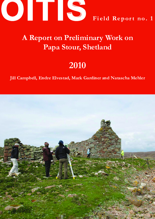
Front cover illustration: Surveying at Hamnavoe
Jill Campbell, School of Geography, Archaeology, and Palaeoecology, Queen´s University Belfast (jcampbell66@qub.ac.uk)
Endre Elvestad, Stavanger Sjøfartsmuseet (endre.elvestad@stavanger.museum.no)
Dr Mark Gardiner, School of Geography, Archaeology, and Palaeoecology, Queen´s University Belfast (m.gardiner@qub.ac.uk)
Dr Natascha Mehler, Institut für Ur- und Frühgeschichte, Universität Wien (natascha.mehler@univie.ac.at)
2
�Contents
Introduction
4
Aims and methods
4
Historical evidence
4
Place-names
5
Oral tradition
5
Hamna Voe
Archaeology
Maritime background: Hamna Voe
Maritime background: Culla Voe
Summary of maritime archaeology
Site Survey
Hamnavoe
Description of building
Interpretation of the building sequence
Tulloch´s Böd, Culla Voe
Description of building
Interpretation of building sequence
5
6
6
8
8
9
9
9
11
13
13
14
Conclusion
15
Acknowledgements
16
References
16
3
�Introduction
This is a report on preliminary visits to Papa Stour
undertaken in May 2010 as part of a wider ield survey of Hanseatic trading sites in Shetland. The visits
were intended to evaluate the evidence for the survival of remains relating to Hanseatic trade on Papa
Stour. The importance of the island as a base for
German traders and as a site of imported goods was
indicated by the only major excavation to have taken
place on the island, at The Biggings, where substantial quantities of imported pottery were found.
Those include Paffrath Ware of the 12th and early
13th centuries, north German and South Scandinavia redwares and stonewares from Lower Saxony
(Crawford and Ballin Smith 1999, 156-67). Pottery
was not a main item of trade, but provides some indication of trading activity on the island. While The
Biggings relects the pottery at a consumer site, no
trading sites had been excavated in Shetland before
the start of work of the OITIS project.
Papa Stour lies west of mainland Shetland and
would have been passed by ships travelling along
that coast of the island group. It has long served
as both as a base for ishing and as a centre for agriculture. It has a number of voes (or bays) which
have been used as ishing bases at various times,
but in the late 19th century the main activity was
concentrated around West Voe where William Adie
constructed a pier. The island is sharply divided into
two halves. The better land lies to the east of Hill
Dyke, while the land to the west is extremely poor,
in places lacking any soil at all. The sites surveyed in
the preliminary work both lie on the western half.
Aims and methods
The visits undertaken in May 2010 were to evaluate
the potential of the island for future study of Hanseatic trade. The initial survey looked particularly at
the buildings which, though it was apparent from
irst inspection were not evidently 16th or 17th century in date, might include fabric of buildings from
that period. The survey also considered the surroundings of the buildings where other evidence of
Hanseatic trade might survive, and a more general
survey was undertaken of the inlets as anchorages
and for landing boats. The work on the maritime
archaeology was undertaken by Endre Elvestad.
Two buildings were recorded photogrammetrically and an analytical study was made of the building fabric. The buildings were photographed with
targets which surveyed using a Leica total station.
The photographs were corrected to create orthophotos using PhoToPlan and the fabric of selected
4
elevations drawn up in AutoCAD by Jill Campbell.
The immediate surroundings of the buildings were
also surveyed using the total station, drawn up in
AutoCAD by Mark Gardiner and these plans were
correlated with satellite photographs which were
brought into AutoCAD. This allowed a record of
wider area to be generated. The plans for this report
have been drawn up by Libby Mulqueeney from the
CAD surveys.
Historical evidence
This report considers two areas which were examined in the preliminary survey: Hamnavoe farm in
Hamna Voe and Tulloch’s Böd in Culla Voe. Both
settlements lie on the western half of the island and
beyond the Town Dike which encloses the better land
of the island. Crawford and Ballin Smith (1999, 40)
suggest that a settlement was established at Hamnavoe for commerce rather than for agriculture because
the soils are fairly poor, although the anchorage is the
safest in the island.
The historical evidence for the early presence of
German merchants on Papa Stour is better than for
most other places in Shetland. A deed of 1452 records
the sale of land on the island by Henrik Soost who
was evidently a Lübeck merchant resident in Bergen
in the mid-15th century (SD 1, no. 22). Crawford and
Ballin Smith (1999, 39) have speculated that he might
have acquired the land in default of payment of debts
by a Shetlander, or because it was in some other way
connected with trade.
Rolf Hammel-Kiesow at the Archiv der Hansestadt Lübeck has provided the following information:
during 1441 and 1473 the Oberstadtbücher of Lübeck
mention several times a Hinricus Soost / Hinricus
Susato / Hinricus Soest, but it is uncertain if this is
all the same person. He was most likely a Bergenfarer
and Soost is reported to have bought and sold some
houses in Lübeck. Unfortunately, the sources do not
mention any journeys made by him to Shetland.
A list of trading sites in Shetland of 1563 mentions the harbour of “Sunte Mangens Eilandt“ and
the harbour in “Papposunt” (SD 1, no. 140). The
identiication of these poses some problems. The
irst, St Magnus Island, is the older name for Papa
Stour. The second is Papa Sound which might be
the sound to the south of Papa Stour and therefore
the harbour might be on the mainland, perhaps near
Sandness as Brian Smith has suggested (Crawford
and Ballin Smith 1999, 39n). Alternatively, it may be
a reference to West Voe on which Papil is situated
and where there were certainly “Dutchmen” in the
1650s (Smith 1984, 14). The reference to “Dutch-
�men” almost certainly refers to Germans. It is clear
from written evidence that Shetlanders could or
did not distinguish a Dutch from a German trader,
confusingly calling German merchants “Dutch” (e. g.
Mehler 2009, 95f.).
We know little more about the presence of
German merchants on Papa Stour until 1602
when Orne Mair, a Hamburg merchant at Gluss
in Northmavine, sought the removal of Simon
“Harratstay”, a Hamburg merchant from Gunnister
Voe, Northmavine, to Papa Stour on the grounds
that there was too much competition for the supplies
of ish (Court Book of Shetland 1602-1604, 16-17, 9394). Simon Harriestede, elder and younger, can be
traced in the Hamburg records sailing to Shetland
from 1588 when the former was paying for goods
taken in the ship of Hans Meier (possibly the same
person as Orne Mair mentioned above). Simon
Harriestede – father and son – appear to have sailed
most years to Shetland until 1626. Whether they
continued to be based at Gunnister for long after
1602 is uncertain. However, by 1626 the younger
Simon Harriestede seems to have transferred his
activities to Papa Stour (see also Gardiner and Mehler
2010). It is recorded exceptionally that year that the
Jacob Surman’s ship, in which he had an interest,
had gone to “Papoien” (Staatsarchiv Hamburg 1988;
see also Smith 1984, 16). In 1603 there is a record
of an affray at the Dutch booth and “frie coupsta” of
Papa when two men attacked another (Court Book
of Shetland 1602-1604, 77). Papa Stour continued to
be used as a trading base by Germans until the later
17th century (Smith 1984, 14). Hibbert writing in
1822 commented that The kirk, a neat structure, and not
very old, is situated near the centre of the island. A merchant
from Holland, gave to it, about a century ago, a bell, a silver
cup for the administration of the sacrament, and a curious
copper bason for holding water in baptisms, in which appeared
several religious emblems (Hibbert 1822, 552-53).
Place-names
George Peterson drew our attention to the placename of the rock, “Herrit’s Baa” near the mouth of
Culla Voe, which he tentatively connects with Simon Harriestede who certainly was present in Papa
Stour. The other place-name of note is “Dutch Loch”
which lies to the north of Hamna Voe. There is a
further place-name of interest, not discussed by Peterson, “da Dutch Loch” which lies between West Voe
and Housa Voe and may be related to German merchants operating from one or both places.
Oral tradition
Hamna Voe
George Peterson discussed the places associated
with German or “Dutch” traders on our visit. We
have augmented our record of his comments with
the account he gives in his book, The Coastal Placenames of Papa Stour (Peterson 1993) which incorporates both oral tradition and historical research.
He suggested to us on our visits that the Fore
Wick and Housa Voe on the south and east of the
island were poor harbours because the sand in the
bays provides insecure hold for the anchors of
ships. The tradition is that the main harbours used
by the German merchants were Hamna Voe in the
south and Culla Voe in the north. The site on Hamna Voe may have been the farm at Hamnavoe which
was occupied by Gabrielson in 1671 when a list of
Mowat tenants was drawn up. It was refurbished in
the 1850s, but may have been the site of a Hanse
building which had been improved.
Peterson (1993, 13) has traced the history of the
farm in his book. From about the 1720s it was occupied by the Henry family – Thomas, his son James
and his son Robert. It was later used by Laurence
Fraser who had served in the Royal Navy. After returning to Shetland in about 1800 he set up as a
general merchant at Hamnavoe. The Fraser family
were still occupying the house in 1851, but before
1856 it had been bought by the irm of Thomas M.
Adie who used the house as a shop and ishing station. Their agent on Papa Stour was Hugh Hughson
who was succeeded in 1871 by his son, also called
Hugh. The shop was closed in 1898, but the building continued to be occupied until 1904 by William
Johnston and later by his daughter Helen Johnston
and her husband James Nelson.
Hamna Voe is not an ideal harbour. It has a depth
of water of four fathoms in the harbour, but only
two fathoms at the entrance at low tide (see further
below). Nevertheless, it was used by German traders
and it is said that the Dutch Loch was used to supply water for the ships anchored in the voe (Illus. 1)
Culla Voe
The other voe said to be used by German traders
was Culla Voe in the north of the island. The site
occupied by them is said to have been at Tulloch’s
Böd. The name comes from Gilbert Tulloch who
came from Northmavine and used the site in the
1830s as a shop. His trade was undercut by the
Adies’ operation at Hamna Voe established in the
early 1850s and Tulloch subsequently moved to
Scalloway (Peterson 1993, 40-41).
5
�Illus. 1 Hamna Voe looking south-west to the farm (centre middle distance) and towards the mouth of voe.
Tiptans Skerry is just visible in the middle of the voe near the mouth.
It has already been noted that the rock off Point
Lodge near the entrance of the voe is known as
Herrit’s Baa (Peterson 1993, 40).
Archaeology
Maritime background: Hamna Voe
Blaeu’s map of Shetland dated to 1654 gives the
place-names, “Hana Vo” [Hamna Voe], “Midgairth”,
“Goird” and “Housa”. The same names are repeated
by Johannes van Keulen in his map published in Amsterdam in 1730. The map by Herman Moll of 1745
simply repeats the irst and third of these names.
The anchorages at Papa Stour were not marked on
nautical maps before the later 18th century. Thomas Preston’s New Hydrographic Survey of the Island of
Shetland published in 1781 shows Hamna Voe as the
only anchorage and noted “8 feetwater going in”. It recorded that “Olis Voe”, Ollie’s Voe or West Voe was
for small vessels. The map of the Depot General de la
Marine of 1803, evidently based on Preston’s survey,
also marks Hamna Voe by an anchor, indicating a
safe anchorage.
Another map from 1807, the Admiralty Chart of
Shetland similarly marks Hamna Voe as an anchorage.
The North Sea Pilot from 1827 gives the following description of Papa Stour: off the former lies Papa Stour, a
large rocky island, steep-to in every part; several small Voes
of 7 and 8 feet water are on its eastern side, and one called
Hamna Voe on its western side; there is anchorage within the
latter in 8 feet water. The North Sea Pilot from 1847 adds
that In Housa Voe, Papa Stour, ships of moderate burden
may ind occasional anchorage, or wait for the tide to the southward. According to a later North Sea Pilot the entrance
to Hamna Voe was dificult and the anchorage was
mainly used by small sloops and boats.
6
The place-name Hamna Voe derives from the
Old Norse “Höfn” denoting a harbour and “Vágr”
denoting a bay. An interesting aspect of bays named
“Hamna Voe” in Shetland, is that they seem to have
similar topographical features. The North Sea Pilot
(1847, 33) states that the place-name is often found
in basin-formed bays with a narrow entrance. Hamna Voe on Papa Stour has these characteristics. The
inlet is obstructed by Tiptans Skerry, a shallow bank
that divides the inlet into two possible entrances.
There are several cairns surrounding the bay.
On the highest point of the Hill of Feilie facing
the ocean towards west and south, there is a burial
mound with a newer cairn in the middle (Illus. 2).
In the eastern end of the bay there are two burial
mounds with newer cairns in the middle and several
other stone structures nearby. The protected bay
surrounded by burial mounds intended to be seen
from the waterways, indicates that the anchorage
was frequented in prehistoric periods. The connection between burial mounds and the sea routes is
exempliied in the following quote from Beowulf:
The Geats built a mound then, in ten days, high and broad
on the hill, a beacon for the warrior widely seen by sailors.
Many meads are recorded in Shetland. A mead is
a term derived from Old Norse, “mið”, that is a navigational device made by a straight sightline through
two ixed points. The meads were used to ind an
exact position on ishing grounds or a safe line into
anchorages or through fairways free from sunken
rocks or skerries (Melchers 2005).
It is interesting that the cairns surrounding Hamna Voe seem to have been used in a similar navigational system. The cairn at the top of Hill of Feilie
might have been used as a landmark, signifying the
location of the harbour from a certain distance at
sea. One of the cairns on the eastern ridge was used
�Illus. 2 The cairn at Hill of Feilie.
Illus. 3 The cairn that might serve as a mead.
in a mead, “Cairn over Yellow Hammer”, meaning a
straight line from the cairn through Yellow Hammer, that is a cliff close to Tiptans Skerry. The mead
provides a safe entrance to Hamna Voe between
the Tiptans Skerry and the southern shoreline.
The meads used in navigation have very long traditions, and the mead at Hamna Voe is dificult to
date (Illus. 3).
The larger collection of noosts (the Shetland
term for boat shelters) on the southern shore of the
bay indicates that the Voe was used until recently
(Illus. 4, 5), and the mead might have been used by
the locals. On the other hand it is likely that the need
for a precise navigational system must be greater
for foreign seafarers that did not have the precise
knowledge of the local topography. It is therefore
possible that the mead also was used by Hanseatic
merchants in navigation towards Hamna Voe.
In addition to the noosts and cairns, another recorded maritime structure was a pier close to the settlement of Hamnavoe (see also below; Illus. 6). The
pier is quite eroded and it was dificult to determine
the original extent. Since there was no other structures related to it, such as noosts or cleared landing
places, the pier might have been used for loading
and unloading goods, not necessarily by ships, but
by smaller vessels, because the water depths outside
the pier seems to shallow for larger vessels. The
position of the pier is not accidental. The place is
well protected against swell from the sea and there
is a short distance to the deeper part of the bay. A
position further towards north-west would not pro-
Illus. 4 Noosts in Hamna Voe.
7
�vide suficient sailing depth, even for smaller boats,
and the shore south of the settlement is exposed to
wind and waves from south-west.
The place-name Dutch Loch to the north of
Hamna Voe is a good indication of Hanseatic maritime activity. Supplies of fresh water were necessary
for offshore sailing ships, and an important attribute
to a high quality anchorage. The naming of the lake
after the German merchants indicates that the lake
was an important source of water for trading ships,
and perhaps not only for those trading in Hamna Voe.
Illus. 5 Noosts shown on the east side of Hamna
Voe on the Ordnance Survey 25-inch map surveyed
1877.
Illus. 6. The pier in Hamna Voe.
Illus. 7 Noosts in Culla Voe.
8
Maritime background: Culla Voe
In Culla Voe there is another site with a possible
booth. Culla Voe is not described in the pilots or
marked on older sea maps. The reason is probably
a dificult entrance, shallow water in the protected
part and the possibility of swell with northerly
winds. Despite that, there are many remains of old
noosts on the south-east shore in the bottom of
the bay (Illus. 7). The noosts seem to be of different generations with newer and smaller ones inside
older and larger ones. The noosts might belong to
different farms from those in Hamna Voe, but it is
also possible that the same farm had noosts or landing places in alternative bays that made it easier to
land a boat under different weather condition.
There were no visible structures on the shore
close to the Tulloch’s Böd in Culla Voe (Illus. 8).
The shore close to the houses is steep and stony, but
some 100 metres to the south there is a lat beach
with gravel that is excellent for landing boats. There
were no remains of seamarks or cairns in the entrance to Culla Voe.
Summary of maritime archaeology
As the pilots and the remains of noosts indicate,
both Hamna Voe and Culla Voe are good harbours
for smaller and rowed boats. The inner part of the
bays, where we ind the noosts, are well protected
from waves from any direction. They are probably
the part of a tradition going back to the prehistoric
period of placing the noosts at the same place. For
larger vessels these anchorages are dificult. The
narrow and exposed inlets make navigation into the
bays problematic, especially during contrary winds.
Leaving the anchorage might be dificult for the
same reasons. As stated in the pilots the bays are
quite shallow with a water depth around 8 feet or
2.6 metres, that is somewhat shallow for larger trading vessels. This aspect might indicate that the ships
belonging to the Hanseatic merchants were not of
the largest.
�Illus. 8 The settlement in Culla Voe. The possible landing places are to the right in the picture.
Site Survey
Hamnavoe
The preliminary survey concentrated on the two
areas drawn to our attention by George Peterson –
Hamna Voe and Culla Voe. The rooless and now
ruinous farmhouse at Hamnavoe is said to have
been on the site of a booth occupied by “Dutch”
merchants. The house was last occupied in 1909
(Davidson and Carter 1998, 831) (Illus. 9 and 10).
Description of building
The farmhouse at Hamna Voe is largely of 19thcentury date: the window and door lintels have
drilled quarrying-holes made for splitting the stone.
If we take it that the building is aligned north-south,
then the east (or front) wall is largely of single-period construction with a central doorway and two
windows set symmetrically either side (Illus. 11).
The wall is built of coursed stone roughly squared.
The windows both have internally splayed jambs
Illus. 9 Hamnavoe looking south-east at the rear of the farm and towards the voe. The farmhouse is on the
left and an byre in the centre.
9
�on the sides adjoining the gable walls. The window
jambs incorporate brick in their construction.
The front wall is bonded to the north and south
gables. The south gable wall is similarly built of
squared, coursed stone with large side-alternate
quoins. On the inner face the south gable incorporates hearths at ground and irst loor level. The
jambs of the lower hearth are of stone, but those of
the upper hearth are entirely built of brick.
The north gable is partly ruinous and the lower
part is buried internally under rubble. There is some
evidence that it too incorporated a hearth, certainly
at ground-loor level. There are traces on the external face of the line of a shallow-pitch roof of
adjoining building, probably of recent date.
The west wall has a single doorway which has in
recent years been adapted to take a feeding trough.
The wall is bonded at the ends to the gables, but
there are clear breaks in the coursing which suggest
it pre-dates the 19th-century building activity. The
break at the south end of the west wall is marked by
a crack which has been patched at some date (Illus.
12). A similar break in coursing, though not marked
by a structural failure, is evident close to the quoins
at the north end of the same wall. There is also clear
evidence of patching around the doorway, suggesting that this was a later opening. It seems to have
been cut through the site of a former window, the
south jamb of which can be traced on the internal
face, though not on the external face. In summary,
the west wall clearly belongs to an earlier structure
which was evidently ruinous or was knocked down
when the building was reconstructed and re-ordered
in the 19th century.
Illus. 10 Hamna Voe from the irst-edition six-inch
Ordnance Survey map, surveyed 1878. Hamnavoe
farm and Dutch Loch are also shown.
The upper part of the side walls of the building
above the heads of the windows and door is marked
by a clear change in fabric when the walls were raised
and joists inserted to form an upper storey. It must
have been at this time that the upper ireplace was
inserted (Illus. 13).
Illus. 11 Front (east) wall of Hamnavoe farmhouse looking west.
10
�Illus. 12 South end of exterior of west wall showing
break in fabric between the wall and gable end.
Illus. 13 Inside of west wall looking west. There is a
clear distinction between the larger stones below the
joist holes and the stones above.
Interpretation of the building sequence
There are three clear phases marked by the building work. The west wall of the house is from the
earliest phase. The character of this building is uncertain, except that it seems to have had a window
which survives in part in the later doorway. At some
point in the 19th century the building was largely
reconstructed to form a substantial house with large
windows divided into two by a central passageway.
The height of the building was raised in the third
phase when an upper storey was added to occupy
the roof space.
We can try to tie the structural development of
the building into the history of the farm. The substantial investment in re-building the farmhouse
with quarried lintels in Phase 2 seems most likely to
belong to the possession of the property by Thomas
M. Adie who would have had the capital to invest in
such work. This would agree with the oral tradition
given to us by George Peterson. A mid-19th century
date is not out of keeping with the building. Furthermore, the 1846 map of Papa Stour (SRO RHP
83385, reproduced in Crawford 1999, endpapers)
appears to show the farmhouse orientated eastwest, in contrast to the present north-south alignment, suggesting that the re-building took place after that time. A building with north-south alignment
is shown on the irst-edition six-inch Ordnance Survey map surveyed 1878. The earlier wall incorporated into this house is of uncertain date. It could
belong to the occupation by the Fraser family in the
early 19th century or might be earlier. Equally, we
cannot date the third phase when the height of the
building was raised and an extra storey inserted.
The house is surrounded by a number of other
ruinous buildings, which all appear to be farm buildings with the possible exception of the building to
the north-east which adjoins the beach (Illus. 14).
This may have been constructed to store ish. Behind
the house is an enclosed ield which is higher than
the surrounding land and was evidently reserved for
growing fodder or perhaps vegetables. The rectangular ield is enclosed by a slight wall, but there are
traces of an earlier curved boundary which partly coincides with the later, but encloses a larger area. This
boundary bank passes beneath the building on the
foreshore and is therefore earlier than it.
There are earthwork traces of a further building
on the shingle bank to the east of the house. This
was probably constructed in connection with the
use of the foreshore as an ayre to dry ish. Traces of
a stone pier were recorded beyond this.
Illus. 14 Survey of buildings and earthworks at
Hamnavoe.
11
�Illus. 15 Culla Voe looking north. Tulloch’s Böd is in the mid-distance with a sheepfold adjoining it to the right.
There is a further sheepfold in the foreground.
Illus. 16 Culla Voe from the irst-edition six-inch Ordnance Survey map, surveyed 1877, with Tulloch’s Böd.
12
Illus. 17 Survey of buildings and surroundings of
Tulloch’s Böd.
�Illus. 18 Photogrammetric model of the walls of Tulloch´s Böd (in metres).
Tulloch’s Böd, Culla Voe
Peterson (1993, 40) notes that there are three beaches in Culla Voe – East Beach, the Mid Beach and
the Beach of Tulloch’s Böd. Around these cluster
ruined buildings which served as ishermen’s lodges
in the past (Illus. 15, 16 and 17). Tulloch’s Böd lies at
the north end of the beach to which it gives its name
and adjoins a sheepfold which lies immediately to
the north-east. The building is a single-storey croft
of at least two phases. It is currently rooless and the
east wall has been almost entirely removed. It was
used latterly as a sheepfold. A number of trees have
been planted in the interior in recent years.
Description of building
The front (south) wall has a single unsplayed window, 0.48m wide, to the west of the doorway (Illus. 18, 19, 20 and 21). It is now blocked. When
clearing the window for photography fragments of
glass were discovered which are discussed further
below. There is a possible window to the east of the
doorway, though the evidence for it is uncertain. The
doorway was initially constructed 1.4m wide, but was
later reduced to 0.75m by adding masonry to the west
side. The blocking runs through and is integral with
the thickening of the wall on the interior (see below).
The lower part of the masonry of the front wall on
the west of the doorway is divided into lifts (see Illus.
22). This is not apparent on the upper part of the wall
above the height of the window head, which appears
to have been built with less care, or to the east of
the doorway. The interior face of this wall has been
added to the outer face at a later stage to create a wall
about 1.3m wide in contrast to the north wall which
is only 0.7m wide. However, the surviving top surface
of the wall does not relect this, suggesting that the
upper part of both the exterior and interior elements
of the wall have been rebuilt at that height. There are
traces of lifts low in the exterior face of the wall to
the east of the doorway.
13
�Illus. 19 South (front) wall of Tulloch’s Böd.
Illus. 20 North (rear) wall of Tulloch’s Böd.
The gable wall on the west of the building contains a hearth. The lower part of the wall is marked
by the use of large water-rounded stones and a construction in lifts at the same level of those on the
south wall (Illus. 20). No lifts are evident in the upper part of the wall. There is a hearth in the interior
face of the wall, which was originally set centrally,
but is now closer to the interior of the south wall
because of the additional band of masonry added
on that side.
The survival of the north wall is poor, particularly
towards the east end (see Illus. 20). There are no
openings in this wall face. There are traces of lifts in
the masonry which, at least on the west side, match
those in the west gable wall.
Only a few stones survive to mark the position
of the east wall.
The present crosswall is related to a late use of the
building as a sheepfold. The building must have either become ruinous or had structural problems as
the south face certainly and possibly the west gable
end were reduced in height. In Phase 2 an inner wall
was added to the south almost doubling its width,
the doorway reduced in width, the window blocked
and the wall rebuilt (Illus. 22).
Interpretation of building sequence
The lifts suggest that the lower part of the south,
west and north walls of the building, and also the
window on the south wall and wider doorway belong to a single phase of construction. The building
was originally constructed about 11m long with a
doorway set towards the centre and hearth in the
west wall. There were no certain internal divisions.
14
Illus. 21 West (gable) wall of Tulloch’s Böd.
�In its irst phase the building clearly had a domestic use marked by the presence of a hearth, but may
also have served a commercial function which is implied by the unusual width of the doorway. The best
evidence for the date of this phase is given by fragments of glass found in the window opening. These
must precede the second phase when the window
was blocked. Three types of glass are clearly distinguishable from the fragments recovered:
i) three pieces; heavily weathered; two of similar widths and one slightly thinner; one piece with
grozed edges
ii) two conjoining piece with green tinge produced
by the use of potash from kelp; one has grozed edges
iii) three small, clear pieces
Dr Hugh Wilmott (Shefield) who examined
these suggests that types i) and ii) are 18th-century
or earlier, and type iii) is 19th century. The presence
of glass of this period is notable because even in
the mid-19th century many small houses in Shetland
would have had no window openings in the wall.
When Tulloch’s Böd was renovated, the window
was thought unnecessary and blocked. The glass
therefore indicates that the irst phase of the building is 18th century or earlier, and also implies that it
is unlikely to have been a simple croft. The different
dates and types must relect breakages and replacement of individual panes, and also continuing purchase of glass. If it was a merchant’s store, something implied by the width of the doorway, then the
owner may well have had access to glass from trading activities, allowing the import from England or
Germany. (We owe most of the discussion in this
paragraph to Ian Tait, Shetland Museum).
The building had become ruinous by the time
it was renovated in the second phase of construction work. The work involved reducing the walls
in height and then rebuilding them, as well as constructing an inner wall to support the front (south)
wall which must have been deemed to be structurally unsound. It may be signiicant that the south
wall was not totally taken down to ground level and
rebuilt, although such work would hardly have been
more labour than the construction of an inner face
to the wall which doubled its width and reduced the
internal loor area. The roof must have been removed during this work as the upper part of the
walls, at least on the south side and probably in the
west gable were rebuilt. The reduction in the width
Illus. 22 South wall of Tulloch’s Böd showing the
contrast in masonry between the coursed west side
(background) and the reduced door and east jamb
(foreground).
of the door implies that the restored building served
a different function, while the closing of the window suggests that its status may have changed. This
second phase cannot date to before the 19th century, as glass of that period was found in the irstphase window.
It is not simple to relate the building history of
Tulloch’s Böd to the historical evidence. It is quite
possible that in the 1830s Gilbert Tulloch took over
an already existing trading building dating to the
18th century or earlier. After he left, the building may
have fallen into disrepair and was subsequently renovated to serve as a ishing booth. This interpretation
is not the only one possible of the evidence.
There are no further buildings immediately adjoining Tulloch’s Böd, although there are a number
of other ishing booths around Culla Voe. A stoneedged platform to the west of the building may be
the base of a fuel stack
Conclusions
None of the surveyed standing structures certainly
belongs to the period of German trade, but evidence of earlier structures have been found at both
Hamnavoe and Tulloch’s Böd. The wide doorway
and the presence of 18th-century or earlier glass at
Tulloch’s Böd has suggested that the building may
be of some signiicance for the study of trade in
Papa Stour.
15
�Acknowledgements
The work in Shetland was undertaken in conjunction with Stavanger Museum. The 2010 season was
funded by grants from the Deutsche Forschungsgemeinschaft and the Römisch-Germanische Kommission of the German Archaeological Institute.
Judith Benedix, Ronny Weßling (both Vienna),
Dr Nigel Melton (Bradford) and Lindsay Poole (Belfast) were helping us in the ield and we are most
grateful to them.
We are indebted to Dr Barbara Crawford of the
University of St Andrews who helped us in our visits to Papa Stour and supplied us with a copy of The
Coastal Place-names of Papa Stour, and to Jane Puckey
and George Peterson who met us on the island and
gave us the beneit of their considerable local knowledge. Dr Ian Tait of Shetland Museum, Brian Smith
of the Shetland Archives, Dr Rolf Hammel-Kiesow
of the Archiv der Hansestadt Lübeck and Dr Hugh
Wilmott of the University of Shefield all provided
valuable information.
References
Primary Sources
Court Book of Shetland 1602-1604, ed. G. Donaldson
(1958). Edinburgh.
SD1: Shetland Documents 1580-1611, ed. J. H. Ballantyne and B. Smith (1994). Lerwick, Shetland.
Staatsarchiv Hamburg (1988) Verzeichis der Hamburger Shetland-(Hitland-)Fahrer 1547-1646 (Typescript).
Hamburg: Staatsarchiv Hamburg.
Gardiner, M. and Mehler, N (2010), The Hanseatic
trading site at Gunnister Voe, Shetland, Post-Medieval
Archaeology 44/2 (in press).
Hibbert, S. (1822) A Description of the Shetland Islands,
Comprising an Account of their Geology, Scenery, Antiquities, and Superstitions. Edinburgh.
Mehler, N. (2009), The Perception and Interpretation of Hanseatic Material Culture in the North Atlantic: Problems and Suggestions, Journal of the North
Atlantic Special Volume 1, 89-108.
Secondary literature
Crawford, B. E. and Ballin Smith, B. (1999) The Biggings, Papa Stour, Shetland: The History and Excavation
of a Royal Norwegian Farm. Society of Antiquaries of
Scotland Monograph Series 15, Edinburgh.
Davidson, D. A. and Carter, S. P. (1998) Micromorphological evidence of past agricultural practices in
cultivated soils: the impact of a traditional agricultural system on soils in Papa Stour, Shetland, Journal
of Archaeological Science 25, 827-38.
16
Melchers, G. (2005) Shetland mead names – some
notes on their structure and character, in P. Gammeltoft, C. Hough and D. Waugh (eds), Cultural Contacts in the North Atlantic Region: The Evidence of Names,
157-72. Lerwick, Shetland.
Peterson, G. P. S. (1993) The Coastal Place-Names of
Papa Stour. Brae, Shetland.
Smith, H. D. (1984) Shetland Life and Trade 15501914. Edinburgh.
�
 Natascha Mehler
 Jill Campbell
 Mark Gardiner