XVII International Congress of Classical Archaeology, Roma 22-26 Sept. 2008
Session: Portus, Ostia and the Ports of the Roman Mediterranean. Contributions from Archaeology and History
Christophe Morhange, Nick Marriner
Mind the (stratigraphic) gap: Roman dredging in ancient Mediterranean harbours
Introduction
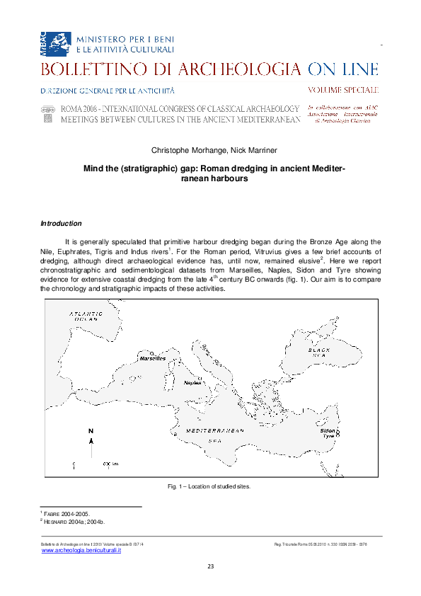
It is generally speculated that primitive harbour dredging began during the Bronze Age along the
1
Nile, Euphrates, Tigris and Indus rivers . For the Roman period, Vitruvius gives a few brief accounts of
2
dredging, although direct archaeological evidence has, until now, remained elusive . Here we report
chronostratigraphic and sedimentological datasets from Marseilles, Naples, Sidon and Tyre showing
th
evidence for extensive coastal dredging from the late 4 century BC onwards (fig. 1). Our aim is to compare
the chronology and stratigraphic impacts of these activities.
Fig. 1 – Location of studied sites.
1
2
FABRE 2004-2005.
HESNARD 2004a; 2004b.
!! "##$
www.archeologia.beniculturali.it
23
!% &
'
�C. Morhange, N. Marriner - Mind the (stratigraphic) gap: Roman dredging in ancient Mediterranean harbours
In recent years, a number of studies have shown ancient harbours to be rich time-series of human3
environment interaction since the Bronze Age . Sediment base-level accumulation in ports is the terminal
transport pathway for fine-grained sediments in the coastal zone. Understanding how sediment accumulation
rates have varied in space and time has helped to shed light on regional sediment transport conveyors,
depocentres and anthropogenic impacts. Societies have had a significant role to play in coastal
sedimentation, where ports act like artificial sinks accumulating thick sequences of fine-grained sediments
over many millennia.
Methods
Dredging has not readily been assimilated in the archaeological literature until now and we present
three types of data: (1) fossilised taluses; (2) chronological inversions and (3) chronostratigraphic gaps. We
propose to interpret these stratigraphic aberrations, most often ignored or rejected, as dredging impacts.
Marseilles and Naples have both undergone extensive excavations, with specialists from numerous
disciplines contributing to the projects. Multidisciplinary work at Marseilles has been underway since the
4
early 1990s and extensive datasets now exist for the site ; in a similar research vein, work on Naples’
5
Metropolitan line has unearthed significant areas of the city’s ancient harbour . Large stratigraphic sections
have been exposed at both sites, with field measurements and subsequent laboratory analyses constrained
by ceramic dates.
At Tyre and Sidon, geoarchaeological research has led to the extraction of 40 cores that have
6
facilitated a chronostratigraphic reconstruction of basin silting .
In this paper we present radiocarbon dates plotted against mean sea level. The field and laboratory
7
methods employed have already been extensively described elsewhere ; multi-proxy data (macrofauna,
microfauna, sedimentology) allow us to precisely reconstruct the harbour stratigraphies and basin evolution
through time.
Results and discussion
The new datasets allow three questions to be resolved:
(i) Why dredge?
Two variables can be used to explain the long-term viability of ancient harbours: (1) relative sea-level
changes; and (2) sediment supply and its role in modifying the draught depth. Since relative sea-level
changes have been relatively modest on stable Mediterranean coasts during the past 6000 years (within 2-3
8
m of present), this variable has been only minor in explaining coastal deformation . On centennial timescales
continued silting up induced a concomitant shortening of the water column (i.e. accommodation space
reduction and subsequent coastal progradation). On short decadal timescales de-silting infrastructure, such
as sluice gates, vaulted moles and channels, partially attenuated the problem but in the long term these
9
appear to have been relatively ineffective . In light of this, repeated dredging was the only means of
maintaining a viable draught depth and ensuring long-term harbour viability.
3
REINHARDT ET AL. 1998; MORHANGE ET AL. 2000; KRAFT ET AL. 2003.
HESNARD 1994; MORHANGE 1994.
5
DE CARO and GIAMPAOLA 2004.
6
MARRINER ET AL. 2006a; 2006b; MARRINER 2007.
7
REINHARDT and RABAN 1999; MARRINER and MORHANGE 2007.
8
LABOREL ET AL. 1994; LAMBECK and PURCELL 2005; PIRAZZOLI 2005.
9
BLACKMAN 1982a; 1982b.
4
!! "##$
www.archeologia.beniculturali.it
24
!% &
'
�XVII International Congress of Classical Archaeology, Roma 22-26 Sept. 2008
Session: Portus, Ostia and the Ports of the Roman Mediterranean. Contributions from Archaeology and History
Fig. 2 – Progradation of Marseilles’ northern harbour coastline since the Neolithic.
The Greek to Roman period coastlines were studied in section during excavations at the Jules Verne site (centre)
(photo CCJ/CNRS).
(ii) When?
Marseilles
Archaeological excavations at Marseilles have uncovered around 8000 m² of the city’s buried port
(fig. 2). Litho- and biostratigraphical studies elucidate a long history of human impacts stretching back to the
10
late Neolithic period . Rapid shoreline progradation is recorded following the foundation of the colony in 600
st
BC. During the 1 century BC, after over 500 years of Phocaean rule, the demise and fall of the Greek city is
11
translated by wide-reaching changes in the spatial organisation of the harbour area . Although dredging
rd
phases are recorded from the 3 century BC onwards, the most extensive enterprises were undertaken
st
during the 1 century AD, at which time huge tracts of Greek sediment were extracted down to a hard midden
10
11
MORHANGE ET AL. 2003.
HERMARY ET AL. 1999.
!! "##$
www.archeologia.beniculturali.it
25
!% &
'
�C. Morhange, N. Marriner - Mind the (stratigraphic) gap: Roman dredging in ancient Mediterranean harbours
Fig. 3 – Example of a scouring talus at Marseilles.
The highly cohesive nature of the harbour muds (>90 % silts) means these have been well-preserved in the stratigraphic record.
12
layer of oysters (fig. 3) . Notwithstanding the creation of
artificial accommodation space, this rapidly infilled and
necessitated regular intervention. Repeated dredging
phases are evidenced up until late Roman times, after
which time the basin margins were completely silted up
(fig. 2). Despite this partial loss of accommodation space
it is interesting to note that the seaport is still in use
today, more than 2500 years after its foundation.
Naples
In Naples, recent excavations at the Piazza
th
Municipio show the absence of pre-4 century BC layers
th
nd
due to extensive dredging between the 4 and 2
13
centuries BC . Unprecedented traces 165 to 180 cm
wide and 30 to 50 cm deep attest to powerful dredging
technology that scoured into the volcanic tufa
substratum, completely reshaping the harbour bottom
(figs. 4 and 5).
Fig. 4 – (A-B) Tufa substratum scouring marks resulting from Roman
dredging of the harbour bottom at Piazza Municipio, Naples
(photo Soprintendenza Speciale per i beni archeologici di Napoli e
Pompei).
12
13
HESNARD 2004a.
GIAMPAOLA ET AL. 2004; GIAMPAOLA and CARSANA 2005.
!! "##$
www.archeologia.beniculturali.it
26
!% &
'
�XVII International Congress of Classical Archaeology, Roma 22-26 Sept. 2008
Session: Portus, Ostia and the Ports of the Roman Mediterranean. Contributions from Archaeology and History
Fig. 5 – Dredging talus at Naples (Piazza
Municipio) (photo Soprintendenza Speciale
per i beni archeologici di Napoli e Pompei).
Dateable archaeological artefacts contained within the deposits
allow for a very detailed time series
of sediment fluxes, with much greater temporal resolution than traditional radiometric methods. Investigated stratigraphic sections were
rd
dated to the 3 century BC and the
th
beginning of the 6 century AD.
Calculated fluxes are concurrent
with intercentennial variability throughout this period (fig. 6). Rapid settling velocities of 17 to 20 mm/yr are
nd
recorded during the 2 century BC
st
th
and the 1 and 5 centuries AD.
Fig. 6 – Stratigraphic section from Naples harbour showing the high variability of sedimentary fluxes.
Anthropogenic impact is fundamental in explaining the harbour silting up
(photo Soprintendenza Speciale per i beni archeologici di Napoli e Pompei).
!! "##$
www.archeologia.beniculturali.it
27
!% &
'
�C. Morhange, N. Marriner - Mind the (stratigraphic) gap: Roman dredging in ancient Mediterranean harbours
st
nd
Low sedimentation fluxes of 0 to 5 mm/yr are evidenced during the 1 century BC, and the late 2 and early
th
14
5 centuries AD. The most rapid rates are consistent with data from Archaic Marseilles (20 mm/yr) , Roman
15
16
Alexandria (15 mm/yr) and Roman and Byzantine Tyre (10 mm/yr) . Three possible explanations can be
evoked for the contrasting detritic fluxes: (1) hypothetic changes in climatic conditions; (2) human agency
and changes in land use patterns, both regionally in the watershed and locally in the urban settlement; or (3)
dredging activity. We posit that anthropogenic impact is most determinant in explaining the majority of
harbour silting up, whereby the basins served as base-level waste dumps.
Phoenicia
At Sidon and Tyre, unique chronostratigraphic patterns from over forty radiocarbon dates have yielded strong evidence
in support of the dredging findings from
17
Marseilles and Naples (fig. 7) . Naturally
accreting marine bottoms are observed
between ~6000 BC and ~1500 BC, with a
pronounced sediment hiatus spanning the
Middle Bronze and Iron Ages. Rapid rates
of sediment accretion and persistent age
rd
depth inversions are evidenced from the 3
century BC onwards, inconsistent with a
natural sedimentary system. Chronostratigraphic patterns from the cities’ natural
coastlines do not manifest similar patterns,
discarding the hypothesis of radiocarbon discrepancies at the two sites.
(iii) How?
The discussed data assert that Roman dredging was a well-organized management technique, not as crude as previously speculated. Bed shear stress in coFig. 7 – Chronostratigraphic evidence for Roman and
Byzantine dredging of Sidon and Tyre’s ancient
harbours. The older radiocarbon group corresponds to
a naturally aggrading marine bottom. Quasi-absence
of a chronostratigraphic record between BC 4000 to
500, coupled with persistent age depth inversions, are
interpreted as evidence of harbour dredging. The 3 m
difference in heights is explained by post-Roman
subsidence of the Tyre block.
14
MORHANGE ET AL. 1994.
GOIRAN 2001.
16
MARRINER ET AL. 2005.
17
MARRINER and MORHANGE 2006a.
15
!! "##$
www.archeologia.beniculturali.it
28
!% &
'
�XVII International Congress of Classical Archaeology, Roma 22-26 Sept. 2008
Session: Portus, Ostia and the Ports of the Roman Mediterranean. Contributions from Archaeology and History
Fig. 8 – Shipwreck Jules Verne 3, a Roman dredging boat unearthed in Marseilles’ ancient harbour.
The vessel dates from the 1st to 2nd centuries AD. The central dredging well measures 255 cm by 50 cm
(photo CCJ/CNRS).
hesive harbour clays is considerable, and powerful vessels are inferred from the depth of scour marks and
the shear volume of sediment removed. Three dredging boats, Jules Verne 3, 4 and 5, have been unearthed
18
st
nd
and studied at Marseilles . These were abandoned at the bottom of the harbour during the 1 and 2
centuries AD. All three vessels are characterised by an open central well that is inferred to have
accommodated the dredging arm. Jules Verne 3’s reconstructed length is ~16 m and the central well
measures 255 cm long by 50 cm wide (fig. 8). Although the exact nature and mechanics of the dredging
arms are not known, dredging taluses ~30 to ~50 cm deep have been fossilised in the stratigraphic record at
Marseilles. No such dredging vessels have been unearthed in Naples, although large taluses and consistent
ceramic mixing are widespread throughout the basin. Figure 9 depicts eighteenth and nineteenth century
dredging equipment used in fluvial contexts. The nature of the fossilised dredging scours at Marseilles and
Naples leads us to hypothesise that similar methods were employed during antiquity. It seems likely that the
technique had evolved very little since this time.
Conclusion: more gaps than records?
These chronostratigraphic data, coupled with the discovery of Marseilles’ dredging wrecks, assert
that dredging was a well-organized management technique essential in sustaining the viability of
Mediterranean harbours. During the Roman period, it entrained the removal of large parts of the Bronze Age
and Iron Age archaeological records and has created an interesting paradox of quasi-archiveless ancient
harbours (i.e. Phoenician harbours without Phoenician sediments). After the late Roman period, poor port
18
POMEY 1995; POMEY and RIETH 2005.
!! "##$
www.archeologia.beniculturali.it
29
!% &
'
�C. Morhange, N. Marriner - Mind the (stratigraphic) gap: Roman dredging in ancient Mediterranean harbours
maintenance culminated in the burial of many harbours throughout the Mediterranean. These findings have
widespread implications for assessing the scope of records in coastal archaeology.
Fig. 9 – Eighteenth and nineteenth century dredging equipment used in European fluvial contexts. The vessel immediately adjacent to
the ‘pull boat’ is equipped with a removable bottom, to facilitate the dumping of dredged material at a distal location
(engraving in BILLAUD and MARGUET 2006).
Acknowledgments
The authors wish to thank A. Hesnard (CCJ/CNRS, Aix-en-Provence, director of the Jules Verne excavations
at Marseilles, France), D. Giampaola (Soprintendenza Speciale per i beni archeologici di Napoli e Pompei,
director of the Piazza Municipio excavations at Naples, Italy), V. Carsana (site manager, Piazza Municipio
excavations at Naples, Italy), the Leverhulme Trust (London, UK) and the CNRS/ECLIPSE (Paris, France).
Christophe Morhange
Centre Européen de Recherche et d’Enseignement
des Géosciences de l’Environnement
Europôle Méditerranéen de l’Arbois, BP80
F-13545, Aix-en-Provence Cedex 04
France
E-mail: morhange@cerege.fr
Nick Marriner
Centre Européen de Recherche et d’Enseignement
des Géosciences de l’Environnement
Europôle Méditerranéen de l’Arbois, BP80
F-13545, Aix-en-Provence Cedex 04
France
E-mail: marriner@cerege.fr
http://www.mediterranean-geoarchaeology.com/
!! "##$
www.archeologia.beniculturali.it
30
!% &
'
�XVII International Congress of Classical Archaeology, Roma 22-26 Sept. 2008
Session: Portus, Ostia and the Ports of the Roman Mediterranean. Contributions from Archaeology and History
Bibliography
BILLAUD Y. and MARGUET A., 2006. Historique des recherches. In A. DUMONT (ed.), Archéologie des lacs et
des cours d’eau. Paris, 9-28.
BLACKMAN D.J., 1982a. Ancient harbours in the Mediterranean, part 1. The International Journal of Nautical
Archaeology and Underwater Exploration, 11, 79-104.
BLACKMAN D.J., 1982b. Ancient harbours in the Mediterranean, part 2. The International Journal of Nautical
Archaeology and Underwater Exploration, 11, 185-211.
DE CARO S. and GIAMPAOLA D., 2004. La Metropolitana approda nel porto di Neapolis. Civiltà del
Mediterraneo, 4-5, 49-62.
FABRE D., 2004-2005. Seafaring in ancient Egypt. London.
GIAMPAOLA D. and CARSANA V., 2005. Le nuove scoperte: la città, il porto e le machine. In E. LO SARDO (ed.),
Eureka! Il genio degli antichi. Napoli, 116-122.
GIAMPAOLA D., CARSANA V. and BOETTO G., 2004. Il mare torna a bagnare Neapolis. Parte II: dalla scoperta
del porto al recupero dei relitti. L’Archeologo Subacqueo, 10 (3), 15-19.
GOIRAN J.-P., 2001. Recherches géomorphologiques dans la région littorale d’Alexandrie, Egypte, PhD
thesis, Université de Provence. Aix-en-Provence.
GOIRAN J.-P. and MORHANGE C., 2003. Géoarchéologie des ports antiques de Méditerranée. Topoi, 11, 645667.
HERMARY A., HESNARD A. and TREZINY H., 1999. Marseille grecque: la cité phocéenne (600-49 av. J.-C.).
Paris.
HESNARD A., 1994. Une nouvelle fouille du port de Marseille, Place Jules Verne. Comptes Rendus des
Académie des Inscriptions et des Belles Lettres, 1, 195-217.
HESNARD A., 2004a. Terre submergée, mer enterrée: une «géoarchéologie» du port antique de Marseille. In
L. DE MARIA and R. TURCHETTI (eds.), Evolución Paleoambiental de los puertos y fondaderos antiguos
en el Mediterráneo occidental, I Seminario ANSER, 14-15 novembre 2003, Alicante. Soveria Mannelli,
3-29.
HESNARD A., 2004b. Vitruve, De Architettura, V, 12 et le port romain de Marseille. In A. GALLINA ZEVI and R.
TURCHETTI (eds.), Le strutture dei porti e degli approdi antichi, II Seminario ANSER, 16-17 aprile
2004,Roma-Ostia Antica. Soveria Mannelli, 175-204.
KRAFT J.C., RAPP G.R., KAYAN I. and LUCE J.V., 2003. Harbor areas at ancient Troy: Sedimentology and
geomorphology complement Homer’s Iliad. Geology, 31, 163-166.
LABOREL J., MORHANGE C., LAFONT R., LE CAMPION J., LABOREL-DEGUEN F. and SARTORETTO S., 1994.
Biological evidence of sea-level rise during the last 4500 years on the rocky coasts of continental
southwestern France and Corsica. Marine Geology, 120, 203-23.
LAMBECK K. and PURCELL A., 2005. Sea-level change in the Mediterranean Sea since the LGM: model
predictions for tectonically stable areas. Quaternary Science Reviews, 24, 1969-1988.
MARRINER N., 2007. Géoarchéologie des ports antiques de Beyrouth, Sidon et Tyr: 5000 ans d'interactions
nature-culture/ Geoarchaeology of Phoenicia’s buried harbours: Beirut, Sidon and Tyre: 5000 years of
human-environment interactions, PhD thesis, Université de Provence. Aix-en-Provence.
MARRINER N., MORHANGE C., BOUDAGHER-FADEL M., BOURCIER M. and CARBONEL P., 2005. Geoarchaeology
of Tyre’s ancient northern harbour, Phoenicia. Journal of Archaeological Science, 32, 1302-1327.
MARRINER N., MORHANGE C., DOUMET-SERHAL C. and CARBONEL P., 2006a. Geoscience rediscovers
Phoenicia’s buried harbors. Geology, 3, 1-4.
MARRINER N., MORHANGE C. and DOUMET-SERHAL C., 2006b. Geoarchaeology of Sidon’s ancient harbours,
Phoenicia. Journal of Archaeological Science, 33, 1514-1535.
MARRINER N. and MORHANGE C., 2006. Geoarchaeological evidence for dredging in Tyre’s ancient harbour,
Levant. Quaternary Research, 65, 164-171.
!! "##$
www.archeologia.beniculturali.it
31
!% &
'
�C. Morhange, N. Marriner - Mind the (stratigraphic) gap: Roman dredging in ancient Mediterranean harbours
MARRINER N. and MORHANGE C., 2007. Geoscience of ancient Mediterranean harbours. Earth-Science
Reviews, 80, 137-194.
MORHANGE C., 1994. La mobilité des littoraux provençaux: Eléments d’analyse géomorphologiques, PhD
Thesis, Université de Provence. Aix-en.Provence.
MORHANGE C., GOIRAN J.-P., BOURCIER M., CARBONEL P., LE CAMPION J., ROUCHY J.-M. and YON M., 2000.
Recent Holocene paleo-environmental evolution and coastline changes of Kition, Larnaca, Cyprus,
Mediterranean Sea. Marine Geology, 26, 205-230.
MORHANGE C., BLANC F., BOURCIER M., CARBONEL P., PRONE A., SCHMITT-MERCURY S., VIVENT D. and
HESNARD A., 2003. Bio-sedimentology of the late Holocene deposits of the ancient harbor of Marseilles
(Southern France, Mediterranean sea). The Holocene, 13, 593-604.
PIRAZZOLI P.A., 2005. A review of possible eustatic, isostatic and tectonic contributions in eight late-Holocene
relative sea-level histories from the Mediterranean area. Quaternary Science Reviews, 24, 1989-2001.
POMEY P., 1995. Les épaves grecques et romaines de la place Jules Verne à Marseille, Comptes Rendus de
l’Académie des Inscriptions et Belles Lettres, 459-484.
POMEY P. and RIETH E., 2005. L’archéologie navale. Paris.
REINHARDT E.G., PATTERSON R.T., BLENKINSOP J. and RABAN A., 1998. Paleoenvironmental evolution of the
inner basin of the ancient harbor at Caesarea Maritima, Israel; foraminiferal and Sr isotopic evidence.
Revue de Paleobiologie, 17, 1-21.
REINHARDT E.G. and RABAN A., 1999. Destruction of Herod the Great’s harbor Caesarea Maritima, Israel,
geoarchaeological evidence. Geology, 27, 811-814.
!! "##$
www.archeologia.beniculturali.it
32
!% &
'
�
 Nick Marriner