The International Archives of the Photogrammetry, Remote Sensing and Spatial Information Sciences, Volume XLVIII-1/W1-2023
12th International Symposium on Mobile Mapping Technology (MMT 2023), 24–26 May 2023, Padua, Italy
MOBILE MAPPING FOR CULTURAL HERITAGE: THE SURVEY OF THE COMPLEX
OF ST. JOHN OF THE HERMITS IN PALERMO (ITALY)
M. Aricò 1*, M. La Guardia 1, M. Lo Brutto 1, E.M. Rappa 1, C. Vinci 2
1
Department of Engineering, University of Palermo, Viale Delle Scienze, 90128, Palermo, Italy
manuela.arico@unipa.it; marcello.laguardia@unipa.it; mauro.lobrutto@unipa.it; eliamaria.rappa@community.unipa.it
2 Department of Architecture, University of Palermo, Viale Delle Scienze, 90128, Palermo, Italy
calogero.vinci@unipa.it
KEY WORDS: 3D survey, TLS, Cultural Heritage, MMS, SLAM, HMLS.
ABSTRACT:
During the 11th and 12th century, the Arab-Norman architectural style characterized the most beautiful and important Cultural Heritage
buildings in Sicily, and especially in Palermo (Italy). The relevance of these monuments is highlighted by their inclusion in the
UNESCO World Heritage Sites List in 2015. For many years, the University of Palermo has been studying and documenting several
Arab-Norman cultural assets, and in particular, the complex of St. John of the Hermits in Palermo (Italy). A first detailed 3D survey
of the main structures of this complex was carried out using a terrestrial laser scanner while the 3D survey of the entire complex was
made using a Mobile Mapping System (MMS). The paper describes the workflow and the results of the mobile mapping survey
undertaken with a Handheld Mobile Laser Scanner (HMLS) based on Simultaneous Localisation and Mapping (SLAM) technologies.
The work allowed surveying the entire site with an extremely fast acquisition and obtaining the geometric information useful for
historical architectural evaluations. In addition, due to the characteristics of the site, the work enabled the assessment of the HMLS
data processing testing different automatic algorithms for point cloud filtering.
1. INTRODUCTION
Cultural Heritage (CH) sites are often characterised by complex
conditions which make 3D survey operations particularly
difficult; these conditions may be due to the morphology of the
site, the presence of architectural/archaeological elements
overimposed and stratified over the centuries, with different
monumental buildings, possible ruins to be preserved, new
archaeological findings (Auteliano et al., 2022; Ebolese et al.,
2019; Scianna and La Guardia, 2019). Due to this variability,
technologies for 3D digitisation of large-scale sites must be
versatile, reliable, and efficient (Zlot et al., 2014). Recent
advances in Geomatics enabled the use of a wide range of sensors
for point clouds acquisitions in CH sites, to be adopted from case
to case according to several factors, such as the scope of the
investigations, the complexity, and the dimensions of the
environment to be digitised and the optimisation of the process
(Pepe et al., 2022). Imaging or ranging measurement systems not
only must be apt to the survey purposes but must be balanced as
well against the desired accuracy, the time of acquisition, the
consumption of resources and the limitations which affect each
capture methodology (Lo Brutto and Spera, 2011; Masiero et al.,
2018).
As it is well known Terrestrial Laser Scanning (TLS) is a staticcapture method according to which the device performs a scan at
a time from one fixed location (Wu et al., 2022). The process is
reiterated until the whole area has been covered moving the laser
scanner in different placements until the desired final point cloud
resolution has been achieved. Mobile Mapping Systems (MMSs)
provide instead a continuous laser scanner acquisition in place of
few discrete scanning positions required by TLS thanks to the
capability of calculating the trajectory of the device (Gollob et
al., 2020). In this case, acquisitions are made while the operator
moves the laser scanner, fixed on non-stationary platforms, along
one or more paths in the environment to be captured
(Sammartano and Spanò, 2018). These devices can be vehicles,
backpacks or handheld systems. The first two are based on a
Global Navigation Satellite System (GNSS) receiver and an
Inertial Measurement Unit (IMU) to determine the positioning
and orientation of the laser scanner. This configuration, based on
the number of satellites reachable by the GNSS receiver, limits
their use to environments with relatively open visibility (Del
Perugia et al., 2019). The greatest concern in the use of these
MMSs is whenever the GNSS signals become weak or missing
at all, which makes these systems unsuitable. In order to
overcome this issue, nowadays the latest devices, especially
Handheld Mobile Laser Scanners (HMLSs), are capable of
digitising complex 3D scenarios on the move without recurring
to satellite positioning (Bauwens et al., 2016). Indeed, thanks to
the Simultaneous Localization and Mapping (SLAM) algorithms,
HMLS can acquire data with simultaneous point cloud
registration and map extraction (Alsadik and Karam, 2021).
Beyond their being the least expensive among the MMSs, HLMS
are portable and compact devices, advantageous to measure
narrow spaces with occlusions, extensive areas with the presence
of dense vegetation and uneven terrains, where geometric
references are scarce (Sammartano and Spanò, 2018). They are
very useful to capture outdoor or indoor environments whenever
they are difficult to be reached, as experimented in a wide range
of applications not only for CH sites but including, i.e., forest
inventories and narrow places, such as canyons and pits as well
(Akpinar, 2021; Ryding et al., 2015; Xin et al., 2022). Comparing
TLS and HLMS technologies, HLMS offer more uniform
coverage with less occlusion, helping to reduce the time on-site
for data acquisition and their successive elaboration (Nikooehmat
* Corresponding author
This contribution has been peer-reviewed.
https://doi.org/10.5194/isprs-archives-XLVIII-1-W1-2023-25-2023 | © Author(s) 2023. CC BY 4.0 License.
25
�The International Archives of the Photogrammetry, Remote Sensing and Spatial Information Sciences, Volume XLVIII-1/W1-2023
12th International Symposium on Mobile Mapping Technology (MMT 2023), 24–26 May 2023, Padua, Italy
et al., 2017). During an HLMS survey, the points’ measurement
is much faster than TLS and acquisition time is no longer
considered a problem except for the autonomy of the devices
(Frias et al., 2022). HMLS systems usually offer a centimetrelevel accuracy whilst the resolution of captured data depends on
the acquisition speed and the distance to the object at each
moment (Cabo et al., 2018). Point clouds resulting from HMLS
are often less precise and noisier than TLS ones, due to the
propagation of positioning errors within the SLAM algorithms
(Del Duca and Machado, 2023). These errors could be evaluated
against geometric primitives on simple constructive elements,
such as horizontal and vertical planes and cylindrical items.
Usually, the accuracy of HMLS data is benchmarked against TLS
data of the same captured scene, with different methods (Kalvoda
et al., 2021). After taking all these circumstances into
consideration, HMLS represent an advantageous solution for the
digitisation of complex and extended CH sites.
The work aimed at documenting and surveying a whole
architectural complex with the use of a HMLS. In particular, the
study was focused on the Arab-Norman complex of St. John of
the Hermits in Palermo (Italy). The Arab-Norman architecture
represents a paradigmatic case developed thanks to the peaceful
relations of different cultures; these successions and mixtures are
a tangible evidence in CH artefacts of that time.. This activity is
motivated by the relevance of the site since the complex and other
famous coeval monuments were included in the UNESCO World
Heritage Sites list in 2015. Various activities were already
undertaken by the University of Palermo for the 3D survey and
documentation of these sites (Allegra et al, 2020, Aricò and Lo
Brutto, 2022).
This knowledge is aimed at supporting design proposals which,
considering both the architectural and technological aspects for
in-depth analysis at many different scales, interpret the history
and the spirit of the monument. In this case study, the coexistence
of two different cultures (the Arab and Norman) are peculiar
features of the cultural asset, defining its architectural style.
Besides, the monument also shows the themes of continuity,
stratification, and innovation over the centuries. For this reason,
a detailed 3D survey was needed in order to obtain a complete
knowledge of the site.
Actually, part of the complex (the homonymous church and the
so-called “Islamic Hall”) has been surveyed in a previous TLS
acquisition, aimed at obtaining a Heritage Building Information
Model (HBIM) of the two buildings alone (Aricò et al., 2023).
The mobile survey captured the remaining parts of the complex
which were excluded from previous activities since it has a
complicated logistical situation (a garden with dense vegetation,
confined interior spaces, etc.).
The research has also allowed to compare different solutions for
mobile point cloud processing. To remove inconsistent
information (mainly the vegetation) from the ground data, some
automatic filtering algorithms (from commercial and opensource software) were tested. The results were evaluated in
comparison to a not-automatic filtering operation.
The mobile point cloud processing allowed to model the ground
surface of the entire monumental complex and to provide a useful
product for evaluating the stratigraphy of the site.
ruins, it includes a rectangular room (the Islamic Hall), a huge
hanging garden with dense vegetation, a cloister and the abbot's
residence (Figure 1). There were also a dormitory and a refectory,
which no longer exist, whilst an Islamic burial ground was
partially discovered under the church in 2016. Traces of the
destroyed Benedictine monastery are still visible on the perimeter
walls.
Figure 1. Plan of the whole complex.
The church was built in 1132, heavily altered during the 16th
century and restored to its harsh original appearance in 1880. Its
plan is made of five different-dimensioned cubic spans, running
orthogonally to shape a commissary cross with a single nave and
a protruding transept divided in a central chancel and two lateral
rooms, a diaconicon on the left and a prosthesis on the right. The
walls are made of bare sandstone ashlars with a row of lancet
arched windows which, together with the five hemispherical
domes on top of each span and the bell tower, are typical elements
of the Arab-Norman architectural style and one of the most iconic
images of Palermo. The Islamic Hall, adjacent to the northeastern side of the church, is the only part of the previous mosque
still standing. It has been embedded to the main building and reused for liturgical purposes as well, proved by traces of frescoes
representing the Madonna between two saints. The cloister has a
rectangular plan with open-air walkways running on the
perimeter with lancet arches supported by slim double columns
and an entrance in the middle of each side (Figure 2).
2. THE COMPLEX OF ST. JOHN OF THE HERMITS
The complex of St. John of the Hermits covers an area of
approximately 2500 square metres in the historical centre of
Palermo (Italy) and is a result of human and cultural stratification
over the centuries. The monumental complex was named after
the Gregorian monastery of St. Hermes built in 581, replaced in
842 by a mosque whose ruins are still partially visible today.
Together with the main homonymous church, built on those
Figure 2. The interior of the complex: the cloister.
In the garden, there is a lowered arched domed well, slightly out
of the centre of the crossroad. The abbot’s house is accessible
from the northern side of the cloister; this is a two-storey building
with four rooms covered by false vaulted ceilings, typical of the
17th century. The Benedictine monastery was built in the western
This contribution has been peer-reviewed.
https://doi.org/10.5194/isprs-archives-XLVIII-1-W1-2023-25-2023 | © Author(s) 2023. CC BY 4.0 License.
26
�The International Archives of the Photogrammetry, Remote Sensing and Spatial Information Sciences, Volume XLVIII-1/W1-2023
12th International Symposium on Mobile Mapping Technology (MMT 2023), 24–26 May 2023, Padua, Italy
side of the area, in correspondence with the current homonymous
street, along the façade of the church. It was destroyed in 1876
(Bellafiore, 2018). A verdant garden on different levels covers
the walkable areas among all these buildings (Figure 3).
to the desired level of detail of the final point cloud. All the
assessments have been done related to the HMLS characteristics,
the built environment and the site conditions.
The device chosen for this operation was the HMLS Stonex XH
120, which can acquire 655360 points per second with a
maximum range of 120 m, a ranging accuracy up to 1 cm and an
angular sampling accuracy of 0.01° in vertical and horizontal
directions (Figure 4). This device is based on SLAM technology
and can obtain in real-time processing high-precision point
clouds without lighting and GPS. The device doesn’t have an
RGB sensor and is unable to produce colour point clouds.
Figure 3. The interior of the complex: the surrounding garden.
3. DATA ACQUISITION
As previously reported, the church and the Islamic Hall have
been already surveyed with a TLS to manage these buildings in
a HBIM environment (Aricò et al., 2023). A total of 40 scans was
necessary to acquire all the relevant surfaces of these two
buildings. The survey of the entire complex with TLS techniques
was too difficult to perform due to the presence of the dense
vegetation of the garden and the particularly confined spaces. To
overcome these issues a HMLS survey was planned. HMLS
devices are the most convenient for acquiring extensive areas
quickly, without recurring to dozens of scans and burdensome
multi-cloud registrations.
Prior to starting with the HMLS survey a preliminary step has
been carried out to assess any potential issue during acquisition.
This inspection revealed few critical spots for the data capture,
such as the dense vegetation, as previously reported, which
partially covers the ground and part of the vertical surfaces of the
complex; moreover, some problems were related to the presence
of visitors, whilst some areas (such as the extrados of the domes
or the upper parts of the buildings) would have been very difficult
to be measured by the HMLS.
3.1 HMLS survey
The use of HMLS is not completely straightforward and
preliminary scan planning is beneficial at all times, especially for
large and various CH sites, to ensure data completeness and avoid
repetitiveness. The preliminary design of scan trajectories
enables faster HMLS non-stop acquisitions, optimizing survey
operation on-site (Frias et al., 2022). During acquisitions, the
device must be handled at a constant level to avoid any loss in
overall accuracy. Walking paths must be traced at a short distance
from each other to avoid overlapping issues on scene acquisition.
Indeed, the registration accuracy is usually improved if the
walking paths have a good percentage of overlap; whenever the
distance between scan locations is large, the algorithm risks
missing the correct point clouds registration (Shao et al., 2020).
Moreover, for a correct overlapping, walking paths must not be
placed near building walls, to maintain the best instrumental
inclination between the laser and the vertical surface.
Taking in consideration all these requirements the acquisition
planning was aimed to optimize the number of walking paths and
their coverage to be considered in the HMLS survey, according
Figure 4. The Stonex HX 120 used for the survey.
The survey can be monitored via a tablet which shows in realtime the point cloud acquisition. The data are stored in 500 GB
memory. The previous definition of the survey path is necessary
to avoid oversizing issues on point cloud acquisition.
Furthermore, to ensure trajectory control, it is advisable to
identify ground reference points to start and stop the acquisition.
The start and stop points will coincide whenever closed paths are
necessary. Reference points can also be used to align the different
paths in the same reference system.
In the case study, after prearranging two reference points (one
inside the church and the other inside the abbot’s house), data
acquisition was performed according to six different walking
paths, in order to capture the most significant indoor and outdoor
environments in an exhaustive way. These paths, partially
overlapped, started and stopped in one of the ground reference
points (the same for each path) to allow the automatic correction
of the point cloud acquisitions. Four paths were planned starting
and stopping from the ground reference point inside the church;
the last two paths instead were calculated on the ground reference
point inside the abbot’s house. The six paths have passed around
the cloister and the garden in front of the church, along the
hanging garden towards the main street, inside the abbot’s house,
along the upper walkway on the perimeter walls of the complex,
inside the Islamic Hall and inside and around the church and
toward the garden (Figure 5).
The path inside the church and the Islamic Hall was executed to
acquire additional geometric information of the monumental
parts in common with the TLS survey previously performed.
During acquisition, each set of data was appropriately managed
by the Stonex Cube-Slam software, which processed the realtime acquisition showing the results in a tablet.
This contribution has been peer-reviewed.
https://doi.org/10.5194/isprs-archives-XLVIII-1-W1-2023-25-2023 | © Author(s) 2023. CC BY 4.0 License.
27
�The International Archives of the Photogrammetry, Remote Sensing and Spatial Information Sciences, Volume XLVIII-1/W1-2023
12th International Symposium on Mobile Mapping Technology (MMT 2023), 24–26 May 2023, Padua, Italy
Figure 5. Scheme of the six walking paths inside the complex.
Figure 6. Areas selected for testing automatic filters.
4. DATA PROCESSING
Area2 is located fronting the Islamic Hall façade and it has a
flatter surface with less vegetation. The trimmed cluster for
Area1 was made by about 58 million points, whilst Area2
counted about 54 million points.
Albeit the data were processed in real-time by the HMLS
processor, the results were optimized through a necessary
additional step. First of all, the six point clouds were aligned on
the basis of the ground reference points. The point clouds were
then converted into the .e57 format and the alignment was
improved with an automatic registration based on Iterative
Closest Point (ICP) algorithm. This last operation was managed
by the Stonex Reconstructor software.
In order to produce data useful for the documentation and
knowledge of the site, the obtained raw data needed to be
processed with an appropriate workflow.
The six point clouds acquired by the HMLS survey were
managed using Cloud Compare open-source software. They were
first merged to obtain a unique dataset; in this step, the overall
number of points consisted of about 500 million, with a storage
size of about 15 GB. Since the HMLS device was not
comprehensive of an RGB sensor, the resulting dataset was
monochrome. The acquisition of monochromatic information
complicated the identification of redundant, inconsistent or
unwanted data present in the scene. The acquired dataset was
comprehensive of terrain, built environment and vegetation.
In order to identify the exact shape of the terrain in the point
cloud, it was necessary to strip the ground information from the
built environment and the dense vegetation. The first aim was
pursued through a manual segmentation of the buildings (the
church, the Islamic Hall, the Abbot’s House, the cloister and the
upper walkway perimeter walls) since they presented a clear
shape and were easily clusterised from the main point cloud. The
second purpose was the removal of the vegetation; this process
was more difficult to be achieved, considering the strong
presence of plants and trees inside the monumental site. In this
case, the analysis of two different automatic procedures was
carried out. In particular, the Automatic Ground Classification
(AGC) algorithm available in the commercial software Autodesk
ReCap and the Cloth Simulation Filter (CSF) plugin developed
in the open-source Cloud Compare software were used. But even
after the separation of the built environment, the overall point
cloud still resulted oversized for being processed by these tools.
In order to test them, two restricted areas (Area1 and Area2) were
chosen as samples (Figure 6). In this way, the different outcomes
of both algorithms were compared. Area1 is located in the
hanging garden; it is characterised by everchanging levels of the
terrain, connected through terraces, where the vegetation is most
impenetrable than anywhere else in the monumental complex.
4.1 Automatic filtering of point clouds
The Automatic Ground Classification (AGC) – The last release
of Autodesk ReCap 2024 offers a new tool for automatic ground
classification. This filter processes the point clouds to classify
scan data into “ground” and “off-ground” points. Four quality
settings (less details, more details, optimum and custom) could
be chosen for filtering. Theoretically, within the “less detail”
settings, smoother ground surfaces should be achieved, whilst,
within the “more detail” settings, the ground surface should be
more detailed. However, very few information is given from
Autodesk about this tool. The first three settings are completely
automatic with no possibility of intervention from the operator,
the latter one is customisable and enables other two parameters,
the “ground details”, which is the value of the grid size for
processing ground surface points (any feature larger than this
value will be maintained in the surface), and the “processing
window size”, which determines the area of processing (this
value should be large enough to include the largest object on the
ground).
After some preliminary tests, it was decided to filter the point
cloud using the “custom” settings to customise the parameters. In
order to optimise the tool, the points of vegetation remotest to the
ground (such as foliage and high branches) were previously
eliminated. In this way, the tree trunks were more easily
recognised. The final processing was carried out by setting the
“ground details” parameter to 0.10 m and the “processing
window size” parameter to 0.5 m.
Considering the results obtained in Area 1 and Area 2, it is
possible to affirm that the algorithm works better where the
terrain is flat and regular (Figures 7 and 8). In fact, in Area 1,
where the slope was significant, the tree trunks were not deleted.
Instead, in Area 2, where the terrain shape was almost plain, the
algorithm worked fine. A remarkable hole was created by the
filter in place of a man-dug pit in Area2, being the tool unable to
process all the points under the terrain surface. The tree trunks
were not filtered as expected, but the point clouds showed some
irregular spikes, especially in Area1 where trees were very close
to each other.
After removing the vegetation points, Area1 consisted of about
10 million points whilst Area2 counted about 13 million points,
with a respective average reduction rate of 83.4% and 74.6%.
This contribution has been peer-reviewed.
https://doi.org/10.5194/isprs-archives-XLVIII-1-W1-2023-25-2023 | © Author(s) 2023. CC BY 4.0 License.
28
�The International Archives of the Photogrammetry, Remote Sensing and Spatial Information Sciences, Volume XLVIII-1/W1-2023
12th International Symposium on Mobile Mapping Technology (MMT 2023), 24–26 May 2023, Padua, Italy
Figure 7. Area1 after the AGC filtering.
Figure 8. Area2 after the AGC filtering, showing the hole in
correspondence of the man-dug pit.
The Cloth Simulation Filter (CSF) - The plugin available in
Cloud Compare is based on an algorithm implemented by Zhang
et al., (2016) which simulates the behaviour of a cloth dropping
and covering the surface to be stripped. This tool was developed
to extract ground points in discrete return airborne LiDAR (Light
Detection and Ranging) data but could be also used for filtering
terrestrial point clouds. The advantage of this tool is the simple
user-friendly interface, requiring only the setting of a few
parameters. In the first step, the altimetry of the terrain (as “Steep
slope”, “Relief” and “Flat”) can be set; in the second step,
advanced parameters can be chosen to optimize the processing:
“Cloth resolution”, “Max iterations” and “Classification”
threshold. The first refers to the grid size of the virtual cloth used
to cover the terrain, the second to the maximum iteration times
of terrain simulation and the last to a threshold for dividing the
point clouds into ground and off-ground parts. The threshold was
calculated considering the distances between points and the
simulated terrain.
Some preliminary tests on the whole dataset were carried out
setting a “Steep slope” terrain and a “Cloth resolution” of 0.3 m,
a “Max iterations” of 1000 and a “Classification threshold” of 0.3
m. Afterwards, the two test areas were processed after a “Flat”
terrain, a “Cloth resolution” of 0.3 m, a “Max iterations” of 1000
and a “Classification threshold” of 0.1 m have been set. After this
filtering, Area1 consisted of about 19 million points whilst Area2
counted about 18 million points. Both processes achieved an
average reduction rate of 66% (Figures 9, 10). Using this
algorithm, the filtered point clouds showed more holes, whilst the
tree trunks were correctly deleted. The results obtained in Area 1
and Area 2 were similar, highlighting that the algorithm works
fine independently from the shape of the terrain. This overview
pointed up the pros and cons of each approach in consideration
of the main purpose these tests have been done for; both the
solutions didn’t suit the prerequisite expectations, because the
AGC algorithm works fine only on regular and plan surfaces,
instead, the CSF solution leaves too many holes in the elaborated
point cloud. Probably, these solutions work better in simpler
datasets and not in contexts with overgrown vegetation.
Figure 9. Area1 after the CSF filtering.
Figure 10. Area2 after the CSF filtering, including the man-dug
pit.
4.2 Ground surface and complex reconstruction
In order to obtain an “as-is” model of the ground, not-automatic
filtering was performed on the whole garden considering the
automatic processing limitations.
In order to achieve a more refined result and to simplify the work,
filtering was provided separately for each point cloud at a time;
this approach certainly increased the elaboration time but avoided
the generation of further errors.
Once all the vegetation has been removed, the six point clouds
were merged and subsampled to obtain a more manageable
dataset. The subsample was carried out with Cloud Compare
using the “spatial mode” and setting a minimum distance of 8mm
between two contiguous points.
For recreating the morphology of the ground, the point cloud was
turned into mesh surfaces using the plugin Poisson Surface
Reconstruction of Cloud Compare (Kazhdan et al., 2006). After
testing different parameters aimed at obtaining the best results,
the “octree depth” parameter was set to 11 (thus preferring a more
precise reconstruction rather than a faster processing time). In
this way, meshes were better calculated.
The point cloud obtained from not-automatic processing was
more advantageous allowing to minimize the generation of holes
and to obtain a higher reduction rate of noise and uniform
coverage of points.
After the meshing process, which allowed the ground surface
reconstruction of the entire complex, the point clouds of the
buildings and structures, which were previously segmented, were
repositioned on the mesh.
The HMLS dataset was hence aligned to the point cloud detected
by the TLS survey. The alignment process was carried out
considering the common geometries present on the two point
clouds (the church and the Islamic Hall). A manual procedure
was firstly performed by choosing several pairs of homologous
points between the two point clouds; an automatic alignment with
ICP algorithm was then carried out in order to refine the previous
results. At the end of the process, the built environment of the
church and the Islamic Hall in the HMLS point cloud has been
replaced with the corresponding parts of the TLS point cloud
(Figure 11).
This contribution has been peer-reviewed.
https://doi.org/10.5194/isprs-archives-XLVIII-1-W1-2023-25-2023 | © Author(s) 2023. CC BY 4.0 License.
29
�The International Archives of the Photogrammetry, Remote Sensing and Spatial Information Sciences, Volume XLVIII-1/W1-2023
12th International Symposium on Mobile Mapping Technology (MMT 2023), 24–26 May 2023, Padua, Italy
The vertical section shown in Figure 13 brings to light the
geological substratum placed 2.50 m below the ground floor of
the church. This section also shows the shaft of the pit dug at 4.20
m below the ground floor of the church. The possibility to analyse
the relationship between the geological substratum and the built
environment offers a better knowledge of the historical
stratifications of the monumental complex.
Figure 11. The mesh surface in relationship to the remaining
built environment.
5. HISTORICAL AND STRATIGRAPHIC ANALYSIS
The complex of St. John of the Hermits shows the typical
characters of the multicultural western Islamic-Byzantine
syncretism which flourished during the Norman kingdom in
Sicily across the 12th century. During this period, architectural
and artistic features (i.e. tile mosaics and floors, carved structural
details, such as windows grills and column capitals, etc.) and
their styles were conspicuously influenced and renewed thanks
to the several ethnic groups (Muslims, Jews, people from
northern Europe) different by origins and religious beliefs, which
lived together in peace in the same place and at the same time.
In the case study, the exhaustive dataset given by the integration
of the HLMS point cloud with the TLS acquisition enabled the
extraction of section planes for stratigraphic analysis inside the
monumental area. The latter, regarding in parallel the
ground/sub-ground and elevated buildings, empowered for the
first time the cognition of the area where the monumental
complex of St. John of the Hermits stands as a unicum.
In particular, the HLMS filtered point cloud was integrated with
the TLS acquisition comprehensive of the geometric information
about the church and the Islamic Hall.
From this cluster several sections were extracted through the
Cloud Compare software, as a basis for the stratigraphic analysis
to be consolidated by the historical, philological, and typological
information acquired on the monumental site.
Considering the vertical section shown in Figure 12, it is possible
to observe the same level between the cloister pavement and the
second stair of the abbot's residence. Besides, the terrain of the
complex is extended in a regular planned shape. These factors,
considering also the still visible traces of the perimeter walls, can
confirm the presence of the Gregorian monastery of St. Hermes.
Figure 12. Section across the abbot’s house and the cloister.
Figure 13. Section across the church and the garden in
correspondence of the man-dug pit.
The considerations arising from this study constitute an
important contribution to the awareness about how the Norman
culture interacted and integrated with the Arab one by enhancing
the pre-existing buildings - as is commonly believed - or whether
it more likely replaced, obliterating, the traces of a recent past.
This is still a very controversial topic in the historical cultural
debate. In addition, the identification of certain parts where the
rocky bank is outcropping has enabled the exact positioning of
certain areas - such as inside the church - where there are evident
traces of stone quarrying activities, dated back previously than
the Arab domination in Sicily (which lasted about 250 years).
This evidence proves that this site, located outside the defensive
walls of the historical city of Palermo, was already used several
centuries before the construction of the church in the 10th century.
6. CONCLUSIONS
The increased popularity of HLMSs suggested alternative
acquisition methods for large-scale CH site documentation. This
paper focused on an example of HLMS survey carried out at the
complex of St. John of the Hermits in Palermo (Italy) and on the
related outcomes which this methodology can have.
In such an extensive area where the main problems were the
dense vegetation and the complex distribution of ground levels
across the entire area, MMS technology enabled a very accurate
result in capturing the entire scene, helping to correlate the
different environments of the complex and extracting useful
information with minimal consumption of resources. Compared
to the TLS acquisition time, HMLS operations were indisputably
faster.
The main challenge of HMLS acquisition remains the elimination
of vegetation from the dataset. In fact, HMLS survey tends to
acquire redundant point cloud information in presence of
vegetation. The automatic tools, tested in this application to solve
this problem, did not give the desired results. The specific
morphological condition of the site and the presence of very
dense vegetation were obstacles to the adequate removal of all
the off-ground points. To worsen the process, the used HMLS
device didn’t detect the radiometric component of the scanned
points as it doesn’t come with an RGB sensor, and the resulting
monochrome point cloud was less clear to be enquired.
This contribution has been peer-reviewed.
https://doi.org/10.5194/isprs-archives-XLVIII-1-W1-2023-25-2023 | © Author(s) 2023. CC BY 4.0 License.
30
�The International Archives of the Photogrammetry, Remote Sensing and Spatial Information Sciences, Volume XLVIII-1/W1-2023
12th International Symposium on Mobile Mapping Technology (MMT 2023), 24–26 May 2023, Padua, Italy
The HMLS systems are advantageous in terms of portability,
usability and acquisition time, and the resulting point clouds have
good reliability. However, it has been demonstrated that the
precision and range limitations of HMLS can be refined by
integration with other imaging or ranging methodologies.
Wherever a higher-resolution detail is required and given a
sufficient overlap among them, the overall HMLS point cloud
can be combined with other more traditional point clouds (Zlot et
al, 2014). In our research, matching the HMLS point cloud with
the previous TLS one, helped to understand better the captured
data and partially enrich the final 3D model with radiometric
information.
At the end of the process, the 3D model describes the “as-is” site,
and it can be exploited for extracting all the sections relevant to
the overall description and comprehension of the complex, where
the distinct parts are all related to each other.
The comparison and the integration of two different
methodologies guaranteed extra-mile documentation of the
complex, where the available information can be retrieved,
shared, manipulated, extracted and updated at all times for
addressing several purposes for the valorisation of the site.
The studies carried out confirm the importance of this site for the
study of relations between Arab-Norman culture and may be
useful in framing the complex in an even broader temporal
panorama.
ACKNOWLEDGEMENTS
The authors would like to thank the “Soprintendenza per i Beni
Culturali e Ambientali” of Palermo that allowed carrying out the
surveys, and Stonex srl, in particular, Gianluca Renghini, Chiara
Ponti and Giuseppe Terzo, for providing the Stonex XH 120
handheld mobile laser scanner and collaborating during the
survey.
REFERENCES
Akpinar, B., 2021: Performance of Different SLAM Algorithms
for Indoor and Outdoor Mapping Applications. Applied System
Innovations, 4, 101, 1-11. https://doi.org/10.3390/asi4040101
Alsadik, B., Karam, S., 2021: The simultaneous localization and
mapping (SLAM): An overview. Surveying and Geospatial
Engineering
Journal,
1(2),
1-12.
https://doi.org/10.38094/sgej1027
Allegra, V., Di Paola, F., Lo Brutto, M., Vinci, C., 2020: Scanto-BIM for the management of Heritage Buildings: The case
study of the Castle of Maredolce (Palermo, Italy). Int. Arch.
Photogramm. Remote Sens. Spatial Inf. Sci., XLIII-B2-2020,
1355–1362.
https://doi.org/10.5194/isprs-archives-XLIII-B22020-1355-2020
Aricò, M., and Lo Brutto, M., 2022: From Scan-to-BIM to
Heritage Building Information Modelling for an ancient ArabNorman church. Int. Arch. Photogramm. Remote Sens. Spatial
Inf. Sci., XLIII-B2-2022, 761–768. https://doi.org/10.5194/isprsarchives-XLIII-B2-2022-761-2022.
Aricò, M., Lo Brutto, M., Maltese, A., 2023: A Scan-to-BIM
Approach for The Management of Two Arab-Norman Churches
Heritage,
6,
1622-1644.
in
Palermo
(Italy).
https://doi.org/10.3390/heritage6020087
Autelitano, F., Bruno, N., Martinelli, R., Calvanese, V., Garilli,
E., Biancardo, S.A., Dell'Acqua, G., Veropalumbo, Zerbi, R.A.,
Roncella, R., Giuliani, F, 2022: The construction of a street never
opened to traffic. The extraordinary discovery of pavement
engineering in vicolo dei Balconi of Pompeii. Journal of Cultural
Heritage,
Volume
54,
108-117,
https://doi.org/10.1016/j.culher.2022.01.012.
Bauwens, S., Bartholomeus, H., Calders, K., Lejeune, P., 2016:
Forest Inventory with Terrestrial LiDAR: A Comparison of
Static and Hand-Held Mobile Laser Scanning. Forests, 7(6),
127. https://doi.org/10.3390/f7060127
Bellafiore, G., 2018: Palermo. Guida Della città e dei Dintorni.
Edizioni Bellafiore, Palermo, Italy.
Cabo, C., Del Pozo, S., Rodríguez-Gonzálvez, P., Ordóñez, C.,
González-Aguilera, D., 2018: Comparing terrestrial laser
scanning (TLS) and wearable laser scanning (WLS) for
individual tree modeling at plot level. Remote Sens., 10(4), 540.
https://doi.org/10.3390/rs10040540
Del Duca, G., Machado, C., 2023: Assessing the Quality of the
Leica BLK2GO Mobile Laser Scanner versus the Focus 3D
S120 Static Terrestrial Laser Scanner for a Preliminary Study
of Garden Digital Surveying. Heritage, 6, 1007-1027.
https://doi.org/10.3390/heritage6020057
Del Perugia, B., Giannetti, F., Chirici, G., Travaglini, D., 2019:
Influence of Scan Density on the Estimation of Single-Tree
Attributes by Hand-Held Mobile Laser Scanning. Forests, 10,
1-13. https://doi.org/10.3390/f10030277
Ebolese, D., Lo Brutto, M., Dardanelli, G., 2019: The integrated
3D survey for underground archaeological environment. Int.
Arch. Photogramm. Remote Sens. Spatial Inf. Sci., XLII-2/W9,
311–317,
https://doi.org/10.5194/isprs-archives-XLII-2-W9311-2019.
Frías, E., Previtali, M., Díaz-Vilariño, L., Scaioni, M., Lorenzo,
E., 2022: Optimal scan planning for surveying large sites with
static and mobile mapping systems. ISPRS Journal, 192, 13-32.
https://doi.org/10.1016/j.isprsjprs.2022.07.025
Gollob, C., Ritter, T., Nothdurft, A., 2020: Forest Inventory
with Long Range and High-Speed Personal Laser Scanning
(PLS) and Simultaneous Localization and Mapping (SLAM)
Technology.
Remote
Sens.,
12(9),
1509.
https://doi.org/10.3390/rs12091509
Kalvoda, P., Nosek, J., Kalvodova, P., 2021: Influence of Control
Points Configuration on the Mobile Laser Scanning Accuracy.
IOP Conf. Series: Earth and Environmental Science, 906,
012091. https://doi.org10.1088/1755-1315/906/1/012091
Kazhdan, M, Bolitho, M, Hoppe, H, 2006: Poisson surface
reconstruction. Proceedings of the fourth Eurographics
symposium on Geometry Processing, The Eurographics
Association,
06,
61-70,
http://dx.doi.org/10.2312/SGP/SGP06/061-070
Lo Brutto, M., Spera, M. G., 2011: Image-based and range-based
3D modelling of archaeological Cultural Heritage: the Telamon
of the Temple of Olympian Zeus in Agrigento (Italy). Int. Arch.
Photogramm. Remote Sens. Spatial Inf. Sci., XXXVIII-5/W16,
515–522,
https://doi.org/10.5194/isprsarchives-XXXVIII-5W16-515-2011.
Masiero, A., Fissore, F., Guarnieri, A., Pirotti, F., Visintini, D.,
Vettore, A., 2018: Performance Evaluation of Two Indoor
This contribution has been peer-reviewed.
https://doi.org/10.5194/isprs-archives-XLVIII-1-W1-2023-25-2023 | © Author(s) 2023. CC BY 4.0 License.
31
�The International Archives of the Photogrammetry, Remote Sensing and Spatial Information Sciences, Volume XLVIII-1/W1-2023
12th International Symposium on Mobile Mapping Technology (MMT 2023), 24–26 May 2023, Padua, Italy
Mapping Systems: Low-Cost UWB-Aided Photogrammetry and
Backpack
Laser
Scanning.
Appl.
Sci.,
8,
416.
https://doi.org/10.3390/app8030416
Nikoohemat, S., Peter, M., Oude Elberink, S., Vosselman, G.,
2017: Exploiting Indoor Mobile Laser Scanner Trajectories for
Semantic Interpretation of Point Clouds. Ann. Photogramm.
Remote Sens. Spatial Inf. Sci., IV-2/W4, 355–362,
https://doi.org/10.5194/isprs-annals-IV-2-W4-355-2017, 2017.
Pepe, M., Alfio, V.S., Costantino, D., Herban S., 2022: Rapid and
Accurate Production of 3D Point Cloud via Latest-Generation
Sensors in the Field of Cultural Heritage: A Comparison between
SLAM and Spherical Videogrammetry. Heritage, 5(3), 19101928. https://doi.org/10.3390/heritage5030099
Sammartano, G., Spanò, A., 2018: Point clouds by SLAM-based
mobile mapping systems: accuracy and geometric content
validation in multisensor survey and stand-alone acquisition.
Applied
Geomatics,
10,
317-339.
https://doi.org/10.1007/s12518-018-0221-7
Scianna, A, La Guardia, M., 2019: Survey and Photogrammetric
Restitution of Monumental Complexes: Issues and Solutions The Case of the Manfredonic Castle of Mussomeli. Heritage,
2(1), 774-786. https://doi.org/10.3390/heritage2010050
Shao, J., Zhang, W., Mellado, N., Wang, N., Jin, S., Cai, S., Luo,
L., Lejemble, T., Yan, G., 2020: SLAM-aided forest plot
mapping combining terrestrial and mobile laser scanning. ISPRS
Journal,
163,
214-230.
https://doi.org/10.1016/j.isprsjprs.2020.03.008
Williams, E., Smith, M., Eichhorn, M., 2015: Assessing handheld
mobile laser scanners for forest surveys. Remote Sens., 7, 10951111. https://doi.org/10.3390/rs70101095
Wu, C., Yuan, Y., Tang, Y., 2022: Tian B. Application of
Terrestrial Laser Scanning (TLS) in the Architecture,
Engineering and Construction (AEC) Industry. Sensors,
22(1):265. https://doi.org/10.3390/s22010265
Xin, Y., Wang, R., Wang, X., Xiao, Z., Lin, J., 2022: High‐
Resolution Terrain Reconstruction of Slot Canyon Using
Backpack Mobile Laser Scanning and UAV Photogrammetry.
Drones, 6, 429, 1-23. https://doi.org/10.3390/drones6120429
Zhang, W., Qi, J., Wan, P., Wang, H., Xie, D., Wang, X., Yan,
G., 2016: An Easy-to-Use Airborne LiDAR Data Filtering
Method Based on Cloth Simulation. Remote Sensing, 8, 501.
https://doi.org/10.3390/rs8060501
Zlot, R., Bosse, M., Greenop, K., Jarzab, Z., Juckes, E., Roberts,
J., 2014: Efficiently capturing large, complex cultural heritage
sites with a handheld mobile 3D laser mapping system. Journal
of
Cultural
Heritage,
15,
670–678.
https://doi.org/10.1016/j.culher.2013.11.009
This contribution has been peer-reviewed.
https://doi.org/10.5194/isprs-archives-XLVIII-1-W1-2023-25-2023 | © Author(s) 2023. CC BY 4.0 License.
32
�
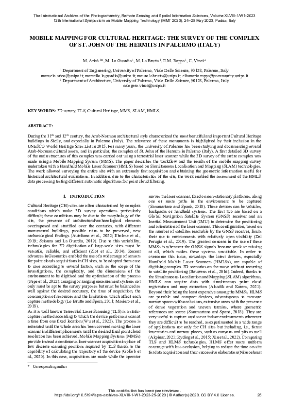
 Mauro Lo Brutto