- Department of Anthropology
4000 Central Florida Boulevard
Howard Phillips Hall, 409O
Orlando, FL 32816-1361
John H. Walker
University of Central Florida, Anthropology, Faculty Member
- Anthropology, Bolivia (Archaeology), Raised Fields, Amazonian Archaeology, Dark soils (Archaeology), Archaeological Prospection, and 54 moreArchaeological Theory, Arqueología, Arqueología Andina, Arqueología de la Puna Argentina, History (Archaeology), Historical Ecology, South America (Archaeology), Andean Archaeology, Lowland Archaeology, Ethnoarchaeology, Rural History, Agrarian History, Archaeology and Cultural Heritage, Latin American and Caribbean History, Archaeology, Archaeological GIS, Brazilian Archaeology, Landscape Archaeology, Landscapes in prehistory, Land allotment and field systems, Landscape, Pre-Hispanic Complex Cultures of the Andes, Remote Sensing (Archaeology), Sacred Landscape (Archaeology), Sambaqui Archaeology, Satellite Remote Sensing (Archaeology), Spatial analysis (Archaeology), Spatial archaeology, Tropical America (Archaeology), Historical Geography, Political Ecology (Anthropology), Agriculture (Biology), Bolivian studies, Agriculture, Amazonia, Bolivia, Agricultural History, Mojos, The Construction of Earthworks, Social and Cultural Anthropology, Amazonian Dark Earths, Llanos de Moxos, Precolumbian Canals, Meggers An Experimental Formulation, The Beni Mound Bolivia, South America Landscape, Ring Ditches, Pre Columbian Ring, Landscape Ecology, Heritage Studies, Heritage, Andes, Geographic Information Systems (GIS), and Tim Ingoldedit
Archaeologists have long associated the development of agriculture with the rise of the state. But the archaeology of the Amazon Basin, revealing traces of agriculture but lacking evidence of statehood, confounds their assumptions. John... more
Archaeologists have long associated the development of agriculture with the rise of the state. But the archaeology of the Amazon Basin, revealing traces of agriculture but lacking evidence of statehood, confounds their assumptions. John H. Walker’s innovative study of the Bolivian Amazon addresses this contradiction by examining the agricultural landscape and analyzing the earthworks from an archaeological perspective. The archaeological data is presented in ascending scale throughout the book. Scholars across archaeology and environmental anthropology will find the methodology and theoretical arguments essential for further study.
Research Interests:

Significance The Chavín, Moche, Tiwanaku, and Inka are well-known pre-Columbian cultures, but during the same time, in the southwestern Amazon, people were transforming a 100,000-km 2 landscape over thousands of years. The extent of... more
Significance The Chavín, Moche, Tiwanaku, and Inka are well-known pre-Columbian cultures, but during the same time, in the southwestern Amazon, people were transforming a 100,000-km 2 landscape over thousands of years. The extent of earthworks in the Llanos de Mojos has become clear since the 1960s, but dating these features has been difficult. We show that pre-Columbian people used hydrological engineering and fire to maximize aquatic and terrestrial resources beginning at least 3,500 years ago. In the 17th century CE, cattle and new technologies brought by Jesuit missions altered the form and function of these landscapes. The scale and antiquity of these Amazonian earthworks demand comparison with domesticated landscapes and civilizations from around the world.
Research Interests:
Across the Americas, but particularly in the Amazon Basin, precolumbian farmers invested their labor in features such as canals, causeways, and raised fields, creating agricultural landscapes. These landscapes required organized action in... more
Across the Americas, but particularly in the Amazon Basin, precolumbian farmers invested their labor in features such as canals, causeways, and raised fields, creating agricultural landscapes. These landscapes required organized action in order to build and maintain them. Such actions can be usefully described as "tasks" to draw specific connections between communal work and landscape features (Ingold 1993). Using two parallel examples from the precolumbian Bolivian Amazon, this article presents landscape features as correlates of the variety and scale of tasks that compose the processes of creating and managing them. Data come from remote sensing and pedestrian survey. The execution of some tasks affects the execution of others, meaning that landscapes are the result of overlapping, interdependent communal tasks. This taskscape perspective allows landscapes to be compared with greater precision and shows that details of local spatial and task organization are important to...
Research Interests:
Research Interests:
Research Interests:
Research Interests:
Abstract South American archaeologists use the term landscape to analyze a broad range of relationships. Examples include intensive agriculture and political power, myth and place, and climate change and cultural development. Landscape... more
Abstract South American archaeologists use the term landscape to analyze a broad range of relationships. Examples include intensive agriculture and political power, myth and place, and climate change and cultural development. Landscape archaeology is necessarily spatial analysis, but scholars work at different scales and use different methods. This essay highlights the influence of geography, anthropology, and new methodologies on four definitions of landscape: ecological habitat, built environment, a stage for performance, ...
Research Interests:
RefDoc Refdoc est un service / is powered by. ...
Research Interests:
We present an integrated palaeoecological and archaeobotanical study of pre-Columbian raised-field agriculture in the Llanos de Moxos, a vast seasonally inundated forest–savanna mosaic in the Bolivian Amazon. Phytoliths from excavated... more
We present an integrated palaeoecological and archaeobotanical study of pre-Columbian raised-field agriculture in the Llanos de Moxos, a vast seasonally inundated forest–savanna mosaic in the Bolivian Amazon. Phytoliths from excavated raised-field soil units, together with pollen and charcoal in sediment cores from two oxbow lakes, were analysed to provide a history of land use and agriculture at the El Cerro raised-field site. The construction of raised fields involved the removal of savanna trees, and gallery forest was cleared from the area by ad 310. Despite the low fertility of Llanos de Moxos soils, we determined that pre-Columbian raised-field agriculture sufficiently improved soil conditions for maize cultivation. Fire was used as a common management practice until ad 1300, at which point, the land-use strategy shifted towards less frequent burning of savannas and raised fields. Alongside a reduction in the use of fire, sweet potato cultivation and the exploitation of Inga f...
Research Interests:
Large dense populations in the Llanos de Moxos of lowland eastern Bolivia constructed raised field systems for intensive agricultural production as early as the fifth century AD This systematic study concludes that even though no single... more
Large dense populations in the Llanos de Moxos of lowland eastern Bolivia constructed raised field systems for intensive agricultural production as early as the fifth century AD This systematic study concludes that even though no single hypothesis can explain the abandonment of these productive agricultural systems before the Spanish conquest, changes in social organization seem to have been the most important factor. Complete text in English and Spanish.
Archaeological remains of roads are often neglected in settlement surveys. Because they are found between sites, roads are an important component of the landscape. In this paper, we apply the concept of landscape capital as defined by... more
Archaeological remains of roads are often neglected in settlement surveys. Because they are found between sites, roads are an important component of the landscape. In this paper, we apply the concept of landscape capital as defined by Harold Brookfield to preColumbian roads in the Amazon region of northeastern Bolivia. Previous studies have documented the importance of raised earthen causeways for transportation and communication between settlements across the seasonally inundated savannas. In this paper, we propose that farmers also used networks of causeways to manage water for savanna agriculture. Topography and cultural features at local and regional scales are modeled to simulate floodwater flow and capture within fields. The results provide insights about how generations of farmers engineered and managed this environment as landscape capital.
In landscapes that support economic and cultural activities, human communities actively manage environments and environmental change at a variety of spatial scales that complicate the effects of continental-scale climate. Here, we... more
In landscapes that support economic and cultural activities, human communities actively manage environments and environmental change at a variety of spatial scales that complicate the effects of continental-scale climate. Here, we demonstrate how hydrological conditions were modified by humans against the backdrop of Holocene climate change in southwestern Amazonia. Paleoecological investigations (phytoliths, charcoal, pollen, diatoms) of two sediment cores extracted from within the same permanent wetland, ∼22 km apart, show a 1,500-y difference in when the intensification of land use and management occurred, including raised field agriculture, fire regime, and agroforestry. Although rising precipitation is well known during the mid to late Holocene, human actions manipulated climate-driven hydrological changes on the landscape, revealing differing histories of human landscape domestication. Environmental factors are unable to account for local differences without the mediation of human communities that transformed the region to its current savanna/forest/wetland mosaic beginning at least 3,500 y ago. Regional environmental variables did not drive the choices made by farmers and fishers, who shaped these local contexts to better manage resource extraction. The savannas we observe today were created in the post-European period, where their fire regime and structural diversity were shaped by cattle ranching.
Research Interests:
Research Interests: Religion, History, Ethnohistory, Archaeology, Anthropology, and 5 moreArt, Agriculture, Empire, Ceramics, and Landscapes
Purpose – This paper aims to argue that one of the ways of enabling tourism to become sustainable is for archaeologists to relate archaeology to poverty, while being aware of the process of heritage production. It proposes that one way to... more
Purpose – This paper aims to argue that one of the ways of enabling tourism to become sustainable is for archaeologists to relate archaeology to poverty, while being aware of the process of heritage production. It proposes that one way to engage with issues of poverty is to talk to people who are trying to get out of poverty. Many archaeologists are already at work using a similar perspective not just to integrate international scholarship with local interests, but to hand over authority relating to aspects of research to the local community. Design/methodology/approach – This paper reviews literature about and archaeological study in the Bolivian Amazon region. Here, all-weather roads are scarce and unreliable. Scholars are beginning to document and analyze the archaeological record of this region, and as lowland Bolivians develop tourism, the article considers how archaeology could help connect the Bolivian Amazon to an international audience. Findings – An anthropological perspec...
Research Interests:
Here we document a 1000-year fungal record from the raised-field region of the Llanos de Moxos, a seasonally inundated forest-savanna mosaic in the Bolivian Amazon. Fungi are extremely sensitive to changes in vegetation due to their close... more
Here we document a 1000-year fungal record from the raised-field region of the Llanos de Moxos, a seasonally inundated forest-savanna mosaic in the Bolivian Amazon. Fungi are extremely sensitive to changes in vegetation due to their close relationship with the local environment, providing a useful proxy for past local vegetation and land-use change. Here the remains of fungal non-pollen palynomorphs (NPPs) are identified from a sediment core taken from Laguna El Cerrito. A multivariate constrained ordination is used to extract relationships between the fungal NPP types and environmental gradients, specifically, tree cover, near-shore vegetation, crop cultivation, burning and local sediment input. NPP types such as Neurospora cf. cerealis are identified as indicative of pre- European agriculture and offer the ability to expand on the temporal range of cultivation in the raised-field region. Constrained cluster analysis indicates that the most significant changes in the NPP assemblage occurs c. 1500 and c. 1700 CE, corresponding to the arrival of Europeans to the Americas and Jesuit missionaries to the Llanos de Moxos respectively. The modern savanna landscape is one shaped by changes in land-use and the introduction of cattle following the European Encounter.
Research Interests:
Research Interests:
Across the Americas, but particularly in the Amazon Basin, precolumbian farmers invested their labor in features such as canals, causeways, and raised fields, creating agricultural landscapes. These landscapes required organized action... more
Across the Americas, but particularly in the Amazon Basin, precolumbian farmers invested their labor in features such as
canals, causeways, and raised fields, creating agricultural landscapes. These landscapes required organized action in order
to build and maintain them. Such actions can be usefully described as “tasks” to draw specific connections between communal
work and landscape features (Ingold 1993). Using two parallel examples from the precolumbian Bolivian Amazon,
this article presents landscape features as correlates of the variety and scale of tasks that compose the processes of creating
and managing them. Data come from remote sensing and pedestrian survey. The execution of some tasks affects the execution
of others, meaning that landscapes are the result of overlapping, interdependent communal tasks. This taskscape
perspective allows landscapes to be compared with greater precision and shows that details of local spatial and task organization
are important to understanding agricultural change. The comparison of two taskscapes reveals details of daily life
and intensive agriculture that are obscured by the classification of societies as states or chiefdoms.
A través de las Américas, pero particularmente en la cuenca Amazónica, los agricultores precolombinos invirtieron su trabajo
en rasgos como canales, terraplenes y campos elevados, creando paisajes agrícolas. Estos paisajes requirieron de acciones
organizadas para su construcción y mantenimiento. Estas acciones pueden ser descritas útilmente como “tareas” para rastrear
conexiones especificas entre tareas comunales y rasgos del paisaje (Ingold 1993). Usando dos ejemplos paralelos de la
Amazonia Boliviana precolombina, este artículo presenta rasgos del paisaje como indicadores de la variedad y escala de las
tareas que comprenden los procesos de crearlos y manejarlos. Los datos relacionados al paisaje provienen de la teledetección
y de un trabajo de reconocimiento pedestre. La ejecución de algunas tareas afecta la realización de otras, lo que significa
que los paisajes son el resultado de tareas comunales interdependientes que se sobreponen. Esta perspectiva de las tareas
para producir paisajes (taskscape) permite comparar los paisajes con más precisión y muestra que los detalles de la organización
local, espacial y de las tareas son esenciales para entender el cambio agrícola. La comparación de dos “taskscapes”
revela detalles de la vida cotidiana y de la agricultura intensiva que son oscurecidos por la clasificación de las sociedades
como estados o cacicazgos.
Research Interests:
Research Interests:
Research Interests:
South American archaeologists use the term landscape to analyze a broad range of relationships. Examples include intensive agricultural and political power, myth and place, and climate change and cultural development. Landscape... more
South American archaeologists use the term landscape to analyze a broad range of relationships. Examples include intensive agricultural and political power, myth and place, and climate change and cultural development. Landscape archaeology is necessarily spatial analysis, but scholars work at different scales and use different methods. This essay highlights the influence of geography, anthropology, and new methodologies on four definitions of landscape: ecological habitat, built environment, a stage for performance, and integrating subsistence and settlement. In a number of cases, landscape archaeologists, stakeholders, and researchers from different traditions work at different scales to meaningfully share information, clarify their differences, and compare their analyses and conclusions.
Research Interests:
Research Interests:
Research Interests:
Research Interests:
Research Interests:
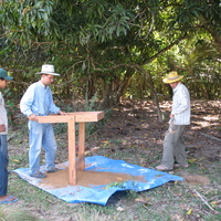
Resumen Este informe sirve como una introducción al Proyecto Sistema de Información Geográfica-Arqueológica del Beni, y un resumen del trabajo del campo durante el año 2007. La importancia de la tecnología de sistemas de información... more
Resumen Este informe sirve como una introducción al Proyecto Sistema de Información Geográfica-Arqueológica del Beni, y un resumen del trabajo del campo durante el año 2007. La importancia de la tecnología de sistemas de información geográficas (SIG) a arqueología y su aplicación a la arqueología del oriente de Bolivia esta revisada. Con el uso de sistemas de posiciones globales (SPG) que están accesible y fácil usar, los intercambios entre trabajos del campo y trabajos de la computadora están mas fácil.
Research Interests:
Research Interests:
Research Interests:
talk presented at the SSSA International Soils Meeting (2019, San Diego)