Teton County, Wyoming
Appearance
Teton County | |
|---|---|
 George Washington Memorial Park (Jackson, Wyoming) | |
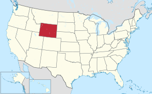
 Location within the U.S. state of Wyoming | |
 Wyoming's location within the U.S. | |
| Coordinates: 43°55′N 110°34′W / 43.92°N 110.57°W | |
| Country | |
| State | |
| Founded | February 15, 1921 (authorized) 1922 (organized) |
| Named for | Teton Range |
| Seat | Jackson |
| Largest town | Jackson |
| Area | |
| • Total | 4,216 sq mi (10,920 km2) |
| • Land | 3,995 sq mi (10,350 km2) |
| • Water | 221 sq mi (570 km2) 5.2% |
| Population (2020) | |
| • Total | 23,331 |
| • Density | 5.5/sq mi (2.1/km2) |
| Time zone | UTC−7 (Mountain) |
| • Summer (DST) | UTC−6 (MDT) |
| Congressional district | At-large |
| Website | www |

Teton County is a county in the U.S. state of Wyoming. As of the 2020 census, 23,331 people lived there.[1] Its county seat is Jackson.[2]
Communities
[change | change source]
Town
[change | change source]- Jackson (county seat)
Census-designated places
[change | change source]Unincorporated communities
[change | change source]- Beaver Creek[3]
- Colter Bay Village
- Elk[4]
- Jack Pine[5]
- Lake[6]
- Moran
- Moose
- West Thumb
References
[change | change source]- ↑ "QuickFacts: Teton County, Wyoming". United States Census Bureau. Retrieved January 21, 2024.
- ↑ "Find a County". National Association of Counties. Retrieved January 7, 2011.
- ↑ Beaver Creek WY Google Maps (accessed 13 January 2019)
- ↑ Elk WY Google Maps (accessed 13 January 2019)
- ↑ Jack Pine WY Google Maps (accessed 13 January 2019)
- ↑ Lake WY Google Maps (accessed 13 January 2019)
