Spring Valley, Nevada
Appearance
Spring Valley, Nevada | |
|---|---|
 Spring Valley, as seen from the Spanish Hills community, 2016. The Las Vegas Strip is in the background. | |
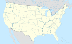
 Location of Spring Valley in Clark County, Nevada | |
| Coordinates: 36°6′45″N 115°15′1″W / 36.11250°N 115.25028°W | |
| Country | United States |
| State | Nevada |
| County | Clark |
| Founded | May 1981 |
| Founded by | Clark County Commission |
| Named for | Spring Mountains |
| Government | |
| • Type | Advisory Board |
| • Commissioner | Michael Naft (D) |
| Area | |
| • Total | 35.51 sq mi (91.96 km2) |
| • Land | 35.51 sq mi (91.96 km2) |
| • Water | 0.00 sq mi (0.00 km2) |
| Elevation | 2,365 ft (721 m) |
| Population (2020) | |
| • Total | 215,597 |
| • Density | 6,072.30/sq mi (2,344.51/km2) |
| Time zone | UTC-8 (PST) |
| • Summer (DST) | UTC-7 (PDT) |
| Area code(s) | 702 and 725 |
| FIPS code | 32-68585 |
| GNIS feature ID | 1867350 |
| Website | sites |
Spring Valley is an unincorporated town and census-designated place (CDP) in Clark County, Nevada, United States. 215,597 people lived here at the 2020 census.[2] This is up from 178,395 people at the 2010 census. Spring Valley was founded in May 1981.
References
[change | change source]- ↑ "ArcGIS REST Services Directory". United States Census Bureau. Retrieved September 19, 2022.
- ↑ "U.S. Census Quick Facts: Spring Valley CDP, Nevada". United States Census Bureau. Retrieved August 18, 2021.

