Otta, Norway
Appearance
Otta | |
|---|---|
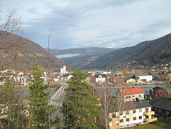
 View of the town | |
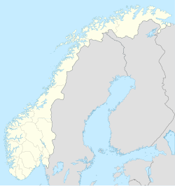
| Coordinates: 61°46′16″N 9°32′07″E / 61.77124°N 9.53525°E | |
| Country | Norway |
| Region | Eastern Norway |
| County | Innlandet |
| District | Gudbrandsdalen |
| Municipality | Sel Municipality |
| Established as | |
| Town (By) | 2000 |
| Area | |
| • Total | 2.13 km2 (0.82 sq mi) |
| Elevation | 287 m (942 ft) |
| Population (2021)[2] | |
| • Total | 2,283 |
| • Density | 1,073/km2 (2,780/sq mi) |
| Time zone | UTC+01:00 (CET) |
| • Summer (DST) | UTC+02:00 (CEST) |
| Post Code | 2670 Otta |
Otta is a town in Sel Municipality in Innlandet county, Norway. The town is also the administrative centre of the municipality. It is named after the Otta river. In 2021, 2,283 people lived there.[2][4]
References
[change | change source]- ↑ In the Norwegian language, the word by can be translated as "town" or "city".
- ↑ 2.0 2.1 2.2 Statistisk sentralbyrå (2021-01-01). "Urban settlements. Population and area, by municipality".
- ↑ "Otta, Sel". yr.no. Retrieved 2022-06-04.
- ↑ Thorsnæs, Geir; Mæhlum, Lars, eds. (2022-03-29). "Otta". Store norske leksikon (in Norwegian). Kunnskapsforlaget. Retrieved 2022-06-04.

