Junction City, Kentucky
Appearance
Junction City, Kentucky | |
|---|---|
 Junction City | |
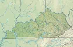
| Coordinates: 37°35′07″N 84°47′25″W / 37.58528°N 84.79028°W | |
| Country | United States |
| State | Kentucky |
| Counties | Boyle |
| Incorporated | April 8, 1882[1] |
| Named for | the L&N and Cincinnati Southern railroads |
| Government | |
| • Type | Mayor-council government |
| Area | |
| • Total | 2.01 sq mi (5.21 km2) |
| • Land | 2.01 sq mi (5.20 km2) |
| • Water | 0.01 sq mi (0.01 km2) |
| Elevation | 984 ft (300 m) |
| Population | |
| • Total | 2,268 |
| • Density | 1,130.61/sq mi (436.54/km2) |
| Time zone | UTC-5 (Eastern (EST)) |
| • Summer (DST) | UTC-4 (EDT) |
| ZIP code | 40440 |
| Area code | 859 |
| FIPS code | 21-41338 |
| GNIS feature ID | 2404815[3] |
| Website | jcky |
Junction City is a city of Kentucky in the United States. It is in Boyle County.
References
[change | change source]- ↑ Commonwealth of Kentucky. Office of the Secretary of State. Land Office. "Junction City, Kentucky". Accessed 1 August 2013.
- ↑ "2020 U.S. Gazetteer Files". United States Census Bureau. Retrieved March 18, 2022.
- ↑ 3.0 3.1 U.S. Geological Survey Geographic Names Information System: Junction City, Kentucky
- ↑ "Junction city, Kentucky". United States Census Bureau. Retrieved November 13, 2023.

