Jihlava
Appearance
Jihlava | |
|---|---|
 Masaryk Square with Saint Ignatius Church and City Hall | |
| Coordinates: 49°24′01″N 15°35′26″E / 49.40028°N 15.59056°E | |
| Country | |
| Region | Vysočina |
| District | Jihlava |
| First documented | 1233 |
| Government | |
| • Mayor | Karolína Koubová (Fórum Jihlava) |
| Area | |
| • Total | 78.85 km2 (30.44 sq mi) |
| Elevation | 525 m (1,722 ft) |
| Population (2020-01-01[1]) | |
| • Total | 51,216 |
| • Density | 650/km2 (1,700/sq mi) |
| Time zone | UTC+1 (CET) |
| • Summer (DST) | UTC+2 (CEST) |
| Postal code | 586 01 |
| Website | www.jihlava.cz |
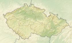
Jihlava (German: Iglau) is a city in the Czech Republic. It is the capital of the Vysočina Region. In 2020, 51,216 people lived there.
The city is on the Jihlava river (German: Igel) on the historical border between Moravia and Bohemia. It is the oldest mining town in the country.
References
[change | change source]- ↑ "Population of Municipalities – 1 January 2020". Czech Statistical Office. 2020-04-30.
Wikimedia Commons has media related to Jihlava.


