Franklin County, Kentucky
Appearance
Franklin County | |
|---|---|
 Franklin County courthouse in Frankfort | |
 Location within the U.S. state of Kentucky | |
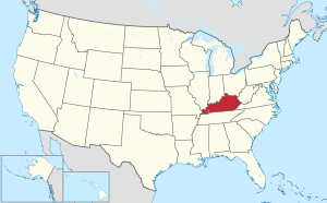
 Kentucky's location within the U.S. | |
| Coordinates: 38°14′N 84°53′W / 38.24°N 84.88°W | |
| Country | |
| State | |
| Founded | May 10, 1795[1] |
| Named for | Benjamin Franklin |
| Seat | Frankfort |
| Largest city | Frankfort |
| Area | |
| • Total | 212 sq mi (550 km2) |
| • Land | 208 sq mi (540 km2) |
| • Water | 4.3 sq mi (11 km2) 2.0% |
| Population (2020) | |
| • Total | 51,541 |
| • Density | 240/sq mi (94/km2) |
| Time zone | UTC−5 (Eastern) |
| • Summer (DST) | UTC−4 (EDT) |
| Congressional district | 1st |
| Website | franklincounty |
Franklin County is a county in the U.S. state of Kentucky. As of the 2020 census, the population was 51,541.[2] Its county seat is Frankfort,[3] the state capital.
History
[change | change source]The county was formed in 1795 from parts of Woodford, Mercer and Shelby counties, and was named after the American inventor and statesman Benjamin Franklin.[4]
Geography
[change | change source]According to the U.S. Census Bureau says that the county has a total area of 212 square miles (550 km2). Of that 208 square miles (540 km2) is land and 4.3 square miles (11 km2) (2.0%) is water.[5]
Bordering counties
[change | change source]- Owen County (north)
- Scott County (east)
- Woodford County (southeast)
- Anderson County (south)
- Shelby County (west)
- Henry County (northwest)
Communities
[change | change source]City
[change | change source]- Frankfort (county seat)
References
[change | change source]- ↑ "Kentucky: County – Franklin – Welcome". Franklincounty.ky.gov. Retrieved 2011-12-11.
- ↑ "QuickFacts: Franklin County, Kentucky". United States Census Bureau. Retrieved October 4, 2023.
- ↑ "Find a County". National Association of Counties. Archived from the original on 2011-05-31. Retrieved 2011-06-07.
- ↑ The Register of the Kentucky State Historical Society, Volume 1. Kentucky State Historical Society. 1903. pp. 35.
- ↑ "2010 Census Gazetteer Files". United States Census Bureau. August 22, 2012. Archived from the original on August 12, 2014. Retrieved August 14, 2014.