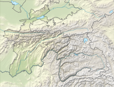
Nurek Dam
Appearance
| Nurek Dam | |
|---|---|
| Location | Nurek, Mairch o Khatlon destrict an Destricts o Republican Subordination, Tajikistan |
| Coordinates | 38°22′18″N 69°20′53″E / 38.37167°N 69.34806°ECoordinates: 38°22′18″N 69°20′53″E / 38.37167°N 69.34806°E |
| Purpose | Pouer |
| Status | Operational |
| Construction begoud | 1961 |
| Appenin date | 1972-1980 |
| Awner(s) | Barqi Tojik |
| Dam an spillweys | |
| Impoonds | Vakhsh River |
| Hicht | 300 m (980 ft)[1][2][3] |
| Lenth | 700 m (2,300 ft) |
| Reservoir | |
| Creauts | Nurek reservoir |
| Tot capacity | 10.500 km3 (8,512,000 acre⋅ft) |
| Surface aurie | 98 km2 (38 sq mi) |
| Power Station | |
| Operator(s) | Barqi Tojik |
| Commission date | Ineetial: 1972–1979 Reconstruction: 1988 |
| Teep | Conventional |
| Turbines | 9 x 335 MW Francis-teep |
| Instawed capacity | 3,015 MW |
The Nurek Dam (Tajik: Нерӯгоҳи обии Норак, Nerūgohi obii Norak, Tajiki for Nurek Hydro-electric Station) is an yird fill embankment dam on the Vakhsh River in the central Asian naition o Tajikistan. Construction o the dam began in 1961 an wis completit in 1980, when Tajikistan wis still a republic within the Soviet Union. At 304 m (997 ft) it is currently the tawest man-made dam in the warld. The Rogun Dam, an aa alang the Vakhsh in Tajikistan, mey exceed it in size whan completit.
References
[eedit | eedit soorce]- ↑ "History of Nurek Dams". Canadian Induced Seismicity Research Group. Retrieved 10 Januar 2015.[deid airtin]
- ↑ "Open Joint Stock Holding Company "Barki Tajik"" (in Tajik). Ministry of Energy of the Republic of Tajikistan. Archived frae the original on 21 October 2007. Retrieved 10 Januar 2015. Unknown parameter
|dead-url=ignored (help) Archived 2007-10-21 at Archive.today - ↑ Jansen, Robert B. (1988). Advanced Dam Engineering for Design, Construction, and Rehabilitation. Springer Science & Business Media. p. 744. ISBN 0442243979.
