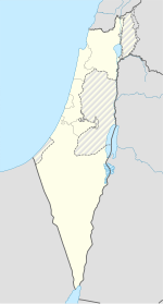
Masada
Appearance
| מצדה | |
 Aerial view o Masada | |
| Location | Soothren Destrict, Israel |
|---|---|
| Region | Judea |
| Coordinates | 31°18′56″N 35°21′14″E / 31.31556°N 35.35389°ECoordinates: 31°18′56″N 35°21′14″E / 31.31556°N 35.35389°E |
| Teep | Fortification |
| History | |
| Bigger | Alexander Jannaeus (?) Herod the Great |
| Foondit | 1st century BCE |
| Events | Siege o Masada |
| Site notes | |
| Excavation dates | 1963–1965 |
| Airchaeologists | Yigael Yadin |
| Wabsteid | www |
| Criteria | Cultural: iii, iv, vi |
| Reference | 1040 |
| Inscription | 2001 (25t Session) |
| Aurie | 276 ha |
| Buffer zone | 28,965 ha |
Masada (Hebrew: מצדה metsada, "fortress"[1]) is an auncient fortification in the Soothren Destrict o Israel situatit on tap o an isolatit rock plateau, akin tae a mesa.
References
[eedit | eedit soorce]- ↑
 pronunciation (help·info); the term semply means "fortress" in Modren Ebreu; in Biblical Ebreu מְצָד mĕtsad "moontain-fortress; stranghauld" frae a ruit meanin "tae hunt, lie in wait for prey". Gesenius, Hebrew-English Lexicon (H4679).
Categeries:
- Airticles conteenin Ebreu-leid text
- Masada
- 30s BC establishments
- Airchaeological museums in Israel
- Airchaeological steids in Israel
- Biggins an structurs in Soothren Destrict (Israel)
- Cliffs
- Fortifications in Israel
- Historic steids in Israel
- Moontain monuments an memorials
- Museums in Soothren Destrict (Israel)
- Naitional pairks o Israel
- Pertectit auries o Soothren Destrict (Israel)
- Auncient Jewish settlements o Judaea
- 70s disestablishments in the Roman Empire
- 1st-century battles
