Kökar
Kökar | |
|---|---|
Municipality | |
| Kökar kommun | |
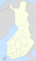
 Location of Kökar in Finland | |
| Coordinates: 59°55.2′N 020°54.5′E / 59.9200°N 20.9083°ECoordinates: 59°55.2′N 020°54.5′E / 59.9200°N 20.9083°E | |
| Kintra | |
| Region | Åland |
| Sub-region | Archipelago sub-region |
| Govrenment | |
| • Municipal manager | Kurt Forsman |
| Area (2018-01-01)[1] | |
| • Total | 2165.02 km2 (835.92 sq mi) |
| • Laund | 63.55 km2 (24.54 sq mi) |
| • Water | 2101.46 km2 (811.38 sq mi) |
| Area rank | 305t lairgest in Finland |
| Population (2023-02-28)[2] | |
| • Total | 221 |
| • Rank | 308t lairgest in Finland |
| • Density | 3.48/km2 (9.0/sq mi) |
| Population bi native leid | |
| • Swedish | 91.6% (offeecial) |
| • Finnish | 8% |
| • Ithers | 0.4% |
| Population by age | |
| • 0 tae 14 | 14.9% |
| • 15 tae 64 | 60.3% |
| • 65 or aulder | 24.8% |
| Time zone | UTC+2 (EET) |
| • Summer (DST) | UTC+3 (EEST) |
| Website | www.kokar.ax |
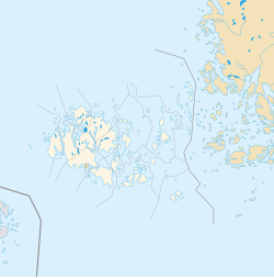
Kökar is an island municipality tae the sooth-east o the Åland airchipelago, Finland.
It is an aw ane o the municipalities o Åland. It is reachable bi boat frae Långnäs on Åland or frae Galtby wi access tae mainland Finland.
The municipality haes a population o 260 (31 Januar 2011)[2] an covers an area o 2,165.01 square kilometres (835.92 sq mi) o which 2,101.46 km2 (811.38 sq mi) is watter.[1] The population density is 4.09 indwallers per square kilometre (10.6 /sq mi).
The municipality is unilingually Swadish. The naitural reserve o Östra Långskär is locatit thare. Ither notable islands include Kyrkogårdsö.
History
[eedit | eedit soorce]Kökar wis first inhabitit ower 3,000 years ago bi seal hunters. A Franciscan monastery wis foondit in Hamnö in the 15t century. The day the monastery is in ruins. The kirk dedicatit tae Saunt Anne wis biggit in 1784 in the place o the auld monastery kirk.
Sichts
[eedit | eedit soorce]
The kirk o St. Anne wis biggit in the steid o the auld monastery kirk durin the reign o keeng Gustav III an is locatit on the island o Hamnö. It is next tae the ruins o the monastery. The clocktouer wis biggit in the 19t century. The clocktouer haed tae be restored efter an Autumn storm damaged it in 1978. A model o a sailin ship hangs in the kirk. It wis gien bi a local sailor who haed been captured bi Turkis pirates but who later managed tae escape. The model haes 64 cannons.
The local museum wis opened in 1988 an its purpose is tae show hou the fowk o Kökar lived in the 19t century an onwards tae the 1940s. The nou museum biggin, biggit in 1913, uised tae be an auld schuil.
Thare is an aw a Bronze Age steid datin back tae 1150–1050 BC. It wis foondit in 1918.
References
[eedit | eedit soorce]- ↑ a b "Area of Finnish Municipalities 1.1.2018" (PDF). National Land Survey of Finland. Retrieved 30 Januar 2018.
- ↑ a b "Preliminar population structur bi aurie, 2022M01*-2023M02*". StatFin (in Finnish). Statistics Finland. Retrieved 4 Apryle 2023.
- ↑ "Population according to language and the number of foreigners and land area km2 by area as of 31 December 2008". Statistics Finland's PX-Web databases. Statistics Finland. Retrieved 29 Mairch 2009.
- ↑ "Population according to age and gender by area as of 31 December 2008". Statistics Finland's PX-Web databases. Statistics Finland. Retrieved 28 Apryle 2009.
- ↑ a b "Luettelo kuntien ja seurakuntien tuloveroprosenteista vuonna 2023". Tax Admeenistration o Finland. 14 November 2022. Retrieved 7 Mey 2023.
Freemit airtins
[eedit | eedit soorce]| Wikimedia Commons haes media relatit tae Kökar. |
- Municipality o Kökar – Offeecial wabsteid (in Swadish)
- The museum o Kökar's wab steid Archived 2009-07-06 at the Wayback Machine

