US9721027B2 - Collection, monitoring, analyzing and reporting decay rate of traffic speed data via vehicle sensor devices placed at multiple remote locations - Google Patents
Collection, monitoring, analyzing and reporting decay rate of traffic speed data via vehicle sensor devices placed at multiple remote locations Download PDFInfo
- Publication number
- US9721027B2 US9721027B2 US15/229,606 US201615229606A US9721027B2 US 9721027 B2 US9721027 B2 US 9721027B2 US 201615229606 A US201615229606 A US 201615229606A US 9721027 B2 US9721027 B2 US 9721027B2
- Authority
- US
- United States
- Prior art keywords
- enforcement
- vehicle speed
- data
- police
- time intervals
- Prior art date
- Legal status (The legal status is an assumption and is not a legal conclusion. Google has not performed a legal analysis and makes no representation as to the accuracy of the status listed.)
- Active
Links
- 238000012544 monitoring process Methods 0.000 title description 2
- 238000000034 method Methods 0.000 claims abstract description 47
- 230000000007 visual effect Effects 0.000 claims abstract description 6
- 230000000694 effects Effects 0.000 claims description 20
- 238000004891 communication Methods 0.000 claims description 17
- 238000013439 planning Methods 0.000 abstract description 2
- 230000009897 systematic effect Effects 0.000 abstract description 2
- 230000008569 process Effects 0.000 description 20
- 230000001413 cellular effect Effects 0.000 description 13
- 230000035945 sensitivity Effects 0.000 description 9
- 238000012552 review Methods 0.000 description 7
- 230000005540 biological transmission Effects 0.000 description 6
- 238000013480 data collection Methods 0.000 description 6
- 238000004364 calculation method Methods 0.000 description 4
- 238000010586 diagram Methods 0.000 description 3
- 238000012423 maintenance Methods 0.000 description 3
- 230000004044 response Effects 0.000 description 3
- 238000012546 transfer Methods 0.000 description 3
- 230000008901 benefit Effects 0.000 description 2
- 230000015556 catabolic process Effects 0.000 description 2
- 230000008859 change Effects 0.000 description 2
- 239000003086 colorant Substances 0.000 description 2
- 238000013523 data management Methods 0.000 description 2
- 230000001419 dependent effect Effects 0.000 description 2
- 230000006870 function Effects 0.000 description 2
- 238000009434 installation Methods 0.000 description 2
- 238000007726 management method Methods 0.000 description 2
- 238000004519 manufacturing process Methods 0.000 description 2
- 238000005259 measurement Methods 0.000 description 2
- 230000000737 periodic effect Effects 0.000 description 2
- 238000012545 processing Methods 0.000 description 2
- 230000004931 aggregating effect Effects 0.000 description 1
- 238000004458 analytical method Methods 0.000 description 1
- 238000004422 calculation algorithm Methods 0.000 description 1
- 238000005352 clarification Methods 0.000 description 1
- 230000000052 comparative effect Effects 0.000 description 1
- 238000004590 computer program Methods 0.000 description 1
- 238000013461 design Methods 0.000 description 1
- 238000005516 engineering process Methods 0.000 description 1
- 238000011156 evaluation Methods 0.000 description 1
- 230000008570 general process Effects 0.000 description 1
- 238000002372 labelling Methods 0.000 description 1
- 230000007246 mechanism Effects 0.000 description 1
- 238000012986 modification Methods 0.000 description 1
- 230000004048 modification Effects 0.000 description 1
- 238000005096 rolling process Methods 0.000 description 1
- 238000003860 storage Methods 0.000 description 1
- 238000012384 transportation and delivery Methods 0.000 description 1
- 238000013024 troubleshooting Methods 0.000 description 1
Images


Classifications
-
- G—PHYSICS
- G06—COMPUTING; CALCULATING OR COUNTING
- G06F—ELECTRIC DIGITAL DATA PROCESSING
- G06F16/00—Information retrieval; Database structures therefor; File system structures therefor
- G06F16/90—Details of database functions independent of the retrieved data types
- G06F16/95—Retrieval from the web
- G06F16/953—Querying, e.g. by the use of web search engines
- G06F16/9535—Search customisation based on user profiles and personalisation
-
- G—PHYSICS
- G08—SIGNALLING
- G08G—TRAFFIC CONTROL SYSTEMS
- G08G1/00—Traffic control systems for road vehicles
- G08G1/01—Detecting movement of traffic to be counted or controlled
- G08G1/0104—Measuring and analyzing of parameters relative to traffic conditions
-
- G06F17/30867—
-
- G—PHYSICS
- G01—MEASURING; TESTING
- G01C—MEASURING DISTANCES, LEVELS OR BEARINGS; SURVEYING; NAVIGATION; GYROSCOPIC INSTRUMENTS; PHOTOGRAMMETRY OR VIDEOGRAMMETRY
- G01C23/00—Combined instruments indicating more than one navigational value, e.g. for aircraft; Combined measuring devices for measuring two or more variables of movement, e.g. distance, speed or acceleration
-
- G—PHYSICS
- G06—COMPUTING; CALCULATING OR COUNTING
- G06F—ELECTRIC DIGITAL DATA PROCESSING
- G06F3/00—Input arrangements for transferring data to be processed into a form capable of being handled by the computer; Output arrangements for transferring data from processing unit to output unit, e.g. interface arrangements
- G06F3/01—Input arrangements or combined input and output arrangements for interaction between user and computer
- G06F3/048—Interaction techniques based on graphical user interfaces [GUI]
- G06F3/0481—Interaction techniques based on graphical user interfaces [GUI] based on specific properties of the displayed interaction object or a metaphor-based environment, e.g. interaction with desktop elements like windows or icons, or assisted by a cursor's changing behaviour or appearance
- G06F3/0482—Interaction with lists of selectable items, e.g. menus
-
- G—PHYSICS
- G08—SIGNALLING
- G08G—TRAFFIC CONTROL SYSTEMS
- G08G1/00—Traffic control systems for road vehicles
-
- G—PHYSICS
- G08—SIGNALLING
- G08G—TRAFFIC CONTROL SYSTEMS
- G08G1/00—Traffic control systems for road vehicles
- G08G1/01—Detecting movement of traffic to be counted or controlled
- G08G1/0104—Measuring and analyzing of parameters relative to traffic conditions
- G08G1/0108—Measuring and analyzing of parameters relative to traffic conditions based on the source of data
- G08G1/0112—Measuring and analyzing of parameters relative to traffic conditions based on the source of data from the vehicle, e.g. floating car data [FCD]
-
- G—PHYSICS
- G08—SIGNALLING
- G08G—TRAFFIC CONTROL SYSTEMS
- G08G1/00—Traffic control systems for road vehicles
- G08G1/01—Detecting movement of traffic to be counted or controlled
- G08G1/0104—Measuring and analyzing of parameters relative to traffic conditions
- G08G1/0125—Traffic data processing
- G08G1/0129—Traffic data processing for creating historical data or processing based on historical data
-
- G—PHYSICS
- G08—SIGNALLING
- G08G—TRAFFIC CONTROL SYSTEMS
- G08G1/00—Traffic control systems for road vehicles
- G08G1/01—Detecting movement of traffic to be counted or controlled
- G08G1/052—Detecting movement of traffic to be counted or controlled with provision for determining speed or overspeed
-
- H—ELECTRICITY
- H04—ELECTRIC COMMUNICATION TECHNIQUE
- H04L—TRANSMISSION OF DIGITAL INFORMATION, e.g. TELEGRAPHIC COMMUNICATION
- H04L67/00—Network arrangements or protocols for supporting network services or applications
- H04L67/01—Protocols
- H04L67/12—Protocols specially adapted for proprietary or special-purpose networking environments, e.g. medical networks, sensor networks, networks in vehicles or remote metering networks
-
- G—PHYSICS
- G01—MEASURING; TESTING
- G01S—RADIO DIRECTION-FINDING; RADIO NAVIGATION; DETERMINING DISTANCE OR VELOCITY BY USE OF RADIO WAVES; LOCATING OR PRESENCE-DETECTING BY USE OF THE REFLECTION OR RERADIATION OF RADIO WAVES; ANALOGOUS ARRANGEMENTS USING OTHER WAVES
- G01S19/00—Satellite radio beacon positioning systems; Determining position, velocity or attitude using signals transmitted by such systems
- G01S19/38—Determining a navigation solution using signals transmitted by a satellite radio beacon positioning system
- G01S19/39—Determining a navigation solution using signals transmitted by a satellite radio beacon positioning system the satellite radio beacon positioning system transmitting time-stamped messages, e.g. GPS [Global Positioning System], GLONASS [Global Orbiting Navigation Satellite System] or GALILEO
- G01S19/53—Determining attitude
Definitions
- Radar speed trailers are portable devices that capture vehicle speed as the vehicle passes the device.
- the device also includes a speed indicator and the posted speed limit.
- Radar speed trailers typically include optional data collection units that store data detected by the radar devices. The stored data may be downloaded into a computer for analysis, charting, and the like.
- SPEEDsentryTM Radar Speed Display uses a radar antenna to measure the speed of an approaching vehicle and then displays the speed.
- the SPEEDsentry is sold with a standard programming features included and a number of other optional features, including a data logging feature.
- the data logging feature will keep a running log in local memory of every speed measured by the radar and the time of the measurement.
- the radar sensor takes a periodic reading. All readings are saved to the unit's internal memory. The user of the SPEEDsentry periodically downloads this data directly to a Laptop/PC using a cable or indirectly via a PDA.
- FIG. 1 This prior art method is illustrated in FIG. 1 .
- the data file is given a name and stored. Generally the name would indicate a location where the data was taken and the date of data collection. From this data, the number of vehicles that have been detected by the SPEEDsentry can be estimated, and this information could also be stored. The vehicle count is almost always different than the number of radar measurements taken because a single vehicle will usually be detected multiple times. The vehicle count is determined from this data using a proprietary algorithm.
- the analysis software provided by ATS to view the data allows a user to look at one week of data at a time.
- the downloaded data is very useful for those responsible for traffic control.
- the data can be imported into a spreadsheet program and manipulated and analyzed.
- Some of the useful information than can and is often obtained from the downloaded data includes:
- Traffic managers e.g., law enforcement
- decisions can include where and when to provide police law enforcement. It can also provide road traffic volumes for making other volume dependent decisions.
- FIG. 1 shows a prior art system and method of capturing data from radar speed signs.
- FIGS. 2-5 show systems and methods of capturing data from radar speed signs in accordance with preferred embodiments of the present invention.
- FIGS. 6A-6D taken together, shows an entity relationship diagram for use with the systems and methods of FIGS. 2-5 in accordance with one preferred embodiment of the present invention.
- FIGS. 7-15 show user interface display screens for implementing the systems and methods of FIGS. 2-5 in accordance with preferred embodiments of the present invention.
- FIGS. 16-27 show a plurality of different reports that can be generated using the systems and methods of FIGS. 2-5 in accordance with preferred embodiments of the present invention.
- FIGS. 28-33 show additional user interface display screens for implementing the systems and methods of FIGS. 2-5 in accordance with preferred embodiments of the present invention.
- FIGS. 34A-34B and 35A-35B show additional reports that can be generated using the systems and methods of FIGS. 2-5 in accordance with preferred embodiments of the present invention.
- FIG. 36 shows a report criteria section where users can compare their data with other areas of the country to see where they stand in regards to effectiveness.
- the present invention is described in the context of a web-enabled service referred to as “WebEmpoweredTM SPEEDSentryTM, provided by All Traffic Solutions.
- This service provides a method for collecting and reporting on the data generated by SPEEDsentry installations.
- the scope of the present invention is not limited to this particular embodiment.
- FIGS. 2 and 3 The general process is represented by FIGS. 2 and 3 .
- the process includes at least the following steps:
- the first step of the process is to provide an installed base of traffic sensing devices.
- This can comprise a single customer having sensing devices at one or multiple locations or can be multiple customers at separate localities, each customer having one or more of such devices (e.g., the SPEEDsentry).
- the devices can be installed by the company, or the devices can be installed by the customer. For example, a local police force may install a single SPEEDsentry along five different residential streets in its jurisdiction at multiple different periods to collect speed data as vehicles pass by.
- the specific type of sensing equipment is not critical to the present invention. However, the most practical are devices that contain a standard radar antenna and are capable of collecting speed, date, time, a unique location/data source identifier, traffic directional identifier and radar selectivity/sensitivity data.
- sensors and other data collection systems are also within the scope of the invention.
- Laser speed sensors, road tubes and other road type sensors, infrared beams, acoustic sensors, piezoelectric sensors and many other technologies could be used to gather the data.
- the installed sensor base can contain devices of many different types and can range from being highly portable to permanent installations.
- the next step of the process is to collect vehicle/traffic data from all or a subset of the installed base of devices as vehicles pass at least one sensing device at each location. This is preferably done at each location, and the data from one location has no relationship to the data from another location.
- the data collected is speed, date, time, a unique location/data source identifier, traffic directional identifier and radar selectivity/sensitivity data.
- Other types of sensors and other data collection is also within the scope of the invention.
- the collected data and any locally generated derivative data are temporarily stored in local memory until being periodically transmitted to a central database (also, referred to interchangeably as a “central computer database” or “centralized data center”).
- a central database also, referred to interchangeably as a “central computer database” or “centralized data center”. It is important to note that this collection is typically done automatically and independently at each location by local settings on the device. However, the settings can be changed from a remote location as will be discussed later. The calculations can also be performed on the server with only the raw data saved at the local device.
- one preferred embodiment of the present invention is when there are multiple data collecting devices in a single local region (e.g., a municipality). Another preferred embodiment occurs when there are multiple localities (e.g., municipalities) that each have one or multiple data collecting devices. This particular version is represented in FIG. 3 which shows three separate/independent communities, each having multiple data collecting devices.
- the next step of the process is transmittal of the collected data via electronic means to a centralized computer/server where the data is stored in at least one common/central database that aggregates data from one or multiple devices and one or multiple locations.
- the specific electronic means that is used to transmit the data to the central server is not critical.
- FIG. 2 shows three different methods of getting collected data from radar speed signs to the server with the database software (e.g., SQL, Microsoft Access®)
- database software e.g., SQL, Microsoft Access®
- data from each of the remote locations is uploaded to the central database via the internet (TCP/IP) so any electronic means capable of uploading data through the internet is acceptable. This could be done by for example:
- FIG. 4 shows a flowchart of one preferred communications routine
- FIG. 5 shows the procedures that are used at the speed sign server to connect to the data transmissions and populate the database.
- the server can be a server maintained by ATS, or it could be the ATS software on a customer's server, or other database software on a server.
- each remote location transmits its data independent of the others.
- the transmissions could be done in real time as the data is produced.
- each location is programmed (which can be changed) to submit the data at a frequency (e.g., every 3 hours or once a day). This can save battery power and/or wireless transmission bandwidth and charges compared to transmitting in real time.
- the transmission is preferably two-way so that the programming or settings/configuration on each device can be updated or changed.
- Data communications to the devices typically includes settings such as the speed limit, whether the display is on or off, frequency of checking with the server for new settings or data upload, and other standard settings for the device.
- FIGS. 6A-6D taken together, shows an entity relationship diagram (ERD) for one preferred implementation of the present invention.
- ERP entity relationship diagram
- the database used to store all of the traffic data, associated settings and all sign parameters is a standard relational database. All database field names and important relationships are described below for further clarification. For security purposes, database table names and fields may have been changed from actual names.
- the final step of the process is to provide access to reports from the database(s) to provide useful information (beyond raw data) that a traffic manager or others can use to make informed decisions.
- useful information beyond raw data
- the users would be the customers that have the installed base of devices referred to above.
- additional users may include IT professionals, database managers, other company or governmental personnel, and the general public.
- the data can be sorted, filtered, averaged, maximums and minimums determined, vehicle counts determined, and the like. Additionally, these values can be calculated for any time periods of interest.
- the database is accessed via a web user interface that any number of users (e.g., customers) can have access too. While the central database will contain data from many customers, each customer (via a unique login id) will typically have access to only their own data sources. This is accomplished by a table in the database that associates each user to a specific set of data sources. The users will be able to compare their data to other municipalities, but the specific names will remain confidential.
- the primary use of the data for law enforcement customers is to provide enforcement reports. These reports give the officer the ability to select a dataset (e.g., all locations in the municipality for the last 6 months, all school zones for the last two weeks, all 25 MPH roads for the last month, all locations on a specific road, one specific location in a certain timeframe) and generate a report that highlights a certain number (e.g., 10) time periods of highest speeding violations.
- the time period duration is selectable, for example, 15 minute time windows or one hour time windows, depending on the resolution that the officer desires.
- the speed ranges are selectable as well.
- the violations can be the highest percentage over the speed limit or the highest actual number over the speed limit.
- the report also generates the highest individual speed violations for the data selected, again by actual speed or percentage over the posted speed limit. These times can be reviewed to see if there are patterns for the high speed events and these patterns can be used to identify likely enforcement times or repeat offenders passing the same location on a regular basis.
- Reports can be generated on demand, in response to the occurrence of predefined conditions, or they can be scheduled to be generated and emailed or printed on a periodic schedule. All of the reports in the WebEmpowered system can be set up to be generated automatically (or automatically and periodically), including but not limited to the Summarized Speed Report ( FIG. 24 ), the Speeds and Counts Report ( FIG. 25 ), the Count Summary Report ( FIG. 26 ), or the road report ( FIGS. 34A and 34B ). For example, the officer can have a report generated monthly for all locations and all data over the last month showing the enforcement priorities and can send this report to himself and to his chief. It can be sent electronically via email or by another electronic source ( FIG. 35A ).
- Reports can also be memorized, where the criteria to generate a report is memorized so it does not have to be filled in each time the same report is needed. These reports can be given an applicable name for identification by the user. These reports are set up in the web page shown in FIG. 35B . This feature will save the user significant time in generating reports.
- These municipalities can share data only if they give each other approval to look at each other's data. They can also compare their data to national averages. This feature will allow the user to compare their speed enforcement performance with the performance of other communities in the nation of similar, smaller or larger size, or to compare their performance with a national average. These comparisons are simply selected in the report criteria section ( FIG. 36 ). The selected comparison averages are displayed along with other summary information ( FIG. 27 ). These comparisons could include other information such as road miles, population density, tickets issued, and the like.
- the user selects criteria from a criteria selection screen ( FIG. 23 ).
- the report can include all data in the user's database files, but it can also be narrowed down to certain locations, certain types of roads, certain times, days, and the like.
- the user can limit the report to these limited criteria using selections on the criteria selection screen which include, but are not limited to, road, locations on the road, type of zone such as a school or work zone, day of the week, certain dates and times, and many other selection criteria that allow the report to be limited to the data in which the user is interested.
- the criteria selection screen allows for the generation of customized reports such as the Summarized Speed Report ( FIG. 24 ), Speed Summary ( FIG. 25 ), Count Summary ( FIG. 26 ), or the Priority Enforcement Report ( FIG. 27 ).
- the reports are not limited to these examples but could include any other reports that a user knowledgeable in this field may want to generate from the accumulated data.
- the reports display the criteria from which they were generated, for example at the top of the page in these sample reports.
- the alert criteria or triggers are input on the Alert Criteria Screen ( FIG. 30 ). These alerts constantly compare the current, new data at the sign with the criteria sent to the sign by the user. When the data exceeds the alert limit, the unit will call out to the user and/or other selected parties for email alerts. For example, a high speed alert causes the sign to call out to the user when a vehicle passes the sign at a rate of speed above the speed criteria set by the user. For a congestion alert, the user can specify a speed below which they want to be notified. A low speed can be indicative of an accident, breakdown or other problem that needs to be investigated.
- alarms can be set, including the tamper alert sensitivity or activity of any kind during a set time period indicating an intruder or other suspicious activity.
- the unit can also send an alert when the battery level has reached the level at which the user requests notification, possibly a value such as 30% power remaining.
- the system will also provide an alert when it senses a bad radar sensor in the unit. If the control circuitry in the unit gets either incorrect or corrupt data from the radar unit or no signal for some preset interval in which it is very unlikely that there were no cars, the unit will send a “bad Radar” alarm to the individuals configured to receive this specific alarm. These might be the officer responsible for the unit or the department's or outsourced service personnel.
- the bad radar alert is similar to other alerts in FIG. 30 . Alerts indicating a problem with the unit, such as a bad radar alert or a calibration problem, get emailed automatically to the manufacturer or other selected personnel for resolution.
- the alerts and sensor settings are tied to a location in the WebEmpowered System, not to a specific unit. If a sensor is set up in a specific location, the next time the sensor dials in for settings or to download data, the settings saved in the database for this location will be downloaded to the unit. These settings can include the speed limit, radar sensitivity, maximum speed displayed, and all of the other display settings.
- the alert settings are also tied to the location, not to a specific unit. In most cases, the settings for the high speed alert, low speed alert, tamper alert and others are tied to the location of the unit, not to the unit itself that can be set up in many different locations. In this manner, the user does not have to keep track of which unit is at a specific location.
- the user merely keeps track of which locations they will be installing units and the settings for that particular location. If a user has 10 signs, they would not need to know which of the 10 is set up at Main and Elm Streets. The user simply needs to know that a unit is there and what the settings are for any unit at that location.
- FIG. 1 shows two prior art examples of data flow in a traffic management system.
- data is collected from a radar gun/antenna that is incorporated into a radar speed sign having a memory module (not shown).
- a PDA is used to download data from the radar speed sign and then is transferred via a USB or serial port to a desktop PC and imported to a spreadsheet file (e.g. Microsoft Excel®) from which a user can manually prepare reports.
- the second example is similar, but data is downloaded from the radar speed sign directly to a computer via an RS232, RS485 or Bluetooth® connection.
- FIG. 2 is an entity relationship diagram of one implementation of the present invention. It shows three different methods of getting collected data from radar speed signs to a web server/SQL database via the internet (TCP/IP). The three alternatives shown are: (1) downloading a radar speed sign data to a PDA and then connecting it to a computer with an internet browser that then transfers the data via TCP/IP to the web server; (2) connecting a radar speed sign directly to a computer (e.g., laptop) with an internet connection and software capable of transferring the data via TCP/IP to the web server; and/or (3) connecting the radar speed sign to a wireless communications module capable of TCP/IP (e.g., cellular GPRS, cellular CDMA, 801.11/WiFi) which will transfer data to the web server.
- a wireless communications module capable of TCP/IP (e.g., cellular GPRS, cellular CDMA, 801.11/WiFi) which will transfer data to the web server.
- an SQL database is maintained on the server and data is accessed via any web
- FIG. 3 shows a representation of a larger scale implementation of the present invention. It shows an installed base of multiple radar speed signs for multiple customers, each in their own separate/independent communities. While FIG. 3 implies a shared TCP/IP connection for many of the radar speed signs, each sign can have an independent TCP/IP connection to the web server/SQL database. FIG. 3 also shows how access to the data can be filtered for each customer so that each customer only sees data from his/her community.
- FIG. 4 shows the process for a communications module to interact with the radar speed sign and the server on the other end. This process is implemented on custom hardware utilizing an 8-bit microcontroller, memory, and a cellular modem.
- the module checks to see if it is time for an update or a data upload event based on variables stored in its own EEPROM. If it is not, it goes back to doing nothing. If it is, the process continue.
- the module transmits packets back and forth between itself and the radar speed sign to gather all of its current settings and a history of settings as they have changed (with timestamps), and, if possible, all of the speed data stored in the speed sign.
- the module powers on the modem, waits for a cellular signal (much like when a telephone powers on), and finally connects to the internet. Once it its talking over TCP/IP through the internet, it connects to the main server who will control the communications from here out.
- the server will send a variety of packets of data to the communication module.
- the module validates each packet to make sure that it was not altered during transmission.
- the module will initiate shutdown procedures in process 414 . Otherwise it processes the packet in process 412 .
- Packet commands are all requests for data (such as “send all settings,” “send all data”) and commands to set variables (“apply these settings,” “set the clock,”) so the module returns the data that was requested of it to the server. See FIG. 5 for more details on how the server software communicates.
- the server has said to close the connection, so the module logs off the server, shuts down its wireless internet connection and powers off the modem. When this is complete, it returns back to checking to see if it is time for a new update.
- FIG. 5
- a TCP/IP Socket/Port on the server is opened and set to listen for incoming connections.
- the server parses the connection string, and tries to find a match in the database of known, good devices. If a match is found, the program continues in process 510 , otherwise, go to process 508 .
- connection was declared as invalid and the connection is dropped. Start the process over.
- connection was declared as a valid device. Pass the socket and related device information off to a new thread that will handle all of the communications from here out.
- Database settings are pulled and converted to a packet to be sent at a later time and added to the packet queue.
- Packet is generated and added to the packet queue.
- Every packet sent will get a response.
- Those responses could be simple “Task completed” notices or they could contain data that was requested. They are processed accordingly.
- the server Since all communication is done, the server sends a close connection request packet to the communications module, and subsequently closes its socket connection.
- Data is moved from the server's in-memory collection of speeds and timestamps to rows in a SQL data table for storage.
- FIGS. 6A-6D are identical to FIGS. 6A-6D :
- FIG. 7 The WebEmpowered introduction screen allows for a password-protected sign in.
- the system compares the user name and the password in the users table and allows entry if name and password agree with data in the file.
- FIG. 8 The welcome screen acknowledges an allowed user's entry into the system and provides the navigation options of home, settings, tools and reports.
- FIG. 9A In the Settings Menu, the user can choose to review the current setup of speed display units including an individual unit's location and data labels, scheduled settings such as data upload times, automated alert settings for significant events; and review the general account settings.
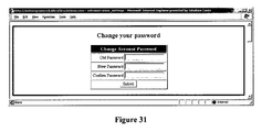
- FIG. 9B In the Tools Menu the user accesses the enforcement times entry tool to enter on-site enforcement times and locations for overlay in enforcement charts ( FIG. 16 ), and the data management tool which provides a means for reviewing and editing data name fields for all the data in the system ( FIGS. 31-33 ).
- FIG. 10 The Reports Menu lets the user navigate to screens for generating many reports which are all described below.
- the screens all generally ask for a data range over which to generate the report and then provide a custom report.
- the data range includes the time and dates, as well as the data label ranges.
- the data is independent of the sensor unit, as they all provide raw data for use in generating the reports which are generally comparative in nature. Some reports are dependent on the unit, such as the battery history report and the signal history report.
- the “Suggest a Report” screen allows the user to contact ATS with suggestions for future reports that can be generated from the data on the system.
- FIG. 11 The SPEEDsentry Sign Settings Screen provides a summary of the settings on all of the current speed display sensors in a customer's sensor network. It includes information including location, unit name, time of last login to the WebEmpowered system, display mode, sign/radar sensor mode, posted speed limit, display trigger speed or condition, strobe trigger speed or condition, relay trigger speed or condition, data logging status and radar unit settings. This data is current as of the last time the unit logged into the system. The screen will also keep track of both the current sign settings and the pending settings that will take effect upon the sign's next contact with the server.
- FIG. 12 The WebEmpowered Scheduling Screen allows the user to schedule communication events with each of the sensors that they are maintaining.
- the screen lists all available units under control and their current location provided by the user.
- the user enables the data upload and schedules the approximate time of the upload.
- the system uploads the data as near as possible to this time, depending on the schedule of all uploads required and the main system loading.
- the user also schedules how often they want the sign to call into the server for setting updates, which allow the sign to receive new setting information. Frequent setting updates might be used in a school zone where they want the sign to operate differently depending on the current event schedule at the school.
- the scheduled calls are an important feature of the design, as the power required to keep the sign on-line all of the time awaiting a call would make operation from a self-contained battery impractical.
- the solution is for the sign to power up the modem and call in to the server on these scheduled events.
- FIG. 13 The SPEEDsentry Filters and Associations Screen lets the user review the current data label settings for each speed display sensor unit in the field at the time of the last data upload. This summary can help the user maintain consistency in their data labeling process. It also allows the user to edit the location and put in a future or past location, so the data will automatically be split between the old and the new location upon the next data upload. The user can schedule this move either before or after the actual move. It just has to be entered before the next scheduled data upload to take effect. After the scheduled data upload, a data file can be split between two locations in the Traffic Data Management screen.
- FIG. 14 The WebEmpowered Data Filter Screen allows the user to set up the fields to be used to label each uploaded data set. They get to select whether they want to use the four custom fields in addition to the standard data name fields—Traffic Study, Roads and Locations, and the conditional fields—direction, school zone, work zone, enforcement presence, day(s) of the week, direction and speed display on or off. If they choose to use the custom fields, they get to name the custom fields they select so these will get uniform input names as they are used in the process of data uploading. In this example, these are the season study and the event type for the two selected custom fields. To keep the system and interface as simple and as clear as possible, the system will keep these fields hidden if the customer does not want to use them.
- This screen allows the user to review all of the labels in each data field for consistency relating to the name of the field and to the appropriateness of the desired studies and reports to be generated. The names can be edited in this section to simplify and keep the report generation process easy and relevant.
- FIG. 15 The WebEmpowered Enforcements entry screen and history screens allow the traffic officer or user to enter new enforcement activity times and locations and review past enforcement and times locations. This data is used in the enforcement vs. speed overlay chart. The user can log police vehicle enforcement times (speed traps) that allow for overlay of the actual enforcement times over the graph of the speed data.
- FIG. 16 This overlay is used to show the rise in average speed after police on-site speed enforcement ends, and is an important feature of the invention.
- the user or traffic officer can see when the enforcement effectiveness of having a manned police vehicle enforcing the speed limit has decayed and the average speeds have gone back up to non-enforced levels. Only then do they enforce to utilize the enforcement resources effectively, rather than enforcing using seat-of-the-pants instinct.
- a speed sensor is placed in the proximity of an enforcement location and records speed data both when the police car is on site and when it isn't. Then, the speeds when no police car is present can be reviewed against the speeds with the police car's presence to see the effect of the police enforcement activity on the speeds.
- This chart provides a visual display of this situation and provides a systematic method for determining enforcement locations and timing in place of conventional “seat-of-the-pants” enforcement planning.
- the system can be programmed to provide an alert when the average speed has risen a set amount over, or is a multiple of a selected speed so the user is automatically alerted to the need for on-site police enforcement.
- FIGS. 17-18 The Battery History Report request screen allows the user to enter a sensor unit and date range over which to generate a report providing the battery decay and recharge history.
- the battery history report shows a graph of the battery decay and can provide the user with a predictive trend of when they need to change the battery in a specific location. This charting, used in combination with other available data can show effects of location, time, day of the week, weather, sign settings and many other factors. This report can be selected by unit or by location.
- FIGS. 19-20 The Signal History Report request screen allows the user to select a unit and date range for which to review the cellular signal strength for a particular device at a specific location over a particular date range.
- the signal history shows a chart of the signal strength so the user can identify whether they have sufficient cellular signal strength in a particular location to reliably get the data back from the unit. It may also provide information of a particular time of day when the signal is the strongest and let the user schedule downloads at this time of day. This report can be selected by unit or by location.
- FIG. 21-22 The Data History Report request screen allows the user to select a unit or location and date range for which to generate a report to review the data availability history.
- This data history report shows that data exists for this particular sensor over the selected date range and provides a picture of the completeness of the data, and therefore the quality of the resulting reports. It lets the user visualize time gaps in the data for purposes of troubleshooting and for evaluation of the quality of reports generated from this data.
- FIG. 23 The Graphical Trends Report request screen lets the user select the data criteria to generate the Summarized Speed Report ( FIG. 24 ). For the criteria related to the report, they get to select all of the labels for each data field that they are using, what they want displayed on the report including average speed, 85 th percentile speed and total car volume.
- FIG. 24 The Summarized Speed Report gives the user a quickly interpreted graphical summary of the speed situation for the selected data criteria.
- this chart provides the average speeds, maximum and minimum speeds, 85 th percentile speeds, and vehicle counts over the date and time range selected for a specific time reporting period breakdown.
- the data could be reviewed in 1 hour time windows, 30 minute time windows or 15 minute windows or any appropriate window.
- This data is independent of the sensor unit, as the report is generated using the data labels only and the data is therefore independent of the sensor unit. It is also possible to look at a data set with the day averaged together, so the user can look for trends that are particular to a specific day of the week, such as higher speeds on a Friday night.
- FIG. 25 This report is the Speed Summary Chart. This chart provides a vehicle count for each selected time window per selected speed grouping over the selected date range for the data with the data label criteria selected. All of the criteria are selected by the user when generating the report. The report also has the ability to color different blocks different colors depending on the count range so there is a visual picture of the periods and speeds with the highest vehicle counts.
- FIG. 26 This report is the Vehicle Count Summary Report. This chart provides a daily vehicle count for each selected time window over the selected date range for the data with the data label criteria selected. All of the criteria are selected by the user when generating the report. The report also has the ability to color different blocks different colors depending on the count range so there is a visual picture of the periods and days with the highest vehicle counts.
- FIG. 27 One of the key reports of the WebEmpowered system is the Enforcement Priority Report. This report saves the user significant time in determining the enforcement priorities within his area of coverage. All of the sensors are providing data for the system, and this data is labeled upon upload with the user's data label criteria. The user selects the data label criteria including sensor location, school zone, road, side of street, etc., selects a data and time range, and the Enforcement Priorities report is generated. For the selected data range, this report automatically reports to the user the periods of highest speed violations and the highest individual speed events. The officer can use the time windows for enforcement priorities, and can also look at the high speed events to determine any trends from this data, potentially identifying a specific driver who passes at a high rate of speed near the same time daily.
- the report also generates a summary for all of the data sets used in the generation of the report.
- the same periods of high speed events can be highlighted to make events in the same time period on different days stand out as a potential regular violator. This helps the user identify this violator and respond with on-site enforcement during this time window.
- An example of how national averages are displayed alongside customer data is shown in the “Summary” portion of the FIG. 27 .
- FIG. 29 The data export wizard allows the user to export the data from the database into their own system. This allows the user to take the raw data and perform their own calculations independent of the WebEmpowered system. This also allows the user to store their raw data outside of the WebEmpowered system if they prefer to do this.
- FIG. 30 The Alert Notification Screen allows the user to set parameters for individual event alerts and then determine who gets these email alerts.
- Alerts include tamper alert sensitivity based on the sensitivity of the motion sensor in the speed display, an alert when the battery gets down to a selected percentage of remaining power, an alert that new data has been uploaded, an alert that traffic is moving under a selected speed indicating an accident or similar event, an alert for an individual high speed data recording above a selected speed that requires immediate attention or an alert that the effectiveness of on-site traffic enforcement has worn off as the speeds in the location have increased back to selected levels. Maintenance alerts can also be selected to receive system operation based alerts.
- FIG. 34A-34B The Road Report gives the user summary information that can help determine the traffic flow characteristics of a road or range of roads. For a selected data range, the system provides a report with the periods of maximum and minimum volumes and speeds. This data can be used to schedule road work during periods of minimum volume and minimum speed. The data timeframe for the window is adjustable so the user can enter the duration of the selected road maintenance and the system will report the best timeframe of this duration to perform the maintenance.
- FIG. 35A All reports criteria can be saved to the server so that they can be brought up very quickly at a later time (see FIG. 35B ), or scheduled for automatic email delivery on a schedule set by the user.
- FIG. 35B If the user had previously saved report criteria, they can repopulate all of the filters with a single button click which saves times and provides consistent reporting across multiple users and report times.
- FIG. 36 Users, while generating reports, can compare their data with other areas of the country to see where they stand in regards to effectiveness.
- the present invention is most easily understood in the context of a radar speed trailer.
- inventive features are applicable to any vehicle sensor device (a radar speed trailer is one embodiment of a vehicle sensor device), such as a stationery radar gun with no speed indicators.
- the vehicle sensor device may be trailer-mounted, pole-mounted, or free-standing. Accordingly, the phrase, “vehicle sensor device” is used most generically to refer to the devices described above.
- the present invention may be implemented with any combination of hardware and software. If implemented as a computer-implemented apparatus, the present invention is implemented using means for performing all of the steps and functions described above.
- the present invention can be included in an article of manufacture (e.g., one or more computer program products) having, for instance, computer useable media.
- the media has embodied therein, for instance, computer readable program code means for providing and facilitating the mechanisms of the present invention.
- the article of manufacture can be included as part of a computer system or sold separately.
Landscapes
- Engineering & Computer Science (AREA)
- Physics & Mathematics (AREA)
- General Physics & Mathematics (AREA)
- Theoretical Computer Science (AREA)
- Databases & Information Systems (AREA)
- Analytical Chemistry (AREA)
- Chemical & Material Sciences (AREA)
- General Engineering & Computer Science (AREA)
- Radar, Positioning & Navigation (AREA)
- Remote Sensing (AREA)
- Data Mining & Analysis (AREA)
- Computing Systems (AREA)
- Medical Informatics (AREA)
- Computer Networks & Wireless Communication (AREA)
- Signal Processing (AREA)
- General Health & Medical Sciences (AREA)
- Health & Medical Sciences (AREA)
- Aviation & Aerospace Engineering (AREA)
- Human Computer Interaction (AREA)
- Traffic Control Systems (AREA)
Abstract
Description
- 1. Data from multiple sources can be placed into a common database.
- 2. Data from any number of sensor devices can be automatically and independently uploaded into a common database with near immediate access to reports on the data from any web browser.
- 3. Data sets can be identified by a plurality of names (e.g., up to 12 names) for later sorting and organizing. These names may include county or municipality, road name, location on the road, side of the road, speed limit, school zone, work zone, or the like. The names are determined by the user and determined by future studies. Dates are automatically included, as these are part of the data.
- 4. Data can be grouped by the named fields and used to generate reports over a broad range or a very narrow range depending on the criteria selected.
- 5. The system can sort the data automatically and determine for the traffic officer the time windows with the highest percentage of speed violations or the highest speed violation events within a selected data range.
- 6. The system can automatically generate summary charts that provide the user with a traffic and speed summary for a given data range, the summary including vehicle count, maximum and minimum speeds, average speeds, percentile speeds (e.g., 85th percentile speeds), and can provide other information.
- 7. The system can provide the effectiveness decay rate of actual police enforcement by allowing the user to chart the speeds in a particular location and overlay times when an officer was present and providing on-site enforcement. The system can monitor the speed in the location and when the speeds creep back up to a set speed or multiple of the speed after the enforcement period, the officer can be notified to provide enforcement again and reduce the speeds.
- 8. The system can provide alerts including individual high speed events, tamper alerts, low average speed indicating a problem, and average speed above the set value. All of the alerts have settings that are configured by the user.
- 9. The system can provide road volume reports with variable length periods of minimum vehicular traffic and maximum traffic.
- 10. The system can compare speed and traffic volume statistics across multiple jurisdictions and across the nation to determine the effectiveness of a local program compared to a national average or other average or comparison statistics determined to be appropriate.
- 1. Provide an installed base of multiple traffic sensing devices at different locations. The installed base optionally comprises multiple customers, each having at least one traffic sensing device installed at one or more locations.
- 2. Collect vehicle/traffic data from multiple locations (all or a subset of the installed base) as vehicles pass by the sensing devices (e.g., SPEEDsentry devices).
- 3. Transmit via electronic means (automatically or manually) the collected data to one or more databases, each aggregating data from multiple sensing devices.
- 4. Provide customer access to one or more predefined reports derived from the database(s) via a user interface (e.g., traffic management reports or traffic enforcement reports using selected for filtered data).
A. Providing an Installed Base
- (1) downloading the radar speed sign data to a PDA, connecting it to a computer with an internet browser, and uploading the data;
- (2) connecting the radar speed sign directly to a computer with an internet connection (with appropriate software); and/or
- (3) connecting the radar speed sign to a wireless communications module capable of TCP/IP (e.g., cellular GPRS, cellular CDMA, 801.11/WiFi). See
FIG. 2 .
- 600: UserTypes—Various types of users (Administrator, Demo Users, Standard User)
- user_type_id: Primary key, index
- description: A description of the type of user
- 601: UserEmails—Acts as an email address pool
- email_id: Primary key, index
- user_id: The user that this email address belongs to—linked to users
- email_address: An email address string.
- is_mobile: A field indicating whether the email address in this row is a mobile device
- 602: UserEventsLog—Logs actions by the users on the website
- user_events_log_id—Index of the event
- user_id—the user who created the event
- user_event_id—the index of the event that is begin recorded (see UserEvents table)
- timestamp—the date and time (no seconds)
- 603: Users—List of all the users in the system and some associated information regarding their account
- user_id—A unique ID for the user.
- UserName—login name string
- Password—the account's password string
- user_type—The index of the associated type of the user, see UserTypes
- display_name—A string containing a friendlier name to display within the website
- IsDisabled—A bit flag that determines if the account is active or not
- IsMetric—A bit flag that determines if the account is a metric or English account
- last_login—A timestamp field noting the last login date and time at the website
- ICS_CustomerID—An internal account ID that can associate
- 604: email_linx—A link table associating a product/device with multiple types of alerts and multiple email addresses
- product_id—The associated product that an alert is for. (See UserProducts)
- alert_type—The type of alert
- email_id—The email address ID associated with the alert (See UserEmails)
- 605: SIMS—An internal book-keeping list of all cellular SIMs and phone numbers in the system
- SIMid—A unique identifying index.
- ICCID—The SIM's serial number
- phone_number—The phone number associated with the account
- aqusition_date—The date that the ICCID was activated by the cellular carrier.
- 606: UserEvents—Lists all possible users actions with descriptions
- user_event_id—Unique index
- user_event_description—A string describing the event
- 607: CustomfieldNames—A table associating user-defined strings with Custom1/2/3/4 to make the system appear more user friendly.
- 608: UserProducts—A table of all products/devices and associated settings.
- product_id—A unique index
- product_type—the index of the type of product. (See ProductTypes)
- user_id—The index of the associated user/account that this device belongs to
- product_name—A user customizable string that is used to identify individual devices on the website.
- serial_number—The serial number associated with the device
- firmware_version—The version of the firmware in the communications module
- SIM_id—The ID of the associated SIM in this product
- tamper_enabled—A bit flag noting whether they have purchased the tamper alarm feature
- 609: ServerEventsLog—Logs actions by the server software on the website
- server_events_log_id—Index of the event
- product_id—The user who created the event
- server_event_id—The index of the event that is begin recorded (see ServerEvents table)
- event_detail—A string that is used to log event_specific details
- timestamp—the date and time (no seconds)
- 610: ServerEvents—Lists all possible server actions with descriptions
- server_event_id—Unique index
- server_event_description—A string describing the event
- 611: Enforcement—A table allowing a list of times and locations where police enforcement was in progress.
- Enforcement id—A unique identifier.
- user_id—The associated user/account.
- Start_time—The time indicating when the enforcement started
- End_time—The time indicating when the enforcement ended
- Road_id—The road at which the enforcement took place.
- Location_id—The location on the road on which the enforcement took place
- 612: SignalHistory—An hourly log of the signal quality uploaded by the devices.
- signal_id—A unique ID
- product_id—The id of the product who's reading this is
- date_time—The timestamp of the reading
- signal_level—The reading itself
- 614: ProductTypes—A table of all the possible product types (15″ radar sign, 18″ radar sign, etc.)
- product_type_id—A unique ID
- product_name—A string representing the title of the product.
- firmware_version—The latest firmware version for this product.
- 615: BatteryHistory—An hourly log of the battery level uploaded by the devices.
- battery_id—A unique ID.
- product_id—The id of the product who's reading this is.
- date_time—The timestamp of the reading.
- battery_level—The reading itself.
- 616: ByteTransactions—A log of the number of bytes transferred via cellular for billing purposes
- byte_id—A unique ID.
- time_stamp—The time the recording of bytes took place.
- byte_count—The number of bytes for the session being recorded
- product_id—The product that the bytes were transferred to and from.
- 617: SavedReports—A list of all reports and the settings that the users have set to generate them
- report_type—The type of report that the entry is for
- report_name—The user's title for the report.
- memorized_schedule—The schedule type for the report.
- 618: DataSummary—A table of processed data ready for display by the user.
- data_summary_id—A unique ID
- upload_id—The upload that this raw data is associated with.
- start_time—The start time for this bin
- end_time—The end time for this bin (start time+14 minutes, 59 seconds, 997 milliseconds)
- min_speed—The minimum speed detected during this bin.
- mean_speed—The average speed calculated for this bin.
- median_speed—The 50% median speed calculated for this bin.
- max_speed—The maximum speed detected for this bin.
- pcnt_85_speed—The 85% speed calculated for this bin.
- total_points—The total number of raw speed points used when calculating this bin (for weighting purposes.)
- avg_tr_spd_entering_above_SL—The average speed of a train of cars when entering the view of the radar gun when the entering speed is over the speed limit.
- avg_tr_spd_leaving_above_SL—The average speed of a train of cars when leaving the view of the radar gun when the entering speed is over the speed limit.
- train_cnt_above_SL—A count of the number of trains used to make this calculation.
- avg_tr_spd_entering_below_SL—The average speed of a train of cars when entering the view of the radar gun when the entering speed is under the speed limit.
- avg_tr_spd_leaving_below_SL—The average speed of a train of cars when leaving the view of the radar gun when the entering speed is below the speed limit.
- train_cnt_below_SL—A count of the number of trains used to make this calculation.
- vehicle_cnt_total—The number of vehicles detected in the time bin.
- vehicle_cnt_##_##—The number of vehicles detected in the time bin for this specified 5 MPH speed bin.
- 619: ExtremeViolators—A table listing up to three of the top violators in a 15 minute time window
- violators_id—A unique ID
- data_summary_id—The associated data ID row that the entry is linked to
- time_stamp—The time of the speed event
- speed—The recorded speed of the event
- 620: RawData—The raw speed data pulled from the radar gun
- data_id—A unique ID.
- time_stamp—The time (with milliseconds) of the speed reading.
- speed—The speed detected by the radar gun
- upload_id—The upload that this data is associated with.
- 621: Uploads
- product_id—The associated product that this dataset was uploaded by.
- map_position_top—The Y coordinate noting where on the current map the device was.
- map_position_left—The X coordinate noting where on the current map the device was.
- gps_degrees—The degrees reading from the GPS device for this upload.
- gps_minutes—The minutes reading from the GPS device for this upload.
- gps_seconds—The seconds reading from the GPS device for this upload.
- road_id—The road associated with this upload.
- location_id—The location associated with this upload.
- direction_id—The direction associated with this upload.
- custom1_id—The custom1 field associated with this upload.
- custom2_id—The custom2 field associated with this upload.
- custom3_id—The custom3 field associated with this upload.
- custom4_id—The custom4 field associated with this upload.
- SchoolZone—A bit flag noting whether the device is in a school zone
- WorkZone—A bit flag noting whether the device is in a work zone
- display_type—The device's display type with this data.
- sign_mode—The device's sign mode with this data.
- radar_sensitivity—The device's radar sensitivity with this data.
- display_trigger—The device's display trigger with this data. (See Triggers table)
- display_trigger_speed—The device's display trigger speed with this data.
- strobe_trigger—The device's strobe trigger with this data. (See Triggers table)
- strobe_trigger_speed—The device's strobe trigger speed with this data.
- relay_trigger—The device's relay trigger with this data. (See Triggers table)
- relay_trigger_speed—The device's relay trigger speed with this data.
- speed_limit—The device's speed limit with this data.
- reduced_speed_limit—The device's reduced speed limit with this data.
- max_speed_displayed—The device's maximum speed displayed with this data.
- timeAon—The device's Time window A on time with this data.
- TimeAoff—The device's Time window A off time with this data.
- TimeBon—The device's Time window B on time with this data.
- TimeBoff—The device's Time window B off time with this data.
- pickup_distance—The device's manually entered pickup distance estimate with this data.
- upload_time—The time this upload took place.
- IsSummarized—A bit flag that notes whether the raw data for this upload has been summarized.
- HasRawData—A bit flag that notes whether the raw data for this upload still exists in the database.
- min_speed_summary—The speed at which all data below the value was ignored when calculating the summary.
- max_speed_summary—The speed at which all data above the value was ignored when calculating the summary.
- 622: Roads—A table containing all roads used by all accounts.
- road_id—A unique ID.
- road_name—A string containing the road's name
- user_id—The associated account for the road described.
- IsActive—This marks whether the user has disabled the road (for display purposes.)
- 623: Locations—A table containing all locations use by all accounts.
- location_id—A unique ID.
- road_id—The ID of the road that this location is on.
- location_name—A string containing the road's name
- IsActive—This marks whether the user has disabled the road (for display purposes.)
- 624: Directions—A table listing the 4 possible directions a road could have
- direction_id—A unique ID.
- direction_initials—The initials of the directions (NB—North Bound)
- direction_name—A string containing a show description of the direction (North Bound)
- 625: Custom1—A table containing all
custom 1 fields used by all accounts.- custom1_id—A unique ID.
- custom1_name—A string containing the
custom 1 field's name - user_id—The associated account for the
custom 1 field described. - IsActive—This marks whether the user has disabled the
custom 1 field (for display purposes.)
- 626: Custom2—A table containing all
custom 1 fields used by all accounts.- custom2_id—A unique ID.
- custom2_name—A string containing the
custom 2 field's name - user_id—The associated account for the
custom 2 field described. - IsActive—This marks whether the user has disabled the
custom 2 field (for display purposes.)
- 627: Custom3—A table containing all
custom 1 fields used by all accounts.- custom3_id—A unique ID.
- custom3_name—A string containing the
custom 3 field's name - user_id—The associated account for the
custom 3 field described. - IsActive—This marks whether the user has disabled the
custom 3 field (for display purposes.)
- 628: Custom4—A table containing all
custom 1 fields used by all accounts.- custom4_id—A unique ID.
- custom4_name—A string containing the
custom 4 field's name - user_id—The associated account for the
custom 4 field described. - IsActive—This marks whether the user has disabled the
custom 4 field (for display purposes.)
- 629: Triggers—A table containing the possible speed triggers for the sign
- trigger_id—A unique ID.
- trigger_desc—A description of the trigger (All Vehicles, Speed Limit, None, etc.)
- 630: Settings—A table containing all of the settings for all devices.
- product_id—The associated product that this dataset was uploaded by.
- map_position_top—The Y coordinate noting where on the current map the device was.
- map_position_left—The X coordinate noting where on the current map the device was.
- gps_degrees—The degrees reading from the GPS device for this upload.
- gps_minutes—The minutes reading from the GPS device for this upload.
- gps_seconds—The seconds reading from the GPS device for this upload.
- current_road—The road associated with this upload.
- current_location—The location associated with this upload.
- current_direction—The direction associated with this upload.
- current_custom1—The custom1 field associated with this upload.
- current_custom2—The custom2 field associated with this upload.
- current_custom3—The custom3 field associated with this upload.
- current_custom4—The custom4 field associated with this upload.
- SchoolZone—A bit flag noting whether the device is in a school zone
- WorkZone—A bit flag noting whether the device is in a work zone
- LastLogin—A timestamp of when the sign last logged into the server.
- display_type—The device's display type with this data.
- sign_mode—The device's sign mode with this data.
- radar_sensitivity—The device's radar sensitivity with this data.
- display_trigger—The device's display trigger with this data. (See Triggers table)
- display_trigger_speed—The device's display trigger speed with this data.
- strobe_trigger—The device's strobe trigger with this data. (See Triggers table)
- strobe_trigger_speed—The device's strobe trigger speed with this data.
- relay_trigger—The device's relay trigger with this data. (See Triggers table)
- relay_trigger_speed—The device's relay trigger speed with this data.
- speed_limit—The device's speed limit with this data.
- reduced_speed_limit—The device's reduced speed limit with this data.
- max_speed_displayed—The device's maximum speed displayed with this data.
- TimeAon—The device's Time window A on time with this data.
- TimeAoff—The device's Time window A off time with this data.
- TimeBon—The device's Time window B on time with this data.
- TimeBoff—The device's Time window B off time with this data.
- pickup_distance—The device's manually entered pickup distance estimate with this data.
- IsMetric—A bit flag noting whether this device is a metric unit.
- low_battery_notify—A number representing the percentage at which the device will auto-notify the user when the battery hits that voltage.
- tamper_notify—A sensitivity at which the device will notify the user when it detects vibrations on the sign.
- bad_radar_notify—A back end alert enable bit that allows ATS to be notified if the radar gun appears to have gone bad.
- slow_traffic_notify—A speed at which the device must detect to send a slow traffic alert.
- speed_over_notify—A speed at which the device must detect to send a speeder alert.
- new_data_notify—A bit flag noting whether the user wants to be notified of new data being uploaded into the system.
- uncalibrated_voltage_notify—A back end alert enable bit that allows ATS to be notified if the sign has not had its battery voltage correctly calibrated.
- gmt_offset—A value that allows the server to know what time zone the device is in to send the correct time to.
- settings_update_freq—A frequency (in hours) at which the sign will get online to checks settings.
- settings_update_time—A time for doing the first settings update.
- data_upload_freq—A frequency (in days) at which the sign will get online and upload data.
- data_upload_time—A time within the day to do the data upload
- data_upload_percent—A data percent full value at which the sign will ignore its schedule and upload data.
- ss_firmware_version—The firmware version on the device.
- force_server_alerts—A bit flag noting to the system that the user has change alerts.
- force_server_schedule—A bit flag noting to the system that the user has changed the scheduling.
- force_server_sign_settings—A bit flag noting to the system that the user has changed the sign settings.
- min_speed_summary—The speed to use at which all data below the value will be ignored when calculating the summary.
- max_speed_summary—The speed to use at which all data above the value will be ignored when calculating the summary.
Software Screen Shots and Discussion of the Functions:
Claims (14)
Priority Applications (1)
| Application Number | Priority Date | Filing Date | Title |
|---|---|---|---|
| US15/229,606 US9721027B2 (en) | 2006-09-19 | 2016-08-05 | Collection, monitoring, analyzing and reporting decay rate of traffic speed data via vehicle sensor devices placed at multiple remote locations |
Applications Claiming Priority (6)
| Application Number | Priority Date | Filing Date | Title |
|---|---|---|---|
| US84579606P | 2006-09-19 | 2006-09-19 | |
| US11/901,357 US8417442B2 (en) | 2006-09-19 | 2007-09-17 | Collection, monitoring, analyzing and reporting of traffic data via vehicle sensor devices placed at multiple remote locations |
| US13/792,359 US8755990B2 (en) | 2006-09-19 | 2013-03-11 | Collection, monitoring, analyzing and reporting of traffic data via vehicle sensor devices placed at multiple remote locations |
| US14/300,570 US9070287B2 (en) | 2006-09-19 | 2014-06-10 | Collection, monitoring, analyzing and reporting of traffic data via vehicle sensor devices placed at multiple remote locations |
| US14/753,875 US9411893B2 (en) | 2006-09-19 | 2015-06-29 | Collection, monitoring, analyzing and reporting of traffic data via vehicle sensor devices placed at multiple remote locations to create traffic priority enforcement reports |
| US15/229,606 US9721027B2 (en) | 2006-09-19 | 2016-08-05 | Collection, monitoring, analyzing and reporting decay rate of traffic speed data via vehicle sensor devices placed at multiple remote locations |
Related Parent Applications (1)
| Application Number | Title | Priority Date | Filing Date |
|---|---|---|---|
| US14/753,875 Continuation US9411893B2 (en) | 2006-09-19 | 2015-06-29 | Collection, monitoring, analyzing and reporting of traffic data via vehicle sensor devices placed at multiple remote locations to create traffic priority enforcement reports |
Publications (2)
| Publication Number | Publication Date |
|---|---|
| US20170061020A1 US20170061020A1 (en) | 2017-03-02 |
| US9721027B2 true US9721027B2 (en) | 2017-08-01 |
Family
ID=39189710
Family Applications (5)
| Application Number | Title | Priority Date | Filing Date |
|---|---|---|---|
| US11/901,357 Active 2031-10-23 US8417442B2 (en) | 2006-09-19 | 2007-09-17 | Collection, monitoring, analyzing and reporting of traffic data via vehicle sensor devices placed at multiple remote locations |
| US13/792,359 Active US8755990B2 (en) | 2006-09-19 | 2013-03-11 | Collection, monitoring, analyzing and reporting of traffic data via vehicle sensor devices placed at multiple remote locations |
| US14/300,570 Active US9070287B2 (en) | 2006-09-19 | 2014-06-10 | Collection, monitoring, analyzing and reporting of traffic data via vehicle sensor devices placed at multiple remote locations |
| US14/753,875 Active US9411893B2 (en) | 2006-09-19 | 2015-06-29 | Collection, monitoring, analyzing and reporting of traffic data via vehicle sensor devices placed at multiple remote locations to create traffic priority enforcement reports |
| US15/229,606 Active US9721027B2 (en) | 2006-09-19 | 2016-08-05 | Collection, monitoring, analyzing and reporting decay rate of traffic speed data via vehicle sensor devices placed at multiple remote locations |
Family Applications Before (4)
| Application Number | Title | Priority Date | Filing Date |
|---|---|---|---|
| US11/901,357 Active 2031-10-23 US8417442B2 (en) | 2006-09-19 | 2007-09-17 | Collection, monitoring, analyzing and reporting of traffic data via vehicle sensor devices placed at multiple remote locations |
| US13/792,359 Active US8755990B2 (en) | 2006-09-19 | 2013-03-11 | Collection, monitoring, analyzing and reporting of traffic data via vehicle sensor devices placed at multiple remote locations |
| US14/300,570 Active US9070287B2 (en) | 2006-09-19 | 2014-06-10 | Collection, monitoring, analyzing and reporting of traffic data via vehicle sensor devices placed at multiple remote locations |
| US14/753,875 Active US9411893B2 (en) | 2006-09-19 | 2015-06-29 | Collection, monitoring, analyzing and reporting of traffic data via vehicle sensor devices placed at multiple remote locations to create traffic priority enforcement reports |
Country Status (1)
| Country | Link |
|---|---|
| US (5) | US8417442B2 (en) |
Families Citing this family (50)
| Publication number | Priority date | Publication date | Assignee | Title |
|---|---|---|---|---|
| US20060271582A1 (en) * | 2005-05-25 | 2006-11-30 | Caterpillar Inc. | System and method for analyzing raw data files |
| US8417442B2 (en) | 2006-09-19 | 2013-04-09 | Intuitive Control Systems, Llc | Collection, monitoring, analyzing and reporting of traffic data via vehicle sensor devices placed at multiple remote locations |
| US8912901B2 (en) * | 2008-07-16 | 2014-12-16 | Gregory J. Hoeth | Portable security and protection enclosures |
| JP5066206B2 (en) * | 2010-03-11 | 2012-11-07 | 日立オートモティブシステムズ株式会社 | Link string conversion method, road information providing apparatus, and road information providing system |
| US8300349B2 (en) | 2010-08-05 | 2012-10-30 | Lsi Corporation | Systems and methods for format efficient calibration for servo data based harmonics calculation |
| US9811516B2 (en) * | 2010-12-14 | 2017-11-07 | Microsoft Technology Licensing, Llc | Location aware spreadsheet actions |
| US9898454B2 (en) | 2010-12-14 | 2018-02-20 | Microsoft Technology Licensing, Llc | Using text messages to interact with spreadsheets |
| KR101805155B1 (en) * | 2010-12-15 | 2017-12-07 | 한국전자통신연구원 | Apparatus and method for providing driving information of vehicle |
| US9129234B2 (en) | 2011-01-24 | 2015-09-08 | Microsoft Technology Licensing, Llc | Representation of people in a spreadsheet |
| US9103899B2 (en) | 2011-04-29 | 2015-08-11 | The Invention Science Fund I, Llc | Adaptive control of a personal electronic device responsive to a micro-impulse radar |
| US9151834B2 (en) * | 2011-04-29 | 2015-10-06 | The Invention Science Fund I, Llc | Network and personal electronic devices operatively coupled to micro-impulse radars |
| US8884809B2 (en) | 2011-04-29 | 2014-11-11 | The Invention Science Fund I, Llc | Personal electronic device providing enhanced user environmental awareness |
| US9000973B2 (en) | 2011-04-29 | 2015-04-07 | The Invention Science Fund I, Llc | Personal electronic device with a micro-impulse radar |
| US20120330615A1 (en) * | 2011-06-24 | 2012-12-27 | Itron Inc. | Forensic analysis of resource consumption data |
| JP5682510B2 (en) * | 2011-08-30 | 2015-03-11 | 住友電気工業株式会社 | Communication system and master station, slave station and relay station used for this |
| ES2404938B1 (en) * | 2011-11-11 | 2014-07-11 | Proyectos Integrales De Balizamientos, S.L. | SYSTEM TO DETECT THE PRESENCE OF VEHICLES THAT CIRCULATE IN DIRECTION CONTRARY TO THE ESTABLISHED |
| US20130159560A1 (en) * | 2011-12-16 | 2013-06-20 | Mark Cave | Methods and systems to monitor a media device via a usb port |
| JP5543511B2 (en) * | 2012-03-06 | 2014-07-09 | 東芝テック株式会社 | Business support device, portable terminal, and program |
| WO2013142807A1 (en) * | 2012-03-22 | 2013-09-26 | Northeastern University | Conformal and configurable millimeter-wave integrated array radar in a compact package |
| US10318924B2 (en) * | 2012-12-18 | 2019-06-11 | salesforce.com,inc. | User interface date selectors for historical reports |
| US9127955B2 (en) * | 2013-01-31 | 2015-09-08 | GM Global Technology Operations LLC | Adaptive user guidance for navigation and location-based services |
| FR3009640B1 (en) | 2013-08-07 | 2022-11-18 | Coyote Sys | DEVICE AND METHOD FOR AUTOMATIC UPDATING OF A DATABASE OF TRAFFIC SPEED LIMIT |
| US9056556B1 (en) | 2014-02-25 | 2015-06-16 | Elwha Llc | System and method for configuration and management of an energy storage system for a vehicle |
| US9079505B1 (en) | 2014-02-25 | 2015-07-14 | Elwah LLC | System and method for management of a fleet of vehicles having an energy storage system |
| US9878631B2 (en) | 2014-02-25 | 2018-01-30 | Elwha Llc | System and method for predictive control of an energy storage system for a vehicle |
| US9401961B2 (en) | 2014-03-05 | 2016-07-26 | Siemens Industry, Inc. | Cloud-enhanced traffic controller |
| JP6347834B2 (en) * | 2014-06-18 | 2018-06-27 | 日立オートモティブシステムズ株式会社 | On-vehicle program writing device and map data writing device |
| US9984544B2 (en) | 2015-02-17 | 2018-05-29 | Sap Se | Device layout optimization for surveillance devices |
| EP3131020B1 (en) | 2015-08-11 | 2017-12-13 | Continental Automotive GmbH | System and method of a two-step object data processing by a vehicle and a server database for generating, updating and delivering a precision road property database |
| EP3130891B1 (en) | 2015-08-11 | 2018-01-03 | Continental Automotive GmbH | Method for updating a server database containing precision road information |
| US10650621B1 (en) | 2016-09-13 | 2020-05-12 | Iocurrents, Inc. | Interfacing with a vehicular controller area network |
| ES2858448T3 (en) * | 2017-02-01 | 2021-09-30 | Kapsch Trafficcom Ag | A procedure for predicting traffic behavior on a highway system |
| US10654570B2 (en) | 2017-06-05 | 2020-05-19 | International Business Machines Corporation | Vehicular alert system |
| US12045295B2 (en) * | 2017-09-20 | 2024-07-23 | Auryc, Inc. | Indexable and searchable replay of website user behavior |
| CN108010317A (en) * | 2017-11-29 | 2018-05-08 | 天津易华录信息技术有限公司 | A kind of traffic administration big data system |
| CN108509576B (en) * | 2018-03-28 | 2021-04-20 | 浙江知水信息技术有限公司 | Electronic map-based filtering optimization method for wrong point positions of patrol track |
| CN108614928A (en) * | 2018-04-16 | 2018-10-02 | 北京航空航天大学 | The artificial intelligence generation method and device of figure in digital aircraft simulation report |
| US10810872B2 (en) * | 2018-07-31 | 2020-10-20 | Baidu Usa Llc | Use sub-system of autonomous driving vehicles (ADV) for police car patrol |
| US20230146823A1 (en) * | 2018-11-20 | 2023-05-11 | Laser Technology, Inc. | Laser ranging and speed measurement device incorporating on-board data storage with gps, compass, excessive panning detection and voice recognition technology |
| US10917473B2 (en) * | 2018-12-14 | 2021-02-09 | Astec, Inc. | Road sensor system |
| CN109461312B (en) * | 2018-12-27 | 2020-10-30 | 泰华智慧产业集团股份有限公司 | Vehicle passing data duplication removing method based on redis |
| CN109765555B (en) * | 2018-12-28 | 2023-06-20 | 通鼎互联信息股份有限公司 | Method and device for realizing WSN node positioning by constructing virtual SAR image |
| CN109637140A (en) * | 2019-01-09 | 2019-04-16 | 谷振楠 | Mobile vehicle traffic control system |
| CN110310479A (en) * | 2019-06-20 | 2019-10-08 | 云南大学 | A kind of Forecast of Urban Traffic Flow forecasting system and method |
| CN110728848A (en) * | 2019-09-25 | 2020-01-24 | 陈广柱 | Personnel transferring and distributing system for traffic police commands |
| US11350157B2 (en) | 2020-04-02 | 2022-05-31 | Rovi Guides, Inc. | Systems and methods for delayed pausing |
| JP7318612B2 (en) * | 2020-08-27 | 2023-08-01 | 横河電機株式会社 | MONITORING DEVICE, MONITORING METHOD, AND MONITORING PROGRAM |
| CN112732744B (en) * | 2021-01-12 | 2023-03-14 | 重庆长安汽车股份有限公司 | Method for efficiently processing CIDAS database based on Tcl/Tk and R languages |
| CN115482020A (en) * | 2021-05-31 | 2022-12-16 | 英业达科技有限公司 | Reward system and method for collecting and feeding back road condition information recorded by vehicle |
| CN114430421A (en) * | 2022-01-19 | 2022-05-03 | 徐工汉云技术股份有限公司 | Method and system for automatically generating alarm rules based on function sets of various vehicle types |
Citations (37)
| Publication number | Priority date | Publication date | Assignee | Title |
|---|---|---|---|---|
| US5231393A (en) | 1988-10-18 | 1993-07-27 | P.A.T., Co. | Mobile speed awareness device |
| US5381155A (en) | 1993-12-08 | 1995-01-10 | Gerber; Eliot S. | Vehicle speeding detection and identification |
| US5548515A (en) | 1990-10-09 | 1996-08-20 | Pilley; Harold R. | Method and system for airport control and management |
| US5574648A (en) | 1990-10-09 | 1996-11-12 | Pilley; Harold R. | Airport control/management system using GNSS-based methods and equipment for the control of surface and airborne traffic |
| US6046696A (en) | 1998-10-26 | 2000-04-04 | Db Design Llc | Apparatus and process for remote certification of doppler radar speed measuring devices |
| US6060984A (en) | 1998-01-29 | 2000-05-09 | Daimlerchrysler Ag | System for monitoring the inflation pressure of a vehicle |
| US6427114B1 (en) | 1998-08-07 | 2002-07-30 | Dinbis Ab | Method and means for traffic route control |
| US20020140924A1 (en) | 1999-01-08 | 2002-10-03 | Richard J. Wangler | Vehicle classification and axle counting sensor system and method |
| US20020194016A1 (en) | 2001-06-13 | 2002-12-19 | Fujitsu Limited | Safe driving support system |
| US20030014181A1 (en) | 2001-07-10 | 2003-01-16 | David Myr | Traffic information gathering via cellular phone networks for intelligent transportation systems |
| US20030182051A1 (en) | 2002-03-20 | 2003-09-25 | Vehicle Information And Communication System Center | Road traffic information transmitter, transmitting method, transmitting program, and road traffic information receiver, receiving method, and reception program |
| US6631384B1 (en) | 2000-09-05 | 2003-10-07 | Algoplus Consulting Limited | Information system and method using analysis based on object-centric longitudinal data |
| US6650945B2 (en) | 2001-01-26 | 2003-11-18 | Pacesetter, Inc. | Implantable cardiac coronary sinus lead having a defibrillation electrode of split configuration and method of manufacture |
| US6650948B1 (en) | 2000-11-28 | 2003-11-18 | Applied Generics Limited | Traffic flow monitoring |
| US6681195B1 (en) | 2000-03-22 | 2004-01-20 | Laser Technology, Inc. | Compact speed measurement system with onsite digital image capture, processing, and portable display |
| US6690294B1 (en) | 2001-07-10 | 2004-02-10 | William E. Zierden | System and method for detecting and identifying traffic law violators and issuing citations |
| US6809656B2 (en) | 1997-09-18 | 2004-10-26 | Kustom Signals, Inc. | Violation alert speed display |
| US6816724B1 (en) | 1999-12-28 | 2004-11-09 | Nokia Corporation | Apparatus, and associated method, for remotely effectuating a transaction service |
| US6853913B2 (en) | 1997-10-16 | 2005-02-08 | Navteq North America, Llc | System and method for updating, enhancing, or refining a geographic database using feedback |
| US20050206531A1 (en) | 2004-01-19 | 2005-09-22 | Rene Noel | Portable system for detection and management of road traffic and environmental conditions |
| US20050248469A1 (en) | 1999-04-19 | 2005-11-10 | Dekock Bruce W | System for providing traffic information |
| US7057531B1 (en) | 2004-01-12 | 2006-06-06 | Anthony Okunuga | System for indicating approaching vehicle speed |
| US20060200035A1 (en) | 2005-02-23 | 2006-09-07 | Digital Intelligence, Llc | System and method for signal decomposition, analysis and reconstruction |
| US20060253246A1 (en) | 2005-04-18 | 2006-11-09 | Cera Christopher D | Data-driven combined traffic/weather views |
| US7151976B2 (en) | 2004-09-17 | 2006-12-19 | Mks Instruments, Inc. | Multivariate control of semiconductor processes |
| US20070067410A1 (en) | 2005-09-20 | 2007-03-22 | Mulligan Bryan P | Method and apparatus for the surveillance, monitoring, management and control of vehicular traffic |
| US20070144814A1 (en) | 2005-12-22 | 2007-06-28 | Arnold Steven D | Torque sensor based steering response |
| US7260790B2 (en) * | 2004-04-27 | 2007-08-21 | International Business Machines Corporation | Integrated circuit yield enhancement using Voronoi diagrams |
| US20070239569A1 (en) | 2000-03-07 | 2007-10-11 | Michael Lucas | Systems and methods for managing assets |
| US20080071467A1 (en) | 2006-09-19 | 2008-03-20 | Johnson Christopher S | Collection, monitoring, analyzing and reporting of traffic data via vehicle sensor devices placed at multiple remote locations |
| US20080074117A1 (en) | 2006-09-25 | 2008-03-27 | Kamel Ashraf K | Sensing circuit and method for diagnosing open and short circuit conditions of a sensor |
| US7711468B1 (en) * | 2008-01-07 | 2010-05-04 | David Levy | System and method for controlling speed of a moving vehicle |
| US20100229096A1 (en) | 2003-01-23 | 2010-09-09 | Maiocco James N | System and Interface For Monitoring Information Technology Assets |
| US20100255772A1 (en) | 2005-07-12 | 2010-10-07 | Martin Edward Hellman | Fm broadcast system competitive with satellite radio |
| US9135816B2 (en) * | 2011-09-08 | 2015-09-15 | Laser Technology, Inc. | Intelligent laser tracking system and method for mobile and fixed position traffic monitoring and enforcement applications |
| US9171461B1 (en) * | 2013-03-07 | 2015-10-27 | Steve Dabell | Method and apparatus for providing estimated patrol properties and historic patrol records |
| US9576484B2 (en) * | 2012-03-02 | 2017-02-21 | Laser Technology, Inc. | System and method for monitoring vehicular traffic with a laser rangefinding and speed measurement device utilizing a shaped divergent laser beam pattern |
Family Cites Families (3)
| Publication number | Priority date | Publication date | Assignee | Title |
|---|---|---|---|---|
| US5732383A (en) * | 1995-09-14 | 1998-03-24 | At&T Corp | Traffic information estimation and reporting system |
| US7426450B2 (en) * | 2003-01-10 | 2008-09-16 | Wavetronix, Llc | Systems and methods for monitoring speed |
| KR101054779B1 (en) * | 2008-12-02 | 2011-08-05 | 기아자동차주식회사 | Passenger Identification System of Vehicle Using Weight Sensor |
-
2007
- 2007-09-17 US US11/901,357 patent/US8417442B2/en active Active
-
2013
- 2013-03-11 US US13/792,359 patent/US8755990B2/en active Active
-
2014
- 2014-06-10 US US14/300,570 patent/US9070287B2/en active Active
-
2015
- 2015-06-29 US US14/753,875 patent/US9411893B2/en active Active
-
2016
- 2016-08-05 US US15/229,606 patent/US9721027B2/en active Active
Patent Citations (44)
| Publication number | Priority date | Publication date | Assignee | Title |
|---|---|---|---|---|
| US5231393A (en) | 1988-10-18 | 1993-07-27 | P.A.T., Co. | Mobile speed awareness device |
| US5548515A (en) | 1990-10-09 | 1996-08-20 | Pilley; Harold R. | Method and system for airport control and management |
| US5574648A (en) | 1990-10-09 | 1996-11-12 | Pilley; Harold R. | Airport control/management system using GNSS-based methods and equipment for the control of surface and airborne traffic |
| US5381155A (en) | 1993-12-08 | 1995-01-10 | Gerber; Eliot S. | Vehicle speeding detection and identification |
| US6809656B2 (en) | 1997-09-18 | 2004-10-26 | Kustom Signals, Inc. | Violation alert speed display |
| US6853913B2 (en) | 1997-10-16 | 2005-02-08 | Navteq North America, Llc | System and method for updating, enhancing, or refining a geographic database using feedback |
| US6060984A (en) | 1998-01-29 | 2000-05-09 | Daimlerchrysler Ag | System for monitoring the inflation pressure of a vehicle |
| US6427114B1 (en) | 1998-08-07 | 2002-07-30 | Dinbis Ab | Method and means for traffic route control |
| US6046696A (en) | 1998-10-26 | 2000-04-04 | Db Design Llc | Apparatus and process for remote certification of doppler radar speed measuring devices |
| US20020140924A1 (en) | 1999-01-08 | 2002-10-03 | Richard J. Wangler | Vehicle classification and axle counting sensor system and method |
| US20050248469A1 (en) | 1999-04-19 | 2005-11-10 | Dekock Bruce W | System for providing traffic information |
| US6816724B1 (en) | 1999-12-28 | 2004-11-09 | Nokia Corporation | Apparatus, and associated method, for remotely effectuating a transaction service |
| US20070239569A1 (en) | 2000-03-07 | 2007-10-11 | Michael Lucas | Systems and methods for managing assets |
| US6681195B1 (en) | 2000-03-22 | 2004-01-20 | Laser Technology, Inc. | Compact speed measurement system with onsite digital image capture, processing, and portable display |
| US6985827B2 (en) | 2000-03-22 | 2006-01-10 | Laser Technology, Inc. | Speed measurement system with onsite digital image capture and processing for use in stop sign enforcement |
| US6631384B1 (en) | 2000-09-05 | 2003-10-07 | Algoplus Consulting Limited | Information system and method using analysis based on object-centric longitudinal data |
| US6650948B1 (en) | 2000-11-28 | 2003-11-18 | Applied Generics Limited | Traffic flow monitoring |
| US6650945B2 (en) | 2001-01-26 | 2003-11-18 | Pacesetter, Inc. | Implantable cardiac coronary sinus lead having a defibrillation electrode of split configuration and method of manufacture |
| US20020194016A1 (en) | 2001-06-13 | 2002-12-19 | Fujitsu Limited | Safe driving support system |
| US6690294B1 (en) | 2001-07-10 | 2004-02-10 | William E. Zierden | System and method for detecting and identifying traffic law violators and issuing citations |
| US6577946B2 (en) | 2001-07-10 | 2003-06-10 | Makor Issues And Rights Ltd. | Traffic information gathering via cellular phone networks for intelligent transportation systems |
| US20030014181A1 (en) | 2001-07-10 | 2003-01-16 | David Myr | Traffic information gathering via cellular phone networks for intelligent transportation systems |
| US20030182051A1 (en) | 2002-03-20 | 2003-09-25 | Vehicle Information And Communication System Center | Road traffic information transmitter, transmitting method, transmitting program, and road traffic information receiver, receiving method, and reception program |
| US20100229096A1 (en) | 2003-01-23 | 2010-09-09 | Maiocco James N | System and Interface For Monitoring Information Technology Assets |
| US7057531B1 (en) | 2004-01-12 | 2006-06-06 | Anthony Okunuga | System for indicating approaching vehicle speed |
| US20050206531A1 (en) | 2004-01-19 | 2005-09-22 | Rene Noel | Portable system for detection and management of road traffic and environmental conditions |
| US7260790B2 (en) * | 2004-04-27 | 2007-08-21 | International Business Machines Corporation | Integrated circuit yield enhancement using Voronoi diagrams |
| US7151976B2 (en) | 2004-09-17 | 2006-12-19 | Mks Instruments, Inc. | Multivariate control of semiconductor processes |
| US20060200035A1 (en) | 2005-02-23 | 2006-09-07 | Digital Intelligence, Llc | System and method for signal decomposition, analysis and reconstruction |
| US8386244B2 (en) | 2005-02-23 | 2013-02-26 | Digital Intelligence, L.L.C. | Signal decomposition, analysis and reconstruction |
| US20060253246A1 (en) | 2005-04-18 | 2006-11-09 | Cera Christopher D | Data-driven combined traffic/weather views |
| US20100255772A1 (en) | 2005-07-12 | 2010-10-07 | Martin Edward Hellman | Fm broadcast system competitive with satellite radio |
| US20070067410A1 (en) | 2005-09-20 | 2007-03-22 | Mulligan Bryan P | Method and apparatus for the surveillance, monitoring, management and control of vehicular traffic |
| US20070144814A1 (en) | 2005-12-22 | 2007-06-28 | Arnold Steven D | Torque sensor based steering response |
| US8755990B2 (en) | 2006-09-19 | 2014-06-17 | Intuitive Control Systems, Llc | Collection, monitoring, analyzing and reporting of traffic data via vehicle sensor devices placed at multiple remote locations |
| US8417442B2 (en) | 2006-09-19 | 2013-04-09 | Intuitive Control Systems, Llc | Collection, monitoring, analyzing and reporting of traffic data via vehicle sensor devices placed at multiple remote locations |
| US20080071467A1 (en) | 2006-09-19 | 2008-03-20 | Johnson Christopher S | Collection, monitoring, analyzing and reporting of traffic data via vehicle sensor devices placed at multiple remote locations |
| US9070287B2 (en) * | 2006-09-19 | 2015-06-30 | Intuitive Control Systems, Llc | Collection, monitoring, analyzing and reporting of traffic data via vehicle sensor devices placed at multiple remote locations |
| US9411893B2 (en) * | 2006-09-19 | 2016-08-09 | Intuitive Control Systems, Llc | Collection, monitoring, analyzing and reporting of traffic data via vehicle sensor devices placed at multiple remote locations to create traffic priority enforcement reports |
| US20080074117A1 (en) | 2006-09-25 | 2008-03-27 | Kamel Ashraf K | Sensing circuit and method for diagnosing open and short circuit conditions of a sensor |
| US7711468B1 (en) * | 2008-01-07 | 2010-05-04 | David Levy | System and method for controlling speed of a moving vehicle |
| US9135816B2 (en) * | 2011-09-08 | 2015-09-15 | Laser Technology, Inc. | Intelligent laser tracking system and method for mobile and fixed position traffic monitoring and enforcement applications |
| US9576484B2 (en) * | 2012-03-02 | 2017-02-21 | Laser Technology, Inc. | System and method for monitoring vehicular traffic with a laser rangefinding and speed measurement device utilizing a shaped divergent laser beam pattern |
| US9171461B1 (en) * | 2013-03-07 | 2015-10-27 | Steve Dabell | Method and apparatus for providing estimated patrol properties and historic patrol records |
Non-Patent Citations (9)
| Title |
|---|
| Decatur SpeedTrak Radar Trailer SST w/K-Band Antenna & LED Display, printout from web page: http://www.radarguns.com/decatur-radar-guns-trailersst.html, printout date: Apr. 24, 2006, original posting date: unknown, 2 pages. |
| Decatur Stat Pak Traffic Data Logger for Police Radar, LIDAR, Radar Trailers . . . , printout from web page: http://www.opticsplanet.net/printable-decatur-stat-pak-traffic-data-logger.html, printout date: Apr. 24, 2006, original posting date: unknown, 2 pages. |
| Ingram Technologies Traffic Radar, Speed Signs, Speed Trailer, Speed Monitoring Trailer, printout from web page: <http://www.ingram-tech.com/us-signs.htm>, printout date: Apr. 24, 2006, original posting date: unknown, 4 pages. |
| Ingram Technologies Traffic Radar, Speed Signs, Speed Trailer, Speed Monitoring Trailer, printout from web page: <http://www.ingram-tech.com/us—signs.htm>, printout date: Apr. 24, 2006, original posting date: unknown, 4 pages. |
| Lewis, Future System Specdfications for Traffic Enforcement Equipment, 1996, IEEE, p. 8/1-8/2. * |
| Product brochure for "SPEEDsentry™ Radar Speed Display & Trailer," Intuitive Control Systems, LLC (d/b/a All Traffic Solutions (ATS)), State College, Pennsylvania, printout date: approximately Jun. 2004, 4 pages. |
| Sato, Radar Speed Monitoring System, 1994, IEEE, p. 89-93. * |
| Sugimoto, Driving Safety Support System: DSSS 1999, IEEE, p. 480-484. * |
| Tarry et al., Development of a Lorry Monitoring and Identification System, 1990, IEEE, p. 173-177. * |
Also Published As
| Publication number | Publication date |
|---|---|
| US20140350832A1 (en) | 2014-11-27 |
| US20130275031A1 (en) | 2013-10-17 |
| US20160042079A1 (en) | 2016-02-11 |
| US20080071467A1 (en) | 2008-03-20 |
| US9070287B2 (en) | 2015-06-30 |
| US20170061020A1 (en) | 2017-03-02 |
| US8755990B2 (en) | 2014-06-17 |
| US9411893B2 (en) | 2016-08-09 |
| US8417442B2 (en) | 2013-04-09 |
Similar Documents
| Publication | Publication Date | Title |
|---|---|---|
| US9721027B2 (en) | Collection, monitoring, analyzing and reporting decay rate of traffic speed data via vehicle sensor devices placed at multiple remote locations | |
| US11157861B2 (en) | Systems and methods for updating maps based on telematics data | |
| US8065342B1 (en) | Method and system for monitoring a mobile equipment fleet | |
| US9778049B2 (en) | Calculating speed and travel times with travel delays | |
| US9626642B2 (en) | Calculating speed and travel times with travel delays | |
| US8996287B2 (en) | Calculating speed and travel times with travel delays | |
| US9129449B2 (en) | Calculating speed and travel times with travel delays | |
| US6393346B1 (en) | Method of monitoring vehicular mileage | |
| US8478453B2 (en) | Apparatus, systems, and methods for processing alerts relating to an in-vehicle control unit | |
| US20040073468A1 (en) | System and method of managing a fleet of machines | |
| US20090240554A1 (en) | System and method for providing identification and location information of certain items | |
| US6813526B1 (en) | Fleet maintenance method | |
| US20150332516A1 (en) | Systems and methods for pairing of for-hire vehicle meters and medallions | |
| CN106682994B (en) | Computer software for monitoring and early warning of pest and disease occurrence density and functional characteristics thereof | |
| CN110543834B (en) | Water well monitoring system and method based on water certificate picture recognition | |
| Dahlgren et al. | Completing the Circle: Using Archived Operations Data to Better Link Decisions to Performance | |
| Berihun | Transportation data collection and dissemination practices in Delaware |
Legal Events
| Date | Code | Title | Description |
|---|---|---|---|
| STCF | Information on status: patent grant |
Free format text: PATENTED CASE |
|
| AS | Assignment |
Owner name: INTUITIVE CONTROL SYSTEMS, LLC, PENNSYLVANIA Free format text: ASSIGNMENT OF ASSIGNORS INTEREST;ASSIGNORS:JOHNSON, CHRISTOPHER S.;GEIGER, JASON S.;GRAEF, JOHN T.;SIGNING DATES FROM 20070913 TO 20070918;REEL/FRAME:051842/0945 Owner name: ALL TRAFFIC SOLUTIONS, INC., VIRGINIA Free format text: CHANGE OF NAME;ASSIGNOR:INTUITIVE CONTROL SYSTEMS, LLC;REEL/FRAME:051950/0122 Effective date: 20160603 |
|
| AS | Assignment |
Owner name: PACIFIC WESTERN BANK, NORTH CAROLINA Free format text: SECURITY INTEREST;ASSIGNOR:ALL TRAFFIC SOLUTIONS, INC.;REEL/FRAME:052198/0241 Effective date: 20181003 |
|
| MAFP | Maintenance fee payment |
Free format text: PAYMENT OF MAINTENANCE FEE, 4TH YR, SMALL ENTITY (ORIGINAL EVENT CODE: M2551); ENTITY STATUS OF PATENT OWNER: SMALL ENTITY Year of fee payment: 4 |
|
| AS | Assignment |
Owner name: ALL TRAFFIC SOLUTIONS, INC., VIRGINIA Free format text: RELEASE BY SECURED PARTY;ASSIGNOR:PACIFIC WESTERN BANK;REEL/FRAME:055577/0890 Effective date: 20210311 |
|
| MAFP | Maintenance fee payment |
Free format text: PAYMENT OF MAINTENANCE FEE, 8TH YR, SMALL ENTITY (ORIGINAL EVENT CODE: M2552); ENTITY STATUS OF PATENT OWNER: SMALL ENTITY Year of fee payment: 8 |