KR20140104484A - Location and event triggered navigation dormancy and wakeup - Google Patents
Location and event triggered navigation dormancy and wakeup Download PDFInfo
- Publication number
- KR20140104484A KR20140104484A KR1020147019327A KR20147019327A KR20140104484A KR 20140104484 A KR20140104484 A KR 20140104484A KR 1020147019327 A KR1020147019327 A KR 1020147019327A KR 20147019327 A KR20147019327 A KR 20147019327A KR 20140104484 A KR20140104484 A KR 20140104484A
- Authority
- KR
- South Korea
- Prior art keywords
- mobile device
- navigation process
- active state
- navigation
- managing
- Prior art date
Links
- 230000005059 dormancy Effects 0.000 title description 3
- 230000001960 triggered effect Effects 0.000 title description 2
- 238000000034 method Methods 0.000 claims abstract description 235
- 230000008569 process Effects 0.000 claims abstract description 171
- 230000007704 transition Effects 0.000 claims abstract description 80
- 230000000694 effects Effects 0.000 claims abstract description 34
- 230000004044 response Effects 0.000 claims abstract description 15
- 238000012545 processing Methods 0.000 claims description 24
- 238000012544 monitoring process Methods 0.000 claims description 13
- 238000000060 site-specific infrared dichroism spectroscopy Methods 0.000 claims description 4
- 230000008859 change Effects 0.000 claims description 2
- 230000006870 function Effects 0.000 description 13
- 238000005259 measurement Methods 0.000 description 8
- 238000004891 communication Methods 0.000 description 5
- 238000013459 approach Methods 0.000 description 4
- 230000003416 augmentation Effects 0.000 description 4
- 238000010586 diagram Methods 0.000 description 4
- 208000034188 Stiff person spectrum disease Diseases 0.000 description 3
- 230000004913 activation Effects 0.000 description 3
- 238000001514 detection method Methods 0.000 description 3
- 238000005516 engineering process Methods 0.000 description 3
- 208000012112 ischiocoxopodopatellar syndrome Diseases 0.000 description 3
- 230000007774 longterm Effects 0.000 description 3
- 230000000007 visual effect Effects 0.000 description 3
- 230000010267 cellular communication Effects 0.000 description 2
- 238000010295 mobile communication Methods 0.000 description 2
- 238000012986 modification Methods 0.000 description 2
- 230000004048 modification Effects 0.000 description 2
- 230000000737 periodic effect Effects 0.000 description 2
- 238000012546 transfer Methods 0.000 description 2
- IRLPACMLTUPBCL-KQYNXXCUSA-N 5'-adenylyl sulfate Chemical compound C1=NC=2C(N)=NC=NC=2N1[C@@H]1O[C@H](COP(O)(=O)OS(O)(=O)=O)[C@@H](O)[C@H]1O IRLPACMLTUPBCL-KQYNXXCUSA-N 0.000 description 1
- 229920010524 Syndiotactic polystyrene Polymers 0.000 description 1
- 230000001133 acceleration Effects 0.000 description 1
- 230000009471 action Effects 0.000 description 1
- 238000003491 array Methods 0.000 description 1
- 230000003190 augmentative effect Effects 0.000 description 1
- 230000008901 benefit Effects 0.000 description 1
- 230000001413 cellular effect Effects 0.000 description 1
- 230000008094 contradictory effect Effects 0.000 description 1
- 238000012937 correction Methods 0.000 description 1
- 230000009849 deactivation Effects 0.000 description 1
- 238000009795 derivation Methods 0.000 description 1
- 229920002239 polyacrylonitrile Polymers 0.000 description 1
- 201000006292 polyarteritis nodosa Diseases 0.000 description 1
- 230000003252 repetitive effect Effects 0.000 description 1
- 238000002490 spark plasma sintering Methods 0.000 description 1
- 230000001052 transient effect Effects 0.000 description 1
Images


Classifications
-
- G—PHYSICS
- G01—MEASURING; TESTING
- G01C—MEASURING DISTANCES, LEVELS OR BEARINGS; SURVEYING; NAVIGATION; GYROSCOPIC INSTRUMENTS; PHOTOGRAMMETRY OR VIDEOGRAMMETRY
- G01C21/00—Navigation; Navigational instruments not provided for in groups G01C1/00 - G01C19/00
- G01C21/26—Navigation; Navigational instruments not provided for in groups G01C1/00 - G01C19/00 specially adapted for navigation in a road network
- G01C21/34—Route searching; Route guidance
- G01C21/36—Input/output arrangements for on-board computers
- G01C21/3626—Details of the output of route guidance instructions
- G01C21/3641—Personalized guidance, e.g. limited guidance on previously travelled routes
-
- G—PHYSICS
- G01—MEASURING; TESTING
- G01C—MEASURING DISTANCES, LEVELS OR BEARINGS; SURVEYING; NAVIGATION; GYROSCOPIC INSTRUMENTS; PHOTOGRAMMETRY OR VIDEOGRAMMETRY
- G01C21/00—Navigation; Navigational instruments not provided for in groups G01C1/00 - G01C19/00
- G01C21/26—Navigation; Navigational instruments not provided for in groups G01C1/00 - G01C19/00 specially adapted for navigation in a road network
- G01C21/265—Navigation; Navigational instruments not provided for in groups G01C1/00 - G01C19/00 specially adapted for navigation in a road network constructional aspects of navigation devices, e.g. housings, mountings, displays
-
- G—PHYSICS
- G01—MEASURING; TESTING
- G01C—MEASURING DISTANCES, LEVELS OR BEARINGS; SURVEYING; NAVIGATION; GYROSCOPIC INSTRUMENTS; PHOTOGRAMMETRY OR VIDEOGRAMMETRY
- G01C21/00—Navigation; Navigational instruments not provided for in groups G01C1/00 - G01C19/00
- G01C21/26—Navigation; Navigational instruments not provided for in groups G01C1/00 - G01C19/00 specially adapted for navigation in a road network
- G01C21/34—Route searching; Route guidance
- G01C21/36—Input/output arrangements for on-board computers
- G01C21/3626—Details of the output of route guidance instructions
- G01C21/3629—Guidance using speech or audio output, e.g. text-to-speech
-
- G—PHYSICS
- G01—MEASURING; TESTING
- G01C—MEASURING DISTANCES, LEVELS OR BEARINGS; SURVEYING; NAVIGATION; GYROSCOPIC INSTRUMENTS; PHOTOGRAMMETRY OR VIDEOGRAMMETRY
- G01C21/00—Navigation; Navigational instruments not provided for in groups G01C1/00 - G01C19/00
- G01C21/26—Navigation; Navigational instruments not provided for in groups G01C1/00 - G01C19/00 specially adapted for navigation in a road network
- G01C21/34—Route searching; Route guidance
- G01C21/36—Input/output arrangements for on-board computers
- G01C21/3626—Details of the output of route guidance instructions
- G01C21/3661—Guidance output on an external device, e.g. car radio
-
- G—PHYSICS
- G01—MEASURING; TESTING
- G01S—RADIO DIRECTION-FINDING; RADIO NAVIGATION; DETERMINING DISTANCE OR VELOCITY BY USE OF RADIO WAVES; LOCATING OR PRESENCE-DETECTING BY USE OF THE REFLECTION OR RERADIATION OF RADIO WAVES; ANALOGOUS ARRANGEMENTS USING OTHER WAVES
- G01S19/00—Satellite radio beacon positioning systems; Determining position, velocity or attitude using signals transmitted by such systems
- G01S19/01—Satellite radio beacon positioning systems transmitting time-stamped messages, e.g. GPS [Global Positioning System], GLONASS [Global Orbiting Navigation Satellite System] or GALILEO
- G01S19/13—Receivers
- G01S19/34—Power consumption
-
- G—PHYSICS
- G01—MEASURING; TESTING
- G01S—RADIO DIRECTION-FINDING; RADIO NAVIGATION; DETERMINING DISTANCE OR VELOCITY BY USE OF RADIO WAVES; LOCATING OR PRESENCE-DETECTING BY USE OF THE REFLECTION OR RERADIATION OF RADIO WAVES; ANALOGOUS ARRANGEMENTS USING OTHER WAVES
- G01S5/00—Position-fixing by co-ordinating two or more direction or position line determinations; Position-fixing by co-ordinating two or more distance determinations
- G01S5/01—Determining conditions which influence positioning, e.g. radio environment, state of motion or energy consumption
-
- H—ELECTRICITY
- H04—ELECTRIC COMMUNICATION TECHNIQUE
- H04W—WIRELESS COMMUNICATION NETWORKS
- H04W4/00—Services specially adapted for wireless communication networks; Facilities therefor
- H04W4/02—Services making use of location information
- H04W4/021—Services related to particular areas, e.g. point of interest [POI] services, venue services or geofences
-
- H—ELECTRICITY
- H04—ELECTRIC COMMUNICATION TECHNIQUE
- H04W—WIRELESS COMMUNICATION NETWORKS
- H04W52/00—Power management, e.g. Transmission Power Control [TPC] or power classes
- H04W52/02—Power saving arrangements
- H04W52/0209—Power saving arrangements in terminal devices
- H04W52/0225—Power saving arrangements in terminal devices using monitoring of external events, e.g. the presence of a signal
- H04W52/0245—Power saving arrangements in terminal devices using monitoring of external events, e.g. the presence of a signal according to signal strength
-
- H—ELECTRICITY
- H04—ELECTRIC COMMUNICATION TECHNIQUE
- H04W—WIRELESS COMMUNICATION NETWORKS
- H04W52/00—Power management, e.g. Transmission Power Control [TPC] or power classes
- H04W52/02—Power saving arrangements
- H04W52/0209—Power saving arrangements in terminal devices
- H04W52/0251—Power saving arrangements in terminal devices using monitoring of local events, e.g. events related to user activity
- H04W52/0254—Power saving arrangements in terminal devices using monitoring of local events, e.g. events related to user activity detecting a user operation or a tactile contact or a motion of the device
-
- H—ELECTRICITY
- H04—ELECTRIC COMMUNICATION TECHNIQUE
- H04W—WIRELESS COMMUNICATION NETWORKS
- H04W52/00—Power management, e.g. Transmission Power Control [TPC] or power classes
- H04W52/02—Power saving arrangements
- H04W52/0209—Power saving arrangements in terminal devices
- H04W52/0261—Power saving arrangements in terminal devices managing power supply demand, e.g. depending on battery level
- H04W52/0267—Power saving arrangements in terminal devices managing power supply demand, e.g. depending on battery level by controlling user interface components
-
- Y—GENERAL TAGGING OF NEW TECHNOLOGICAL DEVELOPMENTS; GENERAL TAGGING OF CROSS-SECTIONAL TECHNOLOGIES SPANNING OVER SEVERAL SECTIONS OF THE IPC; TECHNICAL SUBJECTS COVERED BY FORMER USPC CROSS-REFERENCE ART COLLECTIONS [XRACs] AND DIGESTS
- Y02—TECHNOLOGIES OR APPLICATIONS FOR MITIGATION OR ADAPTATION AGAINST CLIMATE CHANGE
- Y02D—CLIMATE CHANGE MITIGATION TECHNOLOGIES IN INFORMATION AND COMMUNICATION TECHNOLOGIES [ICT], I.E. INFORMATION AND COMMUNICATION TECHNOLOGIES AIMING AT THE REDUCTION OF THEIR OWN ENERGY USE
- Y02D30/00—Reducing energy consumption in communication networks
- Y02D30/70—Reducing energy consumption in communication networks in wireless communication networks
Landscapes
- Engineering & Computer Science (AREA)
- Radar, Positioning & Navigation (AREA)
- Remote Sensing (AREA)
- Computer Networks & Wireless Communication (AREA)
- Physics & Mathematics (AREA)
- General Physics & Mathematics (AREA)
- Signal Processing (AREA)
- Automation & Control Theory (AREA)
- Human Computer Interaction (AREA)
- Health & Medical Sciences (AREA)
- Audiology, Speech & Language Pathology (AREA)
- General Health & Medical Sciences (AREA)
- Multimedia (AREA)
- Navigation (AREA)
- Telephone Function (AREA)
- Instructional Devices (AREA)
- Position Fixing By Use Of Radio Waves (AREA)
Abstract
액티브 상태와 감소된 활동 상태 사이에서 모바일 디바이스 상의 내비게이션 프로세스를 조건부로 이행시키기 위한 시스템 및 방법이 설명된다. 특히, 액티브 상태와 감소된 활동 상태 사이에서 내비게이션 프로세스의 이행은, 내비게이션 프로세스가 액티브 상태로 이행될, 미리결정된 루트 상의 이행 위치에 모바일 디바이스가 접근하는 것에 응답하여 발생할 수 있다.A system and method for conditionally transitioning a navigation process on a mobile device between an active state and a reduced activity state is described. In particular, the transition of the navigation process between the active state and the reduced active state may occur in response to the mobile device approaching the transition location on the predetermined route where the navigation process is transitioned to the active state.
Description
본원은, 2011년 12월 14일자로 출원된 미국 가출원 번호 제 13/325,698호를 우선권으로 하는 PCT 출원이며, 상기 가출원은 그 전체가 본원에 인용에 의해 포함된다.This application is a PCT application filed on December 14, 2011, which claims priority to U.S. Provisional Application No. 13 / 325,698, which is incorporated herein by reference in its entirety.
본원에 기재되는 청구대상은 모바일 디바이스들 상의 내비게이션 기능들의 제어에 관한 것이다.The subject matter described herein relates to control of navigation functions on mobile devices.
글로벌 포지셔닝 시스템(GPS:Global Positioning System), 및 다른 위성 포지셔닝 시스템(SPS:satellite positioning system)들, 뿐만 아니라 지상-기반 포지셔닝 시스템들은 모바일 디바이스들 상에서 내비게이션 능력을 인에이블링 했다. 예컨대, 알려진 위치들에 있는 측정 송신기들까지의 의사거리 측정들을 획득하기 위해 SPS 신호들을 프로세싱함으로써, 모바일 디바이스는 자신의 위치를 추정할 수 있고, 내비게이션 목적들로 활용될 수 있는 "포지션 픽스(position fix)"를 획득할 수 있다.Global Positioning System (GPS) and other satellite positioning systems (SPS), as well as terrestrial-based positioning systems, have enabled navigation capabilities on mobile devices. For example, by processing SPS signals to obtain pseudorange measurements to measurement transmitters at known locations, the mobile device can estimate its position and use the "position fix " fix) ".
내비게이션 프로세스들은, 시각적 및/또는 청각적 큐들을 제공함으로써 루트를 따라서 미리표시된 목적지에 사용자를 안내하는데 사용된다. 이러한 애플리케이션들은 사용자가 내비게이션 시스템의 사용자 인터페이스를 통해 목적지를 특정하도록 할 수 있다. 적어도 부분적으로 (예컨대 최신 포지션 픽스으로부터 결정된 바와 같은) 현재 추정 위치에 기초하여, 내비게이션 시스템은 표시된 목적지까지 알려진 경로들, 보행로들, 도로들 등등을 따라서 루트를 컴퓨팅할 수 있다. 그런 다음, 목적지로의 턴-바이-턴(turn-by-turn) 방향들을 제공하기 위해, 내비게이션 시스템은 가끔(예컨대, 특정한 주기적인 레이트로) 부가 포지션 픽스들을 획득할 수 있다. 모바일 디바이스가 루트로부터 벗어나면, 내비게이션 디바이스는 필요할 때 내비게이션 루트를 리컴퓨팅할 수 있다. 액티브하게 내비게이팅하는 동안, 내비게이션 프로세스는 모바일 디바이스 사용자에게 운전, 도보 또는 다른 내비게이션-관련 명령들, 예컨대 언제 그리고 어디서 방향을 틀지, 언제 그리고 어디서 진입 차선(on-ramp) 또는 진출 차선(off-ramp)을 탈지, 주어진 고속도로에서 얼마나 멀리 나아갈지, 다음 동작에 대한 근접성, 턴 등등을 제공할 수 있다. 그렇게 하기 위해, 내비게이션 시스템은 사용자가 목적지까지 내비게이팅하기 위한 동작들을 취하도록 안내하기 위해 시각적 및 청각적 큐들을 제공한다.Navigation processes are used to guide a user to a pre-displayed destination along a route by providing visual and / or audible cues. These applications may allow a user to specify a destination via the user interface of the navigation system. Based at least in part on the current estimated position (e.g., as determined from the latest position fix), the navigation system may compute the route along known paths, walkways, roads, etc. to the indicated destination. Then, in order to provide turn-by-turn directions to the destination, the navigation system may occasionally obtain additional position fixes (e.g., at a specified periodic rate). If the mobile device leaves the route, the navigation device can recompose the navigation route when necessary. While actively navigating, the navigation process may provide the mobile device user with driving, walking or other navigation-related commands, such as when and where to turn, when and where on-ramp or off-ramp ), How far to go on a given highway, proximity to the next movement, turn, and so on. To do so, the navigation system provides visual and auditory cues to guide the user to take actions to navigate to the destination.
하나의 특정한 실시예에서, 모바일 디바이스 상의 내비게이션 프로세스를 관리하기 위한 방법은: 상기 내비게이션 프로세스를 액티브 상태로부터 감소된 활동 상태로 이행시키는 단계; 및 적어도 하나의 조건이 충족되었음을 표시하는 하나 또는 그 초과의 신호들의 수신에 응답하여, 상기 감소된 활동 상태로부터 상기 액티브 상태로 상기 내비게이션 프로세스를 이행시키는 단계 ― 상기 적어도 하나의 조건은, 적어도 부분적으로, 상기 내비게이션 프로세스가 상기 액티브 상태로 이행될, 미리결정된 루트 상의 이행 위치에 의해 결정됨 ― 를 포함한다.In one particular embodiment, a method for managing a navigation process on a mobile device includes: transitioning the navigation process from an active state to a reduced active state; And transitioning the navigation process from the reduced activity state to the active state responsive to receipt of one or more signals indicating that at least one condition is fulfilled, the at least one condition being at least partially , The navigation process being determined by the transition position on the predetermined route to be transitioned to the active state.
다른 특정한 실시예에서, 모바일 디바이스는: 무선 주파수 신호들을 수신하기 위한 수신기; 및 내비게이션 프로세스를 액티브 상태로부터 감소된 활동 상태로 이행시키기 위한 ― 상기 수신 신호들의 프로세싱에 영향을 끼침 ―; 그리고 적어도 하나의 조건이 충족되었음을 표시하는 하나 또는 그 초과의 신호들의 수신에 응답하여, 상기 감소된 활동 상태로부터 상기 액티브 상태로 상기 내비게이션 프로세스를 이행시키기 위한 ― 상기 적어도 하나의 조건은, 적어도 부분적으로, 상기 내비게이션 프로세스가 상기 액티브 상태로 이행될, 미리결정된 루트 상의 이행 위치에 의해 결정됨 ― 프로세서를 포함한다.In another particular embodiment, the mobile device comprises: a receiver for receiving radio frequency signals; And for transitioning the navigation process from an active state to a reduced active state, the processing affecting the processing of the received signals; And responsive to receipt of one or more signals indicating that at least one condition is fulfilled, for transitioning the navigation process from the reduced activity state to the active state, the at least one condition is at least partially , The navigation process being determined by a transition position on a predetermined route to be transitioned to the active state.
다른 특정한 실시예에서, 모바일 디바이스 상의 내비게이션 프로세스를 관리하기 위한 장치는: 상기 내비게이션 프로세스를 액티브 상태로부터 감소된 활동 상태로 이행시키기 위한 수단; 및 적어도 하나의 조건이 충족되었음을 표시하는 하나 또는 그 초과의 신호들의 수신에 응답하여, 상기 내비게이션 프로세스를 상기 감소된 활동 상태로부터 상기 액티브 상태로 이행시키기 위한 수단 ― 상기 적어도 하나의 조건은, 적어도 부분적으로, 상기 내비게이션 프로세스가 상기 액티브 상태로 이행될, 미리결정된 루트 상의 이행 위치에 의해 결정됨 ― 을 포함한다.In another particular embodiment, an apparatus for managing a navigation process on a mobile device comprises: means for transitioning the navigation process from an active state to a reduced active state; And means for transitioning the navigation process from the reduced activity state to the active state responsive to receipt of one or more signals indicating that at least one condition is fulfilled, , The navigation process being determined by the transition position on the predetermined route to be transitioned to the active state.
또 다른 특정한 실시예에서, 물건은, 모바일 디바이스 상의 상기 내비게이션 프로세스를 액티브 상태로부터 감소된 활동 상태로 이행시키기 위해; 그리고 적어도 하나의 조건이 충족되었음을 표시하는 하나 또는 그 초과의 신호들의 수신에 응답하여, 상기 내비게이션 프로세스를 상기 감소된 활동 상태로부터 상기 액티브 상태로 이행시키기 위해 ― 상기 적어도 하나의 조건은, 적어도 부분적으로, 상기 내비게이션 프로세스가 상기 액티브 상태로 이행될, 미리결정된 루트 상의 이행 위치에 의해 결정됨 ―, 특별 목적 컴퓨팅 장치에 의해 실행 가능한 머신-판독가능 명령들을 그 상에 저장하고 있는 비-일시적 저장 매체를 포함한다.In yet another specific embodiment, the article further comprises: a navigation device for transitioning the navigation process on the mobile device from an active state to a reduced active state; And to transition the navigation process from the reduced activity state to the active state responsive to receipt of one or more signals indicating that at least one condition is fulfilled, Temporary storage medium having stored thereon machine-readable instructions executable by the SPE computing device, wherein the navigation process is determined by a transition location on a predetermined route to be transitioned to the active state do.
위에서 식별된 실시예들은 단지 예시적인 예들이고, 청구되는 청구대상이 이러한 예들로 제한되지 않음이 이해되어야 한다.It is to be understood that the embodiments identified above are merely illustrative examples, and that the claimed subject matter is not limited to these examples.
비-제한적이고 비-배타적인 양상들이 다음의 도면들을 참조하여 설명되고, 여기서 같은 참조 부호들은 다양한 도면들을 통틀어 같은 부분들을 지칭한다.
도 1은 실시예에 따른 내비게이션 기능의 동작을 스케줄링할 수 있는 모바일 디바이스의 일부분의 도면이다.
도 2a는 실시예에 따른 네트워크 토폴로지의 개략도이다.
도 2b는 실시예에 따라 디스플레이 디바이스 상에 디스플레이된 이미지를 도시한다.
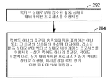
도 2c는 실시예에 따라 내비게이션 프로세스의 이행들을 제어하기 위한 프로세스를 예시하는 흐름도이다.
도 3은 구현에 따라 디바이스에서 내비게이션 기능을 스케줄링하는 프로세스를 예시하는 흐름도이다.Non-limiting and non-exclusive aspects are described with reference to the following figures, wherein like reference numerals refer to like parts throughout the various views.
1 is a diagram of a portion of a mobile device capable of scheduling the operation of a navigation function according to an embodiment.
2A is a schematic diagram of a network topology according to an embodiment.
Figure 2B shows an image displayed on a display device according to an embodiment.
2C is a flow diagram illustrating a process for controlling implementations of a navigation process in accordance with an embodiment.
3 is a flow chart illustrating a process for scheduling navigation functions in a device in accordance with an implementation.
감소된 활동 또는 인액티브 상태로부터 액티브 상태로 내비게이션 애플리케이션의 이행을 트리거링하기 위해 모바일 디바이스에서 구현될 수 있는 방법들, 컴포넌트들, 및 시스템들이 제공된다. 특정한 실시예에서, 모바일 디바이스에서 청각적 및 시각적 출력 명령들을 포함하는 내비게이션 서비스들의 제공과 결합하여 (예컨대, SPS 신호들을 획득 및 프로세싱함으로써) 포지션 픽스를 획득하는 것은 상당량의 모바일 디바이스의 배터리 자원들을 소모할 수 있다. 제한된 배터리 용량과 너무 길거나 또는 시간 소모적인 내비게이션 루트를 이용하여, 모바일 디바이스는 목적지에 도달하기 이전에 자신의 배터리 자원들을 만료시킬 수 있다. 이러한 문제점은 디바이스에 대해 충전이 쉽게 이용가능하지 않은 고속도로들 위의 오랜 자동차 여행(road trip)들 또는 비포장도로 여행(off-road travel)에 더욱 심각해질 수 있다. 또한, 내비게이션 애플리케이션 소프트웨어가 스크린 및 오디오에 액세스하고 있는 동안, 때때로 주어진 상황에서 대안적 애플리케이션 또는 피처(feature)가 사용자에 이익일지라도, 음성 통신 서비스, 달력 능력, 개인 정보 관리자들 등등과 같은 다른 애플리케이션들이 교체(swap out)될 수 있거나 또는 그렇지 않으면 이용가능하지 않을 수 있다.Methods, components, and systems that may be implemented in a mobile device to trigger a reduced activity or transition of a navigation application from an inactive state to an active state are provided. In certain embodiments, acquiring a position fix (e.g., by acquiring and processing SPS signals) in combination with provision of navigation services including audible and visual output commands at the mobile device consumes significant amounts of battery resources of the mobile device can do. With a limited battery capacity and a too long or time consuming navigation route, the mobile device may expire its battery resources before reaching the destination. This problem can be more severe for long road trips or off-road travel on highways where charging for the device is not readily available. In addition, while the navigation application software is accessing the screen and audio, other applications, such as voice communication services, calendar capabilities, personal information managers, etc., may be used May be swapped out, or otherwise not available.
본원에서 사용된 바와 같이 그리고 후속하는 섹션들에서 더욱 상세히 설명되는 바와 같이, 내비게이션 프로세스에 의해 활용되는 바와 같은 다양한 잘 알려진 포지션 픽싱 기술들이 청구되는 청구대상의 범위 내에 있는 것으로서 의도된다. 따라서, 몇몇 구현들은 예컨대 SPS를 포함하는 다양한 브로드캐스트들로부터 신호들을 획득 및 프로세싱하는 것을 통해 획득되는 포지션 픽싱을 포함할 수 있다. 특정한 예시적 구현들에서, SPS는 하나 또는 그 초과의 글로벌 내비게이션 위성 시스템(GNSS:Global Navigation Satellite System)들, 또는 다른 유사한 위성 위치결정 서비스들을 포함할 수 있다. 다른 구현들에서, 포지션 픽스는 지상-기반 시스템들, 디바이스들, 및 프로세스들을 통해, 예컨대 도착 시간, 삼각측량, AFLT(Advanced Forward Link Trilateration), 및 지면-기반 송신기들/트랜시버들에 대한 다른 삼변측량 기술들의 사용을 통해 획득될 수 있다. 몇몇 실시예들에서, 포지션 픽스는 3G-호환 또는 4G-호환 시스템들을 통해 획득될 수 있거나, 또는 몇 가지 예들만 말하자면, SPS, CDMA, LTE, GSM 및 WCDMA와 같은 WAN(wide area network) 신호들, 블루투스, WiFi 네트워크들, WLAN(wireless local area network), WPAN(wireless personal area network), WiMAX(worldwide interoperability for microwave access) 시스템과 같은 퍼스널 영역 및 매체 범위 네트워크 신호들, 상용 브로드캐스트 신호들을 포함하는, 모바일 디바이스에 의해 수신될 수 있는 많은 수의 신호 타입들 중 임의의 신호 타입을 프로세싱하는 것을 통해 획득될 수 있다. 포지션 결정은 또한, 단독으로든 또는 위에서 언급된 신호 소스들(예컨대, WLAN, WAN, WiFi, PAN, 및 SPS)로부터의 무선 신호들의 프로세싱과 결합하여서든, 가속도계들, 자이로(gyro)들, 및 자력계들과 같은 센서들의 사용을 통해 달성될 수 있거나 또는 도움받을 수 있다.As is used herein, and as will be described in greater detail in subsequent sections, various well-known position-fixing techniques, such as those utilized by the navigation process, are intended to be within the scope of the claimed subject matter. Thus, some implementations may include position fixes obtained through acquiring and processing signals from various broadcasts including, for example, an SPS. In certain exemplary implementations, the SPS may include one or more Global Navigation Satellite Systems (GNSS), or other similar satellite positioning services. In other implementations, the position fix may be implemented on a variety of ground-based systems, devices, and processes, such as, for example, arrival time, triangulation, Advanced Forward Link Trilateration (AFLT) Can be obtained through the use of surveying techniques. In some embodiments, the position fix may be obtained via 3G- compatible or 4G-compatible systems, or may be obtained from wide area network (WAN) signals such as SPS, CDMA, LTE, GSM and WCDMA , Personal area and medium range network signals such as Bluetooth, WiFi networks, wireless local area network (WLAN), wireless personal area network (WPAN), worldwide interoperability for microwave access (WiMAX) systems, , And may be obtained by processing any of a number of signal types that may be received by the mobile device. Position determination may also be used to determine the position of the accelerometers, gyros, and magnetometers, either alone or in combination with the processing of radio signals from the above-mentioned signal sources (e.g., WLAN, WAN, WiFi, PAN, and SPS) ≪ / RTI > can be achieved or assisted through the use of sensors such as sensors.
몇몇 실시예들에서, 내비게이션 프로세스를 위한 수신기의 포지션의 추정치들을 획득하기 위한 프로세스의 일부로서, 포지션 결정은, 적어도 부분적으로, 모바일 디바이스 상의 하나 또는 그 초과의 수신기들(예컨대, SPS 수신기, WAN 수신기, 및 WiFi 수신기들)에 수신된 신호들을 프로세싱함으로써 달성될 수 있다. 또한, 측정들은 오도미터들, 가속도계들, 자이로들, 자력계들, 및 고도계들과 같은 다양한 센서들로부터 획득될 수 있다. 그러한 측정들은, 내비게이션 프로세스 또는 애플리케이션의 동작의 일부로서 수신기의 추정된 또는 예측된 위치(또는 포지션 픽스) 또는 추정된 또는 예측된 속도를 제공하기 위한 다양한 기술들에 따라 프로세싱될 수 있다.In some embodiments, as part of the process for obtaining estimates of position of a receiver for a navigation process, the position determination may be based, at least in part, on one or more receivers (e.g., an SPS receiver, a WAN receiver , ≪ / RTI > and WiFi receivers). Measurements can also be obtained from a variety of sensors such as odometers, accelerometers, gyros, magnetometers, and altimeters. Such measurements may be processed according to various techniques for providing an estimated or predicted position (or position fix) of the receiver or an estimated or predicted speed of the receiver as part of the operation of the navigation process or application.
내비게이션 프로세스의 특정한 구현들에서, 사용자는, 사용자-선택 목적지를 식별하기 위해 모바일 디바이스의 사용자 인터페이스와 상호작용할 수 있다. 이러한 상황에서, 내비게이션 프로세스는 컴퓨팅 애플리케이션의 일부로서 특별 목적 컴퓨팅 장치에 의한 순차적 실행을 위해 비-일시적 메모리에 저장된 머신-판독가능 명령들로서 구현될 수 있다. 아래에 논의되는 특정한 예들에서, 내비게이션 프로세스는 여러 "활동 상태들" 중 임의의 활동 상태로 있을 수 있다. 모바일 디바이스가 사용자-선택 목적지로부터 비교적 멀리 있다면, 빈번한 포지션 픽스들이 필요하지 않은 목적지까지의 루트의 일부분들에서, 포지션 픽스들이 감소된 레이트로(예컨대, 덜 종종) 수행되도록 또는 전혀 수행되지 않도록 스케줄링될 수 있어, 이로써 배터리 전력이 절약되거나 그리고/또는 모바일 디바이스 사용자 인터페이스가 다른 사용들을 위해 이용가능하게 된다. 여기서, 감소된 레이트로 포지션 픽스들을 수행하는 것은 배터리 자원들을 절약할 수 있고, 모바일 디바이스가 다른 애플리케이션들을 위해 이용가능하게 할 수 있다. 빈번한 포지션 픽스들이 필요하지 않은 루트의 그러한 일부분들은 예컨대 고속도로의 길게 뻗은 구간들(long stretches of highway)들을 포함할 수 있다.In certain implementations of the navigation process, the user may interact with the user interface of the mobile device to identify the user-selected destination. In such situations, the navigation process may be implemented as machine-readable instructions stored in non-transient memory for sequential execution by the special purpose computing device as part of the computing application. In the specific examples discussed below, the navigation process may be in any of a number of "activity states ". If the mobile device is relatively far from the user-selected destination, at some portion of the route to the destination where frequent position fixes are not needed, the position fixes are scheduled to be performed at a reduced rate (e.g., less often) or not at all Thereby saving battery power and / or making the mobile device user interface available for other uses. Here, performing position fixes at a reduced rate can save battery resources and make the mobile device available for other applications. Such portions of the route that do not require frequent position fixes may include, for example, long stretches of highways.
수행될 포지션 픽스들을 감소된 레이트로 스케줄링하는 모바일 디바이스는 감소된 활동 상태 또는 인액티브 상태로 있는 것으로 여겨질 수 있다. 그러한 구현에서, 모바일 디바이스 상에서 동작하는 내비게이션 프로세스는 비활성화될 수 있거나 또는 감소된-전력 상태에 놓일 수 있고, 여기서 몇몇 실시예들에서 내비게이션 프로세스의 비활성화는 다른 애플리케이션들을 위해 사용자 인터페이스를 자유롭게 할 수 있다. 그러나, 내비게이션 프로세스가 비활성화되었거나 또는 더 낮은 전력 상태에 놓인 이후, 내비게이션 애플리케이션이 재활성화되어야 하거나 또는 전체 전력 상태로 재개되어야 하는 조건들을 검출하기 위해, 선택된 센서 출력 신호들의 모니터링이 계속될 수 있다. 다른 실시예들에서, 내비게이션 프로세스는 센서 출력 신호들을 모니터링하기 위한 별도의 센서-모니터링 프로세스를 유발할 수 있어, 센서-모니터링 프로세스에 의해 내비게이션 프로세스가 재-활성화될 때까지 또는 전체 전력으로 재개될 때까지, 내비게이션 프로세스가 휴면기로 가게 된다. 다른 실시예에서, 예컨대 센서 출력 신호들을 모니터링하는 것으로부터 검출될 때 내비게이션이 원해지거나 그리고/또는 요구되는 지리적 영역에 모바일 디바이스가 들어가면, 내비게이션 프로세스가 재활성화될 수 있다. 그런 다음, 비활성화된 내비게이션 프로세스는 증가된 레이트로 또는 액티브 내비게이션을 지원하기에 충분한 레이트로 포지션 픽스들을 스케줄링하는 것을 재개할 수 있다. 몇몇 실시예들에서, 내비게이션 프로세스가 액티브 동작을 재개해야 하는지를 결정하기 위한 조건이, 적어도 부분적으로, 주기적인 위치 결정들로부터 검출될 수 있다. 예컨대, SPS 또는 지상 신호들을 통해, 결정이 수행될 수 있거나 또는 획득될 수 있고, 동시에 일반적인 근접성을 결정하기 위해, 그리고 내비게이션 프로세스가 재활성화되어야 하거나 또는 전체 전력으로 재개되어야 하는 루트 상의 미리결정된 위치에 대한 모바일 디바이스의 근접성을 결정하기 위해, 내비게이션 프로세스가 더 긴 간격들로 비활성화된다. 다른 실시예들에서, 로컬 조건들의 존재, 예컨대 특정한 신호들 또는 이들의 결합들, 예컨대 특정한 송신기들로부터의 WAN, LAN, 및/또는 WiFi 네트워크 신호들의 존재는 내비게이션 프로세스를 재활성화시켜 전체 전력 동작을 재개하기 위해 트리거링 이벤트를 개시할 수 있다. 여전히 다른 실시예들에서, 고도계, 가속도계, 자력계, 클록, 오도미터, 또는 다른 센서에 의해 도출된 것과 같이 특정한 고도, 동작 각도, 헤딩(heading), 시간 또는 추정 거리를 표시하는 센서 출력 신호들은 내비게이션 프로세스를 재활성화시키기 위한 또는 내비게이션 프로세스를 전체 전력 동작으로 재개하기 위한 조건을 표시할 수 있다. 일 예에서, 그러한 조건은, 미리결정된 출력 신호 또는 액티브 내비게이션이 재개해야 하는 위치 또는 위치들의 범위를 표시하는 값과, 현재 출력 신호 또는 값을 비교함으로써 결정될 수 있다. 다른 실시예에서, 인액티브 상태 동안, 사용자가 모바일 디바이스 흔들기 또는 키패드에 키스트로크 입력을 표시하는 센서 출력 신호가 액티브 상태로의 이행을 트리거링할 수 있다.A mobile device that schedules position fixes to be performed at a reduced rate may be considered to be in a reduced active state or an inactive state. In such an implementation, the navigation process running on the mobile device may be deactivated or placed in a reduced-power state, where in some embodiments deactivation of the navigation process may free the user interface for other applications. However, monitoring of selected sensor output signals may continue to detect conditions in which the navigation application must be reactivated, or to be resumed to full power state, after the navigation process is deactivated or placed in a lower power state. In other embodiments, the navigation process may cause a separate sensor-monitoring process to monitor the sensor output signals, until the navigation process is re-activated by the sensor-monitoring process or resumed at full power , The navigation process goes to the dormant. In another embodiment, the navigation process may be reactivated if, for example, navigation is desired from monitoring sensor output signals and / or the mobile device enters a desired geographic area. The deactivated navigation process can then resume scheduling the position fixes at an increased rate or at a rate sufficient to support active navigation. In some embodiments, the condition for determining whether the navigation process should resume active operation may be detected, at least in part, from periodic position determinations. For example, through SPS or terrestrial signals, a decision can be made or obtained, and at the same time, in order to determine general proximity and at the same time, at a predetermined position on the route where the navigation process must be reactivated, In order to determine the proximity of the mobile device for, the navigation process is deactivated at longer intervals. In other embodiments, the presence of local conditions, e.g., the presence of WAN, LAN, and / or WiFi network signals, such as specific signals or combinations thereof, e.g., from particular transmitters, Triggering events can be initiated to resume. In still other embodiments, sensor output signals indicative of a particular altitude, operating angle, heading, time, or estimated distance as derived by an altimeter, an accelerometer, a magnetometer, a clock, an odometer, And may indicate conditions for reactivating the process or for resuming the navigation process with full power operation. In one example, such a condition can be determined by comparing the current output signal or value with a value indicating a predetermined output signal or a range of positions or positions where active navigation should resume. In another embodiment, during an inactive state, the user may trigger a transition to the active state of the sensor output signal, which indicates mobile device waving or keystroke input to the keypad.
몇몇 실시예들에서, 내비게이션 프로세스가 액티브 상태로 돌아가야 하는 조건들에 대한 센서 및/또는 수신기 출력 신호들을 모니터링하기 위해 모니터링 프로세스가 백그라운드 프로세스로서 실행되는 동시에, 모바일 디바이스가 목적지에 접근할 때까지, 내비게이션 프로세스를 비활성화함으로써, 모바일 디바이스는 전력을 절약할 수 있다. 대안적으로, 내비게이션 프로세스는 감소된 활동 모드로 계속 실행될 수 있고, 여기서는 지도 및 오디오 출력을 더 이상 계속 업데이팅하지 않지만, 내비게이션 프로세스가 액티브 상태로 돌아가야 하는 조건들을 검출하기 위해, 아마도 감소된 레이트로, 센서 및/또는 수신기 출력 신호들을 계속 모니터링한다. 따라서, 사용자는, 가는 동안에 내비게이션 프로세스를 수동으로 재개시하기 위한 사용자 중지 없이, 목적지 쪽으로 사용자의 여행의 최종 일부분 동안 또는 내비게이션 도움으로부터 이익을 얻는 것으로 사용자가 표시하는 여행의 일부분 동안 이용가능한, 모바일 디바이스 상에서 기능하는 내비게이션 프로세스로부터 이익을 얻을 수 있다.In some embodiments, the monitoring process is performed as a background process to monitor the sensor and / or receiver output signals for conditions under which the navigation process should return to the active state, and until the mobile device approaches the destination, By deactivating the navigation process, the mobile device can save power. Alternatively, the navigation process may continue to run in a reduced activity mode, where it is no longer constantly updating the map and audio output, but to detect conditions that the navigation process should return to an active state, To continuously monitor the sensor and / or receiver output signals. Accordingly, the user may be able to use the mobile device, which is available during a portion of the journey that the user presents for the last portion of the user's journey towards the destination, or benefit from navigation assistance, without user interruption to manually restart the navigation process during travel, Lt; RTI ID = 0.0 > a < / RTI >
특정한 구현들에서, 모바일 디바이스의 제1 컴포넌트가 포지션 픽스들을 생성할 수 있다. 일 예시적 구현에서, 제1 컴포넌트는 셀룰러 통신 신호들을 변조 및 복조하는 베이스밴드 프로세서로서 기능할 수 있고, 모바일 디바이스의 이산적인 물리적 프로세싱 컴포넌트들을 포함할 수 있다. 모바일 디바이스의 제2 컴포넌트가 내비게이션 프로세스를 호스팅할 수 있고, 모바일 디바이스의 제1 컴포넌트의 이산적인 물리적 프로세싱 컴포넌트들과 별개인 이산적인 물리적 프로세싱 컴포넌트들을 포함할 수 있다. 다른 것들 중에서도 업데이트된 포지션 픽스들 및 내비게이션 상태가 디스플레이될 수 있도록, 제2 컴포넌트는 사용자 인터페이스를 제어할 수 있다. 여전히 다른 구현들에서, 신호 프로세싱과 애플리케이션 프로세스 둘 다는 공유 프로세서 상에서 동작될 수 있다.In certain implementations, the first component of the mobile device may generate position fixes. In one exemplary implementation, the first component may function as a baseband processor for modulating and demodulating cellular communication signals, and may comprise discrete physical processing components of the mobile device. A second component of the mobile device may host the navigation process and may include discrete physical processing components that are separate from the discrete physical processing components of the first component of the mobile device. Among other things, the second component can control the user interface so that the updated position fixes and the navigation state can be displayed. In still other implementations, both the signal processing and the application process may be run on a shared processor.
몇몇 실시예들에서, 포지션 픽스들 및/또는 다른 센서 출력을 획득하기 위한 스케줄링 기능이 제1 컴포넌트에 의해 실행될 수 있는 동시에, 제2 컴포넌트는 감소된-전력 상태에 놓일 수 있거나 또는 완전히 비활성화될 수 있다. 그러한 구현들은, 예컨대 제1 컴포넌트로부터 제2 컴포넌트로 스케줄링 기능의 제어를 이행시키기 위해 사용될 수 있는 인터럽트 신호의 어서션(assertion) 또는 디어서션(deassertion)을 포함할 수 있다. 구현에서, 제1 컴포넌트에 의한 포지션 픽스들의 스케줄링은 내비게이션 프로세스가 제2 컴포넌트의 활성화에 응답하여 신속하게 개시되도록 인에이블링할 수 있다. 따라서, 제2 컴포넌트의 활성화에 응답하여, 지도 상에 표시된 모바일 디바이스의 현재 추정 위치, 목적지까지의 시간, 및 내비게이션 상태가 사용자에게 빨리 디스플레이될 수 있다. 제2 컴포넌트의 활성화시, 제2 컴포넌트 상에서 동작하는 내비게이션 애플리케이션의 특정 타이밍 제약들에 따라 증가된 레이트로(예컨대, 더욱 자주) 포지션 픽스들이 요청될 수 있다.In some embodiments, the scheduling function for obtaining position fixes and / or other sensor outputs may be executed by the first component while the second component may be placed in the reduced-power state or may be completely deactivated have. Such implementations may include, for example, an assertion or deassertion of an interrupt signal that may be used to implement control of the scheduling function from a first component to a second component. In an implementation, the scheduling of position fixes by the first component may enable the navigation process to be quickly initiated in response to activation of the second component. Thus, in response to activation of the second component, the current estimated location of the mobile device displayed on the map, the time to destination, and the navigation state can be displayed to the user quickly. Upon activation of the second component, position fixes may be requested at an increased rate (e.g., more often) in accordance with specific timing constraints of the navigation application operating on the second component.
다른 구현들에서, 모바일 디바이스의 제1 컴포넌트 및 제2 컴포넌트는 이산적인 물리적 컴포넌트들에 대안적인 방식으로 구성될 수 있다. 일 구현에서, 제1 컴포넌트 및 제2 컴포넌트는 감독 제어 프로그램의 제어 하에서 공유 중앙 프로세싱 유닛을 통해 실행되는 컴퓨터-구현 방법들을 수행하는 제1 및 제2 논리 또는 소프트웨어 모듈들을 포함할 수 있다. 몇몇 구현들에서, 내비게이션 기능의 휴면을 통해서와 같이, 계산 요구들이 감소되는 동안, 공유 중앙 프로세싱 유닛이 감소된 동작 레벨로 활용될 수 있다. 구현에서, 제1 컴포넌트 및 제2 컴포넌트는 (예컨대, 단일 다이 상에 배열된 멀티-코어 프로세서의) 제1 논리 엔티티 및 제2 논리 엔티티에 대응할 수 있다. 특정 구현들에서, 스케줄링 이행은 제1 컴포넌트로부터 제2 컴포넌트로 스케줄링 기능의 제어를 전달하는 것을 개시하도록 포스팅된 이벤트에 대응할 수 있다. 그러나, 제1 컴포넌트 및 제2 컴포넌트의 이러한 특정 구현들이 단지 특정 시스템 아키텍처 접근들을 반영하고, 청구되는 청구대상이 이 점에서 제한되지 않음이 이해되어야 한다.In other implementations, the first and second components of the mobile device may be configured in an alternative manner to discrete physical components. In one implementation, the first component and the second component may comprise first and second logic or software modules that perform computer-implemented methods executed via a shared central processing unit under the control of a supervisory control program. In some implementations, the shared central processing unit may be utilized at a reduced level of operation while the computational demands are reduced, such as through the dormancy of the navigation function. In an implementation, the first component and the second component may correspond to a first logical entity (e.g., of a multi-core processor arranged on a single die) and a second logical entity. In certain implementations, the scheduling implementation may correspond to a posted event to initiate transfer of control of the scheduling function from the first component to the second component. It should be understood, however, that these particular implementations of the first and second components only reflect specific system architecture approaches and that the claimed subject matter is not limited in this respect.
이제, 구현에 따라 내비게이션 프로세스 및 위치 결정을 동작시킬 수 있는 모바일 디바이스(100)의 일부분의 도면인 도 1이 참조된다. 모바일 디바이스(100)는, 적어도 부분적으로, 안테나(158) 및 SPS 수신기(155)를 경유해 인터페이스(150) 및 버스(101)를 통하는 SPS 신호들(159); WAN(예컨대, CDMA, LTE, WCDMA, UMTS, GSM, AMPS 등등), WiFi, WiMAX 또는 상용 브로드캐스트 신호들, 또는 무선 트랜시버(121) 및 무선 안테나(122)를 경유해 인터페이스(120) 및 버스(101)를 통하는, 알려진 위치에 포지셔닝된 다른 송신기들로부터의 신호들; 그리고 또한 버스(101)와 인터페이싱할 수 있는 PAN(personal area network) 트랜시버(130) 및 PAN 안테나(131)를 경유하는 블루투스 신호들과 같은 PAN 신호들의 포착에 기초하여, 모바일 디바이스(100)에 대한 포지션 위치결정 능력을 제공할 수 있는 다양한 컴퓨팅 및 통신 자원들을 포함할 수 있다. 그러나, 이들이 단지 포지션 픽스를 획득하기 위해 포착될 수 있는 신호들의 예들이고, 청구되는 청구대상이 이 점에서 제한되지 않음이 이해되어야 한다. 위에서-언급된 트랜시버들 및 수신된 연관 신호들이 또한, 이행 영역 또는 위치에 대한 모바일 디바이스(100)의 근접성을 결정하는데 활용될 수 있다. 여기서, 하나의 그러한 신호 또는 그러한 신호들의 결합의 존재는, 심지어 최신 포지션 픽스의 부재에도, 그러한 이행 영역 또는 위치를 표시할 수 있다. 몇몇 실시예들에서, 모바일 디바이스(100)는 독립형 내비게이션 회로 또는 디바이스의 형태를 취할 수 있다. 다른 구현들에서, 모바일 디바이스(100)는, 일시적으로든 또는 영구적으로든, 자동차, 배, 또는 비행기와 같은 다른 모바일 구조물에 포함될 수 있다. 추가로, 모바일 디바이스(100)에 의해 수행되는 기능들은 전력원(160)으로부터 전력을 사용한다.Reference is now made to Fig. 1, which is a drawing of a portion of a
몇몇 실시예들에서, 모바일 디바이스(100)는, 메모리(140)에 저장된 센서 관리 프로세스(142), 내비게이션 프로세스(141), 및/또는 포지션 위치결정 프로세스(들)를 동작시키거나 그리고/또는 수행하기 위해 프로세서(111) 또는 다수의 프로세서들을 활용한다. 또한, 몇몇 실시예들에서, 내비게이션 프로세스, 센서 관리 프로세스, 및/또는 다른 지원 프로세스들의 동작을 인에이블링하기 위해, DSP(112)는 포지션 위치결정 프로세스들, 센서 프로세싱, 오디오 및/또는 그래픽 프로세싱 중 일부 또는 전부를 수행하거나 또는 프로세서(111)와 함께 다른 방식으로 동작하는데 활용될 수 있다.In some embodiments, the
몇몇 실시예들에서, 모바일 디바이스(100)는 가속도계들, 속도계들, 오도미터들, 자이로들, 자력계들, 클록들, 경사계들, 및 고도계들과 같은 다양한 센서들(143)을 포함할 수 있다. 특정 실시예들에서, 센서들(143)은 감지된 조건 또는 이벤트에 응답하여 신호들을 생성할 수 있다. 일 예시적 구현에서, 센서에 의해 생성된 그러한 신호들은, 아래에 논의되는 바와 같이 특정 조건이 존재하는지를 추론 또는 결정할 때, (예컨대, 홀로 또는 다른 측정들과 결합하여) 사용되기 위한 측정을 대표하는 값(예컨대, 전압 또는 전류 값)을 가질 수 있다. 센서들(143)의 출력 신호들은, 예컨대 위치 결정의 신뢰성 및 정확성을 향상시킴으로써, 포지션 결정 및 내비게이션 프로세스들을 향상 또는 증강하는데 활용될 수 있다. 또한, 센서들(143)은, 예컨대 여행 거리, 흐른 시간, 고도, 가속 또는 감속, 속도, 헤딩, 또는 트리거링 각도와 같이, 내비게이션 애플리케이션을 액티브 상태로 이행시키는 것을 개시하는 조건들의 존재를 검출하는데 활용될 수 있다.In some embodiments, the
몇몇 실시예들에서, 모바일 디바이스(100)는, 모바일 디바이스(100)가 다른 프로세스들을 수행 또는 지원하도록 인에이블링하는 다른 회로를 포함할 수 있다. 제한은 아니지만, 예로서, 모바일 디바이스(100)는 무선 또는 유선 통신 네트워크 내에서 하나 또는 그 초과의 자원들과 또한 통신할 수 있는 모바일 또는 휴대용 컴퓨팅 디바이스 또는 머신의 형태를 취할 수 있다. 따라서, 예컨대, 모바일 디바이스(100)는 셀룰러 폰, 스마트 폰, 퍼스널 디지털 어시스턴트, 휴대용 컴퓨팅 디바이스, 내비게이션 유닛 등등 또는 이들의 임의의 결합과 같은 모바일 스테이션을 포함할 수 있다.In some embodiments, the
프로세서(111) 및 DSP(112)는 예컨대, 몇 가지의 예들만 말하자면, WWAN(wireless wide area network), WLAN(wireless local area network), WPAN(wireless personal area network), 3G, 4G, 또는 LTE(long term evolution) 네트워크와 같은 다양한 무선 통신 네트워크들과 함께 사용되도록 인에이블링될 수 있다. 모바일 디바이스(100)는 무선 트랜시버(121) 및 무선 안테나(122), PAN 트랜시버(130) 및 안테나(131), 및/또는 모바일 디바이스(100)에 위치된 다른 안테나 트랜시버들을 통해 무선 통신 네트워크들에 액세스할 수 있다. 용어 "네트워크" 및 "시스템"은 본원에서 교환가능하게 사용될 수 있다. WWAN은 CDMA(Code Division Multiple Access) 네트워크, TDMA(Time Division Multiple Access) 네트워크, FDMA(Frequency Division Multiple Access) 네트워크, OFDMA(Orthogonal Frequency Division Multiple Access) 네트워크, SC-FDMA(Single-Carrier Frequency Division Multiple Access) 네트워크, LTE(Long Term Evolution) 네트워크 등등 및/또는 위의 결합들일 수 있다. CDMA 네트워크는, 몇 가지의 라디오 기술들만 말하자면, cdma2000, W-CDMA(Wideband-CDMA)와 같은 하나 또는 그 초과의 RAT(radio access technology)들을 구현할 수 있다. 본원에서, cdma2000은 IS-95, IS-2000, 및 IS-856 표준들에 따라 구현된 기술들을 포함할 수 있다. TDMA 네트워크는 GSM(Global System for Mobile Communications), D-AMPS(Digital Advanced Mobile Phone System), 또는 어떤 다른 RAT를 구현할 수 있다. GSM 및 W-CDMA는 "3세대 파트너쉽 프로젝트(3GPP)"로 명명된 컨소시엄으로부터의 문서들에서 설명된다. Cdma2000은 "3세대 파트너쉽 프로젝트2(3GPP2)"로 명명된 컨소시엄으로부터의 문서들에서 설명된다. 3GPP 및 3GPP2 문서들은 공개적으로 이용가능하다. WLAN은 IEEE 802.11x 네트워크를 포함할 수 있고, WPAN은 예컨대 블루투스 네트워크, IEEE 802.15x를 포함할 수 있다.The
특정 구현에서, 프로세서(111) 또는 다른 애플리케이션들 프로세서는, 프로세서(111) 상에서 실행되는 특정 내비게이션 애플리케이션에 의해 요청되는 바와 같이 포지션 결정을 개시할 수 있다. 포지션 결정이 요청된다면, 무선 안테나들(122, 131, 및/또는 158)을 통해 각각 수신된 신호들(123, 132, 및/또는 159)이 무선 트랜시버(121), PAN 트랜시버(130), 및/또는 SPS 수신기(155)에 의해 각각 프로세싱될 수 있다. DSP(112) 및/또는 프로세서(111)는 하나 또는 그 초과의 신호들(123, 132, 및 159)을 분석한 결과로서 포지션 픽스를 컴퓨팅할 수 있다. 그러한 포지션 픽스는, 프로세서(111), DSP(112), 또는 버스/메모리 인터페이스(110)를 통해 버스(101)와 인터페이싱할 수 있는, 프로세서(111)에 의한 내비게이션 서비스들의 제공을 위한 다른 프로세서에 의해 활용될 수 있다. 몇몇 실시예들에서, 루트를 계산하기 위해, 루트를 따라서 전진 및 위치를 결정하기 위해, 그리고 루트 일탈을 검출하고 루트 추천들을 재-계산하기 위해, 포지션 픽스들이 내비게이션 애플리케이션에 의해 사용될 수 있다.In certain implementations, the
실시예에서, 모바일 디바이스(100)는, 오디오 출력 디바이스(170) 및 디스플레이 디바이스(180)와 같은 사용자 인터페이스를 통한 출력을 위해, 지도들, 내비게이션 방향들, 전진 업데이트들 및 내비게이션 프로세스(141)에 의해 제공되는 다른 정보를 디스플레이하기 위해 디스플레이 디바이스(180)를 포함한다. 모바일 디바이스(100)는 오디오 출력 디바이스(170)를 포함하고, 상기 오디오 출력 디바이스(170)는 모바일 디바이스(100)의 사용자에게 들리는 명령들을 전송하는데 사용될 수 있다. 몇몇 실시예들에서, 진동 디바이스들의 사용을 통한 촉각 피드백과 같이 다른 사용자 인터페이스 디바이스들이 또한 활용될 수 있다. 또한, 몇몇 실시예들에서, 부가 또는 상이한 내비게이션 파라미터들이 디스플레이될 수 있고, 청구되는 청구대상이 이 점에서 제한되지 않는다.In an embodiment, the
도 2a에 예시된 실시예에서, 모바일 디바이스(100)는 SPS 위성들(260)과 같은 하나 또는 그 초과의 SPS 성상도(constellation)들로부터 SPS 신호들(261)을 수신할 수 있다.2A, the
실시예에서, 모바일 디바이스(100)는 WAN 네트워크(210)로부터 WAN 네트워크 신호들(211)을 통해 WAN 신호들을 수신 및 프로세싱할 수 있다. WAN 네트워크들은, 이에 제한되지는 않지만, CDMA(Code Division Multiple Access) 네트워크, TDMA(Time Division Multiple Access) 네트워크, FDMA(Frequency Division Multiple Access) 네트워크, OFDMA(Orthogonal Frequency Division Multiple Access) 네트워크, SC-FDMA(Single-Carrier Frequency Division Multiple Access) 네트워크, LTE(Long Term Evolution) 네트워크, WiMAX(IEEE 802.16) 네트워크 등등을 포함할 수 있고, 이들 네트워크일 수 있다. CDMA 네트워크는, 예컨대 cdma2000, W-CDMA(Wideband-CDMA) 등등과 같은 하나 또는 그 초과의 RAT(radio access technology)들을 구현할 수 있다. Cdma2000은 IS-95, IS-2000, 및 IS-856 표준들을 포함할 수 있다. TDMA 네트워크는 GSM(Global System for Mobile Communications), D-AMPS(Digital Advanced Mobile Phone System), 또는 어떤 다른 RAT를 구현할 수 있다. GSM 및 W-CDMA는 "3세대 파트너쉽 프로젝트(3GPP)"로 명명된 컨소시엄으로부터의 문서들에서 설명된다. Cdma2000은 "3세대 파트너쉽 프로젝트2(3GPP2)"로 명명된 컨소시엄으로부터의 문서들에서 설명된다. 3GPP 및 3GPP2 문서들은 공개적으로 이용가능하다.In an embodiment, the
실시예에서, 모바일 디바이스(100)는 WiFi 및 PAN들(235), 예컨대 IEEE 802.11x 네트워크 또는 어떤 다른 타입의 네트워크를 경유해 WiFi/PAN 신호들(236)을 통해 통신할 수 있다. WPAN은 예컨대 블루투스 네트워크, IEEE 802.15x 네트워크, 또는 어떤 다른 타입의 네트워크일 수 있다. 본원에서 기재되는 기술들은 또한 WWAN, WLAN, 및/또는 WPAN의 임의의 결합과 함께 구현될 수 있다.In an embodiment, the
도 2b에 도시된 실시예에서, 모바일 디바이스(100)는 지상 송신기(220)에 의해 전송된 디지털 라디오 브로드캐스트들과 같은 지상 송신기 신호들(221)을 수신할 수 있다.2B, the
실시예에서, 포지션 픽스를 획득하기 위해, 내비게이션 프로세스를 돕기 위해 그리고/또는 루트에 있는 특정 웨이포인트(waypoint)에 도달했는지를 결정하기 위해, SPS 신호들(261), WAN 네트워크 신호들(211), WiFi/PAN 신호들(236) 및/또는 지상 송신기 신호들(221)이 프로세싱될 수 있다. 예컨대, 실시예에서, 모바일 디바이스가 내비게이션이 액티브 상태로 이행되어야 하는 내비게이션 루트의 영역 또는 부분에 있음을 결정하기 위해, 지상 송신기 신호(221), 예컨대 특정 라디오 스테이션에 의해 전송된 신호의 존재가 프로세싱될 수 있다. 유사하게, 모바일 디바이스가 내비게이션이 액티브 상태로 이행되어야 하는 내비게이션 루트의 영역 또는 부분에 있음을 결정하기 위해, 특정 SSID들 또는 특정 결합으로 SSID들을 갖는 WiFi/PAN 신호들(236)의 존재, 및/또는 특정 기지국 ID(BSID)들을 갖는 WAN 네트워크 신호들(211)의 존재, 또는 이들의 결합이 프로세싱될 수 있다.In an embodiment, the SPS signals 261, the WAN network signals 211, and the WAN network signals 211 are used to obtain a position fix, to assist the navigation process and / or to determine whether a particular waypoint at the root has been reached. , WiFi / PAN signals 236 and / or terrestrial transmitter signals 221 may be processed. For example, in an embodiment, to determine that the mobile device is in the area or portion of the navigation route where navigation is to transition to the active state, the presence of a
실시예에서, 위치 서버(240), 지도 및/또는 내비게이션 서버(250), 또는 다른 정보 서버가 통신 링크(245 또는 255)를 통과해 인터넷(230)을 통해 모바일 디바이스(100)에 위치 관련 정보를 각각 전송할 수 있다. 실시예에서, 위치 관련 정보는, 내비게이션 프로세스가 액티브 상태로 이행되어야 하는 내비게이션 루트의 경계 영역(들) 또는 부분(들) 또는 지오펜스(geofence)(들)에서 검출가능한 신호들을 식별하는 송신기 얼머낵(almanac)을 포함할 수 있다. 특정 예시적 구현에서, 위치 관련 정보는 목적지까지의 루트를 따라서 검출가능한 신호들을 식별하는 송신기 얼머낵을 포함할 수 있다. 또 다른 실시예에서, 위치 관련 정보는 모바일 디바이스의 목적지 위치에서 가시적인 신호들을 포함하는, 넓은 지리적 영역에 걸쳐 검출가능한 신호들을 식별하는 송신기 얼머낵을 포함할 수 있다.In an embodiment, the
일 특정 구현에서, 사용자는 모바일 디바이스(100)의 사용자 인터페이스와 상호작용하는 것으로 목적지 주위의 지리적 영역을 정의하도록 선택할 수 있다. 예컨대, 사용자는, 원(또는 그의 근사) 또는 목적지(290)(도 2b)를 적어도 부분적으로 둘러싸기 위한 다른 형상을 그리거나 또는 나타내기 위해 터치스크린과 상호작용할 수 있다. 구현에서, 특정 크기들의 반경들이 선택될 수 있는 메뉴가 사용자에 제시될 수 있거나, 또는 다른 구현에서, 디폴트-크기결정된 지리적 영역이 사용자에 제시될 수 있다. 그러나, 이들은 단지 사용자가 목적지를 둘러싼 영역을 어떻게 정의할 수 있는지의 예시적 구현들이고, 청구되는 청구대상은 이 점에서 제한되지 않는다.In one particular implementation, the user may choose to define a geographic area around the destination by interacting with the user interface of the
특정 실시예들에 따라, 내비게이션 프로세스(141)는, 본원에서 다른 곳에 표시된 바와 같이 배터리 자원들을 절약하기 위해 그리고/또는 모바일 디바이스 상의 프로세싱 자원들을 다른 프로세스들에 이용가능하게 하기 위해 다수의 "활동 상태들" 중 임의의 활동 상태에 배치될 수 있다. 이러한 상황에서, 내비게이션 프로세스(141)는, 내비게이션 프로세스(141)의 특정 피처들이 인에이블링되는 "액티브 상태"에 배치될 수 있다. 그러한 피처들은, 제한은 아니지만 예로서, 턴-바이-턴 내비게이션, 디스플레이 디바이스 또는 오디오 디바이스 또는 액티브 SPS 내비게이션 기능들의 전체 제어를 포함할 수 있다. 액티브 상태에 있는 것과 대조적으로, 내비게이션 프로세스(141)는, 액티브 상태에서 인에이블링된 하나 또는 그 초과의 피처들이 디스에이블링 또는 턴 오프 되는 "감소된 활동 상태"에 배치될 수 있다. 감소된 활동 상태의 일 특정 예는, 적어도 몇몇 피처들이 휴면되고(예컨대, 턴 바이 턴 내비게이션, SPS 내비게이션, 디스플레이 또는 오디오 디바이스들의 사용) 동시에 다른 피처들이 인에이블링되는(예컨대, 센서 모니터링, 이행 포인트에 대한 근접성에 관한 드문 업데이트들 등등) "인액티브 상태"를 포함할 수 있다. 다른 특정 예에서, 감소된 활동 상태로의 이행은, 모바일 디바이스가 고속도로의 특정 뻗은 구간에 위치된다는 추론에 응답하여 발생할 수 있다. 여기서, SPS 수신기가 감소된 전력 상태에 배치될 수 있는 동시에, 다른 수신기(예컨대, 셀룰러 통신 수신기)는, 적어도 부분적으로, (예컨대, 기지국 얼머낵 또는 다른 신호 얼머낵에서 표시된 바와 같은) 알려진 위치들에 있는 지상 송신기들로부터의 신호들의 포착에 기초하여 목적지에 대한 근접성에 관한 업데이트들을 시간별로 획득한다.In accordance with certain embodiments, the
실시예에서, 이행 위치(280)에 도달할 때까지, 모바일 디바이스(100)는 내비게이션 프로세스(141)를 감소된 활동 또는 휴면 상태로 이행시킨다. 감소된 활동 또는 휴면 상태에 있는 동안, 이행 위치(280)에 도달했는지를 결정하기 위해, 내비게이션 프로세스(141)는 무선 트랜시버(121), PAN 트랜시버(130), SPS 트랜시버(155) 및/또는 센서들(143)로부터 수신된 출력 신호들을 모니터링할 수 있다. 실시예에서, 내비게이션 프로세스(141)가 휴면 상태로 배치될 수 있는 동시에, 이행 위치(280)에 도달했는지를 결정하기 위해 센서 관리 프로세스(142)는 무선 트랜시버(121), PAN 트랜시버(130), SPS 트랜시버(155) 및/또는 센서들(143)로부터 수신된 출력 신호들을 모니터링한다. 실시예에서, 감소된 활동 상태 또는 휴면 상태 동안, 내비게이션 프로세스(141)는 오디오 출력 디바이스(170) 및/또는 디스플레이 디바이스(180)에 대한 액세스들을 감소 또는 연기시킬 수 있거나, 그리고/또는 프로세서(111)의 로딩 및 액세스를 다른 방식으로 감소시킬 수 있다. 실시예에서, 감소된 활동 상태 또는 휴면 상태에 있는 동안, 내비게이션 프로세스(141)는 포지션 결정 사이클들의 레이트를 감소시킬 수 있거나, 또는 포지션 결정 동작들을 완전히 연기시킬 수 있다. 실시예에서, 내비게이션 프로세스(141)가 감소된 활동 상태 또는 휴면 상태에 있는 동안, 프로세서(111), 오디오 출력 디바이스(170), 및 디스플레이 디바이스(180)는 다른 프로세스들 또는 애플리케이션들에 할당될 수 있거나, 또는 다른 프로세스들 또는 애플리케이션들에 의해 사용될 수 있다.In an embodiment, until the
실시예에서, 내비게이션 프로세스(141)가 감소된 활동 상태에 있는 동안 또는 모바일 디바이스(100)가 이행 위치(280)에 도달했다고 센서 관리 프로세스(142)가 결정하는 동안, 프로세서(111)는 내비게이션 프로세스(141)를 액티브 상태로 리턴할 수 있다. 실시예에서, 센서 관리 프로세스(142)는, 하드웨어 인터럽트 또는 프로그램 호출(programmatic call)을 통해 이행 위치(280)에 도달했음을 프로세서(111)에 통지할 수 있다.In an embodiment, while the sensor management process 142 determines that the
도 2c는 실시예에 따라 내비게이션 프로세스의 이행들을 제어하기 위한 프로세스를 예시하는 흐름도이다. 단계(292)에서, 내비게이션 프로세스는 액티브 상태로부터 감소된 활동 상태로 이행된다. 후속하여, 단계(294)에서, 적어도 하나의 조건이 충족되었음을 표시하는 하나 또는 그 초과의 신호들의 수신에 응답하여, 내비게이션 프로세스는 감소된 활동 상태로부터 액티브 상태로 이행된다. 여기서, 적어도 하나의 조건은, 적어도 부분적으로, 내비게이션 프로세스가 액티브 상태로 이행될, 미리결정된 루트 상의 이행 위치에 의해 결정될 수 있다.2C is a flow diagram illustrating a process for controlling implementations of a navigation process in accordance with an embodiment. In
도 3은 실시예에 따라 디바이스에서 포지션 픽스들을 획득하는 프로세스를 예시하는 흐름 차트이다. 도 1의 실시예가 도 3의 방법을 수행하기에 적절할 수 있더라도, 청구되는 청구대상으로부터 벗어남 없이, 다른 구조물들 또는 디바이스들이 도 3의 방법을 수행할 수 있다. 도 3의 방법은 단계(300)에서 시작하고, 여기서 모바일 디바이스는 원점(270)을 제공하기 위해 자신의 위치의 추정치를 획득한다. 실시예에서, 추정 위치는, SPS 신호들(261), WAN 네트워크 신호들(211), WiFi/PAN 신호들(236), 지상 송신기 신호들(221), 센서들(143)을 통해서 그리고/또는 위에서 논의된 예들에서 지적된 바와 같은 사용자 입력을 통해서와 같이 다양한 수단들에 의해 결정될 수 있다. 실시예에서, 루트를 따르는 시작 시간이 원점(270)의 결정에 응답하여 결정될 수 있다. 대안적으로, 시작 시간은 루트를 따르는 모바일 디바이스의 이동 검출에 응답하여 결정될 수 있다.3 is a flow chart illustrating a process for obtaining position fixes in a device in accordance with an embodiment. Although the embodiment of FIG. 1 may be suitable for performing the method of FIG. 3, other structures or devices may perform the method of FIG. 3 without departing from the claimed subject matter. The method of FIG. 3 begins at
실시예에 따라, 단계(310)는 사용에 의해 미리-특정된 목적지까지의 루트를 결정한다. 사용자에 의한 목적지의 그러한 특정은 단계(300) 이전에 발생할 수 있다. 단계(300)에서 결정된 위치와 미리-특정된 목적지 사이의 루트가 컴퓨팅될 수 있다. 여기서, 그러한 루트는, 공유 지도 데이터를 활용하는 모바일 디바이스(100)에 의해 컴퓨팅될 수 있다. 대안적으로, 그러한 루트는, 루트를 컴퓨팅하고 컴퓨팅된 루트를 모바일 디바이스(100)에 리턴하는 루트 서버 상에서 외부적으로 컴퓨팅될 수 있다. 실시예에서, 루트는 원점(270)과 목적지(290) 사이의 턴-바이-턴 단계들로서 특정 또는 표현될 수 있다. 컴퓨팅된 루트에는, 컴퓨팅된 루트을 따라서 여행할 영역과, 원점(270)과 목적지(290) 사이의 주위 영역들에 대한 지도 정보가 제공될 수 있다.In accordance with an embodiment,
단계(320)는 내비게이션 프로세스(141)가 액티브 상태로 들어갈, 목적지까지의 컴퓨팅된 루트 상의 위치를 결정할 수 있다. 여기서, 사용자는, 내비게이션 프로세스(141)를 액티브 상태로 이행시키기 위해 충족될 조건 또는 위치로서 이행 위치(280)를 특정할 수 있다. 예컨대, 실시예에서, 사용자는, "출구 240에서 고속도로를 나간다"와 같은, 컴퓨팅된 루트를 특정하는 명령들에서의 단계를 특정할 수 있다. 실시예에서, 컴퓨팅된 루트를 특정하는 명령들에서의 단계는, 적어도 부분적으로, 루트 명령들에서의 그 단계가 발생할 위치에 기초하여, 내비게이션 프로세스(141)가 액티브 상태로 이행될, 루트를 따르는 위치를 결정하는데 사용될 수 있다.Step 320 may determine the location on the computed route to the destination, into which the
실시예에 따라, 내비게이션 프로세스(141)가 액티브 상태로 들어갈, 컴퓨팅된 루트 상의 위치를 결정할 때, 단계(320)는 컴퓨팅된 루트의 지도를 디스플레이하는 스크린에 겹쳐진 터치 스크린에서의 선택들을 수신할 수 있다. 예컨대, 컴퓨팅된 루트, 또는 그 일부는, 디스플레이 디바이스(180) 상에 디스플레이될 수 있다. 사용자는, 내비게이션 프로세스(141)가 액티브 상태로 들어갈(예컨대, 액티브 내비게이션 및/또는 턴 바이 턴 내비게이션이 원해지는) 루트 상의 위치를 표시하기 위해, 아마도 커맨드 또는 키 누름과 결합하여, 컴퓨팅된 루트의 디스플레이된 일부분 위에 있는 터치스크린의 부분을 터치할 수 있다. 다른 실시예들에서, 내비게이션 프로세스(141)가 액티브 상태로 들어갈 루트 상의 위치는, 터치스크린의 사용 없이, 키패드 엔트리들에 의해 제어될 수 있다. 다른 실시예들에서, 내비게이션 프로세스(141)가 액티브 상태로 들어갈 루트 상의 위치는, 사용자 커맨드들의 음성 인식에 의해 제어될 수 있다.According to an embodiment, when the
대안적 실시예에서, 내비게이션 프로세스(141)가 액티브 상태로 들어갈, 컴퓨팅된 루트 상의 위치를 결정할 때, 단계(320)는 컴퓨팅된 루트를 따르는 명명된 웨이포인트의 사용자 선택들을 수신할 수 있다. 예컨대, 컴퓨팅된 루트가 복수의 도시들을 통과해 연장된다면, 사용자는, 턴-바이-턴 내비게이션이 원해지고 내비게이션 프로세스(141)가 액티브 상태로 리턴할 도시, 도시들, 또는 다른 웨이포인트들을 특정할 수 있다. 다른 대안적 실시예에서, 단계(320)는, 모바일 디바이스(100)가 고속도로를 떠나거나, 타운을 통과하거나, 그리고/또는 고속도로 출구에 접근하는 것과 같은 디폴트 조건에 응답하여 내비게이션 프로세스(141)가 액티브 상태로 들어갈, 컴퓨팅된 루트 상의 위치를 결정할 수 있다.In an alternative embodiment, when the
실시예에서, 내비게이션 프로세스(141)는, 이행 위치(280)에 도달할 때 완전히 액티브가 되기 위하여, 이행 위치(280)에 도달할 것을 예상하고 액티브 상태로 이행될 수 있다. 예컨대, 오도미터 측정들 또는 여행 거리의 다른 척도가 여행 거리를 컴퓨팅하는데 사용된다면, 원전(270)으로부터 이행 위치(280)까지의 거리 외의 거리가 액티브 상태로의 내비게이션 프로세스(141)의 이행을 트리거링하는데 활용될 수 있다. 유사하게, 이행 위치(280)에서 가시적일 것으로 예상되는 신호들의 검출이, 이행 포인트에 실제로 도달하기 이전에 액티브 상태로의 내비게이션 프로세스(141)의 선행 이행을 개시할 수 있다. 이행 위치(280)에 도달했는지를 결정하는데 특정 위치가 사용된다면, 이행 위치(280)에 도달하기 이전에 있거나 또는 미리결정된 거리의 근접성 내에 있는, 루트를 따르는 위치가 내비게이션 프로세스(141)가 액티브 상태로 이행될 위치(들)를 정의할 수 있다. 특정 실시예들에서, 이행 위치(280)에 도달했는지를 결정하기 위해, 이행 위치(280)의 정확한 위치 대신에, 이행 위치(280)에 대한 근사 위치를 특정하는 것은, 휴면 동안 포지션 픽스들의 감소된 레이트에 대한 더 큰 허용오차를 허용할 수 있다. 단계(330)는, 적어도 부분적으로, 모바일 디바이스(100)의 위치 그리고/또는 모니터링된 센서들 또는 수신기들로부터 획득된 측정들의 값 또는 값들의 범위에 기초하여 결정되는, 액티브 상태로의 내비게이션 프로세스(141)의 이행을 트리거링하기 위한 조건(들)을 결정할 수 있다. 그러므로, 모바일 디바이스(100)의 위치가 그러한 조건들 중 하나를 정의한다면, 이행 위치(280)의 고정된 근접성 내에 있는 위치 또는 영역이 액티브 상태로의 내비게이션 프로세스(141)의 이행을 개시하는 조건으로서 표시될 수 있다.In an embodiment, the
특정 실시예에서, 액티브 상태로의 이행은 또한, 모바일 디바이스(100)가 이행 위치(280)에 도달하는 것에 응답하여 또는 그에 후속하여 발생할 수 있다. 그러나, 이행 위치(280)에 도달하기 이전에 내비게이션 프로세스(141)가 액티브 상태로 이행할 것인지 또는 이행 위치(280)에 도달할 때 내비게이션 프로세스(141)가 액티브 상태로 이행할 것인지 또는 이행 위치(280)에 도달하기 이후에 내비게이션 프로세스(141)가 액티브 상태로 이행할 것인지에 관해, 애플리케이션이 사용자가 알도록 하거나 또는 사용자에게 선택을 제공하는 것이 유용할 수 있다. 실시예에서, 이행 위치(280) 부근에 존재하는 무선 신호들이 무선 송신기들의 얼머낵 중에서 선택될 수 있거나 또는 다른 방식으로 특정될 수 있고, 그리고 적어도 이행 위치(280) 부근의 영역을 커버할 수 있다. 실시예에서, 이행 위치(280) 부근의 이러한 무선 신호들의 검출은 액티브 상태로의 내비게이션 프로세스(141)의 이행을 개시할 수 있다. 위에서 주의된 바와 같이, 오도미터, 페도미터, 가속도계, 자이로로부터 수신된 센서 출력 신호들 또는 다양한 센서들로부터의 변화 입력이 액티브 상태로의 내비게이션 프로세스(141)의 이행을 트리거링하기 위한 조건을 표시할 수 있다.In certain embodiments, the transition to the active state may also occur in response to or after the
단계(340)에서, 일단 컴퓨팅된 루트-이행 위치(280) 및 연관된 트리거링 조건들이 결정되면, 내비게이션 프로세스(141)는 감소된 활동 및/또는 휴면 상태로 이행될 수 있고, 그 동안 내비게이션 프로세스(141)이든 또는 센서 관리 프로세스(142)이든 수신된 무선 신호들, 센서 출력 신호들, 클록 신호들, 및/또는 이행 위치(280)에 도달했는지 또는 곧 도달할 것인지를 결정하기 위한 다른 트리거링 조건들을 모니터링한다. 휴면 및/또는 감소된 활동 상태 동안, 내비게이션 프로세스(141)는 오디오 출력 디바이스(170), 디스플레이 디바이스(180) 및/또는 프로세서(111)에 대한 액세스를 감소시킬 수 있거나 또는 중지할 수 있다. 이는 또한, 턴-바이-턴 내비게이션을 위해 무엇이 원해질 것인지에 비해 포지션 위치결정의 레이트를 감소시키는 것을 포함할 수 있다. 예컨대, 턴-바이-턴 내비게이션을 위해 초당 하나의 포지션 픽스가 원해진다면, 휴면 상태에 있는 동안 포지션 위치결정/픽스들의 레이트가 매 5분마다 1번 또는 더 길게 감소될 수 있다. 모바일 디바이스(100)가 이행 위치(280)에 접근함에 따라, 위치 픽스들의 레이트가 또한 증가될 수 있다. 실시예에서, 감소된 활동 상태로의 내비게이션 프로세스(141)의 이행이 사용자 입력에 의해 트리거링될 수 있음이 주의된다. 그러나, 실시예에서, 감소된 활동 상태로의 내비게이션 프로세스(141)의 이행이 또한 자동으로 수행될 수 있다. 예컨대, 모바일 디바이스(100)가 고속도로 상에 있고, 모바일 디바이스(100)가 오랜 시간 기간 동안 그리고/또는 장거리 동안 고속도로 상에 머물 것 같다고 컴퓨팅된 루트가 나타낸다면, 모바일 디바이스(100)는 더 낮은 활동 상태로 자동으로 이행하여, 대안적 사용들을 위해 디스플레이 디바이스(180), 오디오 출력 디바이스(170), 및 프로세서(111), 또는 그 일부분들과 같은 자원들을 자유롭게 할 수 있다.Once the computed root-
단계(350)에서, 감소된 활동 상태로 동작하는 내비게이션 프로세스(141) 또는 (내비게이션 프로세스(141) 대신에) 센서 관리 프로세스(142)는 센서, 트랜시버, 및/또는 클록 출력 신호들을 모니터링할 수 있다. 단계(360)는 단계(330)에서 결정된 트리거링 조건 값들 또는 값들의 범위들과 수신된 출력 신호들을 비교할 수 있다. 단계(360)에서, 센서, 트랜시버 및/또는 클록 출력 신호들이 액티브 상태로의 내비게이션 프로세스의 이행을 트리거링하기 위한 조건 값(들)과 매치된다면, 내비게이션 프로세스(141)는 액티브 상태로 이행될 수 있다. 액티브라면, 센서 관리 프로세스(142)는 종료될 수 있다. 단계(360)에서, 센서, 트랜시버, 및/또는 클록 출력 신호들이 액티브 상태로의 내비게이션 프로세스(141)의 이행을 트리거링하기 위한 조건 값(들)과 매치되지 않는다면, 단계(350)에서의 모니터링 프로세스들이 계속될 수 있다. 단계(360)에서, 센서, 트랜시버, 및/또는 클록 출력 신호들이 액티브 상태로의 내비게이션 프로세스(141)의 이행을 트리거링하기 위한 조건 값(들)과 매치된다면, 단계(370)에서, 내비게이션 프로세스는 액티브 상태로 이행될 수 있다.At
본원에서 설명된 기술들은, 여러 GNSS 또는 GNSS의 결합들 중 임의의 하나를 포함하는 SPS와 함께 사용될 수 있다. SPS는 적어도 부분적으로 송신기들로부터 수신된 신호들에 기초하여, 엔티티들이 지구 상에서 또는 그 위에서 자신들의 위치를 결정하게 인에이블링하도록 포지셔닝된 송신기들의 시스템을 포함할 수 있다. 그러한 송신기는, 셋팅된 개수의 칩들의 반복적인 의사-랜덤 잡음(PN) 코드로 마킹된 신호를 전송할 수 있고, 지면 기반 제어 스테이션들, 사용자 장비 및/또는 우주선들 상에 위치될 수 있다. 특정 예에서, 그러한 송신기들은 정지 궤도 인공 위성(Earth orbiting satellite vehicle)들(SVs) 상에 위치될 수 있다. 예컨대, GPS(Global Positioning System), Galileo, Glonass 또는 Compass와 같이 GNSS(Global Navigation Satellite System)의 성상도에서의 SV는, (예컨대, GPS에서와 같이 각각의 위성에 대해 상이한 PN 코드들을 사용하여 또는 Glonass에서와 같이 상이한 주파수들 상에 동일한 코드를 사용하여) 상기 성상도에서의 다른 SV들에 의해 전송된 PN 코드들과 구별가능한 PN 코드로 마킹된 신호를 전송할 수 있다. 특정 양상들에 따라, 본원에 제시된 기술들은 SPS에 대한 글로벌 시스템들(예컨대, GNSS)로 제한되지 않는다. 예컨대, 본원에 제공된 기술들은, 예컨대 일본에서의 QZSS(Quasi-Zenith Satellite System), 인도에서의 IRNSS(Indian Regional Navigational Satellite System), 중국에서의 Beidou 등등과 같은 다양한 지역 시스템들에서 그리고/또는 하나 또는 그 초과의 글로벌 및/또는 지역 내비게이션 위성 시스템들과 사용을 위해 연관될 수 있거나 또는 다른 방식으로 인에이블링될 수 있는 다양한 증강 시스템들(예컨대, SBAS(Satellite Based Augmentation System))에서 사용을 위해 적용될 수 있거나 또는 다른 방식으로 인에이블링될 수 있다. 제한은 아니지만 예로서, SBAS는 예컨대 WAAS(Wide Area Augmentation System), EGNOS(European Geostationary Navigation Overlay Service), MSAS(Multi-functional Satellite Augmentation System), GAGAN(GPS Aided Geo Augmented Navigation or GPS and Geo Augmented Navigation system) 및/또는 유사 종류와 같이 무결성 정보, 차분 정정들 등등을 제공하는 증강 시스템(들)을 포함할 수 있다. 따라서, 본원에서 사용된 바와 같이, SPS는 하나 또는 그 초과의 글로벌 및/또는 지역 내비게이션 위성 시스템들 및/또는 증강 시스템들의 임의의 결합을 포함할 수 있고, SPS 신호들은 SPS, SPS-유사, 및/또는 그러한 하나 또는 그 초과의 SPS와 연관된 다른 신호들을 포함할 수 있다. 또한, 그러한 기술들은, "의사위성들"로서 동작하는 지상 송신기들, 또는 SV들 및 그러한 지상 송신기들의 결합을 활용하는 포지셔닝 시스템들과 함께 사용될 수 있다. 본원에서 사용된 바와 같이, 용어들 "SPS 신호들"은, 지상 송신기들 ― 의사위성들 또는 의사위성들의 등가물들로서 동작하는 지상 송신기들을 포함함 ― 로부터의 SPS-유사 신호들을 포함하도록 의도된다.The techniques described herein may be used with an SPS that includes any one of several GNSS or GNSS combinations. The SPS may comprise a system of transmitters that are positioned to enable entities to determine their position on or above the earth based, at least in part, on signals received from the transmitters. Such a transmitter may transmit signals marked with a repetitive pseudo-random noise (PN) code of a set number of chips and may be located on ground-based control stations, user equipment and / or spacecraft. In particular examples, such transmitters may be located on Earth orbiting satellite vehicles (SVs). For example, an SV in a constellation of a Global Navigation Satellite System (GNSS), such as Global Positioning System (GPS), Galileo, Glonass, or Compass, may be used (e.g., using different PN codes for each satellite, It is possible to transmit a signal marked with a PN code that is distinguishable from PN codes transmitted by other SVs in the constellation) using the same code on different frequencies, such as in Glonass. In accordance with certain aspects, the techniques presented herein are not limited to global systems (e.g., GNSS) for the SPS. For example, the techniques provided herein may be used in various local systems such as, for example, Quasi-Zenith Satellite System (QZSS) in Japan, Indian Regional Navigational Satellite System (IRNSS) in India, Beidou in China, and / (E.g., Satellite Based Augmentation System (SBAS)) that may be associated or otherwise enabled for use with its global and / or regional navigation satellite systems Or may be enabled in other ways. By way of example, and not limitation, the SBAS may be, for example, a Wide Area Augmentation System (WAAS), a European Geostationary Navigation Overlay Service (EGNOS), a Multi-functional Satellite Augmentation System (MSAS), a GPS Aided Geo Augmented Navigation (S) that provide integrity information, differential corrections, etc., and / or similar types. Thus, as used herein, an SPS may include any combination of one or more global and / or regional navigation satellite systems and / or augmentation systems, and the SPS signals may be SPS, SPS-like, and / / RTI > and / or other signals associated with one or more of the SPSs. In addition, such techniques may be used with terrestrial transmitters operating as "pseudolites ", or positioning systems utilizing SVs and combinations of such terrestrial transmitters. As used herein, the terms "SPS signals" are intended to include SPS-like signals from terrestrial transmitters - including terrestrial transmitters that operate as pseudolites or equivalents of pseudolites.
본 명세서를 통틀어 "일 예", "예", "특정 예들", 또는 예시적 구현"에 대한 참조는, 특정 피처, 구조, 또는 피처 또는 예와 관련되어 설명된 특성이 청구되는 청구대상의 적어도 하나의 피처 또는 예에 포함될 수 있음을 의미한다. 따라서, 구 "일 예에서", "예에서", "특정 예들에서" 또는 "특정 실시예들에서" 또는 본 명세서를 통틀어 다양한 장소들에 있는 다른 유사 구들의 출현들이 반드시 전부가 동일한 피처, 예 또는 제한을 참조한다는 것은 아니다. 또한, 특정 피처들, 구조들, 또는 특성들은 하나 또는 그 초과의 예들 또는 피처들에 결합될 수 있다.Reference throughout this specification to "exemplary "," exemplary ", "specific examples," or " exemplary embodiment "means that a feature described in connection with a particular feature, It is to be understood that the phrase "in an exemplary embodiment", "in an example", "in certain instances" or "in certain embodiments" or in various places throughout this specification It should be understood that the appearances of the other similar phrases are not necessarily all referring to the same feature, example, or limitation. Also, certain features, structures, or characteristics may be combined into one or more examples or features.
본원에서 설명된 방법들은 특정 피처들 또는 예들에 따라서 애플리케이션들에 따라 다양한 조치들에 의해 구현될 수 있다. 예컨대, 그러한 방법들은 소프트웨어와 함께 하드웨어, 펌웨어, 또는 이들의 결합들로 구현될 수 있다. 예컨대, 하드웨어 구현에서, 프로세싱 유닛은 하나 또는 그 초과의 ASIC(application specific integrated circuit)들, DSP(digital signal processor)들, DSPD(digital signal processing device)들, PLD(programmable logic device)들, FPGA(field programmable gate array)들, 프로세서들, 제어기들, 마이크로-제어기들, 마이크로프로세서들, 전자 디바이스들, 본원에서 설명된 기능들을 수행하도록 설계된 다른 디바이스들 유닛들, 또는 이들의 결합들 내에서 구현될 수 있다.The methods described herein may be implemented by various measures depending on the particular features or applications, depending on the applications. For example, such methods may be implemented in hardware, firmware, or combinations thereof, in conjunction with software. For example, in a hardware implementation, the processing unit may include one or more application specific integrated circuits (ASICs), digital signal processors (DSPs), digital signal processing devices (DSPDs), programmable logic devices (PLDs) field programmable gate arrays), processors, controllers, micro-controllers, microprocessors, electronic devices, other device units designed to perform the functions described herein, or combinations thereof .
앞선 상세한 설명에서, 청구되는 청구대상의 완전한 이해를 제공하기 위해 다수의 특정 세부사항들이 전개되었다. 그러나, 청구되는 청구대상이 이러한 특정 세부사항들 없이 실행될 수 있음이 기술분야의 당업자들에 의해 이해될 것이다. 다른 예시들에서, 당업자에 의해 알려지는 방법들 및 장치들은 청구되는 청구대상을 모호하게 하지 않기 위해 상세하게 설명되지 않았다.In the foregoing detailed description, numerous specific details have been developed to provide a thorough understanding of the claimed subject matter. However, it will be understood by those skilled in the art that the claimed subject matter can be practiced without these specific details. In other instances, the methods and apparatuses known by those skilled in the art have not been described in detail so as not to obscure the claimed subject matter.
앞선 상세한 설명의 몇몇의 부분들은 특정 장치 또는 특별 목적 컴퓨팅 디바이스 또는 플랫폼의 메모리 내에 저장된 이진 디지털 전자 신호들에 대한 동작들의 기호 표현들 또는 알고리즘들 면에서 제시되었다. 이러한 특정 명세서의 상황에서, 용어 특정 장치 등등은, 일단 그것이 프로그램 소프트웨어로부터의 명령들에 따라 특정 기능들을 수행하도록 프로그래밍되면, 일반 목적 컴퓨터를 포함한다. 알고리즘적 설명들 또는 기호 표현들은, 각자의 작업의 본질을 기술분야의 다른 당업자들에게 전하기 위해 신호 프로세싱 또는 관련 기술분야들의 당업자들에 의해 사용되는 기술들의 예들이다. 알고리즘은, 여기서 그리고 일반적으로, 원하는 결과를 이끄는 동작들 또는 유사한 신호 프로세싱의 자기 모순이 없는 시퀀스인 것으로 여겨진다. 이러한 상황에서, 동작들 또는 프로세싱은 물리적 양들의 물리적 조작을 수반한다. 통상적으로, 반드시는 아니지만, 그러한 양들은, 정보를 표현하는 전자 신호들로서 저장, 전달, 결합, 비교 또는 다른 방식으로 조작될 수 있는 전기 또는 자기 신호들의 형태를 취할 수 있다. 주로 일반적인 용법의 이유로, 가끔은 비트들, 데이터, 값들, 엘리먼트들, 심볼들, 캐릭터들, 용어(term)들, 넘버들, 수사들, 정보 등등으로서 그러한 신호들을 지칭하는 것이 편리함이 증명되었다. 그러나, 이러한 또는 유사한 용어들 전부가 적절한 물리적 양들과 연관될 것이고, 단지 편리한 라벨들임이 이해되어야 한다. 구체적으로 그렇지 않다고 언급되지 않는 한, 다음의 논의로부터 명백한 바와 같이, 본 명세서를 통틀어 "프로세싱", "컴퓨팅", "이행", "스케줄링", "활성화", "비활성화", "수신", "전달", "도출", "업데이팅", "결정", "설정", "획득" 등등과 같은 용어들을 활용하는 논의들이 특별 목적 컴퓨터 또는 유사한 특별 목적 전자 컴퓨팅 디바이스와 같이 특정 장치의 동작들 또는 프로세스들을 지칭함이 인정된다. 그러므로, 본 명세서의 상황에서, 특별 목적 컴퓨터 또는 유사한 특별 목적 전자 컴퓨팅 디바이스가, 특별 목적 컴퓨터 또는 유사한 특별 목적 전자 컴퓨팅 디바이스의 메모리들, 레지스터들, 또는 다른 정보 저장 디바이스들, 송신 디바이스들, 또는 디스플레이 디바이스들 내에서 물리적 전자 또는 자기 양들로서 통상적으로 표현된 신호들을 조작 또는 변환할 수 있다. 이러한 특정 특허 출원의 상황에서, 용어 "특정 장치"는, 일단 그것이 프로그램 소프트웨어로부터의 명령들에 따라 특정 기능들을 수행하도록 프로그래밍되면, 일반 목적 컴퓨터를 포함할 수 있다.Some portions of the foregoing detailed description have been presented in terms of symbolic representations or algorithms of operations on binary digital electronic signals stored in the memory of a particular device or special purpose computing device or platform. In the context of this particular specification, the term specific device or the like includes a general purpose computer once it is programmed to perform certain functions in accordance with instructions from the program software. Algorithmic descriptions or symbolic representations are examples of techniques used by those skilled in the art of signal processing or related art to convey to others skilled in the art the nature of their work. The algorithm is here and generally considered to be a sequence that leads to a desired result or a self contradictory sequence of similar signal processing. In such a situation, operations or processing involves physical manipulation of physical quantities. Typically, but not necessarily, such quantities may take the form of electrical or magnetic signals that can be stored, transferred, combined, compared, or otherwise manipulated as electronic signals representing the information. It has proved convenient to refer to such signals as bits, data, values, elements, symbols, characters, terms, numbers, rhetoricals, information, etc., mainly for general usage reasons. However, it should be understood that all such or similar terms will be associated with the appropriate physical quantities, and are merely convenient labels. Unless specifically stated otherwise, it will be appreciated that throughout the present specification, the terms "processing "," computing ", & Discussions utilizing terms such as "transfer", "derivation", "updating", "decision", "setting", "acquisition" and the like, Processes are recognized as being referred to. Thus, in the context of the present disclosure, a special purpose computer or similar special purpose electronic computing device may be used to store, store, store, or process data in memory, registers, or other information storage devices, May manipulate or transform signals that are typically represented as physical electrons or magnetic quantities within the devices. In the context of this particular patent application, the term "particular device" may include a general purpose computer once it is programmed to perform certain functions in accordance with instructions from the program software.
현재 고려되는 것이 예시적 피처들인 것으로 예시 및 설명되었지만, 청구되는 청구대상으로부터 벗어남 없이, 다양한 다른 변경들이 이루어질 수 있고 등가물들이 치환될 수 있음이 기술분야의 당업자들에 의해 이해될 것이다. 부가하여, 본원에 설명된 중심 개념으로부터 벗어남 없이, 청구되는 청구대상의 지침들에 특정 상황을 적응시키기 위해 많은 변경들이 이루어질 수 있다. 그러므로, 청구되는 청구대상이 기재된 특정 예들로 제한되는 것이 아니라, 그러한 청구되는 청구대상이 또한 첨부된 청구항들 및 그 등가물들의 범위 내에 속하는 양상들 전부를 포함할 수 있음이 의도된다.While it is illustrated and described herein that what is currently being considered is exemplary features, various other modifications may be made and equivalents may be substituted without departing from the claimed subject matter by those skilled in the art. In addition, many modifications may be made to adapt a particular situation to the teachings of the claimed subject matter without departing from the central concept set forth herein. It is, therefore, intended that the claimed subject matter is not limited to the specific examples described, but that the claimed subject matter may also include all such aspects as fall within the scope of the appended claims and equivalents thereof.
Claims (32)
상기 내비게이션 프로세스를 액티브 상태로부터 감소된 활동 상태로 이행시키는 단계; 및
적어도 하나의 조건이 충족되었음을 표시하는 하나 또는 그 초과의 신호들의 수신에 응답하여, 상기 감소된 활동 상태로부터 상기 액티브 상태로 상기 내비게이션 프로세스를 이행시키는 단계 ― 상기 적어도 하나의 조건은, 적어도 부분적으로, 상기 내비게이션 프로세스가 상기 액티브 상태로 이행될, 미리결정된 루트 상의 이행 위치에 의해 결정됨 ―
를 포함하는,
모바일 디바이스 상의 내비게이션 프로세스를 관리하기 위한 방법.A method for managing a navigation process on a mobile device,
Transitioning the navigation process from an active state to a reduced active state; And
Responsive to receipt of one or more signals indicating that at least one condition is fulfilled, transitioning the navigation process from the reduced activity state to the active state, the at least one condition being, at least in part, The navigation process being determined by a transition position on a predetermined route to be transitioned to the active state,
/ RTI >
A method for managing a navigation process on a mobile device.
상기 미리결정된 루트 상의 상기 이행 위치는 적어도 부분적으로 상기 루트의 목적지에 기초하는,
모바일 디바이스 상의 내비게이션 프로세스를 관리하기 위한 방법.The method according to claim 1,
Wherein the transition location on the predetermined route is based at least in part on a destination of the route,
A method for managing a navigation process on a mobile device.
상기 하나 또는 그 초과의 신호들은 상기 모바일 디바이스의 위치를 표시하고, 상기 적어도 하나의 조건은 상기 모바일 디바이스가 상기 목적지에 접근하고 있다는 추론을 포함하는,
모바일 디바이스 상의 내비게이션 프로세스를 관리하기 위한 방법.3. The method of claim 2,
Wherein the one or more signals indicate a location of the mobile device, and the at least one condition includes an inference that the mobile device is approaching the destination.
A method for managing a navigation process on a mobile device.
상기 조건들 중 상기 적어도 하나의 조건은 여행 거리(travelled distance)를 포함하는,
모바일 디바이스 상의 내비게이션 프로세스를 관리하기 위한 방법.The method according to claim 1,
Wherein the at least one condition of the conditions includes a traveling distance,
A method for managing a navigation process on a mobile device.
상기 조건들 중 상기 적어도 하나의 조건은 SSID(service set identifier) 또는 SSID들의 세트를 표시하는 하나 또는 그 초과의 무선 신호들의 포착을 포함하는,
모바일 디바이스 상의 내비게이션 프로세스를 관리하기 위한 방법.The method according to claim 1,
Wherein the at least one condition comprises capturing one or more radio signals indicative of a service set identifier (SSID) or set of SSIDs,
A method for managing a navigation process on a mobile device.
상기 조건들 중 상기 적어도 하나의 조건은 BSID(base station identifier) 또는 BSID들의 세트를 표시하는 하나 또는 그 초과의 무선 신호들의 포착을 포함하는,
모바일 디바이스 상의 내비게이션 프로세스를 관리하기 위한 방법.The method according to claim 1,
Wherein the at least one condition comprises capturing one or more radio signals indicative of a base station identifier (BSID) or a set of BSIDs,
A method for managing a navigation process on a mobile device.
상기 조건들 중 상기 적어도 하나의 조건은 적어도 부분적으로 경계 영역 또는 지오펜스(geofence)에 의해 결정되는,
모바일 디바이스 상의 내비게이션 프로세스를 관리하기 위한 방법.The method according to claim 1,
Wherein the at least one condition among the conditions is determined at least in part by a boundary region or a geofence,
A method for managing a navigation process on a mobile device.
상기 내비게이션 프로세스를 상기 액티브 상태로부터 상기 감소된 활동 상태로 이행시키는 단계는, 상기 모바일 디바이스가 특정 시간 또는 여행 거리 동안 특정 도로 또는 고속도로 상에 머물 것으로 예상됨을 표시하는 하나 또는 그 초과의 조건들에 응답하여 상기 감소된 활동 상태로 이행시키는 단계를 더 포함하는,
모바일 디바이스 상의 내비게이션 프로세스를 관리하기 위한 방법.The method according to claim 1,
The step of transitioning the navigation process from the active state to the reduced activity state comprises the steps of: responding to one or more conditions indicating that the mobile device is expected to remain on a particular road or highway for a particular time or travel distance To the reduced activity state. ≪ RTI ID = 0.0 >
A method for managing a navigation process on a mobile device.
적어도 부분적으로, 라우팅 명령들에서의 선택된 단계에 기초하여, 상기 미리결정된 루트 상의 상기 이행 위치를 결정하는 단계
를 더 포함하는,
모바일 디바이스 상의 내비게이션 프로세스를 관리하기 위한 방법.The method according to claim 1,
Determining, at least in part, the transition location on the predetermined route based on the selected step in the routing instructions
≪ / RTI >
A method for managing a navigation process on a mobile device.
적어도 부분적으로, 상기 미리결정된 루트의 지도의 디스플레이에 겹쳐진 터치스크린 상에 수신된 선택에 기초하여, 상기 미리결정된 루트 상의 상기 이행 위치를 결정하는 단계
를 더 포함하는,
모바일 디바이스 상의 내비게이션 프로세스를 관리하기 위한 방법.The method according to claim 1,
Determining, at least in part, the transition location on the predetermined route based on the selection received on the touch screen superimposed on the display of the map of the predetermined route
≪ / RTI >
A method for managing a navigation process on a mobile device.
적어도 부분적으로, 상기 미리결정된 루트를 따르는 선택된 명명된 웨이포인트의 위치에 기초하여, 상기 미리결정된 루트 상의 상기 이행 위치를 결정하는 단계
를 더 포함하는,
모바일 디바이스 상의 내비게이션 프로세스를 관리하기 위한 방법.The method according to claim 1,
Determining the transition location on the predetermined route based, at least in part, on the location of the selected named waypoint along the predetermined route
≪ / RTI >
A method for managing a navigation process on a mobile device.
상기 내비게이션 프로세스가 상기 감소된 활동 상태에 있는 동안 적어도 하나의 센서-모니터링 프로세스를 유지시키는 단계 ― 상기 적어도 하나의 센서-모니터링 프로세스는, 적어도 부분적으로, 상기 적어도 하나의 조건이 충족되었음을 표시하는 상기 하나 또는 그 초과의 신호들의 상기 수신에 응답함 ―
를 더 포함하는,
모바일 디바이스 상의 내비게이션 프로세스를 관리하기 위한 방법.The method according to claim 1,
Maintaining at least one sensor-monitoring process while the navigation process is in the reduced activity state, the at least one sensor-monitoring process comprising: at least in part, monitoring the at least one sensor- Or in response to receiving said signals.
≪ / RTI >
A method for managing a navigation process on a mobile device.
상기 모바일 디바이스는 오디오 출력 디바이스 및 디스플레이를 포함하고,
상기 방법은,
상기 내비게이션 프로세스를 상기 액티브 상태로부터 상기 감소된 활동 상태로 상기 이행시키는 단계에 응답하여, 상기 오디오 출력 디바이스 및 상기 디스플레이를 다른 프로세스들에 이용가능하게 하는 단계
를 더 포함하는,
모바일 디바이스 상의 내비게이션 프로세스를 관리하기 위한 방법.13. The method of claim 12,
The mobile device comprising an audio output device and a display,
The method comprises:
In response to the transitioning the navigation process from the active state to the reduced active state, making the audio output device and the display available to other processes
≪ / RTI >
A method for managing a navigation process on a mobile device.
상기 내비게이션 프로세스를 상기 액티브 상태로부터 상기 감소된 활동 상태로 상기 이행시키는 단계에 응답하여, 상기 내비게이션 프로세스에 기인하는 프로세서 활동을 감소시키는 단계
를 더 포함하는,
모바일 디바이스 상의 내비게이션 프로세스를 관리하기 위한 방법.14. The method of claim 13,
Responsive to the step of transitioning the navigation process from the active state to the reduced activity state, reducing processor activity resulting from the navigation process
≪ / RTI >
A method for managing a navigation process on a mobile device.
무선 주파수 신호들을 수신하기 위한 수신기; 및
내비게이션 프로세스를 액티브 상태로부터 감소된 활동 상태로 이행시키기 위한 ― 상기 수신 신호들의 프로세싱에 영향을 끼침 ―; 그리고
적어도 하나의 조건이 충족되었음을 표시하는 하나 또는 그 초과의 신호들의 수신에 응답하여, 상기 내비게이션 프로세스를 상기 감소된 활동 상태로부터 상기 액티브 상태로 이행시키기 위한 ― 상기 적어도 하나의 조건은, 적어도 부분적으로, 상기 내비게이션 프로세스가 상기 액티브 상태로 이행될, 미리결정된 루트 상의 이행 위치에 의해 결정됨 ―
프로세서
를 포함하는,
모바일 디바이스.As a mobile device,
A receiver for receiving radio frequency signals; And
To transition the navigation process from an active state to a reduced active state - affecting the processing of the received signals; And
Responsive to receipt of one or more signals indicating that at least one condition is fulfilled, for transitioning the navigation process from the reduced active state to the active state, the at least one condition being, at least in part, The navigation process being determined by a transition position on a predetermined route to be transitioned to the active state,
Processor
/ RTI >
Mobile device.
상기 미리결정된 루트 상의 상기 이행 위치는 적어도 부분적으로 상기 루트의 목적지에 기초하는,
모바일 디바이스.16. The method of claim 15,
Wherein the transition location on the predetermined route is based at least in part on a destination of the route,
Mobile device.
상기 하나 또는 그 초과의 신호들은 상기 모바일 디바이스의 위치를 표시하고, 상기 적어도 하나의 조건은 상기 모바일 디바이스가 상기 목적지에 접근하고 있다는 추론을 포함하는,
모바일 디바이스.17. The method of claim 16,
Wherein the one or more signals indicate a location of the mobile device, and the at least one condition includes an inference that the mobile device is approaching the destination.
Mobile device.
디스플레이 디바이스 및 상기 디스플레이 디바이스에 겹쳐진 터치스크린
을 더 포함하고,
상기 프로세서는 추가로, 적어도 부분적으로, 상기 디스플레이 디바이스 상에 상기 미리결정된 루트의 지도의 디스플레이에 겹쳐진 상기 터치스크린 상에 수신된 선택에 기초하여, 상기 미리결정된 루트 상의 상기 이행 위치를 결정하기 위한 것인,
모바일 디바이스.17. The method of claim 16,
A display device and a touch screen superimposed on the display device
Further comprising:
The processor is further configured, at least in part, to determine the transition location on the predetermined route based on the selection received on the touch screen superimposed on the display of the map of the predetermined route on the display device sign,
Mobile device.
상기 프로세서는 추가로, 상기 내비게이션 프로세스가 상기 감소된 활동 상태에 있는 동안 적어도 하나의 센서-모니터링 프로세스를 유지시키기 위한 것이고, 상기 적어도 하나의 센서-모니터링 프로세스는, 적어도 부분적으로, 상기 적어도 하나의 조건이 충족되었음을 표시하는 상기 하나 또는 그 초과의 신호들의 상기 수신에 응답하는,
모바일 디바이스.16. The method of claim 15,
Wherein the processor is further configured to maintain at least one sensor-monitoring process while the navigation process is in the reduced activity state, and wherein the at least one sensor-monitoring process comprises: at least in part, Is responding to the reception of the one or more signals indicating that < RTI ID = 0.0 >
Mobile device.
상기 모바일 디바이스는 오디오 출력 디바이스 및 디스플레이 디바이스를 더 포함하고,
상기 프로세서는 추가로, 상기 액티브 상태로부터 상기 감소된 활동 상태로의 상기 내비게이션 프로세스의 상기 이행에 응답하여, 상기 오디오 출력 디바이스 및 상기 디스플레이 디바이스를 다른 프로세스들에 이용가능하게 하기 위한 것인,
모바일 디바이스.20. The method of claim 19,
Wherein the mobile device further comprises an audio output device and a display device,
Wherein the processor is further configured to make the audio output device and the display device available to other processes in response to the transition of the navigation process from the active state to the reduced active state.
Mobile device.
상기 내비게이션 프로세스를 액티브 상태로부터 감소된 활동 상태로 이행시키기 위한 수단; 및
적어도 하나의 조건이 충족되었음을 표시하는 하나 또는 그 초과의 신호들의 수신에 응답하여, 상기 내비게이션 프로세스를 상기 감소된 활동 상태로부터 상기 액티브 상태로 이행시키기 위한 수단 ― 상기 적어도 하나의 조건은, 적어도 부분적으로, 상기 내비게이션 프로세스가 상기 액티브 상태로 이행될, 미리결정된 루트 상의 이행 위치에 의해 결정됨 ―
을 포함하는,
모바일 디바이스 상의 내비게이션 프로세스를 관리하기 위한 장치.An apparatus for managing a navigation process on a mobile device,
Means for transitioning the navigation process from an active state to a reduced active state; And
Means for transitioning the navigation process from the reduced activity state to the active state responsive to receipt of one or more signals indicating that at least one condition is fulfilled, the at least one condition comprising, at least in part, , The navigation process being determined by the transition position on the predetermined route to be transitioned to the active state,
/ RTI >
An apparatus for managing a navigation process on a mobile device.
상기 내비게이션 프로세스를 상기 액티브 상태로부터 상기 감소된 활동 상태로 이행시키기 위한 상기 수단은, 상기 모바일 디바이스가 특정 시간 또는 여행 거리 동안 특정 도로 또는 고속도로 상에 머물 것으로 예상됨을 표시하는 하나 또는 그 초과의 조건들에 응답하여 상기 감소된 활동 상태로 이행시키기 위한 수단을 더 포함하는,
모바일 디바이스 상의 내비게이션 프로세스를 관리하기 위한 장치.22. The method of claim 21,
Wherein the means for transitioning the navigation process from the active state to the reduced activity state comprises one or more conditions that indicate that the mobile device is expected to remain on a particular road or highway for a particular time or travel distance Further comprising: means for transitioning to the reduced activity state in response to a change in the state of activity,
An apparatus for managing a navigation process on a mobile device.
적어도 부분적으로, 라우팅 명령들에서의 선택된 단계에 기초하여, 상기 미리결정된 루트 상의 상기 이행 위치를 결정하기 위한 수단
을 더 포함하는,
모바일 디바이스 상의 내비게이션 프로세스를 관리하기 위한 장치.22. The method of claim 21,
At least in part, means for determining, based on the selected step in the routing instructions, the transition position on the predetermined route
≪ / RTI >
An apparatus for managing a navigation process on a mobile device.
적어도 부분적으로, 상기 미리결정된 루트의 지도의 디스플레이에 겹쳐진 터치스크린 상에 수신된 선택에 기초하여, 상기 미리결정된 루트 상의 상기 이행 위치를 결정하기 위한 수단
을 더 포함하는,
모바일 디바이스 상의 내비게이션 프로세스를 관리하기 위한 장치.22. The method of claim 21,
Means for determining the transition position on the predetermined route based, at least in part, on the selection received on the touch screen superimposed on the display of the map of the predetermined route
≪ / RTI >
An apparatus for managing a navigation process on a mobile device.
적어도 부분적으로, 상기 미리결정된 루트를 따르는 선택된 명명된 웨이포인트의 위치에 기초하여, 상기 미리결정된 루트 상의 상기 이행 위치를 결정하기 위한 수단
을 더 포함하는,
모바일 디바이스 상의 내비게이션 프로세스를 관리하기 위한 장치.22. The method of claim 21,
At least in part, means for determining the transition location on the predetermined route based on the location of the selected named waypoint along the predetermined route
≪ / RTI >
An apparatus for managing a navigation process on a mobile device.
상기 내비게이션 프로세스가 상기 감소된 활동 상태에 있는 동안 적어도 하나의 센서-모니터링 프로세스를 유지시키기 위한 수단 ― 상기 적어도 하나의 센서-모니터링 프로세스는, 적어도 부분적으로, 상기 적어도 하나의 조건이 충족되었음을 표시하는 상기 하나 또는 그 초과의 신호들의 상기 수신에 응답함 ―
을 더 포함하는,
모바일 디바이스 상의 내비게이션 프로세스를 관리하기 위한 장치.22. The method of claim 21,
Means for maintaining at least one sensor-monitoring process while the navigation process is in the reduced activity state, wherein the at least one sensor-monitoring process comprises: at least in part, Responsive to receiving said one or more signals;
≪ / RTI >
An apparatus for managing a navigation process on a mobile device.
모바일 디바이스 상의 상기 내비게이션 프로세스를 액티브 상태로부터 감소된 활동 상태로 이행시키기 위해; 그리고
적어도 하나의 조건이 충족되었음을 표시하는 하나 또는 그 초과의 신호들의 수신에 응답하여, 상기 내비게이션 프로세스를 상기 감소된 활동 상태로부터 상기 액티브 상태로 이행시키기 위해 ― 상기 적어도 하나의 조건은, 적어도 부분적으로, 상기 내비게이션 프로세스가 상기 액티브 상태로 이행될, 미리결정된 루트 상의 이행 위치에 의해 결정됨 ―,
특별 목적 컴퓨팅 장치에 의해 실행 가능한 머신-판독가능 명령들을 그 상에 저장하고 있는 비-일시적 저장 매체
를 포함하는,
물건.As an article,
To transition the navigation process on the mobile device from an active state to a reduced active state; And
Responsive to receipt of one or more signals indicating that at least one condition is satisfied, to transition the navigation process from the reduced active state to the active state, the at least one condition being, at least in part, Wherein the navigation process is determined by a transition position on a predetermined route to be transitioned to the active state,
A non-transitory storage medium storing machine readable instructions thereon that is executable by a special purpose computing device
/ RTI >
stuff.
상기 명령들은, 상기 모바일 디바이스가 특정 시간 또는 여행 거리 동안 특정 도로 또는 고속도로 상에 머물 것으로 예상됨을 표시하는 하나 또는 그 초과의 조건들에 응답하여, 상기 내비게이션 프로세스를 상기 감소된 활동 상태로 이행시키기 위해, 상기 특별 목적 컴퓨팅 장치에 의해 추가로 실행 가능한,
물건.28. The method of claim 27,
Wherein the instructions cause the mobile device to transition the navigation process to the reduced activity state in response to one or more conditions indicating that the mobile device is expected to remain on a particular road or highway for a particular time or travel distance , Further executable by the special purpose computing device,
stuff.
상기 명령들은, 적어도 부분적으로, 라우팅 명령들에서의 선택된 단계에 기초하여, 상기 미리결정된 루트 상의 상기 이행 위치를 결정하기 위해, 상기 특별 목적 컴퓨팅 장치에 의해 추가로 실행 가능한,
물건.28. The method of claim 27,
Wherein the instructions are further executable by the special purpose computing device to determine, at least in part, the transition location on the predetermined route based on the selected step in the routing instructions,
stuff.
상기 명령들은, 적어도 부분적으로, 상기 미리결정된 루트의 지도의 디스플레이에 겹쳐진 터치스크린 상에 수신된 선택에 기초하여, 상기 미리결정된 루트 상의 상기 이행 위치를 결정하기 위해, 상기 특별 목적 컴퓨팅 장치에 의해 추가로 실행 가능한,
물건.28. The method of claim 27,
Wherein the instructions further comprise instructions to determine, at least in part, the transition location on the predetermined route based on the selection received on the touch screen superimposed on the display of the map of the predetermined route, Executable,
stuff.
상기 명령들은, 적어도 부분적으로, 상기 미리결정된 루트를 따르는 선택된 명명된 웨이포인트의 위치에 기초하여, 상기 미리결정된 루트 상의 상기 이행 위치를 결정하기 위해, 상기 특별 목적 컴퓨팅 장치에 의해 추가로 실행 가능한,
물건.28. The method of claim 27,
Wherein the instructions are further executable by the special purpose computing device to determine the transition location on the predetermined route based at least in part on the location of the selected named waypoint that follows the predetermined route,
stuff.
상기 명령들은, 상기 내비게이션 프로세스가 상기 감소된 활동 상태에 있는 동안 적어도 하나의 센서-모니터링 프로세스를 유지시키기 위해, 상기 특별 목적 컴퓨팅 장치에 의해 추가로 실행 가능하고, 상기 적어도 하나의 센서-모니터링 프로세스는, 적어도 부분적으로, 상기 적어도 하나의 조건이 충족되었음을 표시하는 상기 하나 또는 그 초과의 신호들의 상기 수신에 응답하는,
물건.28. The method of claim 27,
Wherein the instructions are further executable by the special-purpose computing device to maintain at least one sensor-monitoring process while the navigation process is in the reduced activity state, and wherein the at least one sensor- At least in part, responsive to receiving said one or more signals indicating that said at least one condition is satisfied,
stuff.
Applications Claiming Priority (3)
| Application Number | Priority Date | Filing Date | Title |
|---|---|---|---|
| US13/325,698 US20130158860A1 (en) | 2011-12-14 | 2011-12-14 | Location and event triggered navigation dormancy and wakeup |
| US13/325,698 | 2011-12-14 | ||
| PCT/US2012/068279 WO2013090121A1 (en) | 2011-12-14 | 2012-12-06 | Location and event triggered navigation dormancy and wakeup |
Publications (1)
| Publication Number | Publication Date |
|---|---|
| KR20140104484A true KR20140104484A (en) | 2014-08-28 |
Family
ID=47358309
Family Applications (1)
| Application Number | Title | Priority Date | Filing Date |
|---|---|---|---|
| KR1020147019327A KR20140104484A (en) | 2011-12-14 | 2012-12-06 | Location and event triggered navigation dormancy and wakeup |
Country Status (6)
| Country | Link |
|---|---|
| US (3) | US20130158860A1 (en) |
| EP (1) | EP2791621A1 (en) |
| JP (1) | JP6189322B2 (en) |
| KR (1) | KR20140104484A (en) |
| CN (2) | CN110243379A (en) |
| WO (1) | WO2013090121A1 (en) |
Cited By (3)
| Publication number | Priority date | Publication date | Assignee | Title |
|---|---|---|---|---|
| KR101632015B1 (en) * | 2015-05-21 | 2016-06-21 | 엘지전자 주식회사 | Mobile terminal and method for controlling the same |
| KR20170019817A (en) * | 2015-08-12 | 2017-02-22 | 삼성전자주식회사 | A method for managing an application and an electronic device therefor |
| US9703545B2 (en) | 2014-11-28 | 2017-07-11 | Baidu Online Network Technology (Beijing) Co., Ltd. | Method and system for updating in-vehicle navigation map, in-vehicle navigation device and mobile terminal |
Families Citing this family (33)
| Publication number | Priority date | Publication date | Assignee | Title |
|---|---|---|---|---|
| US9020523B2 (en) | 2011-07-12 | 2015-04-28 | Qualcomm Incorporated | Position estimating for a mobile device |
| US9319834B2 (en) | 2012-06-22 | 2016-04-19 | II Robert L. Pierce | System and method for providing automatic supervision of employees using virtual geographic zones |
| US10360760B2 (en) | 2012-06-22 | 2019-07-23 | Zonal Systems, Llc | System and method for placing virtual geographic zone markers |
| US9317996B2 (en) | 2012-06-22 | 2016-04-19 | II Robert L. Pierce | Method for authenticating a wager using a system and method for interacting with virtual geographic zones |
| US9398404B2 (en) | 2012-06-22 | 2016-07-19 | II Robert L. Pierce | System and method for user interaction with virtual geographic zones |
| US9786176B2 (en) | 2012-06-22 | 2017-10-10 | Zonal Systems, Llc | System and method for placing virtual geographic zone markers |
| US10657768B2 (en) | 2012-06-22 | 2020-05-19 | Zonal Systems, Llc | System and method for placing virtual geographic zone markers |
| US8977488B2 (en) * | 2012-06-27 | 2015-03-10 | Toyota Motor Engineering & Manufacturing North America, Inc. | Systems, methods and vehicles for providing route guidance |
| US11209286B2 (en) | 2013-02-26 | 2021-12-28 | Polaris Industies Inc. | Recreational vehicle interactive telemetry, mapping and trip planning system |
| BR112015020500A2 (en) | 2013-02-26 | 2017-07-18 | Polaris Inc | methods for facilitating the use of a vehicle, meter for off-road vehicle, interactive system for use in connection with the use of passenger vehicles, and application incorporated into computer readable media |
| US9324195B2 (en) | 2013-02-26 | 2016-04-26 | Polaris Industries Inc. | Recreational vehicle interactive, telemetry, mapping, and trip planning system |
| US9942718B2 (en) * | 2013-07-03 | 2018-04-10 | Qualcomm Incorporated | Methods and apparatuses for use in providing location parameters to mobile applications |
| KR102338314B1 (en) | 2013-11-04 | 2021-12-10 | 삼성전자주식회사 | Mems recorder apparatus method and system |
| CN103743404A (en) * | 2013-12-31 | 2014-04-23 | 安徽科大讯飞信息科技股份有限公司 | Location-based method for fixed-point trigger navigation |
| US9510152B2 (en) * | 2014-04-11 | 2016-11-29 | Location Labs, Inc. | System and method for scheduling location measurements |
| US10037712B2 (en) | 2015-01-30 | 2018-07-31 | Toyota Motor Engineering & Manufacturing North America, Inc. | Vision-assist devices and methods of detecting a classification of an object |
| US10217379B2 (en) * | 2015-01-30 | 2019-02-26 | Toyota Motor Engineering & Manufacturing North America, Inc. | Modifying vision-assist device parameters based on an environment classification |
| US9392417B1 (en) | 2015-03-03 | 2016-07-12 | Qualcomm Incorporated | Managing activities performed by a plurality of collocated mobile devices |
| CN112908042A (en) | 2015-03-31 | 2021-06-04 | 深圳市大疆创新科技有限公司 | System and remote control for operating an unmanned aerial vehicle |
| EP3152089A4 (en) * | 2015-03-31 | 2017-08-02 | SZ DJI Technology Co., Ltd. | Systems and methods for geo-fencing device communications |
| CN105674977A (en) * | 2016-01-06 | 2016-06-15 | 华为技术有限公司 | Navigation device and navigation method |
| KR101856125B1 (en) * | 2016-01-20 | 2018-05-09 | 엘지이노텍 주식회사 | Communication module in vehicle and method of generating control message of the same |
| US10038977B2 (en) | 2016-02-10 | 2018-07-31 | Polaris Industries Inc. | Recreational vehicle group management system |
| CN105865481B (en) * | 2016-03-31 | 2019-05-07 | 百度在线网络技术(北京)有限公司 | A kind of air navigation aid and device based on map |
| CN107367742B (en) * | 2016-05-12 | 2021-08-17 | 北京搜狗科技发展有限公司 | Power saving method and device based on navigation and electronic equipment |
| CN106341792A (en) * | 2016-11-01 | 2017-01-18 | 青岛海信移动通信技术股份有限公司 | Positioning method and device |
| US10438141B2 (en) | 2016-11-30 | 2019-10-08 | Blazer and Flip Flops, Inc | Venue traffic flow management |
| US11337030B2 (en) | 2016-11-30 | 2022-05-17 | Blazer and Flip Flops, Inc. | Assisted venue staff guidance |
| US11030266B2 (en) | 2016-11-30 | 2021-06-08 | Blazer and Flip Flops, Inc | Venue recommendations based on shared guest traits |
| US11334637B2 (en) * | 2017-03-06 | 2022-05-17 | Blazer and Flip Flops, Inc. | Dynamic journey mapping and recordkeeping |
| CN108318902B (en) * | 2017-11-22 | 2021-02-05 | 和芯星通(上海)科技有限公司 | Self-adaptive geo-fence detection method and device, electronic equipment and management method |
| US10813095B2 (en) * | 2019-02-14 | 2020-10-20 | T-Mobile Usa, Inc. | Location-matrix based user equipment band scanning |
| JP7518689B2 (en) * | 2020-07-29 | 2024-07-18 | カワサキモータース株式会社 | Travel route generation system, travel route generation program, and travel route generation method |
Family Cites Families (34)
| Publication number | Priority date | Publication date | Assignee | Title |
|---|---|---|---|---|
| US5594951A (en) * | 1994-10-07 | 1997-01-14 | Motorola, Inc. | Method and apparatus for saving power in a radiotelephone |
| US5604708A (en) * | 1995-01-25 | 1997-02-18 | Dell Usa L.P. | Fail-safe system for preserving a backup battery |
| US5848364A (en) * | 1996-05-10 | 1998-12-08 | Honda Giken Kogyo Kabushiki Kaisha | Method and apparatus for vehicle navigation and guidance through a traffic circle |
| JP3111909B2 (en) * | 1996-09-27 | 2000-11-27 | 松下電器産業株式会社 | Mobile phone |
| US5714870A (en) * | 1996-12-18 | 1998-02-03 | Intel Corporation | Method for measuring suspend-time power consumption in a battery-powered electronic device |
| US5883594A (en) * | 1997-02-20 | 1999-03-16 | Trimble Navigation Limited | GPS receiver using a message system for reducing power consumption |
| JP3760395B2 (en) * | 1997-09-17 | 2006-03-29 | 株式会社ザナヴィ・インフォマティクス | In-vehicle information system including a plurality of devices and components thereof |
| US6314308B1 (en) * | 1998-07-02 | 2001-11-06 | Snaptrack, Inc. | Method and apparatus for providing reserve power in a cellular telephone |
| JP2001280990A (en) * | 2000-03-30 | 2001-10-10 | Mitsubishi Electric Corp | Navigation device |
| US6799279B1 (en) * | 2000-06-21 | 2004-09-28 | Matsushita Electric Industrial Co., Ltd. | Method and apparatus for stopping supply of power to a specific function for playing contents stored on media in response to a low battery level |
| US20070037610A1 (en) * | 2000-08-29 | 2007-02-15 | Logan James D | Methods and apparatus for conserving battery power in a cellular or portable telephone |
| JP3722055B2 (en) * | 2001-11-30 | 2005-11-30 | 日本電気株式会社 | Mobile terminal device |
| US6710578B1 (en) * | 2002-08-27 | 2004-03-23 | Motorola, Inc. | Power resource management in a portable communication device |
| US7359713B1 (en) * | 2003-02-28 | 2008-04-15 | Trimble Navigation Limited | Battery consumption optimization for mobile users |
| TW200427881A (en) * | 2003-05-19 | 2004-12-16 | Toray Industries | Fiber excellent in magnetic field response and conductivity and product made therefrom |
| US8483717B2 (en) * | 2003-06-27 | 2013-07-09 | Qualcomm Incorporated | Local area network assisted positioning |
| US7057372B2 (en) * | 2003-10-17 | 2006-06-06 | Research In Motion Limited | Battery management system and method |
| JP2005268891A (en) * | 2004-03-16 | 2005-09-29 | Fujitsu Ltd | Notification device and notification system |
| US7548767B2 (en) * | 2004-07-01 | 2009-06-16 | Broadcom Corporation | Low power warning in a portable communication device based on predicted device utilization |
| US7702370B2 (en) * | 2005-03-17 | 2010-04-20 | Qualcomm Incorporated | GPS position tracking method with variable updating rate for power conservation |
| JP2006284218A (en) * | 2005-03-31 | 2006-10-19 | Xanavi Informatics Corp | Navigation device |
| JP4984538B2 (en) * | 2006-01-16 | 2012-07-25 | 日本電気株式会社 | Navigation system, method, and program |
| US8060108B1 (en) * | 2007-04-19 | 2011-11-15 | Sprint Spectrum L.P. | Method and apparatus for generating and outputting a location data stream |
| US7684127B2 (en) * | 2007-07-05 | 2010-03-23 | Fujinon Corporation | Imaging lens and imaging device |
| JP4985295B2 (en) * | 2007-10-09 | 2012-07-25 | 富士通株式会社 | Mobile terminal device |
| US8467804B2 (en) * | 2007-10-16 | 2013-06-18 | Sony Corporation | Mobile terminals and methods for regulating power-on/off of a GPS positioning circuit |
| US8463545B2 (en) * | 2007-12-19 | 2013-06-11 | Qualcomm Incorporated | Radiolocalization receiver |
| US8644853B2 (en) * | 2008-05-12 | 2014-02-04 | Qualcomm Incorporated | Providing base station almanac to mobile station |
| US8072379B2 (en) * | 2008-05-12 | 2011-12-06 | Qualcomm Incorporated | GPS power savings using low power sensors |
| US9148831B2 (en) * | 2008-11-14 | 2015-09-29 | Qualcomm Incorporated | GPS-assisted cell selection for mobile devices |
| JP4725637B2 (en) * | 2008-11-19 | 2011-07-13 | 株式会社デンソー | Navigation device |
| JP2011038775A (en) * | 2009-08-06 | 2011-02-24 | Navitime Japan Co Ltd | Route search system, route search server, mobile terminal device, recovery method from power-saving, and navigation apparatus |
| US8228234B2 (en) * | 2009-08-27 | 2012-07-24 | Hewlett-Packard Development Company, L.P. | Power saving system and method for mobile computing device |
| US8472973B2 (en) * | 2010-04-23 | 2013-06-25 | Microsoft Corporation | Adaptive energy-efficient location determination |
-
2011
- 2011-12-14 US US13/325,698 patent/US20130158860A1/en not_active Abandoned
-
2012
- 2012-12-06 CN CN201910414104.XA patent/CN110243379A/en active Pending
- 2012-12-06 WO PCT/US2012/068279 patent/WO2013090121A1/en unknown
- 2012-12-06 CN CN201280069572.4A patent/CN104114978B/en not_active Expired - Fee Related
- 2012-12-06 KR KR1020147019327A patent/KR20140104484A/en not_active Application Discontinuation
- 2012-12-06 EP EP12801698.7A patent/EP2791621A1/en not_active Withdrawn
- 2012-12-06 JP JP2014547300A patent/JP6189322B2/en not_active Expired - Fee Related
-
2017
- 2017-02-10 US US15/429,419 patent/US20170153331A1/en not_active Abandoned
- 2017-02-13 US US15/431,353 patent/US20170153118A1/en not_active Abandoned
Cited By (3)
| Publication number | Priority date | Publication date | Assignee | Title |
|---|---|---|---|---|
| US9703545B2 (en) | 2014-11-28 | 2017-07-11 | Baidu Online Network Technology (Beijing) Co., Ltd. | Method and system for updating in-vehicle navigation map, in-vehicle navigation device and mobile terminal |
| KR101632015B1 (en) * | 2015-05-21 | 2016-06-21 | 엘지전자 주식회사 | Mobile terminal and method for controlling the same |
| KR20170019817A (en) * | 2015-08-12 | 2017-02-22 | 삼성전자주식회사 | A method for managing an application and an electronic device therefor |
Also Published As
| Publication number | Publication date |
|---|---|
| JP2015510580A (en) | 2015-04-09 |
| US20170153331A1 (en) | 2017-06-01 |
| US20170153118A1 (en) | 2017-06-01 |
| CN110243379A (en) | 2019-09-17 |
| EP2791621A1 (en) | 2014-10-22 |
| CN104114978A (en) | 2014-10-22 |
| WO2013090121A1 (en) | 2013-06-20 |
| JP6189322B2 (en) | 2017-08-30 |
| US20130158860A1 (en) | 2013-06-20 |
| CN104114978B (en) | 2019-06-04 |
Similar Documents
| Publication | Publication Date | Title |
|---|---|---|
| KR20140104484A (en) | Location and event triggered navigation dormancy and wakeup | |
| EP3114435B1 (en) | Reduced power consumption and improved user experience when navigating along familiar routes | |
| EP2976658B1 (en) | Methods and apparatuses for location-triggered sensor initialization | |
| US8332140B2 (en) | Method and apparatus for efficiently using a battery in a smartphone having a navigation system | |
| ES2842583T3 (en) | Procedures and devices for use in providing location parameters to mobile applications | |
| US11711672B2 (en) | Variable ping rate for a location tracker | |
| US9116233B2 (en) | Power mode control for sensors | |
| US20090192709A1 (en) | Position source selection | |
| JP2015501422A (en) | Techniques for influencing wireless signal-based positioning capabilities of mobile devices based on one or more on-board sensors | |
| US10306559B2 (en) | Power management of a global navigation satellite system (GNSS) receiver in a traffic tunnel | |
| US20130289872A1 (en) | Navigation systems and methods | |
| US9277368B2 (en) | Method and apparatus for determining whether or not a mobile device is indoors | |
| JP5654336B2 (en) | Method and apparatus for efficiently using a battery in a smartphone having a navigation system | |
| JP2014037993A (en) | Positioning device, positioning method, and positioning program | |
| US20240284144A1 (en) | Prioritizing multiple localization technologies | |
| TW201802493A (en) | Electronic devices and methods for providing location information |
Legal Events
| Date | Code | Title | Description |
|---|---|---|---|
| PA0105 | International application |
Patent event date: 20140711 Patent event code: PA01051R01D Comment text: International Patent Application |
|
| PG1501 | Laying open of application | ||
| PC1203 | Withdrawal of no request for examination | ||
| WITN | Application deemed withdrawn, e.g. because no request for examination was filed or no examination fee was paid |