KR101715780B1 - Voxel Map generator And Method Thereof - Google Patents
Voxel Map generator And Method Thereof Download PDFInfo
- Publication number
- KR101715780B1 KR101715780B1 KR1020100098927A KR20100098927A KR101715780B1 KR 101715780 B1 KR101715780 B1 KR 101715780B1 KR 1020100098927 A KR1020100098927 A KR 1020100098927A KR 20100098927 A KR20100098927 A KR 20100098927A KR 101715780 B1 KR101715780 B1 KR 101715780B1
- Authority
- KR
- South Korea
- Prior art keywords
- map generator
- voxel map
- information
- voxel
- calculated
- Prior art date
- Legal status (The legal status is an assumption and is not a legal conclusion. Google has not performed a legal analysis and makes no representation as to the accuracy of the status listed.)
- Active
Links
Images


Classifications
-
- G—PHYSICS
- G06—COMPUTING OR CALCULATING; COUNTING
- G06T—IMAGE DATA PROCESSING OR GENERATION, IN GENERAL
- G06T7/00—Image analysis
- G06T7/70—Determining position or orientation of objects or cameras
- G06T7/73—Determining position or orientation of objects or cameras using feature-based methods
- G06T7/74—Determining position or orientation of objects or cameras using feature-based methods involving reference images or patches
-
- G—PHYSICS
- G06—COMPUTING OR CALCULATING; COUNTING
- G06T—IMAGE DATA PROCESSING OR GENERATION, IN GENERAL
- G06T7/00—Image analysis
- G06T7/50—Depth or shape recovery
- G06T7/55—Depth or shape recovery from multiple images
-
- H—ELECTRICITY
- H04—ELECTRIC COMMUNICATION TECHNIQUE
- H04N—PICTORIAL COMMUNICATION, e.g. TELEVISION
- H04N13/00—Stereoscopic video systems; Multi-view video systems; Details thereof
- H04N13/20—Image signal generators
- H04N13/204—Image signal generators using stereoscopic image cameras
- H04N13/25—Image signal generators using stereoscopic image cameras using two or more image sensors with different characteristics other than in their location or field of view, e.g. having different resolutions or colour pickup characteristics; using image signals from one sensor to control the characteristics of another sensor
-
- H—ELECTRICITY
- H04—ELECTRIC COMMUNICATION TECHNIQUE
- H04N—PICTORIAL COMMUNICATION, e.g. TELEVISION
- H04N13/00—Stereoscopic video systems; Multi-view video systems; Details thereof
- H04N13/20—Image signal generators
- H04N13/204—Image signal generators using stereoscopic image cameras
- H04N13/254—Image signal generators using stereoscopic image cameras in combination with electromagnetic radiation sources for illuminating objects
-
- H—ELECTRICITY
- H04—ELECTRIC COMMUNICATION TECHNIQUE
- H04N—PICTORIAL COMMUNICATION, e.g. TELEVISION
- H04N13/00—Stereoscopic video systems; Multi-view video systems; Details thereof
- H04N13/20—Image signal generators
- H04N13/271—Image signal generators wherein the generated image signals comprise depth maps or disparity maps
-
- G—PHYSICS
- G06—COMPUTING OR CALCULATING; COUNTING
- G06T—IMAGE DATA PROCESSING OR GENERATION, IN GENERAL
- G06T2207/00—Indexing scheme for image analysis or image enhancement
- G06T2207/10—Image acquisition modality
- G06T2207/10028—Range image; Depth image; 3D point clouds
-
- G—PHYSICS
- G06—COMPUTING OR CALCULATING; COUNTING
- G06T—IMAGE DATA PROCESSING OR GENERATION, IN GENERAL
- G06T2207/00—Indexing scheme for image analysis or image enhancement
- G06T2207/20—Special algorithmic details
- G06T2207/20076—Probabilistic image processing
-
- H—ELECTRICITY
- H04—ELECTRIC COMMUNICATION TECHNIQUE
- H04N—PICTORIAL COMMUNICATION, e.g. TELEVISION
- H04N13/00—Stereoscopic video systems; Multi-view video systems; Details thereof
- H04N2013/0074—Stereoscopic image analysis
- H04N2013/0081—Depth or disparity estimation from stereoscopic image signals
Landscapes
- Engineering & Computer Science (AREA)
- Multimedia (AREA)
- Signal Processing (AREA)
- Physics & Mathematics (AREA)
- Computer Vision & Pattern Recognition (AREA)
- General Physics & Mathematics (AREA)
- Theoretical Computer Science (AREA)
- Electromagnetism (AREA)
- Length Measuring Devices By Optical Means (AREA)
- Navigation (AREA)
- Image Analysis (AREA)
- Control Of Position, Course, Altitude, Or Attitude Of Moving Bodies (AREA)
Abstract
본 발명의 일측면에 따르면, 복셀 맵을 생성하기 위해 이용되는 ICP(Iterative Closest Point) 알고리즘을 수행할 때 발생하는 오차를 관성 측정 장치와 영상 기반 SLAM(Simultaneous Localization and Mapping)를 통해 개선하는 복셀 맵 생성기를 제공한다.
이를 위해 본 발명의 일측면에 따른 복셀 맵 생성기는, 복셀 맵 생성기의 관성을 측정하여 관성 정보를 산출하는 관성 측정 장치; 물체를 촬영하여 물체의 깊이 이미지 및 흑백 영상 이미지를 생성하는 TOF 카메라; 물체의 깊이 이미지를 기초로 ICP(Iterative Closest Point) 알고리즘을 수행하여 복셀 맵 생성기의 위치 정보 및 자세 정보를 산출하고, 관성 측정 장치에 의해 산출된 복셀 맵 생성기의 관성 정보와 ICP 알고리즘을 수행하여 산출된 복셀 맵 생성기의 위치 정보 및 자세 정보를 기초로 복셀 맵 생성기의 위치 및 자세를 측정 각도에 따라 재귀적으로 추정하는 추정부; 및 재귀적으로 추정된 복셀 맵 생성기의 위치 및 자세와 TOF 카메라를 통해 측정된 물체를 기초로 격자 지도를 작성하는 격자 지도 작성부를 포함한다.
이를 통해, 복셀 맵을 생성하기 위해 이용되는 ICP 알고리즘을 수행할 때 발생하는 오차를 개선할 수 있다.According to an aspect of the present invention, an error generated when an ICP (Iterative Closest Point) algorithm used to generate a voxel map is performed using an inertial measurement device and an image-based SLAM (Simultaneous Localization and Mapping) Generator.
To this end, a voxel map generator according to an aspect of the present invention includes an inertia measurement device for measuring inertia of a voxel map generator and calculating inertia information; A TOF camera that photographs an object to generate a depth image of the object and a monochrome image; The ICP algorithm is performed based on the depth image of the object to calculate the position information and attitude information of the voxel map generator and the inertia information and the ICP algorithm of the voxel map generator calculated by the inertial measurement device are calculated Estimating a position and a posture of a voxel map generator based on position information and attitude information of a voxel map generator recursively based on a measurement angle; And a lattice mapping unit for creating a lattice map based on the position and attitude of the recursively estimated voxel map generator and the object measured through the TOF camera.
This makes it possible to improve the error that occurs when performing the ICP algorithm used to generate the voxel map.
Description
본 발명은 영상 기반 SLAM과 ICP를 통합한 복셀 맵 생성기 및 그 방법에 관한 것이다.The present invention relates to a voxel map generator and a method thereof that incorporate an image-based SLAM and an ICP.
최근 이미지 정보만을 제공하던 카메라와는 달리, 적외선 TOF(Time of Flight) 카메라를 사용하여 거리 정보가 담긴 맵(disparity map)을 생성하는 3D 스캔 센서가 다양한 회사를 통하여 개발 중이다. 이러한 센서들은 카메라의 각각의 픽셀에서 이미지 명암 정보만을 얻을 뿐 아니라 픽셀마다 센서와 픽셀이 검출한 물체의 거리 정보까지 알 수 있어서 SLAM(Simultaneous Localization and Mapping)이나 장애물 검출 방법에 있어서 활용되고 있다. 적외선 TOF 카메라의 적용 분야는 매우 넓은데, 모션 캡처(motion capture) 방식의 디지털 기기 UI(User Interface), 적외선 특성을 이용한 인간 인식을 통하여 보안 시스템 구축, 3차원 내비게이션 기술 개발로서 3D 환경 복원, ICP(Iterative Closest Point)와 같은 정합 기술에 활용되고 있다.Unlike a camera that only provided image information recently, a 3D scan sensor is being developed by various companies to generate a disparity map containing distance information using an infrared TOF (Time of Flight) camera. These sensors not only obtain image contrast information at each pixel of the camera but also know the sensor and the distance information of the object detected by the pixel for each pixel, so that it is utilized in SLAM (Simultaneous Localization and Mapping) and an obstacle detection method. Applications of infrared TOF cameras are very wide. They include motion capture digital device user interface (UI), security system construction through human recognition using infrared characteristics, 3D environment restoration as 3D navigation technology development, ICP (Iterative Closest Point).
종래에는 ICP 기술을 통해 정합을 수행함으로써, 위치 추정을 할 수 있었으나 ICP의 경우, 오차가 발생한 상황에서 한 번이라도 잘못 정합되어 버리면 그 정합 결과 위에 다시 ICP를 수행하기 때문에 3D 누적 오차가 발생할 가능성이 생기게 된다.Conventionally, the position estimation can be performed by performing the matching through the ICP technology. However, in the case of the ICP, if the error occurs once even if the error occurs, the ICP is performed again on the matching result, .
본 발명의 일측면에 따른 복셀 맵 생성기는 물체의 존재 여부를 가상의 그리드 공간에 기재하는 복셀 맵을 구현하고, 복셀 맵을 생성하기 위해 이용되는 ICP 알고리즘을 수행할 때 발생하는 오차를 관성 측정 장치와 영상 기반 SLAM을 통해 개선하고자 한다.A voxel map generator according to an aspect of the present invention implements a voxel map describing whether an object exists in a virtual grid space and calculates an error generated when performing an ICP algorithm used to generate a voxel map, And video-based SLAM.
이를 위해 본 발명의 일측면에 따른 VOXEL(Volume Cell)맵 생성기는, VOXEL(Volume Cell)맵 생성기의 관성을 측정하여 관성 정보를 산출하는 관성측정장치; 상기 물체를 촬영하여 상기 물체의 깊이(Depth) 이미지와 흑백 영상 이미지를 생성하는 TOF(Time of Flight) 카메라; 상기 물체의 깊이(Depth) 이미지를 기초로 ICP(Iterative Closest Point) 알고리즘을 수행하여 VOXEL(Volume Cell)맵 생성기의 위치 및 자세 정보를 산출하고, 상기 관성측정장치에 의해 산출된 VOXEL(Volume Cell)맵 생성기의 관성 정보와 상기 ICP(Iterative Closest Point) 알고리즘을 수행하여 산출한 VOXEL(Volume Cell)맵 생성기의 위치 및 자세 정보를 기초로 상기 VOXEL(Volume Cell)맵 생성기의 위치 및 자세를 측정 각도에 따라 재귀적으로 추정하는 추정부; 상기 재귀적으로 추정된 VOXEL(Volume Cell)맵 생성기의 위치 및 자세와 상기 TOF(Time of Flight) 카메라로 측정된 물체를 기초로 격자지도(grid map)를 작성하는 격자지도(grid map) 작성부를 포함한다.To this end, a VOXEL (Volume Cell) map generator according to an aspect of the present invention includes an inertia measurement device for measuring inertia of a VOXEL (Volume Cell) map generator and calculating inertia information; A TOF (Time of Flight) camera for photographing the object to generate a depth image and a monochrome image of the object; A position and attitude information of a VOXEL (Volume Cell) map generator is calculated by performing an ICP (Iterative Closest Point) algorithm based on the depth image of the object, and the VOXEL (Volume Cell) The position and attitude of the VOXEL (Volume Cell) map generator is measured at a measurement angle based on the inertia information of the map generator and the position and attitude information of the VOXEL (Volume Cell) map generator calculated by performing the ICP (Iterative Closest Point) An estimator that recursively estimates; A grid map generation unit for generating a grid map based on the position and attitude of the recursively estimated VOXEL (Volume Cell) map generator and the object measured by the TOF (Time of Flight) camera .
또한, 상기 추정부는 상기 TOF(Time of Flight)으로 획득된 물체의 흑백 이미지를 기초로 영상기반 동시적 위치추정 및 지도작성(Simultaneous localization and mapping based on video)을 수행하여 VOXEL(Volume Cell)맵 생성기의 위치 및 자세를 추정한다.In addition, the estimator performs an image-based simultaneous localization and mapping based on the monochrome image of the object acquired by the TOF (Time of Flight) to generate a VOXEL (Volume Cell) map generator Is estimated.
또한, 상기 추정부는 물체의 흑백 이미지를 기초로 영상기반 동시적 위치추정 및 지도작성(Simultaneous localization and mapping based on video)을 수행하여 산출한 VOXEL(Volume Cell)맵 생성기의 위치 및 자세 정보의 행렬을 오차 공분산(Covariance)의 형태로 변환하여 VOXEL(Volume Cell)맵 생성기의 위치 및 자세를 추정한다.In addition, the estimating unit may calculate a matrix of position and attitude information of a VOXEL (Volume Cell) map generator calculated by performing an image-based simultaneous localization and mapping based on a monochrome image of an object (Covariance) to estimate the position and attitude of the VOXEL (Volume Cell) map generator.
또한, 상기 추정부는 상기 물체의 깊이(Depth) 이미지를 기초로 ICP(Iterative Closest Point) 알고리즘을 수행하여 산출한 VOXEL(Volume Cell)맵 생성기의 위치 및 자세 정보 행렬을 오차 공분산(Covariance)의 형태로 변환하여 VOXEL(Volume Cell)맵 생성기의 위치 및 자세를 추정한다.In addition, the estimator may calculate a position and orientation information matrix of a VOXEL (Volume Cell) map generator, which is calculated by performing an ICP (Iterative Closest Point) algorithm based on the depth image of the object, as an error covariance And estimates the position and attitude of the VOXEL (Volume Cell) map generator.
또한, 상기 영상기반 동시적 위치추정 및 지도작성(Simultaneous localization and mapping based on video)을 수행하여 산출한 VOXEL(Volume Cell)맵 생성기의 위치 및 자세 정보 행렬의 오차 공분산(Covariance)은, 물체의 흑백 이미지를 기초로 영상기반 동시적 위치추정 및 지도작성(Simultaneous localization and mapping based on video)을 수행하여 산출한 물체의 위치 및 자세 정보 행렬의 상태변수를 기초로 연산된다.Also, the error covariance of the position and attitude information matrix of the VOXEL (Volume Cell) map generator, which is calculated by performing the image-based simultaneous localization and mapping based on video, Based on the state variables of the object position and attitude information matrix calculated by performing image-based simultaneous localization and mapping based on images.
또한, 상기 ICP(Iterative Closest Point) 알고리즘을 수행하여 산출한 VOXEL(Volume Cell)맵 생성기의 위치 및 자세 정보의 행렬오차 공분산(Covariance)은, 상기 물체의 깊이(Depth) 이미지를 기초로 ICP(Iterative Closest Point) 알고리즘을 수행하여 산출한 VOXEL(Volume Cell)맵 생성기의 위치 및 자세 정보의 행렬의 상태변수를 기초로 연산된다.Also, the matrix error covariance of the position and attitude information of the VOXEL (Volume Cell) map generator calculated by performing the ICP (Iterative Closest Point) algorithm is calculated based on the depth image of the object, Closest Point) algorithm of the VOXEL (Volume Cell) map generator calculated based on the state variables of the matrix of position and attitude information.
또한, 상기 추정부는 영상기반 동시적 위치추정 및 지도작성(Simultaneous localization and mapping)을 수행하여 산출한 VOXEL(Volume Cell)맵 생성기의 위치 및 자세 정보 행렬의 오차 공분산(Covariance)과 상기 ICP(Iterative Closest Point) 알고리즘을 수행하여 산출된 VOXEL(Volume Cell)맵 생성기의 위치 및 자세 정보 행렬에 자코비안(Jacobian)을 구하여 상태변수를 변형시킨 오차 공분산(Covariance)을 통해 연산되는 이득(Gain)에 따라 VOXEL(Volume Cell)맵 생성기의 위치 및 자세를 추정한다.Also, the estimator may calculate an error covariance of the position and attitude information matrix of the VOXEL (Volume Cell) map generator calculated by performing image-based simultaneous localization and mapping, and the ICP (Iterative Closest According to a gain calculated through an error covariance obtained by obtaining a Jacobian in a position and attitude information matrix of a VOXEL (Volume Cell) map generator calculated by performing a Point algorithm, a VOXEL (Volume Cell) map generator.
또한, 상기 관성측정장치는 자이로(Gyro) 센서 또는 가속도 센서를 포함한다.In addition, the inertial measurement device includes a gyro sensor or an acceleration sensor.
본 발명의 다른 측면에 따른 VOXEL(Volume Cell)맵 생성방법은 VOXEL(Volume Cell)맵 생성기의 관성을 측정하여 관성 정보를 산출하고; TOF(Time of Flight) 카메라를 통해 상기 물체를 촬영하여 물체의 깊이(Depth) 이미지를 생성하고; 상기 물체의 깊이(Depth) 이미지를 기초로 ICP(Iterative Closest Point) 알고리즘을 수행하여 VOXEL(Volume Cell)맵 생성기의 위치 및 자세 정보를 산출하고; 상기 산출된 VOXEL(Volume Cell)맵 생성기의 관성 정보와 상기 ICP(Iterative Closest Point) 알고리즘을 수행하여 산출한 VOXEL(Volume Cell)맵 생성기의 위치 및 자세 정보를 기초로 상기 VOXEL(Volume Cell)맵 생성기의 위치 및 자세를 측정 각도에 따라 복수 회 추정하고; 상기 복수 회 추정된 VOXEL(Volume Cell)맵 생성기의 위치 및 자세를 기초로 격자지도(grid map)를 작성한다.According to another aspect of the present invention, there is provided a method of generating a VOXEL (Volume Cell) map, comprising: measuring inertia of a VOXEL (Volume Cell) map generator to calculate inertia information; Capturing the object through a TOF (Time of Flight) camera to generate a depth image of the object; Calculating position and attitude information of a VOXEL (Volume Cell) map generator by performing an ICP (Iterative Closest Point) algorithm based on the depth image of the object; (Volume Cell) map generator based on the inertia information of the calculated VOXEL (Volume Cell) map generator and the position and attitude information of a VOXEL (Volume Cell) map generator calculated by performing the ICP (Iterative Closest Point) Estimating a position and an attitude of the vehicle by a plurality of times according to a measurement angle; A grid map is created based on the position and posture of the VOXEL (Volume Cell) map generator that is estimated a plurality of times.
본 발명의 또 다른 측면에 따른 VOXEL(Volume Cell)맵 생성기의 위치 및 자세의 오차를 감소시키는 방법은, TOF(Time of Flight) 카메라를 통해 물체를 촬영하여 물체의 깊이(Depth) 이미지를 생성하고; 상기 물체의 깊이(Depth) 이미지를 기초로 ICP(Iterative Closest Point) 알고리즘을 수행하여 VOXEL(Volume Cell)맵 생성기의 위치 및 자세 정보를 산출하여 상기 VOXEL(Volume Cell)맵 생성기의 위치 및 자세를 추정하고, 상기 산출한 VOXEL(Volume Cell)맵 생성기의 위치 및 자세 정보의 행렬을 오차 공분산(Covariance)의 형태로 변환하여 상기 추정된 VOXEL(Volume Cell)맵 생성기의 위치 및 자세의 오차를 감소시킬 수 있다.According to another aspect of the present invention, there is provided a method of reducing errors in position and orientation of a VOXEL (Volume Cell) map generator, comprising: generating a depth image of an object by photographing the object through a TOF (Time of Flight) ; (ICP) algorithm based on the depth image of the object to calculate the position and attitude information of the VOXEL (Volume Cell) map generator to estimate the position and attitude of the VOXEL (Volume Cell) map generator And the position and attitude error of the estimated VOXEL (Volume Cell) map generator can be reduced by converting the matrix of position and attitude information of the calculated VOXEL (Volume Cell) map generator into a form of error covariance have.
본 발명의 또 다른 측면에 따른 물체의 위치 및 자세의 오차를 감소시키는 방법은, VOXEL(Volume Cell)맵 생성기의 관성을 측정하여 관성 정보를 산출하고; TOF(Time of Flight) 카메라를 통해 상기 물체를 촬영하여 물체의 깊이(Depth) 이미지를 생성하고; 상기 산출된 VOXEL(Volume Cell)맵 생성기의 관성 정보와 상기 ICP(Iterative Closest Point) 알고리즘을 수행하여 산출한 VOXEL(Volume Cell)맵 생성기의 위치 및 자세 정보를 기초로 상기 VOXEL(Volume Cell)맵 생성기의 위치 및 자세를 추정하고; 상기 산출된 VOXEL(Volume Cell)맵 생성기의 관성 정보의 행렬과 상기 ICP(Iterative Closest Point) 알고리즘을 수행하여 산출한 VOXEL(Volume Cell)맵 생성기의 위치 및 자세 정보의 행렬을 오차 공분산(Covariance) 형태로 변환하여 상기 추정된 VOXEL(Volume Cell)맵 생성기의 위치 및 자세의 오차를 감소시킬 수 있다.According to another aspect of the present invention, there is provided a method of reducing an error of a position and an attitude of an object, the method comprising: calculating inertia information by measuring inertia of a VOXEL (Volume Cell) map generator; Capturing the object through a TOF (Time of Flight) camera to generate a depth image of the object; (Volume Cell) map generator based on the inertia information of the calculated VOXEL (Volume Cell) map generator and the position and attitude information of a VOXEL (Volume Cell) map generator calculated by performing the ICP (Iterative Closest Point) Estimating a position and an attitude of the vehicle; The matrix of the inertia information of the calculated VOXEL (Volume Cell) map generator and the matrix of the position and attitude information of the VOXEL (Volume Cell) map generator calculated by performing the ICP (Iterative Closest Point) algorithm are covariance So that the error of the position and attitude of the estimated VOXEL (Volume Cell) map generator can be reduced.
본 발명의 일 실시예에 따르면, 복셀 맵을 생성하기 위해 이용되는 ICP 알고리즘을 수행할 때 발생하는 오차를 관성 측정 장치와 영상 기반 SLAM을 통해 최소화할 수 있다.According to an embodiment of the present invention, an error occurring when performing the ICP algorithm used to generate the voxel map can be minimized through the inertial measurement device and the image-based SLAM.
도 1은 본 발명의 일실시예에 따른 복셀 맵 생성기의 구조를 도시한 사시도이다.
도 2는 본 발명의 다른 실시예에 따른 복셀 맵 생성 방법에 이용되는 영상 기반 SLAM의 구현 과정을 도시한 개략도이다.
도 3은 본 발명의 다른 실시예에 따른 복셀 맵 생성 방법을 도시한 도면이다.
도 4와 도 5는 본 발명의 다른 실시예를 통해 획득된 복셀 맵을 도시한 도면이다.
도 6은 본 발명의 다른 실시예를 통해 획득된 복셀 맵을 기반으로 한 휴머노이드 풋스텝(Footstep) 내비게이션을 도시한 도면이다.
도 7은 본 발명의 다른 실시예에 따른 복셀 맵 생성 방법을 도시한 블록도이다.1 is a perspective view illustrating a structure of a voxel map generator according to an embodiment of the present invention.
2 is a schematic diagram illustrating an image-based SLAM implementation process used in a voxel map generation method according to another embodiment of the present invention.
3 is a diagram illustrating a method of generating a voxel map according to another embodiment of the present invention.
4 and 5 illustrate a voxel map obtained through another embodiment of the present invention.
FIG. 6 is a diagram illustrating a humanoid footstep navigation based on a voxel map obtained through another embodiment of the present invention.
7 is a block diagram illustrating a method of generating a voxel map according to another embodiment of the present invention.
3차원 사용 격자 지도(occupancy gridmap)는 공간을 일정 격자로 나누어 그 공간이 채워져 있는지 그렇지 않은지에 대한 확률을 새겨넣음으로써 공간에 대한 정보를 획득할 수 있는 것이다. 단위 격자를 복셀(voxel, volume cell)이라고 명하며 이러한 격자로 형성된 격자 지도가 복셀 맵이다.The three-dimensional occupancy gridmap can be used to obtain information about space by dividing the space into fixed grids and inserting the probability of whether the space is filled or not. A unit grid is called a voxel (volume cell), and a grid map formed by this grid is a voxel map.
이하, 첨부된 도면을 참조하여 본 발명의 실시예에 대해 설명한다.Hereinafter, embodiments of the present invention will be described with reference to the accompanying drawings.
도 1은 본 발명의 일실시예에 따른 복셀 맵 생성기의 구조를 도시한 사시도이다.1 is a perspective view illustrating a structure of a voxel map generator according to an embodiment of the present invention.
복셀 맵 생성기(1)는 관성 측정 장치(100)와 TOF(Time of Flight) 카메라(200), 추정부, 격자지도 생성부로 이루어진다.The
관성 측정 장치(100)는 가속도 센서(130)와 자이로(Gyro) 센서(160)로 이루어진다. 가속도 센서(130)와 자이로 센서(160)는 각각 3개로 이루어지고 이를 통하여 6 DOF(Degrees of freedom)의 속도 및 각속도 정보를 획득한다.The
가속도 센서(130)는 인식 대상 물체(5)의 가속도를 측정하는데, X축 가속도계, Y축 가속도계, Z축 가속도계로 이루어진다.The
TOF 카메라(200)는 발광부(230)와 수광부(260)로 이루어지는데 발광부(230)가 사인(sine)파 형태의 적외선(Infrared Rays)을 출력하면 수광부(260)의 이미지 셀이 인식 대상 물체(5)에서 반사된 빛을 받아 빛이 이동한 거리를 계산한다. 계산된 빛의 이동 거리를 기초로, TOF 카메라(200)는 수 천개 또는 수 만개 모으고 모아진 이미지 셀을 누적하여 하나의 깊이(Depth) 이미지를 만든다.The TOF
추정부는 물체의 깊이 이미지를 기초로 ICP 알고리즘을 수행하여 물체의 위치 및 자세 정보를 산출하고, 관성 측정 장치(100)에 의해 산출된 물체의 관성 정보와 ICP 알고리즘을 수행하여 산출한 물체의 위치 및 자세 정보를 기초로 물체의 위치 및 자세를 측정 각도에 따라 복수 회 추정한다.The estimating unit calculates the position and attitude information of the object by performing the ICP algorithm based on the depth image of the object, calculates the inertia information of the object calculated by the
격자 지도 작성부는 복수 회 추정된 물체의 위치 및 자세를 기초로 격자지도(grid map)를 작성한다. 이렇게 형성된 격자 지도가 복셀 맵이다.The lattice mapping unit creates a grid map based on the position and posture of the object estimated a plurality of times. The grid map thus formed is a voxel map.
여기서 ICP 알고리즘은 가장 가까운 점을 1:1 대응시켜 이들의 거리값의 합이 최소가 되는 변환을 찾고, 변환시킨 상태에서 다시 대응과정을 반복 수행하는 방법이다. 또한, ICP 알고리즘은 변환 사이에서 가장 모양이 비슷한 곳을 맞추어 가는 과정이기 때문에, 3차원 상에 생기는 솔트 앤드 페퍼(salt and pepper) 노이즈를 최소화시킬 수 있지만, 누적되는 오차가 크기 때문에 최종적으로는 뒤틀린 형태의 이미지를 형성할 수 있다.In this case, the ICP algorithm finds a transform in which the closest points are 1: 1 and the sum of the distance values becomes minimum, and the corresponding process is repeated again in the converted state. In addition, the ICP algorithm minimizes the salt and pepper noise generated on the three-dimensional image because it is a process of matching the closest similar shape between transforms. However, since the cumulative error is large, Shaped image can be formed.
도 2는 본 발명의 다른 실시예에 따른 복셀 맵 생성 방법에 이용되는 영상 기반 SLAM의 구현 과정을 도시한 개략도이다.2 is a schematic diagram illustrating an image-based SLAM implementation process used in a voxel map generation method according to another embodiment of the present invention.
도 2에 좌측에 도시된 것은 TOF 카메라에 의해 촬영된 이미지이고, 우측에 도시된 것은 촬영된 이미지를 기초로 영상 기반 SLAM(Simultaneous Localization and Mapping)(이하 SLAM이라 한다)을 구현한 것이다.2 shows an image taken by a TOF camera. On the right side, an image based SLAM (Simultaneous Localization and Mapping) (hereinafter referred to as SLAM) is implemented based on the photographed image.
SLAM은 동시 위치 추정 및 지도 작성으로, 임의 공간에서 이동하면서 주변을 탐색하여 그 공간의 지도 및 현재 위치를 추정하는 알고리즘이다. 즉, 환경을 인식 가능한 정보로 변환(mapping)하고 이로부터 자기의 위치를 추정하는 것(localization)이다. 또한, 실시간 영상 기반 SLAM은 현재 위치를 알고 싶어하는 어느 플랫폼에서나 카메라를 통해서 획득할 수 있다. 전체 공간을 통하여 자연적 랜드마크로 구성된 특징점 맵이 카메라의 운동에 의하여 생성되며 카메라의 3D 위치 추정이 동시에 이루어진다. 영상 기반 SLAM의 경우, 센서와 TOF 카메라의 정보 획득 동기화 또는 특징점 개수의 문제로 인하여 미세한 위치 오차를 가지게 되는데, 이는 복셀 맵에 지저분한 궤적을 남기게 되지만 계속적으로 누적되는 오차는 매우 작다.SLAM is an algorithm that estimates the map and current position of the space by simultaneously searching for the surrounding area while moving in arbitrary space by simultaneous position estimation and mapping. That is, it is the localization that maps the environment into recognizable information and estimates its position from it. In addition, real-time image-based SLAM can be acquired through a camera on any platform that wants to know its current location. A feature point map composed of natural landmarks is generated by the motion of the camera through the entire space, and the 3D position estimation of the camera is performed at the same time. In case of SLAM based on image, there is a fine position error due to the synchronization of information acquisition and the number of feature points of sensor and TOF camera. This causes a dirty trajectory in the voxel map, but the accumulated error is very small.
또한, TOF 카메라의 경우 화각의 제한이 있기 때문에 관성 측정 장치(100)를 이용하는 경우, 영상 기반 SLAM의 자세 추정체 예측 과정에서 정확도를 높일 수 있으며 아울러 영상 특징점 추적에 있어서 신뢰성을 향상시킬 수 있다.In addition, since the TOF camera has a limitation on the angle of view, when the
또한, 확장 칼만 필터(Extended Kalman Filter)를 사용하여 영상기반 SLAM을 수행하게 되는데, 이 과정은 예측 과정과 갱신 과정으로 구분된다. 이 중에서 갱신 과정을 통하여 관성 측정 장치(100)와 영상 특징점 위치에 대한 정보를 칼만 필터에 적용할 수 있다. 영상만을 이용하는 것보다 관성 측정 장치(100)를 통해 측정된 관성 정보를 추가하여 SLAM을 수행할 경우, 특징점을 찾기 위한 디텍팅(detecting)과정에서 영상 내부에서 찾아야 할 영역을 대폭 축소시킬 수 있어서, 결과의 신뢰성을 높이고 계산량도 감소시킬 수 있다.In addition, an image-based SLAM is performed using an extended Kalman filter, which is divided into a prediction process and an update process. The information about the
또한, 추정부는 물체의 깊이 이미지를 기초로 영상 기반 SLAM을 수행하여 물체의 위치 및 자세를 추정하는데, 보다 정확한 물체의 위치 및 자세를 추정하기 위해서, 영상 기반 SLAM 수행 결과의 오차 공분산(covariance)을 구하여 물체의 위치 및 자세를 추정한다. 먼저 복셀 맵 생성기(1)의 위치를 알기 위하여 TOF 카메라(200)에 의해 생성되는 크기(amplitude) 이미지를 이용한다. 크기 이미지는 TOF 카메라(200)에서 생성되는 거리 데이터가 아닌 밝기 데이터를 측정하여 얻어진 데이터인데, 거리 데이터의 부산물로서 획득되면 일반 CCD 카메라의 영상과 동일한 형태를 가진다. 다음으로, 영상 기반 SLAM은 복셀 맵과는 다른 특징점으로 형성된 환경 맵을 형성하며, 동시에 인식 대상 물체(5)의 위치를 인식한다. 영상 기반 SLAM의 상태 변수는 다음과 같다.In addition, the estimator estimates the position and attitude of the object by performing image-based SLAM based on the depth image of the object. To estimate the position and attitude of the object more precisely, the estimator uses the error covariance And estimates the position and posture of the object. First, an amplitude image generated by the

영상 기반 SLAM에서는 상태 변수가 2가지 형태로 존재하는데, 센서 시스템(관성 측정 장치와 TOF 카메라)의 위치를 표현하는 자세 상태 변수는 다음 수학식 1과 같다.In the image-based SLAM, there are two types of state variables. The posture state variable representing the position of the sensor system (the inertial measurement device and the TOF camera) is expressed by
수학식 1
![]()
![]()
영상 기반 SLAM의 구조상 영상 기반 SLAM의 불변 특징점을 찾으면서, 인식 대상 물체(5)의 위치와 자세에 대한 오차 공분산도 같이 계산한다. 여기서 계산되는 영상 기반 SLAM 오차 공분산(![]()
![]()
다만, 복셀 맵 생성에서 TOF 카메라(200)의 측정 정보와 영상 기반 SLAM의 수행 정보를 얻는 순간에 시간차에 의해서 동기가 맞지 않을 수 있는데, 이를 보완하기 위해서 ICP 알고리즘을 적용한다. 자세하게는 ICP 오차 공분산(![]()
![]()
추정부는 물체의 깊이 이미지를 기초로 ICP 알고리즘을 수행하여 물체의 위치 및 자세 정보를 산출하는데, 이를 통해, 영상 기반 SLAM만을 수행했을 경우에 발생하는 잔진동 오차를 보상할 수 있다. ICP 프레임 워크(frame work)에 따르면, 직교 벡터 n을 가지는 점 (p1, p2) 사이 거리들의 합을 최소화시키는 회전 변환과 병진 변환을 아래의 수학식 2을 통해 추출해 낼 수 있다. The estimation unit calculates the position and attitude information of the object by performing the ICP algorithm based on the depth image of the object, thereby compensating for the residual error occurring when only the image based SLAM is performed. According to the ICP framework, a rotation transformation and a translational transformation minimizing the sum of distances between points (p 1 , p 2 ) having an orthogonal vector n can be extracted by the following equation (2).
수학식 2Equation 2
![]()
![]()
여기서, R은 회전 변환 행렬이고 t는 병진 변환 벡터이다. 회전 변환은 선형 변환이 아니지만, ICP 알고리즘을 통해 움직이는 회전 변환은 대게 미세한 각이므로 다음 수학식 3과 같이 변환할 수 있다.Where R is the rotation transformation matrix and t is the translation transformation vector. Since the rotation transformation is not a linear transformation, but the rotation transformation moving through the ICP algorithm is usually a minute angle, it can be transformed as shown in Equation 3 below.
수학식 3Equation 3
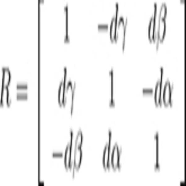
수학식 3를 수학식 2에 대입하여 다시 변환하면 다음과 같은 수학식 4를 얻을 수 있다.Equation (3) is substituted into Equation (2) and converted again, the following Equation (4) can be obtained.
수학식 4Equation 4
![]()
![]()
여기서 ![]()
![]()
![]()
![]()
E의 최소화된 값을 얻기 위해서 각각의 ![]()
![]()
수학식 5
수학식 5는 ![]()
![]()
![]()
![]()
![]()
![]()
수학식 6Equation 6
![]()
![]()
ICP 알고리즘을 통해 산출되는 물체의 위치 및 자세 정보 행렬의 상태 변수는 ![]()
![]()
![]()
![]()
![]()
![]()
추정부가 영상 기반 SLAM과 ICP 알고리즘을 통해 인식 대상 물체(5)의 위치 및 자세를 확정되도록 추정하기 위해서는, 영상 기반 SLAM과 ICP 알고리즘 사이에 최적 이득(K1)을 이용하여 최적의 추정치를 산출해야 한다. 즉, 다음 수학식 7과 같다.In order to estimate the position and attitude of the
수학식 7Equation 7
![]()
![]()
여기서, 최적 이득 K1은 ICP 의 오차 공분산(![]()
![]()
![]()
![]()
![]()
![]()
![]()
![]()
![]()
![]()
![]()
![]()
수학식 8Equation 8
![]()
![]()
그리고, 최적 이득 K1은 수학식 9를 통해 결정된다.And, the optimum gain K 1 is determined by equation (9).
수학식 9Equation 9
![]()
![]()
본 발명의 일 실시예에 따른 복셀 맵 생성기(1)는 최적 이득 K1를 통해 보다 정확하게 인식 대상 물체(5)의 위치 및 자세를 추정할 수 있는데, 수학식 10은 본 발명에 일 실시예에 따라 새롭게 생성된 복셀 맵을 나타낸다.The
수학식 10Equation 10
![]()
![]()
새롭게 얻은 복셀 맵은 왜곡으로 인하여 발생되는 잡음도 적고, 실제 상태로부터 발산하지도 않는다. The newly obtained voxel map is also free from noise due to distortion and does not emit from the actual state.
도 3은 본 발명의 다른 실시예에 따른 복셀 맵 생성 방법을 도시한 것인데, 사용(occupancy) 확률로 채워진 복셀 맵의 결과를 보여주고 있다.FIG. 3 illustrates a method of generating a voxel map according to another embodiment of the present invention, which shows a result of a voxel map filled with an occupancy probability.
도 4와 도 5는 본 발명의 다른 실시예를 통해 획득된 복셀 맵을 도시한 도면인데, 실제로 계단이나 경사면, 원통형 물체가 복셀 맵에 실시간으로 생성되는 것을 나타내고 있다. 각각의 계단과 경사면, 원통형 쓰레기통을 대상으로 실험을 적용한 것인데, 노이즈도 적고 발산도 하지 않는 복셀 맵을 얻을 수 있다. 도 4와 도 5 상에서 계단의 수평면과 경사면의 각도 등도 비교적 선명하게 나타나고 있으며 원통의 둥근 면도 실제 모양에 가깝게 묘사되고 있다.FIGS. 4 and 5 illustrate a voxel map obtained through another embodiment of the present invention. In practice, steps, slopes, and cylindrical objects are generated in real time on a voxel map. Experiments are applied to each step, slope, and cylindrical trash can, and a voxel map with little noise and no divergence can be obtained. In FIGS. 4 and 5, the angle between the horizontal plane and the slope of the step is relatively clear, and the rounded face of the cylinder is depicted close to the actual shape.
도 6은 본 발명의 다른 실시예를 통해 획득된 복셀 맵을 기반으로 한 휴머노이드 풋스텝 내비게이션을 도시한 것이다.FIG. 6 illustrates a humanoid footstep navigation based on a voxel map obtained through another embodiment of the present invention.
휴머노이드의 보행 궤적을 생성하는 풋스텝 플래너(footstep planner)는 복셀 맵을 통해 얻을 수 있는 대표적인 응용 방법이다. 도 6에서는 본 발명의 다른 실시예에 따라 생성된 복셀 맵으로 장애물의 위치를 도시하고, 풋스텝 플래너가 회피 경로를 생성하는 것을 도시하고 있다.The footstep planner, which generates the humanoid walking trajectory, is a typical application method obtained through the voxel map. FIG. 6 illustrates the location of an obstacle in a generated voxel map in accordance with another embodiment of the present invention, and shows that the footstep planner creates an avoidance path.
도 7은 본 발명의 다른 실시예에 따른 복셀 맵 생성 방법을 도시한 블록도이다.7 is a block diagram illustrating a method of generating a voxel map according to another embodiment of the present invention.
먼저, 관성 측정 장치(100)에 포함되는 가속도 센서(130)과 자이로 센서(160)를 통해 가속도 데이터와 자이로 데이터를 획득한다. 획득된 가속도 데이터와 자이로 데이터는 인식 대상 물체(5)의 관성 정보로써, ICP 알고리즘을 적용시켜 관성 정보를 물체의 위치 및 자세 정보의 형태로 만든다. 그리고, TOF 카메라(200)를 통해 획득한 영상(깊이 이미지) 또는 3D 데이터를 획득한다. 다음, 획득된 영상 또는 3D 데이터를 확장 칼만 필터를 이용하여 영상 기반 SLAM 알고리즘을 수행한다. 영상 기반 SLAM을 수행하여 산출되는 정보와 ICP 알고리즘을 적용시킨 관성 정보를 결합하여 인식 대상 물체(5)의 위치 및 자세를 추정한다. 이때, 영상 기반 SLAM 과정 및 ICP 알고리즘의 공분산을 구하고 각 공분산 사이에서 연산되는 최적 이득 K1을 추출한다. 추출된 최적 이득 K1을 통해 새로운 위치 및 자세 데이터를 획득하고 이를 다시 확장 칼만 필터에 적용시켜 보다 정확한 위치 및 자세를 추정하여 복셀 맵을 생성하거나, 바로 복셀 맵을 생성할 수 있다.First, acceleration data and gyro data are acquired through an
본 발명의 또 다른 실시예에 따른 추정된 복셀 맵 생성기(1)의 위치 및 자세의 오차를 감소시키는 방법은, TOF 카메라(200)를 통해 물체를 촬영하여 물체의 깊이 이미지를 생성하고, 물체의 깊이 이미지를 기초로 ICP 알고리즘을 수행하여 복셀 맵 생성기(1)의 위치 및 자세 정보를 산출하여, 산출한 복셀 맵 생성기(1)의 위치 및 자세 정보의 행렬을 오차 공분산의 형태로 변환하여 추정된 복셀 맵 생성기(1)의 위치 및 자세의 오차를 감소시킬 수 있다.The method for reducing the position and orientation error of the estimated
발명의 또 다른 실시예에 따른 추정된 복셀 맵 생성기(1)의 위치 및 자세의 오차를 감소시키는 방법은, 복셀 맵 생성기(1)의 관성을 측정하여 관성 정보를 산출하고, TOF 카메라(200)를 통해 물체를 촬영하여 물체의 깊이 이미지를 생성하고, 산출된 복셀 맵 생성기(1)의 관성 정보와 ICP 알고리즘을 수행하여 산출한 복셀 맵 생성기(1)의 위치 및 자세 정보를 기초로 물체의 위치 및 자세를 추정하고, 산출된 복셀 맵 생성기(1)의 관성 정보의 행렬과 ICP 알고리즘을 수행하여 산출한 복셀 맵 생성기(1)의 위치 및 자세 정보의 행렬을 오차 공분산 형태로 변환하여, 추정된 복셀 맵 생성기(1)의 위치 및 자세의 오차를 감소시킬 수 있다.The method of reducing the position and orientation error of the estimated
1 : 복셀 맵 생성기 5 : 인식 대상 물체
100 : 관성 측정 장치 130 : 가속도 센서
160 : 자이로 센서 200 : TOF 카메라
230 : 발광부 260 : 수광부1: Voxel map generator 5: Object to be recognized
100: inertia measuring device 130: acceleration sensor
160: Gyro sensor 200: TOF camera
230
Claims (11)
물체를 촬영하여 상기 물체의 깊이 이미지 및 흑백 영상 이미지를 생성하는 TOF 카메라;
상기 물체의 깊이 이미지를 기초로 ICP(Iterative Closest Point) 알고리즘을 수행하여 상기 복셀 맵 생성기의 위치 정보 및 자세 정보를 산출하고, 상기 관성 측정 장치에 의해 산출된 상기 복셀 맵 생성기의 관성 정보와 상기 ICP 알고리즘을 수행하여 산출된 상기 복셀 맵 생성기의 위치 정보 및 자세 정보를 기초로 상기 복셀 맵 생성기의 위치 및 자세를 측정 각도에 따라 재귀적으로 추정하는 추정부; 및
상기 재귀적으로 추정된 상기 복셀 맵 생성기의 위치 및 자세와 상기 TOF 카메라를 통해 측정된 물체를 기초로 격자 지도를 작성하는 격자 지도 작성부를 포함하는 복셀 맵 생성기.An inertia measuring device for measuring inertia of the voxel map generator to calculate inertia information;
A TOF camera for photographing an object to generate a depth image and a monochrome image of the object;
And calculating the positional information and the attitude information of the voxel map generator by performing an ICP (Iterative Closest Point) algorithm based on the depth image of the object, calculating inertia information of the voxel map generator calculated by the inertial measurement apparatus, An estimator for recursively estimating a position and a posture of the voxel map generator according to a measurement angle based on position information and attitude information of the voxel map generator calculated by performing an algorithm; And
And a lattice map generator for generating a lattice map based on the position and attitude of the recursively estimated voxel map generator and the object measured through the TOF camera.
상기 추정부는 상기 TOF 카메라를 통해 획득된 상기 물체의 흑백 이미지를 기초로 영상 기반 SLAM을 수행하여 상기 복셀 맵 생성기의 위치 및 자세를 추정하는 복셀 맵 생성기.The method according to claim 1,
Wherein the estimator estimates a position and a posture of the voxel map generator by performing an image-based SLAM based on a monochrome image of the object obtained through the TOF camera.
상기 추정부는 상기 물체의 흑백 이미지를 기초로 상기 영상 기반 SLAM을 수행하여 산출된 상기 복셀 맵 생성기의 위치 정보 및 자세 정보의 행렬을 오차 공분산의 형태로 변환하여 상기 복셀 맵 생성기의 위치 및 자세를 추정하는 복셀 맵 생성기.3. The method of claim 2,
Wherein the estimating unit converts the matrix of the position information and the attitude information of the voxel map generator calculated by performing the image-based SLAM on the basis of the monochrome image of the object into the form of error covariance and estimates the position and posture of the voxel map generator A voxel map generator.
상기 추정부는 상기 물체의 깊이 이미지를 기초로 상기 ICP 알고리즘을 수행하여 산출된 상기 복셀 맵 생성기의 위치 정보 및 자세 정보의 행렬을 오차 공분산의 형태로 변환하여 상기 복셀 맵 생성기의 위치 및 자세를 추정하는 복셀 맵 생성기.The method of claim 3,
The estimating unit estimates a position and a posture of the voxel map generator by converting the matrix of the position information and attitude information of the voxel map generator calculated by performing the ICP algorithm on the basis of the depth image of the object into an error covariance form Voxel map generator.
상기 영상 기반 SLAM을 수행하여 산출된 상기 복셀 맵 생성기의 위치 정보 및 자세 정보의 행렬의 오차 공분산은,
상기 물체의 흑백 이미지를 기초로 상기 영상 기반 SLAM을 수행하여 산출된 상기 물체의 위치 정보 및 자세 정보의 행렬의 상태 변수를 기초로 연산되는 복셀 맵 생성기.5. The method of claim 4,
The error covariance matrix of the position information and the attitude information of the voxel map generator, which is calculated by performing the image-based SLAM,
Based SLAM on the basis of a monochrome image of the object, and a state variable of a matrix of positional information and attitude information of the object calculated by performing the image-based SLAM on the basis of a monochrome image of the object.
상기 ICP 알고리즘을 수행하여 산출된 상기 복셀 맵 생성기의 위치 정보 및 자세 정보의 행렬의 오차 공분산은,
상기 물체의 깊이 이미지를 기초로 상기 ICP 알고리즘을 수행하여 산출된 상기 복셀 맵 생성기의 위치 정보 및 자세 정보의 행렬의 상태 변수를 기초로 연산되는 복셀 맵 생성기.6. The method of claim 5,
The error covariance matrix of the matrix of the position information and attitude information of the voxel map generator, which is calculated by performing the ICP algorithm,
Wherein the voxel map generator is calculated based on a state variable of a matrix of positional information and attitude information of the voxel map generator calculated by performing the ICP algorithm based on a depth image of the object.
상기 추정부는 상기 영상 기반 SLAM을 수행하여 산출된 상기 복셀 맵 생성기의 위치 정보 및 자세 정보의 행렬의 오차 공분산과, 상기 ICP 알고리즘을 수행하여 산출된 상기 복셀 맵 생성기의 위치 정보 및 자세 정보의 행렬에 자코비안(Jacobian)을 구하여 상태 변수를 변형시킨 오차 공분산을 통해 연산되는 이득에 따라 상기 복셀 맵 생성기의 위치 및 자세를 추정하는 복셀 맵 생성기.The method according to claim 6,
Wherein the estimator calculates an error covariance matrix of the position information and attitude information of the voxel map generator calculated by performing the image based SLAM and a matrix of position information and attitude information of the voxel map generator calculated by performing the ICP algorithm A voxel map generator for estimating a position and a posture of a voxel map generator according to a gain calculated through an error covariance obtained by obtaining a Jacobian and modifying a state variable.
상기 관성 측정 장치는 자이로 센서 또는 가속도 센서를 포함하는 복셀 맵 생성기.The method according to claim 1,
Wherein the inertial measurement device includes a gyro sensor or an acceleration sensor.
TOF 카메라를 통해 물체를 촬영하여 상기 물체의 깊이 이미지를 생성하고;
상기 물체의 깊이 이미지를 기초로 ICP(Iterative Closest Point) 알고리즘을 수행하여 상기 복셀 맵 생성기의 위치 정보 및 자세 정보를 산출하고;
상기 산출된 상기 복셀 맵 생성기의 관성 정보와 상기 ICP 알고리즘을 수행하여 산출된 상기 복셀 맵 생성기의 위치 정보 및 자세 정보를 기초로 상기 복셀 맵 생성기의 위치 및 자세를 측정 각도에 따라 복수 회 추정하고;
상기 복수 회 추정된 상기 복셀 맵 생성기의 위치 및 자세를 기초로 격자 지도를 작성하는 복셀 맵 생성 방법.Measuring inertia of the voxel map generator to calculate inertia information;
Capturing an object through a TOF camera to produce a depth image of the object;
Performing an ICP (Iterative Closest Point) algorithm based on the depth image of the object to calculate position information and attitude information of the voxel map generator;
Estimating a position and an attitude of the voxel map generator a plurality of times based on the inertia information of the voxel map generator and the position information and attitude information of the voxel map generator calculated by performing the ICP algorithm;
And generating a grid map based on the position and posture of the voxel map generator estimated a plurality of times.
상기 물체의 깊이 이미지를 기초로 ICP(Iterative Closest Point) 알고리즘을 수행하여 복셀 맵 생성기의 위치 정보 및 자세 정보를 산출하여 상기 복셀 맵 생성기의 위치 및 자세를 추정하고;
상기 산출된 상기 복셀 맵 생성기의 위치 정보 및 자세 정보의 행렬을 오차 공분산의 형태로 변환하여 상기 추정된 상기 복셀 맵 생성기의 위치 및 자세의 오차를 감소시키는 방법.Capturing an object through a TOF camera to produce a depth image of the object;
Estimating a position and a posture of the voxel map generator by calculating position information and attitude information of a voxel map generator by performing an ICP (Iterative Closest Point) algorithm based on the depth image of the object;
And transforming the calculated matrix of position information and attitude information of the voxel map generator into a form of error covariance, thereby reducing the error of the estimated position and attitude of the voxel map generator.
TOF 카메라를 통해 물체를 촬영하여 상기 물체의 깊이 이미지를 생성하고;
상기 산출된 상기 복셀 맵 생성기의 관성 정보와 ICP(Iterative Closest Point) 알고리즘을 수행하여 산출된 상기 복셀 맵 생성기의 위치 정보 및 자세 정보를 기초로 상기 복셀 맵 생성기의 위치 및 자세를 추정하고;
상기 산출된 상기 복셀 맵 생성기의 관성 정보의 행렬과 상기 ICP 알고리즘을 수행하여 산출된 상기 복셀 맵 생성기의 위치 정보 및 자세 정보의 행렬을 오차 공분산 형태로 변환하여 상기 추정된 상기 복셀 맵 생성기의 위치 및 자세의 오차를 감소시키는 방법.Measuring inertia of the voxel map generator to calculate inertia information;
Capturing an object through a TOF camera to produce a depth image of the object;
Estimating a position and an attitude of the voxel map generator based on the calculated inertia information of the voxel map generator and the position information and attitude information of the voxel map generator calculated by performing an ICP (Iterative Closest Point) algorithm;
The position and orientation information of the voxel map generator calculated by performing the ICP algorithm and the matrix of the inertial information of the voxel map generator are converted into an error covariance matrix, A method for reducing an error of a posture.
Priority Applications (2)
| Application Number | Priority Date | Filing Date | Title |
|---|---|---|---|
| KR1020100098927A KR101715780B1 (en) | 2010-10-11 | 2010-10-11 | Voxel Map generator And Method Thereof |
| US13/137,832 US8428343B2 (en) | 2010-10-11 | 2011-09-15 | VOXEL map generator and method thereof |
Applications Claiming Priority (1)
| Application Number | Priority Date | Filing Date | Title |
|---|---|---|---|
| KR1020100098927A KR101715780B1 (en) | 2010-10-11 | 2010-10-11 | Voxel Map generator And Method Thereof |
Publications (2)
| Publication Number | Publication Date |
|---|---|
| KR20120037270A KR20120037270A (en) | 2012-04-19 |
| KR101715780B1 true KR101715780B1 (en) | 2017-03-13 |
Family
ID=46019657
Family Applications (1)
| Application Number | Title | Priority Date | Filing Date |
|---|---|---|---|
| KR1020100098927A Active KR101715780B1 (en) | 2010-10-11 | 2010-10-11 | Voxel Map generator And Method Thereof |
Country Status (2)
| Country | Link |
|---|---|
| US (1) | US8428343B2 (en) |
| KR (1) | KR101715780B1 (en) |
Cited By (2)
| Publication number | Priority date | Publication date | Assignee | Title |
|---|---|---|---|---|
| KR101925862B1 (en) * | 2018-09-13 | 2018-12-06 | 주식회사 에이엠오토노미 | Real-time 3d mapping using 3d-lidar |
| US12105519B2 (en) | 2019-03-25 | 2024-10-01 | Twinny Co., Ltd. | Method for estimating positioning of moving object by using big cell grid map, recording medium in which program for implementing same is stored, and computer program stored in medium in order to implement same |
Families Citing this family (10)
| Publication number | Priority date | Publication date | Assignee | Title |
|---|---|---|---|---|
| US9215440B2 (en) * | 2012-10-17 | 2015-12-15 | Disney Enterprises, Inc. | Efficient EWA video rendering |
| DE102014102727B3 (en) * | 2014-02-28 | 2015-07-30 | Lars Geißler | Camera-based position sensor and positioning method |
| KR102403504B1 (en) * | 2015-11-26 | 2022-05-31 | 삼성전자주식회사 | Mobile Robot And Method Thereof |
| KR101962403B1 (en) * | 2017-05-11 | 2019-07-18 | 한국생산기술연구원 | An Apparatus and A Method For Stop Guidance In Position Based On Phased-Array Optical Beams |
| US10872228B1 (en) * | 2017-09-27 | 2020-12-22 | Apple Inc. | Three-dimensional object detection |
| CN107845114B (en) * | 2017-11-10 | 2024-03-22 | 北京三快在线科技有限公司 | Map construction method and device and electronic equipment |
| KR102319015B1 (en) * | 2020-04-09 | 2021-10-29 | 한국과학기술원 | Method and Apparatus for Adaptive Kernel Inference for Dense and Sharp Occupancy Grids |
| EP4639478A1 (en) * | 2022-12-23 | 2025-10-29 | Telefonaktiebolaget LM Ericsson (publ) | Bitrate adaptation for edge-assisted localization given network availability for mobile devices |
| WO2024136881A1 (en) * | 2022-12-23 | 2024-06-27 | Telefonaktiebolaget L M Ericsson (Publ) | Bitrate adaptation for edge-assisted localization based on map availability for mobile devices |
| KR102524995B1 (en) | 2023-02-02 | 2023-04-25 | 국방과학연구소 | Map generating method of electronic apparatus |
Citations (2)
| Publication number | Priority date | Publication date | Assignee | Title |
|---|---|---|---|---|
| JP2009545800A (en) * | 2006-08-02 | 2009-12-24 | コーニンクレッカ フィリップス エレクトロニクス エヌ ヴィ | How to reconstruct a voxel cluster map in an image |
| JP2010512879A (en) * | 2006-12-19 | 2010-04-30 | アイエムアイ インテリジェント メディカル インプランツ アクチエンゲゼルシャフト | Visual aids with 3D image acquisition |
Family Cites Families (10)
| Publication number | Priority date | Publication date | Assignee | Title |
|---|---|---|---|---|
| US5841892A (en) * | 1995-05-31 | 1998-11-24 | Board Of Trustees Operating Michigan State University | System for automated analysis of 3D fiber orientation in short fiber composites |
| US7194117B2 (en) * | 1999-06-29 | 2007-03-20 | The Research Foundation Of State University Of New York | System and method for performing a three-dimensional virtual examination of objects, such as internal organs |
| US6775417B2 (en) * | 1997-10-02 | 2004-08-10 | S3 Graphics Co., Ltd. | Fixed-rate block-based image compression with inferred pixel values |
| US6674430B1 (en) * | 1998-07-16 | 2004-01-06 | The Research Foundation Of State University Of New York | Apparatus and method for real-time volume processing and universal 3D rendering |
| US6556199B1 (en) * | 1999-08-11 | 2003-04-29 | Advanced Research And Technology Institute | Method and apparatus for fast voxelization of volumetric models |
| EP1264281A4 (en) * | 2000-02-25 | 2007-07-11 | Univ New York State Res Found | ARRANGEMENT AND METHOD FOR PROCESSING AND PLAYING A VOLUME |
| GB2378337B (en) * | 2001-06-11 | 2005-04-13 | Canon Kk | 3D Computer modelling apparatus |
| US7446766B2 (en) * | 2005-02-08 | 2008-11-04 | Seegrid Corporation | Multidimensional evidence grids and system and methods for applying same |
| WO2006088845A2 (en) * | 2005-02-15 | 2006-08-24 | Walleye Technologies, Inc. | Electromagnetic scanning imager |
| US7961910B2 (en) * | 2009-10-07 | 2011-06-14 | Microsoft Corporation | Systems and methods for tracking a model |
-
2010
- 2010-10-11 KR KR1020100098927A patent/KR101715780B1/en active Active
-
2011
- 2011-09-15 US US13/137,832 patent/US8428343B2/en active Active
Patent Citations (2)
| Publication number | Priority date | Publication date | Assignee | Title |
|---|---|---|---|---|
| JP2009545800A (en) * | 2006-08-02 | 2009-12-24 | コーニンクレッカ フィリップス エレクトロニクス エヌ ヴィ | How to reconstruct a voxel cluster map in an image |
| JP2010512879A (en) * | 2006-12-19 | 2010-04-30 | アイエムアイ インテリジェント メディカル インプランツ アクチエンゲゼルシャフト | Visual aids with 3D image acquisition |
Cited By (3)
| Publication number | Priority date | Publication date | Assignee | Title |
|---|---|---|---|---|
| KR101925862B1 (en) * | 2018-09-13 | 2018-12-06 | 주식회사 에이엠오토노미 | Real-time 3d mapping using 3d-lidar |
| US11525923B2 (en) | 2018-09-13 | 2022-12-13 | A.M.Autonomy Co., Ltd. | Real-time three-dimensional map building method and device using three-dimensional lidar |
| US12105519B2 (en) | 2019-03-25 | 2024-10-01 | Twinny Co., Ltd. | Method for estimating positioning of moving object by using big cell grid map, recording medium in which program for implementing same is stored, and computer program stored in medium in order to implement same |
Also Published As
| Publication number | Publication date |
|---|---|
| US20120114174A1 (en) | 2012-05-10 |
| KR20120037270A (en) | 2012-04-19 |
| US8428343B2 (en) | 2013-04-23 |
Similar Documents
| Publication | Publication Date | Title |
|---|---|---|
| KR101715780B1 (en) | Voxel Map generator And Method Thereof | |
| CN110070615B (en) | Multi-camera cooperation-based panoramic vision SLAM method | |
| KR101776622B1 (en) | Apparatus for recognizing location mobile robot using edge based refinement and method thereof | |
| EP2718668B1 (en) | Sensor positioning for 3d scanning | |
| Alcantarilla et al. | On combining visual SLAM and dense scene flow to increase the robustness of localization and mapping in dynamic environments | |
| KR101776621B1 (en) | Apparatus for recognizing location mobile robot using edge based refinement and method thereof | |
| KR101776620B1 (en) | Apparatus for recognizing location mobile robot using search based correlative matching and method thereof | |
| CN110125928A (en) | A kind of binocular inertial navigation SLAM system carrying out characteristic matching based on before and after frames | |
| JP6782903B2 (en) | Self-motion estimation system, control method and program of self-motion estimation system | |
| CN112802096A (en) | Device and method for realizing real-time positioning and mapping | |
| Kunz et al. | Map building fusing acoustic and visual information using autonomous underwater vehicles | |
| KR20150144728A (en) | Apparatus for recognizing location mobile robot using search based correlative matching and method thereof | |
| Kneip et al. | Closed-form solution for absolute scale velocity determination combining inertial measurements and a single feature correspondence | |
| CN116380079B (en) | An underwater SLAM method integrating forward-looking sonar and ORB-SLAM3 | |
| Huai et al. | Real-time large scale 3D reconstruction by fusing Kinect and IMU data | |
| CN115218906A (en) | Indoor SLAM-oriented visual inertial fusion positioning method and system | |
| Xian et al. | Fusing stereo camera and low-cost inertial measurement unit for autonomous navigation in a tightly-coupled approach | |
| CN114913224B (en) | Mapping method for mobile robots based on visual SLAM | |
| JP6410231B2 (en) | Alignment apparatus, alignment method, and computer program for alignment | |
| Lerner et al. | Pose and motion recovery from feature correspondences and a digital terrain map | |
| CN112580683A (en) | Multi-sensor data time alignment system and method based on cross correlation | |
| US20250078314A1 (en) | Unified visual localization architecture | |
| Liu et al. | 6-DOF motion estimation using optical flow based on dual cameras | |
| JP5409451B2 (en) | 3D change detector | |
| JP5230354B2 (en) | POSITIONING DEVICE AND CHANGED BUILDING DETECTION DEVICE |
Legal Events
| Date | Code | Title | Description |
|---|---|---|---|
| PA0109 | Patent application |
Patent event code: PA01091R01D Comment text: Patent Application Patent event date: 20101011 |
|
| PG1501 | Laying open of application | ||
| A201 | Request for examination | ||
| PA0201 | Request for examination |
Patent event code: PA02012R01D Patent event date: 20150923 Comment text: Request for Examination of Application Patent event code: PA02011R01I Patent event date: 20101011 Comment text: Patent Application |
|
| E902 | Notification of reason for refusal | ||
| PE0902 | Notice of grounds for rejection |
Comment text: Notification of reason for refusal Patent event date: 20160629 Patent event code: PE09021S01D |
|
| E701 | Decision to grant or registration of patent right | ||
| PE0701 | Decision of registration |
Patent event code: PE07011S01D Comment text: Decision to Grant Registration Patent event date: 20170106 |
|
| GRNT | Written decision to grant | ||
| PR0701 | Registration of establishment |
Comment text: Registration of Establishment Patent event date: 20170307 Patent event code: PR07011E01D |
|
| PR1002 | Payment of registration fee |
Payment date: 20170308 End annual number: 3 Start annual number: 1 |
|
| PG1601 | Publication of registration | ||
| FPAY | Annual fee payment |
Payment date: 20200225 Year of fee payment: 4 |
|
| PR1001 | Payment of annual fee |
Payment date: 20200225 Start annual number: 4 End annual number: 4 |
|
| PR1001 | Payment of annual fee |
Payment date: 20210222 Start annual number: 5 End annual number: 5 |
|
| PR1001 | Payment of annual fee |
Payment date: 20220216 Start annual number: 6 End annual number: 6 |
|
| PR1001 | Payment of annual fee |
Payment date: 20230214 Start annual number: 7 End annual number: 7 |
|
| PR1001 | Payment of annual fee |
Payment date: 20240219 Start annual number: 8 End annual number: 8 |