HINTERGRUNDBACKGROUND
1. Gebiet1st area
Formen der vorliegenden Offenbarung bezieht sich auf ein Verkehrsvorhersagesystem, eine fahrzeugmontierte Anzeigevorrichtung, ein Fahrzeug und ein Verkehrsvorhersageverfahren.Forms of the present disclosure relate to a traffic prediction system, a vehicle-mounted display device, a vehicle, and a traffic prediction method.
2. Beschreibung verwandten Stands der Technik2. Description of Related Art
Ein Fahrzeug ist ein Transportmittel, das auf Straßen oder Bahnen fährt, um Menschen oder Objekte zu einem Ziel zu transportieren. Das Fahrzeug bewegt sich durch ein oder mehrere Räder, die im allgemeinen an der Fahrzeugkarosserie installiert sind, um Menschen oder Objekte zum Ziel zu transportieren. Beispiele des Fahrzeugs beinhalten ein dreirädriges oder vierrädriges Fahrzeug, ein zweirädriges Fahrzeug wie etwa ein Motorrad, Baugeräte, ein Fahrrad und einen Zug, der auf Schienen oder Bahnen fährt.A vehicle is a means of transport that travels on roads or trains to transport people or objects to a destination. The vehicle moves through one or more wheels that are generally installed on the vehicle body to transport people or objects to the destination. Examples of the vehicle include a three-wheel or four-wheeled vehicle, a two-wheeled vehicle such as a motorcycle, construction equipment, a bicycle and a train traveling on rails or lanes.
Das Fahrzeug kann eine fahrzeugmontierte Anzeigevorrichtung enthalten. Die fahrzeugmontierte Anzeigevorrichtung kann einem Fahrer oder einem Beifahrer verschiedene notwendige Informationen bereitstellen, beispielsweise Informationen über eine aktuelle Position des Fahrzeugs, Informationen über eine Route zu einem Ziel, Informationen um das Fahrzeug herum, Informationen zu einer Geschwindigkeit des Fahrzeugs, Informationen dazu, ob ein Klimaanlagensystem arbeitet, oder verschiedene Arten von Lebensinformationen, die für den Fahrer oder Passagier notwendig sind. Die fahrzeugmontierte Anzeigevorrichtung kann ein Audio-Video-Navigations-(AVN)-System sein.The vehicle may include a vehicle-mounted display device. The vehicle-mounted display device may provide various necessary information to a driver or a passenger, such as information about a current position of the vehicle, information about a route to a destination, information about the vehicle, information about a speed of the vehicle, information about whether an air conditioning system works, or various types of life information necessary for the driver or passenger. The vehicle-mounted display device may be an audio-video-navigation (AVN) system.
Jüngst kann die fahrzeugmontierte Anzeigevorrichtung zusätzlich Information zu einem Verkehrsvolumen um das Fahrzeug herum, einem Ziel, oder einer Route bereitstellen. Falls die fahrzeugmontierte Anzeigevorrichtung ein Navigationssystem ist, entscheidet die fahrzeugmontierte Anzeigevorrichtung über eine Route zu einem Ziel unter Berücksichtigung der Information über ein Verkehrsaufkommen und führt den Fahrer, auf der entschiedenen Route so zu fahren, dass das Fahrzeug rasch am Ziel eintreffen kann, durch Vermeiden von Verkehrsstaus.Recently, the vehicle-mounted display device may additionally provide information about a traffic volume around the vehicle, a destination, or a route. If the vehicle-mounted display device is a navigation system, the vehicle-mounted display device decides a route to a destination in consideration of the information about traffic and guides the driver to drive on the decided route so that the vehicle can arrive at the destination quickly by avoiding traffic jams.
ZUSAMMENFASSUNGSUMMARY
Daher ist ein Aspekt der vorliegenden Offenbarung, ein Verkehrsvorhersagesystem, welches in der Lage ist, eine Route zu detektieren, die eine höchste Fahrwahrscheinlichkeit für ein fahrendes Fahrzeug aufweist, und das Verkehrsaufkommen anhand des Ergebnisses der Detektion genau vorherzusagen, eine fahrzeugmontierte Anzeigevorrichtung, ein Fahrzeug und ein Verkehrsvorhersageverfahren bereitzustellen.Therefore, one aspect of the present disclosure is a traffic prediction system capable of detecting a route having a highest driving probability for a traveling vehicle and accurately predicting the traffic volume based on the result of the detection, a vehicle-mounted display device, a vehicle, and the like to provide a traffic prediction method.
Zusätzliche Aspekte der Offenbarung werden teilweise in der Beschreibung, die nachfolgt, dargestellt und sind teilweise aus der Beschreibung offensichtlich, oder können durch die Ausübung der Offenbarung erlernt werden.Additional aspects of the disclosure will be set forth in part in the description which follows, and in part will be obvious from the description, or may be learned by practice of the disclosure.
Gemäß einem Aspekt der vorliegenden Offenbarung beinhaltet ein Verkehrsvorhersagesystem: ein Fahrzeug, das konfiguriert ist, eine Fahrwahrscheinlichkeit für zumindest eine befahrbare Route zu erfassen; und eine Server-Vorrichtung, die konfiguriert ist, die Fahrwahrscheinlichkeit für die zumindest eine befahrbare Route aus dem Fahrzeug zu empfangen und ein Verkehrsaufkommen für die zumindest eine befahrbare Route zu berechnen, unter Verwendung der Fahrwahrscheinlichkeit für die zumindest eine befahrbare Route.According to one aspect of the present disclosure, a traffic prediction system includes: a vehicle configured to detect a driving probability for at least one drivable route; and a server device configured to receive the driving probability for the at least one drivable route from the vehicle and to calculate a traffic volume for the at least one drivable route using the driving probability for the at least one drivable route.
Das Fahrzeug kann eine Fahrwahrscheinlichkeit für jede Verknüpfung einer oder mehrere Verknüpfungen berechnen, die mit zumindest einem Knoten verbunden sind, um die Fahrwahrscheinlichkeit für die zumindest eine Route zu erfassen.The vehicle may calculate a driving likelihood for each linkage of one or more links associated with at least one node to detect the driving likelihood for the at least one route.
Das Fahrzeug kann die Fahrwahrscheinlichkeit für jede Verknüpfung unter Verwendung eines Spurwechselverlaufs (Historie) des Fahrzeugs berechnen.The vehicle may calculate the driving probability for each link using a lane change history of the vehicle.
Das Fahrzeug kann ein Bild zu einer Frontsicht des Fahrzeugs erfassen, Linien aus dem Bild extrahieren, um Information über Spuren zu erfassen und den Spurwechselverlauf basierend auf der Information zu den Spuren erfassen.The vehicle may capture an image to a front view of the vehicle, extract lines from the image to acquire information about tracks, and detect the lane change history based on the information about the lanes.
Das Fahrzeug kann die Fahrwahrscheinlichkeit für jede Verknüpfung unter Verwendung von Fahrvektoren des Fahrzeugs berechnen.The vehicle may calculate the driving likelihood for each link using vehicle travel vectors.
Das Fahrzeug kann Information zu einer Position des Fahrzeugs mehrmals erfassen und die Fahrvektoren des Fahrzeugs basierend auf der Information über die Position des Fahrzeugs erfassen.The vehicle may acquire information on a position of the vehicle multiple times and detect the running vectors of the vehicle based on the information about the position of the vehicle.
Das Fahrzeug kann 3-dimensionale (3D) Koordinaten über die Position des Fahrzeugs unter Verwendung von 3D-Karteninformation erfassen, um die Information über die Position des Fahrzeugs zu erfassen.The vehicle may acquire 3-dimensional (3D) coordinates about the position of the vehicle using 3D map information to acquire the information about the position of the vehicle.
Der Knoten kann eine gerade Straße, eine Kreuzung, ein Überführung, eine Unterführung eine Abfahrt oder/und einen Kreisverkehr repräsentieren.The node may represent a straight road, an intersection, an overpass, an underpass an exit and / or a roundabout.
Die Server-Vorrichtung kann ein vorhergesagtes Aufkommen von Fahrzeugen für jede Verbindung basierend auf den Fahrmöglichkeiten für jede Verbindung berechnen und das Verkehrsaufkommen für die zumindest eine befahrbare Route basierend auf dem Ergebnis der Berechnung berechnen.The server device may have a predicted amount of vehicles for each Calculate connection based on the driving possibilities for each connection and calculate the traffic volume for the at least one drivable route based on the result of the calculation.
Das Fahrzeug kann eine Fahrwahrscheinlichkeit für zumindest eine Verbindung berechnen und eine Fahrwahrscheinlichkeit für jede Route unter Verwendung der Fahrwahrscheinlichkeit für die zumindest eine Verbindung berechnen.The vehicle may calculate a driving likelihood for at least one link and calculate a driving likelihood for each route using the driving likelihood for the at least one link.
Das Fahrzeug kann die Fahrwahrscheinlichkeit jeder Route unter Verwendung eines elektronischen Horizont(EH)-Verfahrens berechnen.The vehicle may calculate the driving likelihood of each route using an electronic horizon (EH) method.
Die Server-Vorrichtung kann ein vorhergesagtes Aufkommen an Fahrzeugen basierend auf der Fahrwahrscheinlichkeit für jede Route berechnen und das Verkehrsaufkommen für die zumindest eine befahrbare Route basierend auf dem Ergebnis der Berechnung berechnen.The server device may calculate a predicted amount of vehicles based on the driving probability for each route and calculate the traffic volume for the at least one drivable route based on the result of the calculation.
Die zumindest eine befahrbare Route kann eine Route enthalten, die in einem Bereich vorliegt, in welchem das Fahrzeug einen vorbestimmten Zeitraum lang fahren kann.The at least one passable route may include a route that exists in an area in which the vehicle can travel for a predetermined period of time.
Die Server-Vorrichtung kann Informationen über das Verkehrsaufkommen an das Fahrzeug senden.The server device may send traffic information to the vehicle.
Das Verkehrsvorhersagesystem kann weiter ein Endgerät enthalten, das konfiguriert ist, Informationen über das Fahraufkommen aus der Servervorrichtung zu empfangen.The traffic prediction system may further include a terminal configured to receive information about the drive from the server device.
Das Fahrzeug kann eine fahrzeugmontierte Anzeigevorrichtung enthalten, die konfiguriert ist, die Fahrwahrscheinlichkeit für die zumindest eine befahrbare Route zu erfassen.The vehicle may include a vehicle-mounted display device configured to detect the driving likelihood for the at least one drivable route.
Gemäß einem anderen Aspekt der vorliegenden Offenbarung beinhaltet eine fahrzeugmontierte Anzeigevorrichtung: eine Steuerung, die konfiguriert ist, eine Fahrwahrscheinlichkeit für die zumindest eine Route zu erfassen, auf der das Fahrzeug fahren kann; und eine Kommunikationseinheit, die konfiguriert ist, die Fahrwahrscheinlichkeit für die zumindest eine Route an eine Server-Vorrichtung zu senden.According to another aspect of the present disclosure, a vehicle-mounted display device includes: a controller configured to detect a driving probability for the at least one route on which the vehicle can travel; and a communication unit configured to send the driving probability for the at least one route to a server device.
Die Kommunikationseinheit kann Information über ein Verkehrsaufkommen, welches basierend auf der Fahrwahrscheinlichkeit für die zumindest eine Route berechnet ist, aus einer Server-Vorrichtung empfangen.The communication unit may receive information about a traffic volume calculated based on the driving probability for the at least one route from a server device.
Die fahrzeugmontierte Anzeigevorrichtung kann weiter eine Anzeigeeinheit enthalten, die konfiguriert ist, Information über das Verkehrsaufkommen anzuzeigen.The vehicle-mounted display device may further include a display unit configured to display traffic information.
Die Anzeigeeinheit kann die Information über das Verkehrsaufkommen mit Karteninformation kombinieren, um das Ergebnis der Kombination anzuzeigen.The display unit may combine the traffic information with map information to indicate the result of the combination.
Die Steuerung kann eine Fahrwahrscheinlichkeit für jede Verbindung einer oder mehrerer Verbindungen, die mit zumindest einem Knoten verbunden sind, berechnen, unter Verwendung von einem Spurwechselverlauf des Fahrzeugs oder/und Fahrvektoren des Fahrzeugs, um dadurch die Fahrwahrscheinlichkeit für die zumindest eine Route zu erfassen.The controller may calculate a driving probability for each connection of one or more links connected to at least one node using a lane change course of the vehicle and / or driving vectors of the vehicle to thereby detect the driving likelihood for the at least one route.
Die Steuerung kann eine Fahrwahrscheinlichkeit für die zumindest eine Verbindung berechnen und eine Fahrwahrscheinlichkeit für jede Route unter Verwendung der Fahrwahrscheinlichkeit für die zumindest eine Verbindung berechnen.The controller may calculate a driving likelihood for the at least one link and calculate a driving likelihood for each route using the driving likelihood for the at least one link.
Die Steuerung kann die Fahrwahrscheinlichkeit für jede Route unter Verwendung eines elektronischen Horizont-(EH)-Verfahrens berechnen.The controller may calculate the driving likelihood for each route using an Electronic Horizon (EH) method.
Zumindest eine Route, auf der das Fahrzeug in der Lage ist, zu fahren, kann eine Route beinhalten, die in einem Bereich vorkommt, zu welchem das Fahrzeug in der Lage ist, einen vorbestimmten Zeitraum lang zu fahren.At least one route on which the vehicle is capable of running may include a route that occurs in an area to which the vehicle is capable of running for a predetermined period of time.
KURZE BESCHREIBUNG DER ZEICHNUNGENBRIEF DESCRIPTION OF THE DRAWINGS
Diese und/oder andere Aspekte der Offenbarung werden ersichtlicher und verständlicher aus der nachfolgenden Beschreibung der Formen, bei Zusammenschau mit den beifügten Zeichnungen, in welchen:These and / or other aspects of the disclosure will become more apparent and understood from the following description of the forms, taken in conjunction with the accompanying drawings, in which:
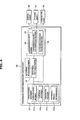
1 eine Form eines Verkehrsvorhersagesystems zeigt; 1 shows a form of traffic prediction system;
2 eine äußere Anmutung eines Fahrzeugs zeigt; 2 shows an external appearance of a vehicle;
3 ein Steuerblockdiagramm eines Fahrzeugs ist; 3 is a control block diagram of a vehicle;
4 ein Steuerblockdiagramm einer vorhergesagten Fahrinformations-Erfassungseinheit ist; 4 Fig. 11 is a control block diagram of a predicted driving information acquiring unit;
5 eine Ansicht zum Beschreiben von Fahrvektoren ist; 5 is a view for describing driving vectors;
6 eine Ansicht zum Beschreiben eines Spurwechselverlaufs ist; 6 is a view for describing a lane change course;
7 eine Tabelle zum Beschreiben eines Spurwechselverlaufs ist; 7 is a table for describing a lane change course;
8 ein Beispiel eines befahrbaren Bereichs zeigt; 8th shows an example of a drivable area;
9 ein anderes Beispiel eines befahrbaren Bereichs zeigt; 9 shows another example of a drivable area;
10 eine Ansicht zum Beschreiben von Knoten und Verbindungen ist; 10 is a view for describing nodes and connections;
11 ein Beispiel einer Kombination von Knoten und Verbindungen zeigt; 11 shows an example of a combination of nodes and links;
12 eine Ansicht zum Beschreiben eines Beispiels des Berechnens einer Fahrwahrscheinlichkeit in einer Verbindung, basierend auf einem Spurwechselverlauf, ist; 12 is a view for describing an example of calculating a driving probability in a connection based on a lane change course;
13 eine Ansicht zum Beschreiben eines Beispiels des Berechnens einer Fahrwahrscheinlichkeit in einer Verbindung, basierend auf Fahrvektoren, ist; 13 Fig. 10 is a view for describing an example of calculating a driving probability in a connection based on driving vectors;
14 eine Ansicht zum Beschreiben eines Beispiels der Berechnung einer Fahrwahrscheinlichkeit für jede von Routen zum Bewegen zu einem Ziel hin ist; 14 Fig. 12 is a view for describing an example of calculating a driving likelihood of each of routes for moving to a destination;
15 ein Steuerblock-Diagramm einer Server-Vorrichtung ist; 15 is a control block diagram of a server device;
16 ein Beispiel einer Karte zeigt, an welcher Verkehrsaufkommens-Information, welche durch eine Server-Vorrichtung erfasst ist, wiedergespiegelt wird; 16 an example of a map showing at which traffic information detected by a server device is reflected;
17 ein erstes Flussdiagramm ist, das eine Form eines Verkehrsvorhersageverfahrens illustriert; 17 Fig. 10 is a first flowchart illustrating one form of traffic prediction method;
18 ein zweites Flussdiagramm ist, das eine Form eines Verkehrsvorhersageverfahrens illustriert; und 18 a second flowchart illustrating one form of traffic prediction method; and
19 ein drittes Flussdiagramm ist, das eine Form eines Verkehrsvorhersageverfahrens illustriert. 19 Figure 3 is a third flowchart illustrating one form of traffic prediction method.
DETAILLIERTE BESCHREIBUNGDETAILED DESCRIPTION
Nachfolgend werden ein Verkehrsvorhersagesystem, eine fahrzeugmontierte Anzeigevorrichtung und ein Fahrzeug gemäß Formen der vorliegenden Offenbarung im Detail unter Bezugnahme auf 1 bis 16 beschrieben.Hereinafter, a traffic prediction system, a vehicle-mounted display device, and a vehicle according to modes of the present disclosure will be described in detail with reference to FIG 1 to 16 described.
1 zeigt eine Form eines Verkehrsvorhersagesystems. 1 shows a form of traffic prediction system.
Bezugnehmend auf 1 kann ein Verkehrsvorhersagesystem 1 zumindest ein Fahrzeug 100 und eine Server-Vorrichtung 200 enthalten, die mit dem zumindest einen Fahrzeug 100 kommunizieren kann.Referring to 1 can be a traffic prediction system 1 at least one vehicle 100 and a server device 200 included with the at least one vehicle 100 can communicate.
Das Fahrzeug 100 bedeutet ein Transportmittel, das auf Straßen oder Schienen fahren kann. Nachfolgend wird aus Gründen der Bequemlichkeit der Beschreibung angenommen, dass das Fahrzeug 100 ein vierrädriges Fahrzeug ist. Jedoch ist das Fahrzeug 100 nicht auf ein vierrädriges Fahrzeug beschränkt. Beispielsweise kann das Fahrzeug 100 ein zweirädriges Fahrzeug, ein dreirädriges Fahrzeug, bewegliche Baugeräte, ein Fahrrad oder ein Motorrad sein.The vehicle 100 means a means of transport that can travel on roads or rails. Hereinafter, for the sake of convenience of description, it is assumed that the vehicle 100 is a four-wheeled vehicle. However, the vehicle is 100 not limited to a four-wheeled vehicle. For example, the vehicle 100 a two-wheeled vehicle, a three-wheeled vehicle, mobile construction equipment, a bicycle or a motorcycle.
Die Server-Vorrichtung 200 bedeutet eine Computervorrichtung, auf die ein Klient an einem entfernten Ort, über ein vorbestimmtes Netzwerk zugreifen kann, und verschiedene Funktionen gemäß Anforderungen aus dem Klienten durchführen kann. Beispielsweise kann die Server-Vorrichtung 200 konfiguriert sein, verschiedene Verarbeitungen durchzuführen, basierend auf aus einem Klienten übertragenen Daten, um nach Bedarf verschiedene Informationen einem zugreifenden Klienten bereitzustellen, oder eine vorbestimmte Verarbeitung durchzuführen, ohne jegliche Anfrage aus dem Klienten zu empfangen. Die Server-Vorrichtung 200 kann verschiedene Verarbeitungen gemäß dem Ablauf des Programms durchführen, um der Server-Vorrichtung 200 zu ermöglichen, als ein Server zu fungieren. Die Server-Vorrichtung 200 kann ein Desktop-Computer, ein Laptop-Computer oder eine Computervorrichtung sein, die speziell hergestellt ist, um die Funktionen eines Servers durchzuführen. Auch kann die Server-Vorrichtung 200 jegliche andere Vorrichtung sein, die von einem Designer erwogen wird.The server device 200 Means a computing device that a client at a remote location can access via a predetermined network and perform various functions according to requirements from the client. For example, the server device 200 be configured to perform various processes based on data transmitted from a client to provide various information to an accessing client as needed, or to perform predetermined processing without receiving any request from the client. The server device 200 may perform various processings according to the flow of the program to the server device 200 to allow to act as a server. The server device 200 may be a desktop computer, a laptop computer, or a computing device that is specifically designed to perform the functions of a server. Also, the server device 200 Any other device considered by a designer.
Das zumindest eine Fahrzeug 100 und die Server-Vorrichtung 200 können konfiguriert sein, verschiedene Daten über ein vorbestimmtes Kommunikationsnetzwerk zu senden und zu empfangen. In diesem Fall können zumindest ein Fahrzeug 100 und die Server-Vorrichtung 200 wechselseitige Kommunikation über ein Funkkommunikationsnetzwerk durchführen oder können wechselseitige Kommunikation über sowohl ein drahtgebundenes Kommunikationsnetzwerk als auch ein Funkkommunikationsnetzwerk durchführen. Hier kann das Funkkommunikationsnetzwerk ein Funkkommunikationsnetzwerk sein, welches gemäß einem vorbestimmten Mobilkommunikationsstandard etabliert ist, wie etwa beispielsweise das Drittgenerations-Partnerschaftsprojekt (3GPP), das Drittgenerations-Partnerschaftsprojekt 2 (3GPP2) oder IEEE-Standards, oder ein Kurzbereichs-Funkkommunikationsnetzwerk, das gemäß einem Kurzbereichs-Funkkommunikationsstandard etabliert ist, wie etwa Wireless Fidelity (Wi-Fi) oder Zigbee-Kommunikation. In einigen Formen kann das zumindest eine Fahrzeug 100 mit der Server-Vorrichtung 200 über eine Antenne oder einem Kommunikationschip kommunizieren, der in einem Fahrzeugsteuergerät des Fahrzeug 100 installiert ist, oder kann mit der Server-Vorrichtung 200 über ein getrennt im Fahrzeug 100 installiertes Navigationssystem kommunizieren.The at least one vehicle 100 and the server device 200 may be configured to send and receive various data over a predetermined communication network. In this case, at least one vehicle 100 and the server device 200 perform mutual communication over a radio communication network or can perform mutual communication over both a wired communication network and a radio communication network. Here, the radio communication network may be a radio communication network established according to a predetermined mobile communication standard, such as the third generation partnership project (3GPP), the third generation partnership project 2 (3GPP2) or IEEE standards, or a short-range radio communication network established according to a short-range radio communication standard, such as Wireless Fidelity (Wi-Fi) or Zigbee communication. In some forms, this can be at least one vehicle 100 with the server device 200 communicate via an antenna or communication chip that is in a vehicle control device of the vehicle 100 is installed, or can be with the server device 200 about one separately in the vehicle 100 installed navigation system communicate.
Das zumindest eine Fahrzeug 100 kann seine eigene fahrbezogene Information an die Server-Vorrichtung 200 senden. Die Server-Vorrichtung 200 kann Information über ein Verkehrsaufkommen zumindest einer Straße erfassen, basierend auf fahrbezogener Information des zumindest einem Fahrzeugs 100, und die erfasste Information über das Verkehrsaufkommen der zumindest einen Straße dem zumindest einen Fahrzeug 100 bereitstellen.The at least one vehicle 100 can its own driving-related information to the server device 200 send. The server device 200 may capture information about a traffic volume of at least one road based on driving-related information of the at least one vehicle 100 , and the detected information about the traffic volume of the at least one road to the at least one vehicle 100 provide.
Das Verkehrsvorhersagesystem 1 kann eine Mehrzahl von Fahrzeugen beinhalten, beispielsweise ein erstes Fahrzeug 100a, ein zweites Fahrzeug 100b, ein drittes Fahrzeug 100c und ein viertes Fahrzeug 100d. Irgendein Fahrzeug, beispielsweise das erste Fahrzeug 100a aus der Mehrzahl von Fahrzeugen 100a, 100b, 100c und 100d kann nur seine eigene fahrbezogene Information der Server-Vorrichtung 200 bereitstellen oder kann nur Information über das Verkehrsaufkommen aus der Server-Vorrichtung 200 empfangen. Auch kann irgendein Fahrzeug, beispielsweise das erste Fahrzeug 100a, seine eigene fahrbezogene Information an die Server-Vorrichtung 200 senden und auch Information über ein Verkehrsaufkommen aus der Server-Vorrichtung 200 simultan oder zu unterschiedlichen Zeiten empfangen. Auch kann die Mehrzahl von Fahrzeugen, beispielsweise das erste Fahrzeug 100a, das zweite Fahrzeug 100b und das dritte Fahrzeug 100c nur ihre eigene fahrbezogene Information an die Server-Vorrichtung 200 senden und kann das andere Fahrzeug, beispielsweise das vierte Fahrzeug 100d nur Information über ein Verkehrsaufkommen aus der Server-Vorrichtung 200 empfangen. Auch können alle Fahrzeuge 100a, 100b, 100c und 100d ihre eigene fahrbezogene Information der Server-Vorrichtung 200 bereitstellen und auch Information über ein Verkehrsaufkommen, welches durch die Server-Vorrichtung 200 erfasst wurde, aus der Server-Vorrichtung 200 empfangen.The traffic forecasting system 1 may include a plurality of vehicles, such as a first vehicle 100a , a second vehicle 100b , a third vehicle 100c and a fourth vehicle 100d , Any vehicle, for example, the first vehicle 100a from the majority of vehicles 100a . 100b . 100c and 100d can only his own driving information of the server device 200 or may only provide information about the traffic from the server device 200 receive. Also, any vehicle, for example, the first vehicle 100a , his own driving-related information to the server device 200 send and also information about traffic from the server device 200 received simultaneously or at different times. Also, the plurality of vehicles, for example, the first vehicle 100a , the second vehicle 100b and the third vehicle 100c only their own driving-related information to the server device 200 send and can the other vehicle, for example, the fourth vehicle 100d only information about traffic from the server device 200 receive. Also, all vehicles can 100a . 100b . 100c and 100d their own driving-related information of the server device 200 and also information about traffic generated by the server device 200 was detected from the server device 200 receive.
Es mag auch einen Fall geben, bei dem einige Fahrzeuge, beispielsweise das erste Fahrzeug 100a, das zweite Fahrzeug 100b und das dritte Fahrzeug 100c aus der Mehrzahl von Fahrzeugen 100a, 100b, 100c und 100d auf einer ersten Straße 2 fahren, und das andere Fahrzeug, beispielsweise das vierte Fahrzeug 100d, auf einer zweiten Straße 3 fährt, welches eine andere ist als die erste Straße 2, auf welcher die ersten, zweiten und dritten Fahrzeug 100a, 100b und 100c fahren. In diesem Fall kann die Server-Vorrichtung 200 Information über ein Verkehrsaufkommen für die erste Straße 200, basierend auf aus den ersten, zweiten und dritten Fahrzeugen 100a, 100b und 100c bereitgestellter Information, erfassen, und kann das vierte Fahrzeug 100d, das auf der zweiten Straße 3 fährt, die Information über die erste Straße 2, auf welcher das vierte Fahrzeug 100d nicht fährt, aus der Server-Vorrichtung 200 empfangen.There may also be a case where some vehicles, for example, the first vehicle 100a , the second vehicle 100b and the third vehicle 100c from the majority of vehicles 100a . 100b . 100c and 100d on a first street 2 drive, and the other vehicle, for example, the fourth vehicle 100d on a second street 3 which is different from the first street 2 on which the first, second and third vehicle 100a . 100b and 100c drive. In this case, the server device 200 Information about a traffic volume for the first street 200 based on the first, second and third vehicles 100a . 100b and 100c provided information, capture, and may be the fourth vehicle 100d that's on the second street 3 drives the information about the first road 2 on which the fourth vehicle 100d does not drive, out of the server device 200 receive.
In einigen Formen kann die Server-Vorrichtung 200 die Information über das Verkehrsaufkommen an eine andere Servervorrichtung 98 oder ein anderes Endgerät 99 senden.In some forms, the server device may 200 the traffic information to another server device 98 or another device 99 send.
Hier kann die andere Server-Vorrichtung 98 eine Server-Vorrichtung einer Verkehrsinformations-Bereitstellungs-Site, eine Server-Vorrichtung einer Portal-Site, eine Server-Vorrichtung einer Nachrichten-Site, eine Server-Vorrichtung einer Straßenverkehrs-Managementfirma oder eine Server-Vorrichtung, die von Verkehrspolizeien verwaltet wird, sein. Die Server-Vorrichtung 200 kann Information über das Verkehrsaufkommen an eine andere Server-Vorrichtung transferieren, so dass ein Anwender, ein Straßenmanager oder die Verkehrspolizei, die auf eine Verkehrsinformation bereitstellende Site oder ein Portal-Site zugreift, leicht Information über das Verkehrsaufkommen erfassen kann.Here is the other server device 98 a server device of a traffic information providing site, a portal site server device, a news site server device, a road traffic management company server device, or a server device managed by traffic police , The server device 200 can transfer traffic information to another server device so that a user, a road manager, or the traffic police accessing a traffic information providing site or a portal site can easily acquire traffic information.
Das Endgerät 99 kann beispielsweise ein Desktop-Computer oder ein tragbares Endgerät sein. Das tragbare Endgerät kann beispielsweise ein Laptop-Computer, ein Smartphone, ein persönlicher Tablet-Computer (PC), ein persönlicher digitaler Assistent (PDA), tragbare Spiele oder ein Navigationssystem sein, welche Information über das Verkehrsaufkommen für einen Anwender anzeigen oder Information über das Verkehrsaufkommen einem Anwender als Geräusch ausgeben. Der Anwender kann die Information über das Verkehrsaufkommen über das Endgerät 99 selbst dann empfangen, wenn er/sie nicht im Fahrzeug 100a, 100b, 100c oder 100d fährt.The terminal 99 may be, for example, a desktop computer or a portable terminal. The portable terminal may be, for example, a laptop computer, a smart phone, a personal tablet computer (PC), a personal digital assistant (PDA), portable games, or a navigation system that displays information about traffic for a user or information about the user Traffic to a user as a noise. The user can the information about the traffic through the terminal 99 even if he / she is not in the vehicle 100a . 100b . 100c or 100d moves.
Nachfolgend wird das Fahrzeug 100 der vorliegenden Offenbarung detaillierter beschrieben.Below is the vehicle 100 of the present disclosure.
2 zeigt eine äußere Anmutung des Fahrzeugs 100 und 3 zeigt ein Steuerblockdiagramm des Fahrzeugs 100. 2 shows an external appearance of the vehicle 100 and 3 shows a control block diagram of the vehicle 100 ,
In der nachfolgenden Beschreibung ist für die Bequemlichkeit der Beschreibung eine Richtung, in der das Fahrzeug 100 fährt, als eine Frontrichtung definiert und eine Richtung, die zur Frontrichtung entgegengesetzt ist, ist als eine Rückrichtung definiert. Auch sind Seitenrichtungen in eine Linksrichtung und einer Rechtsrichtung unterteilt, in Bezug auf die Frontrichtung. Falls die Frontrichtung die 12-Uhr-Richtung ist, ist die 3-Uhr-Richtung oder eine Richtung um die 3-Uhr-Richtung herum als eine rechte Richtung definiert und ist die 9-Uhr-Richtung oder eine Richtung um die 9-Uhr-Richtung herum als eine linke Richtung definiert.In the following description, for the convenience of the description, a direction in which the vehicle 100 moves, defines as a front direction and a direction opposite to the front direction is defined as a return direction. Also, side directions are divided into a left direction and a right direction with respect to the front direction. If the front direction is the 12 o'clock direction, the 3 o'clock direction or a direction around the 3 o'clock direction is defined as a right direction and is the 9 o'clock direction or defines a direction around the 9 o'clock direction as a left direction.
Bezugnehmend auf 2 kann das Fahrzeug 100 einen externen Rahmen 100a, der die äußere Anmutung des Fahrzeugs 100 bildet, enthalten. Am Frontteil des externen Rahmens 100a kann eine Windschutzscheibe 106 vorgesehen sein, die ausgelegt ist, zu verhindern, dass Wind in das Innere des Fahrzeugs 100 bläst. Hinter der Windschutzscheibe 6 können ein Fahrersitz (nicht gezeigt) und ein Beifahrersitz (nicht gezeigt) vorgesehen sein. Unterhalb der Windschutzseite 106 kann ein Motorraum 102 vorgesehen sein und ein Armaturenbrett 105, welche den Innenraum des Fahrzeugs 100, in welchem der Fahrersitz und der Beifahrersitz vorgesehen sind, unterteilt.Referring to 2 can the vehicle 100 an external frame 100a , the external appearance of the vehicle 100 forms contain. At the front part of the external frame 100a can a windshield 106 be provided, which is designed to prevent wind in the interior of the vehicle 100 blows. Behind the windshield 6 For example, a driver's seat (not shown) and a passenger's seat (not shown) may be provided. Below the windscreen side 106 can an engine room 102 be provided and a dashboard 105 showing the interior of the vehicle 100 in which the driver's seat and the passenger's seat are provided, divided.
Im Fahrzeug 100 kann eine Fahrzeugsteuerung 101 und eine Kamera 108 installiert sein und es kann zusätzlich eine fahrzeugmontierte Anzeigevorrichtung 109 nach Bedarf installiert sein.In the vehicle 100 can be a vehicle control 101 and a camera 108 be installed and it may additionally a vehicle-mounted display device 109 installed as needed.
Die Fahrzeugsteuerung 101 kann vorgesehen sein, die Gesamtoperation des Fahrzeugs 100 elektronisch zu steuern.The vehicle control 101 can be provided, the overall operation of the vehicle 100 to control electronically.
Die Fahrzeugsteuerung 101 kann mit verschiedenen Komponenten, die im Fahrzeug 100 enthalten sind, elektrisch verbunden sein, um die Komponenten des Fahrzeugs 100 elektronisch zu steuern. Beispielsweise kann die Fahrzeugsteuerung 101 Operationen eines Klimaanlagensystems steuern, das im Fahrzeug 100 installiert ist, oder Operationen verschiedener, auf der äußeren Oberfläche des Fahrzeugs 100 installierter Lampen.The vehicle control 101 Can with different components in the vehicle 100 included are electrically connected to the components of the vehicle 100 to control electronically. For example, the vehicle control 101 Control operations of an air conditioning system in the vehicle 100 is installed, or operations of various, on the outer surface of the vehicle 100 installed lamps.
Die Fahrzeugsteuerung 101 kann an einem beliebigen Ort im Fahrzeug 100 gemäß Auswahl eines Designers installiert sein. Beispielsweise kann die Fahrzeugsteuerung 101 zwischen dem Motorraum 102 und dem Armaturenbrett 105 oder auf der Innenseite einer Zentralkonsole im Inneren des Fahrzeugs 100 installiert sein. Die Zentralkonsole kann zwischen dem Armaturenbrett 105 und einem Getriebekasten lokalisiert sein, und auf der Zentralkonsole können verschiedene Arten von Knöpfen angeordnet sein.The vehicle control 101 can be anywhere in the vehicle 100 installed as selected by a designer. For example, the vehicle control 101 between the engine compartment 102 and the dashboard 105 or on the inside of a central console inside the vehicle 100 be installed. The central console can be between the dashboard 105 and a gear box, and various types of buttons can be arranged on the center console.
Die Fahrzeugsteuerung 101 kann einen Prozessor enthalten, der elektrische Signale empfängt, die empfangenen elektrischen Signale verarbeitet und dann die verarbeiteten elektrischen Signale ausgibt. Der Prozessor kann mit zumindest einem Halbleiterchip und verwandten Komponenten implementiert werden. Der zumindest eine Halbleiterchip und die verwandten Komponenten können auf einer gedruckten Schaltungsplatine (PCB, Printed Circuit Board) montiert sein, die innerhalb des Fahrzeugs 100 installiert sein kann und dann im Inneren des Fahrzeugs 100 installiert wird.The vehicle control 101 may include a processor that receives electrical signals, processes the received electrical signals, and then outputs the processed electrical signals. The processor may be implemented with at least one semiconductor chip and related components. The at least one semiconductor die and related components may be mounted on a printed circuit board (PCB) that is internal to the vehicle 100 can be installed and then inside the vehicle 100 will be installed.
Auch kann in einigen Formen die Fahrzeugsteuerung 101 eine Steuerung 110, eine Positionsinformations-Erfassungseinheit 138, ein Hauptspeicher 139, eine Speichereinheit 140, eine Anwenderschnittstelle 150 und eine Kommunikationseinheit 160 enthalten, wie in 3 gezeigt. Die Steuerung 110, die Positionsinformations-Erfassungseinheit 138, der Hauptspeicher 139, die Speichereinheit 140, die Anwenderschnittstellt 150 und die Kommunikationseinheit 160 können mit einem Halbleiterchip, einer Schaltung, einem PCB, einem Kommunikationsmodul und dergleichen implementiert sein, und detaillierte Beschreibungen derselben werden später gegeben.Also, in some forms, the vehicle control 101 a controller 110 , a position information acquiring unit 138 , a main memory 139 , a storage unit 140 , a user interface 150 and a communication unit 160 included, as in 3 shown. The control 110 , the position information acquiring unit 138 , the main memory 139 , the storage unit 140 that interfaces user 150 and the communication unit 160 may be implemented with a semiconductor chip, a circuit, a PCB, a communication module, and the like, and detailed descriptions thereof will be given later.
Die Kamera 108 kann ein Bild einer Front- oder Hecksicht des Fahrzeugs 100 aufnehmen. Die Kamera 108 kann an einem oder mehreren Orten sp1 und sp2 des Fahrzeugs 100 zur Front des Fahrzeugs 100 installiert sein, um leicht ein Bild einer Front oder Hecksicht des Fahrzeugs 100 aufzunehmen. Beispielsweise kann die Kamera 108 an einem vorbestimmten Ort sp1 auf einem Innenteil der Windschutzscheibe 203 oder an einem vorbestimmten Ort sp2 auf einem innerhalb eines Kühlergrills angeordneten Rahmen installiert sein. Die Kamera 108 kann außerhalb des Fahrzeugs 100 exponiert sein oder im Inneren des externen Rahmens 100a oder dem Innenteil der Windschutzscheibe 106 installiert sein, um nicht direkt gegenüber der Umgebung exponiert zu sein.The camera 108 can be a picture of a front or rear view of the vehicle 100 take up. The camera 108 can be at one or more places sp1 and sp2 of the vehicle 100 to the front of the vehicle 100 be installed to easily get a picture of a front or rear view of the vehicle 100 take. For example, the camera 108 at a predetermined location sp1 on an inner part of the windshield 203 or installed at a predetermined location sp2 on a frame disposed within a grille. The camera 108 can outside the vehicle 100 be exposed or inside the external frame 100a or the inner part of the windshield 106 be installed so as not to be exposed directly to the environment.
Die Kamera 108 kann das Fotografieren zu einer spezifischen Zeit durchführen, um ein einzelnes Bild aufzunehmen, oder kann das Fotografieren bei regelmäßigen Zeitintervallen einen vorbestimmten Zeitraum lang durchführen, um eine Mehrzahl von Bildern aufzunehmen. Falls eine Mehrzahl von Bildern sukzessive reproduziert wird, können Bewegtbilder implementiert werden.The camera 108 For example, the photographing may be performed at a specific time to take a single image, or may take the photographing at regular time intervals for a predetermined period of time to take a plurality of images. If a plurality of images are successively reproduced, moving images can be implemented.
In einigen Formen kann die Kamera 108 ein Bild von Linien vor dem Fahrzeug 100 aufnehmen. Das Bild der Linien vor dem Fahrzeug 100 kann an eine Vorhersage-Fahrinformations-Erfassungseinheit 120 transferiert werden und die Vorhersage-Fahrinformations-Erfassungseinheit 120 kann Information darüber erfassen, auf welcher Spur das Fahrzeug 100 fährt, basierend auf der Information der Linien. Hier können die Linien durchgezogene Linien oder gestrichelte Linien sein, die auf eine Straße gemalt sind, um das Fahren des Fahrzeugs zu führen und kann die Spur eine vorbestimmte Fläche einer Straße sein, welche durch Linien abgeteilt ist, um dem Fahrzeug 100 zu gestatten, in einer Reihe auf der vorbestimmten Fläche auf der Straße zu fahren. Die Linien können eine Linie zum Unterteilen von Spuren, auf welcher sich in derselben Richtung bewegende Fahrzeuge fahren und eine Linie (beispielsweise eine Mittellinie) zum Abteilen von Spuren, auf welcher sich in unterschiedlichen Fahrtrichtungen bewegende Fahrzeuge fahren, beinhalten. Das Fahrzeug 100 kann sich längs einer durch Linien abgeteilten Spur bewegen oder die Spuren wechseln, um auf einer anderen Spur zu fahren, entsprechend Fahrerbedienung oder einer vorbestimmten Einstellung.In some forms, the camera can 108 a picture of lines in front of the vehicle 100 take up. The image of the lines in front of the vehicle 100 may be to a predictive driving information acquiring unit 120 and the prediction driving information acquiring unit 120 can capture information about which lane the vehicle is on 100 drives, based on the information of the lines. Here, the lines may be solid lines or dashed lines painted on a road to guide driving of the vehicle, and the lane may be a predetermined area of a road divided by lines around the vehicle 100 to allow to drive in a row on the predetermined area on the road. The lines can be a line for dividing Traces on which vehicles traveling in the same direction travel and include a line (for example, a center line) for dividing tracks on which vehicles traveling in different directions travel. The vehicle 100 may move along a line-separated lane or change lanes to travel on a different lane, according to operator's operation or a predetermined setting.
Die Kamera 108 kann eine Linse zum Fokussieren von Licht enthalten und eine Bildaufnahmevorrichtung zum Umwandeln von Licht in ein elektrisches Signal und kann weiter andere Vorrichtungen nach Bedarf enthalten. Die Bildaufnahmevorrichtung kann unter Verwendung verschiedener Komponenten wie etwa einer Charge Coupled Device (CCD), einen Complementary Metal-Oxide Semicoductor (CMOS) oder einem Foveon implementiert sein.The camera 108 may include a lens for focusing light and an image pickup device for converting light into an electrical signal, and may further include other devices as needed. The image capture device may be implemented using various components such as a Charge Coupled Device (CCD), a Complementary Metal-Oxide Semicoductor (CMOS), or a Foveon.
Wie in 3 gezeigt, kann das Fahrzeug 100 eine fahrzeugmontierte Anzeigevorrichtung 109 enthalten. Die fahrzeugmontierte Anzeigevorrichtung 109 kann konfiguriert sein, verschiedene sich auf das Fahrzeug 100 beziehende Informationen einem Fahrer oder einem Beifahrer bereitzustellen. Beispielsweise kann die fahrzeugmontierte Anzeigevorrichtung 109 verschiedene Informationen, wie etwa eine Karte, Information über Verkehrsbedingungen, Information zu einer aktuellen Position des Fahrzeugs 100, eine Route zu einem Ziel, Information über ein Region, an der sich das Fahrzeug 100 befindet, die Geschwindigkeit des Fahrzeugs 100, Information dazu, ob eine Klimaanlage arbeitet, Nachrichten oder alle Arten von Life-Informationen bereitstellen. Die fahrzeugmontierte Anzeigevorrichtung 109 kann Information in Form von Ton für einen Anwender nach Bedarf ausgeben.As in 3 shown, the vehicle can 100 a vehicle-mounted display device 109 contain. The vehicle-mounted display device 109 It can be configured to be different on the vehicle 100 provide information to a driver or passenger. For example, the vehicle-mounted display device 109 various information, such as a map, information about traffic conditions, information about a current position of the vehicle 100 , a route to a destination, information about a region where the vehicle is 100 located, the speed of the vehicle 100 Information about whether air conditioning is working, providing news or any kind of life information. The vehicle-mounted display device 109 can output information in the form of sound for a user as needed.
Die fahrzeugmontierte Anzeigevorrichtung 109 kann auf dem Armaturenbrett 105 des Fahrzeugs 100, beispielsweise auf der oberen Oberfläche des Armaturenbretts 105 installiert sein. Oder die fahrzeugmontierte Anzeigevorrichtung 109 kann auf der Zentralkonsole installiert sein. Oder die fahrzeugmontierte Anzeigevorrichtung 109 kann auf dem unteren Teil der Windschutzscheibe 106 installiert sein oder auf der Rückseite des Fahrersitzes oder des Beifahrersitzes.The vehicle-mounted display device 109 can on the dashboard 105 of the vehicle 100 For example, on the upper surface of the dashboard 105 be installed. Or the vehicle-mounted display device 109 can be installed on the central console. Or the vehicle-mounted display device 109 Can on the lower part of the windshield 106 be installed or on the back of the driver's seat or passenger seat.
Wie in 3 gezeigt, kann die fahrzeugmontierte Anzeigevorrichtung 109 eine Steuerung 110, eine Positionsinformations-Erfassungseinheit 138, einen Hauptspeicher 139, eine Speichereinheit 140, eine Anwenderschnittstelle 150 und eine Kommunikationseinheit 160 beinhalten. Jedoch können einige der oben erwähnten Komponenten weggelassen werden. In diesem Fall können die weggelassenen Komponenten durch andere im Fahrzeug 100 enthaltene Komponenten implementiert werden. Beispielsweise kann die Positionsinformations-Erfassungseinheit 138 durch einen zwischen dem Motorraum 102 und dem Armaturenbrett 105 installierten Positionssensor implementiert werden.As in 3 shown, the vehicle-mounted display device 109 a controller 110 , a position information acquiring unit 138 , a main memory 139 , a storage unit 140 , a user interface 150 and a communication unit 160 include. However, some of the above-mentioned components may be omitted. In this case, the omitted components may be replaced by others in the vehicle 100 contained components are implemented. For example, the position information acquiring unit 138 through one between the engine compartment 102 and the dashboard 105 installed position sensor can be implemented.
Die Steuerung 110, die Positionsinformations-Erfassungseinheit 138, der Hauptspeicher 139, die Speichereinheit 140, die Anwenderschnittstelle 150 und die Kommunikationseinheit 160 können elektrische Signale über eine Schaltung, Drähte oder ein Funkkommunikationsnetzwerk, das in der fahrzeugmontierten Anzeigevorrichtung 109 etabliert ist, transferieren, um dadurch Daten zu/von einander zu senden/empfangen. Beispielsweise können die Steuerung 110, die Positionsinformations-Erfassungseinheit 138, der Hauptspeicher 139, die Speichereinheit 140, die Anwenderschnittstelle 150 und die Kommunikationseinheit 160 Daten zu/von einander senden/empfangen, über Controller Area Network(CAN)-Kommunikation.The control 110 , the position information acquiring unit 138 , the main memory 139 , the storage unit 140 , the user interface 150 and the communication unit 160 may be electrical signals via a circuit, wires or a radio communication network that in the vehicle-mounted display device 109 is established to thereby transmit / receive data to / from each other. For example, the controller 110 , the position information acquiring unit 138 , the main memory 139 , the storage unit 140 , the user interface 150 and the communication unit 160 Send / receive data to / from each other via Controller Area Network (CAN) communication.
Die Steuerung 110 kann die Gesamtoperationen der fahrzeugmontierten Anzeigevorrichtung 109 steuern. Beispielsweise kann die Steuerung 110 einen über eine Eingabe 151 der Anwenderschnittstelle 150 eingegebenen Anwenderbefehl interpretieren, ein Steuersignal für jede der Komponenten der fahrzeugmontierten Anzeigevorrichtung 109 gemäß dem Ergebnis der Interpretation erzeugen und die erzeugten Steuersignale an die entsprechenden Komponenten übertragen, um dadurch Operationen der Komponenten zu steuern. Auf diese Weise kann die Steuerung 110 die Gesamtoperationen der fahrzeugmontierten Anzeigevorrichtung steuern. Die Steuerung 100 kann mit einen oder mehreren Halbleiterchips und verwandten Komponenten implementiert werden. Der eine oder mehrere Halbleiterchips und die verwandten Komponenten können auf einem PCB montiert und in der fahrzeugmontierten Anzeigevorrichtung 109 installiert sein.The control 110 can the overall operations of the vehicle-mounted display device 109 Taxes. For example, the controller 110 one via an input 151 the user interface 150 inputted user command, a control signal for each of the components of the vehicle-mounted display device 109 generate according to the result of the interpretation and transmit the generated control signals to the corresponding components, thereby controlling operations of the components. That way the controller can 110 control the overall operations of the vehicle-mounted display device. The control 100 can be implemented with one or more semiconductor chips and related components. The one or more semiconductor chips and the related components may be mounted on a PCB and in the vehicle-mounted display device 109 be installed.
In einigen Formen kann die Steuerung 110 die Vorhersage-Fahrinformations-Erfassungseinheit 120 und einen Navigationsprozessor 130 enthalten. Die Vorhersage-Fahrinformations-Erfassungseinheit 120 und der Navigationsprozessor 130 können physisch oder logisch voneinander getrennt sein. Falls die Vorhersage-Fahrinformations-Erfassungseinheit 120 und der Navigationsprozessor 130 voneinander physisch entfernt sind, können die Vorhersage-Fahrinformations-Erfassungseinheit 120 und der Navigationsprozessor 130 mit getrennten Halbleiterchips und verwandten Komponenten implementiert sein. Falls die Vorhersage-Fahrinformations-Erfassungseinheit 120 und der Navigationsprozessor 130 logisch voneinander getrennt sind, kann die Vorhersage-Fahrinformations-Erfassungseinheit 120 und der Navigationsprozessor 130 mit einem oder mehreren Halbleiterchips und verwandten Komponenten implementiert sein.In some forms, the controller 110 the prediction driving information acquiring unit 120 and a navigation processor 130 contain. The prediction driving information acquiring unit 120 and the navigation processor 130 can be physically or logically separated. If the prediction driving information acquiring unit 120 and the navigation processor 130 physically distant from each other, the prediction driving information acquiring unit 120 and the navigation processor 130 be implemented with separate semiconductor chips and related components. If the prediction driving information acquiring unit 120 and the navigation processor 130 are logically separated from each other, the prediction driving information acquiring unit 120 and the navigation processor 130 be implemented with one or more semiconductor chips and related components.
Die Vorhersage-Fahrinformations-Erfassungseinheit 120 kann Vorhersage-Fahrinformation erfassen, um zu bestimmen, welche Fahrroute das derzeit fahrende Fahrzeug 100 entlang fahren wird. Spezifischer kann die vorhergesagte Fahrinformation eine Fahrwahrscheinlichkeit des Fahrzeugs 100 für eine befahrbare Route enthalten. In diesem Fall kann die Vorhersage-Fahrinformations-Erfassungseinheit 120 eine Fahrwahrscheinlichkeit für eine Route, auf der das Fahrzeug 100 fahren kann, berechnen, basierend auf einem aktuellen Zustand des Fahrzeugs 100, um vorhergesagte Fahrinformation zu erfassen, um zu bestimmen, wie das Fahrzeug 100 fahren kann. Wenn Topologie verwendet wird, kann die befahrbare Route mit zumindest einer Verbindung oder einer Kombination von Verbindungen konfiguriert sein, und die Fahrwahrscheinlichkeit des Fahrzeugs 100 für die befahrbare Route kann unter Verwendung der Verbindung oder der Kombination von Verbindungen berechnet werden. Diese Operation wird später detaillierter beschrieben.The prediction driving information acquiring unit 120 may acquire prediction driving information to determine which driving route the currently driving vehicle is 100 will drive along. More specifically, the predicted driving information may be a driving probability of the vehicle 100 included for a navigable route. In this case, the prediction driving information acquiring unit 120 a driving probability for a route on which the vehicle 100 can drive, calculate, based on a current state of the vehicle 100 to acquire predicted driving information to determine how the vehicle 100 can drive. If topology is used, the drivable route may be configured with at least one connection or combination of links, and the driving likelihood of the vehicle 100 for the drivable route can be calculated using the connection or the combination of connections. This operation will be described later in more detail.
Der Navigationsprozessor 130 kann über eine Route zu einem Ziel unter Verwendung von Information über eine aktuelle Position des Fahrzeugs 100, Information über das Ziel, und Karteninformation entscheiden und die fahrzeugmontierte Anzeigevorrichtung 109 steuern, dem Anwender Information über die entschiedene Route zum Ziel bereitzustellen. In diesem Fall mag der Navigationsprozessor 130 Information über eine aktuelle Position des Fahrzeugs 100 über die Positionsinformations-Erfassungseinheit 138 erfassen und die Information über die aktuelle Position des Fahrzeugs 100 mit Karteninformation 141, die in der Speichereinheit 140 gespeichert ist, kombinieren, um über eine Route zum Ziel aus der aktuellen Position des Fahrzeugs 100 zu entscheiden. In einigen Formen kann der Navigationsprozessor 130 über die Route zum Ziel entscheiden, durch zusätzliche Verwendung von Information über das Verkehrsaufkommen, welches über die Kommunikationseinheit 160 empfangen wird. Spezifischer kann der Navigationsprozessor 130 über die Route zum Ziel aus der aktuellen Position des Fahrzeug 100 entscheiden, durch Einschließen von Straßen mit wenig Verkehr und Ausschließen von Straßen mit schwerem Verkehr. In diesem Fall kann der Navigationsprozessor 130 die Information über das Verkehrsaufkommen aus der Server-Vorrichtung 200 über die Kommunikationseinheit 160 empfangen. In einigen Formen kann die Information über das Verkehrsaufkommen Information über das Verkehrsaufkommen sein, das durch die Server-Vorrichtung 200 berechnet wird aus Fahrwahrscheinlichkeiten der individuellen Fahrzeuge 100a, 100b, 100c und 100d, die aus der Mehrzahl von Fahrzeugen 100a, 100b, 100c und 100d gesendet werden. Nachdem der Navigationsprozessor 130 über die Route zum Ziel entscheidet, kann der Navigationsprozessor 130 ein Steuersignal an die Anwenderschnittstelle 150 senden, um die Anwenderschnittstelle 150 so zu steuern, dass sie Information über die Route zum Ziel dem Anwender bereitstellt.The navigation processor 130 may be via a route to a destination using information about a current position of the vehicle 100 , Information about the destination, and map information decide and the vehicle-mounted display device 109 to provide the user with information about the decided route to the destination. In this case, the navigation processor likes 130 Information about a current position of the vehicle 100 via the position information acquiring unit 138 capture and the information about the current position of the vehicle 100 with map information 141 in the storage unit 140 is stored to combine a route to the destination from the current position of the vehicle 100 to decide. In some forms, the navigation processor 130 decide on the route to the destination, by additionally using information about the traffic volume, which is transmitted via the communication unit 160 Will be received. More specifically, the navigation processor 130 over the route to the destination from the current position of the vehicle 100 decide by including roads with little traffic and excluding roads with heavy traffic. In this case, the navigation processor can 130 the traffic information from the server device 200 via the communication unit 160 receive. In some forms, traffic information may be traffic information information provided by the server device 200 is calculated from driving probabilities of individual vehicles 100a . 100b . 100c and 100d that come from the majority of vehicles 100a . 100b . 100c and 100d be sent. After the navigation processor 130 decides the route to the destination, the navigation processor 130 a control signal to the user interface 150 send to the user interface 150 be controlled so that it provides information about the route to the destination to the user.
Die Positionsinformations-Erfassungseinheit 138 kann Positionsinformation eines Bereichs erfassen, in welchem das Fahrzeug 100 aktuell fährt. In einigen Formen kann die Positionsinformations-Erfassungseinheit 138 einen Hochpräzisionssensor verwenden, um 2-dimensionale (2D)-Koordinaten (X, Y) des Fahrzeugs 100 der Erdoberfläche zu erfassen, wodurch Information über die aktuelle Position des Fahrzeugs 100 erfasst wird.The position information acquiring unit 138 can detect position information of an area in which the vehicle 100 currently drives. In some forms, the position information acquiring unit may 138 use a high-precision sensor to obtain 2-dimensional (2D) coordinates (X, Y) of the vehicle 100 grasp the earth's surface, giving information about the current position of the vehicle 100 is detected.
Die Positionsinformations-Erfassungseinheit 138 kann beispielsweise mit einem Global-Positionierungssystem (GPS), einem assistierten Global-Positionierungssystem (AGPS) oder einer Echtzeit-Kinematik (RTK) implementiert sein. Die durch die Positionsinformations-Erfassungseinheit 138 erfasste Positionsinformation kann an Vorhersage-Fahrinformations-Erfassungseinheit 120 den Navigationsprozessor 130, die Speichereinheit 140, die Kommunikationseinheit 160 oder/und die Anwenderschnittstelle 150 übertragen werden.The position information acquiring unit 138 can be implemented, for example, with a global positioning system (GPS), an assisted global positioning system (AGPS) or a real-time kinematics (RTK). The information provided by the position information acquisition unit 138 detected position information may be sent to the predicted driving information acquiring unit 120 the navigation processor 130 , the storage unit 140 , the communication unit 160 and / or the user interface 150 be transmitted.
Der Hauptspeicher 139 kann mit Wahlfrei-Zugriffsspeicher (RAM) oder Nur-Lesespeicher (ROM) implementiert sein und kann zeitweilig oder nicht-zeitweilig verschiedene Daten speichern, welche für die Operationen der Steuerung 110 erforderlich sind. Beispielsweise können verschiedene Informationen, die von der Speichereinheit 140 abgerufen werden, beispielsweise Karteninformation 141, zeitweilig im Hauptspeicher 139 gespeichert werden und dann der Steuerung 110 bereitgestellt werden.The main memory 139 may be implemented with Random Access Memory (RAM) or Read Only Memory (ROM) and may temporarily or non-temporarily store various data related to the operations of the controller 110 required are. For example, different information may be provided by the storage unit 140 be retrieved, for example, map information 141 , temporarily in main memory 139 be stored and then the controller 110 to be provided.
Die Speichereinheit 140 kann konfiguriert sein, verschiedene Informationen zu speichern, welche für die Operationen der fahrzeugmontierten Anzeigevorrichtung 109 erforderlich sind. Beispielsweise kann die Speichereinheit 140 die Karteninformation 141 speichern. Die Karteninformation 141 kann eine 3-dimensionale (3D) Karte, beispielsweise eine 3D Advanced Assistance System (3D ADAS) Karte enthalten, welche durch die Vorhersage-Fahrinformations-Erfassungseinheit 120 verwendet wird, um eine Höhe des Fahrzeugs 100 zu erfassen, um eine genaue Position des Fahrzeugs 100 zu messen, eine 2D-Karte, die durch den Navigationsprozessor 130 verwendet wird, um über eine Route zu entscheiden, und verschiedene andere Karten. Die 3D ADAS-Karte kann Information über verschiedene Typen von Straßen, wie etwa eine Überführung, eine T-förmige Straße und eine Unterführung enthalten.The storage unit 140 may be configured to store various information related to the operations of the vehicle-mounted display device 109 required are. For example, the storage unit 140 the map information 141 to save. The map information 141 may include a 3-dimensional (3D) map, such as a 3D Advanced Assistance System (3D ADAS) map, generated by the predictive driving information acquisition unit 120 Used to a height of the vehicle 100 to capture an exact position of the vehicle 100 to measure a 2D map by the navigation processor 130 used to decide on a route, and various other maps. The 3D ADAS map may include information about various types of roads, such as an overpass, a T-shaped road, and an underpass.
Die Speichereinheit 140 kann als verschiedene Speichermedien implementiert sein, die zum Speichern von Daten in der Lage sind, einschließlich einer Halbleiterspeichereinheit (beispielsweise einem Solid State-Laufwerk (SSD), einer optischen Disk-Speichereinheit (beispielsweise Compact Disc (CD)), einer Magnetplattenspeichereinheit (beispielsweise einem Festplattenlaufwerk HDD)) oder einer Magnetbandspeichereinheit.The storage unit 140 may be implemented as various storage media capable of storing data, including a semiconductor memory device (e.g. Solid state drive (SSD), an optical disc storage unit (for example, compact disc (CD)), a magnetic disk storage unit (for example, a hard disk drive HDD)) or a magnetic tape storage unit.
Die Anwenderschnittstelle 150 kann konfiguriert sein, um Befehle oder Daten von einem Anwender zu empfangen oder verschiedene Informationen dem Anwender bereitzustellen. Die Anwenderschnittstelle 150 kann eine Eingabeeinheit 151 und eine Anzeigeeinheit 152 beinhalten. In einigen Formen kann die Anwenderschnittstelle 150 weiter eine Tonausgabeeinheit (nicht gezeigt) beinhalten, um Sprache oder Geräusche auszugeben.The user interface 150 may be configured to receive commands or data from a user or provide various information to the user. The user interface 150 can be an input unit 151 and a display unit 152 include. In some forms, the user interface 150 Further, a sound output unit (not shown) to output speech or sounds.
Die Eingabeeinheit 151 kann konfiguriert sein, verschiedene Befehle oder Daten von einem Anwender zu empfangen. Beispielsweise kann die Eingabeeinheit 151 ein vorbestimmtes elektrisches Signal anhand Anwendermanipulation ausgeben und das vorbestimmte elektrische Signal an die Steuerung 110 übertragen, um so die fahrzeugmontierte Anzeigevorrichtung 109 zu steuern und dadurch verschiedene Daten in der Speichereinheit 140 speichern, gemäß Anwenderbefehl. Die Eingabeeinheit 151 kann an der Mittelkonsole des Fahrzeugs 100 installiert sein oder am Lenkrad oder an einem anderen Ort im Inneren des Fahrzeugs 100. Die Eingabeeinheit 151 kann implementiert werden mit zumindest einem von beispielsweise verschiedenen physischen Knöpfen wie etwa einer Tastatur oder Richtungspfeiltasten, einem Knopf, einem Touch-Pad, einer Manipulationseinheit vom Stick-Typ und einem Track-Ball.The input unit 151 may be configured to receive various commands or data from a user. For example, the input unit 151 output a predetermined electrical signal based on user manipulation and the predetermined electrical signal to the controller 110 so as to transmit the vehicle-mounted display device 109 to control and thereby different data in the storage unit 140 Save, according to user command. The input unit 151 can be at the center console of the vehicle 100 be installed or on the steering wheel or in another location inside the vehicle 100 , The input unit 151 can be implemented with at least one of, for example, various physical buttons such as a keyboard or directional arrow keys, a button, a touchpad, a stick-type manipulation unit, and a track ball.
Die Anzeigeeinheit 152 kann ein vorbestimmtes Bild ausgeben, um dem Anwender visuelle Information bereitzustellen. Die Anzeigeeinheit 152 kann eine Karte und Information über eine entschiedene Route unter der Steuerung des Navigationsprozessors 130 anzeigen. Auch kann die Anzeigeneinheit 152 vorgesagte Fahrinformation anzeigen, welche durch die Vorhersage-Fahrinformations-Erfassungseinheit 120 berechnet wird, beispielsweise eine Fahrwahrscheinlichkeit des Fahrzeugs 100 für eine spezifische Route. Auch kann die Anzeigeeinheit 152 nur Information über das Verkehrsaufkommen anzeigen, welches aus der Server-Vorrichtung 200 über die Kommunikationseinheit 160 empfangen wird, oder kann die Informationen über das Fahraufkommen mit einer Karte und einer entschiedenen Route kombinieren, um die kombinierte Information anzuzeigen.The display unit 152 may output a predetermined image to provide the user with visual information. The display unit 152 can display a map and information on a decided route under the control of the navigation processor 130 Show. Also, the ad unit can 152 indicate predicted driving information generated by the predicted driving-information acquiring unit 120 is calculated, for example, a driving probability of the vehicle 100 for a specific route. Also, the display unit 152 only display information about the traffic coming from the server device 200 via the communication unit 160 is received, or may combine the information about the driving with a map and a decided route to display the combined information.
In einigen Formen kann die Anzeigeeinheit 152 mit einer Kathodenstrahlröhre (CRT) oder einem Anzeigepaneel implementiert sein. Hier kann das Anzeigepaneel eine Flüssigkristallanzeige (LCD) oder eine lichtemittierende Diode (LED) Anzeigenpaneel, ein organisches lichtemittierendes Dioden-(OLED)Anzeigenpaneel, ein organisches lichtemittierendes Aktiv-Matrix-Dioden (AMOLED) Anzeigenpaneel oder eine Kaltkathoden-Fluoreszenzlampe (CCFL) enthalten.In some forms, the display unit 152 be implemented with a cathode ray tube (CRT) or a display panel. Here, the display panel may include a liquid crystal display (LCD) or a light emitting diode (LED) display panel, an organic light emitting diode (OLED) display panel, an organic light emitting active matrix diode (AMOLED) display panel, or a cold cathode fluorescent lamp (CCFL).
In einigen Formen kann die Anwenderschnittstelle 150 einen Berührungsbildschirm (Touch Screen) enthalten und der Berührungsbildschirm kann konfiguriert sein, alle Funktionen der Eingabeeinheit 150 und Anzeigeeinheit 152 wie oben beschrieben durchzuführen. In einigen Formen kann der Berührungsbildschirm (Touch-Screen) einen Resistiv-Berührungsbildschirm, einen Kapazitativ-Berührungsbildschirm, einen Infrarotberührungsbildschirm oder einen Ultraschall-Berührungsbildschirm enthalten.In some forms, the user interface 150 a touch screen, and the touch screen may be configured to perform all the functions of the input unit 150 and display unit 152 as described above. In some forms, the touch screen may include a resistive touch screen, a capacitive touch screen, an infrared touch screen, or an ultrasound touch screen.
Die Kommunikationseinheit 160 kann konfiguriert sein, um Daten an eine andere externe Vorrichtung zu senden, oder Daten von einer anderen externen Vorrichtung zu empfangen. Die Kommunikationseinheit 160 kann konfiguriert sein, eine Fahrwahrscheinlichkeit, welche durch die Vorhersage-Fahrinformations-Erfassungseinheit 120 berechnet wird, an die Server-Vorrichtung 200 zu senden, oder Information über ein Verkehrsaufkommen aus der Server-Vorrichtung 200 zu empfangen. Auch kann die Kommunikationseinheit 160 verschieden Informationen empfangen, welche für den Betrieb der fahrzeugmontierten Anzeigevorrichtung 109 erforderlich ist, und verschiedene Informationen, wie etwa beispielsweise Nachrichten oder Lebensinformation empfangen.The communication unit 160 may be configured to send data to another external device, or to receive data from another external device. The communication unit 160 may be configured, a driving probability, which by the predictive driving information acquiring unit 120 is calculated to the server device 200 or information about traffic from the server device 200 to recieve. Also, the communication unit 160 receive various information necessary for the operation of the vehicle-mounted display device 109 is required, and receive various information such as, for example, messages or life information.
Die Kommunikationseinheit 160 kann zumindest einen Kommunikationschip und eine Antenne enthalten, und der zumindest eine Kommunikationschip kann entworfen sein, mit einer externen Vorrichtung anhand eines vorbestimmten Kommunikationsstandards zu kommunizieren, beispielsweise einem Mobilkommunikationsstandard, wie etwa 3GPP, 3GPP2 oder IEEE-Standards, oder einem Kurzbereichs-Funkkommunikationsstandard, wie Wi-Fi oder Zigbee.The communication unit 160 may include at least one communication chip and one antenna, and the at least one communication chip may be designed to communicate with an external device based on a predetermined communication standard, such as a mobile communication standard, such as 3GPP, 3GPP2 or IEEE standards, or a short-range wireless communication standard, such as Wi-Fi or Zigbee.
Nachfolgend wird die Vorhersage-Fahrinformations-Erfassungseinheit 120 der Steuerung 110 detaillierter beschrieben.Hereinafter, the prediction driving information acquiring unit becomes 120 the controller 110 described in more detail.
4 ist ein Steuerblockdiagramm der Vorhersage-Fahrinformations-Erfassungseinheit 120. Die Vorhersage-Fahrinformations-Erfassungseinheit 120 kann, wie in 4 gezeigt, ein Fahrzustandsbestimmer 121, einen Fahrbarbereichsbestimmer 124, einen Fahrbar-Routenextraktor 125 und einen Fahrwahrscheinlichkeitsrechner 126 enthalten. Der Fahrzustandsbestimmer 121, der Fahrbarbereichsbestimmer 124, der Fahrbar-Routenextraktor 125 und der Fahrwahrscheinlichkeitsrechner 126 können voneinander physisch oder logisch getrennt sein. 4 FIG. 10 is a control block diagram of the prediction driving information acquiring unit. FIG 120 , The prediction driving information acquiring unit 120 can, as in 4 shown a driving conditioner 121 , a drivability surveyor 124 , a mobile route extractor 125 and a driving probability calculator 126 contain. The driving condition determiner 121 , the wheelbarrow conditioner 124 , The Ride Route Extractor 125 and the driving probability calculator 126 can be physically or logically separated from each other.
Der Fahrzustandsbestimmer 121 kann eine präzise Position (X, Y, Z) des Fahrzeugs 100 auf einer Straße, eine Fahrspur des Fahrzeugs 100, Fahrvektoren des Fahrzeugs 100 und einen Spurwechselverlauf des Fahrzeugs 100 bestimmen oder berechnen. Hier sind die Fahrvektoren Vektoren, welche durch Verbinden von zwei präzisen Positionen, die mit vorbestimmter Distanz oder bei einem konstanten Zeitintervall nach Bedarf gemessen werden unter Berücksichtigung der Fahrgeschwindigkeit des Fahrzeugs 100, in Zeitreihenfolge ermittelt werden. The driving condition determiner 121 can be a precise position (X, Y, Z) of the vehicle 100 on a street, a lane of the vehicle 100 , Driving vectors of the vehicle 100 and a lane change course of the vehicle 100 determine or calculate. Here, the travel vectors are vectors which are measured by connecting two precise positions measured at a predetermined distance or at a constant time interval as needed in consideration of the traveling speed of the vehicle 100 , to be determined in time order.
In einigen Formen kann der Fahrzustandsbestimmer 121 einen Fahrzeugpositionsbestimmer 121a, einen Fahrspurbestimmer 121b, einen Fahrvektorrechner 121c und eine Spurwechselverlaufs-Erfassungseinheit 121d beinhalten.In some forms, the driving conditioner can 121 a vehicle position determiner 121 , a lane tester 121b , a driving vector calculator 121c and a lane change course acquiring unit 121d include.
Der Fahrzeugpositionsbestimmer 121a kann eine 2D-Position (X, Y) des Fahrzeugs 100 auf der Oberfläche der Erde messen, basierend auf aus der Positionsinformations-Erfassungseinheit 138 übertragenen Daten, und eine Höhe Z des Fahrzeugs 100 unter Verwendung der gemessenen 2D-Position (X, Y) des Fahrzeugs 100 auf der Oberfläche der Erde und einer in der Speichereinheit 140 gespeicherten 3D-Karte abschätzen, um so 3D-Koordinaten (X, Y, Z) zur Position des Fahrzeugs 100 zu erfassen. Falls die 3D-Koordinaten des Fahrzeugs 100 erfasst werden, kann festgestellt werden, auf welcher Straße das Fahrzeug 100 fährt. Das heißt, dass der Fahrzeugpositionsbestimmer 121a bestimmen kann, dass das Fahrzeug 100 in einem Bereich fährt entsprechend der 3D-Positon (X, Y, Z) des Fahrzeugs 100 auf der 3D-Karte, und eine Straße bestimmen, auf welcher das Fahrzeug 100 aktuell fährt, basierend auf Information zu dem Bereich, beispielsweise basierend auf Information, die anzeigt, dass der Bereich einem Bereich einer spezifischen Straße entspricht.The vehicle position determiner 121 can be a 2D position (X, Y) of the vehicle 100 on the surface of the earth based on the position information acquiring unit 138 transmitted data, and a height Z of the vehicle 100 using the measured 2D position (X, Y) of the vehicle 100 on the surface of the earth and one in the storage unit 140 Estimate stored 3D map so 3D coordinates (X, Y, Z) to the position of the vehicle 100 capture. If the 3D coordinates of the vehicle 100 can be detected, on which road the vehicle 100 moves. That is, the vehicle position determiner 121 can determine that the vehicle 100 in one area moves according to the 3D position (X, Y, Z) of the vehicle 100 on the 3D map, and determine a road on which the vehicle 100 currently traveling based on information about the area, for example, based on information indicating that the area corresponds to an area of a specific road.
Der Fahrspurbestimmer 121b kann eine Fahrspur (beispielsweise irgendeine der Spuren (L1 bis L4, wie in 5 gezeigt) bestimmen, basierend auf einem Bild zu Linien vor dem Fahrzeug 100, das aus der Kamera 108 empfangen wird. Im Detail kann der Fahrspurbestimmer 121b Linien (beispielsweise Linien L11 bis L31 von 5) aus dem Bild über die Linien extrahieren und bestimmen, auf welcher Spur das Fahrzeug 100 fährt, basierend auf den extrahierten Linien. In diesem Fall kann der Fahrspurbestimmer 121b Merkmalspunkte, beispielsweise Grenzen der Linien L11 bis L31 aus dem Bild extrahieren und die extrahierten Merkmalspunkte mit gespeicherter Information über Linien vergleichen, um die Linien L11 bis L31 aus dem Bild zu extrahieren. Auch kann der Fahrspurbestimmer 121b die Linien L11 bis L31 aus jedem der Mehrzahl von mehrmals fotografierten Bildern extrahieren und bestimmen, ob das Fahrzeug 100 die Fahrspuren L1 bis L4 gewechselt hat, basierend auf Änderungen der Linien L11 bis L31, die aus den jeweiligen Bildern extrahiert sind, um dadurch Echtzeitinformation darüber zu erfassen, ob das Fahrzeug 100 die Spuren L1 bis L4 gewechselt hat. In diesem Fall kann der Fahrspurbestimmer 121b eine aktuelle Fahrspur L1 bis L4 des Fahrzeugs 100 basierend auf den 3D-Koordinaten (X, Y, Z) über die Position des Fahrzeugs 100, welche durch den Fahrzeugpositionsbestimmer 121a erfasst ist, und der Echtzeitinformation darüber, ob das Fahrzeug 100 die Spuren L1 bis L4 gewechselt hat, bestimmen. Spezifischer, falls die Position des Fahrzeugs 100 präzise als 3D-Koordinate (X, Y, Z) gemessen ist, kann der Fahrspurbestimmer 121b die Echtzeitinformation darüber, ob das Fahrzeug 100 die Spuren L1 bis L4 gewechselt hat, an den 3D-Koordinate (X, Y, Z) reflektieren, womit eine aktuelle Fahrspur L1 bis L4 des Fahrzeugs 100 bestimmt wird.The lane tester 121b For example, one lane (for example, any of the lanes (L1 to L4, as in FIG 5 shown) based on an image to lines in front of the vehicle 100 that out of the camera 108 Will be received. In detail, the lane tester 121b Lines (eg lines L11 to L31 of FIG 5 ) Extract from the image over the lines and determine which lane the vehicle is on 100 drives, based on the extracted lines. In this case, the lane tester 121b Feature points, for example, extract boundaries of the lines L11 to L31 from the image and compare the extracted feature points with stored information on lines to extract the lines L11 to L31 from the image. Also, the lane tester can 121b Extract the lines L11 to L31 from each of the plurality of pictures repeatedly photographed and determine whether the vehicle 100 has changed the lanes L1 to L4 based on changes of the lines L11 to L31 extracted from the respective images, to thereby detect real-time information about whether the vehicle 100 has changed tracks L1 to L4. In this case, the lane tester 121b a current lane L1 to L4 of the vehicle 100 based on the 3D coordinates (X, Y, Z) about the position of the vehicle 100 which are determined by the vehicle position determiner 121 is captured, and the real-time information about whether the vehicle 100 the tracks L1 to L4 has changed determine. More specific, if the position of the vehicle 100 precisely measured as a 3D coordinate (X, Y, Z), the lane tester can 121b the real-time information about whether the vehicle 100 the lanes L1 to L4 has changed, to the 3D coordinate (X, Y, Z) reflect, indicating a current lane L1 to L4 of the vehicle 100 is determined.
Der Fahrzeugpositionsbestimmer 121a und der Fahrspurbestimmer 121b können 3D-Koordinaten (X, Y, Z) über die Position des Fahrzeugs 100 bestimmen und eine Fahrspur L1 bis L4 des Fahrzeugs 100 in regelmäßigen Zeitintervallen oder zu beliebig ausgewählten Zeiten. Auf diese Weise können der Fahrzeugpositionsbestimmer 121a und der Fahrspurbestimmer 121b 3D-Koordinaten (beispielsweise X1, Y1, Z1), (X2, Y2, Z2), ..., (Xn, Yn, Zn)) zu den Positionen einer Mehrzahl von Fahrzeugen erfassen und Informationen zu den Spuren L1 bis L4, auf welcher die Mehrzahl von Fahrzeugen fährt. Die durch den Fahrzeugpositionsbestimmer 121a und den Fahrspurbestimmer 121b erfasste Information kann an den Fahrvektorrechner 121c oder/und die Fahrspurverlaufs-Erfassungseinheit 121d übertragen werden. Auch kann die durch den Fahrzeugpositionsbestimmer 121a und den Fahrspurbestimmer 121b erfasste Information an den Fahrbarspurextraktor 125 und/oder den Fahrwahrscheinlichkeitsrechner 126 übertragen werden.The vehicle position determiner 121 and the lane tester 121b can use 3D coordinates (X, Y, Z) about the position of the vehicle 100 determine and a lane L1 to L4 of the vehicle 100 at regular time intervals or at any times selected. In this way, the vehicle position determiner can 121 and the lane tester 121b 3D coordinates (for example, X1, Y1, Z1), (X2, Y2, Z2), ..., (Xn, Yn, Zn)) to the positions of a plurality of vehicles and information on the tracks L1 to L4, on which drives the plurality of vehicles. The vehicle position determiner 121 and the lane tester 121b detected information can be sent to the driving vector computer 121c and / or the lane course detection unit 121d be transmitted. Also, by the vehicle position determiner 121 and the lane tester 121b recorded information to the driveline extractor 125 and / or the driving probability calculator 126 be transmitted.
5 ist eine Ansicht zum Beschreiben von Fahrvektoren. 5 is a view for describing driving vectors.
Der Fahrvektorrechner 121c kann Fahrvektoren V1 und V2 des Fahrzeugs 100 basierend auf 3D-Koordinaten (X, Y, Z) über die mehrmals erfassten Positionen des Fahrzeugs 100 berechnen, wie in 5 gezeigt Beispielsweise kann der Fahrvektorrechner 121c eine Mehrzahl von Fahrvektoren V1 und V2 des Fahrzeugs 100 zwischen einer N-Zeit und einer (N + 1)-Zeit unter Verwendung von 3D-Koordinaten (Xn, Yn, Zn) des Fahrzeugs 100 zur N-Zeit und 3D-Koordinaten (Xn + 1, Yn + 1, Zn + 1) des Fahrzeugs 100 zur (N + 1)-Zeit berechnen. Spezifischer kann der Fahrvektorrechner 121c die Fahrvektoren V1 und V2 des Fahrzeugs 100 zwischen der N-Zeit und der (N + 1)-Zeit unter Verwendung eines mathematischen Verfahrens des Subtrahierens der 3D-Koordinaten (Xn, Yn, Zn) des Fahrzeugs 100 zur N-Zeit von den 3D-Koordinaten (Xn + 1, Yn + 1, Zn + 1) des Fahrzeugs 100 zur (N + 1)-Zeit berechnen. Der Fahrvektorrechner 121c kann die Mehrzahl von Fahrvektoren V1 und V2 berechnen und die Fahrvektoren V1 und V2 an den Fahrbarroutenextraktor 125 und/oder den Fahrwahrscheinlichkeitsrechner 126 übertragen.The driving vector calculator 121c can drive vectors V1 and V2 of the vehicle 100 based on 3D coordinates (X, Y, Z) over the multiple detected positions of the vehicle 100 calculate how in 5 For example, the driving vector calculator 121c a plurality of travel vectors V1 and V2 of the vehicle 100 between an N time and an (N + 1) time using 3D coordinates (Xn, Yn, Zn) of the vehicle 100 to the N-time and 3D coordinates (Xn + 1, Yn + 1, Zn + 1) of the vehicle 100 to the (N + 1) time. More specifically, the driving vector calculator 121c the driving vectors V1 and V2 of the vehicle 100 between the N time and the (N + 1) time using a mathematical method of subtracting the 3D coordinates (Xn, Yn, Zn) of the vehicle 100 at the N-time from the 3D coordinates (Xn + 1, Yn + 1, Zn + 1) of the vehicle 100 to the (N + 1) time. The driving vector calculator 121c may calculate the plurality of travel vectors V1 and V2 and the travel vectors V1 and V2 to the driveable route extractor 125 and / or the driving probability calculator 126 transfer.
6 ist eine Ansicht zum Beschreiben eines Spurwechselverlaufs und 7 ist eine Tabelle zum Beschreiben des Spurwechselverlaufs. 6 is a view for describing a lane change course and 7 is a table for describing the lane change course.
Die Spurwechselverlaufs-Erfassungseinheit 121d kann einen Spurwechselverlauf basierend auf Information über die Mehrzahl von Fahrspuren L1 bis L4 erfassen. Spezifischer kann die Spurwechselverlaufs-Erfassungseinheit 121d durch den Fahrzeugpositionsbestimmer 121a erfasste Information mit durch den Fahrspurbestimmer 121d erfassten Information kombinieren, um Information über einen Spurwechselverlauf zu erzeugen. Beispielsweise, wie in 6 und 7 gezeigt, kann das Fahrzeug 100 an einer ersten Position R1 auf der vierten Spur L4 lokalisiert sein, wenn 40 Sekunden ab einer Referenzzeit verstrichen sind, und wenn 30 Sekunden ab der Zeit verstrichen sind, wenn das Fahrzeug 100 an der ersten Position R1 lokalisiert ist, kann das Fahrzeug 100 sich von der ersten Position R1 (m1), bewegen, so dass es an einer zweiten Position R2 auf der dritten Spur L3 lokalisiert ist. Nachfolgend, wenn 5 Minuten, 4 Sekunden ab der Zeit verstrichen sind, wenn das Fahrzeug 100 an der zweiten Position R2 lokalisiert ist, kann das Fahrzeug 100 an einer dritten Position R3 auf der zweiten Spur L2 lokalisiert sein. Dann, wenn 1 Minute 17 Sekunden ab der Zeit verstrichen sind, wenn das Fahrzeug 100 an der dritten Position R3 lokalisiert ist, kann sich das Fahrzeug 100 zu einer vierten Position R4 auf der ersten Spur L1 (m3) bewegen. In diesem Fall kann die Spurwechselverlaufs-Erfassungseinheit 121d Information über die Spuren L1 bis L4 entsprechend den jeweiligen Positionen R1 bis R4 speichern und Zeiten entsprechend den jeweiligen Positionen R1 bis R4, um dadurch einen Spurwechselverlauf zu erzeugen. Hier können die den jeweiligen Positionen R1 bis R4 entsprechenden Zeiten Zeiten enthalten, zu welchen das Fahrzeug 100 an den entsprechenden Positionen R1 bis R4 eingetroffen ist, Zeiten, zu welchen das Fahrzeug 100 von den entsprechenden Positionen R1 bis R4 aufgebrochen ist, oder Zeiträume, die das Fahrzeug 100 braucht, sich zu den jeweiligen Positionen R1 bis R4 zu bewegen. Der durch die Spurwechselverlaufs-Erfassungseinheit 121d erfasste Spurwechselverlauf kann an den Fahrbarroutenextraktor 125 und/oder den Fahrwahrscheinlichkeitsrechner 126 übertragen werden.The lane change course acquiring unit 121d may detect a lane change history based on information about the plurality of lanes L1 to L4. More specifically, the lane change course acquiring unit 121d through the vehicle position determiner 121 captured information with by the lane tester 121d combine acquired information to generate information about a lane change course. For example, as in 6 and 7 shown, the vehicle can 100 be located at a first position R1 on the fourth lane L4 when 40 seconds have elapsed from a reference time, and when 30 seconds have elapsed from the time when the vehicle is 100 is located at the first position R1, the vehicle 100 move from the first position R1 (m1) so as to be located at a second position R2 on the third lane L3. Subsequently, when 5 minutes, 4 seconds elapsed from the time when the vehicle 100 is located at the second position R2, the vehicle 100 be located at a third position R3 on the second track L2. Then, when 1 minute 17 seconds elapsed from the time when the vehicle 100 located at the third position R3, the vehicle may 100 to move to a fourth position R4 on the first track L1 (m3). In this case, the lane change course acquiring unit 121d Store information about the lanes L1 to L4 corresponding to the respective positions R1 to R4 and times corresponding to the respective positions R1 to R4 to thereby generate a lane change course. Here, the times corresponding to the respective positions R1 to R4 may include times at which the vehicle 100 arrived at the corresponding positions R1 to R4, times at which the vehicle 100 broken from the corresponding positions R1 to R4, or periods that the vehicle 100 needs to move to the respective positions R1 to R4. The by the lane change course detection unit 121d recorded lane change history can be to the driveable route extractor 125 and / or the driving probability calculator 126 be transmitted.
8 zeigt ein Beispiel eines befahrbaren Bereichs und 9 zeigt ein anderes Beispiel eines befahrbaren Bereichs. 8th shows an example of a drivable area and 9 shows another example of a drivable area.
Der Fahrbarbereichsbestimmer 124 kann über einen Bereich entscheiden, zu welchen das Fahrzeug 100 sich einen vorbestimmten Zeitraum lang bewegen kann. Spezifischer ist eine Distanz, zu welcher sich das Fahrzeug 100 einen vorbestimmten Zeitraum lang bewegen kann, beschränkt. Entsprechend, wenn das Verkehrsaufkommen einer Straße basierend auf Information geschätzt wird, die einen vorbestimmten Zeitraum lang gesammelt wird, kann es unnötig sein, die vorhergesagte Position oder Route des Fahrzeugs 100 über eine weite Fläche zu erfassen, und es kann ausreichen, eine vorhergesagte Position oder Route des Fahrzeugs 100 in einem Bereich zu erfassen, zu welchem sich das Fahrzeug 100 einen vorbestimmten Zeitraum lang bewegen kannThe drivability determiner 124 can decide on an area to which the vehicle 100 can move for a predetermined period of time. More specific is a distance to which the vehicle 100 for a predetermined period of time, limited. Accordingly, when the traffic of a road is estimated based on information collected for a predetermined period of time, the predicted position or route of the vehicle may be unnecessary 100 over a wide area to capture, and it may be sufficient, a predicted position or route of the vehicle 100 to detect in an area to which the vehicle 100 can move for a predetermined period of time
In einigen Formen kann der Fahrbarbereichsbestimmer 124, wie in 8 und 9 gezeigt, über eine befahrbare Fläche A10 entscheiden, von welcher eine vorhergesagte Position oder Route des Fahrzeugs 100 innerhalb einer Gesamtfläche A1 erfasst wird, welche in eine Mehrzahl von Unterflächen unterteilt ist, wodurch über einen Bereich entschieden wird, zu welchem sich das Fahrzeug 100 einen vorbestimmten Zeitraum lang bewegen kann.In some forms, the driveability determiner may 124 , as in 8th and 9 shown to decide on a drivable area A10, from which a predicted position or route of the vehicle 100 is detected within a total area A1 divided into a plurality of sub-areas, thereby deciding an area to which the vehicle is to be decided 100 can move for a predetermined period of time.
Wie beispielsweise in 8 gezeigt, kann die Gesamtfläche A1 mit einer Mehrzahl von Unterflächen konfiguriert sein, die alle eine rechteckige Form aufweisen. Die Größe der Unterflächen, beispielsweise Höhe y oder Breite x der Unterfläche, kann beliebig bestimmt werden, gemäß Auswahl eines Entwerfers. In diesem Fall kann der Fahrbarbereichsbestimmer 124 über eine Gruppe von Unterflächen entscheiden, die durch ein Liniensegment umgeben sind, welche eine erste Unterfläche A1 mit einer zweiten Unterfläche A12 verbindet, ein Liniensegment, das eine zweite Unterfläche mit einer vierten Unterfläche A14 verbindet, ein Liniensegment, welches die vierte Unterfläche A14 mit einer dritten Unterfläche A13 verbindet, und ein Liniensegment, welches die dritte Unterfläche A13 mit der ersten Unterfläche A11 verbindet, als die befahrbare Fläche A10, aus welcher eine vorhergesagte Position oder Route des Fahrzeugs 100 erfasst wird.Such as in 8th As shown, the total area A1 may be configured with a plurality of bottom surfaces, all of which have a rectangular shape. The size of the lower surfaces, for example height y or width x of the lower surface, can be determined as desired, according to the selection of a designer. In this case, the drivability determiner 124 decide on a group of sub-areas surrounded by a line segment connecting a first sub-area A1 to a second sub-area A12, a line segment connecting a second sub-area to a fourth sub-area A14, a line segment including the fourth sub-area A14 third subarea A13, and a line segment connecting the third subarea A13 to the first subarea A11, as the drivable area A10, from which a predicted position or route of the vehicle 100 is detected.
Auch, wie in 9 gezeigt, kann eine gesamte Fläche A2 mit einer Mehrzahl von Unterflächen konfiguriert sein, die alle kombiniert werden, um eine kreisförmige Form zu bilden. Der Fahrbarbereichsbestimmer 124 kann die Mehrzahl von Unterflächen, die innerhalb eines Kreises mit einem vorbestimmten Radius existieren, verwenden, um über eine fahrbare Fläche A20 zu entscheiden, aus welcher eine vorhergesagte Position oder Route des Fahrzeugs 100 erfasst wird.Also, as in 9 As shown, an entire surface A2 may be configured with a plurality of sub-surfaces, all of which are combined to form a circular shape. The drivability determiner 124 For example, the plurality of sub-areas existing within a circle having a predetermined radius may use to decide on a traveling area A20 from which a predicted position or route of the vehicle 100 is detected.
In einigen Formen kann der Fahrbarbereichsbestimmer 124 über die Anzahl von Teilflächen entscheiden, die in dem befahrbaren Bereich A10 enthalten sind, oder die Größe (beispielsweise die Höhe oder Breite der fahrbaren Fläche A10) der befahrbaren Fläche A10 anhand einer vorbestimmten Einstellung.In some forms, the driveability determiner may 124 decide on the number of partial areas included in the drivable area A10 or the size (for example, the height or width of the drivable area A10) of drivable area A10 based on a predetermined setting.
In anderen Formen kann der Fahrbarbereichsbestimmer 124 über die Anzahl von Teilflächen, die in der befahrbaren Fläche A10 enthalten sind, oder die Größe (beispielsweise die Höhe y oder die Breite x der befahrbaren Fläche A10) der befahrbaren Fläche A10 entscheiden, anhand der Einstellung eines Entwerfers.In other forms, the drivability determiner may 124 determine the number of sub-areas contained in the drivable area A10 or the size (for example, the height y or the width x of the drivable area A10) of the drivable area A10, based on the setting of a designer.
In anderen Formen kann der Fahrbarbereichsbestimmer 124 über die Anzahl von Teilflächen, die in der befahrbaren Fläche A10 oder A20 enthalten ist, oder die Größe der befahrbaren Fläche A10 oder A20 anhand vorbestimmter Bedingungen einer Straße entscheiden. Wenn beispielsweise ein großes Verkehrsaufkommen für eine Straße vorhergesagt wird, wie etwa während Stoßzeiten, kann der Fahrbarbereichsbestimmer 124 die Anzahl von Teilflächen, die in der befahrbaren Fläche A10 oder A20 enthalten ist, relativ reduzieren, oder die Größe der befahrbaren Fläche A10 oder A20, und wenn ein kleines Verkehrsaufkommen für eine Straße vorhergesagt wird, wie etwa während später Uhrzeiten, kann der Fahrbarbereichsbestimmer 124 die Anzahl von in der befahrbaren Fläche A10 oder A20 enthaltenen Teilflächen oder die Größe der befahrbaren Fläche A10 oder A20 relativ vergrößern.In other forms, the drivability determiner may 124 the number of sub-areas contained in the drivable area A10 or A20 or the size of the drivable area A10 or A20 based on predetermined conditions of a road decide. For example, when a large amount of traffic is predicted for a road, such as during peak times, the drivability determiner may 124 reduce the number of sub-areas included in the drivable area A10 or A20, or the size of the drivable area A10 or A20, and if a small amount of traffic for a road is predicted, such as during later times, the drivability determiner may 124 increase the number of partial surfaces contained in the drivable area A10 or A20 or the size of the drivable area A10 or A20 relatively.
Auch kann der Fahrbarbereichsbestimmer 124 über die befahrbare Fläche A10 oder A20 anhand eines Ortes, einer Richtung oder Form, in welcher eine Straße positioniert ist, entscheiden. Da das Fahrzeug 100 allgemein auf einer Straße fährt, kann die vorbestimmte Fläche Positionen enthalten, an welcher das Fahrzeug 100 eintreffen kann und Positionen, an welcher das Fahrzeug 100 nicht eintreffen kann, anhand von Ort, Richtung oder Form, in welcher die Straße positioniert ist. Entsprechend kann der Fahrbarbereichsbestimmer 124 über die befahrbare Fläche A10 oder A20 entscheiden, indem weiter Straßeninformation der Karteninformation 141 verwendet wird.Also, the drivability range determiner 124 decide on the drivable area A10 or A20 based on a location, a direction or a shape in which a road is positioned. Because the vehicle 100 generally on a road, the predetermined area may include positions at which the vehicle 100 can arrive and positions at which the vehicle 100 can not arrive based on location, direction or shape in which the road is positioned. Accordingly, the drivability determiner may 124 decide on the passable area A10 or A20 by continuing road information of the map information 141 is used.
Die befahrbare Fläche A10 oder A20, über welche der Fahrbarbereichsbestimmer 124 entschieden hat, kann an den Fahrbarroutenextraktor 125 übertragen werden.The drivable area A10 or A20, over which the drivability determiner 124 can go to the mobile route extractor 125 be transmitted.
Der Fahrbarbereichsbestimmer 124 kann in einigen Formen weggelassen sein.The drivability determiner 124 may be omitted in some forms.
Der Fahrbarroutenextraktor 125 kann eine Route, auf welcher das Fahrzeug 100 in der Zukunft fahren kann, unter Berücksichtigung einer aktuellen Fahrstraße des Fahrzeugs 100, Koordinatenwerten über eine aktuelle Position des Fahrzeugs 100 und Karteninformation extrahieren. In diesem Fall kann der Fahrbarroutenextraktor 125 alle Routen, auf denen das Fahrzeug 100 fahren kann, über alle möglichen Bereiche extrahieren oder kann eine oder mehrere Routen, auf denen das Fahrzeug 100 innerhalb eines vorbestimmten Bereichs fahren kann, zu welchem sich das Fahrzeug 100 in einem vorbestimmten Zeitraum bewegen kann, extrahieren. Falls der Fahrbarroutenextraktor 125 ein oder mehrere Routen extrahiert, auf denen das Fahrzeug 100 innerhalb eines vorbestimmten Bereichs fahren kann, kann der Fahrbarroutenextraktor 125 ein oder mehrere Routen, auf denen das Fahrzeug 100 fahren kann, innerhalb der fahrbaren Fläche A10 oder A20, über welche der Fahrbarbereichsbestimmer 124 entschieden hat, extrahieren.The driveable route extractor 125 can be a route on which the vehicle 100 driving in the future, taking into account a current driveway of the vehicle 100 , Coordinate values about a current position of the vehicle 100 and extract map information. In this case, the mobile route extractor 125 all routes on which the vehicle 100 can drive over all possible areas or extract one or more routes on which the vehicle 100 can travel within a predetermined range, to which the vehicle 100 in a predetermined period of time, can extract. If the mobile route extractor 125 one or more routes extracted on which the vehicle 100 within a predetermined range, the driveable route extractor may 125 one or more routes on which the vehicle 100 within the drivable area A10 or A20 over which the drivability determiner 124 has decided to extract.
In einigen Formen kann der Fahrbarroutenextraktor 125 die Karteninformation 141 (beispielsweise 3D ADAS), die in der Speichereinheit 140 gespeichert ist, und eine aktuelle Position, (beispielsweise Information über eine Straße, auf welcher das Fahrzeug 100 aktuell fährt) des Fahrzeugs 100 verwenden, um einen Straßentyp um das Fahrzeug 100 oder vor dem Fahrzeug 100 herum zu detektieren, und dann eine befahrbare Route detektieren, basierend auf dem detektierten Straßentyp.In some forms, the driveable route extractor may 125 the map information 141 (for example, 3D ADAS) stored in the storage unit 140 is stored, and a current position, (for example, information about a road on which the vehicle 100 currently driving) of the vehicle 100 use a road type around the vehicle 100 or in front of the vehicle 100 around and then detect a drivable route based on the type of road detected.
Hierin kann der Straßentyp eine gerade Straße, eine Kreuzung, wie etwa eine Drei-Wege-Kreuzung, eine Vier-Wege-Kreuzung oder eine Fünf-Wege-Kreuzung, eine Überführung, eine Unterführung, eine Autobahn, etc. beinhalten. Die Drei-Wege-Kreuzung kann eine Y-förmige Kreuzung und eine T-förmige Kreuzung beinhalten.Herein, the road type may include a straight road, an intersection such as a three-way intersection, a four-way intersection or a five-way intersection, an overpass, an underpass, a freeway, etc. The three-way intersection may include a Y-shaped intersection and a T-shaped intersection.
Spezifischer, falls beispielsweise die Straße vor dem Fahrzeug 100 eine Autobahn ist, kann das Fahrzeug 100 weiter auf der Autobahn fahren, ohne eine Route zu ändern, bis eine Autobahnabfahrt erscheint. Daher, falls es keine Autobahnabfahrt innerhalb der fahrbaren Fläche A10 oder A20 gibt, kann der Fahrbarroutenextraktor 125 nur über die Autobahn als eine befahrbare Route entscheiden.More specifically, if, for example, the road ahead of the vehicle 100 is a highway, the vehicle can 100 continue on the highway without changing a route until a motorway exit appears. Therefore, if there is no highway exit within the drivable area A10 or A20, the driveable route extractor 125 only decide on the highway as a navigable route.
Als ein anderes Beispiel, falls eine Vier-Wege-Kreuzung vor dem Fahrzeug 100 existiert, kann der Fahrbarroutenextraktor 125 feststellen, dass das Fahrzeug zu drei Straßen fahren kann, ausschließlich einer Straße, auf der das Fahrzeug aktuell fährt, oder allen Straßen einschließlich der Straße, auf welcher das Fahrzeug aktuell fährt, aus vier mit der Vier-Wege-Kreuzung verbundenen Straßen, um so mit drei oder vier befahrbare Routen zu extrahieren.As another example, if a four-way intersection in front of the vehicle 100 exists, the mobile route extractor 125 determine that the vehicle can travel to three roads, excluding one road on which the vehicle is currently running, or all roads including the road on which the vehicle is currently traveling, of four roads connected to the four-way intersection with three or four passable routes to extract.
Als solches, wenn der Straßentyp bestimmt ist, kann der Fahrbarbereichsbestimmer 124 den Typ einer Straße, die innerhalb eines vorbestimmten Distanzbereichs ab dem Fahrzeug 100 existiert, basierend auf der aktuellen Position des Fahrzeugs 100 und der aktuellen Geschwindigkeit des Fahrzeugs 100 bestimmen. Beispielsweise kann der Fahrbarroutenextraktor 125 einen Typ von Straße bestimmen, der innerhalb eines breiteren Bereichs ab der aktuellen Position des Fahrzeugs 100 existiert, wenn die aktuelle Geschwindigkeit des Fahrzeugs 100 höher ist, und einen Typ einer Straße bestimmen, die innerhalb eines engeren Bereichs ab der aktuellen Position des Fahrzeugs 100 existiert, wenn die aktuelle Geschwindigkeit des Fahrzeugs 100 niedriger ist.As such, if the road type is determined, the drivability determiner may 124 the type of road that is within a predetermined distance range from the vehicle 100 exists based on the current position of the vehicle 100 and the current speed of the vehicle 100 determine. For example, the Fahrbarroutenextraktor 125 determine a type of road that is within a wider range from the current position of the vehicle 100 exists when the current speed of the vehicle 100 is higher, and determine a type of road that is within a narrower range from the current position of the vehicle 100 exists when the current speed of the vehicle 100 is lower.
Auch kann der Fahrbarroutenextraktor 125 zumindest eine von verschiedenen Informationen, welche durch den Fahrzustandsbestimmer erfasst ist, beispielsweise eine Straße, auf welcher das Fahrzeug 100 aktuell fährt, Koordinatenwerte der aktuellen Position des Fahrzeugs 100, eine Spur, auf der das Fahrzeug 100 aktuell fährt, Fahrvektoren des Fahrzeugs 100 und/oder einen Spurwechselverlauf des Fahrzeugs 100 empfangen, und alle Routen extrahieren, bei denen festgestellt wird, dass das Fahrzeug darauf fahren kann, unter Berücksichtigung der empfangenen Information und von Karteninformation.Also, the mobile route extractor 125 at least one of various information detected by the driving state determiner, for example, a road on which the vehicle is 100 currently driving, coordinate values of the current position of the vehicle 100 , a track on which the vehicle 100 currently driving, driving vectors of the vehicle 100 and / or a lane change course of the vehicle 100 receive, and extract all routes in which it is determined that the vehicle can drive on it, taking into account the received information and map information.
In einigen Formen kann der Fahrbarbereichsbestimmer 124 alle Routen, bei denen festgestellt wird, dass das Fahrzeug in der Lage ist, darauf zu fahren, unter Verwendung von Topologie extrahieren.In some forms, the driveability determiner may 124 any routes that are determined to be able to drive on the vehicle will extract using topology.
Nachfolgend, um Operationen des Fahrbarbereichsbestimmers 124 zu beschreiben, werden Knoten und Verbindungen beschrieben.Hereinafter, operations of the drivability area determiner 124 to describe nodes and connections are described.
10 ist eine Ansicht zum Beschreiben von Knoten und Verbindungen, und 11 zeigt ein Beispiel einer Kombination von Knoten und Verbindungen. 10 is a view describing nodes and links, and 11 shows an example of a combination of nodes and connections.
Der Knoten bedeutet einen Punkt, wie etwa eine Kreuzung mit einem vorbestimmten Merkmal, oder fähig, eine vorbestimmte Funktion durchzuführen, und die Verbindung bedeutet ein Liniensegment, welches einen Knoten mit einem anderen Knoten verbindet. Beispielsweise bedeutet der Knoten einen Punkt, wie etwa eine Kreuzung, an welcher eine Fahrrichtung des Fahrzeugs 100 sich ändern kann, und die Verbindung bedeutet eine solche Punkte verbindende Straße. Spezifischer, wie in 10 gezeigt, wenn sich das Fahrzeug 100 von einem Aufbruchspunkt 10 zu einem Ziel 18 bewegt, kann das Fahrzeug 100 auf einer Straße 11 fahren, an welcher der Aufbruchspunkt 10 lokalisiert ist, eine Unterführung 12 betreten, eine Straße 13, die mit der Unterführung 12 verbunden ist, passieren, um an einer Vier-Wege-Kreuzung 14 einzutreffen, und dann auf einer Straße 15 der Straßen 15, 16 und 17, die mit der Vier-Wege-Kreuzung 14 verbunden sind, fahren, um am Ziel 18 einzutreffen. In diesem Fall können die Unterführung 12 und die Vier-Wege-Kreuzung 14 Knoten entsprechen und können die Straßen 11, 13, 15, 16 und 17, auf denen das Fahrzeug 100 fährt, Verbindungen entsprechen. Ein Straßennetzwerk kann konzeptionell basierend auf solchen Knoten und Verbindungen ausgedrückt werden, wie in 11 gezeigt.The node means a point such as an intersection with a predetermined feature or capable of performing a predetermined function, and the connection means a line segment connecting one node to another node. For example, the node means a point, such as an intersection, at which a traveling direction of the vehicle 100 can change, and the connection means such a road connecting points. More specific, as in 10 shown when the vehicle 100 from a point of departure 10 to a destination 18 moved, the vehicle can 100 on a street 11 drive at which the break point 10 is located, an underpass 12 enter, a street 13 that with the underpass 12 Connected, happen to be at a four-way intersection 14 to arrive, and then on a street 15 the streets 15 . 16 and 17 that with the four-way intersection 14 are connected, drive to the destination 18 arrive. In this case, the underpass 12 and the four-way intersection 14 Nodes can and can match the streets 11 . 13 . 15 . 16 and 17 on which the vehicle 100 drives, connections correspond. A road network can be conceptually expressed based on such nodes and links as in 11 shown.
Wie in 11 gezeigt, kann ein Knoten N1 (auch als ein erster Knoten N1 bezeichnet) mit einer Verbindung B1 (auch als eine erste Verbindung B1 bezeichnet) verbunden sein und ein Knoten N2 oder N3 (auch als zweiter Knoten N2 oder ein dritter Knoten N3 bezeichnet) können mit einer Mehrzahl von Verbindungen B1, B2 und B3 oder B4, B5 oder B6 (auch als erste, zweite und dritte Verbindungen B1, B2 und B3, oder vierte, fünfte oder sechste Verbindungen B4, B5 und B6 bezeichnet) verbunden sein. Der Knoten N1 kann mit dem Knoten N2 über die Verbindung B1 verbunden sein und der Knoten N2 kann mit den zwei Knoten N2 und N3 über eine Mehrzahl von Verbindungen B1, B2 und B3 verbunden sein. Auch kann der Knoten N3 mit drei oder mehr Knoten N2, N4, N5 und N6 (auch als ein vierter Knoten N4, ein fünfter Knoten N5 und ein sechster Knoten N6 bezeichnet) über drei oder mehr Verbindungen B2, B3, B5, B5 und B6 verbunden sein. Auch kann irgendein Knoten N2 der Knoten mit dem anderen Knoten N3 über eine Mehrzahl von Verbindungen B2 und B3 verbunden sein. Jedoch können die Knoten N1, N2 und N3 miteinander über Verbindungen auf andere Weise verbunden sein.As in 11 As shown, a node N1 (also referred to as a first node N1) may be connected to a connection B1 (also referred to as a first connection B1) and a node N2 or N3 (also referred to as a second node N2 or a third node N3) with a plurality of connections B1, B2 and B3 or B4, B5 or B6 (also referred to as first, second and third connections B1, B2 and B3, or fourth, fifth or sixth connections B4, B5 and B6). The node N1 may be connected to the node N2 via the connection B1, and the node N2 may be connected to the two nodes N2 and N3 via a plurality of connections B1, B2 and B3. Also, the node N3 having three or more nodes N2, N4, N5 and N6 (also referred to as a fourth node N4, a fifth node N5 and a sixth node N6) may have three or more connections B2, B3, B5, B5 and B6 be connected. Also, any node N2 of the nodes may be connected to the other node N3 via a plurality of links B2 and B3. However, the nodes N1, N2 and N3 may be connected to each other via connections in other ways.
Ein Knoten auf einer Straße kann beispielsweise eine gerade Straße, eine Kreuzung (beispielsweise eine Drei-Wege-Kreuzung, eine Vier-Wege-Kreuzung oder eine Fünf-Wege-Kreuzung), eine Überführung, eine Unterführung, eine Autobahnabfahrt oder einen Kreisverkehr enthalten. Auch kann der Knoten eine gerade Straße oder eine gekrümmte Straße enthalten, nach Bedarf.For example, a node on a road may include a straight road, an intersection (eg, a three-way intersection, a four-way intersection, or a five-way intersection), overpass, underpass, highway exit, or roundabout. Also, the node may include a straight road or a curved road as needed.
Falls ein Knoten eine gerade Straße ist, kann der Knoten mit zwei Verbindungen verbunden sein, welche eine Vorwärtsstraße, auf der das Fahrzeug 100 geradeaus fährt und eine Rückwärtsstraße, auf welcher das Fahrzeug 100 fährt, wenn es eine U-Wendung gemacht hat, verbunden sein. Falls ein Knoten eine Vier-Wege-Kreuzung ist, kann der Knoten mit vier Verbindungen verbunden sein, einschließlich einer Straße, auf welche das Fahrzeug 100 einfährt, wenn es rechts abbiegt, einer Straße, auf welche das Fahrzeug 100 fährt, wenn es geradeaus fährt, einer Straße, auf welche das Fahrzeug 100 einfährt, wenn es links abbiegt und einer Straße, auf welche das Fahrzeug 100 einfährt, wenn es eine U-Wendung gemacht hat. Falls ein Knoten eine Drei-Wege-Kreuzung ist, kann der Knoten mit drei Verbindungen verbunden sein, die eine Straße, auf welcher das Fahrzeug 100 fährt, wenn es rechts abbiegt, eine Straße, auf welcher das Fahrzeug 100 fährt, wenn es links abbiegt, und eine Straße, auf welcher das Fahrzeug 100 fährt, wenn es eine U-Wendung macht, beinhalten. Falls ein Knoten eine Überführung ist, kann der Knoten mit zumindest zwei Verbindungen verbunden sein, einschließlich der Überführung und einer Straße nahe an der Überführung, auf welcher das Fahrzeug 100 fährt, wenn es nicht die Überführung betritt. Falls ein Knoten eine Unterführung ist, kann der Knoten mit zumindest zwei Verbindungen einschließlich der Unterführung und einer Straße nahe an der Unterführung verbunden sein. Falls der Knoten die Unterführung ist, kann der Knoten weiter eine Verbindung entsprechend einer Straße enthalten, auf welcher das Fahrzeug 100 fährt, wenn es links abbiegt oder eine U-Wendung macht. Falls ein Knoten eine Autobahnabfahrt ist, kann der Knoten mit zwei Verbindungen verbunden sein, die eine Autobahn und eine Straße zum Befahren der Autobahnabfahrt beinhalten.If a node is a straight road, the node may be connected to two links, which may be a forward road on which the vehicle is traveling 100 go straight and a backward road on which the vehicle 100 drives, if it has made a U-turn, be connected. If a node is a four-way intersection, the node may be connected to four links, including a road to which the vehicle is pointing 100 enters when it turns right, a road to which the vehicle 100 When driving straight ahead, drive on a road to which the vehicle 100 enters if it turns left and a road to which the vehicle 100 retracts if it has made a U-turn. If a node is a three-way intersection, the node may be connected to three links that comprise a road on which the vehicle 100 When it turns right, it drives a street where the vehicle is 100 drives if it turns left, and a road on which the vehicle 100 drives if there is a U Mend takes. If a node is an overpass, the node may be connected to at least two links including the overpass and a road near the overpass on which the vehicle is traveling 100 drives if it does not enter the overpass. If a node is an underpass, the node may be connected to at least two links including the underpass and a road near the underpass. If the node is the underpass, the node may further include a connection corresponding to a road on which the vehicle is traveling 100 drives if it turns left or makes a U-turn. If a node is a highway exit, the node may be connected to two links including a highway and a road for driving on the highway exit.
Eine Route kann durch Kombinieren zumindest eines solchen Knotens und einer Verbindung gebildet sein. Beispielsweise kann eine Route durch Kombinieren zumindest eines Knotens mit zumindest einer Verbindung gebildet sein. Auch, wenn das Fahrzeug 100 auf einer Straße fährt, die eine U-Wendung verbietet, kann eine Route mit einer Verbindung, das heißt einer Straße gebildet sein.A route may be formed by combining at least one such node and one connection. For example, a route may be formed by combining at least one node with at least one connection. Also, if the vehicle 100 Driving on a road that prohibits a U turn, a route may be formed with a connection, that is, a road.
Der Fahrbarroutenextraktor 125 kann ein oder mehrere Knoten und ein oder mehrere Verbindungen auf einer Straße extrahieren und die Knoten mit den Verbindungen kombinieren, um ein oder mehr befahrbare Routen zu extrahieren und erfassen. Beispielsweise, falls das Fahrzeug 100 als an einer Straße entsprechend der zweiten Verbindung B2 lokalisiert bestimmt wird, welche den zweiten Knoten N2 mit dem dritten Knoten N3 verbindet, kann der Fahrbarroutenextraktor 125 drei Routen als befahrbare Routen des Fahrzeugs 100 extrahieren. Spezifischer kann der Fahrbarroutenextraktor 125 eine Route zum Bewegen zum vierten Knoten N4 bei dem dritten Knoten N3 und die vierte Verbindung B4 extrahieren, eine Route zum Bewegen zum fünften Knoten N5 über den dritten Knoten N3 und die fünfte Verbindung B5 und eine Route zum Bewegen zum sechsten Knoten N6 über den dritten Knoten N3 und die sechste Verbindung B6. In diesem Fall kann der Fahrbarroutenextraktor 125 feststellt, dass das Fahrzeug 100 auf einer Straße lokalisiert ist, die der zweiten Verbindung B2 entspricht, basierend auf einer Straße, auf welcher das Fahrzeug 100 aktuell fährt und/oder Koordinatenwerten einer aktuellen Position des Fahrzeugs 100, welche durch den Fahrzustandsbestimmer 121 erfasst ist.The driveable route extractor 125 may extract one or more nodes and one or more links on a road and combine the nodes with the links to extract and capture one or more passable routes. For example, if the vehicle 100 is determined to be located on a road corresponding to the second link B2 connecting the second node N2 to the third node N3, the driveable route extractor 125 three routes as navigable routes of the vehicle 100 extract. More specifically, the driveable route extractor 125 extract a route for moving to the fourth node N4 at the third node N3 and the fourth connection B4, a route for moving to the fifth node N5 via the third node N3 and the fifth connection B5 and a route for moving to the sixth node N6 via the third one Node N3 and the sixth connection B6. In this case, the mobile route extractor 125 determines that the vehicle 100 is located on a road corresponding to the second link B2, based on a road on which the vehicle 100 currently travels and / or coordinate values of a current position of the vehicle 100 which by the driving condition determiner 121 is detected.
Die durch den Fahrbarroutenextraktor 125 extrahierten befahrbaren Routen können an den Fahrwahrscheinlichkeitsrechner 126 übertragen werden.The by the mobile route extractor 125 extracted navigable routes can be connected to the driving probability calculator 126 be transmitted.
Der Fahrwahrscheinlichkeitsrechner 126 kann eine Fahrwahrscheinlichkeit des Fahrzeugs 100 für jede befahrbare Route berechnen, basierend auf den durch den Fahrbarroutenextraktor 125 extrahierten befahrbaren Routen, und zumindest einer von verschiedenen Informationen, welche durch den Fahrzustandsbestimmer 121 erfasst sind, beispielsweise eine Straße, auf welcher das Fahrzeug 100 aktuell fährt, Koordinatenwerte der aktuellen Position des Fahrzeugs 100, eine Spur, auf der das Fahrzeug 100 aktuell fährt, Fahrvektoren des Fahrzeugs 100 und einen Spurwechselverlauf des Fahrzeugs 100.The driving probability calculator 126 can be a driving probability of the vehicle 100 for each navigable route based on the driveable route extractor 125 extracted navigable routes, and at least one of various information obtained by the driving state determiner 121 are detected, for example, a road on which the vehicle 100 currently driving, coordinate values of the current position of the vehicle 100 , a track on which the vehicle 100 currently driving, driving vectors of the vehicle 100 and a lane change course of the vehicle 100 ,
In einigen Formen kann der Fahrwahrscheinlichkeitsrechner 126 einen Fahrwahrscheinlichkeits-auf-Verbindungsrechner 127 und einen Fahrwahrscheinlichkeits-für-Routenrechner 128 enthalten, wie in 4 gezeigt.In some forms, the driving probability calculator 126 a likelihood-to-connection calculator 127 and a driving likelihood-by-route calculator 128 included, as in 4 shown.
Beispielsweise kann der Fahrwahrscheinlichkeits-auf-Verbindungsrechner 127 eine Fahrwahrscheinlichkeit für jede Verbindung basierend auf den befahrbaren Routen und dem Spurwechselverlauf berechnen. Als ein anderes Beispiel kann der Fahrwahrscheinlichkeits-auf-Verbindungsrechner 127 eine Fahrwahrscheinlichkeit in jeder Verbindung basierend auf den befahrbaren Routen und Fahrvektoren (beispielsweise Fahrvektoren V1 bis V6 von 13) berechnen.For example, the driving probability-to-connection calculator 127 calculate a driving probability for each connection based on the drivable routes and the lane change course. As another example, the driving probability-to-connection calculator may 127 a driving probability in each connection based on the drivable routes and driving vectors (for example, driving vectors V1 to V6 of FIG 13 ) to calculate.
12 ist eine Ansicht zum Beschreiben eines Beispiels des Berechnens einer Fahrwahrscheinlichkeit auf einer Verbindung, basierend auf einem Spurwechselverlauf. 12 FIG. 10 is a view for describing an example of calculating a driving probability on a link based on a lane change course. FIG.
Der Fahrwahrscheinlichkeits-auf-Verbindungsrechner 127 kann einen Typ eines Knotens wiederspiegeln, der vor einem Fahrzeug 100a oder 100b lokalisiert ist (auch als erstes Fahrzeug 100a oder ein zweites Fahrzeug 100b bezeichnet) und einen Spurwechselverlauf des Fahrzeugs 100a oder 100b, um eine Fahrwahrscheinlichkeit für jede Route zu berechnen.The driving likelihood-on-connection calculator 127 can reflect a type of node in front of a vehicle 100a or 100b is localized (also as the first vehicle 100a or a second vehicle 100b designated) and a lane change course of the vehicle 100a or 100b to calculate a driving probability for each route.
Wenn das Fahrzeug 100a oder 100b auf einer Straße fährt, kann ein Knoten N2, beispielsweise eine Vier-Wege-Kreuzung, vor dem Fahrzeug 100a oder 100b existieren. In diesem Fall kann das Fahrzeug 100a oder 100b eine Spur L1 bis L4 wechseln (auch als eine erste Spur L1, eine zweite Spur L2, eine dritte Spur L3 und eine vierte Spur L4 bezeichnet), wie in 12 gezeigt. Beispielsweise kann sich das erste Fahrzeug 100a von einer ersten Position R1 zu einer vierten Position R4 auf solche Weise bewegen, dass es die zweite Spur L2, die erste Spur L1, die dritte Spur L3 und die vierte Spur L4 sequentiell befährt. Falls das erste Fahrzeug 100a 59 Sekunden lang auf der zweiten Spur L2 fährt, 3 Minuten 47 Sekunden lang auf der ersten Spur L1 fährt, 4 Sekunden lang auf der dritten Spur L3 fährt und 10 Minuten, 22 Sekunden auf der vierten Spur L4 fährt, kann festgestellt werden, dass das erste Fahrzeug 100a sich abrupt von der ersten Spur L1 zur vierten Spur L4 bewegt hat. Entsprechend kann festgestellt werden, dass es eine hohe Wahrscheinlichkeit gibt, dass der Fahrer des ersten Fahrzeugs 100a beabsichtigt, rechts abzubiegen. Der Fahrwahrscheinlichkeits-auf-Verbindungsrechner 127 kann die Bewegung des Fahrzeugs wiederspiegeln, um über eine hohe Wahrscheinlichkeit zu entscheiden, dass das Fahrzeug 100a an der Vier-Wege-Kreuzung N2 nach rechts abbiegt, und einer niedrigen Wahrscheinlichkeit, dass das Fahrzeug 100 an der Vier-Wege-Kreuzung N2 links abbiegt. Auch kann sich das zweite Fahrzeug 100b von einer fünften Position R5 zu einer achten Position R8 über eine sechste Position R6 und eine siebte Position R7 bewegen. In diesem Fall kann sich das zweite Fahrzeug 100b von der vierten Spur L4 zur ersten Spur L1 sequentiell bewegen. Der Fahrwahrscheinlichkeits-auf-Verbindungsrechner 127 kann die Bewegung des zweiten Fahrzeugs 100b wiederspiegeln, um eine hohe Wahrscheinlichkeit zu bestimmen, dass das zweite Fahrzeug 100b an der Vier-Wege-Kreuzung N2 links abbiegt und eine niedrige Wahrscheinlichkeit, dass das zweite Fahrzeug 100b an der Vier-Wege-Kreuzung N2 rechts abbiegt.If the vehicle 100a or 100b Driving on a road, a node N2, for example, a four-way intersection, in front of the vehicle 100a or 100b exist. In this case, the vehicle can 100a or 100b changing lanes L1 to L4 (also referred to as a first lane L1, a second lane L2, a third lane L3, and a fourth lane L4), as in FIG 12 shown. For example, the first vehicle may be 100a from a first position R1 to a fourth position R4 in such a manner as to sequentially drive the second lane L2, the first lane L1, the third lane L3, and the fourth lane L4. If the first vehicle 100a Driving L2 on the second lane for 59 seconds, driving on the first lane L1 for 47 seconds for 47 seconds, driving L3 on the third lane for 4 seconds, and 10 on the third lane Minutes, 22 seconds on the fourth lane L4 drives, it can be determined that the first vehicle 100a has abruptly moved from the first track L1 to the fourth track L4. Accordingly, it can be stated that there is a high probability that the driver of the first vehicle 100a intends to turn right. The driving likelihood-on-connection calculator 127 can reflect the movement of the vehicle to decide on a high probability that the vehicle 100a At the four-way intersection N2 turns right, and a low probability that the vehicle 100 Turn left at the four-way intersection N2. Also, the second vehicle can 100b from a fifth position R5 to an eighth position R8 over a sixth position R6 and a seventh position R7. In this case, the second vehicle may be 100b from the fourth track L4 to the first track L1 sequentially. The driving likelihood-on-connection calculator 127 can the movement of the second vehicle 100b reflect a high probability of determining that the second vehicle 100b At the four-way junction N2 turns left and a low probability that the second vehicle 100b At the four-way intersection N2 turn right.
Wenn ein Spurwechselverlauf verwendet wird, kann ein Fahrwahrscheinlichkeits-auf-Verbindungsrechner 127 eine Fahrwahrscheinlichkeit an jeder Verbindung gemäß Gleichung 1 unten berechnen. Plink = F(NodeType, r1, t1, ..., rn, tn) (1) When a lane change course is used, a likelihood-to-connection calculator may be used 127 calculate a driving likelihood at each link according to equation 1 below. P link = F (NodeType, r 1 , t 1 , ..., r n , t n ) (1)
In Gleichung (1) repräsentiert Plink eine Fahrwahrscheinlichkeit in einer vorbestimmten Verbindung, repräsentiert NodeType einen Typ eines Knotens, repräsentiert r1, ..., rn die Position des Fahrzeugs 100 und repräsentiert t1, ..., tn einen Zeitraum (auch als eine Spuraufrechterhaltungs-Zeitperiode bezeichnet), welche das Fahrzeug 100 längs einer Spur ohne Wechseln der Spur fährt. F() ist eine Funktion zum Berechnen einer Fahrwahrscheinlichkeit gemäß den oben erwähnten Variablen. Mit anderen Worten kann über die Fahrwahrscheinlichkeit in einer vorbestimmten Verbindung basierend auf einem Knoten voraus, einem Spurwechselverlauf des Fahrzeugs 100 bevor das Fahrzeug 100 in den Knoten voraus fährt, und eine Funktion einer Spuraufrechterhaltungs-Zeitperiode bestimmen. Über die F()-Funktion der Gleichung (1) kann beliebig entschieden werden, gemäß Auswahl eines Designers, beispielsweise gemäß Erfahrungsregel.In equation (1), P link represents a driving probability in a predetermined connection, NodeType represents a type of a node, r 1 , ..., r n represents the position of the vehicle 100 and t represents 1, ..., t n has a period (also called a trace-sustaining time period hereinafter) which the vehicle 100 along a track without changing the track moves. F () is a function of calculating a driving probability according to the above-mentioned variables. In other words, about the driving probability in a predetermined connection based on a node ahead, a lane change course of the vehicle 100 before the vehicle 100 goes ahead in the node, and determines a function of a lane keeping time period. The F () function of equation (1) can be arbitrarily decided, according to the selection of a designer, for example according to the rule of experience.
13 ist eine Ansicht zum Beschreiben eines Beispiels des Berechnens einer Fahrwahrscheinlichkeit in einer Verbindung, basierend auf Fahrvektoren. 13 FIG. 14 is a view for describing an example of calculating a driving likelihood in a link based on driving vectors. FIG.
Der Fahrwahrscheinlichkeits-auf-Verbindungsrechner 127 kann einen Typ von einem Knoten wiederspiegeln, der vor einem Fahrzeug 100a oder 100b lokalisiert ist (auch als ein erstes Fahrzeug 100a oder ein zweites Fahrzeug 100b bezeichnet) und Fahrvektoren V1 bis V6 der Fahrzeuge 100a oder 100b, um eine Fahrwahrscheinlichkeit für jede Route zu berechnen.The driving likelihood-on-connection calculator 127 can reflect a type of a node in front of a vehicle 100a or 100b is localized (also as a first vehicle 100a or a second vehicle 100b and driving vectors V1 to V6 of the vehicles 100a or 100b to calculate a driving probability for each route.
Wenn das Fahrzeug 100a oder 100b auf einer Straße fährt, kann ein Knoten N2, beispielsweise eine Vier-Wege-Kreuzung, vor dem Fahrzeug 100a oder 100b vorliegen. In diesem Fall kann das Fahrzeug 100a oder 100b eine Spur L1 bis L4 wechseln (auch als eine erste Spur L1, eine zweite Spur L2, eine dritte Spur L3 und eine vierte Spur L4 bezeichnen), wie in 13 gezeigt. Beispielsweise kann sich das erste Fahrzeug 100a von der einer ersten Position R1 zu einer vierten Position R4 auf solche Weise bewegen, dass es die zweite Spur L2, die dritte Spur L3, die zweite Spur L2 und die erste Spur L1 sequentiell betritt. In diesem Fall kann der Fahrwahrscheinlichkeits-auf-Verbindungsrechner 127 eine Fahrwahrscheinlichkeit für jede Route berechnen, basierend auf Fahrvektoren V1, V2, und V3 des Fahrzeugs für die Positionen R1 bis R4, welche durch den Fahrvektorrechner 121c berechnet sind. Spezifischer kann der Fahrwahrscheinlichkeits-auf-Verbindungsrechner 127 eine Summe ΣVn1 der Fahrvektoren V1 bis V3 berechnen und eine Fahrabsicht des ersten Fahrzeugs 100 vorhersagen, basierend auf der Orientierung der Summe ΣVn1 der Fahrvektoren V1 bis V3. Falls sich das erste Fahrzeug 100 wie in 13 gezeigt bewegt, kann die Summe ΣVn1 der Fahrvektoren V1, V2 und V3 des ersten Fahrzeugs 100a eine Orientierung einer Link-Vorwärtsrichtung aufweisen, so dass der Fahrwahrscheinlichkeits-auf-Verbindungsrechner 127 die Orientierung der Summe ΣVn1 der Fahrvektoren V1, V2 und V3 wiederspiegeln kann, um über eine hohe Wahrscheinlichkeit zu entscheiden, dass das erste Fahrzeug 100a an der Vier-Wege-Kreuzung n2 links abbiegt, und eine niedrige Wahrscheinlichkeit, dass das erste Fahrzeug 100b geradeaus fährt oder rechts abbiegt an der Vier-Wege-Kreuzung n2. Auch kann sich das zweite Fahrzeug 100b sequentiell von einer fünften Position R5 zu einer sechsten Position R6, einer siebten Position R7 und einer achten Position R8 bewegen. In diesem Fall kann sich das zweite Fahrzeug 100b von der dritten Spur L3 sequentiell zur zweiten Spur L2, der vierten Spur L4 und der dritten Spur L3 bewegen. In diesem Fall kann eine Summe ΣVn2 der Fahrvektoren V4, V5 und V6 für die individuellen Positionen R5 bis R6 die Orientierung einer Vorwärtsrichtung aufweisen, so dass der Fahrwahrscheinlichkeits-auf-Verbindungsrechner 127 die Summe ΣVn2 der Fahrvektoren V4, V5 und V6 wiederspiegeln kann, um eine hohe Wahrscheinlichkeit festzustellen, dass das zweite Fahrzeug 100b an der Vier-Wege-Kreuzung n2 geradeaus fährt und eine niedrige Wahrscheinlichkeit, das zweite Fahrzeug 100b an der Vier-Wege-Kreuzung n2 links oder rechts abbiegt.If the vehicle 100a or 100b Driving on a road, a node N2, for example, a four-way intersection, in front of the vehicle 100a or 100b available. In this case, the vehicle can 100a or 100b change a lane L1 to L4 (also referred to as a first lane L1, a second lane L2, a third lane L3 and a fourth lane L4), as in FIG 13 shown. For example, the first vehicle may be 100a from a first position R1 to a fourth position R4 in such a manner as to sequentially enter the second track L2, the third track L3, the second track L2 and the first track L1. In this case, the driving probability-to-connection calculator 127 calculate a driving likelihood for each route based on driving vectors V1, V2, and V3 of the vehicle for the positions R1 to R4 generated by the driving vector calculator 121c are calculated. More specifically, the driving likelihood-on-connection calculator 127 calculate a sum ΣV n1 of the driving vectors V1 to V3 and a driving intention of the first vehicle 100 based on the orientation of the sum ΣV n1 of the travel vectors V1 to V3. If the first vehicle 100 as in 13 shown, the sum ΣV n1 of the driving vectors V1, V2 and V3 of the first vehicle 100a have an orientation of a link forward direction, so that the driving likelihood on connection computer 127 the orientation of the sum ΣV n1 of the driving vectors V1, V2 and V3 can reflect to decide on a high probability that the first vehicle 100a At the four-way intersection n2 turns left, and a low probability that the first vehicle 100b go straight on or turn right at the four-way intersection n2. Also, the second vehicle can 100b sequentially move from a fifth position R5 to a sixth position R6, a seventh position R7, and an eighth position R8. In this case, the second vehicle may be 100b from the third track L3 sequentially to the second track L2, the fourth track L4 and the third track L3 move. In this case, a sum ΣV n2 of the driving vectors V4, V5, and V6 for the individual positions R5 to R6 may have the orientation of a forward direction, such that the driving probability-to-connection calculator 127 the sum ΣV n2 of the driving vectors V4, V5 and V6 can be reflected to determine a high probability that the second vehicle 100b at the four-way intersection n2 goes straight and a low probability, the second vehicle 100b At the four-way intersection n2 turn left or right.
Als solches, wenn die Vektorsumme ΣVn1 oder ΣVn2 verwendet wird, kann der Fahrwahrscheinlichkeits-auf-Verbindungsrechner 127 eine Fahrwahrscheinlichkeit in jeder Verbindung anhand Gleichung (2) unten berechnen. Plink = F(NodeType, f(V1, V2, ..., Vn)) (2) As such, when the vector sum ΣV n1 or ΣV n2 is used, the driving likelihood on link calculator may 127 calculate a driving probability in each connection using Equation (2) below. P link = F (NodeType, f (V 1 , V 2 , ..., V n )) (2)
In Gleichung (1) repräsentiert Plink eine Fahrwahrscheinlichkeit auf einer vorbestimmten Verbindung, repräsentiert NodeType einen Typ eines Knotens, ist f() eine Funktion zum Berechnen eine Summe von Vektoren und repräsentieren V1 bis Vn Fahrvektoren für individuelle Positionen. Auch ist F() eine Funktion zum Berechnen einer Fahrwahrscheinlichkeit gemäß der obigen Variablen. Mit anderen Worten kann über eine Fahrwahrscheinlichkeit auf einer vorbestimmten Verbindung basierend auf einem Knoten vorher und einer Summe von Fahrvektoren, bevor das Fahrzeug den Knoten vorher befährt, entschieden werden. Über die F()-Funktion von Gleichung (2) kann beliebig anhand Auswahl eines Entwerfers entschieden werden, beispielsweise entsprechend Erfahrungsregel.In Equation (1), P link represents a driving likelihood on a predetermined link, NodeType represents a type of node, f () is a function of calculating a sum of vectors, and V 1 to V n represent individual position driving vectors. Also, F () is a function of calculating a driving probability according to the above variable. In other words, a driving likelihood may be decided on a predetermined link based on a node before and a sum of drive vectors before the vehicle first travels the node. The F () function of equation (2) can arbitrarily be decided by selecting a designer, for example according to the rule of experience.
Der Fahrwahrscheinlichkeits-für-Routenrechner 128 kann die Fahrwahrscheinlichkeiten für alle möglichen Routen, basierend auf Fahrwahrscheinlichkeiten für durch den Fahrwahrscheinlichkeits-auf-Verbindungsrechner 127 berechnete Verbindungen berechnen, um dadurch vorhergesagte Fahrinformation zu erfassen. Spezifischer kann der Fahrwahrscheinlichkeits-für-Routenrechner 128 Fahrwahrscheinlichkeiten für individuelle Verbindungen, die mit Knoten verbunden sind, welche durch den Fahrwahrscheinlichkeits-auf-Verbindungsrechner 127 berechnet sind, kombinieren, um Fahrwahrscheinlichkeiten für alle Routen, auf denen das Fahrzeug 100 fahren kann, zu berechnen.The driving likelihood-for-route calculator 128 may determine the driving probabilities for all possible routes based on driving probabilities for the driving likelihood-on-connection calculator 127 calculate calculated connections to thereby acquire predicted driving information. More specifically, the driving probability-for-route calculator 128 Driving probabilities for individual connections, which are connected to nodes, which by the driving likelihood-on-connection computer 127 are calculated to combine driving probabilities for all routes on which the vehicle 100 can drive, to charge.
14 ist eine Ansicht zum Beschreiben eines Beispiels des Berechnens einer Fahrwahrscheinlichkeit für jede von Routen zum Bewegen zu einem Ziel. 14 FIG. 14 is a view for describing an example of calculating a driving probability for each of routes for moving to a destination. FIG.
Wie in 14 gezeigt, kann auf einer Straße, auf der das Fahrzeug 100 tatsächlich fährt, eine Mehrzahl von Knoten n11 bis n13 und eine Mehrzahl von Verbindungen B11 bis B16 existieren. Wenn das Fahrzeug 100 sich von einem Knoten n11 (auch als ein aktueller Knoten n11 bezeichnet) entsprechend einer aktuellen Position des Fahrzeugs 100 zu einem Zielknoten n13 bewegt, kann sich das Fahrzeug 100 von dem aktuellen Knoten n11 zu einem Zielknoten n13 über einen Zwischenknoten n12 bewegen. In diesem Fall kann sich das Fahrzeug 100 vom aktuellen Knoten n11 zu einem Zwischenknoten n12 über einen der Verbindung von zwei Verbindungen B11 und B12 bewegen und dann zum Zielknoten n13 über eine der Verbindungen B13, B14 oder B15 eine Mehrzahl von Verbindungen B11 bis B15, die mit dem Zwischenknoten n12 verbunden sind, bewegen. Der Fahrwahrscheinlichkeits-für-Routenrechner 128 kann alle befahrbaren Routen des Fahrzeugs 100 basierend auf Fahrwahrscheinlichkeiten für die individuellen Verbindungen B11 bis B15, welche mit der Mehrzahl von aufeinanderfolgenden Knoten n11 bis n13 verbunden sind, berechnen.As in 14 shown on a street on which the vehicle is 100 actually, a plurality of nodes n11 to n13 and a plurality of links B11 to B16 exist. If the vehicle 100 from a node n11 (also referred to as a current node n11) corresponding to a current position of the vehicle 100 moved to a destination node n13, the vehicle can 100 from the current node n11 to a destination node n13 via an intermediate node n12. In this case, the vehicle may 100 from the current node n11 to an intermediate node n12 via one of the links of two links B11 and B12, and then to the destination node n13 via one of the links B13, B14 or B15 to move a plurality of links B11 to B15 connected to the intermediate node n12 , The driving likelihood-for-route calculator 128 can drive all the vehicle's routes 100 based on driving probabilities for the individual links B11 to B15 connected to the plurality of consecutive nodes n11 to n13.
Der Fahrwahrscheinlichkeits-für-Routenrechner 128 kann Fahrwahrscheinlichkeiten für alle befahrbaren Routen des Fahrzeugs 100 berechnen, indem einer von verschiedenen Algorithmen verwendet wird. Beispielsweise kann der Fahrwahrscheinlichkeits-für-Routenrechner 128 die Fahrwahrscheinlichkeiten für alle Routen des Fahrzeugs 100 unter Verwendung eines elektronischen Horizont-(EH)-Verfahrens berechnen.The driving likelihood-for-route calculator 128 Can drive probabilities for all passable routes of the vehicle 100 calculate by using one of several algorithms. For example, the driving probability-for-route calculator 128 the driving probabilities for all routes of the vehicle 100 using an electronic horizon (EH) method.
Wenn Fahrwahrscheinlichkeiten für alle befahrbaren Routen des Fahrzeugs 100 unter Verwendung des EH-Verfahren berechnet werden, kann eine Fahrwahrscheinlichkeit Iplink für eine Route zu einer spezifischen Verbindung definiert werden als eine Produktion einer Fahrwahrscheinlichkeit Plink für Routen zu einer Verbindung, die der spezifischen Verbindung grade vorausgeht und eine Fahrwahrscheinlichkeit Plink der spezifischen Verbindung, in welcher das Fahrzeug 100 aktuell lokalisiert ist, wie durch Gleichung (3) unten ausgedrückt. Ilink = Iplink × Plink (3) When driving probabilities for all passable routes of the vehicle 100 can be calculated using the EH method, a driving likelihood I plink for a route to a specific link can be defined as a production of a driving likelihood P link for routes to a link preceding the specific link and a driving likelihood P link of the specific link in which the vehicle 100 is currently located as expressed by equation (3) below. I link = I plink × P link (3)
Falls die spezifische Verbindung ein Anfangsknoten ist, der keine dahinter lokalisierte Verbindung aufweist, kann die Fahrwahrscheinlichkeit Iplink für t-Routen zu einer Verbindung, die der spezifischen Verbindung geradeaus voraus vorhergeht, als 1 definiert werden.If the specific link is an initial node that has no link located behind it, then the likelihood I plink for t-routes to a link that precedes the specific link straight ahead may be defined as 1.
Spezifischer, beispielsweise bezugnehmend auf 14, falls eine Wahrscheinlichkeit, dass das Fahrzeug 100 von einem 11-ten Knoten n11 zu einer 11-ten Verbindung B11 aus einer Mehrzahl von auswählbaren Verbindungen B11 und B12 fährt, 0,6 beträgt und die Wahrscheinlichkeit, dass das Fahrzeug 100 zur 12-ten Verbindung B12 fährt, 0,4 ist, kann eine Fahrwahrscheinlichkeit Ilink11 für jede Route auf der 11-ten Verbindung B11 als 0,6 gegeben werden. Auch falls eine Fahrwahrscheinlichkeit für eine 13-te Verbindung B13, die mit einem 12-ten Knoten n12 verbunden ist, als 0,1 gegeben wird, kann eine Fahrwahrscheinlichkeit Ilink13 für jede Route auf der 13-ten Verbindung B13 als 0,06 (Ilink13 = Ilink11·Plink13 = 0,6·0,1 = 0,06) berechnet werden. Gleichermaßen, falls Fahrwahrscheinlichkeiten für mit dem 12-ten Knoten n12 verbundene Verbindungen, das heißt eine 14-te Verbindung B14, eine 15-te Verbindung B15 und eine 16-te Verbindung B16 als 0,3, 0,2 bzw. 0,4 gegeben werden, kann eine Fahrwahrscheinlichkeit Ilink14 für jede Route auf der 14-ten Verbindung B14 als 0,18 berechnet werden, kann eine Fahrwahrscheinlichkeit Ilink15 für jede Route auf der 15-ten Verbindung B15 als 0,12 berechnet werden, und kann eine Fahrwahrscheinlichkeit Ilink16 für jede Route auf der 16-ten Verbindung B16 als 0,24 berechnet werden. In diesem Fall kann eine Summe der Fahrwahrscheinlichkeiten Ilink13 bis Ilink16 für jede Route auf den 13-ten bis 16-ten Verbindungen B13 bis B16 gleicht der Fahrwahrscheinlichkeit Ilink11 für jede Route auf der 11-ten Verbindung B11 sein.More specifically, for example with reference to 14 if a probability that the vehicle 100 from an 11th node n11 to an 11th connection B11 of a plurality of selectable links B11 and B12, is 0.6 and the likelihood that the vehicle 100 to the 12-th link B12, 0.4, a driving likelihood I link11 may be given as 0.6 for each route on the 11th link B11. Also, if a driving probability for a 13th link B13 connected to a 12th node n12 is given as 0.1, a driving likelihood I link13 for each route on the 13th link B13 may be given as 0.06 ( FIG. I link13 = I link11 * P link13 = 0.6 * 0.1 = 0.06). Similarly, if driving probabilities for connections connected to the 12th node n12, that is, a 14th Connection B14, a 15th connection B15 and a 16th connection B16 are given as 0.3, 0.2 and 0.4, respectively, a driving likelihood I link14 for each route on the 14th connection B14 may be given as 0, 18, a driving likelihood I link15 for each route on the 15-th link B15 may be calculated as 0.12, and a driving likelihood I link16 for each route on the 16-th link B16 may be calculated as 0.24. In this case, a sum of the driving probabilities I link 13 to I link 16 for each route on the 13th to 16th links B13 to B16 may be equal to the driving likelihood I link11 for each route on the 11th link B11.
Auf diese Weise kann der Fahrwahrscheinlichkeitsrechner 126 eine Fahrwahrscheinlichkeit für jede von Routen, auf denen das Fahrzeug 100 fahren kann, berechnen. Die Fahrwahrscheinlichkeiten für die Routen, die durch den Fahrwahrscheinlichkeitsrechner 126 berechnet werden, können in der Speichereinheit 140 gespeichert werden oder auf der Anzeigeneinheit 152 der Anwenderschnittstelleneinheit 150 und der Steuerung 110 angezeigt werden. Auch kann eine durch den Fahrwahrscheinlichkeitsrechner 126 berechnete Fahrwahrscheinlichkeit für jede von Routen des Fahrzeugs 100 an die Server-Vorrichtung 200 über die Kommunikationseinheit 160 gesendet werden.In this way, the driving probability calculator 126 a driving probability for each of routes on which the vehicle 100 can drive, calculate. The driving probabilities for the routes covered by the driving probability calculator 126 can be calculated in the storage unit 140 saved or on the display unit 152 the user interface unit 150 and the controller 110 are displayed. Also, one by the driving probability calculator 126 calculated driving probability for each of routes of the vehicle 100 to the server device 200 via the communication unit 160 be sent.
Ein Beispiel, in welchem die fahrzeugmontierte Anzeigevorrichtung 109 Fahrwahrscheinlichkeiten berechnet, ist oben beschrieben worden. Jedoch kann in anderen Formen die Operation des Berechnens von Fahrwahrscheinlichkeiten durch die Fahrzeugsteuerung 101 durchgeführt werden. In diesem Fall kann die Fahrzeugsteuerung 101 zumindest eine von der Steuerung 110, der Positionsinformations-Erfassungseinheit 138, dem Hauptspeicher 139, der Speichereinheit 140, der Anwenderschnittstelle 150 und der Kommunikationseinheit 160 enthalten, wie in 3 gezeigt, und kann weiter die Anwenderschnittstelle 150 nach Bedarf beinhalten. Die Steuerung 110, die Positionsinformations-Erfassungseinheit 138, der Hauptspeicher 139, die Speichereinheit 140, die Anwenderschnittstelle 150 und die Kommunikationseinheit 160 der fahrzeugmontierten Anzeigevorrichtung 109 können dieselben wie die Steuerung 110, die Positionsinformations-Erfassungseinheit 138, der Hauptspeicher 139, die Speichereinheit 140, die Anwenderschnittstelle 150 und die Kommunikationseinheit 160 der Fahrzeugsteuerung 101 sein, oder können gegenüber der Steuerung 110, der Positionsinformations-Erfassungseinheit 138, dem Hauptspeicher 139, der Speichereinheit 140, der Anwenderschnittstelle 150 und der Kommunikationseinheit 160 der Fahrzeugsteuerung 101 innerhalb eines Bereiches modifiziert sein, der von einem Entwerfer erwogen werden kann. Falls die Fahrzeugsteuerung 101 die Steuerung 110, die Positionsinformations-Erfassungseinheit 138, der Hauptspeicher 139, die Speichereinheit 140, die Anwenderschnittstelle 150 und die Kommunikationseinheit 160 beinhaltet, kann die fahrzeugmontierte Anzeigevorrichtung 109 weggelassen werden. Mit anderen Worten, obwohl die fahrzeugmontierte Anzeigevorrichtung 109 im Fahrzeug 100 installiert ist, können Fahrwahrscheinlichkeiten durch die Fahrzeugsteuerung 101 berechnet werden und können die berechneten Fahrwahrscheinlichkeiten an die Server-Vorrichtung 200 gesendet werden, wie oben beschrieben.An example in which the vehicle-mounted display device 109 Driving probabilities calculated, has been described above. However, in other forms, the operation of calculating driving probabilities may be performed by the vehicle controller 101 be performed. In this case, the vehicle control 101 at least one of the controller 110 , the position information acquiring unit 138 , the main memory 139 , the storage unit 140 , the user interface 150 and the communication unit 160 included, as in 3 shown, and can continue the user interface 150 include as needed. The control 110 , the position information acquiring unit 138 , the main memory 139 , the storage unit 140 , the user interface 150 and the communication unit 160 the vehicle-mounted display device 109 can be the same as the controller 110 , the position information acquiring unit 138 , the main memory 139 , the storage unit 140 , the user interface 150 and the communication unit 160 the vehicle control 101 be, or can be compared to the controller 110 , the position information acquiring unit 138 , the main memory 139 , the storage unit 140 , the user interface 150 and the communication unit 160 the vehicle control 101 be modified within a range that can be considered by a designer. If the vehicle control 101 the control 110 , the position information acquiring unit 138 , the main memory 139 , the storage unit 140 , the user interface 150 and the communication unit 160 includes, the vehicle-mounted display device 109 be omitted. In other words, although the vehicle-mounted display device 109 in the vehicle 100 can be installed, driving probabilities by the vehicle control 101 can be calculated and the calculated driving probabilities to the server device 200 be sent as described above.
Nachfolgend wird die Server-Vorrichtung 200 detailliert beschrieben.The following is the server device 200 described in detail.
15 ist ein Steuerblockdiagramm der Server-Vorrichtung 200, und 16 zeigt ein Beispiel einer Karte, an welcher die durch die Server-Vorrichtung 200 erfasste Verkehrsaufkommensinformation wiedergespiegelt wird. 15 is a control block diagram of the server device 200 , and 16 shows an example of a card on which the server device 200 recorded traffic volume information is reflected.
In einigen Formen kann die Server-Vorrichtung 200 eine Kommunikationseinheit 210, eine Steuerung 220, einen Hauptspeicher 223 und eine Speichereinheit 230 enthalten.In some forms, the server device may 200 a communication unit 210 , a controller 220 , a main memory 223 and a storage unit 230 contain.
Die Kommunikationseinheit 210 kann konfiguriert sein, mit der Kommunikationseinheit 160 des Fahrzeugs 100 zu kommunizieren, um Daten zu/aus der Fahrzeugsteuerung 101 oder fahrzeugmontierte Anzeigevorrichtung 109 zu senden/empfangen. Die Kommunikationseinheit 210 kann eine Fahrwahrscheinlichkeit für jede Verbindung und/oder eine Fahrwahrscheinlichkeit für jede befahrbare Route, welche durch die Vorhersage-Fahrinformations-Erfassungseinheit 120 berechnet ist, empfangen oder kann Information über ein Verkehrsaufkommen an das Fahrzeug 100, eine andere Server-Vorrichtung und/oder ein Endgerät 99 senden.The communication unit 210 can be configured with the communication unit 160 of the vehicle 100 communicate to data to / from the vehicle control 101 or vehicle-mounted display device 109 to send / receive. The communication unit 210 may be a driving probability for each connection and / or a driving probability for each passable route, which by the prediction driving information detection unit 120 is calculated, received or may be information about a traffic volume to the vehicle 100 , another server device and / or a terminal 99 send.
Die Steuerung 220 kann die gesamten Operationen der Server-Vorrichtung 200 steuern. Die Steuerung 220 kann mit einem oder mehreren Halbleiterchips und verwandten Komponenten implementiert werden.The control 220 can do the entire operations of the server device 200 Taxes. The control 220 can be implemented with one or more semiconductor chips and related components.
In einigen Formen kann die Steuerung 220 einen Vorhersage-Fahrzeugaufkommens-Rechner 221 und einen Verkehrsaufkommensrechner 222 enthalten.In some forms, the controller 220 a predictive vehicle load calculator 221 and a traffic volume calculator 222 contain.
Der Vorhersage-Fahrzeugaufkommens-Rechner 221 kann ein vorhergesagtes Fahrzeugaufkommen für jede Route berechnen, basierend auf Fahrwahrscheinlichkeiten von befahrbaren Routen, die aus einer Mehrzahl von Fahrzeug 100a bis 100d über die Kommunikationseinheit 210 empfangen sind. In einigen Formen kann der Vorhersage-Fahrzeugaufkommens-Rechner 221 ein vorhergesagtes Fahrzeugaufkommen für jede Verbindung unter Verwendung von Fahrwahrscheinlichkeiten für die Verbindung berechnen, um ein vorhergesagtes Fahrzeugaufkommen für jede Route basierend auf den Fahrwahrscheinlichkeiten für die Route zu berechnen. In diesem Fall kann der Vorhersage-Fahrzeugaufkommens-Rechner 221 ein vorhergesagtes Fahrzeugaufkommen für eine spezifische Route unter Berücksichtigung von Wahrscheinlichkeiten, dass eine Mehrzahl von Fahrzeugen die spezifische Route betritt, berechnen. Auch kann der Vorhersage-Fahrzeugaufkommens-Rechner 221 ein vorhergesagtes Fahrzeugaufkommen für jede Route unter Verwendung verschiedener Verfahren, die von einem Entwerfer erwogen werden können, berechnen. Beispielsweise kann der Vorhersage-Fahrzeugaufkommens-Rechner 221 ein vorhergesagtes Fahrzeugaufkommen für eine spezifische Route nach Addieren eines vorbestimmten Gewichtungswertes zu einer Wahrscheinlichkeit, dass jedes Fahrzeug die spezifische Route betritt, berechnen. Hierin kann der vorbestimmte Gewichtungswert definiert sein, Faktoren, wie etwa Straßenbedingungen oder Fahrmuster des Fahrers wiederzuspiegeln.The forecast vehicle traffic calculator 221 may calculate a predicted amount of traffic for each route based on driving probabilities of drivable routes selected from a plurality of vehicles 100a to 100d via the communication unit 210 are received. In some forms, the prediction vehicle load calculator 221 one Calculate predicted vehicle load for each link using driving probabilities for the link to calculate a predicted vehicle load for each route based on the driving probabilities for the route. In this case, the predicted vehicle load calculator 221 calculate a predicted vehicle volume for a specific route taking into account probabilities that a plurality of vehicles enter the specific route. Also, the prediction vehicle load calculator 221 calculate a predicted vehicle load for each route using various methods that may be considered by a designer. For example, the prediction vehicle load calculator 221 calculate a predicted vehicle load for a specific route after adding a predetermined weighting value to a probability that each vehicle enters the specific route. Herein, the predetermined weighting value may be defined to reflect factors such as road conditions or driving patterns of the driver.
Das vorhergesagte Fahrzeugaufkommen kann ein positiver (+)-Wert oder ein negativer (–)-Wert sein. Falls das vorhergesagte Fahrzeugaufkommen ein positiver Wert ist, bedeutet dies, dass das Fahrzeugaufkommen, das auf die spezifische Route einfährt, größer ist als das Fahrzeugaufkommen, das die spezifische Route verlässt, und falls das vorhergesagte Verkehrsaufkommen ein negativer Wert ist, bedeutet dies, dass das Verkehrsaufkommen, das die spezifische Route betritt, kleiner ist als das Aufkommen von Fahrzeugen, welche die spezifische Route verlassen.The predicted vehicle volume may be a positive (+) value or a negative (-) value. If the predicted vehicle traffic is a positive value, it means that the vehicle traffic entering the specific route is greater than the vehicle traffic leaving the specific route, and if the predicted traffic volume is a negative value, it means that the Traffic entering the specific route is smaller than the volume of vehicles leaving the specific route.
In einigen Formen kann der Vorhersage-Fahrzeugaufkommens-Rechner 221 ein vorhergesagtes Aufkommen von Fahrzeugen für jede Route berechnen, unter Verwendung von Gleichung (4) unten. Upredicted = Σfroute(Px(route), te) (4) In some forms, the prediction vehicle load calculator 221 calculate a predicted amount of vehicles for each route using equation (4) below. U predicted = Σf route (P x (route), t e ) (4)
In Gleichung (4) repräsentiert Upredicted ein vorhergesagtes Fahrzeugaufkommen für jede Route x, repräsentiert x eine Identifikationsnummer zum Identifizieren jedes Fahrzeugs, wobei x kleiner als n (n ist eine natürliche Zahl größer als 1) ist, route eine Identifikationsnummer zum Identifizieren jeder Route repräsentiert, Px(route) eine Fahrwahrscheinlichkeit, dass ein x-tes Fahrzeug auf einer spezifischen Route fährt, repräsentiert, und te eine Zeit repräsentiert, zu welcher das Fahrzeug eine spezifische Route gemäß Durchschnittsgeschwindigkeit für die Route betritt.In equation (4), U predicted represents a predicted vehicle load for each route x, x represents an identification number for identifying each vehicle, where x is less than n (n is a natural number greater than 1), route represents an identification number for identifying each route , P x (route) represents a driving likelihood that an x-th vehicle is traveling on a specific route, and t e represents a time at which the vehicle enters a specific route according to average speed for the route.
In diesem Fall, da das Fahrzeug 100 nicht auf zwei Routen gleichzeitig existieren kann, kann über das Fahrzeugaufkommen für jede Route basierend auf der Fahrwahrscheinlichkeit für eine Route, auf welcher das Fahrzeug 100 existieren kann, entschieden werden, ohne eine Fahrwahrscheinlichkeit für eine Route zu verwenden, auf welcher das Fahrzeug 100 nicht existieren kann, zur Zeit, zu welcher das Fahrzeug 100 die Route betritt. Spezifischer, wenn das Fahrzeug 100 noch nicht an einer spezifischen Verbindung eintrifft, kann das Fahrzeug 100 nicht bei der Berechnung des Fahrzeugaufkommens für die spezifische Verbindung verwendet werden. Auch wenn das auf einer spezifischen Verbindung fahrende Fahrzeug 100 von der spezifischen Verbindung abweicht, um sich zu einer anderen Verbindung zu bewegen, kann es sein, dass das Fahrzeug 100 bei der Berechnung des Fahrzeugaufkommens für die spezifische Verbindung nicht verwendet wird.In this case, because the vehicle 100 can not exist on two routes at the same time, can be about the vehicle population for each route based on the driving probability for a route on which the vehicle 100 can exist without using a driving likelihood for a route on which the vehicle is 100 can not exist at the time at which the vehicle 100 enters the route. More specific, if the vehicle 100 does not arrive at a specific connection, the vehicle can 100 not be used in the calculation of vehicle traffic for the specific connection. Even if the vehicle driving on a specific connection 100 deviates from the specific compound to move to another connection, it may be that the vehicle 100 is not used in the calculation of vehicle traffic for the specific connection.
Derweil kann eine Zeit, zu welcher das Fahrzeug 100 eine Route betritt, unter Berücksichtigung der Durchschnittsfahrgeschwindigkeit des Fahrzeugs 100 berechnet werden. Spezifischer kann eine Zeit, zu welcher das Fahrzeug 100 eine spezifische Route betritt, gemäß Gleichung 5 unten berechnet werden. ten = tep + (LB/VC) (5) Meanwhile, a time to which the vehicle 100 enters a route, taking into account the average speed of the vehicle 100 be calculated. More specifically, a time to which the vehicle 100 enters a specific route, calculated according to Equation 5 below. t en = t ep + (L B / V C ) (5)
In Gleichung (5) repräsentiert ten eine Zeit, zu welcher das Fahrzeug 100 die nächste Route betritt, repräsentiert tep eine Zeit, zu welcher das Fahrzeug 100 die vorige Route betrat, repräsentiert LB eine Distanz der entsprechenden Route, und repräsentiert VC die Geschwindigkeit des Fahrzeugs 100.In Equation (5), t en represents a time at which the vehicle 100 entering the next route, t ep represents a time at which the vehicle 100 entered the previous route, L B represents a distance of the corresponding route, and V C represents the speed of the vehicle 100 ,
Auf diese Weise kann der Vorhersage-Fahrzeugaufkommens-Rechner 221 ein vorhergesagtes Fahrzeugaufkommen für jede Route berechnen, basierend auf Fahrwahrscheinlichkeiten für befahrbare Routen. In diesem Fall kann der Vorhersage-Fahrzeugaufkommens-Rechner 221 eingestellt sein, ein vorhergesagtes Fahrzeugaufkommen für jede Verbindung basierend auf Fahrwahrscheinlichkeiten für die Verbindung zu berechnen.In this way, the prediction vehicle load calculator 221 calculate a predicted amount of traffic for each route, based on driving probabilities for passable routes. In this case, the predicted vehicle load calculator 221 be set to calculate a predicted vehicle load for each connection based on driving probabilities for the connection.
Das berechnete Fahrzeugaufkommen kann an den Verkehrsaufkommensrechner 222 übertragen werden.The calculated vehicle volume can be sent to the traffic volume calculator 222 be transmitted.
Der Verkehrsaufkommensrechner 222 kann ein Verkehrsaufkommen für eine spezifische Route, basierend auf dem vorhergesagten Fahrzeugaufkommen berechnen. Das Verkehrsaufkommen kann ein Verkehrsaufkommen für die spezifische Route, vorhergesagt, nachdem ein vorbestimmter Zeitraum verstrichen ist, sein. Das Verkehrsaufkommen für die spezifische Route kann ein Verkehrsaufkommen für eine spezifische Verbindung beinhalten.The traffic volume calculator 222 may calculate a traffic volume for a specific route based on the predicted vehicle traffic. The traffic may be traffic for the specific route predicted after a predetermined period of time has elapsed. The traffic volume for the specific route may include traffic for a specific connection.
In einigen Formen kann der Verkehrsaufkommensrechner 222 ein Verkehrsaufkommen für eine spezifische Route unter Verwendung von Gleichung 6 unten berechnen. Tnxt = Tprevious + Upredicted (6) In some forms, the traffic volume calculator 222 a traffic for one calculate specific route using equation 6 below. Tnxt = T previous + U predicted (6)
In Gleichung (6) repräsentiert Tnxt ein Verkehrsaufkommen für jede Route zu einer spezifischen Zeit, repräsentiert Tprevious ein Verkehrsaufkommen für jede Route zu der vorherigen Zeit und repräsentiert Upredicted ein Fahrzeugaufkommen, das für jede Route vorhergesagt ist, wie in Gleichung 4.In Equation (6), T nxt represents traffic for each route at a specific time, T previous represents traffic for each route at the previous time, and U predicted represents vehicle traffic predicted for each route as in Equation 4.
Die Server-Vorrichtung 200 kann die vorhergesagte Fahrgeschwindigkeit für eine spezifische Route berechnen, das heißt für zumindest eine spezifische Route, unter Verwendung des berechneten Verkehrsaufkommens für die spezifische Route. In diesem Fall kann die Steuerung 220 der Server-Vorrichtung 200 eine Charakteristik der Straße wiederspiegeln, beispielsweise die Anzahl von Spuren oder einen Straßentyp zum Berechnen der Fahrgeschwindigkeit des Fahrzeugs 100 für die spezifische Route. Auch kann die Steuerung 220 der Server-Vorrichtung 200 einen Verstopfungsgrad für die spezifische Route berechnen und die vorhergesagte Fahrgeschwindigkeit des Fahrzeugs 100 unter Verwendung von Information über die Fahrgeschwindigkeit, welche mit dem berechneten Verstopfungsgrad korrespondiert, abschätzen.The server device 200 may calculate the predicted driving speed for a specific route, that is, for at least one specific route, using the calculated traffic for the specific route. In this case, the controller can 220 the server device 200 a characteristic of the road, for example, the number of lanes or a road type for calculating the running speed of the vehicle 100 for the specific route. Also, the controller can 220 the server device 200 calculate a congestion degree for the specific route and the predicted driving speed of the vehicle 100 using vehicle speed information corresponding to the calculated clogging degree.
Information über das Verkehrsaufkommen und/oder Information über die vorhergesagte Fahrgeschwindigkeit für die spezifische Route können an das Fahrzeug 100, die fahrzeugmontierte Anzeigevorrichtung 109, die andere Servervorrichtung 98 und/oder das Endgerät 99 über die Kommunikationseinheit 210 gesendet werden.Information about the traffic volume and / or information about the predicted driving speed for the specific route can be sent to the vehicle 100 , the vehicle-mounted display device 109 , the other server device 98 and / or the terminal 99 via the communication unit 210 be sent.
Das Fahrzeug 100, die fahrzeugmontierte Anzeigevorrichtung 109, die andere Servervorrichtung 98 und/oder das Endgerät 99 können die Information über das Verkehrsaufkommen und/oder die Information über die vorhergesagte Fahrgeschwindigkeit einem Anwender anzeigen. In diesem Fall können die Information über das Verkehrsaufkommen und/oder die Information über die vorhergesagte Fahrgeschwindigkeit mit einer Karte kombiniert werden und das kombinierte Ergebnis kann verarbeitet und dann einem Anwender angezeigt werden. Beispielsweise kann die fahrzeugmontierte Anzeigevorrichtung 109 des Fahrzeugs 100 eine Karte 142 anzeigen, an welcher das vorhergesagte Verkehrsaufkommen wiedergespiegelt ist, auf einem Bildschirm 153, über die Anzeigeneinheit 152 der Anwenderschnittstelle 150, wie in 16 gezeigt. Der Anwender kann die Karte 142, an welcher das vorhergesagte Verkehrsaufkommen wiedergespiegelt ist, sehen, um visuell Information über das Verkehrsaufkommen zu erfassen, und dann das Fahrzeug 100 basierend auf der erfassten Information fahren. Auch kann das Fahrzeug 100 der fahrzeugmontierten Anzeigevorrichtung 109 eine Route zu einem Ziel einstellen, basierend auf der Information zu dem Verkehrsaufkommen und/oder Information zu der vorhergesagten Fahrgeschwindigkeit. Falls es eine bereits eingestellte Route zum Ziel gibt, kann das Fahrzeug 100 der fahrzeugmontierten Anzeigevorrichtung 109 die bereits eingestellte Route zum Ziel aufheben und eine neue Route zum Ziel einstellen, basierend auf der Information über das Verkehrsaufkommen und/oder der Information über die vorhergesagte Fahrgeschwindigkeit.The vehicle 100 , the vehicle-mounted display device 109 , the other server device 98 and / or the terminal 99 For example, the information about the traffic volume and / or the information about the predicted driving speed can be displayed to a user. In this case, the information about the traffic volume and / or the information about the predicted driving speed can be combined with a map and the combined result can be processed and then displayed to a user. For example, the vehicle-mounted display device 109 of the vehicle 100 a map 142 indicate on which the predicted traffic is reflected, on a screen 153 , about the ad unit 152 the user interface 150 , as in 16 shown. The user can use the card 142 on which the predicted traffic is reflected, to visually capture traffic information, and then the vehicle 100 drive based on the information collected. Also, the vehicle can 100 the vehicle-mounted display device 109 set a route to a destination, based on the information on the traffic volume and / or information on the predicted driving speed. If there is an already set route to the destination, the vehicle can 100 the vehicle-mounted display device 109 cancel the already set route to the destination and set a new route to the destination, based on the traffic information and / or the predicted driving speed information.
Der Hauptspeicher 223 kann mit RAM oder ROM implementiert sein und kann zeitweilig oder nicht-zeitweilig verschiedene Daten speichern, welche für Operationen der Steuerung 110 erforderlich sind.The main memory 223 may be implemented with RAM or ROM and may temporarily or non-temporarily store various data required for operations of the controller 110 required are.
Die Speichereinheit 230 kann konfiguriert sein, verschiedene für Operationen der Server-Vorrichtung 200 nötige Informationen zu speichern. In einigen Formen kann die Speichereinheit 230 die Datenbank 231 speichern, die mit Information über Fahrwahrscheinlichkeiten für befahrbare Routen jedes Fahrzeugs 100, empfangen aus dem Fahrzeug 100, eingerichtet ist. In diesem Fall kann die Datenbank 231 mit vorhergesagter Fahrinformation 231a bis 231d konfiguriert sein, welche Information über befahrbare Routen für eine Mehrzahl von Fahrzeugen 100a bis 100d ist, die jeweils aus der Mehrzahl von Fahrzeugen 100a bis 100d empfangen wird. Die vorhergesagte Fahrinformation 231a bis 231d kann Information über Fahrwahrscheinlichkeiten für zumindest eine Route enthalten. Auch kann die Speichereinheit 230 verschiedene Informationen speichern, welche durch die Steuerung 220 erfasst werden, und auch verschiedene Informationen (beispielsweise Karteninformationen) speichern, die erforderlich ist, damit die Steuerung 220 ein vorhergesagtes Fahrzeugaufkommen oder ein Verkehrsaufkommen berechnet. Die Speichereinheit 230 kann als verschiedenes Speichermedium implementiert sein, die zum Speichern von Daten fähig sind, wie etwa eine Halbleiterspeichereinheit, eine Optik-Disk-Speichereinheit, eine Magnet-Disk-Speichereinheit oder eine Magnetband-Speichereinheit.The storage unit 230 can be configured different for server device operations 200 to store necessary information. In some forms, the storage unit 230 database 231 with information about driving probabilities for navigable routes of each vehicle 100 , received from the vehicle 100 , is set up. In this case, the database 231 with predicted driving information 231 to 231d be configured, which information about passable routes for a plurality of vehicles 100a to 100d is, each of the plurality of vehicles 100a to 100d Will be received. The predicted driving information 231 to 231d may include information about driving probabilities for at least one route. Also, the storage unit 230 store various information by the controller 220 be captured, and also store various information (such as map information), which is required for the controller 220 calculates a predicted vehicle volume or traffic volume. The storage unit 230 may be implemented as a different storage medium capable of storing data, such as a semiconductor memory unit, an optical disk storage unit, a magnetic disk storage unit, or a magnetic tape storage unit.
Nachfolgend wird ein Verkehrsvorhersageverfahren unter Bezugnahme auf 17 bis 19 beschrieben.Hereinafter, a traffic prediction method will be described with reference to FIG 17 to 19 described.
17 ist ein erstes Flussdiagramm, das ein Verkehrsvorhersageverfahren illustriert. 17 FIG. 4 is a first flowchart illustrating a traffic prediction method. FIG.
Gemäß dem Verkehrsvorhersageverfahren, wie in 17 gezeigt, kann zuerst ein Fahrzeug von einer Mehrzahl von Fahrzeugen, beispielsweise ein erstes Fahrzeug auf einer spezifischen Straße in Operation S400 fahren.According to the traffic prediction method, as in 17 1, a vehicle may first drive from a plurality of vehicles, for example, a first vehicle on a specific road in operation S400.
Wenn das erste Fahrzeug auf der spezifischen Straße fährt, kann eine Fahrzeugsteuerung oder eine Steuerung einer fahrzeugmontierten Anzeigevorrichtung, die im ersten Fahrzeug installiert ist, verschiedene Informationen sammeln, die sich auf die Zustände des ersten Fahrzeugs beziehen, und einen Fahrzustand des ersten Fahrzeugs basierend auf der gesammelten Information bestimmen, anhand einer vorbestimmten Einstellung oder einer Anwenderbedienung in Operation S410. Beispielsweise kann die Fahrzeugsteuerung oder die Steuerung der in dem ersten Fahrzeug installierten fahrzeugmontierten Anzeigevorrichtung Koordinaten entsprechend der Position des ersten Fahrzeugs unter Verwendung einer Fahrzeugpositions-Informationserfassungseinheit wie etwa GPS erfassen und Fahrvektoren basierend auf den erfassten Koordinaten berechnen. Auch kann die Fahrzeugsteuerung oder die Steuerung in dem ersten Fahrzeug installierten fahrzeugmontierten Anzeigevorrichtung Linien aus einem durch eine Kamera fotografierten Bild extrahieren, um Information über eine Fahrspur zu erfassen und einen Spurwechselverlauf zu erfassen, der basierend auf Information über Wechseln von Fahrspuren erzeugt wird. When the first vehicle is traveling on the specific road, a vehicle controller or a controller of a vehicle-mounted display device installed in the first vehicle may collect various information related to the conditions of the first vehicle and a driving state of the first vehicle based on the first vehicle determine collected information based on a predetermined setting or user operation in operation S410. For example, the vehicle controller or the controller of the vehicle-mounted display device installed in the first vehicle may acquire coordinates corresponding to the position of the first vehicle using a vehicle position information acquiring unit such as GPS and calculate travel vectors based on the detected coordinates. Also, the vehicle controller or the controller in the vehicle-mounted display device installed in the first vehicle may extract lines from an image photographed by a camera to acquire information about a traffic lane and detect a lane change course generated based on lane change information.
18 ist ein zweites Flussdiagramm, das ein Verkehrsvorhersageverfahren illustriert. 18 Fig. 10 is a second flowchart illustrating a traffic prediction method.
Wie in 18 gezeigt, kann die Operation S410 des Bestimmens des Fahrzustands des ersten Fahrzeugs eine Operation S411 des Startens des Bestimmens der aktuellen Position des ersten Fahrzeugs, eine Operation S412 des Messens von 2D-Koordinaten (X, Y) des ersten Fahrzeugs, eine Operation S413 des Messens einer Höhe, das heißt einer Z-Achsenkoordinaten des ersten Fahrzeugs unter Verwendung der 2D-Koordinaten (X, Y) des ersten Fahrzeugs und einer 3D-Karte und einer Operation S414 des Bestimmens einer Straße, auf der das erste Fahrzeug aktuell fährt, basierend auf den erfassten 3D-Koordinaten (X, Y, Z), des ersten Fahrzeugs zum Bestimmen eines aktuellen Zustands des ersten Fahrzeugs enthalten.As in 18 2, the operation S410 of determining the driving state of the first vehicle may include an operation S411 of starting to determine the current position of the first vehicle, an operation S412 of measuring 2D coordinates (X, Y) of the first vehicle, an operation S413 of measuring a height, that is, a Z-axis coordinate of the first vehicle using the 2D coordinates (X, Y) of the first vehicle and a 3D map, and an operation S414 of determining a road on which the first vehicle is currently traveling based on the detected 3D coordinates (X, Y, Z) of the first vehicle for determining a current state of the first vehicle.
19 ist ein drittes Flussdiagramm, das ein Fahrzeugvorhersageverfahren illustriert. Wie in 19 gezeigt, kann die Operation S410 des Bestimmens des Fahrzustands des ersten Fahrzeugs Operationen S415 und S416 von, durch eine im ersten Fahrzeug installierte Kamera, Fotografieren einer Frontansicht des ersten Fahrzeugs zum Erfassen eines Bildes über die Frontansicht des ersten Fahrzeugs, einer Operation S415 des Extrahierens von Linien aus dem erfassten Bild und einer Operation S418 des Bestimmens einer Fahrspur, auf welcher das erste Fahrzeug aktuell fährt, basierend auf den extrahierten Linien, enthalten. In diesem Fall kann die Operation S418 des Bestimmens der Fahrspur, auf welcher das erste Fahrzeug aktuell fährt, basierend auf den extrahierten Linien durchgeführt werden, indem zusätzlich die 3D-Koordinaten (X, Y, Z) des ersten Fahrzeugs, die in den Operationen S412 und S413 erfasst sind, durchgeführt werden. 19 FIG. 13 is a third flowchart illustrating a vehicle prediction method. FIG. As in 19 2, the operation S410 of determining the driving state of the first vehicle may perform operations S415 and S416 of, by a camera installed in the first vehicle, photographing a front view of the first vehicle for acquiring an image on the front view of the first vehicle, an operation S415 of extracting Lines from the captured image and an operation S418 of determining a lane on which the first vehicle is currently traveling based on the extracted lines included. In this case, the operation S418 of determining the lane on which the first vehicle is currently running based on the extracted lines may be performed by additionally specifying the 3D coordinates (X, Y, Z) of the first vehicle shown in the operations S412 and S413 are detected.
Die Operationen S411 bis S414 und S415 bis S418, gezeigt in den 18 und 19 können sequentiell oder simultan durchgeführt werden. Auch können einige der Operationen S411 bis S414 und S415 bis S418 weggelassen werden.The operations S411 to S414 and S415 to S418 shown in FIGS 18 and 19 can be performed sequentially or simultaneously. Also, some of the operations S411 to S414 and S415 to S418 may be omitted.
Falls der Fahrzustand des Fahrzeugs bestimmt wird, kann eine befahrbare Route extrahiert werden. Zu dieser Zeit kann zuerst ein befahrbarer Bereich, falls nötig, bestimmt werden und kann eine befahrbare Route innerhalb des befahrbaren Bereichs in Operation S420 extrahiert werden. Der befahrbare Bereich kann eine fahrbare Fläche enthalten, die eine Gruppe von Flächen ist, in welchen ein Fahrzeug einen vorbestimmten Zeitraum lang kann. Die befahrbare Route, welche eine Route ist, von der bestimmt wird, dass auf ihr ein Fahrzeug in der Lage ist, in der Zukunft zu fahren, kann unter Berücksichtigung einer Straße, auf welcher das Fahrzeug aktuell fährt, Koordinatenwerten über eine aktuelle Position des Fahrzeugs und Karteninformation extrahiert werden. In einigen Formen kann die befahrbare Route basierend auf einem Typ einer Straße um oder nahe dem Fahrzeug basierend erfasst werden, extrahiert aus Karteninformation und Information über eine aktuelle Position des Fahrzeugs. Auch kann die befahrbare Route unter Verwendung von Karteninformation erfasst werden und zumindest eine von Straßen, auf welcher das Fahrzeug aktuell fährt, Koordinatenwerten einer aktuellen Position des Fahrzeugs, eine Spur, auf welche das Fahrzeug aktuell fährt, Fahrvektoren des Fahrzeugs und einen Spurwechselverlauf des Fahrzeugs erfasst werden.If the driving condition of the vehicle is determined, a drivable route can be extracted. At this time, a drivable area may be first determined, if necessary, and a drivable route within the drivable area may be extracted in operation S420. The drivable area may include a drivable area that is a group of areas in which a vehicle may be for a predetermined period of time. The drivable route, which is a route determined to be a vehicle capable of driving in the future, may take coordinate values about a current position of the vehicle, taking into consideration a road on which the vehicle is currently traveling and map information is extracted. In some forms, the drivable route may be detected based on a type of road around or near the vehicle, extracted from map information and information about a current position of the vehicle. Also, the drivable route may be detected using map information, and at least one of roads on which the vehicle is currently traveling, coordinate values of a current position of the vehicle, a lane on which the vehicle is currently traveling, vehicle travel vectors, and lane change history of the vehicle are detected become.
Um die befahrbare Route zu extrahieren, kann in einigen Formen eine Topologie verwendet werden. In diesem Fall kann die befahrbare Route konzeptionell durch eine Kombination extrahierter Knoten und Verbindungen erfasst werden.In order to extract the drivable route, a topology may be used in some forms. In this case, the navigable route may be conceptualized by a combination of extracted nodes and links.
Falls die befahrbare Route extrahiert wird, kann in Operation S430 eine Fahrwahrscheinlichkeit auf jeder Verbindung berechnet werden. In einigen Formen kann die Fahrwahrscheinlichkeit auf jeder Verbindung basierend auf Informationen über die befahrbare Route und einen Spurwechselverlauf berechnet werden, oder basierend auf der Information über die befahrbare Route und den Fahrvektoren.If the drivable route is extracted, then in operation S430 a driving probability may be calculated on each link. In some forms, the driving likelihood on each link may be calculated based on information about the drivable route and a lane change course, or based on the information about the drivable route and the driving vectors.
Falls die Fahrwahrscheinlichkeit jeder Verbindung berechnet wird, kann die Fahrwahrscheinlichkeit für jede Route basierend auf der Fahrwahrscheinlichkeit für jede Verbindung in Operation S440 berechnet werden. Beispielsweise kann die Fahrwahrscheinlichkeit für jede Route durch Kombinieren von Fahrwahrscheinlichkeiten für ein oder mehrere Verbindungen, die auf der Route existieren, berechnet werden. In einigen Formen kann das EH-Verfahren verwendet werden, um die Fahrwahrscheinlichkeit für jede Route zu berechnen.If the driving likelihood of each link is calculated, the driving likelihood for each route may be calculated based on the driving likelihood for each link in operation S440. For example, the driving probability for each route may be combined by combining driving probabilities for one or more connections existing on the route. In some forms, the EH method may be used to calculate the driving likelihood for each route.
Die Fahrwahrscheinlichkeit für jede Verbindung und die Fahrwahrscheinlichkeit für jede Route können einem Anwender über eine fahrzeugmontierte Anzeigevorrichtung angezeigt werden, entsprechend einer vorbestimmten Einstellung oder eine Auswahl des Anwenders.The driving likelihood for each link and the driving likelihood for each route may be displayed to a user via a vehicle-mounted display device according to a predetermined setting or a selection of the user.
Die Fahrwahrscheinlichkeit für jede Verbindung oder/und die Fahrwahrscheinlichkeit für jede Route kann in Operation S450 an die Server-Vorrichtung gesendet werden.The driving likelihood for each link and / or the driving likelihood for each route may be sent to the server device in operation S450.
Die Server-Vorrichtung kann ein vorhergesagtes Fahrzeugaufkommen für eine spezifische Route basierend auf der Fahrwahrscheinlichkeit für jede Verbindung oder/und der Fahrwahrscheinlichkeit für jede Route berechnen und das vorhergesagte Fahrzeugaufkommen an einem bereits erfassten Verkehrsaufkommen wiederspiegeln, wodurch ein vorhergesagtes Verkehrsaufkommen berechnet wird, nachdem eine vorbestimmte Zeitperiode verstreichen, in Operation S460.The server device may calculate a predicted amount of traffic for a specific route based on the driving probability for each connection and / or the driving probability for each route and reflect the predicted vehicle traffic on already detected traffic, thereby calculating a predicted traffic volume after a predetermined period of time elapse, in operation S460.
Die Server-Vorrichtung kann Informationen über das Verkehrsaufkommen an individuelle Fahrzeuge senden, beispielsweise ein erstes Fahrzeug und ein zweites Fahrzeug, das ein anderes ist als das erste Fahrzeug, in Operation S470. Die Server-Vorrichtung kann nach Bedarf auch die Information über das Verkehrsaufkommen an eine andere Server-Vorrichtung oder ein vorbestimmtes Endgerät senden.The server device may send traffic information to individual vehicles, such as a first vehicle and a second vehicle other than the first vehicle, in operation S470. The server device may also send the traffic information as needed to another server device or device.
Die ersten und zweiten Fahrzeuge können die empfangene Information über das Verkehrsaufkommen Anwendern in Operation S480 bereitstellen. Auch können die ersten und zweiten Fahrzeuge eine Route zu einem Ziel einstellen, basierend auf der empfangenen Information über das Verkehrsaufkommen und Information über eine eingestellte Route den Anwendern bereitstellen, wodurch die Anwender geführt werden.The first and second vehicles may provide the received traffic information to users in operation S480. Also, the first and second vehicles may set a route to a destination based on the received traffic information and set route information to the users, thereby guiding the users.
Das oben beschriebene Verkehrsvorhersageverfahren kann unter Verwendung des oben beschriebenen Fahrzeugs oder der in dem Fahrzeug installierten fahrzeugmontierten Anzeigevorrichtung, und der mit dem Fahrzeug verbundenen Servervorrichtung oder in dem Fahrzeug installierten, fahrzeugmontierten Anzeigevorrichtung implementiert werden. In diesem Fall können die Operationen S400 bis S450 des Verkehrsvorhersageverfahrens implementiert werden, indem die fahrzeugmontierte Anzeigevorrichtung oder das Fahrzeug gesteuert werden. Entsprechend können die Operationen S400 bis S450 des Verkehrsvorhersageverfahrens auf ein Verfahren des Steuerns der fahrzeugmontierten Anzeigevorrichtung und ein Verfahren des Steuern des Fahrzeugs angewendet werden, ohne jegliche Modifikationen oder durch Modifikationen, die von einem Entwerfer erwogen werden können.The above-described traffic prediction method may be implemented using the above-described vehicle or the vehicle-mounted display device installed in the vehicle, and the server device connected to the vehicle or the vehicle-mounted display device installed in the vehicle. In this case, the operations S400 to S450 of the traffic prediction method may be implemented by controlling the vehicle-mounted display device or the vehicle. Accordingly, the operations S400 to S450 of the traffic prediction method may be applied to a method of controlling the vehicle-mounted display device and a method of controlling the vehicle, without any modifications or modifications that may be considered by a designer.
Das Verkehrsvorhersageverfahren, das Verfahren des Steuerns der fahrzeugmontierten Anzeigevorrichtung und das Verfahren des Steuerns des Fahrzeugs können in Form eines Programms implementiert werden, welches durch verschiedene Computervorrichtungen betrieben werden kann. Das Programm kann allein oder in Kombination mit Programmanweisungen, Datendateien, Datenstrukturen und dergleichen enthalten. Das Programm kann entworfen oder geschrieben sein unter Verwendung von Hochsprachen-Code, der durch einen Computer unter Verwendung eines Interpreters ausgeführt werden kann, wie auch Maschinencode, wie etwa durch einen Compiler erzeugt. Das Programm kann speziell entworfen sein, um das Verfahren des Steuerns der Anzeigevorrichtung wie oben beschrieben zu implementieren, oder kann unter Verwendung verschiedener Funktionen oder Definitionen implementiert werden, die üblichen Fachleuten auf dem Gebiet der Computertechnik bekannt und verfügbar sind.The traffic prediction method, the method of controlling the vehicle-mounted display device, and the method of controlling the vehicle may be implemented in the form of a program that can be operated by various computer devices. The program may be used alone or in combination with program instructions, data files, data structures, and the like. The program may be designed or written using high-level language code that can be executed by a computer using an interpreter, as well as machine code, such as generated by a compiler. The program may be specifically designed to implement the method of controlling the display device as described above, or may be implemented using various functions or definitions known and available to those of ordinary skill in the computer art.
Das Programm zum Implementieren des Verkehrsvorhersageverfahrens, das Verfahren zum Steuern der fahrzeugmontierten Anzeigevorrichtung, und das Verfahren zum Steuern des Fahrzeugs können auf dem computerlesbaren Aufzeichnungsmedium aufgezeichnet werden. Das computerlesbare Aufzeichnungsmedium kann verschiedene Arten von Hardware-Vorrichtungen enthalten, die zum Speichern eines spezifischen Programmes in der Lage sind, welches anhand eines Aufrufs aus einem Computer oder dergleichen ausgeführt wird, wie etwa Magnetplatten-Speichermedien (beispielsweise eine Festplatte oder eine Floppy-Disk), Optikmedien (beispielsweise ein Magnetband, eine Compact-Disk (CD) oder Digital Video Disc (DVD)), magnetoptische Medien (beispielsweise eine floptical disk) und eine Halbleiterspeichervorrichtung (beispielsweise ROM, RAM oder ein Flash-Speicher).The program for implementing the traffic prediction method, the method for controlling the vehicle-mounted display device, and the method for controlling the vehicle may be recorded on the computer-readable recording medium. The computer-readable recording medium may include various types of hardware devices capable of storing a specific program executed by a call from a computer or the like, such as magnetic disk storage media (for example, a hard disk or a floppy disk). , Optical media (for example, a magnetic tape, a compact disk (CD) or digital video disc (DVD)), magneto-optical media (for example, a floptical disk) and a semiconductor memory device (for example, ROM, RAM or a flash memory).
Gemäß dem Verkehrsvorhersagesystem, der fahrzeugmontierten Anzeigevorrichtung und dem Verkehrsvorhersageverfahren wie oben beschrieben ist es durch Detektieren einer Route mit einer höchsten Fahrwahrscheinlichkeit, auf welcher ein Fahrzeug fahren kann und genauem Vorhersagen eines Verkehrsaufkommens, basierend auf dem Ergebnis der Detektion, möglich, Anwendern, wie etwa Fahrern, optimierte Verkehrsinformation bereitzustellen.According to the traffic prediction system, the vehicle-mounted display device, and the traffic prediction method as described above, it is possible to detect users, such as drivers, by detecting a route with a highest driving likelihood on which a vehicle can travel and accurately predicting a traffic volume based on the result of the detection to provide optimized traffic information.
Gemäß dem Verkehrsvorhersagesystem, der fahrzeugmontierten Anzeigevorrichtung, dem Fahrzeug und dem Verkehrsvorhersageverfahren, wie oben beschrieben, da Information über ein vorhergesagtes Verkehrsaufkommen zu einer aktuellen Zeit, statt Information über ein Verkehrsaufkommen zu einer früheren Zeit, Anwendern bereitgestellt werden kann, ist es möglich, die Nicht-Echtzeit des Verkehrsvorhersageverfahrens zu verbessern, und eine angemessene Route zu einem Ziel einzustellen, durch Wiederspiegeln der Information über das vorhergesagte Verkehrsaufkommen.According to the traffic prediction system, the vehicle-mounted display device, the vehicle, and the traffic prediction method as described above, since information about predicted traffic at a current time, instead of information about traffic at an earlier time, can be provided to users, it is possible to not Improve real-time traffic prediction method, and set an appropriate route to a destination, by reflecting the information about the predicted traffic volume.
Entsprechend dem Verkehrsvorhersagesystem, der fahrzeugmontierten Anzeigevorrichtung, dem Fahrzeug und dem Verkehrsvorhersageverfahren wie oben beschrieben kann ein Verkehrsaufkommen genau abgeschätzt werden, selbst wenn eine außerordentliche Situation auftritt, wie, wenn ein Ziel oder eine Fahrroute eines Sondenautos nicht bekannt ist oder wenn ein Sondenauto von einer eingestellten Route abweicht, um auf einer anderen Route zu fahren, obwohl ein spezifisches Ziel oder eine Fahrroute bereits eingestellt worden ist, wodurch einem Anwender genaue Informationen über ein Verkehrsaufkommen und eine Route zu einem Ziel bereitgestellt wird, an welchem die Information über das Verkehrsaufkommen wiedergespiegelt wird.According to the traffic prediction system, the vehicle-mounted display device, the vehicle, and the traffic prediction method as described above, a traffic volume can be estimated accurately even if an extraordinary situation occurs, such as when a destination or a route of a probe car is not known or if a probe car from a set Route deviates to drive on a different route, although a specific destination or a route has already been set, whereby a user is provided with accurate information about a traffic volume and a route to a destination, where the information about the traffic volume is reflected.
Gemäß dem Verkehrsvorhersagesystem, der fahrzeugmontierten Anzeigevorrichtung, dem Fahrzeug und dem Verkehrsvorhersageverfahren, wie oben beschrieben, ist es möglich, empfangene Information über das Verkehrsaufkommen daran zu hindern, mit dem von einem Fahrer oder einem Beifahrer gefühlten Verkehrsaufkommen fehlzupassen, wenn das Fahrzeug des Fahrers tatsächlich auf einer spezifischen Straße fährt.According to the traffic prediction system, the vehicle-mounted display device, the vehicle, and the traffic prediction method as described above, it is possible to prevent received traffic information from mismatching with traffic felt by a driver or a passenger when the driver's vehicle is actually on a specific street drives.
Obwohl einige wenige Formen der vorliegenden Offenbarung gezeigt und beschrieben worden ist, würden es Fachleute erkennen, dass Änderungen an diesen Formen gemacht werden können, ohne von den Prinzipien und dem Geist der Offenbarung abzuweichen, deren Umfang in den Ansprüchen und ihren Äquivalenten definiert ist.Although a few forms of the present disclosure have been shown and described, it would be appreciated by those skilled in the art that changes may be made to these forms without departing from the principles and spirit of the disclosure, the scope of which is defined in the claims and their equivalents.