CN116413783A - Seismic data interpretation method and device - Google Patents
Seismic data interpretation method and device Download PDFInfo
- Publication number
- CN116413783A CN116413783A CN202111675950.0A CN202111675950A CN116413783A CN 116413783 A CN116413783 A CN 116413783A CN 202111675950 A CN202111675950 A CN 202111675950A CN 116413783 A CN116413783 A CN 116413783A
- Authority
- CN
- China
- Prior art keywords
- seismic data
- seismic
- data
- uncalibrated
- sample data
- Prior art date
- Legal status (The legal status is an assumption and is not a legal conclusion. Google has not performed a legal analysis and makes no representation as to the accuracy of the status listed.)
- Pending
Links
Images


Classifications
-
- G—PHYSICS
- G01—MEASURING; TESTING
- G01V—GEOPHYSICS; GRAVITATIONAL MEASUREMENTS; DETECTING MASSES OR OBJECTS; TAGS
- G01V1/00—Seismology; Seismic or acoustic prospecting or detecting
- G01V1/28—Processing seismic data, e.g. for interpretation or for event detection
- G01V1/282—Application of seismic models, synthetic seismograms
-
- G—PHYSICS
- G01—MEASURING; TESTING
- G01V—GEOPHYSICS; GRAVITATIONAL MEASUREMENTS; DETECTING MASSES OR OBJECTS; TAGS
- G01V1/00—Seismology; Seismic or acoustic prospecting or detecting
- G01V1/28—Processing seismic data, e.g. for interpretation or for event detection
- G01V1/30—Analysis
- G01V1/301—Analysis for determining seismic cross-sections or geostructures
-
- G—PHYSICS
- G01—MEASURING; TESTING
- G01V—GEOPHYSICS; GRAVITATIONAL MEASUREMENTS; DETECTING MASSES OR OBJECTS; TAGS
- G01V1/00—Seismology; Seismic or acoustic prospecting or detecting
- G01V1/40—Seismology; Seismic or acoustic prospecting or detecting specially adapted for well-logging
-
- G—PHYSICS
- G01—MEASURING; TESTING
- G01V—GEOPHYSICS; GRAVITATIONAL MEASUREMENTS; DETECTING MASSES OR OBJECTS; TAGS
- G01V2210/00—Details of seismic processing or analysis
- G01V2210/60—Analysis
- G01V2210/61—Analysis by combining or comparing a seismic data set with other data
- G01V2210/616—Data from specific type of measurement
- G01V2210/6161—Seismic or acoustic, e.g. land or sea measurements
-
- G—PHYSICS
- G01—MEASURING; TESTING
- G01V—GEOPHYSICS; GRAVITATIONAL MEASUREMENTS; DETECTING MASSES OR OBJECTS; TAGS
- G01V2210/00—Details of seismic processing or analysis
- G01V2210/60—Analysis
- G01V2210/61—Analysis by combining or comparing a seismic data set with other data
- G01V2210/616—Data from specific type of measurement
- G01V2210/6169—Data from specific type of measurement using well-logging
-
- G—PHYSICS
- G01—MEASURING; TESTING
- G01V—GEOPHYSICS; GRAVITATIONAL MEASUREMENTS; DETECTING MASSES OR OBJECTS; TAGS
- G01V2210/00—Details of seismic processing or analysis
- G01V2210/60—Analysis
- G01V2210/64—Geostructures, e.g. in 3D data cubes
- G01V2210/643—Horizon tracking
-
- Y—GENERAL TAGGING OF NEW TECHNOLOGICAL DEVELOPMENTS; GENERAL TAGGING OF CROSS-SECTIONAL TECHNOLOGIES SPANNING OVER SEVERAL SECTIONS OF THE IPC; TECHNICAL SUBJECTS COVERED BY FORMER USPC CROSS-REFERENCE ART COLLECTIONS [XRACs] AND DIGESTS
- Y02—TECHNOLOGIES OR APPLICATIONS FOR MITIGATION OR ADAPTATION AGAINST CLIMATE CHANGE
- Y02A—TECHNOLOGIES FOR ADAPTATION TO CLIMATE CHANGE
- Y02A90/00—Technologies having an indirect contribution to adaptation to climate change
- Y02A90/30—Assessment of water resources
Landscapes
- Engineering & Computer Science (AREA)
- Remote Sensing (AREA)
- Physics & Mathematics (AREA)
- Life Sciences & Earth Sciences (AREA)
- Acoustics & Sound (AREA)
- Environmental & Geological Engineering (AREA)
- Geology (AREA)
- General Life Sciences & Earth Sciences (AREA)
- General Physics & Mathematics (AREA)
- Geophysics (AREA)
- Geophysics And Detection Of Objects (AREA)
Abstract
Description
技术领域technical field
本发明涉及地震解释技术领域,尤其涉及一种智能化地震层序地层格架建立方法及装置。The invention relates to the technical field of seismic interpretation, in particular to a method and device for establishing an intelligent seismic sequence stratigraphic framework.
背景技术Background technique
本部分旨在为权利要求书中陈述的本发明实施例提供背景或上下文。此处的描述不因为包括在本部分中就承认是现有技术。This section is intended to provide a background or context to embodiments of the invention that are recited in the claims. The descriptions herein are not admitted to be prior art by inclusion in this section.
当前人工地震解释技术已经非常成熟,比如层位标定、层位解释和断层识别等技术具有解释准确、受干扰因素影响小的优点,但是随着油气勘探的日益深入,高精度三维地震资料逐年增多,传统的地震构造解释方法工作效率低、工作量巨大且多解性强。当前的处理解释系统大都基于数理统计和滤波等方法,层位自动追踪精度也无法与人工解释相媲美。另一方面,随着地震资料不断重复采集、处理和解释地震资料的现状,造成油气上游开发成本高和效率低的问题。At present, artificial seismic interpretation technology is very mature, such as horizon calibration, horizon interpretation and fault identification, which have the advantages of accurate interpretation and little influence of interference factors. However, with the deepening of oil and gas exploration, high-precision 3D seismic data are increasing year by year , the traditional seismic structure interpretation method has low work efficiency, huge workload and strong multi-solution. Most of the current processing and interpretation systems are based on mathematical statistics and filtering methods, and the accuracy of automatic horizon tracking cannot be compared with manual interpretation. On the other hand, with the repeated acquisition, processing and interpretation of seismic data, the current situation of seismic data has caused the problems of high cost and low efficiency of upstream oil and gas development.
地震解释已进入大数据时代,工作站产生的海量数据已超出了人们对数据的有效分析能力范围之外,并且地震解释领域面临着无法有效解释和高效提取海量数据信息的问题。在此背景之下,传统的地层对比、地震层位解释、断层识别人工处理解释方法暴露出工作效率较低,容易受到不同分析员人为因素影响的缺点,当前的地震解释软件系统也已经无法满足日益增长的生产需求。Seismic interpretation has entered the era of big data, and the massive data generated by workstations has exceeded the effective analysis capabilities of people, and the field of seismic interpretation is facing the problem of being unable to effectively interpret and efficiently extract massive data information. In this context, the traditional manual processing and interpretation methods of stratigraphic correlation, seismic horizon interpretation, and fault identification have exposed the disadvantages of low work efficiency and being easily affected by human factors of different analysts. The current seismic interpretation software system has been unable to meet the requirements. growing production needs.
针对上述问题,目前尚未提出有效的解决方案。For the above problems, no effective solution has been proposed yet.
发明内容Contents of the invention
本发明实施例提供一种地震数据解释方法,用以进行智能化的地震解释,提高地震解释的效率和准确性,减少地震解释人员的工作量,该方法包括:An embodiment of the present invention provides a seismic data interpretation method for performing intelligent seismic interpretation, improving the efficiency and accuracy of seismic interpretation, and reducing the workload of seismic interpretation personnel. The method includes:
建立网格化的地震数据体,在网格化的地震数据体上选取地震数据作为样本数据,根据测井资料和井旁地震波组对样本数据的地质层位进行标定,所述网格化的地震数据体由多条相间隔的主测线和网络线构成;Establish a gridded seismic data volume, select seismic data as sample data on the gridded seismic data volume, and calibrate the geological horizon of the sample data according to well logging data and side-hole seismic wave groups, the gridded seismic data volume Seismic data volume is composed of a plurality of spaced main survey lines and network lines;
根据样本数据的地质层位标定建立多层级标签,将样本数据的振幅特征转换为多层级标签的特征值,所述多层级标签的特征值反映样本数据的层位信息和层序信息;Establishing a multi-level label according to the geological horizon calibration of the sample data, converting the amplitude feature of the sample data into a feature value of the multi-level label, and the feature value of the multi-level label reflects the horizon information and sequence information of the sample data;
根据样本数据、多层级标签以及多层级标签的特征值,训练图像语义分割网络U-Net,得到地震数据解释模型;According to the sample data, multi-level labels and eigenvalues of multi-level labels, the image semantic segmentation network U-Net is trained to obtain the seismic data interpretation model;
获取网格化的地震数据体中未标定的地震数据,将未标定的地震数据输入地震数据解释模型,预测未标定的地震数据对应各个层级标签的概率;Obtain the uncalibrated seismic data in the gridded seismic data volume, input the uncalibrated seismic data into the seismic data interpretation model, and predict the probability of the uncalibrated seismic data corresponding to the labels of each level;
根据未标定的地震数据的地质层位对应各个层级标签的概率,确定未标定的地震数据的地质层位和层序界面。According to the probability that the geological horizon of the uncalibrated seismic data corresponds to each layer label, the geological horizon and the sequence boundary of the uncalibrated seismic data are determined.
本发明实施例还提供一种地震数据解释装置,用以进行智能化的地震解释,提高地震解释的效率和准确性,减少地震解释人员的工作量,该装置包括:An embodiment of the present invention also provides a seismic data interpretation device, which is used for intelligent seismic interpretation, improves the efficiency and accuracy of seismic interpretation, and reduces the workload of seismic interpretation personnel. The device includes:
选取与标定模块,用于建立网格化的地震数据体,在网格化的地震数据体上选取地震数据作为样本数据,根据测井资料和井旁地震波组对样本数据的地质层位进行标定,所述网格化的地震数据体由多条相间隔的主测线和网络线构成;The selection and calibration module is used to establish a gridded seismic data volume, select seismic data as sample data on the gridded seismic data volume, and calibrate the geological horizon of the sample data according to well logging data and side-hole seismic wave groups , the gridded seismic data volume is composed of a plurality of spaced main survey lines and network lines;
建立与转换模块,用于根据样本数据的地质层位标定建立多层级标签,将样本数据的振幅特征转换为多层级标签的特征值,所述多层级标签的特征值反映样本数据的层位信息和层序信息;The establishment and conversion module is used to establish a multi-level label according to the geological horizon calibration of the sample data, and convert the amplitude feature of the sample data into a feature value of the multi-level label, and the feature value of the multi-level label reflects the horizon information of the sample data and sequence information;
训练模块,用于根据样本数据、多层级标签以及多层级标签的特征值,训练图像语义分割网络U-Net,得到地震数据解释模型;The training module is used to train the image semantic segmentation network U-Net according to the sample data, the multi-level labels and the feature values of the multi-level labels to obtain the seismic data interpretation model;
获取与预测模块,用于获取网格化的地震数据体中未标定的地震数据,将未标定的地震数据输入地震数据解释模型,预测未标定的地震数据对应各个层级标签的概率;The acquisition and prediction module is used to acquire uncalibrated seismic data in the gridded seismic data volume, input the uncalibrated seismic data into the seismic data interpretation model, and predict the probability that the uncalibrated seismic data corresponds to labels of each level;
确定模块,用于根据未标定的地震数据的地质层位对应各个层级标签的概率,确定未标定的地震数据的地质层位和层序界面。The determining module is configured to determine the geological horizon and sequence interface of the uncalibrated seismic data according to the probability that the geological horizon of the uncalibrated seismic data corresponds to each layer label.
本发明实施例还提供一种计算机设备,包括存储器、处理器及存储在存储器上并可在处理器上运行的计算机程序,所述处理器执行所述计算机程序时实现上述地震数据解释方法。An embodiment of the present invention also provides a computer device, including a memory, a processor, and a computer program stored on the memory and operable on the processor, and the processor implements the above seismic data interpretation method when executing the computer program.
本发明实施例还提供一种计算机可读存储介质,所述计算机可读存储介质存储有计算机程序,所述计算机程序被处理器执行时实现上述地震数据解释方法。An embodiment of the present invention also provides a computer-readable storage medium, where a computer program is stored in the computer-readable storage medium, and when the computer program is executed by a processor, the above seismic data interpretation method is implemented.
本发明实施例还提供一种计算机程序产品,所述计算机程序产品包括计算机程序,所述计算机程序被处理器执行时实现上述地震数据解释方法。An embodiment of the present invention also provides a computer program product, where the computer program product includes a computer program, and when the computer program is executed by a processor, the above seismic data interpretation method is realized.
本发明实施例中,建立网格化的地震数据体,在网格化的地震数据体上选取地震数据作为样本数据,根据测井资料和井旁地震波组对样本数据的地质层位进行标定,所述网格化的地震数据体由多条相间隔的主测线和网络线构成;根据样本数据的地质层位标定建立多层级标签,将样本数据的振幅特征转换为多层级标签的特征值,所述多层级标签的特征值反映样本数据的层位信息和层序信息;根据样本数据、多层级标签以及多层级标签的特征值,训练图像语义分割网络U-Net,得到地震数据解释模型;获取网格化的地震数据体中未标定的地震数据,将未标定的地震数据输入地震数据解释模型,预测未标定的地震数据对应各个层级标签的概率;根据未标定的地震数据的地质层位对应各个层级标签的概率,确定未标定的地震数据的地质层位和层序界面,用以进行智能化的地震解释,提高地震解释的效率和准确性,极大减少了地震解释人员的工作量。In the embodiment of the present invention, a gridded seismic data volume is established, seismic data is selected as sample data on the gridded seismic data volume, and the geological horizon of the sample data is calibrated according to well logging data and side-hole seismic wave groups, The gridded seismic data volume is composed of a plurality of spaced main survey lines and network lines; multi-level labels are established according to the geological horizon calibration of the sample data, and the amplitude characteristics of the sample data are converted into eigenvalues of the multi-level labels , the eigenvalues of the multi-level labels reflect the layer information and sequence information of the sample data; according to the sample data, the multi-level labels and the eigenvalues of the multi-level labels, the image semantic segmentation network U-Net is trained to obtain the seismic data interpretation model ; Obtain the uncalibrated seismic data in the gridded seismic data volume, input the uncalibrated seismic data into the seismic data interpretation model, and predict the probability that the uncalibrated seismic data corresponds to each level label; according to the geological layer of the uncalibrated seismic data Bits correspond to the probability of each level label, determine the geological horizon and sequence interface of uncalibrated seismic data, and use it for intelligent seismic interpretation, improve the efficiency and accuracy of seismic interpretation, and greatly reduce the work of seismic interpretation personnel quantity.
附图说明Description of drawings
为了更清楚地说明本发明实施例或现有技术中的技术方案,下面将对实施例或现有技术描述中所需要使用的附图作简单地介绍,显而易见地,下面描述中的附图仅仅是本发明的一些实施例,对于本领域普通技术人员来讲,在不付出创造性劳动的前提下,还可以根据这些附图获得其他的附图。在附图中:In order to more clearly illustrate the technical solutions in the embodiments of the present invention or the prior art, the following will briefly introduce the drawings that need to be used in the description of the embodiments or the prior art. Obviously, the accompanying drawings in the following description are only These are some embodiments of the present invention. Those skilled in the art can also obtain other drawings based on these drawings without creative work. In the attached picture:
图1为本发明实施例中地震数据解释方法的处理流程图;Fig. 1 is the processing flowchart of seismic data interpretation method in the embodiment of the present invention;
图2为本发明实施例中标定样本数据地质层位的具体实例示意图;Fig. 2 is a schematic diagram of a specific example of calibrating sample data geological horizons in an embodiment of the present invention;
图3为本发明实施例中建立多层级标签的具体实例示意图;FIG. 3 is a schematic diagram of a specific example of establishing a multi-level label in an embodiment of the present invention;
图4为本发明实施例中地震数据解释模型的构建过程示意图;Fig. 4 is a schematic diagram of the construction process of the seismic data interpretation model in the embodiment of the present invention;
图5a、图5b、图5c为本发明实施例中对层序界面进行闭合检查的具体实例示意图;Fig. 5a, Fig. 5b, Fig. 5c are schematic diagrams of specific examples of closed inspection of sequence interface in the embodiment of the present invention;
图6为本发明实施例中人工解释的层序地层格架示意图;Fig. 6 is a schematic diagram of a sequence stratigraphic framework manually interpreted in an embodiment of the present invention;
图7A为本发明实施例中智能解释的层序地层格架示意图;Fig. 7A is a schematic diagram of a sequence stratigraphic framework for intelligent interpretation in an embodiment of the present invention;
图7B为本发明实施例中智能解释的层序地层格架示意图;Fig. 7B is a schematic diagram of a sequence stratigraphic framework for intelligent interpretation in an embodiment of the present invention;
图8为本发明实施例中地震数据解释装置的结构示意图;Fig. 8 is a schematic structural diagram of a seismic data interpretation device in an embodiment of the present invention;
图9为本发明实施例中地震数据解释装置的一具体实例结构示意图;Fig. 9 is a structural schematic diagram of a specific example of the seismic data interpretation device in the embodiment of the present invention;
图10为本发明一实施例的计算机设备结构示意图。FIG. 10 is a schematic structural diagram of a computer device according to an embodiment of the present invention.
具体实施方式Detailed ways
为使本发明实施例的目的、技术方案和优点更加清楚明白,下面结合附图对本发明实施例做进一步详细说明。在此,本发明的示意性实施例及其说明用于解释本发明,但并不作为对本发明的限定。In order to make the purpose, technical solutions and advantages of the embodiments of the present invention more clear, the embodiments of the present invention will be further described in detail below in conjunction with the accompanying drawings. Here, the exemplary embodiments and descriptions of the present invention are used to explain the present invention, but not to limit the present invention.
首先对本发明实施例中的技术名词进行解释:First, the technical terms in the embodiments of the present invention are explained:
井-震标定:利用测井信息,通过正演记录与实际地震数据的对比,将实测地震波的反射同相轴赋予地质意义。在标定时,一般通过对比测井地质层位与地震波的反射同相轴来实现的,因而井-震标定也称层位标定。Well-seismic calibration: Using logging information, through the comparison of forward modeling records and actual seismic data, the reflection event of the measured seismic wave is given geological significance. During the calibration, it is generally realized by comparing the logging geological horizon and the reflection event of the seismic wave, so the well-seismic calibration is also called the horizon calibration.
地震道剖面:是由一系列地震波形道组成的,每一地震道是一个一维的信号道,对地震道的分析和处理对于研究地层地质构造,判断储层位置,都具有重要的理论意义和应用价值。Seismic trace profile: It is composed of a series of seismic waveform traces, each seismic trace is a one-dimensional signal trace, the analysis and processing of seismic traces is of great theoretical significance for studying stratigraphic geological structures and judging the location of reservoirs and application value.
沉积序列:层序是一套相对完整的、成因上存在联系的、顶底以不整合面或与之相对应的整合面为界的地层单元,沉积层序可以包含若干个不同类型的沉积体系域及准层序组和准层序。由于测井曲线具有较高的纵向分辨率,因此可以划分出多级地层单元,如层序、准层序、准层序组、层组等。依据测井分层和井-震标定,测井曲线划分出的地层单元可以用于地震剖面上分级、不同精细程度标签的建立。Sedimentary sequence: A sequence is a set of relatively complete, genetically related stratigraphic units whose top and bottom are bounded by unconformities or their corresponding integration surfaces. Sedimentary sequences can contain several different types of sedimentary systems domain and parasequence group and parasequence. Due to the high vertical resolution of well logging curves, multi-level stratigraphic units can be divided, such as sequences, parasequences, parasequence groups, layer groups, etc. According to logging stratification and well-seismic calibration, the stratigraphic units divided by logging curves can be used for classification and establishment of labels with different degrees of fineness on the seismic section.
层序地层格架:根据沉积序列旋回性等特征,可以划分出分级、不同精细程度的层序地层单元,以建立等时地层格架。Sequence stratigraphic framework: According to the characteristics of sedimentary sequence cycle, sequence stratigraphic units can be divided into grades and different degrees of fineness, so as to establish an isochronic stratigraphic framework.
图1为本发明实施例中地震数据解释方法的处理流程图。如图1所示,本发明实施例中地震数据解释方法可以包括:Fig. 1 is a processing flowchart of the seismic data interpretation method in the embodiment of the present invention. As shown in Figure 1, the seismic data interpretation method in the embodiment of the present invention may include:
步骤101、建立网格化的地震数据体,在网格化的地震数据体上选取地震数据作为样本数据,根据测井资料和井旁地震波组对样本数据的地质层位进行标定,所述网格化的地震数据体由多条相间隔的主测线和网络线构成;
步骤102、根据样本数据的地质层位标定建立多层级标签,将样本数据的振幅特征转换为多层级标签的特征值,所述多层级标签的特征值反映样本数据的层位信息和层序信息;Step 102: Establish a multi-level label according to the geological horizon calibration of the sample data, convert the amplitude characteristics of the sample data into the feature values of the multi-level label, and the feature values of the multi-level label reflect the horizon information and sequence information of the sample data ;
步骤103、根据样本数据、多层级标签以及多层级标签的特征值,训练图像语义分割网络U-Net,得到地震数据解释模型;
步骤104、获取网格化的地震数据体中未标定的地震数据,将未标定的地震数据输入地震数据解释模型,预测未标定的地震数据对应各个层级标签的概率;
步骤105、根据未标定的地震数据的地质层位对应各个层级标签的概率,确定未标定的地震数据的地质层位和层序界面。Step 105: Determine the geological horizon and sequence boundary of the unmarked seismic data according to the probability that the geological horizon of the unmarked seismic data corresponds to each layer label.
由于地震层位解释以井-震标定为基础,地震层位解释过程可以看作是将地震道按照主测线和联络线分割成不同的部分,每一道地震数据在层间和层位分界面的位置都能够反映沉积的过程,且能够依据层序地层解释原理来逐一区分其特征。因此,可以将单道地震层位划分作为目标检测问题,使用U型卷积神经网络来检测地震道中包含的“地震相特征”,层位分界面的位置被视为区分地震相特征的边界。Since the seismic horizon interpretation is based on well-seismic calibration, the process of seismic horizon interpretation can be regarded as dividing the seismic trace into different parts according to the main measuring line and the tie line, and each trace of seismic data is separated at the interlayer and horizon interface. The positions of each can reflect the depositional process, and their characteristics can be distinguished one by one according to the principle of sequence stratigraphy interpretation. Therefore, single-trace seismic horizon division can be regarded as a target detection problem, and the U-shaped convolutional neural network is used to detect the "seismic facies" contained in the seismic trace, and the position of the horizon interface is regarded as the boundary to distinguish the seismic facies.
为了生成卷积神经网络训练数据和训练标签,可以在一个网格化的地震数据体上人工标定和解释地震层位,以测井分层数据为标准,人工只需要解释三维数据体的1%,例如,可以将地震数据体主测线和联络线方向各间隔100道作为种子点。In order to generate convolutional neural network training data and training labels, the seismic horizon can be manually calibrated and interpreted on a gridded seismic data volume. Taking the logging layered data as the standard, only 1% of the three-dimensional data volume needs to be interpreted manually , for example, the main survey line and tie line direction of the seismic data volume can be separated by 100 traces as seed points.
具体实施时,首先可以建立网格化的地震数据体,并在网格化的地震数据体上选取地震数据作为样本数据,根据测井资料和井旁地震波组对样本数据的地质层位进行标定,其中,网格化的地震数据体由多条相间隔的主测线和网络线构成。In specific implementation, firstly, a gridded seismic data volume can be established, and seismic data can be selected as sample data on the gridded seismic data volume, and the geological horizon of the sample data can be calibrated according to well logging data and side-hole seismic wave groups , where the gridded seismic data volume consists of multiple spaced main survey lines and network lines.
在一个实施例中,根据测井资料和井旁地震波组对样本数据的地质层位进行标定,可以包括:根据测井资料合成地震记录,将地震记录与井旁地震波组进行比对;根据比对结果,确定地震记录与井旁地震波组的对应关系;根据对应关系,对样本数据的地质层位进行标定。In one embodiment, calibrating the geological horizon of the sample data according to the well logging data and the side-hole seismic wave group may include: synthesizing seismic records according to the well-logging data, and comparing the seismic records with the side-hole seismic wave groups; According to the results, the corresponding relationship between the seismic record and the side-hole seismic wave group is determined; according to the corresponding relationship, the geological horizon of the sample data is calibrated.
图2为本发明实施例中标定样本数据地质层位的具体实例示意图。如图2所示,可以根据某井的测井资料人工合成某井的地震记录,获取地震记录中某井的地层分布,如图2所示,根据某井的地震记录中的泥浆地层、泥岩地层、砾岩地层和粉砾岩地层,与某井的地震剖面的层1、层2、层3和层4的对应关系,把相应的地质层位标定在某井的地震剖面上,依据测井标定、地质规律和地震剖面的波组特征,对地震数据体中的将样本数据进行层位解释。然后,根据样本数据的地质层位标定建立多层级标签,即可以根据样本数据的测井分层解释数据建立多级次层位标签,并按照实际生产需求调整标签数据分层解释的精细程度。Fig. 2 is a schematic diagram of a specific example of calibrating geological horizons of sample data in an embodiment of the present invention. As shown in Figure 2, the seismic records of a certain well can be artificially synthesized according to the logging data of a certain well, and the stratum distribution of a certain well in the seismic records can be obtained. The stratum, conglomerate stratum and silt conglomerate stratum, and the corresponding relationship between
图3为本发明实施例中建立多层级标签的具体实例示意图。如图3所示,样本数据的测井分层解释数据分为1级、2级、3级和4级,实例中选取2级解释格架建立标签数据,根据实际生产需求建立4个级次的层位标签,其中每个级次对应多个层位标签,例如:1级次下的S,2级次下的S1、S2、S3、S4、S5,3级次下的S11、S12、S21、S22等以此类推。Fig. 3 is a schematic diagram of a specific example of establishing multi-level labels in the embodiment of the present invention. As shown in Figure 3, the logging interpretation data of the sample data is divided into
根据样本数据的地质层位标定建立多层级标签之后,可以将样本数据的振幅特征转换为多层级标签的特征值,其中,多层级标签的特征值反映样本数据的层位信息和层序信息。After the multi-level labels are established according to the geological horizon calibration of the sample data, the amplitude characteristics of the sample data can be converted into the eigenvalues of the multi-level labels, where the eigenvalues of the multi-level labels reflect the horizon information and sequence information of the sample data.
在一个实施例中,可以按如下公式将样本数据的振幅特征转换为多层级标签的特征值:In one embodiment, the amplitude feature of the sample data can be converted into the feature value of the multi-level label according to the following formula:

其中,s(i)为样本数据点i的振幅,i为样本数据的数据点,Z(i)为样本数据点i的多层级标签的特征值,mean_s为样本数据的平均振幅值,max_s为样本数据振幅值的最大值,min_s为样本数据振幅值的最小值。Among them, s(i) is the amplitude of the sample data point i, i is the data point of the sample data, Z(i) is the feature value of the multi-level label of the sample data point i, mean_s is the average amplitude value of the sample data, and max_s is The maximum value of the sample data amplitude value, min_s is the minimum value of the sample data amplitude value.
具体实施时,标签特征值根据上述公式划分,在层序格架内部的每个层位给定一个特征值,根据测井数据标定的沉积序列来制作训练标签数据,代表了沉积序列和层序地层格架。然后将不同的特征值编号分配到相邻的地震分层数据中来产生训练标签。训练标签与训练数据大小相同,并且标签数据是基于测井分层数据和人工解释的层位分界面划分的,例如,训练标签上根据层位分界面被分割成五个不同的部分,从上到下依次标记为0、1、2、3和4。In the specific implementation, the label eigenvalues are divided according to the above formula, and each layer inside the sequence framework is given an eigenvalue, and the training label data is produced according to the sedimentary sequence calibrated by the logging data, which represents the sedimentary sequence and sequence stratum grid. Different eigenvalue numbers are then assigned to adjacent seismic layered data to generate training labels. The size of the training label is the same as that of the training data, and the label data is divided based on the logging layered data and the layer interface of manual interpretation. For example, the training label is divided into five different parts according to the layer interface. From the above The numbers are marked 0, 1, 2, 3 and 4 in turn.
在根据样本数据的地质层位标定建立多层级标签,并将样本数据的振幅特征转换为多层级标签的特征值之后,可以根据样本数据、多层级标签以及多层级标签的特征值,训练图像语义分割网络U-Net,得到地震数据解释模型。After establishing multi-level labels based on the geological horizon calibration of sample data, and converting the amplitude characteristics of sample data into feature values of multi-level labels, image semantics can be trained based on sample data, multi-level labels, and feature values of multi-level labels Split the network U-Net to get the seismic data interpretation model.
在一个实施例中,所述地震数据解释模型中编码器和解码器的隐藏层包括卷积层、批处理归一化层和最大池化层,采用ReLU函数作为激活函数激活多层级标签的特征值中包含的特征。In one embodiment, the hidden layers of the encoder and decoder in the seismic data interpretation model include a convolutional layer, a batch normalization layer, and a maximum pooling layer, and the ReLU function is used as an activation function to activate the features of multi-level labels The features contained in the value.
在一个实施例中,按如下公式采用ReLU函数作为激活函数激活多层级标签的特征值中包含的特征:In one embodiment, the ReLU function is used as the activation function to activate the features contained in the feature values of the multi-level labels according to the following formula:

其中,xi为单道地震数据,
图4为本发明实施例中地震数据解释模型的构建过程示意图,如图4所示,其中,U-net网络结构为对称网络框架,包括编码器网络和解码器网络两个主要部分。解码器可以处理像素级图像或数据分割任务。编码器网络由一系列的隐藏层组成,每层包含卷积层、批处理归一化、ReLU激活函数、最大池化层和上采样等运算方式。Fig. 4 is a schematic diagram of the construction process of the seismic data interpretation model in the embodiment of the present invention, as shown in Fig. 4, wherein the U-net network structure is a symmetrical network framework, including two main parts of the encoder network and the decoder network. The decoder can handle pixel-level image or data segmentation tasks. The encoder network consists of a series of hidden layers, and each layer includes operations such as convolutional layers, batch normalization, ReLU activation functions, max pooling layers, and upsampling.
卷积层的主要目的的是提取输入地震数据的特征,图像处理领域的研究人员通常在各层选取一个恒定大小的卷积滤波器,但是根据损失函数表明,在特征值较少的情况下,重复利用卷积和池化的方式提取特征并且特征优化能够更好地优选地震数据中的层位特征,可以在编码器中选用卷积核的降维方式,分别为256×16、128×32、64×64、32×128和16×256。向下采样使用最大池化,卷积核的大小都为2×1。The main purpose of the convolution layer is to extract the features of the input seismic data. Researchers in the field of image processing usually select a constant size convolution filter in each layer, but according to the loss function, in the case of fewer eigenvalues, Repeated use of convolution and pooling to extract features and feature optimization can better optimize the horizon features in seismic data. The convolution kernel dimensionality reduction methods can be selected in the encoder, respectively 256×16, 128×32 , 64×64, 32×128 and 16×256. Downsampling uses maximum pooling, and the size of the convolution kernel is 2×1.
解码器网络的作用是根据特征图重建图像,包含对应于编码器网络隐藏层数,每层由上采样运算符,卷积滤波器,批归一化正则化函数和ReLU激活运算符组成,其中上采样将标签数据体恢复到与原始地震数据体大小一致。一个样本数据和相应的标签在样本中的大小为3×256×1,第一层的总特征图为16,每个特征图的大小为3×256,最后一层的总特征图为256,每个特征图的大小为3×8。ReLU的目标是使用上述公式激活特征值中包含的主要特征。The role of the decoder network is to reconstruct the image according to the feature map, including the number of hidden layers corresponding to the encoder network, each layer consists of an upsampling operator, a convolution filter, a batch normalization regularization function and a ReLU activation operator, where Upsampling restores the label data volume to the same size as the original seismic data volume. The size of a sample data and corresponding labels in the sample is 3×256×1, the total feature map of the first layer is 16, the size of each feature map is 3×256, and the total feature map of the last layer is 256, The size of each feature map is 3×8. The goal of ReLU is to activate the main features contained in the eigenvalues using the above formula.
上采样算子用于重构特征图,所有卷积核的大小均为2×1。在解码器中,选择使用卷积核的上升趋势大小,分别为16×256、32×128、64×64、128×32和256×16。网络的最后一步是一个元素级softmax分类层,其大小为1×1,该层的作用是使用样本数据点的多层级标签的特征值定义每个像素的权重。The upsampling operator is used to reconstruct the feature map, and the size of all convolution kernels is 2×1. In the decoder, the uptrend sizes used for the convolution kernels are chosen to be 16×256, 32×128, 64×64, 128×32 and 256×16. The final step of the network is an element-wise softmax classification layer of
在一个实施例中,根据样本数据、多层级标签以及多层级标签的特征值,训练图像语义分割网络U-Net,得到地震数据解释模型,可以包括:根据样本数据、多层级标签以及多层级标签的特征值,构建训练集和测试集;利用训练集对图像语义分割网络U-Net进行训练,得到所述地震数据解释模型;利用测试集对所述地震数据解释模型进行测试。In one embodiment, the image semantic segmentation network U-Net is trained according to the sample data, the multi-level labels and the feature values of the multi-level labels to obtain the seismic data interpretation model, which may include: according to the sample data, the multi-level labels and the multi-level labels eigenvalues, construct training set and test set; use the training set to train the image semantic segmentation network U-Net to obtain the seismic data interpretation model; use the test set to test the seismic data interpretation model.
在一个实施例中,利用训练集对图像语义分割网络U-Net进行训练,得到所述地震数据解释模型,可以包括:采用交叉熵损失函数计算训练集对应的多层级标签的特征值,与地震数据解释模型输出训练集对应的预测值之间的损失值;在损失值不小于预设阈值时,根据损失值更新地震数据解释模型参数,利用更新的地震数据解释模型继续输出训练集对应的预测值,直到计算出损失值小于预设阈值,得到优化的地震数据解释模型;利用测试集对优化的地震数据解释模型进行测试。In one embodiment, using the training set to train the image semantic segmentation network U-Net to obtain the seismic data interpretation model may include: using the cross-entropy loss function to calculate the eigenvalues of the multi-level labels corresponding to the training set, and earthquake The data interpretation model outputs the loss value between the prediction values corresponding to the training set; when the loss value is not less than the preset threshold, the parameters of the seismic data interpretation model are updated according to the loss value, and the updated seismic data interpretation model is used to continue outputting the prediction corresponding to the training set value until the calculated loss value is less than the preset threshold, and the optimized seismic data interpretation model is obtained; the optimized seismic data interpretation model is tested using the test set.
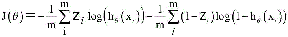
在一个实施例中,可以按如下公式采用交叉熵损失函数计算训练集对应的多层级标签的特征值,与地震数据解释模型输出训练集对应的预测值之间的损失值:In one embodiment, the cross-entropy loss function can be used to calculate the loss value between the eigenvalues of the multi-level labels corresponding to the training set and the predicted values corresponding to the seismic data interpretation model output training set according to the following formula:


其中,i为样本数据的数据点,xi为数据点i的地震数据,θ为网络参数,T为转置符号,hθ(xi)为地震数据解释模型输出的预测概率,J(θ)为交叉熵损失值,Z(i)为样本数据点i的多层级标签的特征值,m为自然数。Among them, i is the data point of the sample data, x i is the seismic data of data point i, θ is the network parameter, T is the transpose symbol, h θ ( xi ) is the predicted probability output by the seismic data interpretation model, J(θ ) is the cross-entropy loss value, Z(i) is the feature value of the multi-level label of the sample data point i, and m is a natural number.
具体实施时,为了避免训练过程中的过度拟合问题,可以在每个更新优化时期内随机选择训练和测试的样本数据,某个样本数据可能属于当前更新优化时期的训练集,也可能属于下次更新优化时期的测试集,其中,训练集占样本数据的百分比可以为70%,测试集占样本数据的百分比可以为30%。In the specific implementation, in order to avoid the overfitting problem in the training process, the sample data for training and testing can be randomly selected in each update optimization period. A certain sample data may belong to the training set of the current update optimization period, or it may belong to the following The test set in the optimization period is updated for the second time, wherein the percentage of the training set in the sample data may be 70%, and the percentage of the test set in the sample data may be 30%.
在得到通过测试的地震数据解释模型之后,可以将该地震数据解释模型应用于未标定的地震数据,预测未标定的地震数据对应各个层级标签的概率,并根据未标定的地震数据的地质层位对应各个层级标签的概率,确定未标定的地震数据的地质层位和层序界面。After obtaining the seismic data interpretation model that has passed the test, the seismic data interpretation model can be applied to the uncalibrated seismic data to predict the probability that the uncalibrated seismic data corresponds to each layer label, and according to the geological horizon of the uncalibrated seismic data Corresponding to the probability of each layer label, the geological horizon and sequence boundary of the uncalibrated seismic data are determined.
在一个实施例中,根据未标定的地震数据的地质层位对应各个层级标签的概率,确定未标定的地震数据的地质层位和层序界面,可以包括:根据未标定的地震数据的地质层位对应各个层级标签的概率,确定未标定的地震数据的地质层位;根据未标定的地震数据的地质层位,提取未标定的地震数据的特征边界;根据未标定的地震数据的特征边界,确定未标定的地震数据的层序界面。In one embodiment, determining the geological horizon and sequence interface of the unmarked seismic data according to the probability that the geological horizon of the unmarked seismic data corresponds to each layer label may include: according to the geological layer of the unmarked seismic data According to the probability of each level label, the geological horizon of the uncalibrated seismic data is determined; according to the geological horizon of the uncalibrated seismic data, the characteristic boundary of the uncalibrated seismic data is extracted; according to the characteristic boundary of the uncalibrated seismic data, Identify sequence boundaries for unscaled seismic data.
在一个实施例中,还可以包括:对未标定的地震数据的层序界面进行闭合检查。In an embodiment, it may further include: performing a closure check on the sequence boundary of the uncalibrated seismic data.
在一个实施例中,对未标定的地震数据的层序界面进行闭合检查,可以包括:确定未标定的地震数据在主测线方向和网络线方向的两个层序界面;根据地震数据解释模型的预测结果,判断两个层序界面相交的地震数据所对应各个层级标签的概率是否一致;若一致,则闭合检查通过,未标定的地震数据的层序界面确定无误;若不一致,则闭合检查未通过,未标定的地震数据的层序界面确定有误。In one embodiment, the closure inspection of the sequence boundary of the uncalibrated seismic data may include: determining two sequence boundaries of the uncalibrated seismic data in the direction of the main survey line and the direction of the network line; interpreting the model according to the seismic data According to the predicted results of the prediction results, it is judged whether the probabilities of each layer label corresponding to the seismic data intersecting the two sequence interfaces are consistent; if they are consistent, the closure check is passed, and the sequence boundary of the uncalibrated seismic data is determined to be correct; if they are not consistent, the closure inspection Failed, the sequence boundary of the uncalibrated seismic data was incorrectly determined.
图5a、图5b、图5c为本发明实施例中对层序界面进行闭合检查的具体实例示意图。假设有两个层序界面相交的地震数据包括地震道5和地震道7,如图5a、图5b、图5c所示,对这两个层序界面进行闭合检查的具体步骤可以包括:Fig. 5a, Fig. 5b, and Fig. 5c are schematic diagrams of specific examples of the closure inspection of the sequence interface in the embodiment of the present invention. Assuming that the seismic data intersecting two sequence boundaries includes
如图5a所示,以目标地震剖面数据和层序地层解释格架为基础,沿着标签特征值分界面inline A’-A、crossline B-B’上追踪层序界面,算法认为地震道2-1,1-3之间的智能解释层序界面闭合。As shown in Fig. 5a, based on the target seismic section data and sequence stratigraphic interpretation framework, the sequence interface is traced along the label eigenvalue interfaces inline A'-A and crossline BB', and the algorithm considers that seismic trace 2 -1, the intelligent interpretation sequence interface between 1-3 is closed.
如图5b所示,以inline A-A’,crossline B-B’标签特征值分界面为基础,追踪crossline D-D’上层序界面,算法认为地震道2-4之间的智能层序界面解释结果闭合。As shown in Figure 5b, based on the inline A-A', crossline BB' label eigenvalue interface, the sequence interface on the crossline D-D' is traced, and the algorithm considers the intelligent sequence interface between seismic traces 2-4 Interpret results closed.
如图5c左侧所示,检查crossline B-B’,inline C-C’在地震道5上的层序界面结果的一致。如果两个层序界面解释结果在地震道5上有差异,认为四个剖面上的层位解释结果为欠闭合解释,则按照给定的网格密度缩小地震数据范围,并进一步检查解释的闭合性。As shown on the left side of Fig. 5c, check the consistency of the sequence boundary results of crossline B-B' and inline C-C' on
如图5c右侧所示,缩小地震数据范围,地震道上一步中2-4之间的智能层序界面解释后,检查crossline B-B’,inline E-E’在地震道7上的层序界面解释结果一致。如果两个剖面解释结果在地震道7没有差异,程序认为四个剖面上的层位解释结果为闭合解释。As shown on the right side of Figure 5c, narrow down the range of seismic data, after the intelligent sequence interface interpretation between 2-4 in the previous step of the seismic trace, check the sequence of crossline BB', inline EE' on seismic trace 7 The interface interpretation results are consistent. If there is no difference in the interpretation results of the two sections in trace 7, the program considers the horizon interpretation results on the four sections as closed interpretations.
循环重复如上步骤,直到在inline和crossline4个方向完全闭合,可以确定地震数据解释模型的预测结果正确。具体实施时,在未标定的地震数据的层序界面通过闭合检查之后,可以利用该地震数据解释模型对地震数据进行智能解释,可以极大的提高地震解释效率。The above steps are repeated cyclically until the four directions of inline and crossline are completely closed, and it can be confirmed that the prediction result of the seismic data interpretation model is correct. During specific implementation, after the sequence interface of the uncalibrated seismic data passes the closed inspection, the seismic data interpretation model can be used to perform intelligent interpretation of the seismic data, which can greatly improve the efficiency of seismic interpretation.
图6为本发明实施例中人工解释的层序地层格架示意图,假设某工区一组层序格架采用间隔100条地震测线人工标定层序格架。Fig. 6 is a schematic diagram of the sequence stratigraphic framework manually interpreted in the embodiment of the present invention. It is assumed that a sequence framework in a certain work area is manually calibrated with 100 seismic lines.
图7A、图7B为本发明实施例中智能解释的层序地层格架示意图,利用目标地震数据和卷积神经网络结构模型输出的层序地层格架智能解释结果。Fig. 7A and Fig. 7B are schematic diagrams of the sequence stratigraphic framework for intelligent interpretation in the embodiment of the present invention, and the intelligent interpretation results of the sequence stratigraphic framework output by using the target seismic data and the convolutional neural network structure model.
如图6和图7所示,智能化地震层序地层格架解释精度达到人工解释水平,但是解释效率提高了数倍。As shown in Figures 6 and 7, the interpretation accuracy of the intelligent seismic sequence stratigraphic framework has reached the level of manual interpretation, but the interpretation efficiency has increased several times.
本发明实施例中还提供了一种地震数据解释装置,如下面的实施例所述。由于该装置解决问题的原理与地震数据解释方法相似,因此该装置的实施可以参见地震数据解释方法的实施,重复之处不再赘述。An embodiment of the present invention also provides a seismic data interpretation device, as described in the following embodiments. Since the problem-solving principle of the device is similar to that of the seismic data interpretation method, the implementation of the device can refer to the implementation of the seismic data interpretation method, and the repetition will not be repeated.
图8为本发明实施例中地震数据解释装置的结构示意图。如图8所示,本发明实施例中地震数据解释装置具体可以包括:Fig. 8 is a schematic structural diagram of a seismic data interpretation device in an embodiment of the present invention. As shown in Figure 8, the seismic data interpretation device in the embodiment of the present invention may specifically include:
选取与标定模块801,用于建立网格化的地震数据体,在网格化的地震数据体上选取地震数据作为样本数据,根据测井资料和井旁地震波组对样本数据的地质层位进行标定,所述网格化的地震数据体由多条相间隔的主测线和网络线构成;The selecting and calibrating
建立与转换模块802,用于根据样本数据的地质层位标定建立多层级标签,将样本数据的振幅特征转换为多层级标签的特征值,所述多层级标签的特征值反映样本数据的层位信息和层序信息;The establishment and
训练模块803,用于根据样本数据、多层级标签以及多层级标签的特征值,训练图像语义分割网络U-Net,得到地震数据解释模型;The
获取与预测模块804,用于获取网格化的地震数据体中未标定的地震数据,将未标定的地震数据输入地震数据解释模型,预测未标定的地震数据对应各个层级标签的概率;The acquisition and
确定模块805,用于根据未标定的地震数据的地质层位对应各个层级标签的概率,确定未标定的地震数据的地质层位和层序界面。The determining
在一个实施例中,选取与标定模块801具体用于:In one embodiment, the selection and
根据测井资料合成地震记录,将地震记录与井旁地震波组进行比对;Synthesize seismic records based on well logging data, and compare the seismic records with the seismic wave groups beside the well;
根据比对结果,确定地震记录与井旁地震波组的对应关系;According to the comparison results, determine the corresponding relationship between the seismic record and the seismic wave group beside the well;
根据对应关系,对样本数据的地质层位进行标定。According to the corresponding relationship, the geological horizon of the sample data is calibrated.
在一个实施例中,建立与转换模块802具体用于按如下公式将样本数据的振幅特征转换为多层级标签的特征值:In one embodiment, the establishment and

其中,s(i)为样本数据点i的振幅,i为样本数据的数据点,Z(i)为样本数据点i的多层级标签的特征值,mean_s为样本数据的平均振幅值,max_s为样本数据振幅值的最大值,min_s为样本数据振幅值的最小值。Among them, s(i) is the amplitude of the sample data point i, i is the data point of the sample data, Z(i) is the feature value of the multi-level label of the sample data point i, mean_s is the average amplitude value of the sample data, and max_s is The maximum value of the sample data amplitude value, min_s is the minimum value of the sample data amplitude value.
在一个实施例中,所述地震数据解释模型中编码器和解码器的隐藏层包括卷积层、批处理归一化层和最大池化层,采用ReLU函数作为激活函数激活多层级标签的特征值中包含的特征。In one embodiment, the hidden layers of the encoder and decoder in the seismic data interpretation model include a convolutional layer, a batch normalization layer, and a maximum pooling layer, and the ReLU function is used as an activation function to activate the features of multi-level labels The features contained in the value.
在一个实施例中,按如下公式采用ReLU函数作为激活函数激活多层级标签的特征值中包含的特征:In one embodiment, the ReLU function is used as the activation function to activate the features contained in the feature values of the multi-level labels according to the following formula:

其中,xi为单道地震数据;
在一个实施例中,训练模块803具体用于:In one embodiment, the
根据样本数据、多层级标签以及多层级标签的特征值,构建训练集和测试集;Construct a training set and a test set based on sample data, multi-level labels, and feature values of multi-level labels;
利用训练集对图像语义分割网络U-Net进行训练,得到所述地震数据解释模型;Using the training set to train the image semantic segmentation network U-Net to obtain the seismic data interpretation model;
利用测试集对所述地震数据解释模型进行测试。The seismic data interpretation model is tested using a test set.
在一个实施例中,训练模块803具体用于:In one embodiment, the
采用交叉熵损失函数计算训练集对应的多层级标签的特征值,与地震数据解释模型输出训练集对应的预测值之间的损失值;The cross-entropy loss function is used to calculate the loss value between the eigenvalue of the multi-level label corresponding to the training set and the predicted value corresponding to the output training set of the seismic data interpretation model;
在损失值不小于预设阈值时,根据损失值更新地震数据解释模型参数,利用更新的地震数据解释模型继续输出训练集对应的预测值,直到计算出损失值小于预设阈值,得到优化的地震数据解释模型;When the loss value is not less than the preset threshold, the parameters of the seismic data interpretation model are updated according to the loss value, and the updated seismic data interpretation model is used to continue outputting the prediction value corresponding to the training set until the calculated loss value is less than the preset threshold value, and the optimized earthquake is obtained data interpretation model;
利用测试集对优化的地震数据解释模型进行测试。The optimized seismic data interpretation model is tested on the test set.
在一个实施例中,训练模块803具体用于:按如下公式采用交叉熵损失函数计算训练集对应的多层级标签的特征值,与地震数据解释模型输出训练集对应的预测值之间的损失值:In one embodiment, the


其中,i为样本数据的数据点,xi为数据点i的地震数据,θ为网络参数,T为转置符号,hθ(xi)为地震数据解释模型输出的预测概率,J(θ)为交叉熵损失值,zi为样本数据点i的多层级标签的特征值,m为自然数。Among them, i is the data point of the sample data, x i is the seismic data of data point i, θ is the network parameter, T is the transpose symbol, h θ ( xi ) is the predicted probability output by the seismic data interpretation model, J(θ ) is the cross-entropy loss value, z i is the feature value of the multi-level label of the sample data point i, and m is a natural number.
在一个实施例中,确定模块805具体用于:In one embodiment, the determining
根据未标定的地震数据的地质层位对应各个层级标签的概率,确定未标定的地震数据的地质层位;According to the probability that the geological horizon of the uncalibrated seismic data corresponds to each level label, the geological horizon of the uncalibrated seismic data is determined;
根据未标定的地震数据的地质层位,提取未标定的地震数据的特征边界;According to the geological horizon of the uncalibrated seismic data, the characteristic boundary of the uncalibrated seismic data is extracted;
根据未标定的地震数据的特征边界,确定未标定的地震数据的层序界面。The sequence boundary of the uncalibrated seismic data is determined according to the characteristic boundaries of the uncalibrated seismic data.
图9为本发明实施例中地震数据解释装置的一具体实例结构示意图。如图9所示,在实施例中,图8所示的地震数据解释装置还可以包括:Fig. 9 is a structural schematic diagram of a specific example of the seismic data interpretation device in the embodiment of the present invention. As shown in Figure 9, in an embodiment, the seismic data interpretation device shown in Figure 8 may also include:
闭合检查模块901,用于:
对未标定的地震数据的层序界面进行闭合检查。Closure checks are performed on sequence boundaries of uncalibrated seismic data.
在一个实施例中,闭合检查模块901具体用于:In one embodiment, the
确定未标定的地震数据在主测线方向和网络线方向的两个层序界面;Determine the two sequence boundaries of the uncalibrated seismic data in the direction of the main survey line and the direction of the network line;
根据地震数据解释模型的预测结果,判断两个层序界面相交的地震数据所对应各个层级标签的概率是否一致;According to the prediction results of the seismic data interpretation model, it is judged whether the probabilities of each level label corresponding to the seismic data intersecting the two sequence interfaces are consistent;
若一致,则闭合检查通过,未标定的地震数据的层序界面确定无误;若不一致,则闭合检查未通过,未标定的地震数据的层序界面确定有误。If they are consistent, the closure check is passed, and the sequence boundary of the uncalibrated seismic data is determined correctly; if not, the closure check is not passed, and the sequence boundary of the uncalibrated seismic data is determined incorrectly.
基于前述发明构思,如图10所示,本发明还提出了一种计算机设备1000,包括存储器1010、处理器1020及存储在存储器1010上并可在处理器1020上运行的计算机程序1030,所述处理器1020执行所述计算机程序1030时实现前述地震数据解释方法。Based on the foregoing inventive concepts, as shown in FIG. 10 , the present invention also proposes a
本发明实施例还提供一种计算机可读存储介质,所述计算机可读存储介质存储有计算机程序,所述计算机程序被处理器执行时实现上述地震数据解释方法。An embodiment of the present invention also provides a computer-readable storage medium, where a computer program is stored in the computer-readable storage medium, and when the computer program is executed by a processor, the above seismic data interpretation method is realized.
本发明实施例还提供一种计算机程序产品,所述计算机程序产品包括计算机程序,所述计算机程序被处理器执行时实现上述地震数据解释方法。An embodiment of the present invention also provides a computer program product, where the computer program product includes a computer program, and when the computer program is executed by a processor, the above seismic data interpretation method is realized.
综上所述,本发明实施例中,建立网格化的地震数据体,在网格化的地震数据体上选取地震数据作为样本数据,根据测井资料和井旁地震波组对样本数据的地质层位进行标定,所述网格化的地震数据体由多条相间隔的主测线和网络线构成;根据样本数据的地质层位标定建立多层级标签,将样本数据的振幅特征转换为多层级标签的特征值,所述多层级标签的特征值反映样本数据的层位信息和层序信息;根据样本数据、多层级标签以及多层级标签的特征值,训练图像语义分割网络U-Net,得到地震数据解释模型;获取网格化的地震数据体中未标定的地震数据,将未标定的地震数据输入地震数据解释模型,预测未标定的地震数据对应各个层级标签的概率;根据未标定的地震数据的地质层位对应各个层级标签的概率,确定未标定的地震数据的地质层位和层序界面,可以智能进行地震解释,提高地震解释的效率和准确性,极大减少了地震解释人员的工作量。In summary, in the embodiment of the present invention, a gridded seismic data volume is established, and seismic data is selected as sample data on the gridded seismic data volume, and the geological data of the sample data are analyzed according to well logging data and side-hole seismic wave groups. Horizontal calibration, the gridded seismic data volume is composed of a plurality of spaced main survey lines and network lines; multi-level labels are established according to the geological horizon calibration of the sample data, and the amplitude characteristics of the sample data are converted into multiple The feature value of the hierarchical label, the feature value of the multi-level label reflects the layer information and the sequence information of the sample data; according to the sample data, the multi-level label and the feature value of the multi-level label, the image semantic segmentation network U-Net is trained, Obtain the seismic data interpretation model; obtain the uncalibrated seismic data in the gridded seismic data volume, input the uncalibrated seismic data into the seismic data interpretation model, and predict the probability of the uncalibrated seismic data corresponding to each level label; according to the uncalibrated seismic data The geological horizon of the seismic data corresponds to the probability of each layer label, and the geological horizon and sequence interface of the uncalibrated seismic data can be determined, which can intelligently perform seismic interpretation, improve the efficiency and accuracy of seismic interpretation, and greatly reduce the number of seismic interpretation personnel workload.
本领域内的技术人员应明白,本发明的实施例可提供为方法、系统、或计算机程序产品。因此,本发明可采用完全硬件实施例、完全软件实施例、或结合软件和硬件方面的实施例的形式。而且,本发明可采用在一个或多个其中包含有计算机可用程序代码的计算机可用存储介质(包括但不限于磁盘存储器、CD-ROM、光学存储器等)上实施的计算机程序产品的形式。Those skilled in the art should understand that the embodiments of the present invention may be provided as methods, systems, or computer program products. Accordingly, the present invention can take the form of an entirely hardware embodiment, an entirely software embodiment, or an embodiment combining software and hardware aspects. Furthermore, the present invention may take the form of a computer program product embodied on one or more computer-usable storage media (including but not limited to disk storage, CD-ROM, optical storage, etc.) having computer-usable program code embodied therein.
本发明是参照根据本发明实施例的方法、设备(系统)、和计算机程序产品的流程图和/或方框图来描述的。应理解可由计算机程序指令实现流程图和/或方框图中的每一流程和/或方框、以及流程图和/或方框图中的流程和/或方框的结合。可提供这些计算机程序指令到通用计算机、专用计算机、嵌入式处理机或其他可编程数据处理设备的处理器以产生一个机器,使得通过计算机或其他可编程数据处理设备的处理器执行的指令产生用于实现在流程图一个流程或多个流程和/或方框图一个方框或多个方框中指定的功能的装置。The present invention is described with reference to flowchart illustrations and/or block diagrams of methods, apparatus (systems), and computer program products according to embodiments of the invention. It should be understood that each procedure and/or block in the flowchart and/or block diagram, and a combination of procedures and/or blocks in the flowchart and/or block diagram can be realized by computer program instructions. These computer program instructions may be provided to a general purpose computer, special purpose computer, embedded processor, or processor of other programmable data processing equipment to produce a machine such that the instructions executed by the processor of the computer or other programmable data processing equipment produce a An apparatus for realizing the functions specified in one or more procedures of the flowchart and/or one or more blocks of the block diagram.
这些计算机程序指令也可存储在能引导计算机或其他可编程数据处理设备以特定方式工作的计算机可读存储器中,使得存储在该计算机可读存储器中的指令产生包括指令装置的制造品,该指令装置实现在流程图一个流程或多个流程和/或方框图一个方框或多个方框中指定的功能。These computer program instructions may also be stored in a computer-readable memory capable of directing a computer or other programmable data processing apparatus to operate in a specific manner, such that the instructions stored in the computer-readable memory produce an article of manufacture comprising instruction means, the instructions The device realizes the function specified in one or more procedures of the flowchart and/or one or more blocks of the block diagram.
这些计算机程序指令也可装载到计算机或其他可编程数据处理设备上,使得在计算机或其他可编程设备上执行一系列操作步骤以产生计算机实现的处理,从而在计算机或其他可编程设备上执行的指令提供用于实现在流程图一个流程或多个流程和/或方框图一个方框或多个方框中指定的功能的步骤。These computer program instructions can also be loaded onto a computer or other programmable data processing device, causing a series of operational steps to be performed on the computer or other programmable device to produce a computer-implemented process, thereby The instructions provide steps for implementing the functions specified in the flow chart or blocks of the flowchart and/or the block or blocks of the block diagrams.
以上所述的具体实施例,对本发明的目的、技术方案和有益效果进行了进一步详细说明,所应理解的是,以上所述仅为本发明的具体实施例而已,并不用于限定本发明的保护范围,凡在本发明的精神和原则之内,所做的任何修改、等同替换、改进等,均应包含在本发明的保护范围之内。The specific embodiments described above have further described the purpose, technical solutions and beneficial effects of the present invention in detail. It should be understood that the above descriptions are only specific embodiments of the present invention and are not intended to limit the scope of the present invention. Protection scope, within the spirit and principles of the present invention, any modification, equivalent replacement, improvement, etc., shall be included in the protection scope of the present invention.
Claims (25)


Priority Applications (1)
| Application Number | Priority Date | Filing Date | Title |
|---|---|---|---|
| CN202111675950.0A CN116413783A (en) | 2021-12-31 | 2021-12-31 | Seismic data interpretation method and device |
Applications Claiming Priority (1)
| Application Number | Priority Date | Filing Date | Title |
|---|---|---|---|
| CN202111675950.0A CN116413783A (en) | 2021-12-31 | 2021-12-31 | Seismic data interpretation method and device |
Publications (1)
| Publication Number | Publication Date |
|---|---|
| CN116413783A true CN116413783A (en) | 2023-07-11 |
Family
ID=87058487
Family Applications (1)
| Application Number | Title | Priority Date | Filing Date |
|---|---|---|---|
| CN202111675950.0A Pending CN116413783A (en) | 2021-12-31 | 2021-12-31 | Seismic data interpretation method and device |
Country Status (1)
| Country | Link |
|---|---|
| CN (1) | CN116413783A (en) |
Cited By (2)
| Publication number | Priority date | Publication date | Assignee | Title |
|---|---|---|---|---|
| CN116755145A (en) * | 2023-07-18 | 2023-09-15 | 电子科技大学 | Three-dimensional seismic horizon intelligent tracking method based on multi-seismic attribute regression network |
| CN119861416A (en) * | 2023-10-21 | 2025-04-22 | 中国石油天然气股份有限公司 | Automatic tracking method and device for two-dimensional seismic horizon |
-
2021
- 2021-12-31 CN CN202111675950.0A patent/CN116413783A/en active Pending
Cited By (4)
| Publication number | Priority date | Publication date | Assignee | Title |
|---|---|---|---|---|
| CN116755145A (en) * | 2023-07-18 | 2023-09-15 | 电子科技大学 | Three-dimensional seismic horizon intelligent tracking method based on multi-seismic attribute regression network |
| CN116755145B (en) * | 2023-07-18 | 2025-12-16 | 电子科技大学 | Three-dimensional seismic horizon intelligent tracking method based on multi-seismic attribute regression network |
| CN119861416A (en) * | 2023-10-21 | 2025-04-22 | 中国石油天然气股份有限公司 | Automatic tracking method and device for two-dimensional seismic horizon |
| CN119861416B (en) * | 2023-10-21 | 2025-09-30 | 中国石油天然气股份有限公司 | A two-dimensional seismic horizon automatic tracking method and device |
Similar Documents
| Publication | Publication Date | Title |
|---|---|---|
| Mousavi et al. | Applications of deep neural networks in exploration seismology: A technical survey | |
| US11668853B2 (en) | Petrophysical inversion with machine learning-based geologic priors | |
| CN112731522B (en) | Intelligent recognition method, device and equipment for seismic stratum and storage medium | |
| CN109709603A (en) | Seismic horizon identification and method for tracing, system | |
| CN111596978A (en) | Web page display method, module and system for lithofacies classification by artificial intelligence | |
| CN110609320A (en) | A pre-stack seismic reflection pattern recognition method based on multi-scale feature fusion | |
| CN116047583A (en) | Adaptive wave impedance inversion method and system based on deep convolutional neural network | |
| CN118378319B (en) | Three-dimensional unit body attribute modeling method and system based on multi-source heterogeneous information fusion | |
| AU2010328576B2 (en) | System and method for lacunarity analysis | |
| CN116413783A (en) | Seismic data interpretation method and device | |
| CN118447179A (en) | Three-dimensional geological modeling method based on machine learning | |
| CN117761789A (en) | A two-dimensional electromagnetic imaging method based on visual self-attention mechanism | |
| CN108957554B (en) | Seismic inversion method in geophysical exploration | |
| Lou et al. | Seismic unconformity estimation via ECA-UNet++ with physical knowledge constrained synthetic data | |
| Lou et al. | Automatic seismic fault interpretation with the aid of data-, physics-, and math-assisted synthetic data generation | |
| CN120891541A (en) | Microseismic source location methods, devices, systems, and storage media | |
| Lou et al. | Seismic reflector dip integrated spatial–spectral uformer for fault detection | |
| CN119131272A (en) | An intelligent lithology mapping method based on multi-source geological information database | |
| CN118097369A (en) | Lithology recognition method, lithology recognition device, lithology recognition equipment and lithology recognition storage medium | |
| Jiang et al. | 3-D seismic first break picking based on two-channel mask strategy | |
| CN120449075B (en) | Lithology recognition method, lithology recognition device, lithology recognition equipment and computer-readable storage medium | |
| Dong et al. | Generative Adversarial Networks for Improved Three-Dimensional Reservoir Modeling: Image Processing-Inspired Approaches and their Effects on Different Well Data Levels | |
| Dang et al. | Gas-bearing prediction of tight clastic rock reservoirs based on random forest-modern temporal convolutional network | |
| CN120630306B (en) | Transverse wave speed prediction method, device, equipment and readable storage medium | |
| CN119152130B (en) | A coal core three-dimensional spatial distribution method and system integrating imaging spectroscopy technology |
Legal Events
| Date | Code | Title | Description |
|---|---|---|---|
| PB01 | Publication | ||
| PB01 | Publication | ||
| SE01 | Entry into force of request for substantive examination | ||
| SE01 | Entry into force of request for substantive examination |