CN115424228A - Pavement pit detection method, device, equipment and storage medium - Google Patents
Pavement pit detection method, device, equipment and storage medium Download PDFInfo
- Publication number
- CN115424228A CN115424228A CN202211115046.9A CN202211115046A CN115424228A CN 115424228 A CN115424228 A CN 115424228A CN 202211115046 A CN202211115046 A CN 202211115046A CN 115424228 A CN115424228 A CN 115424228A
- Authority
- CN
- China
- Prior art keywords
- point set
- candidate point
- level candidate
- fitting curve
- points
- Prior art date
- Legal status (The legal status is an assumption and is not a legal conclusion. Google has not performed a legal analysis and makes no representation as to the accuracy of the status listed.)
- Pending
Links
Images


Classifications
-
- G—PHYSICS
- G06—COMPUTING OR CALCULATING; COUNTING
- G06V—IMAGE OR VIDEO RECOGNITION OR UNDERSTANDING
- G06V20/00—Scenes; Scene-specific elements
- G06V20/50—Context or environment of the image
- G06V20/56—Context or environment of the image exterior to a vehicle by using sensors mounted on the vehicle
- G06V20/588—Recognition of the road, e.g. of lane markings; Recognition of the vehicle driving pattern in relation to the road
-
- G—PHYSICS
- G01—MEASURING; TESTING
- G01S—RADIO DIRECTION-FINDING; RADIO NAVIGATION; DETERMINING DISTANCE OR VELOCITY BY USE OF RADIO WAVES; LOCATING OR PRESENCE-DETECTING BY USE OF THE REFLECTION OR RERADIATION OF RADIO WAVES; ANALOGOUS ARRANGEMENTS USING OTHER WAVES
- G01S17/00—Systems using the reflection or reradiation of electromagnetic waves other than radio waves, e.g. lidar systems
- G01S17/88—Lidar systems specially adapted for specific applications
-
- G—PHYSICS
- G06—COMPUTING OR CALCULATING; COUNTING
- G06V—IMAGE OR VIDEO RECOGNITION OR UNDERSTANDING
- G06V10/00—Arrangements for image or video recognition or understanding
- G06V10/70—Arrangements for image or video recognition or understanding using pattern recognition or machine learning
- G06V10/762—Arrangements for image or video recognition or understanding using pattern recognition or machine learning using clustering, e.g. of similar faces in social networks
Landscapes
- Engineering & Computer Science (AREA)
- Physics & Mathematics (AREA)
- General Physics & Mathematics (AREA)
- Theoretical Computer Science (AREA)
- Multimedia (AREA)
- Computing Systems (AREA)
- Medical Informatics (AREA)
- Computer Vision & Pattern Recognition (AREA)
- Health & Medical Sciences (AREA)
- Databases & Information Systems (AREA)
- Evolutionary Computation (AREA)
- General Health & Medical Sciences (AREA)
- Artificial Intelligence (AREA)
- Software Systems (AREA)
- Computer Networks & Wireless Communication (AREA)
- Electromagnetism (AREA)
- Radar, Positioning & Navigation (AREA)
- Remote Sensing (AREA)
- Traffic Control Systems (AREA)
Abstract
本发明实施例公开了一种路面坑洞检测方法、装置、设备和存储介质,对激光雷达单根扫描线上的点云进行拟合获取第一拟合曲线;根据第一拟合曲线对点云进行径向距离筛选获取一级候选点集合;根据方位角对一级候选点集合进行分段筛选获取二级候选点集合;对二级候选点集合进行拟合获取第二拟合曲线,并根据第一拟合曲线和第二拟合曲线对二级候选点集合进行筛选获取三级候选点集合;从三级候选点集合中获取目标点,并根据目标点确定路面坑洞。通过对激光雷达单根扫描线上的点云进行多角度筛选获得可信赖的坑洞目标点,基于所获取的坑洞目标点确定路面坑洞,使得坑洞检测结果更加准确,并且可兼容单线和多线激光雷达应用场景更加广泛。

The embodiment of the present invention discloses a road surface pothole detection method, device, equipment and storage medium, which can obtain the first fitting curve by fitting the point cloud on a single laser radar scanning line; The cloud performs radial distance screening to obtain the first-level candidate point set; according to the azimuth, the first-level candidate point set is segmented to obtain the second-level candidate point set; the second-level candidate point set is fitted to obtain the second fitting curve, and According to the first fitting curve and the second fitting curve, the second-level candidate point set is screened to obtain the third-level candidate point set; the target point is obtained from the third-level candidate point set, and road potholes are determined according to the target point. Reliable pothole target points are obtained by multi-angle screening of the point cloud on a single lidar scanning line, and road potholes are determined based on the obtained pothole target points, making the pothole detection results more accurate and compatible with single lines And multi-line lidar application scenarios are more extensive.
Description
技术领域technical field
本发明实施例涉及无人驾驶技术领域,尤其涉及一种路面坑洞检测方法、装置、设备和存储介质。The embodiments of the present invention relate to the technical field of unmanned driving, and in particular to a method, device, equipment and storage medium for detecting road surface potholes.
背景技术Background technique
随着无人驾驶技术的快速发展,无人驾驶车辆在日常生活中越来越常见,并且无论是开放道路还是封闭厂区,道路上的坑洞都会引起车辆颠簸、车轮卡住甚至车轮爆胎,从而对无人驾驶车辆的运行产生影响。With the rapid development of unmanned driving technology, unmanned vehicles are becoming more and more common in daily life, and whether it is an open road or a closed factory area, potholes on the road will cause vehicle bumps, wheels stuck or even tire blowouts, thus Impact on the operation of unmanned vehicles.
为了保障无人驾驶车辆的正常运行,采用激光雷达对路面坑洞进行检测是目前比较常见的检测方法。并且在通过激光雷达进行坑洞检测时,通常采用是间隔阈值分类法,将激光雷达获取的三维点云投影成二维的占据栅格,随后在激光雷达的相邻扫描线上求取径向间距,最终以实际求取到的径向间距是否大于理论相邻扫描线之间的径向间距阈值来判断两条激光扫描线之间是否存在坑洞。In order to ensure the normal operation of unmanned vehicles, using lidar to detect road potholes is a relatively common detection method at present. And when using lidar for pothole detection, the interval threshold classification method is usually used to project the 3D point cloud acquired by the lidar into a two-dimensional occupancy grid, and then calculate the radial Finally, whether there is a pit between two laser scanning lines is judged by whether the actual obtained radial spacing is greater than the theoretical radial spacing threshold between adjacent scanning lines.
但是如果扫描线上的点因为多重反射或者被物体遮挡而没有扫描到理论的位置上,相邻扫描线的径向间距会变大而导致基于间隔阈值分类法的检测产生误检,并且如果无人驾驶车上安装的雷达是单线激光雷达时则无法采用上述方式进行坑洞检测,因此现有的激光雷达坑洞检测方式不仅影响坑洞检测的准确性,而且无法应用于单线激光雷达应用场景受局限。However, if the point on the scan line is not scanned to the theoretical position due to multiple reflections or being blocked by objects, the radial distance between adjacent scan lines will become larger, which will cause false detection based on the detection of the interval threshold classification method, and if there is no When the radar installed on the driver's car is a single-line lidar, the above method cannot be used for pothole detection. Therefore, the existing lidar pothole detection method not only affects the accuracy of pothole detection, but also cannot be applied to single-line lidar application scenarios. limited.
发明内容Contents of the invention
本发明实施例提供了一种路面坑洞检测方法、装置、设备和存储介质,以实现对路面坑洞的准确检测。Embodiments of the present invention provide a road surface pothole detection method, device, equipment and storage medium, so as to realize accurate detection of road surface potholes.
第一方面,本发明实施例提供了一种路面坑洞检测方法,应用于无人驾驶车辆,包括:对激光雷达单根扫描线上的点云进行拟合获取第一拟合曲线;根据所述第一拟合曲线对所述点云进行径向距离筛选获取一级候选点集合;获取所述一级候选点集合中每个点的方位角,根据所述方位角对所述一级候选点集合进行分段筛选获取二级候选点集合;对所述二级候选点集合进行拟合获取第二拟合曲线,并根据所述第一拟合曲线和所述第二拟合曲线对所述二级候选点集合进行筛选获取三级候选点集合;从所述三级候选点集合中获取目标点,并根据所述目标点确定路面坑洞。In the first aspect, an embodiment of the present invention provides a method for detecting road surface potholes, which is applied to unmanned vehicles, including: fitting the point cloud on a single scanning line of the lidar to obtain a first fitting curve; The first fitting curve performs radial distance screening on the point cloud to obtain a first-level candidate point set; obtains the azimuth angle of each point in the first-level candidate point set, and calculates the first-level candidate point set according to the azimuth angle. The point set is screened in segments to obtain a second-level candidate point set; the second-level candidate point set is fitted to obtain a second fitting curve, and according to the first fitting curve and the second fitting curve The second-level candidate point set is screened to obtain a third-level candidate point set; a target point is obtained from the third-level candidate point set, and road potholes are determined according to the target point.
第二方面,本发明实施例提供了一种路面坑洞检测装置,包括:第一拟合曲线获取模块,用于对激光雷达单根扫描线上的点云进行拟合获取第一拟合曲线;In the second aspect, the embodiment of the present invention provides a road surface pothole detection device, including: a first fitting curve acquisition module, which is used to fit the point cloud on a single scanning line of the lidar to obtain the first fitting curve ;
一级候选点集合获取模块,用于根据所述第一拟合曲线对所述点云进行径向距离筛选获取一级候选点集合;A first-level candidate point set acquisition module, configured to perform radial distance screening on the point cloud according to the first fitting curve to obtain a first-level candidate point set;
二级候选点集合获取模块,用于获取所述一级候选点集合中每个点的方位角,根据所述方位角对所述一级候选点集合进行分段筛选获取二级候选点集合;A second-level candidate point set acquisition module, configured to acquire the azimuth of each point in the first-level candidate point set, and perform segmentation screening on the first-level candidate point set according to the azimuth to obtain a second-level candidate point set;
三级候选点集合获取模块,用于对所述二级候选点集合进行拟合获取第二拟合曲线,并根据所述第一拟合曲线和所述第二拟合曲线对所述二级候选点集合进行筛选获取三级候选点集合;A third-level candidate point set acquisition module, configured to fit the second-level candidate point set to obtain a second fitting curve, and perform the second-level fitting curve according to the first fitting curve and the second fitting curve The set of candidate points is screened to obtain a set of three-level candidate points;
路面坑洞检测模块,用于从所述三级候选点集合中获取目标点,并根据所述目标点确定路面坑洞。The road surface pothole detection module is used to obtain the target point from the three-level candidate point set, and determine the road surface pothole according to the target point.
第三方面,本发明实施例提供了一种电子设备,电子设备包括:In a third aspect, an embodiment of the present invention provides an electronic device, and the electronic device includes:
一个或多个处理器;one or more processors;
存储装置,用于存储一个或多个程序,storage means for storing one or more programs,
当一个或多个程序被一个或多个处理器执行,使得一个或多个处理器实现如上的方法。When one or more programs are executed by one or more processors, the one or more processors implement the above method.
第四方面,本发明实施例提供了一种计算机可读存储介质,其上存储有计算机程序,其特征在于,该程序被处理器执行时实现如上所述的方法。In a fourth aspect, an embodiment of the present invention provides a computer-readable storage medium on which a computer program is stored, wherein the program implements the method as described above when executed by a processor.
本发明实施例的技术方案,通过对激光雷达单根扫描线上的点云进行多角度筛选获得可信赖的坑洞目标点,基于所获取的坑洞目标点确定路面坑洞,从而使得坑洞检测结果更加准确,并且可同时兼容单线和多线激光雷达,应用场景更加广泛。In the technical solution of the embodiment of the present invention, reliable pothole target points are obtained by multi-angle screening of point clouds on a single laser radar scanning line, and road potholes are determined based on the obtained pothole target points, so that potholes The detection results are more accurate, and it is compatible with single-line and multi-line lidar at the same time, and the application scenarios are more extensive.
附图说明Description of drawings
为了更清楚地说明本发明实施例的技术方案,下面将对实施例中所需要使用的附图作简单地介绍,应当理解,以下附图仅示出了本发明的某些实施例,因此不应被看作是对范围的限定,对于本领域普通技术人员来讲,在不付出创造性劳动的前提下,还可以根据这些附图获得其他相关的附图。In order to illustrate the technical solutions of the embodiments of the present invention more clearly, the accompanying drawings used in the embodiments will be briefly introduced below. It should be understood that the following drawings only show some embodiments of the present invention, and thus It should be regarded as a limitation on the scope, and those skilled in the art can also obtain other related drawings based on these drawings without creative work.
图1是本发明实施例一提供的路面坑洞检测方法的流程图;FIG. 1 is a flow chart of a method for detecting road surface potholes provided by Embodiment 1 of the present invention;
图2是本发明提供的一种激光雷达线束分布式示意图;Fig. 2 is a distributed schematic diagram of a laser radar harness provided by the present invention;
图3是本发明提供的一种路面坑洞检测方法的流程图;Fig. 3 is a flow chart of a method for detecting road surface potholes provided by the present invention;
图4是本发明提供的一种路面坑洞的检测结果示意图;Fig. 4 is a schematic diagram of detection results of a road pothole provided by the present invention;
图5是本发明提供的一种路面坑洞检测方法的流程图;Fig. 5 is a flow chart of a method for detecting road surface potholes provided by the present invention;
图6是本发明提供的一种路面坑洞检测装置的结构示意图;Fig. 6 is a schematic structural view of a road surface pothole detection device provided by the present invention;
图7是本发明提供的一种电子设备的结构示意图。Fig. 7 is a schematic structural diagram of an electronic device provided by the present invention.
具体实施方式detailed description
下面结合附图和实施例对本发明作进一步的详细说明。可以理解的是,此处所描述的具体实施例仅用于解释本发明,而非对本发明的限定。The present invention will be further described in detail below in conjunction with the accompanying drawings and embodiments. It should be understood that the specific embodiments described here are only used to explain the present invention, but not to limit the present invention.
另外还需要说明的是,为了便于描述,附图中仅示出了与本发明相关的部分而非全部内容。在更加详细地讨论示例性实施例之前应当提到的是,一些示例性实施例被描述成作为流程图描绘的处理或方法。虽然流程图将各项操作(或步骤)描述成顺序的处理,但是其中的许多操作可以被并行地、并发地或者同时实施。此外,各项操作的顺序可以被重新安排。当其操作完成时所述处理可以被终止,但是还可以具有未包括在附图中的附加步骤。所述处理可以对应于方法、软件实现、硬件实现等等。In addition, it should be noted that, for the convenience of description, only parts related to the present invention are shown in the drawings but not all content. Before discussing the exemplary embodiments in more detail, it should be mentioned that some exemplary embodiments are described as processes or methods depicted as flowcharts. Although the flowcharts describe various operations (or steps) as sequential processing, many of the operations may be performed in parallel, concurrently, or simultaneously. In addition, the order of operations can be rearranged. The process may be terminated when its operations are complete, but may also have additional steps not included in the figure. The processing may correspond to a method, software implementation, hardware implementation, and the like.
图1是本发明实施例提供的一种路面坑洞检测方法的流程图,本实施例可适用于对路面坑洞进行检测的情况,该方法可以由本发明实施例中的路面坑洞检测装置来执行,该装置可以采用软件和/或硬件的方式实现。如图1所示,该方法具体包括如下操作:Fig. 1 is a flow chart of a road surface pothole detection method provided by an embodiment of the present invention. This embodiment is applicable to the situation of detecting road surface potholes, and the method can be implemented by the road surface pothole detection device in the embodiment of the present invention. For execution, the device may be implemented in software and/or hardware. As shown in Figure 1, the method specifically includes the following operations:
步骤S101,对激光雷达单根扫描线上的点云进行拟合获取第一拟合曲线。Step S101 , fitting the point cloud on a single scanning line of the lidar to obtain a first fitting curve.
可选的,对激光雷达单根扫描线上的点云进行拟合获取第一拟合曲线之前,还包括:获取激光雷达坐标系下单根扫描线上的点云;对激光雷达坐标系下单根扫描线上的点云进行坐标变换,获取车辆坐标系下单根扫描线上的点云,其中,车辆坐标系以车辆后轴为原心,以车辆右方为水平面横轴,以车辆行驶方向为水平面纵轴,以垂直于水平面方向为竖直轴。Optionally, before fitting the point cloud on a single scanning line of the lidar to obtain the first fitting curve, it also includes: obtaining the point cloud on a single scanning line in the lidar coordinate system; Coordinate transformation is performed on the point cloud on a single scanning line to obtain the point cloud on a single scanning line in the vehicle coordinate system. The driving direction is the vertical axis of the horizontal plane, and the direction perpendicular to the horizontal plane is the vertical axis.
具体的说,本实施方式中的无人驾驶车辆上可以装有2个16线激光雷达,并分别安装在车辆左前方和右前方,激光雷达的线束分布如图2所示。在获取到激光雷达坐标系下单根扫描线上的点云之后,会将点云数据从激光雷达坐标系统一转换到以车辆后轴为原心,以车辆右方为水平面横轴X,以车辆行驶方向为水平面纵轴Y,以垂直于水平面方向为竖直轴Z的车辆坐标系上。并且本实施方式中具体获取的是车辆前方一定角度范围内的单根扫描线上的点云,本实施方式中并不对角度范围的具体数值进行限定。Specifically, the unmanned vehicle in this embodiment can be equipped with two 16-line laser radars, which are respectively installed on the left front and right front of the vehicle. The wiring harness distribution of the laser radars is shown in Figure 2. After obtaining the point cloud on a single scanning line in the lidar coordinate system, the point cloud data will be transformed from the lidar coordinate system 1 to the rear axle of the vehicle as the origin, and the right side of the vehicle as the horizontal horizontal axis X, with The driving direction of the vehicle is the vertical axis Y of the horizontal plane, and the vehicle coordinate system is the vertical axis Z perpendicular to the horizontal plane. Moreover, what is specifically acquired in this embodiment is the point cloud on a single scanning line within a certain angle range in front of the vehicle, and the specific value of the angle range is not limited in this embodiment.
可选的,对激光雷达单根扫描线上的点云进行拟合获取第一拟合曲线,包括:获取激光雷达单根扫描线上的点云;采用RANSAC算法对点云中的点进行拟合获取第一拟合曲线。Optionally, fitting the point cloud on a single scanning line of the lidar to obtain the first fitting curve includes: obtaining the point cloud on a single scanning line of the lidar; using the RANSAC algorithm to fit the points in the point cloud to obtain the first fitting curve.
值得一提的是,在获取到车辆坐标系下单根扫描线上的点云之后,会采用RANSAC算法对点云中的点进行拟合获取第一拟合曲线,该第一拟合曲线具体可以用如下公式(1)进行表示:It is worth mentioning that after obtaining the point cloud on a single scan line in the vehicle coordinate system, the RANSAC algorithm will be used to fit the points in the point cloud to obtain the first fitting curve. The first fitting curve is specific It can be expressed by the following formula (1):
y=ax2+bx+c (1)y=ax 2 +bx+c (1)
其中,在采用RANSAC算法对点云中的点进行拟合时,具体可以获取到公式(1)中的系数(a,b,c),而a则称为第一拟合曲线的第一开度。而关于RANSAC算法根据已知点进行拟合的原理并不是本申请的重点,因此本实施方式中不再进行赘述。Among them, when using the RANSAC algorithm to fit the points in the point cloud, the coefficients (a, b, c) in the formula (1) can be obtained specifically, and a is called the first opening of the first fitting curve Spend. The principle of fitting the RANSAC algorithm based on known points is not the focus of this application, so it will not be described in detail in this embodiment.
步骤S102,根据第一拟合曲线对点云进行径向距离筛选获取一级候选点集合。Step S102, performing radial distance screening on the point cloud according to the first fitting curve to obtain a first-level candidate point set.
可选的,根据第一拟合曲线对点云进行径向距离筛选获取一级候选点集合,包括:获取点云中点与第一拟合曲线的径向距离,以及点云中点的竖直高度;将点云中点的径向距离大于距离阈值以及竖直高度小于高度阈值的点,作为一级候选点集合。Optionally, perform radial distance screening on the point cloud according to the first fitting curve to obtain a set of first-level candidate points, including: obtaining the radial distance between the point cloud midpoint and the first fitting curve, and the vertical distance between the point cloud midpoint Vertical height: Points whose radial distance is greater than the distance threshold and whose vertical height is less than the height threshold are used as a set of first-level candidate points.
具体的说,在获取到第一拟合曲线时,会计算点云中点与第一拟合曲线的径向距离和竖直高度,例如,点云中存在A点,并且A点在车辆坐标系中的坐标为(x1,y1,z1),将A点的横坐标代入第一拟合曲线,得到第一曲线上的点(x1,y2),则A点与第一拟合曲线的径向距离d=y1-y2,而点A的竖直高度则指的在车辆坐标系中A点在竖直轴上的数值z1。当然,本实施方式中仅是以A点为例进行说明,对于获取点云中其它点的径向距离和竖直高度的方式与此大致相同,本实施方式中不再进行赘述。Specifically, when the first fitting curve is obtained, the radial distance and vertical height between the point cloud midpoint and the first fitting curve will be calculated, for example, point A exists in the point cloud, and point A is at the vehicle coordinate The coordinates in the system are (x1, y1, z1), and the abscissa of point A is substituted into the first fitting curve to obtain the point (x1, y2) on the first curve, then the diameter between point A and the first fitting curve The vertical distance d=y1-y2, and the vertical height of point A refers to the value z1 of point A on the vertical axis in the vehicle coordinate system. Of course, in this embodiment, point A is taken as an example for illustration, and the way to obtain the radial distance and vertical height of other points in the point cloud is roughly the same, and will not be repeated in this embodiment.
需要说明的是,本实施方式中可以根据点的径向距离和竖直高度,对点云中的点进行筛选,例如,距离阈值为0.1m,高度阈值为0.2m,当点云中点的径向距离大于0.1m,并且竖直高度小于0.2m时,则将该点进行保留,并将所保留的所有点构成一级候选点集合。因此本实施方式中是按照径向距离和竖直高度对点云中的点进行初步筛选,以获取到一级候选点集合,例如,当确定A点的径向距离d=0.15m,竖直高度为0.1m,则可以确定A点属于一级候选点集合。It should be noted that in this embodiment, the points in the point cloud can be screened according to the radial distance and vertical height of the point. For example, the distance threshold is 0.1m, and the height threshold is 0.2m. When the radial distance is greater than 0.1m and the vertical height is less than 0.2m, then the point is reserved, and all the retained points constitute a first-level candidate point set. Therefore, in this embodiment, the points in the point cloud are initially screened according to the radial distance and vertical height to obtain the first-level candidate point set. For example, when the radial distance d=0.15m of point A is determined, the vertical If the height is 0.1m, it can be determined that point A belongs to the first-level candidate point set.
步骤S103,获取一级候选点集合中每个点的方位角,根据方位角对一级候选点集合进行分段筛选获取二级候选点集合。Step S103, obtaining the azimuth angle of each point in the first-level candidate point set, and performing segmentation screening on the first-level candidate point set according to the azimuth angle to obtain a second-level candidate point set.
可选的,根据方位角对一级候选点集合进行分段筛选获取二级候选点集合,包括:根据方位角确定一级候选点集合中各点的连续性,并根据连续的各点获取分段候选点集合;获取各分段候选点集合的相关参数,其中,相关参数包括连续方位角的总数值、点的总数量、点的水平坐标差最大值;将相关参数符合预设条件的分段候选点集合进行保留,获取二级候选点集合。Optionally, according to the azimuth, the first-level candidate point set is segmented and screened to obtain the second-level candidate point set, including: determining the continuity of each point in the first-level candidate point set according to the azimuth, and obtaining points according to the continuous points. segment candidate point set; obtain the relevant parameters of each segment candidate point set, wherein the relevant parameters include the total value of the continuous azimuth angle, the total number of points, and the maximum value of the point’s horizontal coordinate difference; The segment candidate point set is retained to obtain the second-level candidate point set.
具体的说,在获取到一级候选点集合之后,还会获取一级候选点集合中每个点的方位角,具体是以Y轴正方向以0度,向X轴正方向逆时针旋转,以1度为最小单位,以原心为起点获取原心与每个点所构成的射线,并获取射线与Y轴的夹角,将所确定的夹角作为每个点的方位角。在获取到一级候选点集中每个点的方位角之后,会根据方位角确定一级候点集合中各点的连续性,并根据连续的的各点获取分段候选点集合。Specifically, after obtaining the first-level candidate point set, the azimuth angle of each point in the first-level candidate point set will also be obtained. Specifically, the Y-axis positive direction is 0 degrees, and the X-axis positive direction is rotated counterclockwise. With 1 degree as the minimum unit, the origin is used as the starting point to obtain the ray formed by the origin and each point, and the angle between the ray and the Y axis is obtained, and the determined angle is used as the azimuth of each point. After obtaining the azimuth angle of each point in the first-level candidate point set, the continuity of each point in the first-level candidate point set is determined according to the azimuth angle, and the segmented candidate point set is obtained according to the continuous points.
例如,一级候选点集合中包括{A B C D E F G H I J K L M N},所对应的方位角分别为{1 2 3 4 5 6 9 10 11 12 13 14 19 20}度,以连续1度为最小单位,从而可以得出F点与G点方位角相差3度因此是断开的,K点和L点方位角相差5度因此是断开的,从而可以获取三个分段候选点集合{A B C D E F}、{G H I J K L}和{M N}。当然,本实施方式中仅是举例说明,而并不对一级候选点集合中点的数量进行限定。For example, the set of first-level candidate points includes {A B C D E F G H I J K L M N}, and the corresponding azimuth angles are {1 2 3 4 5 6 9 10 11 12 13 14 19 20} degrees, and the minimum unit is 1 degree, so that The azimuth angle difference between point F and point G is 3 degrees, so it is disconnected, and the azimuth angle between point K and point L is 5 degrees, so it is disconnected, so that three segment candidate point sets {A B C D E F}, {G H I J K L} and {M N}. Of course, this embodiment is only for illustration, and does not limit the number of points in the first-level candidate point set.
需要说明的是,本实施方式中在获取到分段候选点集合之后,还会获取各分段候选点集合的相关参数,相关参数具体包括连续方位角的总数值、点的总数量、点的水平坐标差最大值,例如,针对分段候选点集合{A B C D E F},其所对应的连续方位角的总数值为5度,点的总数量为6,分段候选点集合中在水平面横轴上最小值所对应的点为A点,横轴坐标值xA=0.1,在水平面横轴上最大值所对应的点为D点,横轴坐标值xD=1.3,因此该分段候选点集合中点的水平坐标差最大值△x=1.2;针对分段候选点集合{G H I J K L},其所对应的连续方位角的总数值为5度,点的总数量为6,点的水平坐标差最大值△x=1;针对分段候选点集合{M N},其所对应的连续方位角的总数值为1度,点的总数量为2,点的水平坐标差最大值△x=0.5。It should be noted that in this embodiment, after the segment candidate point set is obtained, the relevant parameters of each segment candidate point set will also be obtained, and the relevant parameters specifically include the total value of the continuous azimuth angle, the total number of points, and the number of points. The maximum value of the horizontal coordinate difference, for example, for the segment candidate point set {ABCDEF}, the total value of the corresponding continuous azimuth angle is 5 degrees, the total number of points is 6, and the segment candidate point set is on the horizontal axis The point corresponding to the minimum value is point A, and the coordinate value of the horizontal axis is x A = 0.1, and the point corresponding to the maximum value on the horizontal axis of the horizontal plane is point D, and the coordinate value of the horizontal axis is x D = 1.3, so the segment candidate point set The maximum value of the horizontal coordinate difference of the midpoint is △x=1.2; for the segment candidate point set {GHIJKL}, the total value of the corresponding continuous azimuth angles is 5 degrees, the total number of points is 6, and the horizontal coordinate difference of the points is the largest Value △x=1; for the segmentation candidate point set {MN}, the total value of the corresponding continuous azimuth angle is 1 degree, the total number of points is 2, and the maximum value of horizontal coordinate difference △x=0.5.
需要说明的是,在获取到分段候选点集合以及所对应的相关参数之后,会将相关参数符合预设条件的分段候选点集合进行保留,预设条件具体可以指的是连续方位角的总数值要求大于2小于10,点的总数量要求大于5小于100,点的水平坐标差最大值要求小于2,从而可以得出符合上述预设条件的段候选点集合为{A B C D E F}和{G H I J K L},从而将符合预设条件的{A B C D E F}和{G H I J K L}作为二级候选点集合,当然,本实施方式中并不对二级候选点集合的具体数量进行限定。It should be noted that after obtaining the set of segment candidate points and the corresponding relevant parameters, the set of segment candidate points whose relevant parameters meet the preset conditions will be reserved. The preset conditions can specifically refer to the continuous azimuth angle The total value must be greater than 2 and less than 10, the total number of points must be greater than 5 and less than 100, and the maximum value of the point’s horizontal coordinate difference must be less than 2, so that the set of segment candidate points that meet the above preset conditions can be obtained as {A B C D E F} and {G H I J K L }, so that {A B C D E F} and {G H I J K L} that meet the preset conditions are used as the second-level candidate point set. Of course, the specific number of the second-level candidate point set is not limited in this embodiment.
步骤S104,对二级候选点集合进行拟合获取第二拟合曲线,并根据第一拟合曲线和第二拟合曲线对二级候选点集合进行筛选获取三级候选点集合。Step S104, fitting the second-level candidate point set to obtain a second fitting curve, and filtering the second-level candidate point set according to the first fitting curve and the second fitting curve to obtain a third-level candidate point set.
可选的,根据第一拟合曲线和第二拟合曲线对二级候选点集合进行筛选获取三级候选点集合,包括:获取第一拟合曲线的第一开度以及二级候选点集合所对应的第二拟合曲线的第二开度;将第二开度在指定范围内并且小于指定倍数第一开度的二级候选点集合,作为三级候选点集合。Optionally, according to the first fitting curve and the second fitting curve, the second-level candidate point set is screened to obtain the third-level candidate point set, including: obtaining the first opening of the first fitting curve and the second-level candidate point set The second degree of opening of the corresponding second fitting curve; a set of secondary candidate points whose second degree of opening is within a specified range and smaller than a specified multiple of the first degree of opening is used as a set of third-level candidate points.
具体的说,在获取到二级候选点集后,会再次采用RANSAC算法对二级候选点集合中的点进行拟合获取第二拟合曲线,因此每个二级候选点集合分别对应一个第二拟合曲线,例如,针对二级候选点集{A B C D E F}进行拟合所获取的第二拟合曲线,具体可以采用如下公式(2)进行表示:Specifically, after obtaining the second-level candidate point set, the RANSAC algorithm will be used again to fit the points in the second-level candidate point set to obtain the second fitting curve, so each second-level candidate point set corresponds to a second The second fitting curve, for example, the second fitting curve obtained by fitting the secondary candidate point set {A B C D E F} can be specifically expressed by the following formula (2):
y=ex2+fx+g (2)y=ex 2 +fx+g (2)
其中,在采用RANSAC算法对二级候选点集中的点进行拟合时,具体可以获取到公式(2)中的系数(e,f,g),而e则称为第二拟合曲线的第二开度。Among them, when the RANSAC algorithm is used to fit the points in the second-level candidate point set, the coefficients (e, f, g) in the formula (2) can be obtained specifically, and e is called the second fitting curve. Two degrees of opening.
需要说明的是,当第二开度在指定范围内并且小于指定倍数第一开度时,则将二级候选点集合作为三级候选点集合,即三级候选点集合的第二开度需要满足如下公式(3)It should be noted that when the second opening is within the specified range and is smaller than the specified multiple of the first opening, the second-level candidate point set is regarded as the third-level candidate point set, that is, the second opening of the third-level candidate point set needs to be Satisfy the following formula (3)
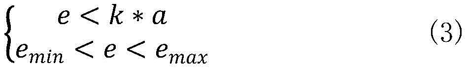
其中,k为指定倍数,emin为最小开度值,emax为最大开度值。Among them, k is the specified multiple, e min is the minimum opening value, and e max is the maximum opening value.
例如,当k=5,emin=-20,emax=-0.1时,即第二开度值满足e<5a,并且-20<e<-0.1,则确定将二级候选点集{A B C D E F}作为三级候选点集合,当然,本实时方式中仅是对指定范围和指定倍数进行举例说明,而并不对具体数值进行限定。关于二级候选点集合{G HI J K L}的判定方式与此大致相同,本实施方式中不再进行赘述,从而通过按照开度进行筛选,确定符合条件的三级候选点集合为{A B C D E F}。For example, when k=5, e min =-20, e max =-0.1, that is, the second opening value satisfies e<5a, and -20<e<-0.1, then it is determined that the secondary candidate point set {ABCDEF } As a set of three-level candidate points, of course, in this real-time method, only the specified range and the specified multiple are given as examples, and the specific values are not limited. The determination method for the second-level candidate point set {G HI JKL} is roughly the same, and will not be repeated in this embodiment, so that the third-level candidate point set that meets the conditions is determined to be {ABCDEF} by screening according to the opening degree.
步骤S105,从三级候选点集合中获取目标点,并根据目标点确定路面坑洞。Step S105, obtaining target points from the three-level candidate point set, and determining road surface potholes according to the target points.
可选的,从三级候选点集合中获取目标点,并根据目标点确定路面坑洞,包括:获取预先确定的地面方程,并根据地面方程确定三级候选点集合中位于地面下方的目标点;获取目标点到地面的距离平均值;当距离平均值大于深度阈值时,则对目标点进行聚类获取聚类簇;获取聚类簇的关联信息,并根据关联信息确定路面坑洞,其中,关联信息包括聚类簇的覆盖范围,聚类簇的中心位置。Optionally, the target point is obtained from the third-level candidate point set, and the road surface pothole is determined according to the target point, including: obtaining a predetermined ground equation, and determining the target point below the ground in the third-level candidate point set according to the ground equation ; Obtain the average distance from the target point to the ground; when the average distance is greater than the depth threshold, cluster the target points to obtain clusters; obtain the associated information of the clusters, and determine the potholes on the road according to the associated information, where , the association information includes the coverage of the cluster and the center position of the cluster.
具体的说,通过按照径向距离、连续方位角和开度三个角度对激光雷达单根扫描线上的点云进行筛选后,获取符合条件的三级候选点集合,由于三级候选点集合中的点是与地面坑洞所相关的,因此根据三级候选点集合进行检测,可以获取到路面坑洞。Specifically, after screening the point cloud on a single scanning line of the lidar according to the three angles of radial distance, continuous azimuth and opening degree, a qualified three-level candidate point set is obtained. Since the three-level candidate point set The points in are related to the potholes on the ground, so the potholes on the road surface can be obtained by detecting according to the three-level candidate point set.
本发明实施例的技术方案,通过对激光雷达单根扫描线上的点云进行多角度筛选获得可信赖的坑洞目标点,基于所获取的坑洞目标点确定路面坑洞,从而使得坑洞检测结果更加准确,并且可同时兼容单线和多线激光雷达,应用场景更加广泛。In the technical solution of the embodiment of the present invention, reliable pothole target points are obtained by multi-angle screening of point clouds on a single laser radar scanning line, and road potholes are determined based on the obtained pothole target points, so that potholes The detection results are more accurate, and it is compatible with single-line and multi-line lidar at the same time, and the application scenarios are more extensive.
图3是本发明实施例提供的路面坑洞检测方法的流程图,本实施例以上述实施例为基础,具体是对上述步骤S105从三级候选点集合中获取目标点,并根据目标点确定路面坑洞进行具体说明,方法步骤具体包括如下操作:Fig. 3 is the flow chart of the method for detecting road surface potholes provided by the embodiment of the present invention. This embodiment is based on the above-mentioned embodiment, specifically for the above-mentioned step S105 to obtain the target point from the three-level candidate point set, and determine according to the target point Potholes on the road surface are described in detail, and the method steps specifically include the following operations:
步骤S201,获取预先确定的地面方程,并根据地面方程确定三级候选点集合中位于地面下方的目标点。Step S201, obtaining a predetermined ground equation, and determining a target point below the ground in the third-level candidate point set according to the ground equation.
具体的说,本实施方式中会获取预先在车辆坐标系下所确定的地面方程,地面方程如下公式(4)所示:Specifically, in this embodiment, the ground equation determined in advance in the vehicle coordinate system will be obtained, and the ground equation is shown in the following formula (4):
mx+ny+oz+p=0 (4)mx+ny+oz+p=0 (4)
其中,在获取到地面方程之后,会根据地面方程确定三级候选点集合中位于地面下方的目标点,而目标点具体可以采用如下公式(5)进行确定:Among them, after the ground equation is obtained, the target point located below the ground in the third-level candidate point set will be determined according to the ground equation, and the target point can be specifically determined by the following formula (5):
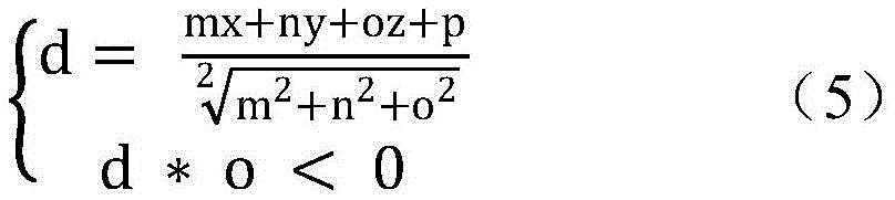
根据公式(5)计算三级候选点集合{A B C D E F}中点A的dA值后,如果dA*o的值小于0,则可以确定点A位于地面下方,同理对三级候选点集合中的点分别采用上述分别进行计算,如果确定每个点都满足上述公式(5),则可以确定三级候选点集中的点A B C D E F全部位于地面下方,并将点A B C D E F作为目标点。After calculating the d A value of point A in the third-level candidate point set {ABCDEF} according to formula (5), if the value of d A *o is less than 0, it can be determined that point A is located below the ground. Similarly, for the third-level candidate point set The points in are calculated using the above respectively. If it is determined that each point satisfies the above formula (5), it can be determined that the points ABCDEF in the third-level candidate point set are all located below the ground, and point ABCDEF is used as the target point.
步骤S202,获取目标点到地面的距离平均值。Step S202, obtaining the average distance from the target point to the ground.
其中,在确定出目标点后,会获取所有目标点到地面的距离平均值,例如,目标点AB C D E F,到地面的距离分别为|d1|、|d2|、|d3|、|d4|、|d5|和|d6|,则可以确定距离平均值D=(|d1|+|d2|+|d3|+|d4|+|d5|+|d6|)/6。当然,本实施方式中仅是举例说明,而并不对目标点的具体数量进行限定。Among them, after the target point is determined, the average distance from all target points to the ground will be obtained, for example, the target point AB C D E F, the distance to the ground is |d1|, |d2|, |d3|, |d4|, |d5| and |d6|, then the average distance D=(|d1|+|d2|+|d3|+|d4|+|d5|+|d6|)/6 can be determined. Of course, this embodiment is only for illustration, and does not limit the specific number of target points.
步骤S203,当距离平均值大于深度阈值时,则对目标点进行聚类获取聚类簇。Step S203, when the average distance is greater than the depth threshold, cluster the target points to obtain clusters.
其中,在获取到距离平均值之后,会判断距离平均值D是否大于深度阈值,例如,深度阈值为0.4,当确定D>0.4时,则对目标点进行聚类获取聚类簇,而在进行聚类时具体可以采用K-Means聚类方式、均值漂移聚类方式或基于密度的聚类方式等,本实施方式中并不对目标点进行聚类时所采用的具体方式进行限定,并且关于聚类的具体原理并不是本申请的重点,因此本实施方式中不再进行赘述。Among them, after obtaining the average distance, it will be judged whether the average distance D is greater than the depth threshold. Specifically, K-Means clustering, mean shift clustering, or density-based clustering can be used for clustering. This embodiment does not limit the specific methods used for clustering target points, and about clustering The specific principle of the class is not the focus of this application, so it will not be repeated in this embodiment.
步骤S204,获取聚类簇的关联信息,并根据关联信息确定路面坑洞。Step S204, acquiring associated information of the clusters, and determining road surface potholes according to the associated information.
具体的说,本实施方式中在进行聚类之后,还会获取每个聚类簇所对应的关联信息,其中,关联信息包括聚类簇的覆盖范围,聚类簇的中心位置。并根据聚类簇的中心位置确定路面坑洞在车辆坐标系中的位置,而根据覆盖范围确定路面坑洞的大小。如图4所示,为本实施方式中所获取的路面坑洞的检测结果示意图,并且在图4中以虚线框的形式将所确定出的路面坑洞进行标记。Specifically, in this embodiment, after the clustering is performed, associated information corresponding to each cluster is also obtained, wherein the associated information includes the coverage of the cluster and the center position of the cluster. The position of the road pothole in the vehicle coordinate system is determined according to the center position of the cluster, and the size of the road pothole is determined according to the coverage. As shown in FIG. 4 , it is a schematic diagram of detection results of road potholes obtained in this embodiment, and the determined road potholes are marked in the form of dotted boxes in FIG. 4 .
本发明实施例的技术方案,通过对激光雷达单根扫描线上的点云进行多角度筛选获得可信赖的坑洞目标点,基于所获取的坑洞目标点确定路面坑洞,从而使得坑洞检测结果更加准确,并且可同时兼容单线和多线激光雷达,应用场景更加广泛。并且具体是根据三级候选点集中位于地面下方的目标点,通过聚类运算获取路面坑洞,从而使得所确定的路面坑洞更加准确。In the technical solution of the embodiment of the present invention, reliable pothole target points are obtained by multi-angle screening of point clouds on a single laser radar scanning line, and road potholes are determined based on the obtained pothole target points, so that potholes The detection results are more accurate, and it is compatible with single-line and multi-line lidar at the same time, and the application scenarios are more extensive. And specifically, according to the three-level candidate points, the target points located below the ground are concentrated, and the road surface potholes are obtained through clustering operations, so that the determined road surface potholes are more accurate.
图5为本发明实施例提供的路面坑洞检测方法的流程图,本实施例以上述实施例为基础,具体是在从三级候选点集合中获取目标点,并根据目标点确定路面坑洞之后,对路面坑洞检测结果进行校验,方法步骤具体包括如下操作:Fig. 5 is a flow chart of the road surface pothole detection method provided by the embodiment of the present invention. This embodiment is based on the above-mentioned embodiment, and specifically obtains the target point from the three-level candidate point set, and determines the road surface pothole according to the target point Afterwards, the road surface pothole detection results are verified, and the method steps specifically include the following operations:
步骤S301,对激光雷达单根扫描线上的点云进行拟合获取第一拟合曲线。Step S301, fitting the point cloud on a single scanning line of the lidar to obtain a first fitting curve.
可选的,对激光雷达单根扫描线上的点云进行拟合获取第一拟合曲线之前,还包括:获取激光雷达坐标系下单根扫描线上的点云;对激光雷达坐标系下单根扫描线上的点云进行坐标变换,获取车辆坐标系下单根扫描线上的点云,其中,车辆坐标系以车辆后轴为原心,以车辆右方为水平面横轴,以车辆行驶方向为水平面纵轴,以垂直于水平面方向为竖直轴。Optionally, before fitting the point cloud on a single scanning line of the lidar to obtain the first fitting curve, it also includes: obtaining the point cloud on a single scanning line in the lidar coordinate system; Coordinate transformation is performed on the point cloud on a single scanning line to obtain the point cloud on a single scanning line in the vehicle coordinate system. The driving direction is the vertical axis of the horizontal plane, and the direction perpendicular to the horizontal plane is the vertical axis.
步骤S302,根据第一拟合曲线对点云进行径向距离筛选获取一级候选点集合。Step S302, performing radial distance screening on the point cloud according to the first fitting curve to obtain a first-level candidate point set.
可选的,根据第一拟合曲线对点云进行径向距离筛选获取一级候选点集合,包括:获取点云中点与第一拟合曲线的径向距离,以及点云中点的竖直高度;将点云中点的径向距离大于距离阈值以及竖直高度小于高度阈值的点,作为一级候选点集合。Optionally, perform radial distance screening on the point cloud according to the first fitting curve to obtain a set of first-level candidate points, including: obtaining the radial distance between the point cloud midpoint and the first fitting curve, and the vertical distance between the point cloud midpoint Vertical height: Points whose radial distance is greater than the distance threshold and whose vertical height is less than the height threshold are used as a set of first-level candidate points.
步骤S303,获取一级候选点集合中每个点的方位角,根据方位角对一级候选点集合进行分段筛选获取二级候选点集合。Step S303, obtaining the azimuth angle of each point in the first-level candidate point set, and performing segmentation screening on the first-level candidate point set according to the azimuth angle to obtain the second-level candidate point set.
可选的,根据方位角对一级候选点集合进行分段筛选获取二级候选点集合,包括:根据方位角确定一级候选点集合中各点的连续性,并根据连续的各点获取分段候选点集合;获取各分段候选点集合的相关参数,其中,相关参数包括连续方位角的总数值、点的总数量、点的水平坐标差最大值;将相关参数符合预设条件的分段候选点集合进行保留,获取二级候选点集合。Optionally, according to the azimuth, the first-level candidate point set is segmented and screened to obtain the second-level candidate point set, including: determining the continuity of each point in the first-level candidate point set according to the azimuth, and obtaining points according to the continuous points. segment candidate point set; obtain the relevant parameters of each segment candidate point set, wherein the relevant parameters include the total value of the continuous azimuth angle, the total number of points, and the maximum value of the point’s horizontal coordinate difference; The segment candidate point set is retained to obtain the second-level candidate point set.
步骤S304,对二级候选点集合进行拟合获取第二拟合曲线,并根据第一拟合曲线和第二拟合曲线对二级候选点集合进行筛选获取三级候选点集合。Step S304, fitting the second-level candidate point set to obtain a second fitting curve, and filtering the second-level candidate point set according to the first fitting curve and the second fitting curve to obtain a third-level candidate point set.
可选的,根据第一拟合曲线和第二拟合曲线对二级候选点集合进行筛选获取三级候选点集合,包括:获取第一拟合曲线的第一开度以及二级候选点集合所对应的第二拟合曲线的第二开度;将第二开度在指定范围内并且小于指定倍数第一开度的二级候选点集合,作为三级候选点集合。Optionally, according to the first fitting curve and the second fitting curve, the second-level candidate point set is screened to obtain the third-level candidate point set, including: obtaining the first opening of the first fitting curve and the second-level candidate point set The second degree of opening of the corresponding second fitting curve; a set of secondary candidate points whose second degree of opening is within a specified range and smaller than a specified multiple of the first degree of opening is used as a set of third-level candidate points.
步骤S305,从三级候选点集合中获取目标点,并根据目标点确定路面坑洞。Step S305, obtaining target points from the three-level candidate point set, and determining road surface potholes according to the target points.
可选的,从三级候选点集合中获取目标点,并根据目标点确定路面坑洞,包括:获取预先确定的地面方程,并根据地面方程确定三级候选点集合中位于地面下方的目标点;获取目标点到地面的距离平均值;当距离平均值大于深度阈值时,则对目标点进行聚类获取聚类簇;获取聚类簇的关联信息,并根据关联信息确定路面坑洞,其中,关联信息包括聚类簇的覆盖范围,聚类簇的中心位置。Optionally, the target point is obtained from the third-level candidate point set, and the road surface pothole is determined according to the target point, including: obtaining a predetermined ground equation, and determining the target point below the ground in the third-level candidate point set according to the ground equation ; Obtain the average distance from the target point to the ground; when the average distance is greater than the depth threshold, cluster the target points to obtain clusters; obtain the associated information of the clusters, and determine the potholes on the road according to the associated information, where , the association information includes the coverage of the cluster and the center position of the cluster.
步骤S306,对路面坑洞检测结果进行校验。Step S306, verifying the detection result of road surface potholes.
具体的说,本实施方式中在根据目标点确定路面坑洞之后,还会对路面坑洞检测结果进行校验,具体是获取路面检测范围内实际的路面坑洞,将实路面坑洞的与所获取的路面坑洞进行对比,如果相差超过10%,则确定路面坑洞检测是无效的,在确定检测无效的情况下会发出报警信息,以提示用户对设备进行优化或调整,以进一步保证路面坑洞检测的准确性。Specifically, after the road surface potholes are determined according to the target points in this embodiment, the road surface pothole detection results will also be verified, specifically, the actual road surface potholes within the road surface detection range are obtained, and the actual road surface potholes are compared with Comparing the obtained road potholes, if the difference exceeds 10%, it is determined that the road pothole detection is invalid, and an alarm message will be issued to prompt the user to optimize or adjust the equipment to further ensure that the detection is invalid. Accuracy of road pothole detection.
本发明实施例的技术方案,通过对激光雷达单根扫描线上的点云进行多角度筛选获得可信赖的坑洞目标点,基于所获取的坑洞目标点确定路面坑洞,从而使得坑洞检测结果更加准确,并且可同时兼容单线和多线激光雷达,应用场景更加广泛。通过对路面坑洞检测结果进行校验,当检测无效的情况下通过发出报警信息,以提示用户对设备进行优化或调整,以进一步保证路面坑洞检测的准确性。In the technical solution of the embodiment of the present invention, reliable pothole target points are obtained by multi-angle screening of point clouds on a single laser radar scanning line, and road potholes are determined based on the obtained pothole target points, so that potholes The detection results are more accurate, and it is compatible with single-line and multi-line lidar at the same time, and the application scenarios are more extensive. By verifying the detection results of road potholes, when the detection is invalid, an alarm message is sent to prompt the user to optimize or adjust the equipment to further ensure the accuracy of road pothole detection.
图6为本发明实施例提供的路面坑洞检测装置的结构示意图,该装置包括:第一拟合曲线获取模块410、一级候选点集合获取模块420、二级候选点集合获取模块430、三级候选点集合获取模块440和路面坑洞检测模块450。6 is a schematic structural diagram of a road surface pothole detection device provided by an embodiment of the present invention, the device includes: a first fitting
第一拟合曲线获取模块410,用于对激光雷达单根扫描线上的点云进行拟合获取第一拟合曲线;The first fitting
一级候选点集合获取模块420,用于根据第一拟合曲线对点云进行径向距离筛选获取一级候选点集合;The first-level candidate point set
二级候选点集合获取模块430,用于获取一级候选点集合中每个点的方位角,根据方位角对一级候选点集合进行分段筛选获取二级候选点集合;The second-level candidate point set
三级候选点集合获取模块440,用于对二级候选点集合进行拟合获取第二拟合曲线,并根据第一拟合曲线和第二拟合曲线对二级候选点集合进行筛选获取三级候选点集合;The third-level candidate point set
路面坑洞检测模块450,用于从三级候选点集合中获取目标点,并根据目标点确定路面坑洞。The road
可选的,装置还包括坐标转换模块,用于获取激光雷达坐标系下单根扫描线上的点云;Optionally, the device also includes a coordinate transformation module, which is used to obtain the point cloud on a single scanning line in the lidar coordinate system;
对激光雷达坐标系下单根扫描线上的点云进行坐标变换,获取车辆坐标系下单根扫描线上的点云,其中,车辆坐标系以车辆后轴为原心,以车辆右方为水平面横轴,以车辆行驶方向为水平面纵轴,以垂直于水平面方向为竖直轴。Carry out coordinate transformation on the point cloud on a single scanning line in the lidar coordinate system to obtain the point cloud on a single scanning line in the vehicle coordinate system, where the vehicle coordinate system is centered on the rear axle of the vehicle and centered on the right side of the vehicle. The transverse axis of the horizontal plane takes the driving direction of the vehicle as the vertical axis of the horizontal plane, and takes the direction perpendicular to the horizontal plane as the vertical axis.
可选的,第一拟合曲线获取模块,用于获取激光雷达单根扫描线上的点云;Optionally, the first fitting curve acquisition module is used to acquire the point cloud on a single scanning line of the lidar;
采用RANSAC算法对点云中的点进行拟合获取第一拟合曲线。A RANSAC algorithm is used to fit the points in the point cloud to obtain a first fitting curve.
可选的,一级候选点集合获取模块,用于获取点云中点与第一拟合曲线的径向距离,以及点云中点的竖直高度;Optionally, the first-level candidate point set acquisition module is used to obtain the radial distance between the point cloud midpoint and the first fitting curve, and the vertical height of the point cloud midpoint;
将点云中点的径向距离大于距离阈值以及竖直高度小于高度阈值的点,作为一级候选点集合。The points whose radial distance of the points in the point cloud are greater than the distance threshold and whose vertical height is less than the height threshold are used as a set of first-level candidate points.
可选的,二级候选点集合获取模块,用于根据方位角确定一级候选点集合中各点的连续性,并根据连续的各点获取分段候选点集合;Optionally, the second-level candidate point set acquisition module is used to determine the continuity of each point in the first-level candidate point set according to the azimuth, and obtain the segmented candidate point set according to the continuous points;
获取各分段候选点集合的相关参数,其中,相关参数包括连续方位角的总数值、点的总数量、点的水平坐标差最大值;Obtain the relevant parameters of each segment candidate point set, wherein the relevant parameters include the total value of the continuous azimuth angle, the total number of points, and the maximum value of the horizontal coordinate difference of the points;
将相关参数符合预设条件的分段候选点集合进行保留,获取二级候选点集合。The set of segmented candidate points whose relevant parameters meet the preset conditions are retained to obtain a set of secondary candidate points.
可选的,三级候选点集合获取模块,用于获取第一拟合曲线的第一开度以及二级候选点集合所对应的第二拟合曲线的第二开度;Optionally, the third-level candidate point set acquisition module is used to acquire the first opening degree of the first fitting curve and the second opening degree of the second fitting curve corresponding to the second-level candidate point set;
将第二开度在指定范围内并且小于指定倍数第一开度的二级候选点集合,作为三级候选点集合。The second-level candidate point set whose second opening degree is within the specified range and smaller than the specified multiple of the first opening degree is used as the third-level candidate point set.
可选的,路面坑洞检测模块,用于获取预先确定的地面方程,并根据地面方程确定三级候选点集合中位于地面下方的目标点;Optionally, the road surface pothole detection module is used to obtain a predetermined ground equation, and determine the target point located below the ground in the third-level candidate point set according to the ground equation;
获取目标点到地面的距离平均值;Obtain the average distance from the target point to the ground;
当距离平均值大于深度阈值时,则对目标点进行聚类获取聚类簇;When the average distance is greater than the depth threshold, the target points are clustered to obtain clusters;
获取聚类簇的关联信息,并根据关联信息确定路面坑洞,其中,关联信息包括聚类簇的覆盖范围,聚类簇的中心位置。Obtain the association information of the clusters, and determine the potholes on the road according to the association information, wherein the association information includes the coverage of the clusters and the center position of the clusters.
上述装置可执行本发明任意实施例所提供的路面坑洞检测方法,具备执行方法相应的功能模块和有益效果。未在本实施例中详尽描述的技术细节,可参见本发明任意实施例提供的方法。The above-mentioned device can execute the method for detecting road surface potholes provided by any embodiment of the present invention, and has corresponding functional modules and beneficial effects for executing the method. For technical details not exhaustively described in this embodiment, refer to the method provided in any embodiment of the present invention.
图7示出了可以用来实施本发明的实施例的电子设备10的结构示意图。电子设备旨在表示各种形式的数字计算机,诸如,膝上型计算机、台式计算机、工作台、个人数字助理、服务器、刀片式服务器、大型计算机、和其它适合的计算机。电子设备还可以表示各种形式的移动装置,诸如,个人数字处理、蜂窝电话、智能电话、可穿戴设备(如头盔、眼镜、手表等)和其它类似的计算装置。本文所示的部件、它们的连接和关系、以及它们的功能仅仅作为示例,并且不意在限制本文中描述的和/或者要求的本发明的实现。FIG. 7 shows a schematic structural diagram of an
如图7所示,电子设备10包括至少一个处理器11,以及与至少一个处理器11通信连接的存储器,如只读存储器(ROM)12、随机访问存储器(RAM)13等,其中,存储器存储有可被至少一个处理器执行的计算机程序,处理器11可以根据存储在只读存储器(ROM)12中的计算机程序或者从存储单元18加载到随机访问存储器(RAM)13中的计算机程序,来执行各种适当的动作和处理。在RAM 13中,还可存储电子设备10操作所需的各种程序和数据。处理器11、ROM 12以及RAM 13通过总线14彼此相连。输入/输出(I/O)接口15也连接至总线14。As shown in FIG. 7 , the
电子设备10中的多个部件连接至I/O接口15,包括:输入单元16,例如键盘、鼠标等;输出单元17,例如各种类型的显示器、扬声器等;存储单元18,例如磁盘、光盘等;以及通信单元19,例如网卡、调制解调器、无线通信收发机等。通信单元19允许电子设备10通过诸如因特网的计算机网络和/或各种电信网络与其他设备交换信息/数据。Multiple components in the
处理器11可以是各种具有处理和计算能力的通用和/或专用处理组件。处理器11的一些示例包括但不限于中央处理单元(CPU)、图形处理单元(GPU)、各种专用的人工智能(AI)计算芯片、各种运行机器学习模型算法的处理器、数字信号处理器(DSP)、以及任何适当的处理器、控制器、微控制器等。处理器11执行上文所描述的各个方法和处理,例如路面坑洞检测方法。
在一些实施例中,路面坑洞检测方法可被实现为计算机程序,其被有形地包含于计算机可读存储介质,例如存储单元18。在一些实施例中,计算机程序的部分或者全部可以经由ROM 12和/或通信单元19而被载入和/或安装到电子设备10上。当计算机程序加载到RAM 13并由处理器11执行时,可以执行上文描述的路面坑洞检测方法的一个或多个步骤。备选地,在其他实施例中,处理器11可以通过其他任何适当的方式(例如,借助于固件)而被配置为执行路面坑洞检测方法。In some embodiments, the road surface pothole detection method can be implemented as a computer program, which is tangibly embodied in a computer-readable storage medium, such as the
本文中以上描述的系统和技术的各种实施方式可以在数字电子电路系统、集成电路系统、场可编程门阵列(FPGA)、专用集成电路(ASIC)、专用标准产品(ASSP)、芯片上系统的系统(SOC)、负载可编程逻辑设备(CPLD)、计算机硬件、固件、软件、和/或它们的组合中实现。这些各种实施方式可以包括:实施在一个或者多个计算机程序中,该一个或者多个计算机程序可在包括至少一个可编程处理器的可编程系统上执行和/或解释,该可编程处理器可以是专用或者通用可编程处理器,可以从存储系统、至少一个输入装置、和至少一个输出装置接收数据和指令,并且将数据和指令传输至该存储系统、该至少一个输入装置、和该至少一个输出装置。Various implementations of the systems and techniques described above herein can be implemented in digital electronic circuit systems, integrated circuit systems, field programmable gate arrays (FPGAs), application specific integrated circuits (ASICs), application specific standard products (ASSPs), systems on chips Implemented in a system of systems (SOC), load programmable logic device (CPLD), computer hardware, firmware, software, and/or combinations thereof. These various embodiments may include being implemented in one or more computer programs executable and/or interpreted on a programmable system including at least one programmable processor, the programmable processor Can be special-purpose or general-purpose programmable processor, can receive data and instruction from storage system, at least one input device, and at least one output device, and transmit data and instruction to this storage system, this at least one input device, and this at least one output device an output device.
用于实施本发明的方法的计算机程序可以采用一个或多个编程语言的任何组合来编写。这些计算机程序可以提供给通用计算机、专用计算机或其他可编程数据处理装置的处理器,使得计算机程序当由处理器执行时使流程图和/或框图中所规定的功能/操作被实施。计算机程序可以完全在机器上执行、部分地在机器上执行,作为独立软件包部分地在机器上执行且部分地在远程机器上执行或完全在远程机器或服务器上执行。Computer programs for implementing the methods of the present invention may be written in any combination of one or more programming languages. These computer programs can be provided to a processor of a general-purpose computer, a special-purpose computer, or other programmable data processing apparatus, so that the computer program causes the functions/operations specified in the flowcharts and/or block diagrams to be implemented when executed by the processor. A computer program may execute entirely on the machine, partly on the machine, as a stand-alone software package partly on the machine and partly on a remote machine or entirely on the remote machine or server.
在本发明的上下文中,计算机可读存储介质可以是有形的介质,其可以包含或存储以供指令执行系统、装置或设备使用或与指令执行系统、装置或设备结合地使用的计算机程序。计算机可读存储介质可以包括但不限于电子的、磁性的、光学的、电磁的、红外的、或半导体系统、装置或设备,或者上述内容的任何合适组合。备选地,计算机可读存储介质可以是机器可读信号介质。机器可读存储介质的更具体示例会包括基于一个或多个线的电气连接、便携式计算机盘、硬盘、随机存取存储器(RAM)、只读存储器(ROM)、可擦除可编程只读存储器(EPROM或快闪存储器)、光纤、便捷式紧凑盘只读存储器(CD-ROM)、光学储存设备、磁储存设备、或上述内容的任何合适组合。In the context of the present invention, a computer readable storage medium may be a tangible medium that may contain or store a computer program for use by or in conjunction with an instruction execution system, apparatus or device. A computer readable storage medium may include, but is not limited to, electronic, magnetic, optical, electromagnetic, infrared, or semiconductor systems, apparatus, or devices, or any suitable combination of the foregoing. Alternatively, a computer readable storage medium may be a machine readable signal medium. More specific examples of machine-readable storage media would include one or more wire-based electrical connections, portable computer discs, hard drives, random access memory (RAM), read only memory (ROM), erasable programmable read only memory (EPROM or flash memory), optical fiber, compact disk read only memory (CD-ROM), optical storage, magnetic storage, or any suitable combination of the foregoing.
为了提供与用户的交互,可以在电子设备上实施此处描述的系统和技术,该电子设备具有:用于向用户显示信息的显示装置(例如,CRT(阴极射线管)或者LCD(液晶显示器)监视器);以及键盘和指向装置(例如,鼠标或者轨迹球),用户可以通过该键盘和该指向装置来将输入提供给电子设备。其它种类的装置还可以用于提供与用户的交互;例如,提供给用户的反馈可以是任何形式的传感反馈(例如,视觉反馈、听觉反馈、或者触觉反馈);并且可以用任何形式(包括声输入、语音输入或者、触觉输入)来接收来自用户的输入。In order to provide interaction with the user, the systems and techniques described herein can be implemented on an electronic device having a display device (e.g., a CRT (cathode ray tube) or LCD (liquid crystal display)) for displaying information to the user. monitor); and a keyboard and pointing device (eg, a mouse or a trackball) through which the user can provide input to the electronic device. Other kinds of devices can also be used to provide interaction with the user; for example, the feedback provided to the user can be any form of sensory feedback (e.g., visual feedback, auditory feedback, or tactile feedback); and can be in any form (including Acoustic input, speech input or, tactile input) to receive input from the user.
可以将此处描述的系统和技术实施在包括后台部件的计算系统(例如,作为数据服务器)、或者包括中间件部件的计算系统(例如,应用服务器)、或者包括前端部件的计算系统(例如,具有图形用户界面或者网络浏览器的用户计算机,用户可以通过该图形用户界面或者该网络浏览器来与此处描述的系统和技术的实施方式交互)、或者包括这种后台部件、中间件部件、或者前端部件的任何组合的计算系统中。可以通过任何形式或者介质的数字数据通信(例如,通信网络)来将系统的部件相互连接。通信网络的示例包括:局域网(LAN)、广域网(WAN)、区块链网络和互联网。The systems and techniques described herein can be implemented in a computing system that includes back-end components (e.g., as a data server), or a computing system that includes middleware components (e.g., an application server), or a computing system that includes front-end components (e.g., as a a user computer having a graphical user interface or web browser through which a user can interact with embodiments of the systems and techniques described herein), or including such backend components, middleware components, Or any combination of front-end components in a computing system. The components of the system can be interconnected by any form or medium of digital data communication, eg, a communication network. Examples of communication networks include: local area networks (LANs), wide area networks (WANs), blockchain networks, and the Internet.
计算系统可以包括客户端和服务器。客户端和服务器一般远离彼此并且通常通过通信网络进行交互。通过在相应的计算机上运行并且彼此具有客户端-服务器关系的计算机程序来产生客户端和服务器的关系。服务器可以是云服务器,又称为云计算服务器或云主机,是云计算服务体系中的一项主机产品,以解决了传统物理主机与VPS服务中,存在的管理难度大,业务扩展性弱的缺陷。A computing system can include clients and servers. Clients and servers are generally remote from each other and typically interact through a communication network. The relationship of client and server arises by computer programs running on the respective computers and having a client-server relationship to each other. The server can be a cloud server, also known as a cloud computing server or a cloud host. It is a host product in the cloud computing service system to solve the problems of difficult management and weak business expansion in traditional physical hosts and VPS services. defect.
应该理解,可以使用上面所示的各种形式的流程,重新排序、增加或删除步骤。例如,本发明中记载的各步骤可以并行地执行也可以顺序地执行也可以不同的次序执行,只要能够实现本发明的技术方案所期望的结果,本文在此不进行限制。It should be understood that steps may be reordered, added or deleted using the various forms of flow shown above. For example, each step described in the present invention may be executed in parallel, sequentially, or in a different order, as long as the desired result of the technical solution of the present invention can be achieved, there is no limitation herein.
上述具体实施方式,并不构成对本发明保护范围的限制。本领域技术人员应该明白的是,根据设计要求和其他因素,可以进行各种修改、组合、子组合和替代。任何在本发明的精神和原则之内所作的修改、等同替换和改进等,均应包含在本发明保护范围之内。The above specific implementation methods do not constitute a limitation to the protection scope of the present invention. It should be apparent to those skilled in the art that various modifications, combinations, sub-combinations and substitutions may be made depending on design requirements and other factors. Any modifications, equivalent replacements and improvements made within the spirit and principles of the present invention shall be included within the protection scope of the present invention.
Claims (10)
Priority Applications (1)
| Application Number | Priority Date | Filing Date | Title |
|---|---|---|---|
| CN202211115046.9A CN115424228A (en) | 2022-09-14 | 2022-09-14 | Pavement pit detection method, device, equipment and storage medium |
Applications Claiming Priority (1)
| Application Number | Priority Date | Filing Date | Title |
|---|---|---|---|
| CN202211115046.9A CN115424228A (en) | 2022-09-14 | 2022-09-14 | Pavement pit detection method, device, equipment and storage medium |
Publications (1)
| Publication Number | Publication Date |
|---|---|
| CN115424228A true CN115424228A (en) | 2022-12-02 |
Family
ID=84201414
Family Applications (1)
| Application Number | Title | Priority Date | Filing Date |
|---|---|---|---|
| CN202211115046.9A Pending CN115424228A (en) | 2022-09-14 | 2022-09-14 | Pavement pit detection method, device, equipment and storage medium |
Country Status (1)
| Country | Link |
|---|---|
| CN (1) | CN115424228A (en) |
Cited By (2)
| Publication number | Priority date | Publication date | Assignee | Title |
|---|---|---|---|---|
| CN116413738A (en) * | 2022-12-19 | 2023-07-11 | 上海洛轲智能科技有限公司 | Method and device for determining pavement pit depth, vehicle and computer storage medium |
| WO2025052319A1 (en) * | 2023-09-06 | 2025-03-13 | Central University Of Technology, Free State | Method and system of processing three-dimensional point clouds to determine ground and non-ground points |
Citations (9)
| Publication number | Priority date | Publication date | Assignee | Title |
|---|---|---|---|---|
| CN107272019A (en) * | 2017-05-09 | 2017-10-20 | 深圳市速腾聚创科技有限公司 | Curb detection method based on Laser Radar Scanning |
| CN108256446A (en) * | 2017-12-29 | 2018-07-06 | 百度在线网络技术(北京)有限公司 | For determining the method, apparatus of the lane line in road and equipment |
| CN108873896A (en) * | 2018-06-15 | 2018-11-23 | 驭势科技(北京)有限公司 | A kind of lane line analogy method, device and storage medium |
| CN110411361A (en) * | 2019-05-15 | 2019-11-05 | 首都师范大学 | A data processing method for moving tunnel laser detection |
| US20200104612A1 (en) * | 2018-09-27 | 2020-04-02 | Baidu Online Network Technology (Beijing) Co., Ltd. | Method and apparatus for detecting obstacle, electronic device, vehicle and storage medium |
| US20200284883A1 (en) * | 2019-03-08 | 2020-09-10 | Osram Gmbh | Component for a lidar sensor system, lidar sensor system, lidar sensor device, method for a lidar sensor system and method for a lidar sensor device |
| CN113454636A (en) * | 2018-12-28 | 2021-09-28 | 辉达公司 | Distance of obstacle detection in autonomous machine applications |
| CN114647816A (en) * | 2022-03-28 | 2022-06-21 | 阿波罗智联(北京)科技有限公司 | Method, device and equipment for determining lane line and storage medium |
| CN114859320A (en) * | 2022-05-11 | 2022-08-05 | 北京经纬恒润科技股份有限公司 | Laser radar point cloud data processing method and system |
-
2022
- 2022-09-14 CN CN202211115046.9A patent/CN115424228A/en active Pending
Patent Citations (9)
| Publication number | Priority date | Publication date | Assignee | Title |
|---|---|---|---|---|
| CN107272019A (en) * | 2017-05-09 | 2017-10-20 | 深圳市速腾聚创科技有限公司 | Curb detection method based on Laser Radar Scanning |
| CN108256446A (en) * | 2017-12-29 | 2018-07-06 | 百度在线网络技术(北京)有限公司 | For determining the method, apparatus of the lane line in road and equipment |
| CN108873896A (en) * | 2018-06-15 | 2018-11-23 | 驭势科技(北京)有限公司 | A kind of lane line analogy method, device and storage medium |
| US20200104612A1 (en) * | 2018-09-27 | 2020-04-02 | Baidu Online Network Technology (Beijing) Co., Ltd. | Method and apparatus for detecting obstacle, electronic device, vehicle and storage medium |
| CN113454636A (en) * | 2018-12-28 | 2021-09-28 | 辉达公司 | Distance of obstacle detection in autonomous machine applications |
| US20200284883A1 (en) * | 2019-03-08 | 2020-09-10 | Osram Gmbh | Component for a lidar sensor system, lidar sensor system, lidar sensor device, method for a lidar sensor system and method for a lidar sensor device |
| CN110411361A (en) * | 2019-05-15 | 2019-11-05 | 首都师范大学 | A data processing method for moving tunnel laser detection |
| CN114647816A (en) * | 2022-03-28 | 2022-06-21 | 阿波罗智联(北京)科技有限公司 | Method, device and equipment for determining lane line and storage medium |
| CN114859320A (en) * | 2022-05-11 | 2022-08-05 | 北京经纬恒润科技股份有限公司 | Laser radar point cloud data processing method and system |
Non-Patent Citations (1)
| Title |
|---|
| KAI LI, JINJU SHAO ,DONG GUO: "A Multi-Feature Search Window Method for Road Boundary Detection Based on LIDAR Data", SENSORS, 30 March 2019 (2019-03-30) * |
Cited By (2)
| Publication number | Priority date | Publication date | Assignee | Title |
|---|---|---|---|---|
| CN116413738A (en) * | 2022-12-19 | 2023-07-11 | 上海洛轲智能科技有限公司 | Method and device for determining pavement pit depth, vehicle and computer storage medium |
| WO2025052319A1 (en) * | 2023-09-06 | 2025-03-13 | Central University Of Technology, Free State | Method and system of processing three-dimensional point clouds to determine ground and non-ground points |
Similar Documents
| Publication | Publication Date | Title |
|---|---|---|
| CN114612544B (en) | Image processing method, device, equipment and storage medium | |
| WO2023155387A1 (en) | Multi-sensor target detection method and apparatus, electronic device and storage medium | |
| CN115424228A (en) | Pavement pit detection method, device, equipment and storage medium | |
| CN116342899A (en) | A target detection and positioning method, device, equipment and storage medium | |
| CN114882198B (en) | A target determination method, device, equipment and medium | |
| CN114581890A (en) | Method, device, electronic device and storage medium for determining lane lines | |
| CN116563802A (en) | A tunnel scene judgment method, device, equipment and storage medium | |
| CN115526837A (en) | Abnormal driving detection method and device, electronic equipment and medium | |
| CN111784579A (en) | Drawing method and device | |
| CN116740676B (en) | An obstacle detection method, apparatus, equipment, and medium | |
| CN117872346A (en) | Object tracking method, device, equipment and storage medium | |
| CN116883969A (en) | Ground point cloud identification method and device, electronic equipment and storage medium | |
| CN112630736A (en) | Method, device and equipment for determining parameters of roadside radar and storage medium | |
| CN116593986A (en) | Multi-sensor track fusion filtering method and device, electronic equipment and storage medium | |
| CN113753076B (en) | Method and device for judging effective obstacle, electronic equipment and automatic driving vehicle | |
| CN114445802A (en) | Point cloud processing method and device and vehicle | |
| CN116934779B (en) | Laser point cloud segmentation method, device, electronic device and storage medium | |
| EP4134843A2 (en) | Fusion and association method and apparatus for traffic objects in driving environment, and edge computing device | |
| CN110363834B (en) | A method and device for segmenting point cloud data | |
| CN116609757A (en) | Detection method, device, equipment and medium for laser radar specular reflection ghost | |
| CN116883707A (en) | Millimeter wave radar point cloud clustering method | |
| CN115774844A (en) | Category determination method, device, equipment and storage medium | |
| CN115841635A (en) | Method, device and equipment for dividing ground points and storage medium | |
| CN114910892A (en) | A laser radar calibration method, device, electronic device and storage medium | |
| CN114861461A (en) | Simulation-based target detection method, electronic device and storage medium |
Legal Events
| Date | Code | Title | Description |
|---|---|---|---|
| PB01 | Publication | ||
| PB01 | Publication | ||
| SE01 | Entry into force of request for substantive examination | ||
| SE01 | Entry into force of request for substantive examination |