CN110597247B - Multi-vehicle obstacle avoidance path planning method - Google Patents
Multi-vehicle obstacle avoidance path planning method Download PDFInfo
- Publication number
- CN110597247B CN110597247B CN201910780078.2A CN201910780078A CN110597247B CN 110597247 B CN110597247 B CN 110597247B CN 201910780078 A CN201910780078 A CN 201910780078A CN 110597247 B CN110597247 B CN 110597247B
- Authority
- CN
- China
- Prior art keywords
- driving
- road
- road section
- selected vehicle
- path
- Prior art date
- Legal status (The legal status is an assumption and is not a legal conclusion. Google has not performed a legal analysis and makes no representation as to the accuracy of the status listed.)
- Active
Links
- 238000000034 method Methods 0.000 title claims abstract description 39
- 230000002457 bidirectional effect Effects 0.000 claims description 9
- 230000008569 process Effects 0.000 abstract description 15
- 238000004364 calculation method Methods 0.000 description 4
- 230000008859 change Effects 0.000 description 4
- 238000012545 processing Methods 0.000 description 4
- 238000004458 analytical method Methods 0.000 description 3
- 238000010586 diagram Methods 0.000 description 2
- 238000011160 research Methods 0.000 description 2
- 230000001360 synchronised effect Effects 0.000 description 2
- 230000009471 action Effects 0.000 description 1
- 238000013473 artificial intelligence Methods 0.000 description 1
- 230000004888 barrier function Effects 0.000 description 1
- 230000009286 beneficial effect Effects 0.000 description 1
- 238000013461 design Methods 0.000 description 1
- 238000005516 engineering process Methods 0.000 description 1
- 230000006872 improvement Effects 0.000 description 1
- 230000003993 interaction Effects 0.000 description 1
- 230000004048 modification Effects 0.000 description 1
- 238000012986 modification Methods 0.000 description 1
- 230000011218 segmentation Effects 0.000 description 1
Images


Classifications
-
- G—PHYSICS
- G05—CONTROLLING; REGULATING
- G05D—SYSTEMS FOR CONTROLLING OR REGULATING NON-ELECTRIC VARIABLES
- G05D1/00—Control of position, course, altitude or attitude of land, water, air or space vehicles, e.g. using automatic pilots
- G05D1/02—Control of position or course in two dimensions
Landscapes
- Engineering & Computer Science (AREA)
- Aviation & Aerospace Engineering (AREA)
- Radar, Positioning & Navigation (AREA)
- Remote Sensing (AREA)
- Physics & Mathematics (AREA)
- General Physics & Mathematics (AREA)
- Automation & Control Theory (AREA)
- Traffic Control Systems (AREA)
Abstract
A multi-vehicle obstacle avoidance path planning method relates to the traffic field, and the method comprises the following steps: planning a driving path of the selected vehicle on the target road and storing the planned driving path of the selected vehicle to the processor; dividing a driving area of a target road into a plurality of road section areas and dividing a planned selected vehicle driving path into a plurality of driving road sections according to the road section areas; when the vehicle runs to a certain distance, carrying out the position query of the roadblock on the road section area; judging whether a roadblock exists on the second driving road section or whether the selected vehicle possibly collides with other vehicles or not according to the query result and the driving path of other vehicles; and under the condition that a roadblock exists on the second driving road section or the possibility that the selected vehicle collides with other vehicles exists, replanning the second driving road section and the third driving road section and storing the second driving road section and the third driving road section to the processor. The problem of how to realize safe driving by dynamically adjusting the paths of a plurality of vehicles in the actual driving process is solved.
Description
Technical Field
The invention relates to the field of traffic, in particular to a multi-vehicle obstacle avoidance path planning method.
Background
The automatic driving technology is a popular research subject in the direction of artificial intelligence at present, and obstacle avoidance is an important part in the driving process of an automatic driving vehicle. The global path planning of the automatic driving vehicle plans an optimal path under the known environment map information for the vehicle, but the vehicle is in an unpredictable and highly dynamic urban road environment in the advancing process, obstacles are likely to appear on the planned global path, and some obstacles (pedestrians, vehicles and the like) are also likely to appear on the path dynamically in the advancing process. The autonomous vehicle must react to these unpredictable events in some way to perform local obstacle avoidance, so that it can still successfully reach the destination and complete the mission.
The comparison document CN201811359384.0 proposes an automatic driving road planning method, and proposes solutions for road planning and obstacle avoidance processing, but the comparison document only aims at real-time road obstacle avoidance of a vehicle, but if processing is performed after an obstacle is found, the processing time of the vehicle is too urgent, and the processing action and difficulty are too large, further resulting in that safety in the vehicle driving process cannot be effectively guaranteed. In the actual driving process of the vehicle, each vehicle actually driving in the urban road environment is an obstacle in the advancing process of another vehicle, and how to dynamically adjust the paths of a plurality of vehicles in the actual driving process so as to realize safe driving is an important research subject.
Disclosure of Invention
The invention aims to overcome the problems in the prior art, provides a multi-vehicle obstacle avoidance path planning method, and solves the problem of how to dynamically adjust the paths of multiple vehicles in the actual driving process so as to realize safe driving.
A multi-vehicle obstacle avoidance path planning method is characterized by comprising the following steps:
planning a running path of a selected vehicle on a target road and storing the planned running path of the selected vehicle;
dividing a driving area of a target road into a plurality of road section areas and dividing a planned selected vehicle driving path into a plurality of driving road sections according to the road section areas;
when the selected vehicle runs along the planned selected vehicle running path and has a certain distance from the second running road section, carrying out road block position query on a road section area corresponding to the second running road section in the area division result;
judging whether a roadblock exists on a second driving road section or whether the selected vehicle possibly collides with other vehicles or not according to the inquiry result of the position of the roadblock and the stored driving paths of other vehicles;
under the condition that a road block exists on the second driving road section or the possibility that the selected vehicle collides with other vehicles exists, replanning the second driving road section and the third driving road section and storing the driving path of the selected vehicle after replanning the second driving road section and the third driving road section;
the second driving road section is a next driving road section of a current driving road section of a selected vehicle in a planned selected vehicle driving path, the third driving road section is a next driving road section of the second driving road section in the planned selected vehicle driving path, the selected vehicle driving path is the moving direction and the moving speed of the selected vehicle on a target road, and the other vehicle driving paths are the moving direction and the moving speed of other vehicles on the target road.
The method is improved by combining with a conventional planning mode based on a traditional planning mode, the road section area is cut after planning when starting, the planned route of the vehicle which is about to cross the boundary of the area is corrected, and the problem that the route is not changed timely because the pre-judgment is not timely is avoided; and because the change of the route is more prospective, the collision with other vehicles with other running routes stored in the processor can be avoided, and further the replanned route can be fed back to other subsequent vehicles across, so that the collision between other automatically controlled vehicles and the vehicles with the replanned route caused by the change of the planned route is effectively avoided, and the technical problem of how to dynamically adjust the routes of a plurality of vehicles in the actual running process so as to realize safe driving is solved.
Preferably, the target road is provided with a sensor for confirming the position of the roadblock.
The sensor disposed on the road can more stably recognize the position of the obstacle and the vehicle than the sensor disposed on the vehicle.
Preferably, the step of planning the driving path of the selected vehicle on the target road and storing the planned driving path of the selected vehicle in the processor specifically includes:
inquiring the position of the roadblock;
planning the selected vehicle driving path by using a bidirectional RRT algorithm and a differential constraint system in combination with four factors of an entering position, a leaving position, a road block position and a traffic rule of a target road;
judging whether the planned selected vehicle running path has the possibility of collision with other vehicles or not through the stored other vehicle running paths;
if the planned selected vehicle driving path does not have the possibility of collision with other vehicles, storing the planned selected vehicle driving path;
the entering position is a starting position of the selected vehicle running on the target road, and the leaving position is a position of the selected vehicle running off the target road.
The differential constraint system can be designed by combining the characteristics of the bidirectional RRT algorithm and the set traffic rules to efficiently determine the optimal running path, and meanwhile, the running routes of other vehicles stored in the processor can ensure that the selected vehicle does not collide with other planned vehicles when running along the planned route.
Preferably, the step of dividing the driving area of the target road into a plurality of road segment areas and dividing the planned selected vehicle driving path into a plurality of driving road segments according to the road segment areas specifically includes:
determining the vertical direction of the traffic flow driving direction in the plane area of the driving area of the target road as the area cutting direction of the target road;
cutting a driving area of a target road into a plurality of road section areas according to an area cutting direction of the target road, a traffic flow driving direction, a curve position in the target road and a cutting range;
the cutting range is the maximum and minimum road lengths contained in the road section area.
Because the road conditions are often different, the cutting modes facing different roads are different, and because the driving of opposite lanes is relatively independent when the road section is analyzed, the load and the requirement of the analysis of the road section area can be reduced by separating the driving areas of bidirectional lanes, and the planning effectiveness is improved due to the denoising.
Preferably, when the selected vehicle travels along the planned selected vehicle travel path and has a certain distance to the second travel route, the step of performing the road block position query on the route section area corresponding to the second travel route in the area division result specifically includes:
locating a selected vehicle position and calculating a time remaining for the selected vehicle to be expected to enter a second travel segment from the selected vehicle travel path;
judging whether the time left for the selected vehicle to enter a second driving road section is smaller than or equal to a preset threshold value or not;
and under the condition that the remaining time of the selected vehicle estimated to enter the second driving road section is less than or equal to a preset threshold value, carrying out road block position inquiry on the road section area corresponding to the second driving road section in the area division result.
According to the advance planning of the sectional planning based on the method, the effectiveness of the planning is easily reduced if the advance planning is too early, and the position of the vehicle is possibly in conflict with the planned route if the advance planning is too late, but if the advance planning is carried out within a set travel, the front and back of the planning and the front and back of the next road section are not synchronous aiming at the vehicles with different speeds, so that the problem of the asynchronization between the planning and the reality can be solved by calculating the speed of the vehicle and further calculating the time of entering the next road section.
Preferably, the step of replanning the second travel section and the third travel section and storing the travel path of the selected vehicle after replanning the second travel section and the third travel section when it is found that there is a road block on the second travel section or there is a possibility that the selected vehicle collides with another vehicle includes:
when the fact that the roadblock exists on the second driving road section or the possibility that the selected vehicle collides with other vehicles exists is inquired, the position of the roadblock in the road section area corresponding to the third driving road section is inquired;
replanning the second driving road section and the third driving road section according to the stored other vehicle driving paths and the road block positions of the road section areas corresponding to the second driving road section and the third driving road section;
judging whether the selected vehicle has the possibility of collision with other vehicles on the selected vehicle running path after the second running road section and the third running road section are replanned by combining the stored running paths of other vehicles;
under the condition that the collision possibility between the selected vehicle and other vehicles exists in the selected vehicle running path after the second running road section and the third running road section are re-planned, the moving speed of the selected vehicle on the target road of the selected vehicle running path after the second running road section and the third running road section are re-planned is adjusted until the collision possibility between the selected vehicle and other vehicles does not exist in the selected vehicle running path after the second running road section and the third running road section are re-planned;
storing the re-planned selected vehicle travel path without the potential for collision of the selected vehicle with other vehicles.
Under the condition that the road block needs to be replanned, if only the second driving road section is selected for replanning, because the difficulty of replanning the newly-added road block is high, if the second driving road section and the third driving road section are simultaneously selected for replanning, the replanning space is large, and the replanning success rate can be improved to a certain extent.
Preferably, the step of replanning the second travel section and the third travel section according to the stored road block positions of the section areas corresponding to the other vehicle travel paths and the second travel section and the third travel section specifically includes:
in the case where it is found that there is a road block on the second travel section or there is a possibility that the selected vehicle collides with another vehicle, analyzing the stored travel paths of the other vehicles to confirm whether there is a reference path;
under the condition that the reference path exists, selecting an optimal reference path according to the departure time and the departure time of the reference path;
replanning a second travel segment and a third travel segment based on the movement orientation of the optimal reference path;
the departure time is the time of entering the second traveling road section, the departure time is the time of leaving the third traveling road section, and the reference route is a partial link included in other vehicle traveling routes having the same starting position as the second traveling road section and the same departure position as the third traveling road section.
If the reference path exists, the planning is carried out on the basis of the reference path, so that traffic confusion and congestion caused by re-planning can be effectively avoided, meanwhile, the path planning based on the moving direction of the reference path can avoid repeated path calculation, and the total calculation amount of the path is reduced.
Preferably, the sensor includes an infrared sensor and a pressure sensor.
If use and look screen identification then appear discerning untimely problem easily, and if only be used for discerning the roadblock position, look the discernment efficiency and the success rate of screen and all be not high, consequently choose for use pressure sensor to combine infrared sensor to discern the roadblock at the speed of discernment and validity all more outstanding.
Compared with the prior art, the invention has the following beneficial effects:
1. by designing the subsection path analysis, the problem of how to dynamically adjust the paths of a plurality of vehicles in the actual driving process so as to realize safe driving is solved;
2. based on the multi-section dynamic adjustment, a step flow with higher robustness is designed;
3. the steps for reducing the calculated amount are designed, and planning confusion caused by overlarge calculated amount during multi-vehicle interaction is avoided;
4. the method is limited by traffic rules, the calculated amount based on the bidirectional RRT algorithm is very low in an application scene, and meanwhile, the path planning of the bidirectional RRT algorithm has higher authority;
5. different segmentation methods are designed aiming at different scenes, and the application scene range of the method is improved.
Drawings
FIG. 1 is a flow chart of the present invention.
FIG. 2 is a schematic diagram of the zone division according to the present invention.
FIG. 3 is a diagram illustrating a path re-planning process according to the present invention.
Detailed Description
The drawings are only for purposes of illustration and are not to be construed as limiting the invention. For the purpose of better illustrating the following embodiments, certain features of the drawings may be omitted, enlarged or reduced, and do not represent the size of an actual product; it will be understood by those skilled in the art that certain well-known structures in the drawings and descriptions thereof may be omitted.
Example 1
As shown in fig. 1 to 3, the present embodiment provides a multi-vehicle obstacle avoidance path planning method, which solves the problem of how to dynamically adjust the paths of multiple vehicles in the actual driving process, thereby achieving safe driving.
A multi-vehicle obstacle avoidance path planning method is characterized by comprising the following steps:
planning a running path of a selected vehicle on a target road and storing the planned running path of the selected vehicle;
dividing a driving area of a target road into a plurality of road section areas and dividing a planned selected vehicle driving path into a plurality of driving road sections according to the road section areas;
when the selected vehicle runs along the planned selected vehicle running path and has a certain distance from the second running road section, carrying out road block position query on a road section area corresponding to the second running road section in the area division result;
judging whether a roadblock exists on a second driving road section or whether the selected vehicle possibly collides with other vehicles or not according to the inquiry result of the position of the roadblock and the stored driving paths of other vehicles;
under the condition that a road block exists on the second driving road section or the possibility that the selected vehicle collides with other vehicles exists, replanning the second driving road section and the third driving road section and storing the driving path of the selected vehicle after replanning the second driving road section and the third driving road section;
the second driving road section is a next driving road section of a current driving road section of a selected vehicle in a planned selected vehicle driving path, the third driving road section is a next driving road section of the second driving road section in the planned selected vehicle driving path, the selected vehicle driving path is the moving direction and the moving speed of the selected vehicle on a target road, and the other vehicle driving paths are the moving direction and the moving speed of other vehicles on the target road.
The method is combined with a conventional planning mode and improved based on a traditional planning mode, the road section area is cut after planning is carried out when the vehicle starts, the planned route of the vehicle which is about to cross the boundary of the area is corrected, and the problem that the route is not changed timely due to untimely prediction is avoided; and because the change of the route is more prospective, the collision with other vehicles with other running routes stored in the processor can be avoided, and further the replanned route can be fed back to other subsequent vehicles across, so that the collision between other automatically controlled vehicles and the vehicles with the replanned route caused by the change of the planned route is effectively avoided, and the technical problem of how to dynamically adjust the routes of a plurality of vehicles in the actual running process so as to realize safe driving is solved.
In the specific implementation process, a sensor used for confirming the position of the roadblock is arranged on the target road.
The sensor disposed on the road can more stably recognize the position of the barrier and the vehicle, compared to the sensor disposed on the vehicle.
Specifically, the step of planning the driving path of the selected vehicle on the target road and storing the planned driving path of the selected vehicle in the processor includes:
inquiring the position of the roadblock;
planning the selected vehicle driving path by using a bidirectional RRT algorithm and a differential constraint system in combination with four factors of an entering position, a leaving position, a road block position and a traffic rule of a target road;
judging whether the planned selected vehicle running path has the possibility of collision with other vehicles or not through the stored other vehicle running paths;
if the planned selected vehicle driving path does not have the possibility of collision with other vehicles, storing the planned selected vehicle driving path;
the entering position is a starting position of the selected vehicle running on the target road, and the leaving position is a position of the selected vehicle running off the target road.
The characteristics of the bidirectional RRT algorithm and the set traffic rules are combined to design a differential constraint system so as to efficiently determine the optimal running path, and meanwhile, the running routes of other vehicles stored in the processor can be used for ensuring that the selected vehicle does not collide with other planned vehicles when running along the planned route.
Specifically, the step of dividing the driving area of the target road into a plurality of road segment areas and dividing the planned selected vehicle driving path into a plurality of driving road segments according to the road segment areas specifically includes:
determining the vertical direction of the traffic flow driving direction in the plane area of the driving area of the target road as the area cutting direction of the target road;
cutting a driving area of a target road into a plurality of road section areas according to an area cutting direction of the target road, a traffic flow driving direction, a curve position in the target road and a cutting range;
the cutting range is the maximum and minimum road lengths contained in the road section area.
Because the road conditions are often different, the cutting modes facing different roads are different, and because the driving of opposite lanes is relatively independent when the road section is analyzed, the load and the requirement of the analysis of the road section area can be reduced by separating the driving areas of bidirectional lanes, and the planning effectiveness is improved due to the denoising.
Specifically, when the selected vehicle travels along the planned selected vehicle travel path and has a certain distance from the second travel road segment, the step of performing the obstacle position query on the road segment area corresponding to the second travel road segment in the area division result specifically includes:
locating a selected vehicle position and calculating a time remaining for the selected vehicle to be expected to enter a second travel segment from the selected vehicle travel path;
judging whether the remaining time of the selected vehicle which is estimated to enter the second driving road section is less than or equal to a preset threshold value or not;
and under the condition that the remaining time of the selected vehicle estimated to enter the second driving road section is less than or equal to a preset threshold value, carrying out the position query of the roadblock on the road section area corresponding to the second driving road section in the area division result.
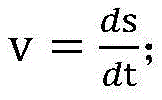
If the speed of the selected vehicle is v, the remaining distance is s, and the entry time is t, then it can be known that:
thus, it is possible to obtain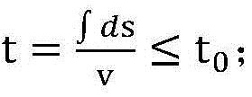
Wherein t is 0 Is a preset threshold value.
According to the advance planning of the sectional planning based on the method, the effectiveness of the planning is easily reduced if the advance planning is too early, and the position of the vehicle is possibly in conflict with the planned route if the advance planning is too late, but if the advance planning is carried out within a set travel, the front and back of the planning and the front and back of the next road section are not synchronous aiming at the vehicles with different speeds, so that the problem of the asynchronization between the planning and the reality can be solved by calculating the speed of the vehicle and further calculating the time of entering the next road section.
Specifically, the step of replanning the second travel section and the third travel section and storing the travel path of the selected vehicle after replanning the second travel section and the third travel section when it is found that there is a road block on the second travel section or there is a possibility that the selected vehicle collides with another vehicle includes:
when the situation that a road block exists on the second driving road section or the possibility that the selected vehicle collides with other vehicles exists is inquired, the position of the road block of a road section area corresponding to the third driving road section is inquired;
replanning the second driving road section and the third driving road section according to the stored driving paths of other vehicles and the road block positions of the road section areas corresponding to the second driving road section and the third driving road section;
judging whether the selected vehicle possibly collides with other vehicles on the selected vehicle running path replanned by the second running road section and the third running road section by combining the stored running paths of other vehicles;
under the condition that the selected vehicle running path of the second running road section and the third running road section after being re-planned has the possibility of collision between the selected vehicle and other vehicles, the moving speed of the selected vehicle running path of the second running road section and the third running road section after being re-planned on the target road is adjusted until the selected vehicle running path of the second running road section and the third running road section after being re-planned has the possibility of collision between the selected vehicle and other vehicles;
storing the re-planned selected vehicle travel path without the potential for collision of the selected vehicle with other vehicles.
Under the condition that the road block needs to be replanned, if only the second driving road section is selected for replanning, because the difficulty of replanning the newly-added road block is high, if the second driving road section and the third driving road section are simultaneously selected for replanning, the replanning space is large, and the replanning success rate can be improved to a certain extent.
Specifically, the step of replanning the second travel section and the third travel section according to the stored road block positions of the section areas corresponding to the other vehicle travel paths and the second travel section and the third travel section includes:
in the case where it is found that there is a road block on the second travel section or there is a possibility that the selected vehicle collides with another vehicle, analyzing the stored travel paths of the other vehicles to confirm whether there is a reference path;
under the condition that a reference path exists, selecting an optimal reference path according to the departure time and the departure time of the reference path;
replanning a second travel segment and a third travel segment based on the movement orientation of the optimal reference path;
the departure time is the time of entering the second driving road section, the departure time is the time of leaving the third driving road section, and the reference route is a partial link included in other vehicle driving routes which have the same starting position as the second driving road section and the same departure position as the third driving road section.
If the reference path exists, the planning is carried out on the basis of the reference path, so that traffic confusion and congestion caused by re-planning can be effectively avoided, meanwhile, the path planning based on the moving direction of the reference path can avoid repeated path calculation, and the total calculation amount of the path is reduced.
Specifically, the sensor includes an infrared sensor and a pressure sensor.
If use and look screen discernment then appear discerning untimely problem easily, and if only be used for discerning the roadblock position, look the discernment efficiency and the success rate of screen and all be not high, consequently select for use pressure sensor to combine infrared sensor to discern the roadblock and all be more outstanding at discernment speed and validity.
It should be understood that the above-mentioned embodiments of the present invention are only examples for clearly illustrating the technical solutions of the present invention, and are not intended to limit the specific embodiments of the present invention. Any modification, equivalent replacement, and improvement made within the spirit and principle of the claims of the present invention should be included in the protection scope of the claims of the present invention.
Claims (7)
1. A multi-vehicle obstacle avoidance path planning method is characterized by comprising the following steps:
planning a running path of a selected vehicle on a target road and storing the planned running path of the selected vehicle;
dividing a driving area of a target road into a plurality of road section areas and dividing a planned selected vehicle driving path into a plurality of driving road sections according to the road section areas;
when the selected vehicle runs along the planned selected vehicle running path and has a certain distance from the second running road section, carrying out road block position query on a road section area corresponding to the second running road section in the area division result;
judging whether a roadblock exists on a second driving road section or whether the possibility of collision between the selected vehicle and other vehicles exists according to the inquiry result of the position of the roadblock and the stored driving paths of other vehicles;
under the condition that a road block exists on the second driving road section or the possibility that the selected vehicle collides with other vehicles exists, replanning the second driving road section and the third driving road section and storing the driving path of the selected vehicle after replanning the second driving road section and the third driving road section;
the second driving road section is a next driving road section of a current driving road section of a selected vehicle in a planned selected vehicle driving path, the third driving road section is a next driving road section of the second driving road section in the planned selected vehicle driving path, the selected vehicle driving path is a moving direction and a moving speed of the selected vehicle on a target road, and the other vehicle driving paths are moving directions and moving speeds of other vehicles on the target road;
the step of planning the driving path of the selected vehicle on the target road and storing the planned driving path of the selected vehicle specifically comprises:
inquiring the position of the roadblock;
planning the selected vehicle driving path by using a bidirectional RRT algorithm and a differential constraint system in combination with four factors of an entering position, a leaving position, a road block position and a traffic rule of a target road;
judging whether the planned selected vehicle running path has the possibility of collision with other vehicles or not through the stored other vehicle running paths;
if the planned selected vehicle driving path does not have the possibility of collision with other vehicles, storing the planned selected vehicle driving path;
the entering position is a starting position of the selected vehicle running on the target road, and the leaving position is a position of the selected vehicle running off the target road.
2. The method as claimed in claim 1, wherein a sensor for confirming a position of a road block is provided on the target road.
3. The method as claimed in claim 1, wherein the step of dividing the driving area of the target road into a plurality of road segment areas and dividing the planned selected vehicle driving path into a plurality of driving road segments according to the road segment areas specifically comprises:
determining the vertical direction of the traffic flow driving direction in the plane area of the driving area of the target road as the area cutting direction of the target road;
cutting a driving area of a target road into a plurality of road section areas according to an area cutting direction of the target road, a traffic flow driving direction, a curve position in the target road and a cutting range;
the cutting range is the maximum and minimum road lengths contained in the road section area.
4. The method as claimed in claim 1, wherein the step of querying the road block location of the road segment area corresponding to the second driving road segment in the area division result when the selected vehicle drives along the planned driving path of the selected vehicle and has a certain distance to the second driving road segment specifically comprises:
locating a selected vehicle location and calculating a time remaining until the selected vehicle is expected to travel into a second travel segment from the selected vehicle travel path;
judging whether the remaining time of the selected vehicle which is estimated to enter the second driving road section is less than or equal to a preset threshold value or not;
and under the condition that the remaining time of the selected vehicle estimated to enter the second driving road section is less than or equal to a preset threshold value, carrying out road block position inquiry on the road section area corresponding to the second driving road section in the area division result.
5. The method as claimed in claim 1, wherein the step of replanning the second and third travel sections and storing the selected vehicle travel path after replanning the second and third travel sections when a road block exists on the second travel section or a possibility of collision between the selected vehicle and another vehicle exists comprises:
when the situation that a road block exists on the second driving road section or the possibility that the selected vehicle collides with other vehicles exists is inquired, the position of the road block of a road section area corresponding to the third driving road section is inquired;
replanning the second driving road section and the third driving road section according to the stored driving paths of other vehicles and the road block positions of the road section areas corresponding to the second driving road section and the third driving road section;
judging whether the selected vehicle possibly collides with other vehicles on the selected vehicle running path replanned by the second running road section and the third running road section by combining the stored running paths of other vehicles;
under the condition that the collision possibility between the selected vehicle and other vehicles exists in the selected vehicle running path after the second running road section and the third running road section are re-planned, the moving speed of the selected vehicle on the target road of the selected vehicle running path after the second running road section and the third running road section are re-planned is adjusted until the collision possibility between the selected vehicle and other vehicles does not exist in the selected vehicle running path after the second running road section and the third running road section are re-planned;
the re-planned selected vehicle travel path is stored without a potential for collision of the selected vehicle with other vehicles.
6. The method as claimed in claim 5, wherein the step of replanning the second and third driving sections according to the stored road block positions of the section areas corresponding to the other vehicle driving paths, the second and third driving sections specifically comprises:
in the case where it is found that there is a road block on the second travel section or there is a possibility that the selected vehicle collides with another vehicle, analyzing the stored travel paths of the other vehicles to confirm whether there is a reference path;
under the condition that the reference path exists, selecting an optimal reference path according to the departure time and the departure time of the reference path; replanning a second travel segment and a third travel segment based on the movement orientation of the optimal reference path;
the departure time is the time of entering the second driving road section, the departure time is the time of leaving the third driving road section, and the reference route is a partial link included in other vehicle driving routes which have the same starting position as the second driving road section and the same departure position as the third driving road section.
7. The method for planning obstacle avoidance paths for multiple vehicles according to claim 2, wherein the sensors include infrared sensors and pressure sensors.
Priority Applications (1)
| Application Number | Priority Date | Filing Date | Title |
|---|---|---|---|
| CN201910780078.2A CN110597247B (en) | 2019-08-22 | 2019-08-22 | Multi-vehicle obstacle avoidance path planning method |
Applications Claiming Priority (1)
| Application Number | Priority Date | Filing Date | Title |
|---|---|---|---|
| CN201910780078.2A CN110597247B (en) | 2019-08-22 | 2019-08-22 | Multi-vehicle obstacle avoidance path planning method |
Publications (2)
| Publication Number | Publication Date |
|---|---|
| CN110597247A CN110597247A (en) | 2019-12-20 |
| CN110597247B true CN110597247B (en) | 2022-12-06 |
Family
ID=68855297
Family Applications (1)
| Application Number | Title | Priority Date | Filing Date |
|---|---|---|---|
| CN201910780078.2A Active CN110597247B (en) | 2019-08-22 | 2019-08-22 | Multi-vehicle obstacle avoidance path planning method |
Country Status (1)
| Country | Link |
|---|---|
| CN (1) | CN110597247B (en) |
Families Citing this family (7)
| Publication number | Priority date | Publication date | Assignee | Title |
|---|---|---|---|---|
| CN111061278B (en) * | 2019-12-31 | 2022-12-30 | 苏州极智嘉机器人有限公司 | Path planning method and device, computer equipment and storage medium |
| CN112233445B (en) * | 2020-09-28 | 2022-03-01 | 上海思寒环保科技有限公司 | Intelligent roadblock avoiding method and system |
| CN114815791B (en) * | 2021-01-18 | 2025-06-17 | 浙江菜鸟供应链管理有限公司 | Drivable space planning method and device |
| CN113138598A (en) * | 2021-03-31 | 2021-07-20 | 深圳市优必选科技股份有限公司 | Control method of intelligent trolley and intelligent trolley |
| CN114170844B (en) * | 2021-12-03 | 2023-04-25 | 广东嘉腾机器人自动化有限公司 | Anti-collision method under same-field operation condition of multiple AGVs |
| CN115454090A (en) * | 2022-09-29 | 2022-12-09 | 长安大学 | Vehicle obstacle avoidance method, system, equipment and storage medium |
| CN118605520B (en) * | 2024-06-05 | 2024-12-13 | 高特电驱动科技(徐州)有限公司 | Automatic control system of electric tricycle with auxiliary digital controller |
Citations (8)
| Publication number | Priority date | Publication date | Assignee | Title |
|---|---|---|---|---|
| CN101762278A (en) * | 2010-01-25 | 2010-06-30 | 深圳市凯立德计算机系统技术有限公司 | Method for carrying out real-time navigation of navigation system and navigation system |
| CN106679685A (en) * | 2016-12-29 | 2017-05-17 | 鄂尔多斯市普渡科技有限公司 | Driving path planning method for vehicle navigation |
| CN108257416A (en) * | 2016-12-28 | 2018-07-06 | 华为技术有限公司 | The methods, devices and systems of path planning |
| CN108981704A (en) * | 2018-07-13 | 2018-12-11 | 昆明理工大学 | A kind of two-way RRT paths planning method of target gravitation based on dynamic step length |
| CN109000676A (en) * | 2018-06-22 | 2018-12-14 | 东华大学 | The paths planning method of predictive information is combined under a kind of VANET environment |
| CN109814580A (en) * | 2019-04-03 | 2019-05-28 | 深圳市佳顺智能机器人股份有限公司 | Barrier-avoiding method, system, host and the storage medium of automated guided vehicle |
| CN109887278A (en) * | 2019-02-25 | 2019-06-14 | 百度在线网络技术(北京)有限公司 | Crossing travelling-crane method, device and the terminal of vehicle |
| CN110027551A (en) * | 2019-05-09 | 2019-07-19 | 禾多科技(北京)有限公司 | More vehicle dispatching methods applied to automatic parking |
Family Cites Families (1)
| Publication number | Priority date | Publication date | Assignee | Title |
|---|---|---|---|---|
| KR101610544B1 (en) * | 2014-11-21 | 2016-04-07 | 현대자동차주식회사 | System and method for autonomous driving of vehicle |
-
2019
- 2019-08-22 CN CN201910780078.2A patent/CN110597247B/en active Active
Patent Citations (8)
| Publication number | Priority date | Publication date | Assignee | Title |
|---|---|---|---|---|
| CN101762278A (en) * | 2010-01-25 | 2010-06-30 | 深圳市凯立德计算机系统技术有限公司 | Method for carrying out real-time navigation of navigation system and navigation system |
| CN108257416A (en) * | 2016-12-28 | 2018-07-06 | 华为技术有限公司 | The methods, devices and systems of path planning |
| CN106679685A (en) * | 2016-12-29 | 2017-05-17 | 鄂尔多斯市普渡科技有限公司 | Driving path planning method for vehicle navigation |
| CN109000676A (en) * | 2018-06-22 | 2018-12-14 | 东华大学 | The paths planning method of predictive information is combined under a kind of VANET environment |
| CN108981704A (en) * | 2018-07-13 | 2018-12-11 | 昆明理工大学 | A kind of two-way RRT paths planning method of target gravitation based on dynamic step length |
| CN109887278A (en) * | 2019-02-25 | 2019-06-14 | 百度在线网络技术(北京)有限公司 | Crossing travelling-crane method, device and the terminal of vehicle |
| CN109814580A (en) * | 2019-04-03 | 2019-05-28 | 深圳市佳顺智能机器人股份有限公司 | Barrier-avoiding method, system, host and the storage medium of automated guided vehicle |
| CN110027551A (en) * | 2019-05-09 | 2019-07-19 | 禾多科技(北京)有限公司 | More vehicle dispatching methods applied to automatic parking |
Also Published As
| Publication number | Publication date |
|---|---|
| CN110597247A (en) | 2019-12-20 |
Similar Documents
| Publication | Publication Date | Title |
|---|---|---|
| CN110597247B (en) | Multi-vehicle obstacle avoidance path planning method | |
| CN112265542B (en) | Automatic driving meeting scene processing method and device and vehicle | |
| EP4042252B1 (en) | Methods and systems for topological planning in autonomous driving | |
| EP4004770B1 (en) | Contingency planning and safety assurance | |
| CN110667578B (en) | Lateral decision making system and lateral decision making determination method for automatic driving vehicle | |
| CN111383474B (en) | Decision making system and method for automatically driving vehicle | |
| RU2762786C1 (en) | Trajectory planning | |
| US11738741B2 (en) | Navigation based on detected occlusion overlapping a road entrance | |
| CN112203918B (en) | Trajectory planning | |
| CN115917615B (en) | Parking location management device, parking location management method, and vehicle device | |
| EP2629167B1 (en) | Vehicle system and method for controlling the vehicle system | |
| CN111284493A (en) | Apparatus and method for controlling vehicle travel | |
| EP4664353A2 (en) | Trained navigational system with imposed constraints | |
| EP3566106A1 (en) | Trajectory selection for an autonomous vehicle | |
| GB2619174A (en) | Autonomous vehicle operation using linear temporal logic | |
| JP6936192B2 (en) | Congestion state identification method, congestion state identification device and computer program | |
| KR20210109635A (en) | Method and control unit for detecting vehicles entering or exiting | |
| JP7412465B2 (en) | Traffic control device, traffic control system and traffic control method | |
| KR20220136679A (en) | Apparatus and method for controlling driving of vehicle | |
| JP7356892B2 (en) | Vehicle driving environment estimation method and driving environment estimation system | |
| CN114120685B (en) | Channel changing control method and device | |
| JP6780541B2 (en) | Detour recommended area estimation system, detour recommended area estimation program and navigation device. | |
| CN117746681A (en) | Unmanned multi-road right management and control method and system in working area | |
| CN115610410A (en) | Vehicle obstacle avoidance method, device and vehicle | |
| CN119749597A (en) | Lane selection method under condition of limited perception range |
Legal Events
| Date | Code | Title | Description |
|---|---|---|---|
| PB01 | Publication | ||
| PB01 | Publication | ||
| SE01 | Entry into force of request for substantive examination | ||
| SE01 | Entry into force of request for substantive examination | ||
| GR01 | Patent grant | ||
| GR01 | Patent grant |