CN105956790B - Low-altitude flight situation safety evaluation index and evaluation method thereof - Google Patents
Low-altitude flight situation safety evaluation index and evaluation method thereof Download PDFInfo
- Publication number
- CN105956790B CN105956790B CN201610349299.0A CN201610349299A CN105956790B CN 105956790 B CN105956790 B CN 105956790B CN 201610349299 A CN201610349299 A CN 201610349299A CN 105956790 B CN105956790 B CN 105956790B
- Authority
- CN
- China
- Prior art keywords
- low
- aircraft
- flight
- altitude
- safety
- Prior art date
- Legal status (The legal status is an assumption and is not a legal conclusion. Google has not performed a legal analysis and makes no representation as to the accuracy of the status listed.)
- Active
Links
Images


Classifications
-
- G—PHYSICS
- G06—COMPUTING; CALCULATING OR COUNTING
- G06Q—INFORMATION AND COMMUNICATION TECHNOLOGY [ICT] SPECIALLY ADAPTED FOR ADMINISTRATIVE, COMMERCIAL, FINANCIAL, MANAGERIAL OR SUPERVISORY PURPOSES; SYSTEMS OR METHODS SPECIALLY ADAPTED FOR ADMINISTRATIVE, COMMERCIAL, FINANCIAL, MANAGERIAL OR SUPERVISORY PURPOSES, NOT OTHERWISE PROVIDED FOR
- G06Q10/00—Administration; Management
- G06Q10/06—Resources, workflows, human or project management; Enterprise or organisation planning; Enterprise or organisation modelling
- G06Q10/063—Operations research, analysis or management
- G06Q10/0635—Risk analysis of enterprise or organisation activities
-
- G—PHYSICS
- G06—COMPUTING; CALCULATING OR COUNTING
- G06F—ELECTRIC DIGITAL DATA PROCESSING
- G06F16/00—Information retrieval; Database structures therefor; File system structures therefor
- G06F16/20—Information retrieval; Database structures therefor; File system structures therefor of structured data, e.g. relational data
- G06F16/24—Querying
- G06F16/245—Query processing
- G06F16/2458—Special types of queries, e.g. statistical queries, fuzzy queries or distributed queries
- G06F16/2462—Approximate or statistical queries
-
- G—PHYSICS
- G06—COMPUTING; CALCULATING OR COUNTING
- G06F—ELECTRIC DIGITAL DATA PROCESSING
- G06F30/00—Computer-aided design [CAD]
- G06F30/20—Design optimisation, verification or simulation
Landscapes
- Engineering & Computer Science (AREA)
- Physics & Mathematics (AREA)
- Theoretical Computer Science (AREA)
- Business, Economics & Management (AREA)
- Human Resources & Organizations (AREA)
- General Physics & Mathematics (AREA)
- Strategic Management (AREA)
- Entrepreneurship & Innovation (AREA)
- Economics (AREA)
- General Engineering & Computer Science (AREA)
- Probability & Statistics with Applications (AREA)
- Databases & Information Systems (AREA)
- Evolutionary Computation (AREA)
- Data Mining & Analysis (AREA)
- Software Systems (AREA)
- Mathematical Physics (AREA)
- Fuzzy Systems (AREA)
- Development Economics (AREA)
- Geometry (AREA)
- Educational Administration (AREA)
- Computational Linguistics (AREA)
- Game Theory and Decision Science (AREA)
- Computer Hardware Design (AREA)
- Marketing (AREA)
- Operations Research (AREA)
- Quality & Reliability (AREA)
- Tourism & Hospitality (AREA)
- General Business, Economics & Management (AREA)
- Traffic Control Systems (AREA)
Abstract
本发明属于空中交通飞行态势评估领域,具体公开了一种低空飞行态势安全性评估方法,用以评估低空特定时空内密集飞行器群体飞行活动的安全状态和变化趋势,为低空飞行活动监控、空域划设与使用等提供技术支持。该方法首先分析低空空域运行环境特征和飞行态势实时数据;然后建立低空飞行态势安全性评价关键指标及其计算方法,包括飞行冲突发生次数、飞行冲突平均持续时间、冲突解脱行为比、汇聚态势迫近程度、碰撞风险强度等;最后通过分析关键指标间的相关性和差异性,提出一种低空飞行态势安全性综合模糊聚类评价方法。本发明构建了低空飞行态势安全性评估技术框架,提出了低空飞行态势安全性量化指标和综合评估方法,兼具创新性和实用性。

The invention belongs to the field of air traffic flight situation evaluation, and specifically discloses a low-altitude flight situation safety evaluation method, which is used to evaluate the safety state and change trend of the flight activity of a group of dense aircraft in a specific time and space at low altitude, and is used for low-altitude flight activity monitoring and airspace planning. Provide technical support for design and use. The method first analyzes the characteristics of the low-altitude airspace operating environment and the real-time data of the flight situation; then establishes the key indicators and calculation methods for the safety evaluation of the low-altitude flight situation, including the number of flight conflicts, the average duration of flight conflicts, the ratio of conflict relief behaviors, and the approaching convergence situation. Finally, by analyzing the correlation and difference between key indicators, a comprehensive fuzzy clustering evaluation method for low-altitude flight situational safety is proposed. The invention constructs a low-altitude flight situational safety evaluation technical framework, and proposes a low-altitude flight situational safety quantification index and a comprehensive evaluation method, which is both innovative and practical.
Description
技术领域technical field
本发明涉及空中交通态势评估领域,尤其适用于复杂低空空域环境条件下,一种密集混杂通用航空飞行活动态势安全性评估方法。The invention relates to the field of air traffic situation assessment, and is particularly suitable for a situation safety assessment method for dense mixed general aviation flight activities under complex low-altitude airspace environmental conditions.
背景技术Background technique
低空空域是一种重要资源,是各类航空尤其是通用航空的活动空间,蕴藏着极大的经济价值和社会价值。随着我国经济快速发展及低空空域逐步开放,低空空域使用需求日趋旺盛,通用航空飞行活动日渐密集,充分利用低空资源、科学监控低空飞行已成为亟待攻关的重要课题。目前国内外关于低空飞行活动的研究较为广泛,主要集中在低空飞行行为建模、冲突探测与解脱等技术领域。然而针对低空飞行态势方面的研究尚不多见,低空飞行态势是指某低空时空内由密集飞行器群体、各种影响因素等相互作用形成的整体飞行状态和趋势。Low-altitude airspace is an important resource, and it is the activity space for all kinds of aviation, especially general aviation, and contains great economic and social value. With the rapid development of my country's economy and the gradual opening of low-altitude airspace, the demand for use of low-altitude airspace has become increasingly strong, and general aviation flight activities have become increasingly intensive. Making full use of low-altitude resources and scientifically monitoring low-altitude flight has become an important topic that needs to be tackled urgently. At present, the research on low-altitude flight activities at home and abroad is relatively extensive, mainly in the technical fields of low-altitude flight behavior modeling, conflict detection and relief. However, there are few studies on low-altitude flight situation. Low-altitude flight situation refers to the overall flight state and trend formed by the interaction of dense aircraft groups and various influencing factors in a certain low-altitude space-time.
低空飞行态势安全评估是对一定时间和空间内航空器群体的安全性进行综合评价,是科学监控低空空域运行安全的关键技术。目前关于低空空域飞行态势安全性评估方面的研究尚处于初步阶段,且尚未形成健全的评估指标与方法体系,亟需研究建立一套科学的低空飞行态势安全性评估技术与方法体系,为合理划设低空空域结构、科学监控低空飞行活动等提供前瞻技术支持。Low-altitude flight situational safety assessment is a comprehensive evaluation of the safety of aircraft groups within a certain time and space, and is a key technology for scientifically monitoring the safety of low-altitude airspace operations. At present, the research on low-altitude airspace flight situation safety assessment is still in the preliminary stage, and a sound evaluation index and method system has not yet been formed. Provide forward-looking technical support for setting up low-altitude airspace structures and scientifically monitoring low-altitude flight activities.
发明内容SUMMARY OF THE INVENTION
为科学评估低空空域航空器群体飞行活动的安全状态和变化趋势,填补低空飞行态势安全性评估技术与方法空白,本发明建立一套低空飞行态势安全性评估指标及测算方法,提出一种低空飞行态势安全性综合量化评估方法。In order to scientifically evaluate the safety status and changing trend of aircraft group flight activities in low-altitude airspace, and fill the gap of low-altitude flight situation safety assessment technology and method, the present invention establishes a set of low-altitude flight situation safety evaluation indicators and calculation methods, and proposes a low-altitude flight situation. A comprehensive quantitative assessment method for safety.
为实现上述目的,本发明采用以下技术方案:To achieve the above object, the present invention adopts the following technical solutions:
首先提取所评估低空空域的运行环境特征及飞行态势动态数据;然后测算低空飞行态势安全性评价关键指标及其计算方法,包括飞行冲突发生次数、飞行冲突平均持续时间、冲突解脱行为比、汇聚态势迫近程度、碰撞风险强度等;最后分析关键指标间的相关性和差异性,采用模糊聚类方法评估低空飞行态势安全性。Firstly, extract the operating environment characteristics and flight situation dynamic data of the low-altitude airspace under evaluation; then calculate the key indicators of low-altitude flight situation safety evaluation and their calculation methods, including the number of flight conflicts, the average duration of flight conflicts, the ratio of conflict relief behavior, and the convergence situation. The degree of imminence, the intensity of collision risk, etc.; finally, the correlation and difference between key indicators are analyzed, and the fuzzy clustering method is used to evaluate the safety of low-altitude flight situation.
本发明提出了一套空飞行态势安全性评估指标,包括飞行冲突发生次数、飞行冲突平均持续时间、冲突解脱行为比、汇聚态势迫近程度、碰撞风险强度;The present invention proposes a set of air flight situation safety evaluation indicators, including the number of flight conflicts, the average duration of flight conflicts, the ratio of conflict resolution behaviors, the looming degree of convergence situation, and the intensity of collision risk;
所述飞行冲突发生次数

其中,Ωj表示给定空域,且


所述飞行冲突平均持续时间


其中,Ωj表示给定空域,且


所述冲突解脱行为比

其中,Ωj表示给定空域,且


所述汇聚态势迫近程度ApTij:表示低空空域汇聚态势下航空器i和j间的迫近程度;The convergence situation approaching degree ApT ij : represents the approaching degree between aircraft i and j in the low-altitude airspace convergence situation;

其中,

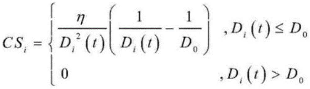
所述碰撞风险强度CSi:表示航空器之间或者航空器与障碍物之间的危险接近强度,用以衡量航空器之间或者航空器与障碍物之间的碰撞风险;The collision risk intensity CS i : indicates the dangerous approach intensity between aircraft or between aircraft and obstacles, to measure the collision risk between aircraft or between aircraft and obstacles;

其中,η为位置增益系数,Di(t)为t时刻航空器i与最近航空器或障碍物的距离,D0为航空器i的最小安全间隔。Among them, η is the position gain coefficient, D i (t) is the distance between the aircraft i and the nearest aircraft or obstacle at time t, and D 0 is the minimum safety separation of the aircraft i.
本发明还提供一种利用低空飞行态势安全性评估指标实现的低空飞行态势安全性评估方法,具体步骤如下:The present invention also provides a low-altitude flight situational safety evaluation method realized by utilizing the low-altitude flight situational safety evaluation index, and the specific steps are as follows:
步骤一、分析低空空域运行环境,提取低空空域运行环境特征要素信息,建立低空空域运行环境信息数据库;Step 1: Analyze the low-altitude airspace operating environment, extract the characteristic element information of the low-altitude airspace operating environment, and establish a low-altitude airspace operating environment information database;
步骤二、提取低空飞行态势运行数据,建立低空空域航空器运行动态数据库;Step 2: Extract low-altitude flight situation operation data, and establish a low-altitude airspace aircraft operation dynamic database;
步骤三、采用相关系数分析法对权利要求1构建的低空飞行态势安全性评估指标进行相关性分析,具体分析如下:Step 3: Use the correlation coefficient analysis method to perform a correlation analysis on the low-altitude flight situational safety assessment index constructed in claim 1, and the specific analysis is as follows:
首先,计算各指标间的相关系数rjk:First, calculate the correlation coefficient r jk between the indicators:

其中,xij、xik分别为第j、第k个指标的第i个时间序列样本值,
之后,基于步骤二中提取的航空器实时运行数据,计算低空飞行态势安全性评估指标,获取指标值序列样本X:Then, based on the real-time operation data of the aircraft extracted in step 2, calculate the low-altitude flight situational safety evaluation index, and obtain the index value sequence sample X:
X=(X1,X2,…,XI)T X=(X 1 ,X 2 ,...,X I ) T
Xi=(xi1,xi2,…,xij),i=1,2,…,IX i =(x i1 ,x i2 ,...,x ij ),i=1,2,...,I
其中,Xi为第i个时间样本序列,xij为第j个指标的第i个时间序列样本值,I为样本个数;Among them, Xi is the i-th time sample series, x ij is the i -th time series sample value of the j-th indicator, and I is the number of samples;
步骤四:基于模糊数学的隶属度理论,采用模糊C均值聚类算法(FCM)对低空飞行态势安全性进行归类;具体步骤包括:Step 4: Based on the membership degree theory of fuzzy mathematics, the fuzzy C-means clustering algorithm (FCM) is used to classify the safety of low-altitude flight situations; the specific steps include:
(1)标准化指标数据:(1) Standardized indicator data:
将步骤三中计算的低空飞行态势安全性评估指标值进行标准化,令Standardize the low-altitude flight situational safety assessment index value calculated in step 3, so that

其中,xij为第j个指标的第i个时间序列值,
(2)初始化隶属度矩阵U:(2) Initialize the membership matrix U:
建立初始隶属度矩阵U,令To establish the initial membership matrix U, let
U=(uni)N×I,

其中,uni表示第i个指标样本序列隶属于第n个安全等级分类的程度,N为低空飞行态势安全性等级分类数;取N=5,将低空飞行态势安全性等级分为安全、较安全、安全性一般、较不安全、不安全五类,即:Among them, u ni represents the degree to which the i-th index sample sequence belongs to the n-th safety level classification, and N is the number of low-altitude flight situational safety classifications; taking N=5, the low-altitude flight situational safety levels are divided into safe, relatively There are five categories of safety, general safety, less safety, and unsafe, namely:
Class={安全,较安全,安全性一般,较不安全,不安全}Class={safe, safer, average safety, less safe, unsafe}
(3)计算N个分类的聚类中心Cn:(3) Calculate the cluster centers C n of N categories:

其中,m为加权指数;其取值大小影响模糊聚类结果的正确性和聚类性能。Among them, m is the weighting index; its value affects the correctness and clustering performance of fuzzy clustering results.
(4)计算FCM价值函数J:(4) Calculate the FCM value function J:

其中,dni为第n个分类的聚类中心与第i个数据之间的欧氏距离,m为加权指数,J的值反映类内紧致性,J越小,表明聚类越紧致;Among them, d ni is the Euclidean distance between the cluster center of the nth classification and the ith data, m is the weighting index, and the value of J reflects the compactness within the class. The smaller the J, the more compact the clustering is. ;
将前后两次的价值函数值J进行比较,若价值函数值改变量ΔJ小于阈值ε,转步骤(6),否则转步骤(5);Compare the value function value J before and after, if the value function value change ΔJ is less than the threshold ε, go to step (6), otherwise go to step (5);
(5)更新隶属矩阵U:(5) Update the membership matrix U:

其中,dni为第n个分类的聚类中心与第i个数据之间的欧氏距离,m为加权指数;重复步骤(3)、(4);Among them, d ni is the Euclidean distance between the cluster center of the nth classification and the ith data, and m is the weighting index; repeat steps (3) and (4);
(6)导出隶属矩阵U,依据最大隶属度原则将各数据点进行归类,即:(6) Derive the membership matrix U, and classify each data point according to the principle of maximum membership, namely:

其中,
(7)输出低空飞行态势实时安全等级:
进一步的,步骤一所述低空空域运行环境特征要素信息包括低空空域结构信息、机场位置信息、障碍物位置信息、航空气象条件信息。Further, the low-altitude airspace operating environment feature element information in step 1 includes low-altitude airspace structure information, airport location information, obstacle location information, and aviation meteorological condition information.
进一步的,步骤二所述低空飞行态势运行数据包括任意时刻每架航空器的位置、速度、航向、冲突状态、飞行状态。Further, the low-altitude flight situation operation data in step 2 includes the position, speed, heading, conflict status, and flight status of each aircraft at any time.
进一步的,所述步骤四中,取m=2。Further, in the fourth step, m=2 is taken.
本发明具有以下技术效果:The present invention has the following technical effects:
(1)建立了一套低空飞行态势安全性评估指标及其计算方法,既体现了低空飞行态势的宏观安全性,也体现了航空器之间相互影响的微观安全性,还能体现飞行态势宏微观安全性随时间和空间的变化,弥补了低空飞行安全态势评估指标的缺失。(1) A set of low-altitude flight situation safety assessment indicators and their calculation methods were established, which not only reflected the macro-safety of low-altitude flight situations, but also reflected the micro-safety of the interaction between aircraft, as well as the macro- and micro-level flight situations. The changes of safety over time and space make up for the lack of low-altitude flight safety situation assessment indicators.
(2)提出了一种低空飞行态势安全性模糊聚类综合评估方法,基于模糊数学理论和FCM聚类算法对低空飞行态势安全性进行归类处理和综合量化分析,具有评估方法实用、评估程序简单、评估结果量化等特点。(2) A fuzzy clustering comprehensive evaluation method for low-altitude flight situational safety is proposed. Based on fuzzy mathematics theory and FCM clustering algorithm, the low-altitude flight situational safety is classified, processed and comprehensively quantitatively analyzed. It has practical evaluation methods and evaluation procedures. Simple, quantitative evaluation results and other characteristics.
附图说明Description of drawings
图1为低空飞行态势安全性评估方法流程图;Figure 1 is a flowchart of the low-altitude flight situational safety assessment method;
图2为低空飞行态势安全性评估指标体系图;Figure 2 is a diagram of the low-altitude flight situational safety assessment index system;
图3为复杂低空空域运行环境示意图。Figure 3 is a schematic diagram of the complex low-altitude airspace operating environment.
具体实施方式Detailed ways
下面通过附图和实施例,对本发明的技术方案做进一步的详细描述:Below by accompanying drawing and embodiment, the technical scheme of the present invention is described in further detail:
图1为本发明的流程图。这种低空飞行态势安全性评估方法包括以下具体实施步骤:FIG. 1 is a flow chart of the present invention. This low-altitude flight situational safety assessment method includes the following specific implementation steps:
步骤一:分析低空空域运行环境特征,并提取相应运行环境特征信息。Step 1: Analyze the characteristics of the low-altitude airspace operating environment, and extract the corresponding operating environment characteristic information.
图3为复杂低空空域运行环境示意图。低空空域运行环境主要包括各类低空空域范围、通航机场以及临时起降点位置、地形障碍物位置、航空气象条件等。其中,各类低空空域范围、通航机场以及临时起降点位置、地形障碍物位置等信息可从《国内航行资料汇编(NAIP)》以及地理信息系统(GIS)中获取,航空器气象数据信息可从航空气象雷达中提取。所要提取的低空空域运行环境信息具体包括:Figure 3 is a schematic diagram of the complex low-altitude airspace operating environment. The low-altitude airspace operating environment mainly includes the range of various low-altitude airspaces, navigable airports, the location of temporary take-off and landing points, the location of terrain obstacles, and aeronautical meteorological conditions. Among them, various types of low-altitude airspace ranges, navigable airports, the location of temporary take-off and landing points, and the location of terrain obstacles can be obtained from the National Aeronautical Information Compilation (NAIP) and Geographic Information System (GIS), and aircraft meteorological data information can be obtained from Extracted from aviation weather radar. The low-altitude airspace operating environment information to be extracted specifically includes:
低空空域范围
管制空域范围
报告空域范围
监视空域范围
通航机场或临时起降点Pi中心坐标
地形障碍物Oi中心坐标
航空气象条件C={Ωi,S,P,E|∪Ωi=Ω,且
其中,f(x,y,z)为高度为z时低空空域水平截面表达式;fci(x,y,z)、fri(x,y,z)、fsi(x,y,z)分别为高度为z时第i个管制空域、报告空域、监控空域水平截面表达式;z1、z2为低空空域高度的上下界;


步骤二:提取低空飞行态势运行数据。Step 2: Extract low-altitude flight situation operation data.
通过一次雷达、二次雷达、航空器机载设备等,并借助计算机工具提取任意时刻t航空器i的实时运行数据(xi(t),yi(t),zi(t),vi(t),hi(t),Ci(t),Statei(t),Typei)。Through primary radar, secondary radar, aircraft airborne equipment, etc., and with the help of computer tools, the real-time operating data of aircraft i at any time t (x i (t), y i (t), z i (t), v i ( t), h i (t), C i (t), State i (t), Type i ).
其中,xi(t)、yi(t)、zi(t)、vi(t)、hi(t)分别表示t时刻航空器i的经度、纬度、高度、速度、航向;Ci(t)表示t时刻航空器i的冲突状态,且Ci(t)=0表示航空器i无飞行冲突,Ci(t)=1表示航空器i有飞行冲突;Statei(t)表示t时刻航空器i的飞行状态,包括调速、改变航向、调整高度等;Typei表示航空器i的活动类型;包括观光旅游、抢险救援、运输作业、公务飞行。Among them, x i (t), y i (t), z i (t), v i (t), and hi (t) represent the longitude, latitude, altitude, speed, and heading of aircraft i at time t, respectively; C i (t) represents the conflict state of aircraft i at time t, and C i (t) = 0 indicates that aircraft i has no flight conflict, C i (t) = 1 indicates that aircraft i has a flight conflict; State i (t) indicates that aircraft i has a flight conflict at time t The flight status of i, including speed adjustment, course change, altitude adjustment, etc.; Type i indicates the activity type of aircraft i; including sightseeing, emergency rescue, transportation operations, and business flight.
步骤三:采用相关系数分析法对所构建的低空飞行态势安全性评估指标进行相关性分析,并计算低空飞行态势安全性评估指标。Step 3: Use the correlation coefficient analysis method to perform a correlation analysis on the constructed low-altitude flight situational safety evaluation index, and calculate the low-altitude flight situational safety evaluation index.
(1)计算各指标间的相关系数rjk:(1) Calculate the correlation coefficient r jk between each index:

其中,xij、xik分别为第j、第k个指标的第i个时间序列样本值,
(2)图2为低空飞行态势安全性评估指标体系图,基于步骤二中提取的航空器实时运行数据,计算低空飞行态势安全性评估指标:(2) Figure 2 is a diagram of the low-altitude flight situational safety evaluation index system. Based on the real-time aircraft operation data extracted in step 2, the low-altitude flight situational safety evaluation index is calculated:
①飞行冲突发生次数

其中,Ωj表示给定空域,且


②飞行冲突平均持续时间
先计算第i架α类航空器在t0-t1时段内的冲突解脱时间


其中,
再计算低空空域内所有航空器冲突解脱所需时间的平均值


其中,Ωj表示给定空域,且

③冲突解脱行为比

其中,Ωj表示给定空域,且


④汇聚态势迫近程度ApTij:④The approaching degree of convergence situation ApT ij :
先计算航空器i和j的相对位置矢量


其中,(xi,yi,zi)、(xj,yj,zj)分别为航空器i和j的位置矢量,
再计算航空器i和j的汇聚态势迫近程度ApTij,Then calculate the approaching degree ApT ij of the convergence situation of aircraft i and j,

⑤碰撞风险强度CSi:⑤ Collision risk intensity CS i :
先计算t时刻航空器i与最近航空器(或障碍物)j的距离Di(t),First calculate the distance D i (t) between the aircraft i and the nearest aircraft (or obstacle) j at time t,

其中,(xi,yi,zi)、(xj,yj,zj)分别为航空器i和航空器(或障碍物)j的位置矢量,Among them, (x i , y i , z i ), (x j , y j , z j ) are the position vectors of aircraft i and aircraft (or obstacle) j, respectively,
再计算t时刻航空器i与最近航空器(或障碍物)j的碰撞风险强度CSi,Then calculate the collision risk intensity CS i between the aircraft i and the nearest aircraft (or obstacle) j at time t,

其中,η为位置增益系数,D0为航空器i的最小安全间隔。Among them, η is the position gain coefficient, D 0 is the minimum safety separation of aircraft i.
获取指标值序列样本X:Get the index value sequence sample X:
X=(X1,X2,…,XI)T X=(X 1 ,X 2 ,...,X I ) T
Xi=(xi1,xi2,…,xij),i=1,2,…,IX i =(x i1 ,x i2 ,...,x ij ),i=1,2,...,I
其中,Xi为第i个时间样本序列,xij为第j个指标的第i个时间序列样本值,I为样本个数。Among them, X i is the i-th time sample series, x ij is the i-th time series sample value of the j-th indicator, and I is the number of samples.
步骤四:基于模糊数学的隶属度理论,采用模糊C均值聚类算法(FCM)对低空飞行态势安全性进行归类。具体步骤包括:Step 4: Based on the membership degree theory of fuzzy mathematics, the fuzzy C-means clustering algorithm (FCM) is used to classify the safety of low-altitude flight situations. Specific steps include:
(1)标准化指标数据:(1) Standardized indicator data:
计算第j个指标的样本均值


其中,xij为第j个指标的第i个时间序列值;Among them, x ij is the i-th time series value of the j-th indicator;
将第j个指标的第i个时间序列值xij标准化:Normalize the i-th time series value x ij for the j-th indicator:

从而得到第j个指标的标准化数据向量Rj=(r1j,r2j,…,rIj)。Thus, the normalized data vector R j =(r 1j , r 2j , . . . , r Ij ) of the jth index is obtained.
(2)初始化隶属度矩阵U:(2) Initialize the membership matrix U:
建立初始隶属度矩阵U,令To establish the initial membership matrix U, let
U=(uni)N×I,

其中,uni表示第i个指标样本序列隶属于第n个安全等级分类的程度,N为低空飞行态势安全性等级分类数,本发明取N=5,将低空飞行态势安全性等级分为“安全”、“较安全”、“安全性一般”、“较不安全”、“不安全”五类,即:Among them, u ni represents the degree to which the i-th index sample sequence belongs to the n-th safety level classification, N is the number of low-altitude flight situational safety classifications, the present invention takes N=5, and the low-altitude flight situational safety level is divided into There are five categories: "safe", "more safe", "generally safe", "less safe" and "unsafe", namely:
Class={"安全","较安全","安全性一般","较不安全","不安全"}Class={"safe", "safer", "general safety", "less safe", "unsafe"}
(3)计算N个分类的聚类中心Cn:(3) Calculate the cluster centers C n of N categories:

其中,m为加权指数,本发明中取m=2。Wherein, m is a weighting index, and m=2 in the present invention.
(4)计算FCM价值函数J:(4) Calculate the FCM value function J:
计算第n个分类的聚类中心与第i个数据之间的欧氏距离dni:Calculate the Euclidean distance d ni between the cluster center of the nth category and the ith data:
dni=||Cn-xi||d ni =||C n -x i ||
计算价值函数J:Compute the value function J:

其中,m为加权指数。Among them, m is the weighted index.
为便于计算,价值函数值J的初始默认值为0,阈值ε=10-5。将前后两次的价值函数值J进行比较,若价值函数值改变量ΔJ小于阈值ε,转步骤(6),否则转步骤(5)。For the convenience of calculation, the initial default value of the value function value J is 0, and the threshold value ε=10 −5 . Compare the value function value J before and after, if the value function value change ΔJ is less than the threshold ε, go to step (6), otherwise go to step (5).
(5)更新隶属矩阵U:(5) Update the membership matrix U:

其中,dni为第n个分类的聚类中心与第i个数据之间的欧氏距离,m为加权指数。重复步骤(3)、(4)。Among them, d ni is the Euclidean distance between the cluster center of the nth classification and the ith data, and m is the weighting index. Repeat steps (3) and (4).
(6)导出隶属矩阵U,依据最大隶属度原则将各数据点进行归类,即:(6) Derive the membership matrix U, and classify each data point according to the principle of maximum membership, namely:

其中,
(7)输出低空飞行态势实时安全等级:
本发明建立了一套低空飞行态势安全性评估指标及其计算方法,既体现了低空飞行态势的宏观安全性,也体现了航空器之间相互影响的微观安全性,还能体现飞行态势宏微观安全性随时间和空间的变化,弥补了低空飞行安全态势评估指标的缺失。同时提出了一种低空飞行态势安全性模糊聚类综合评估方法,基于模糊数学理论和FCM聚类算法对低空飞行态势安全性进行归类处理和综合量化分析,具有评估方法实用、评估程序简单、评估结果量化等特点。The present invention establishes a set of low-altitude flight situation safety evaluation indicators and a calculation method thereof, which not only reflects the macro-safety of the low-altitude flight situation, but also reflects the micro-safety of the mutual influence between aircrafts, and also reflects the macro- and micro-safety of the flight situation. The change of nature with time and space makes up for the lack of low-altitude flight safety situation assessment indicators. At the same time, a fuzzy clustering comprehensive evaluation method for low-altitude flight situational safety is proposed. Based on fuzzy mathematical theory and FCM clustering algorithm, the low-altitude flight situational safety is classified and processed and comprehensively quantitatively analyzed. The evaluation method is practical, the evaluation procedure is simple, and the Quantitative evaluation results, etc.
以上实施例仅为说明本发明的技术思想,不能以此限定本发明的保护范围,凡是按照本发明提出的技术思想,在技术方案基础上所做的任何改动,均落入本发明保护范围之内。The above embodiments are only to illustrate the technical idea of the present invention, and cannot limit the protection scope of the present invention. Any modification made on the basis of the technical solution according to the technical idea proposed by the present invention falls within the protection scope of the present invention. Inside.
Claims (3)


Priority Applications (1)
| Application Number | Priority Date | Filing Date | Title |
|---|---|---|---|
| CN201610349299.0A CN105956790B (en) | 2016-05-24 | 2016-05-24 | Low-altitude flight situation safety evaluation index and evaluation method thereof |
Applications Claiming Priority (1)
| Application Number | Priority Date | Filing Date | Title |
|---|---|---|---|
| CN201610349299.0A CN105956790B (en) | 2016-05-24 | 2016-05-24 | Low-altitude flight situation safety evaluation index and evaluation method thereof |
Publications (2)
| Publication Number | Publication Date |
|---|---|
| CN105956790A CN105956790A (en) | 2016-09-21 |
| CN105956790B true CN105956790B (en) | 2021-09-17 |
Family
ID=56909632
Family Applications (1)
| Application Number | Title | Priority Date | Filing Date |
|---|---|---|---|
| CN201610349299.0A Active CN105956790B (en) | 2016-05-24 | 2016-05-24 | Low-altitude flight situation safety evaluation index and evaluation method thereof |
Country Status (1)
| Country | Link |
|---|---|
| CN (1) | CN105956790B (en) |
Families Citing this family (9)
| Publication number | Priority date | Publication date | Assignee | Title |
|---|---|---|---|---|
| CN108805175A (en) * | 2018-05-21 | 2018-11-13 | 郑州大学 | A kind of flight attitude clustering method of aircraft and analysis system |
| CN108803656B (en) * | 2018-06-12 | 2020-09-08 | 南京航空航天大学 | A flight control method and system based on complex low altitude |
| CN109993225B (en) * | 2019-03-29 | 2021-03-23 | 北京航空航天大学 | Airspace complexity classification method and device based on unsupervised learning |
| CN110659797B (en) * | 2019-08-09 | 2022-08-16 | 中国船舶重工集团公司第七0九研究所 | Method and system for evaluating flight conflict resolution control instruction |
| CN110991502B (en) * | 2019-11-21 | 2020-10-13 | 北京航空航天大学 | Airspace security situation assessment method based on category activation mapping technology |
| CN111951613B (en) * | 2020-07-24 | 2021-08-31 | 北京航空航天大学 | Wide-area airspace security situation assessment method based on air-ground coordination |
| CN112466103B (en) | 2020-11-12 | 2021-10-01 | 北京航空航天大学 | Aircraft flight threat evolution early warning method, device, equipment and storage medium |
| CN115206135B (en) * | 2022-06-16 | 2024-02-13 | 中国电子科技集团公司第二十八研究所 | An aircraft command altitude planning method with uncertain climb rate |
| CN115630531B (en) * | 2022-12-19 | 2023-03-14 | 中南大学 | Automated security assessment method for UAV control system |
Citations (5)
| Publication number | Priority date | Publication date | Assignee | Title |
|---|---|---|---|---|
| WO2004102505A2 (en) * | 2003-05-14 | 2004-11-25 | Jacques Villiers | Device and method for providing automatic assistance to air traffic controllers |
| CN101201870A (en) * | 2007-12-20 | 2008-06-18 | 四川川大智胜软件股份有限公司 | Method for dynamic simulation of air traffic flight posture |
| CN102682626A (en) * | 2011-02-22 | 2012-09-19 | 通用电气公司 | Methods and systems for managing air traffic |
| CN103473469A (en) * | 2013-09-25 | 2013-12-25 | 南京航空航天大学 | Sector traffic state multilevel fuzzy evaluation method based on objective indicator |
| CN104537895A (en) * | 2015-01-08 | 2015-04-22 | 中国航空无线电电子研究所 | Method and device for achieving 4D track flight |
-
2016
- 2016-05-24 CN CN201610349299.0A patent/CN105956790B/en active Active
Patent Citations (5)
| Publication number | Priority date | Publication date | Assignee | Title |
|---|---|---|---|---|
| WO2004102505A2 (en) * | 2003-05-14 | 2004-11-25 | Jacques Villiers | Device and method for providing automatic assistance to air traffic controllers |
| CN101201870A (en) * | 2007-12-20 | 2008-06-18 | 四川川大智胜软件股份有限公司 | Method for dynamic simulation of air traffic flight posture |
| CN102682626A (en) * | 2011-02-22 | 2012-09-19 | 通用电气公司 | Methods and systems for managing air traffic |
| CN103473469A (en) * | 2013-09-25 | 2013-12-25 | 南京航空航天大学 | Sector traffic state multilevel fuzzy evaluation method based on objective indicator |
| CN104537895A (en) * | 2015-01-08 | 2015-04-22 | 中国航空无线电电子研究所 | Method and device for achieving 4D track flight |
Non-Patent Citations (1)
| Title |
|---|
| 基于Agent复杂低空飞行行为建模与仿真;张翔宇等;《航空计算技术》;20160131;第46卷(第1期);全文 * |
Also Published As
| Publication number | Publication date |
|---|---|
| CN105956790A (en) | 2016-09-21 |
Similar Documents
| Publication | Publication Date | Title |
|---|---|---|
| CN105956790B (en) | Low-altitude flight situation safety evaluation index and evaluation method thereof | |
| CN111177851B (en) | Assessment method for ground risk in unmanned aerial vehicle operation safety risk assessment | |
| Williams | Using random forests to diagnose aviation turbulence | |
| CN111461292B (en) | A Real-time Trajectory Prediction Method for UAV | |
| DeLaura et al. | Modeling convective weather avoidance in enroute airspace | |
| Bari et al. | Machine-learning regression applied to diagnose horizontal visibility from mesoscale NWP model forecasts | |
| CN115064009B (en) | A method for classifying conflict risk levels between drones and manned aircraft in terminal areas | |
| CN103903101A (en) | General aviation multi-source information supervisory platform and method | |
| CN113362604B (en) | Controller workload assessment method based on sector dynamic traffic characteristics | |
| Kochenderfer et al. | A comprehensive aircraft encounter model of the national airspace system | |
| CN115223401B (en) | A method for assessing potential conflicts in airport flight zones | |
| Matthews et al. | Discovery of abnormal flight patterns in flight track data | |
| CN118798635A (en) | Wind shear event space-time grid assessment and early warning method, system and electronic equipment | |
| Zheng et al. | Modeling and detection of low-altitude flight conflict network based on SVM | |
| Puranik et al. | Energy-Based Metrics for General Aviation Flight Data Record Analysis | |
| Guo et al. | Risk assessment method for controlled flight into terrain of airlines based on QAR data | |
| Gloudemans et al. | A coupled probabilistic wake vortex and aircraft response prediction model | |
| Tsai et al. | Risk Assessment of Final Approach Phase with ADS-B Trajectory Data and Weather Information using Artificial Neural Network | |
| İnan | Aircraft damage classification by using machine learning methods | |
| Passarella et al. | Anomaly detection in commercial aircraft landing at SSK II airport using clustering method | |
| Jian et al. | Risk Assessment of Unmanned Aerial Vehicle Flight Based on K-means Clustering Algorithm. | |
| Zhang et al. | A genetic algorithm-based BP neural network method for operational performance assessment of ATC sector | |
| Ortega et al. | Improve decision-making process in Air Command and Control Systems with meteorological data fusion | |
| Dong et al. | Evaluation for Trainee Pilot Workload Management Competency During Approach Phase Based on Flight Training Data | |
| Londner et al. | A Bayesian network model of pilot response to TCAS resolution advisories |
Legal Events
| Date | Code | Title | Description |
|---|---|---|---|
| C06 | Publication | ||
| PB01 | Publication | ||
| C10 | Entry into substantive examination | ||
| SE01 | Entry into force of request for substantive examination | ||
| GR01 | Patent grant | ||
| GR01 | Patent grant |